
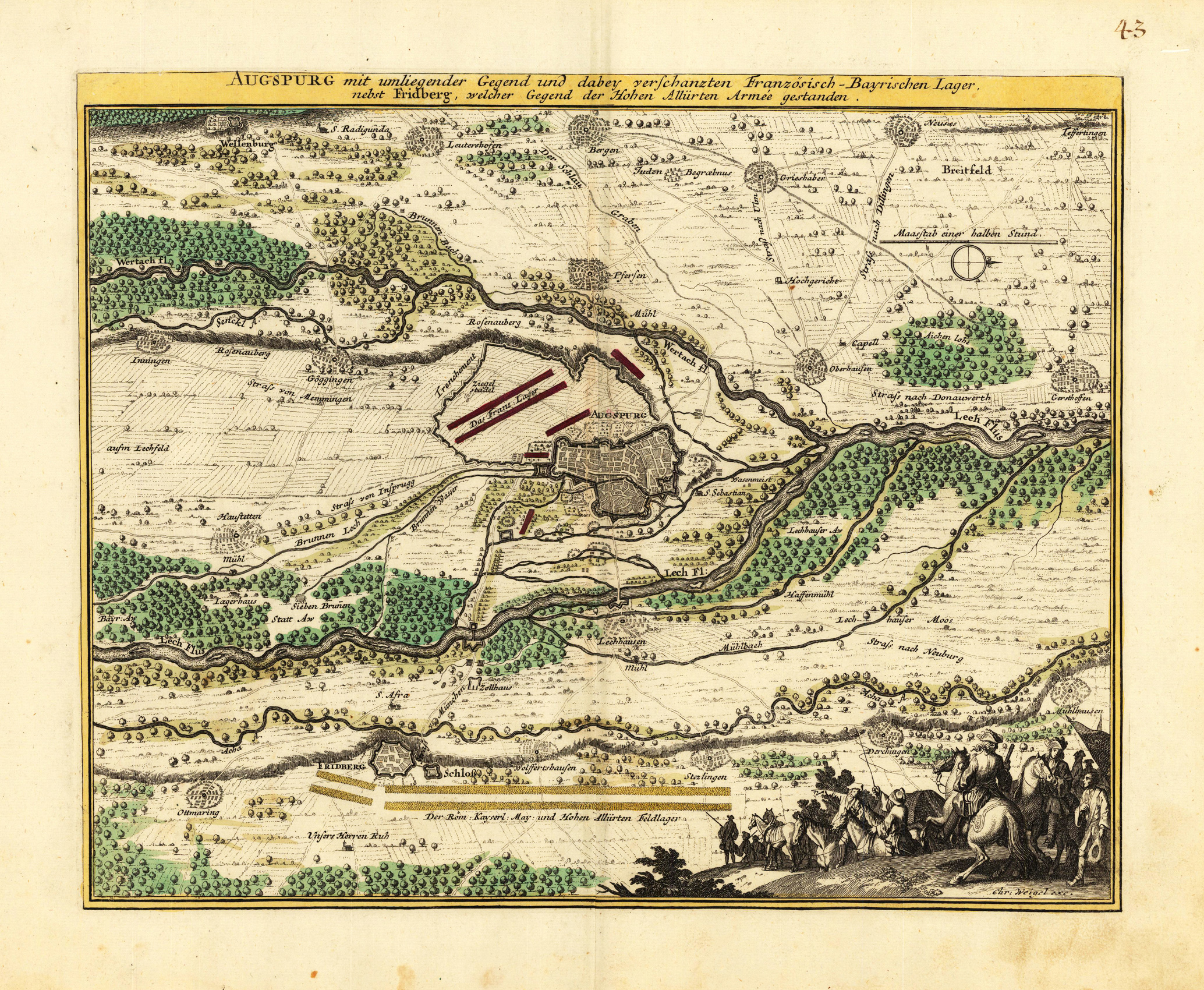
Augspurg mit umliegender Gegend und dabey verschanzten Französisch-Bayrischen Lager, nebst Fridberg, welcher Gegend der Hohen Allürten Armee gestanden.
Product information: Augspurg mit umliegender Gegend und dabey verschanzten Französisch-Bayrischen Lager, nebst Fridberg, welcher Gegend der Hohen Allürten Armee gestanden.
Original antique copper engraving, hand colored in outline and wash when published. This antique map shows us the surrounding of the city of Augsburg towards the river Lech and Friedberg. With engraved military possessions of the French and Bavarian army. The map is richly detailed engraved with small rivers, woods and various small place names. The allegoric cartouche in the lower right corner with soldiers on horses. Johann Christoph Weigel, known as Christoph Weigel the Elder (9 November 1654 – 5 February 1725), was a German engraver, art dealer and publisher. He was born at Redwitz, Free imperial city of Eger in Egerland, and died in Nuremberg, aged 70. The cartographer Weigel worked around 1719 in Nürnberg and his maps are showing the typical style of this period in map making in Southern German. He worked very close as with Johann B. Homann in Nürnberg. All his maps were hand colored in outline and decorative body color immediatelly in his printing house, after they were printed.
Properties
| Category: | Augsburg |
|---|---|
| Issue date: | 1719-35 |
| Published place: | Nürnberg |
| Publisher: | Chr. Weigel. |
| Technique: | Copper engraving / Original color. |
| Type: | Antique Map, map |