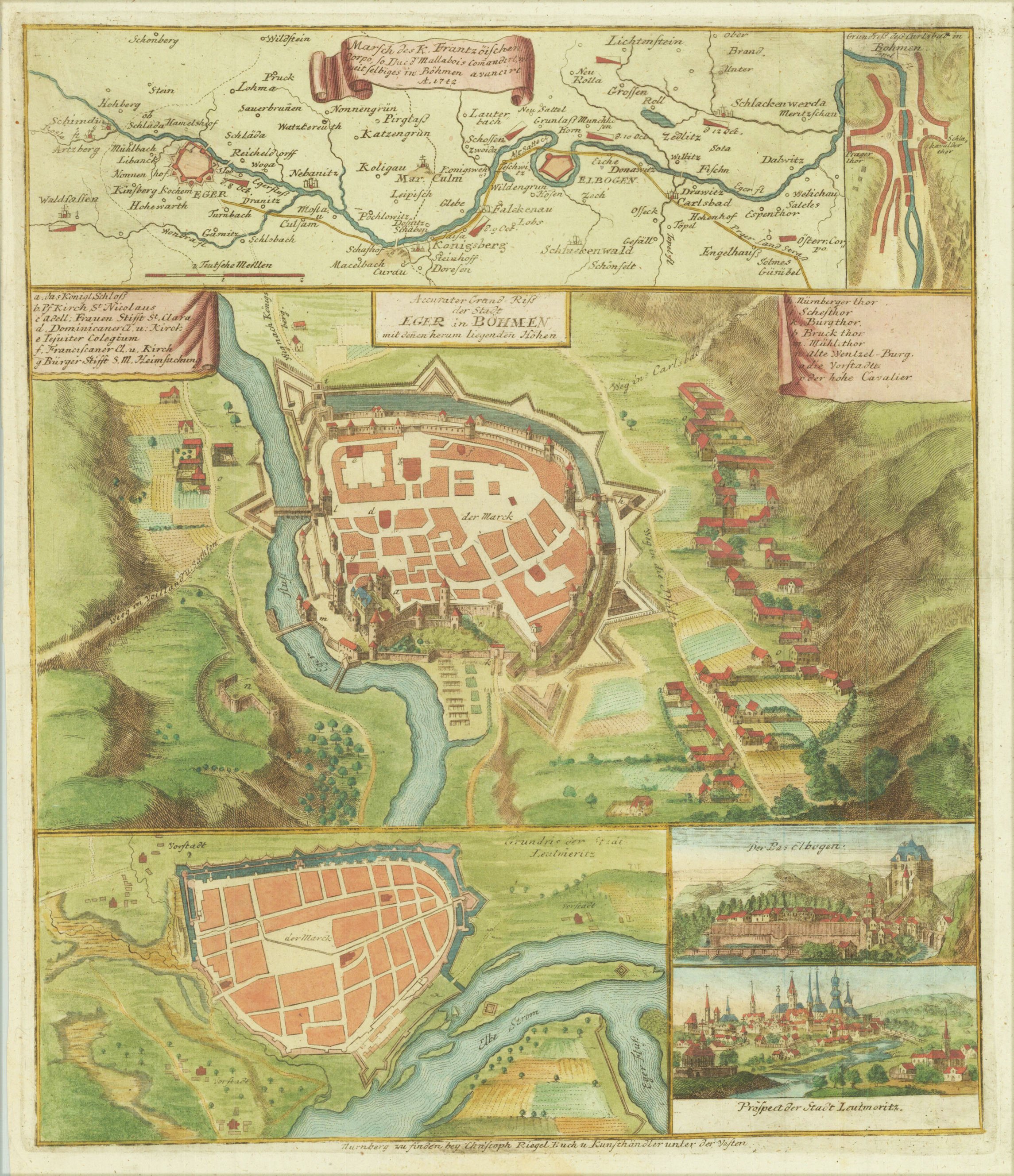
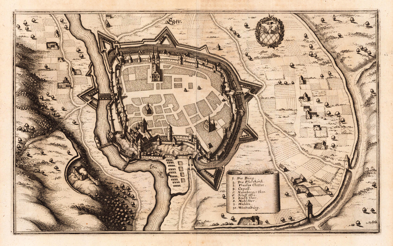
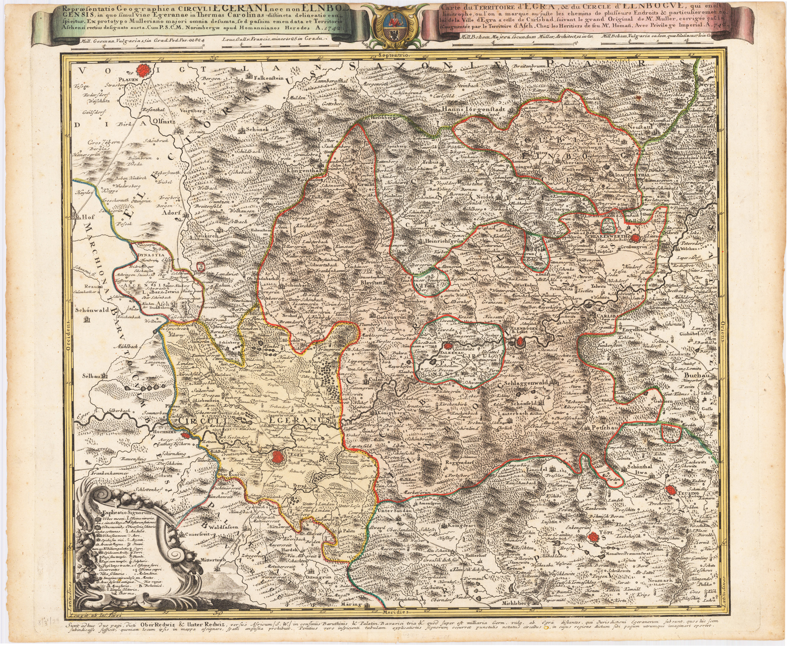
2 Karten auf 1 Blatt : Original Kupferstich in späterem Handkolorit; Mit 2 Nebenkarten: Grundriß deß Carlsbad in Bohmen. Grundris der Stadt Leutmeritz. - Mit 2 Ansichten: Der Pas Elbogen. Prospect der Stadt Leutmeritz, Grundriss der Stadt Eger und der Stadt Leitmeritz in Böhmen, ca. 1:30 000, Kupferst., nach 1742
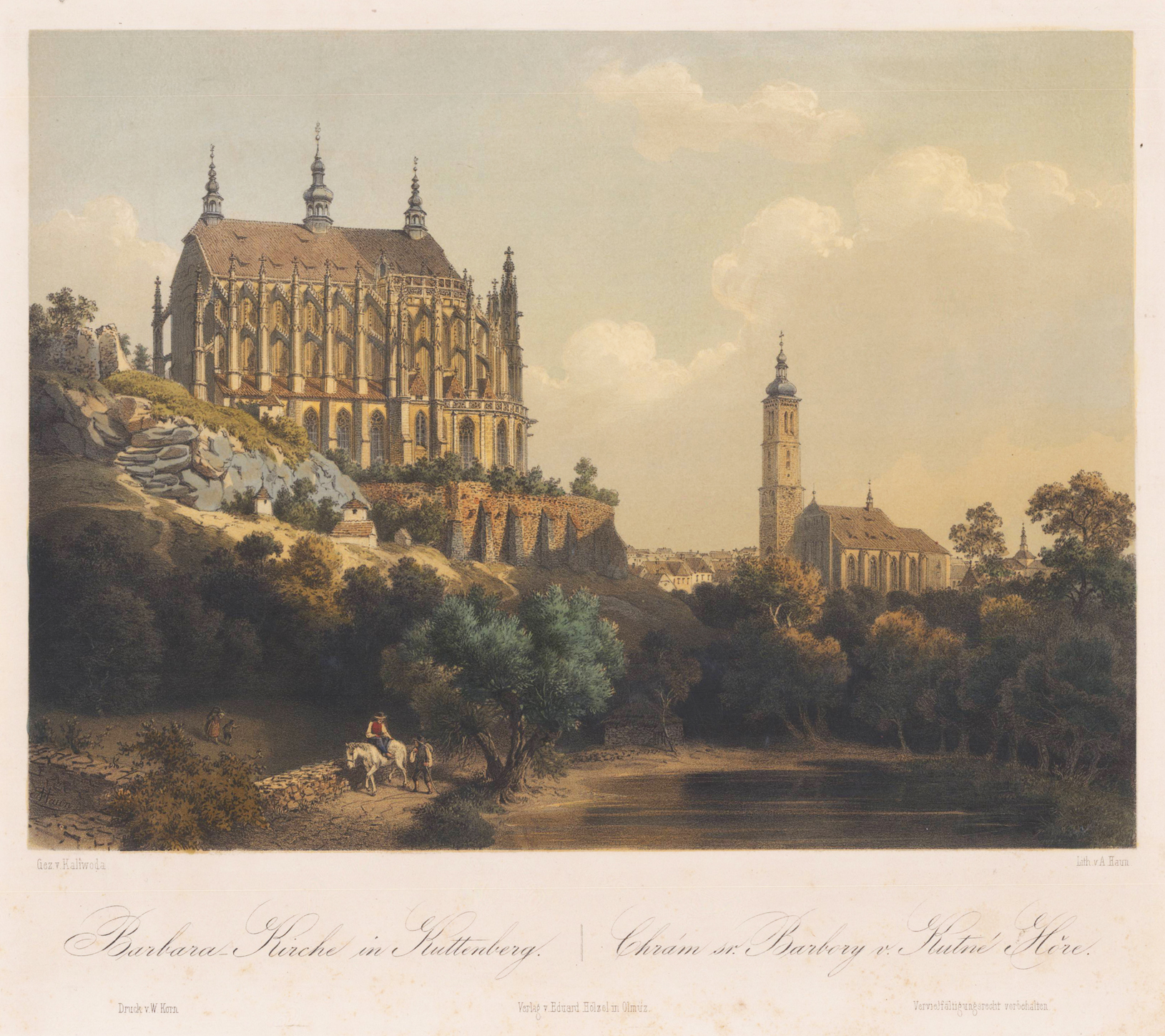
Original Farblithographie, breitrandig. Nach einer Zeichtnung von Franz Kaliwoda aus E. Hölzel "Malerisch- historisches Album vom Königreich Böhmen." Kutná Hora (deutsch Kuttenberg) ist eine Stadt in Tschechien in der Region Mittelböhmen mit etwa 20.000 Einwohnern. Sie wurde im 12. Jahrhundert als Bergmannssiedlung gegründet. Gegen Ende des 13. Jahrhunderts entwickelte sie sich zu einer der lebhaftesten und wohlhabendsten Städte Böhmens. Kuttenberg gelang dies durch den Silberbergbau und die berühmte Prägung der Prager Groschen. Es war nach Prag die zweitgrößte Stadt Böhmens, bis im Zuge der Hussitenkriege in den 1420er Jahren ein großer Teil der Bevölkerung von Kuttenberg ermordet wurde. Danach verlor die Stadt viel von ihrer Bedeutung. Heute gehört die Altstadt von Kuttenberg zum UNESCO-Weltkulturerbe. (Wikipedia)
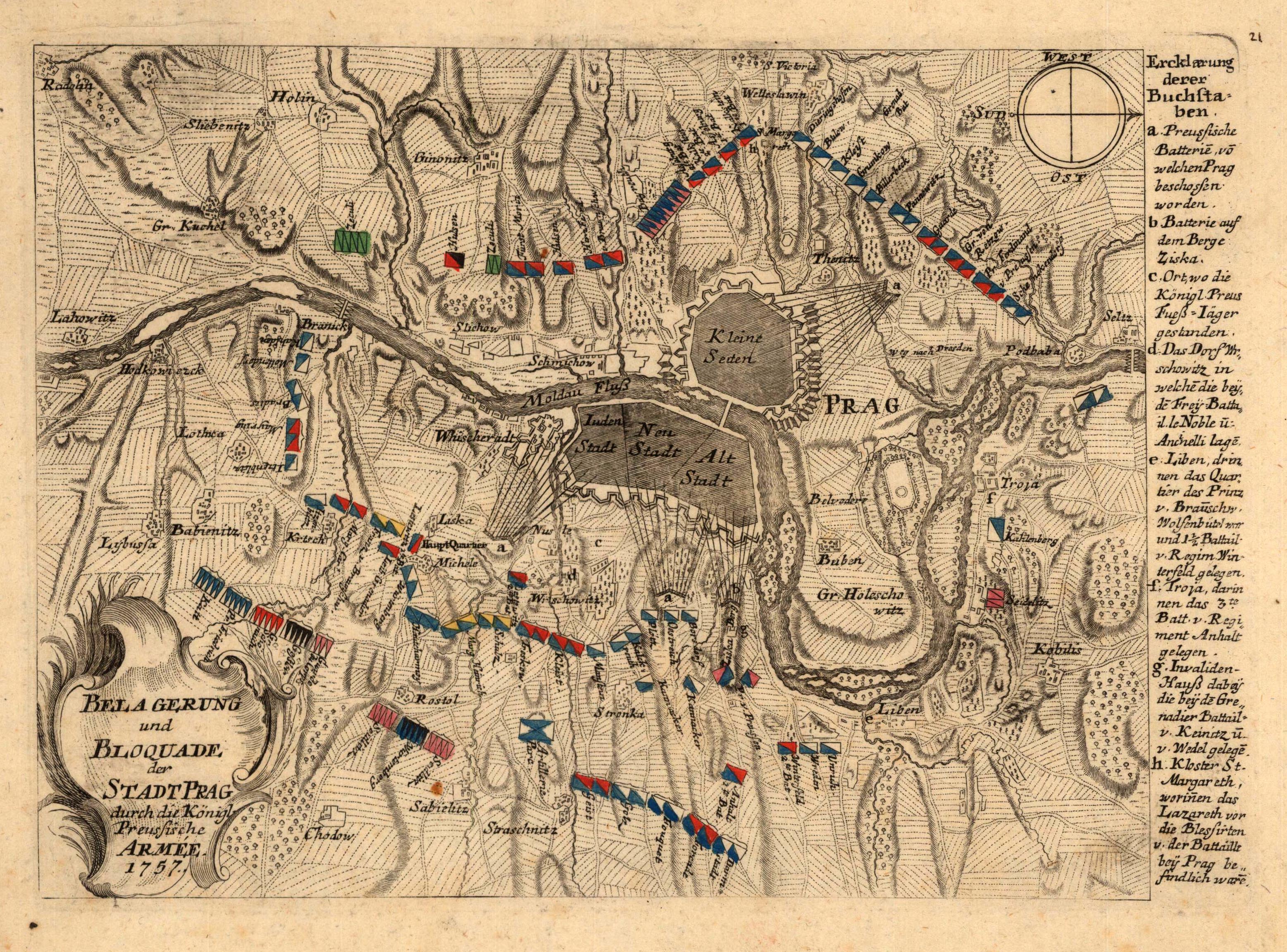
Original copper engraving, hand colored when published. Original map from the famous series ,Neues Kriegs-Theater'. This plan depicts the battle in Prague with the Prussians in 1757.
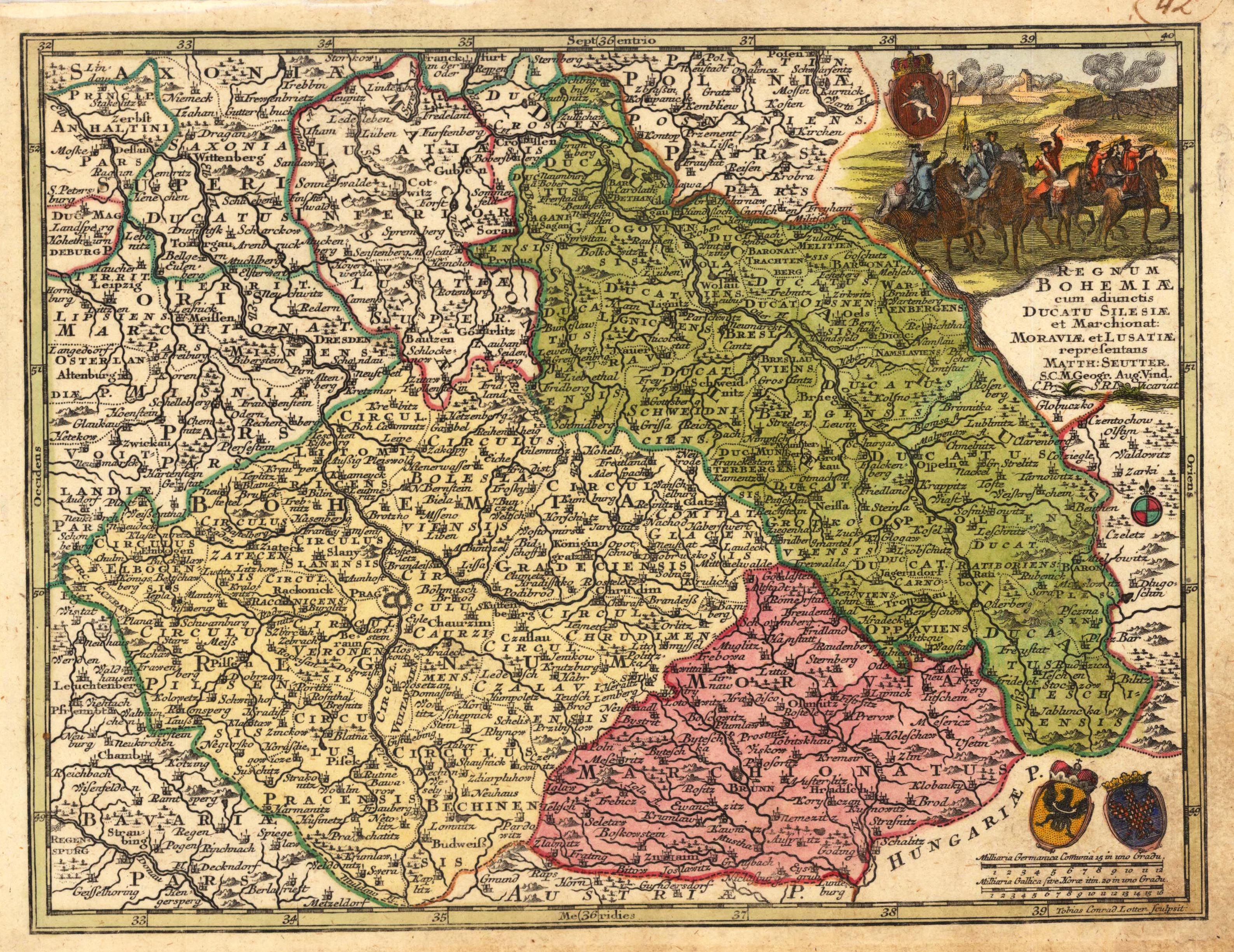
Copper engraving, hand colored in outline and wash when published. Engraved by Tobias Conrad Lotter. The small map depicts the kingdom of Bohemia, the duchy of Silesia, as well Moravia and the Lausnitz region. In the upper right corner is a small engraving of soldiers on horses and the coat of arms from Bohemia. In the lower right corner is the milliage scale with the coat of arms from Moravia and Silesia.
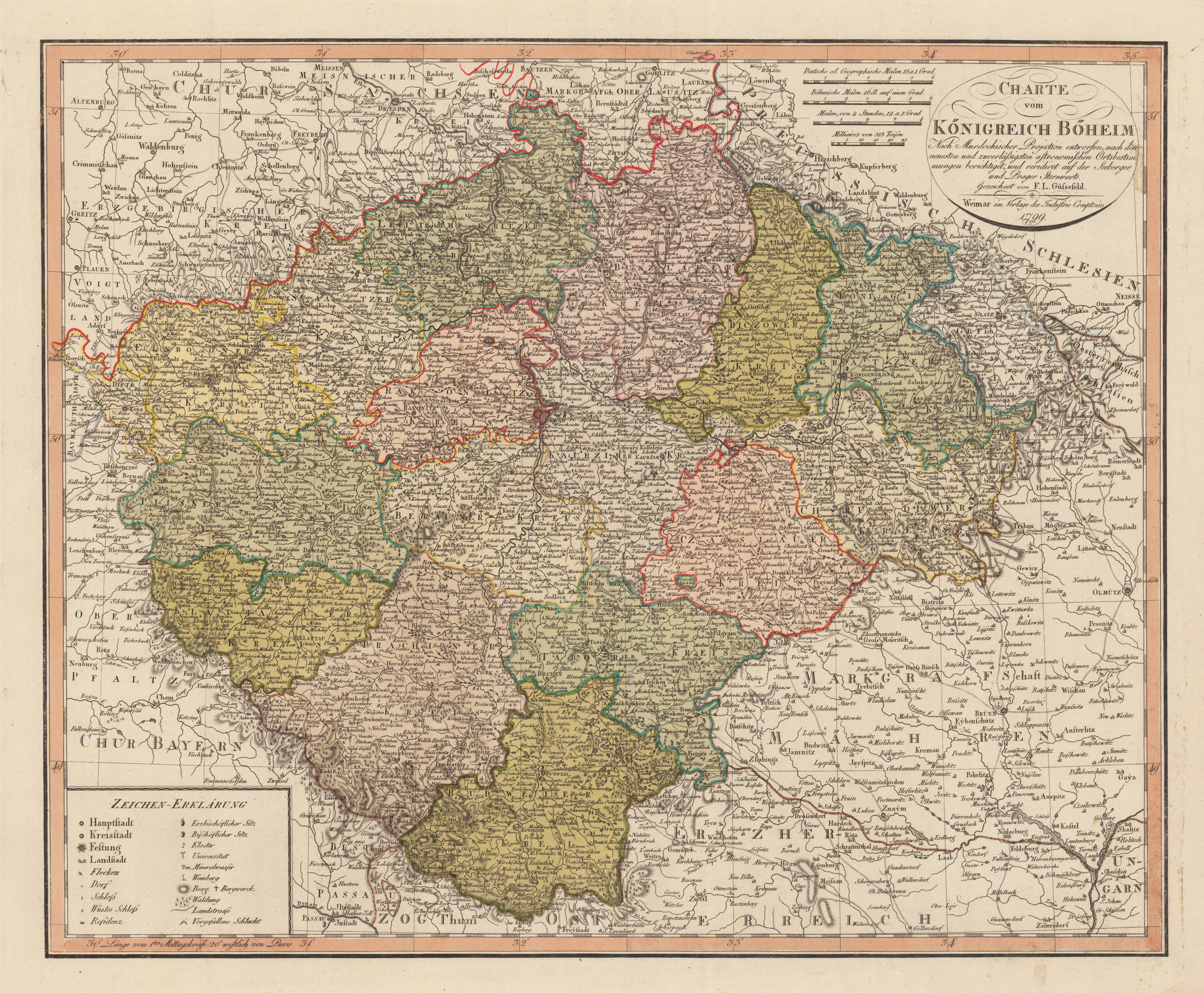
Copper engraving, hand colored in outline and wash when published. This detailed antique map shows the region between Meissen in the north and Passau in the south, Olmütz in the east and Greitz in the west. The title cartouche and four different milegage scales are in the upper right corner. The legend is engraved in the lower left corner.
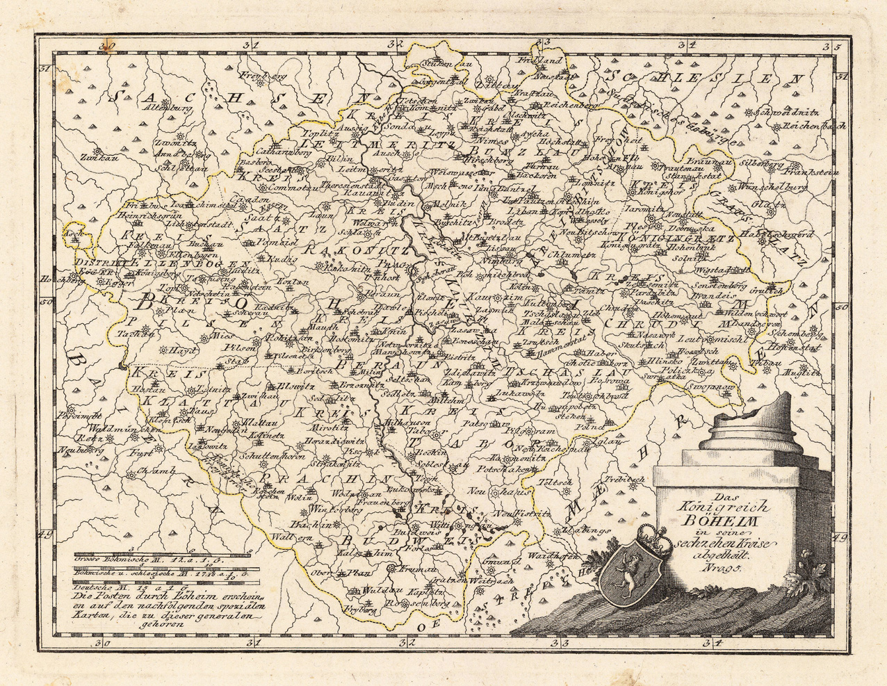
Original copper engraving, hand colored in wash and outline, when published. The detailed map shows the kingdom of Bohemia divided up into its sixteen circles. The Austrian cartographer Franz Joh. Josef von Reilly published around 1789 in Vienna a large amount of very detailed district maps of Central Europe. These maps are famous for their large scales and the many details they provide. Even tiny place names can be found on those maps, rivers, mountains, streets, monasteries are as well engraved. The maps, which Franz J. Reilly engraved, were especially designed for the Austrian Royal house and show countries, provinces and districts belonging to the 'Austrian-Hungarian Empire'.
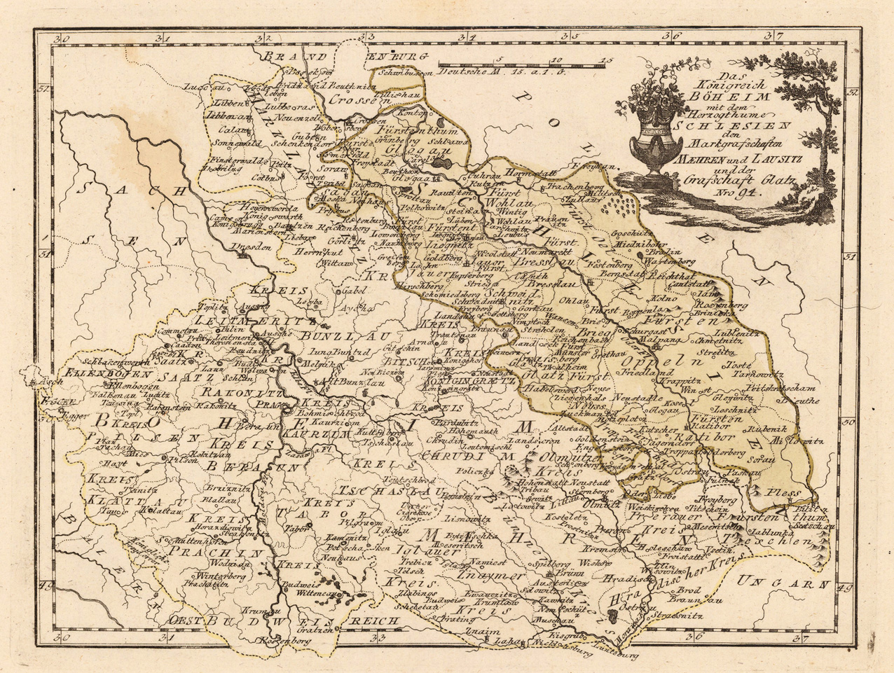
Original copper engraving, hand colored in wash and outline, when published. The Austrian cartographer Franz Joh. Josef von Reilly published around 1789 in Vienna a large amount of very detailed district maps of Central Europe. These maps are famous for their large scales and the many details they provide. Even tiny place names can be found on those maps, rivers, mountains, streets, monasteries are as well engraved. The maps, which Franz J. Reilly engraved, were especially designed for the Austrian Royal house and show countries, provinces and districts belonging to the 'Austrian-Hungarian Empire'.
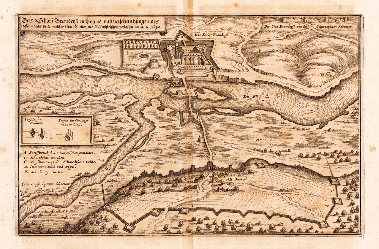
Copper engraving, uncolored as published. This antique map shows us in a bird´s eye view the Kingdom 'Brandeiß' in Bohemia. Arround the Kingdom are a landscape with many fields, woods, streets, rivers, etc. The title cartouche is in the upper left corner to see.
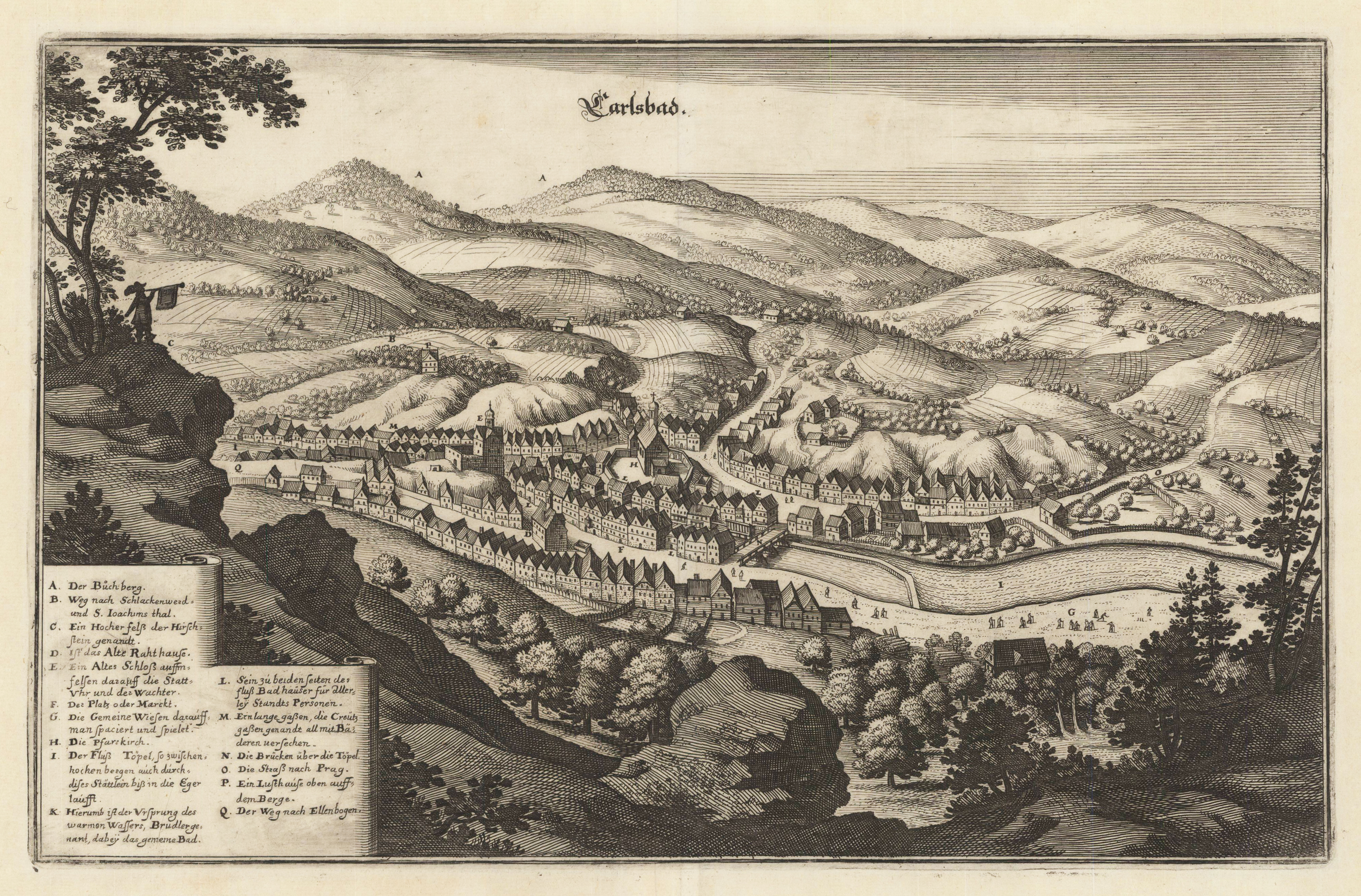
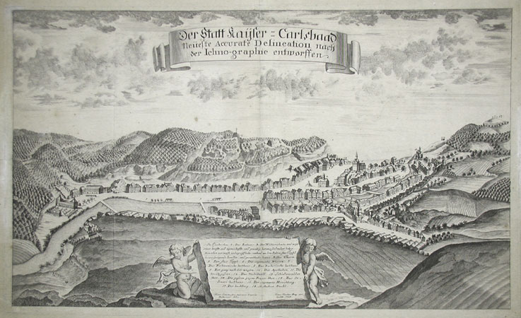
Copper-engraving, uncolored as published. Unusual prospect of the city of Carlsbad in Bohemia engraved after the drawing of Franz Lotoscha, who originated from Glogau in upper Silesia. Decorative view across the river Töpl towards the city of Carlsbad. Ornated in the lower centre with a large table of explanations to Carlsbad and the nearby surroundings.
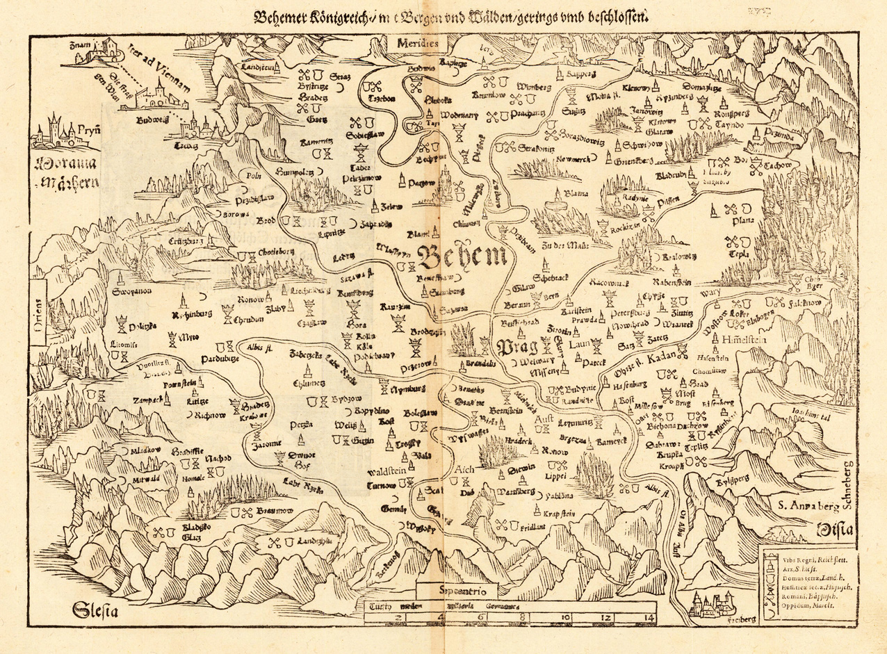
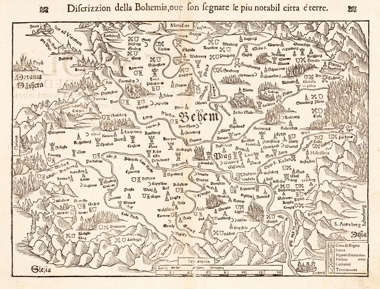
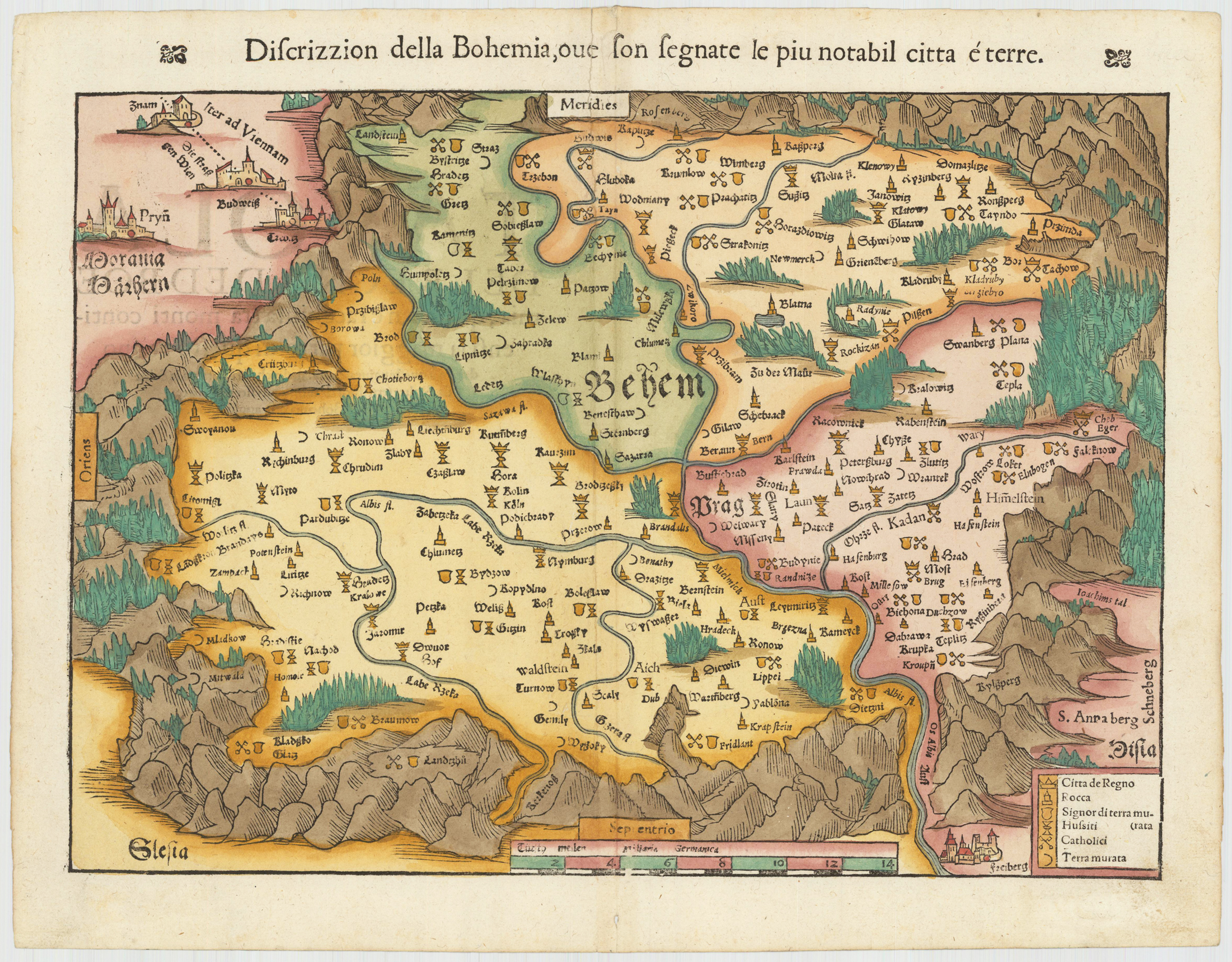
Original woodcut map, decorative hand colored in wash, published in a Italian text edition of the ,Cosmographia' by Sebastian Münster around 1560-75. The fine 16th century woodcut map of Bohemia is showing place names as small miniature views. The mountains, woods and the landscape are shown in a schematic manner.
Original antique copper engraving. Hand colored in outline and wash. This decorative map shows the Kingdom of Bohemia. The map is equipped with many locations, rivers, mountains, forests, etc. The individual regions are hand-colored in different colors. The title cartouche is in the upper right corner, and we also find a small cartouche with an explanatory legend and mile marker in the lower left corner. "Johann Baptist Homann (born March 20, 1664 in Oberkammlach, today part of Kammlach in the Unterallgäu district; † July 1, 1724 in Nuremberg) was a German cartographer, publisher, engraver and made globes.... Johann Baptist Homann died on January 1st July 1724. His company passed to his son Johann Christoph Homann (1703-1730). He appointed his two managing directors, Johann Georg Ebersberger (or Ebersperger) and Johann Michael Franz, as heirs of the business. After his death, the company went under continued under the name "Homanns Erben" (also "Homannsche Erben" or "Homännische Erben", French Heritiers de Homann, lat Homannianos Heredes). In the middle of the 18th century, renowned scholars such as Johann Michael Franz, Tobias Mayer, Johann Gabriel Doppelmayr, Georg Moritz Lowitz, Johann Hübner and Johann Gottfried Gregorii worked for the company. The long and eventful success story of the industry leader only ended in 1848 with the death of the last owner, Christoph Franz Fembo." - Wikipedia
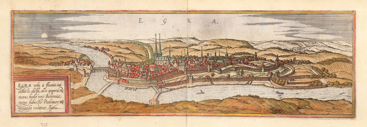
Original copper engraving, hand colored in the periode when published ca. in the town books 'Civitates Orbis Terrarum' by Braun and Hogenberg. The entire series of the 'Civitates Orbis Terrarum' comprised six volumes and was published and printed from 1572 towards 1619. A very nice bird´eye view of the city Eger. Georg Braun (also Brunus, Bruin; 1541 – 10 March 1622) was a topo-geographer. From 1572 to 1617 he edited the Civitates orbis terrarum, which contains 546 prospects, bird's-eye views and maps of cities from all around the world. He was the principal editor of the work, he acquired the tables, hired the artists, and wrote the texts. He died as an octogenarian in 1622, as the only survivor of the original team to witness the publication of volume VI in 1617. Braun was born and died in Cologne. His principal profession was as a Catholic cleric. However, he spent thirty-seven years as canon and dean at the church, St. Maria ad Gradus, in Cologne. His six-volume work was inspired by Sebastian Münster's Cosmographia. In form and layout it resembles the 1570 Theatrum orbis terrarum by Abraham Ortelius, as Ortelius was interested in a complementary companion for the Theatrum. The Braun publication set new standards in cartography for over 100 years. Frans Hogenberg (1535–1590, from Mechelen) created the tables for volumes I through IV, and Simon van den Neuwel created those for volumes V and VI. Other contributors were Joris Hoefnagel, Jacob Hoefnagel, cartographer Daniel Freese, and Heinrich Rantzau. Works by Jacob van Deventer, Sebastian Münster, and Johannes Stumpf were also used. Primarily European cities are depicted in the publication; however, Cairo Casablanca and Mexico City as well as Cuzco on one sheet are also included in volume I, whereas Tunis is featured in volume II. Frans Hogenberg (1535–1590) was a Flemish and German painter, engraver, and mapmaker. Hogenberg was born in Mechelen in Flanders as the son of Nicolaas Hogenberg. In 1568 he was banned from Antwerp by the Duke of Alva and travelled to London, where he stayed a few years before emigrating to Cologne. He is known for portraits and topographical views as well as historical allegories. He also produced scenes of contemporary historical events. Hogenberg died in Cologne. (Wikipedia)
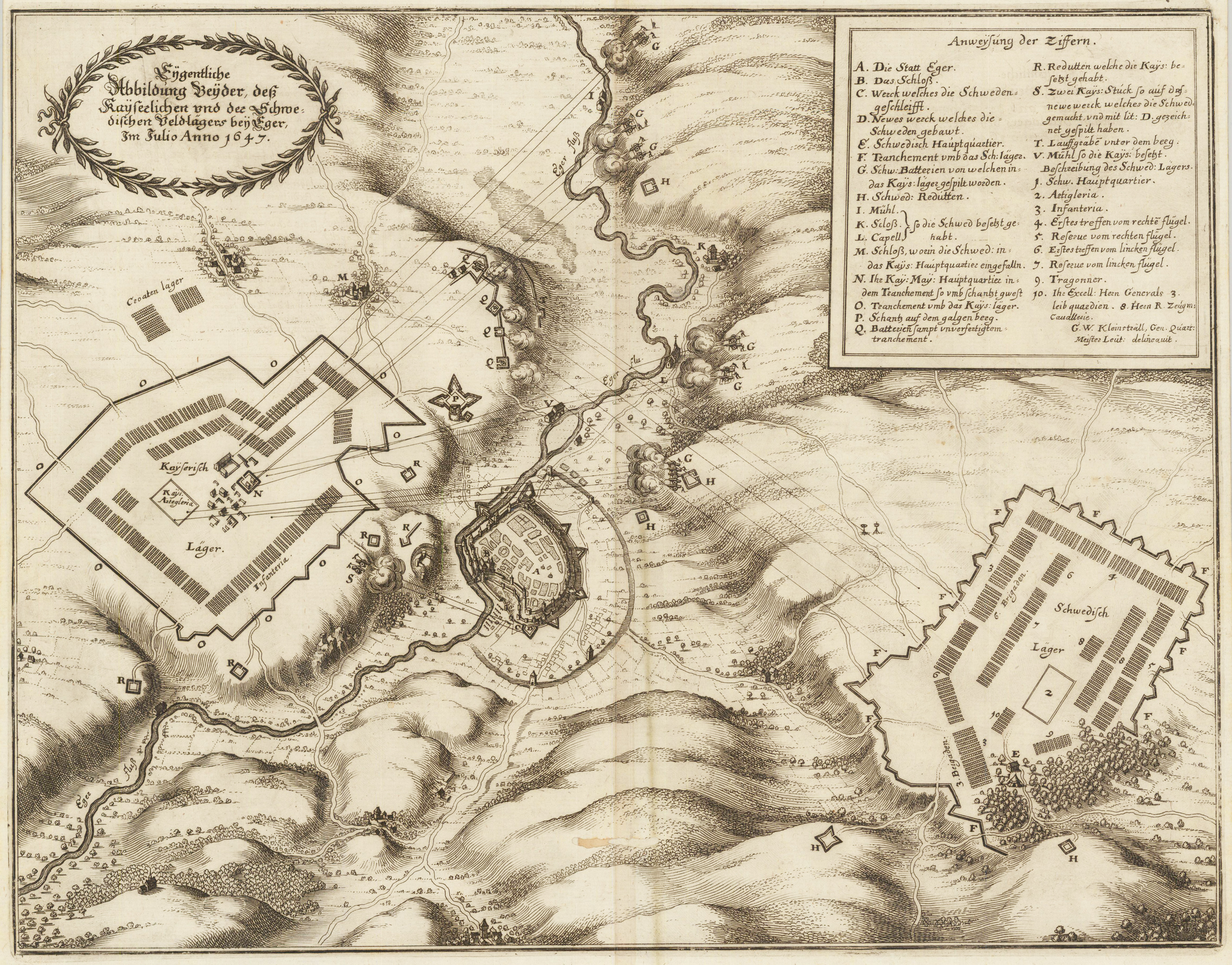
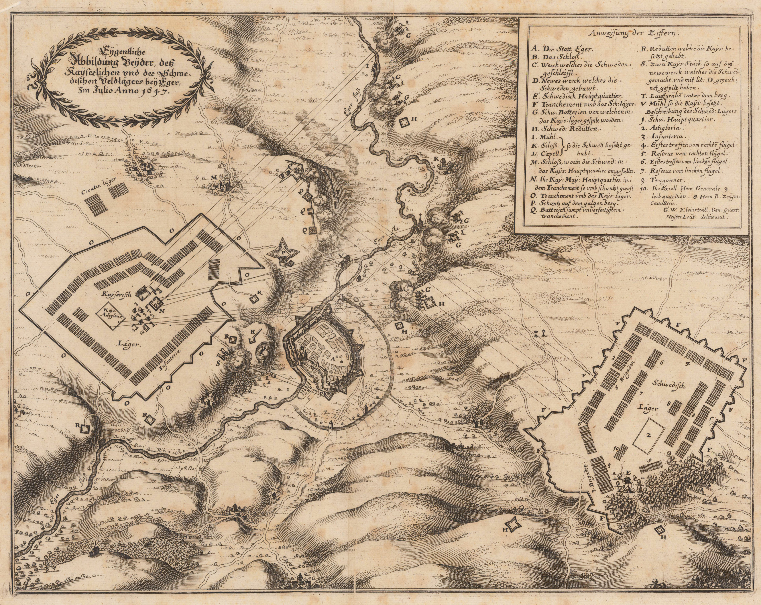
Original antique copper engraving, uncolored. The copper engraving shows the landscape around the city of Eger, the river Eger runs across it, the city itself is only schematically sketched on a relatively small scale. The camps of the hostile armies are on both sides of the city. In the top left corner is a short German declaration inscription in a laurel wreath. At the top right is the legend: A – V and 1–10. As soon as the Swedish general Wrangel was protected in the hinterland by the armistice between Maximilian of Bavaria and the Swedes and the French in Ulm in March 1647, he marched with his army to the northeast, conquered Schweinfurt and invaded Bohemia. On June 14, 1647, he besieged the city of Eger, which he declared was the key to Bohemia. In the meantime, a strong imperial army concentrated under the command of General Graf Holzapfel, who was originally called Melander. Even Emperor Ferdinand III. came to Budweis to lend more weight to the prepared combat action. Despite the approaching army, the Swedes were able to capture Eger by chord on July 5. The neutrality of the Elector of Saxony and the ever increasing pressure from the imperial army finally forced Wrangel to leave Bohemia and move through Thuringia to the source area of the Weser.
Original antique copper engraving, uncolored. Titled and the year at the top left with a laurel wreath. Army troops and buildings were identified by letters. The corresponding legend can be found in the box at the top right. The graphic gives an overview of the battles for Eger in 1647. Matthäus Merian was born as the son of the saw miller and councilor Walther Merian. After attending high school, he learned drawing, engraving and etching from the Zurich engraver Friedrich Meyer. From 1610 to 1615 he studied and worked in Strasbourg (with Friedrich Brentel), Nancy and Paris (with Jacques Callot). His large Basel city plan was created in Basel in 1615. After his travels via Augsburg, Stuttgart and the Netherlands, Merian came to Frankfurt am Main and Oppenheim in 1616, where he worked for the publisher and engraver Johann Theodor de Bry; de Bry owned an engraving shop in Oppenheim and a publishing house in Frankfurt, where large travel books on the Far Eastern countries were prepared at the time. In 1617 Merian married Maria Magdalena de Bry, his employer's daughter. During this time he also worked for the engraver and publisher Eberhard Kieser. In 1620 he moved back to his hometown of Basel, where he acquired guild rights and became self-employed. After his father-in-law's death (1623), he continued his publishing house in Frankfurt and acquired Frankfurt citizenship in 1626. In 1627 he took Wenzel Hollar into his workshop as a student. After his wife's death (1645), Merian married Johanna Sibylla Heim in 1646. From his first marriage there are three daughters (Susanna Barbara, Margaretha and Maria Magdalena) and three sons: the two Matthäus Merian the Younger and Caspar Merian, who also work in his workshop, as well as Joachim. The second marriage resulted in the daughter Maria Sibylla Merian, the natural scientist and artist. Matthäus Merian died after a long illness on June 19, 1650 in Langenschwalbach near Wiesbaden. He was buried in the Peterskirchhof in Frankfurt. (Wikipedia)
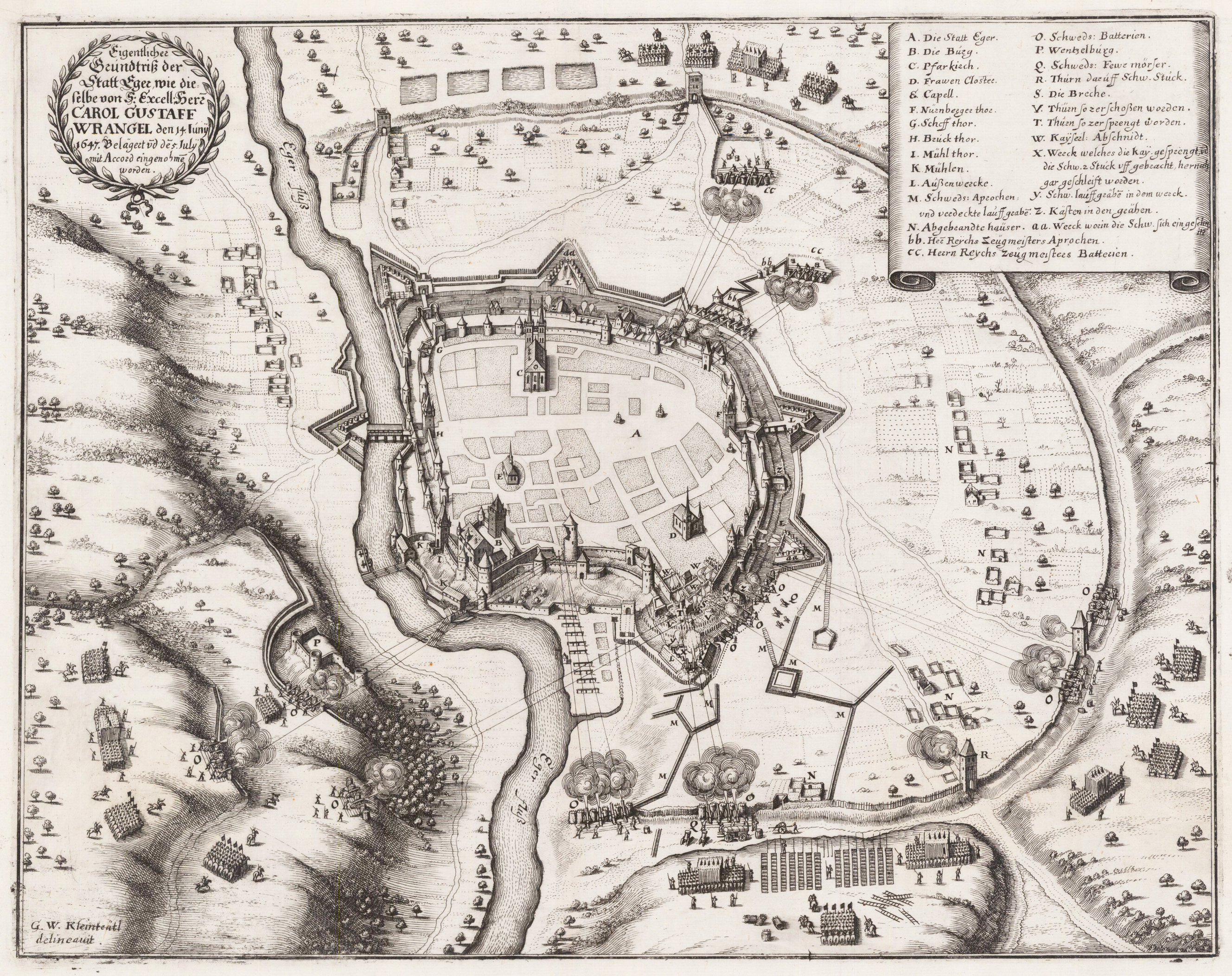
Original antique copper engraving, uncolored. Engraved after a sketch by G. W. Kleinsträtl, published in the description of the thirty years war ,Theatrum Europaeum' ca. 1647-50 by Matthaeus Merian in Frankfurt. Siege of the city of Eger in Bohemia by Carl Gustav Wrangel during the thirty years war on June 14th, 1647. The plan depicts the city as an bird´s eye view with its city walls and the nearby surrounding including the river Eger. Upper left corner with title cartoushe and a detailed explanation in the upper right corner.
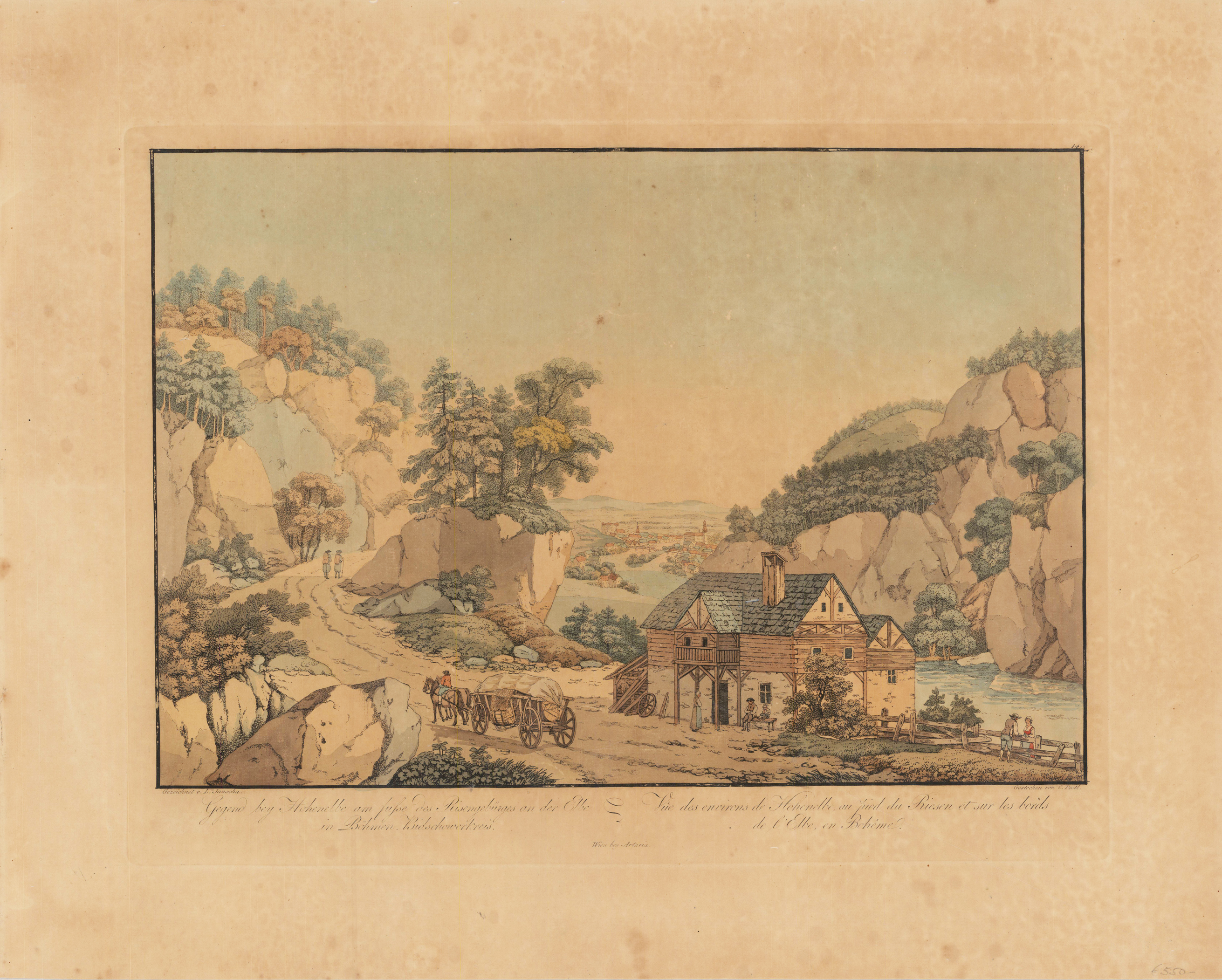
Copper engraving, original color in outline and wash. Decorative panoramic landscape near Hohenelbe at the feet of the ,Riesengebirge' in Bohemia. The etching was engraved by C. Postl after a sketch by Lorenz Jantscha. Printed on handmade paper, with watermark ,van Gelder Zonen'.
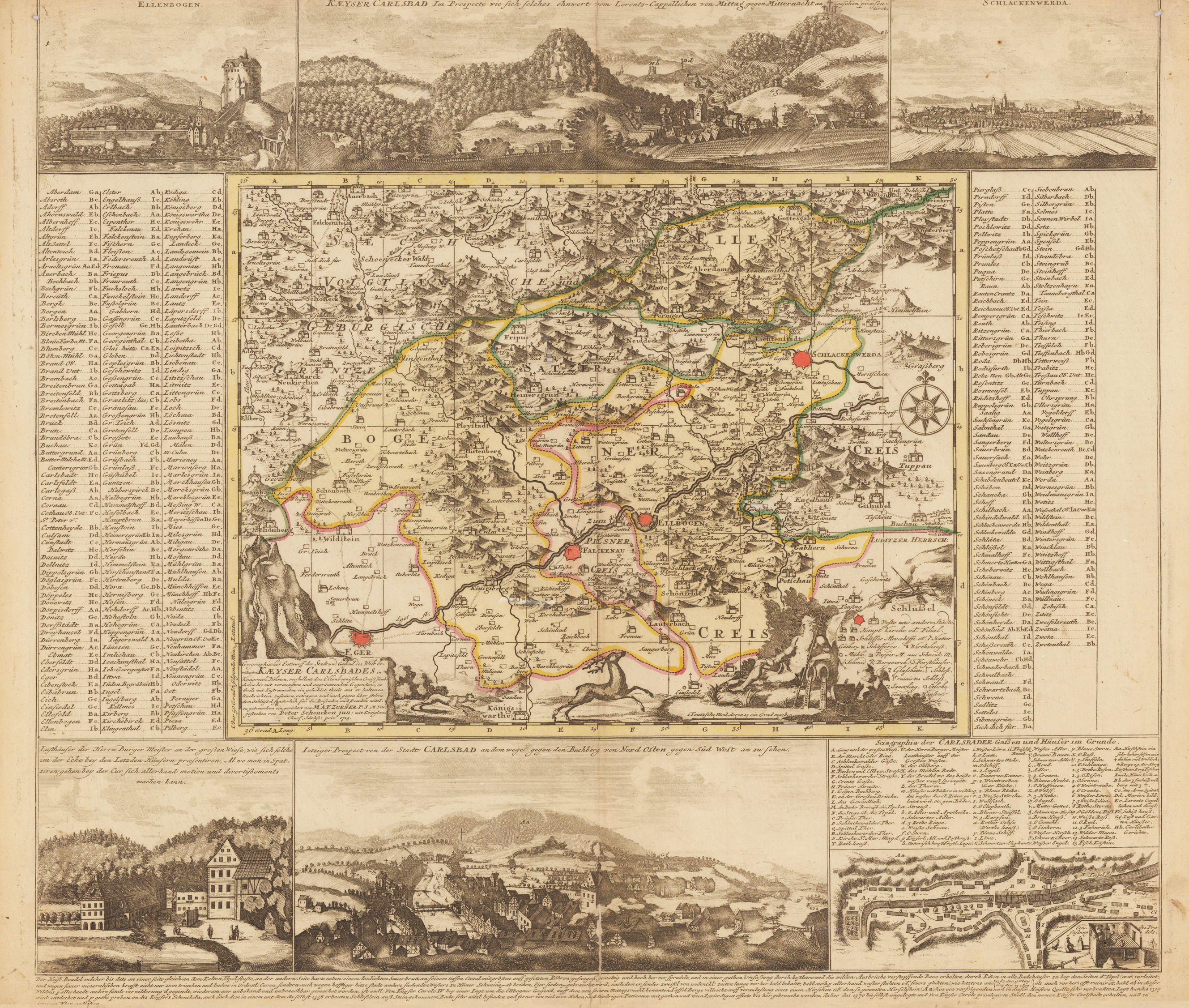
Original antique copper engraving, hand colored in outline and wash. Copper engraved map with old border and area coloring by Peter Schenk after Adam Friedrich Zürner from: New Saxon Atlas, containing the seven circles. In the middle the map of the Carlsbad area, with many place names, rivers, mountains, etc. Marginal views at the top and bottom (above: Ellenbogen, Karlsbad, Schlaccowerth; below: Karlsbad 2x and city map of Karlsbad), on the left and right margin explanations. Title cartouche in the lower left corner of the middlemap. Peter Schenk the Younger (born February 15, 1693 in Amsterdam; † January 14, 1775 in Amsterdam) was a German engraver and map publisher who is considered the most important publisher of Saxon special maps in the first half of the 18th century. He was the son of the engraver and map publisher Peter Schenk the Elder (1660-1711) and followed the expansion of his range of maps and topographical views of central Germany, which his father had started. He also acquired printing plates from the Dutch publisher Nicolaes Visscher II to further expand the publishing program. Schenk also often worked with Adam Friedrich Zürner. (Wikipedia) Peter Schenk the Younger (born 15 February 1693 in Amsterdam; died: 14 January 1775) was a Dutch engraver and map publisher active in Leipzig. He was the son of the engraver and map publisher Peter Schenk the Elder who owned a shop in Leipzig and travelled regularly between there and Amsterdam in the 17th century. In 1715 Peter the Younger traveled to Leipzig in order to sell some paintings by Jan van Huchtenburgh and Jan and Willem van Mieris. (Wikipedia)
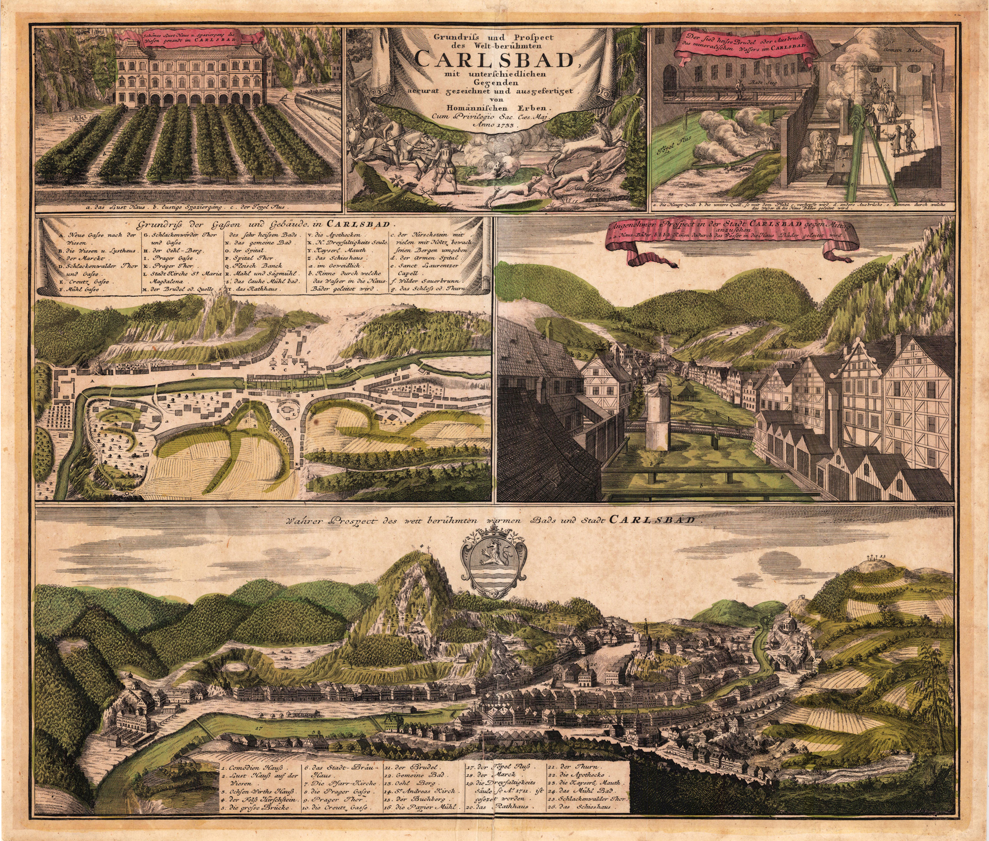
Copper engraving, hand colored in outline and wash when published. Prospect of Carlsbad in Bohemia. Panoramic view of the famous spa in northwest Bohemia, the view is combined with various scenes of the town, as well scenes of the warm spas are shown.
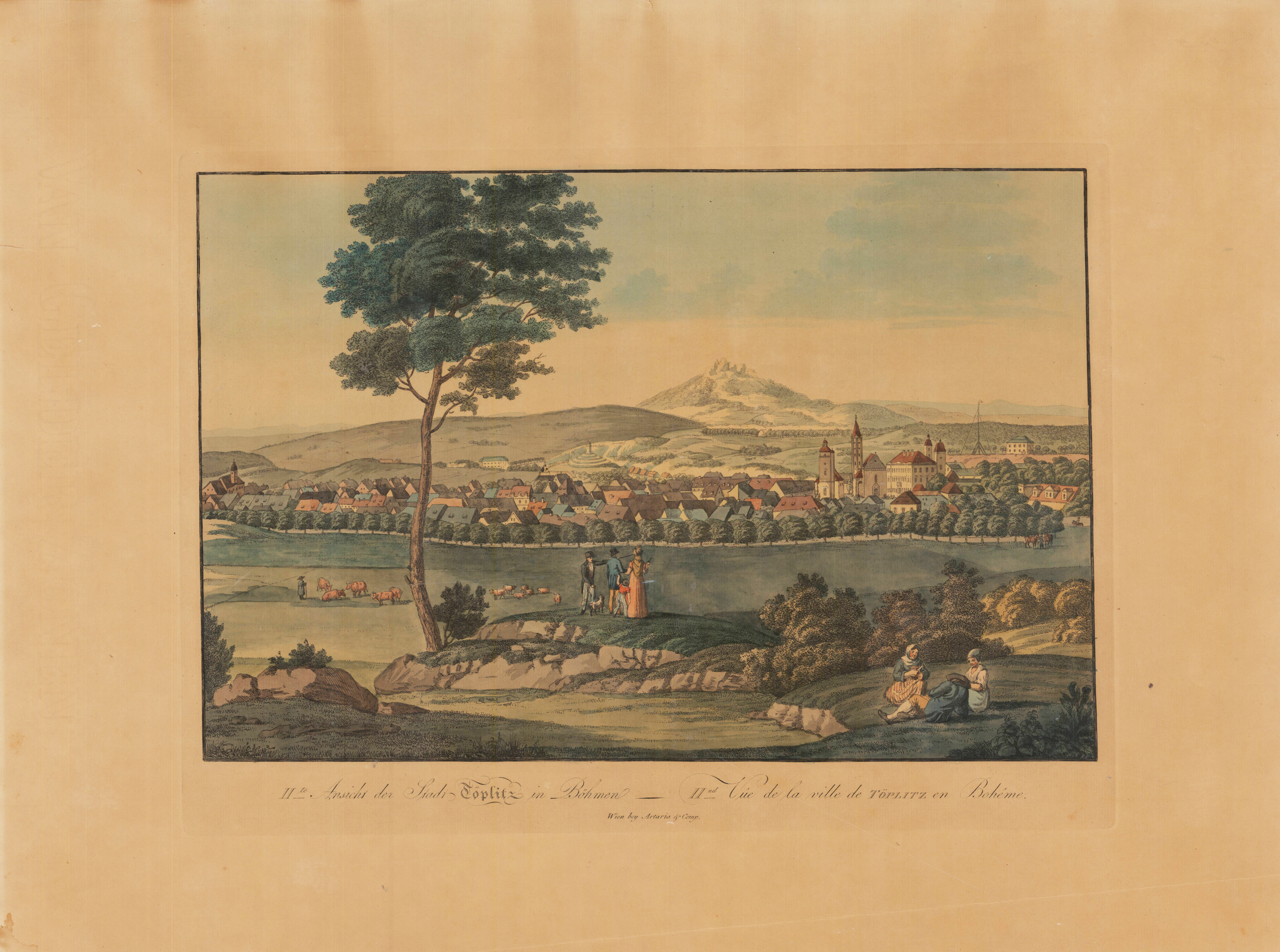
Copper engraving, original color in outline and wash. Decorative panoramic city view of Töplitz (Teplice) in Bohemia. The etching was probably engraved by C. Postl after a sketch by Lorenz Jantscha. Printed on handmade paper, with watermark,van Gelder Zonen'.