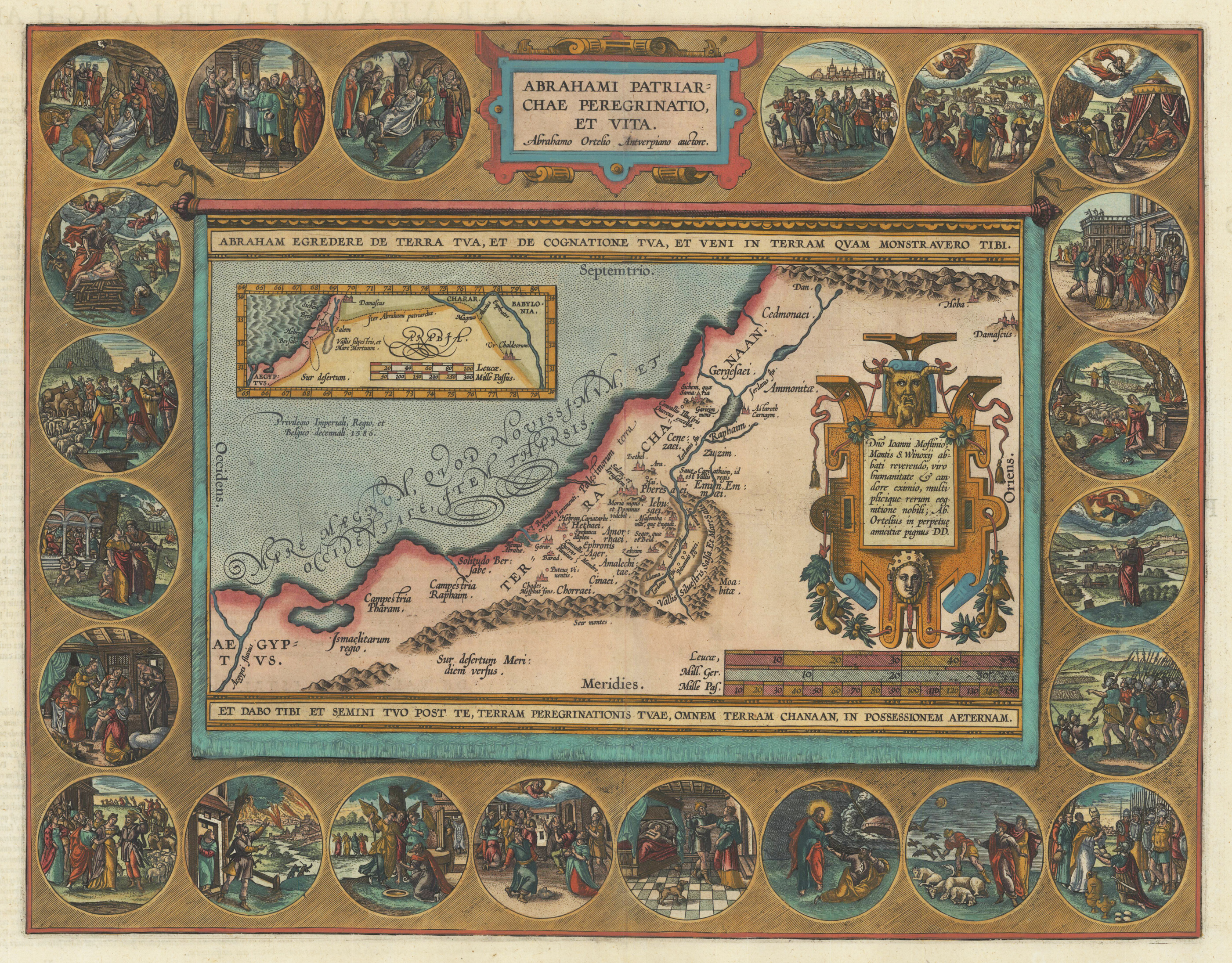
Original copper engraving, published 1612 in the famous historical atlas "Parergon" (Latin text-edition) by Abraham Ortelius. Finely later hand colored in wash and outline. The map shows the travels and life of Abraham. More else, this highly decorative map, is surrounded by 22 fine engraved medallions, which are showing episodes of the life of the Patriach Abraham. The map was published 1592 for the first time in Abraham Ortelius edition of the ,Theatrum Orbis Terrarum'. Ortelius, who created this map used as cartographical source for this map information from Ptolemy and from the bible, particulary for the illustrations of Abraham's life depicted in 22 medallions.
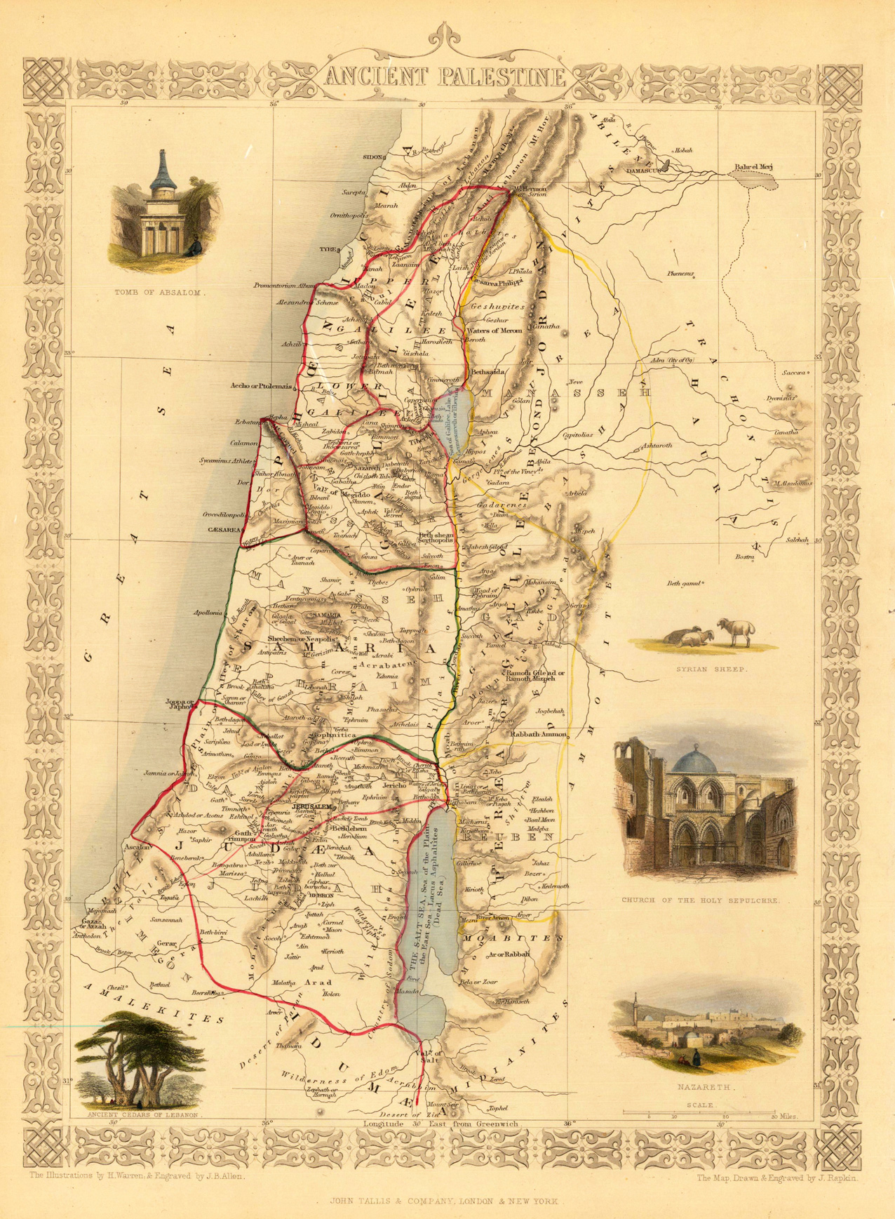
Steel engraving, hand colored in outline and wash. Fine engraved map is showing Ancient Palestine. The map is decorated with five finely hand colored engraved vignettes: the tomb of Absalom, the church of the holy sepulchre, a city view of Nazareth, ancient cedars of Lebanon and a Syrian sheep. The actual map was drawn and engraved by J. Rapkin. The illustrations were engraved by various artists: R. Radclyffe, W. Lacy, J. Rogers, J. H. Kernot, J. B. Allen, T. Fleming, H. Winkles, R. Baker after drawings by H. Warren, H. Winkles and H. Wray.
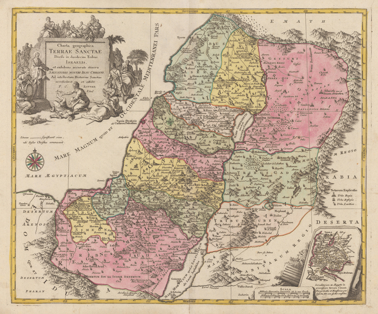
Copper engraving handcolored in wash and outline, when published. Engraved ca. 1762 by Georg Friedrich Lotter in Augsburg. Decorative map of the Holy Land divided up in its twelve tribes. This detailled map of the Holy Land is ornated in the lower right corner with a small inset map, a well in the upper right corner with a large allegoric decorative title cartouche.
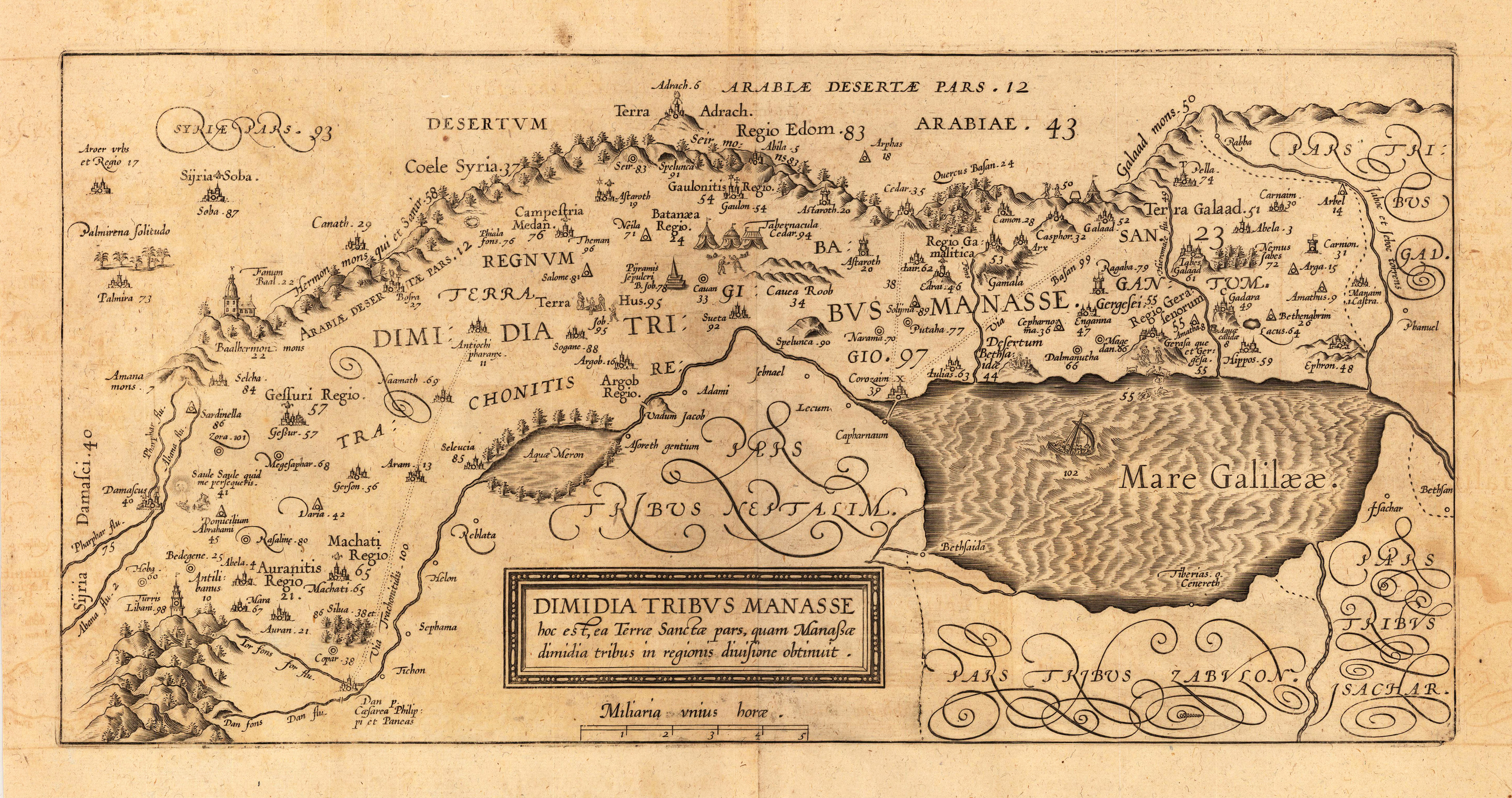
Copper engraving, uncolored as published. Tribe of Manasse. This decorative map of the Holy Land is engraved by Christian Adrichom (Christiaan van Adrichems), who was born in Delft.
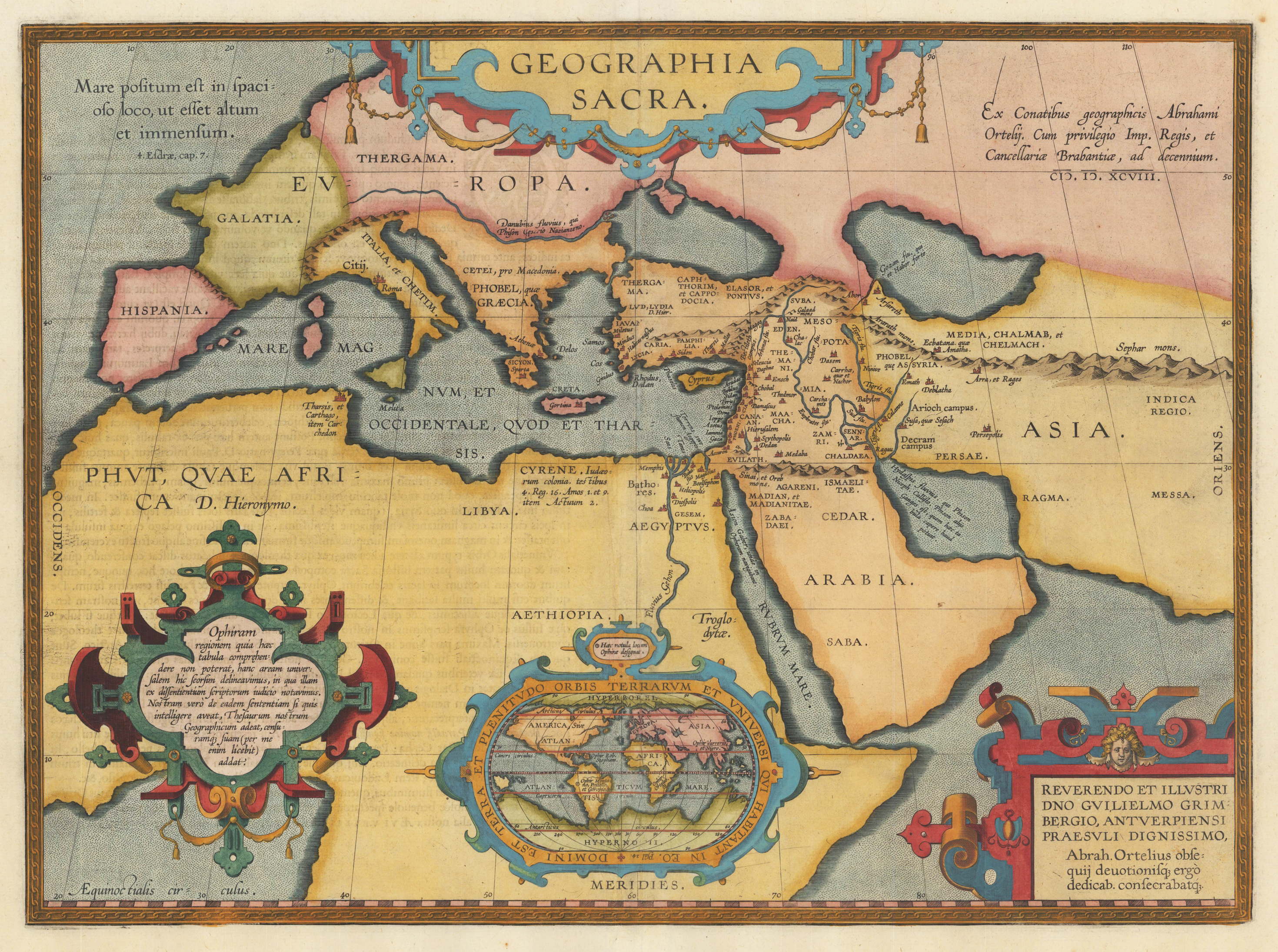
Original copper engraving, published 1612 in the famous historical atlas "Parergon" (Latin text-edition) by Abraham Ortelius. Finely later hand colored in wash and outline. Depicted is the ancient world focussing the Middle East with Asia Minor, Syria and Persia and neighbouring areas. Richly decorated with renaissance text cartoiuches and ornated in the lower centre with an oval decorative modern world map by Abraham Ortelius. This map of ,Sacred Geography' is based on holy writers in the Old and New Testament following the translation of the Septuaginta.
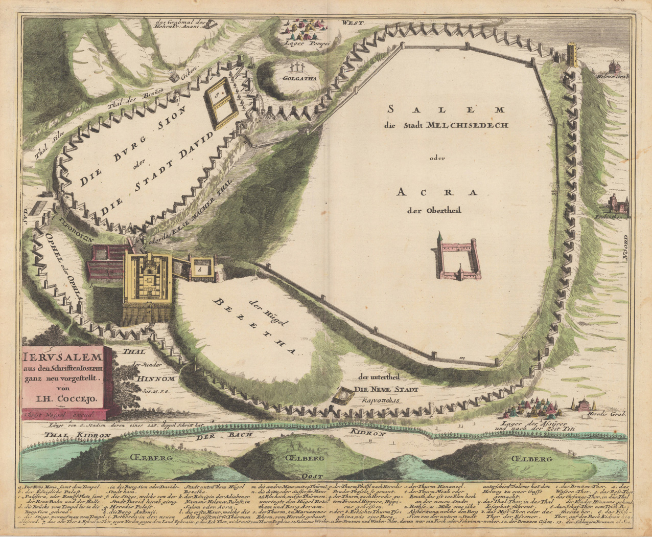
Original antique copper engraving, hand colored in outline and wash when published. This map was published in the historical atlas by Ch. Weigel in Augsburg. J.B. Homann worked together with Ch. Weigel as an engraver in this atlas. A strong and fine impression of this detailed historical plan or map of Jerusalem, engraved after the scripts of I.H. Coccejo. Below we find a detailed table with explanations. Johann Christoph Weigel, known as Christoph Weigel the Elder (9 November 1654 – 5 February 1725), was a German engraver, art dealer and publisher. He was born at Redwitz, Free imperial city of Eger in Egerland, and died in Nuremberg, aged 70. The cartographer Weigel worked around 1719 in Nürnberg and his maps are showing the typical style of this period in map making in Southern German. He worked very close as with Johann B. Homann in Nürnberg. All his maps were hand colored in outline and decorative body color immediatelly in his printing house, after they were printed.
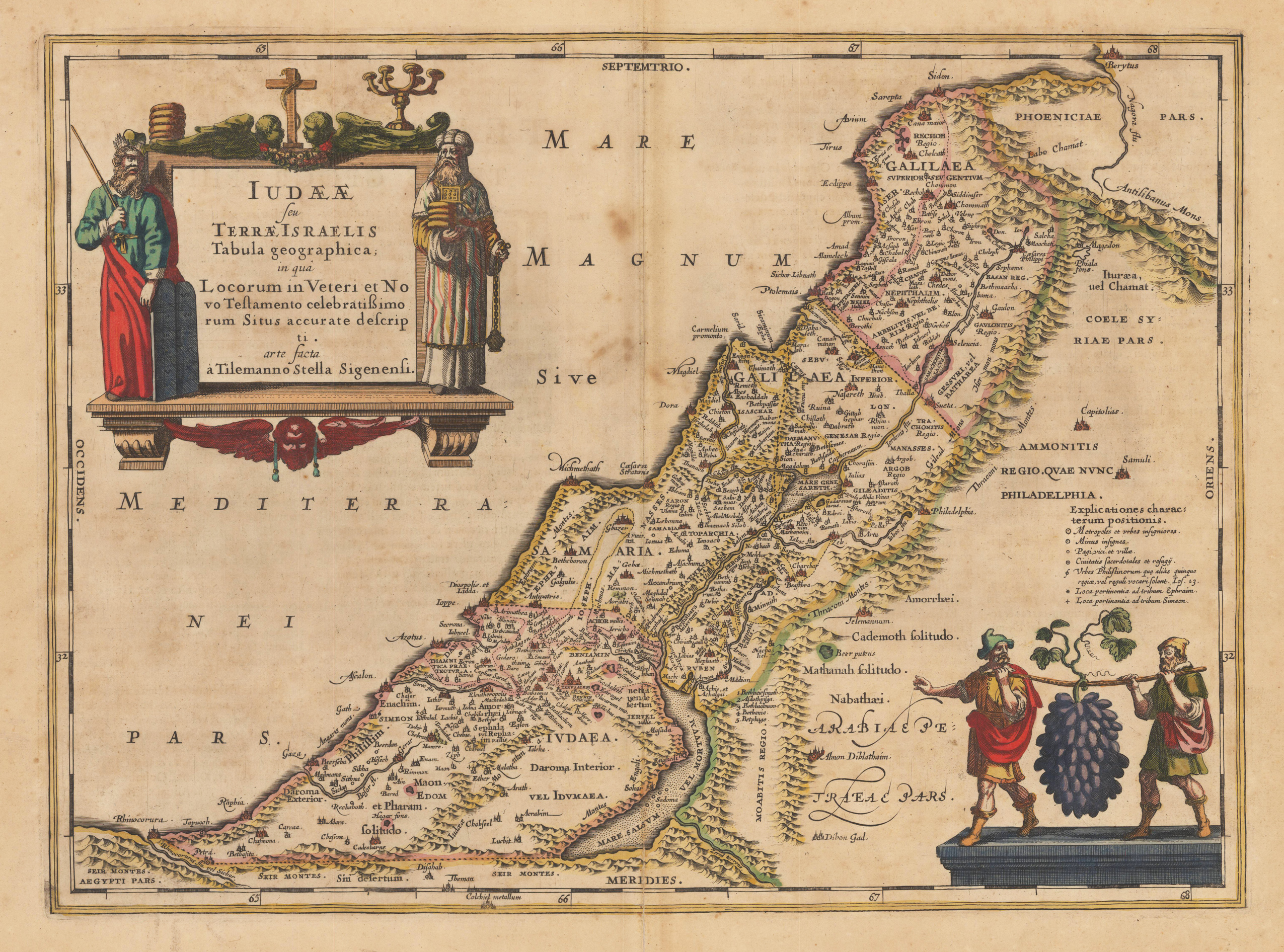
Copper engraving, hand colored in outline when published. A highly decorative map of the Holy Land, which is ornated with a large decorative figurative title cartouche at the upper left corner. In the lower right corner we find a decorative cartouche of two males carrying fruits. Janssonius published this map in his historical atlas after the cartographic sources of Tilleman Stella. A small split mended at the lower centre fold (hardly visible).
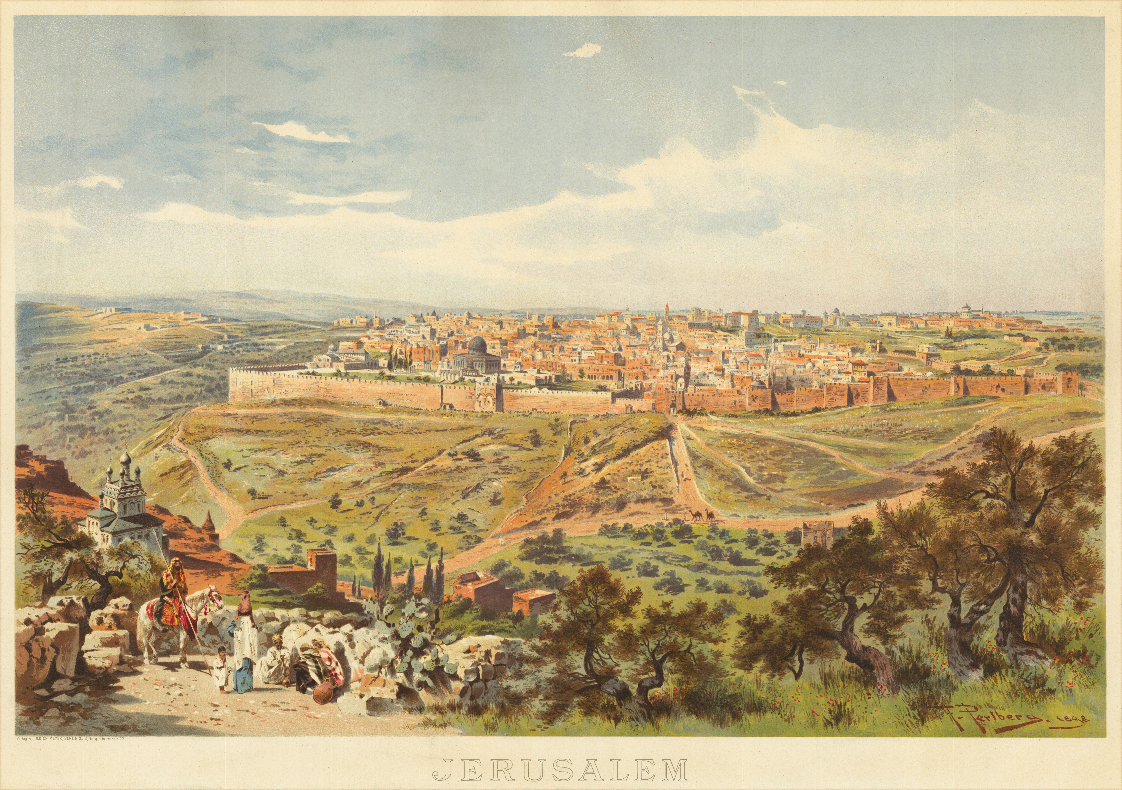
Original lithograph in color. In the foreground sit a group of men smoking a water pipe. Next to it, a woman with a clay jug on her head and a rider in front of a small church. Jerusalem inside the city wall can be seen in the background. In between a hilly landscape with meadows and trees. Friedrich Perlberg was the son of the painter Georg Christian Perlberg (1806–1884). He studied from 1868 to 1875 he studied architecture and landscape painting at the school of applied arts in Nürnberg and Paris. His main place of work was in Munich, however also in Italy, Spain and and especially in the Orient.
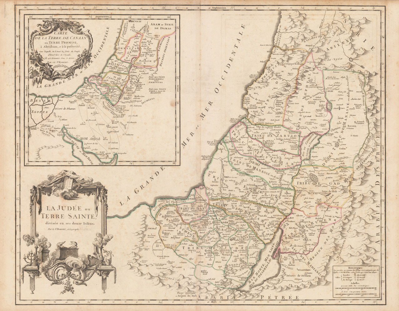
Copper engraving, hand colored in outline, when published. Detailed map by the French cartographer Sr. Robert de Vaugondy. This antique map shows detailed the Holy Land. The map pretty much up to date on the newest cartographic sources for this period around 1752-55, engraved after the cartographic sources by Nicolaus Sanson. With many engraved historical place names of cities and villages, streets and routes and mountain chains are shown as well. Ornated with a large decorative allegoric title cartouche in the lower left corner. Further on we find an interesting inset map in the upper left corner.
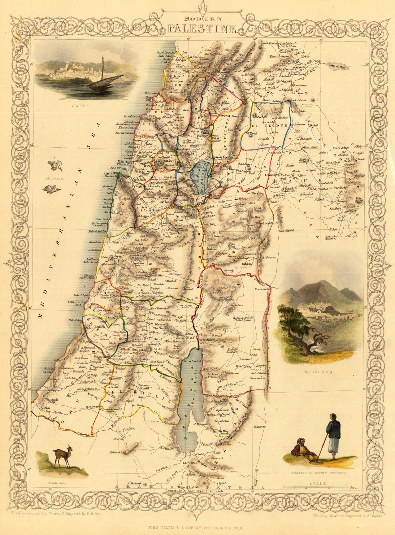
Steel engraving, hand colored in outline and wash. A fine engraved map, which is showing modern Palestine with many details, the dead sea and the Mediterranean Sea. The map is decorated with four finely hand colored engraved vignettes: a ship with Jaffa in the backround, the city of Nazareth, some animales and natives of mount Lebanon. The actual map was drawn and engraved by J. Rapkin. The illustrations were engraved by various artists: R. Radclyffe, W. Lacy, J. Rogers, J. H. Kernot, J. B. Allen, T. Fleming, H. Winkles, R. Baker after drawings by H. Warren, H. Winkles and H. Wray.
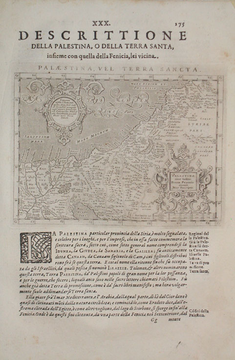
Fine copper engraved map, printed into the full text page, published in 'Geografia ... Universale de la Terra', which was translated by Cernoti and published 1621 in Padua. A small decorative map fine engraved map showing Palestine. The map is ornated with two renaissance cartouches, also this interesting old map provides a lot of engraved place names, rivers, mountains, etc.
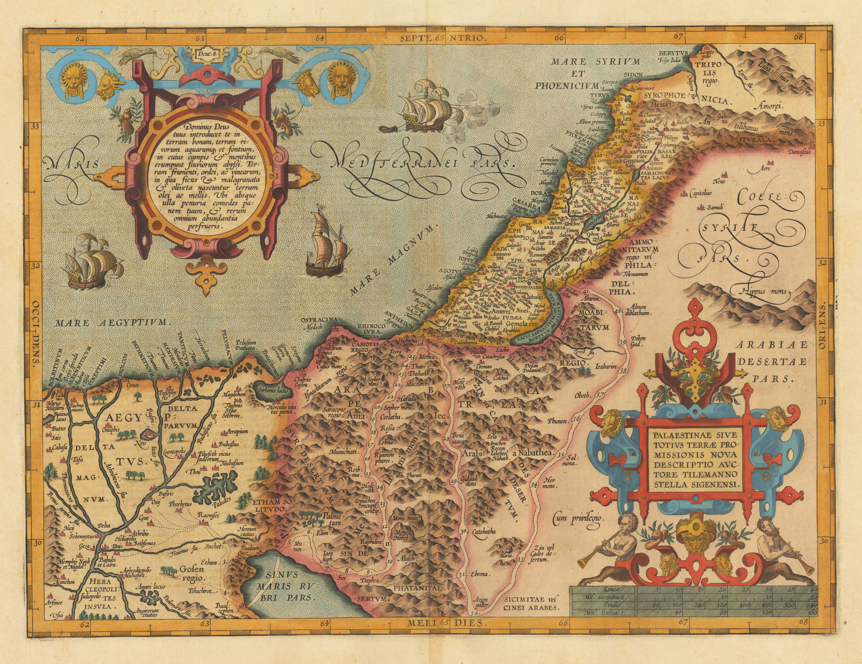
Original antique copper engraving, published 1612 in the famous historical Atlas "Parergon" (Latin text-edition) by Abraham Ortelius. Finely later hand colored in wash and outline. A highly decorative and early map of Palestine by the famous cartographer and mapmaker Abraham Ortelius based on Stella's map of 1552. The early map here present in a strong impression, ornated with two beautiful renaissance text cartouches and an ornated mileage scale below at the bottom. Ortelius was born on 14 April 1527 in the city of Antwerp, which was then in the Habsburg Netherlands (modern-day Belgium). The Orthellius family were originally from Augsburg, a Free imperial city of the Holy Roman Empire. In 1535, the family had fallen under suspicion of Protestantism. Following the death of Ortelius's father, his uncle Jacobus van Meteren returned from religious exile in England to take care of Ortelius. Abraham remained close to his cousin Emanuel van Meteren, who would later move to London. In 1575 he was appointed geographer to the king of Spain, Philip II, on the recommendation of Arias Montanus, who vouched for his orthodoxy. He travelled extensively in Europe and is specifically known to have traveled throughout the Seventeen Provinces; in southern, western, northern, and eastern Germany (e.g., 1560, 1575–1576); France (1559–1560); England and Ireland (1576); and Italy (1578, and perhaps twice or thrice between 1550 and 1558). Beginning as a map-engraver, in 1547 he entered the Antwerp Guild of Saint Luke as an illuminator of maps. He supplemented his income trading in books, prints, and maps, and his journeys included yearly visits to the Frankfurt book and print fair, where he met Gerardus Mercator in 1554. In 1560, however, when travelling with Mercator to Trier, Lorraine, and Poitiers, he seems to have been attracted, largely by Mercator's influence, towards the career of a scientific geographer. (Wikipedia)
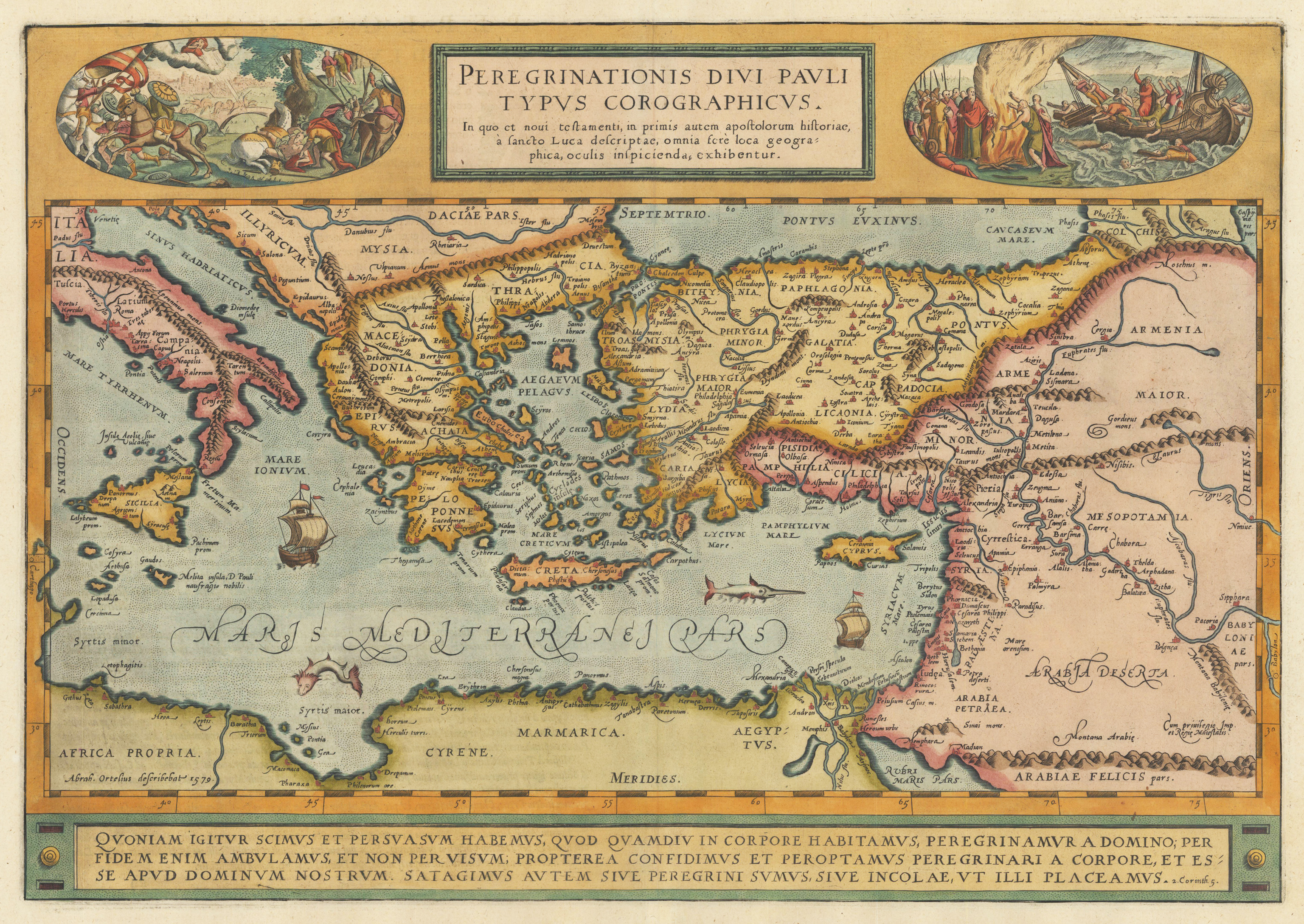
Original copper engraving, published 1612 in the famous historical atlas "Parergon" (Latin text-edition) by Abraham Ortelius. Finely later hand colored in wash and outline. A highly decorative map showing the travels of St. Paul in the Mediterrean. Decorated with two oval historical engraved scenes from the travels of St. Paul. The map is equipped with two sailing ships, a speer fish and a sea monster in the Mediterranean Sea. Engraved place names and towns are shown as miniature views, rivers and mountains are engraved, too. The bottom of the map contains a large text chapter in three lines: the fifth chapter of the Second Epistle to the Corinthians in the New Testament of the Christian Bible. It is authored by Paul the Apostle and Saint Timothy (2 Corinthians 5). The map was published for the first time in 1579 in the edition of the ,Theatrum Orbis Terrarum' and was published until 1624 in the atlas ,Parergon' by A. Ortelius. This is the first state of two, published 1612 with Latin text verso. The 1st state can be identified that the word ,Corographicus' has yet not been corrected to ,Chorographicus' and that the stippling around the sea names has not been added.
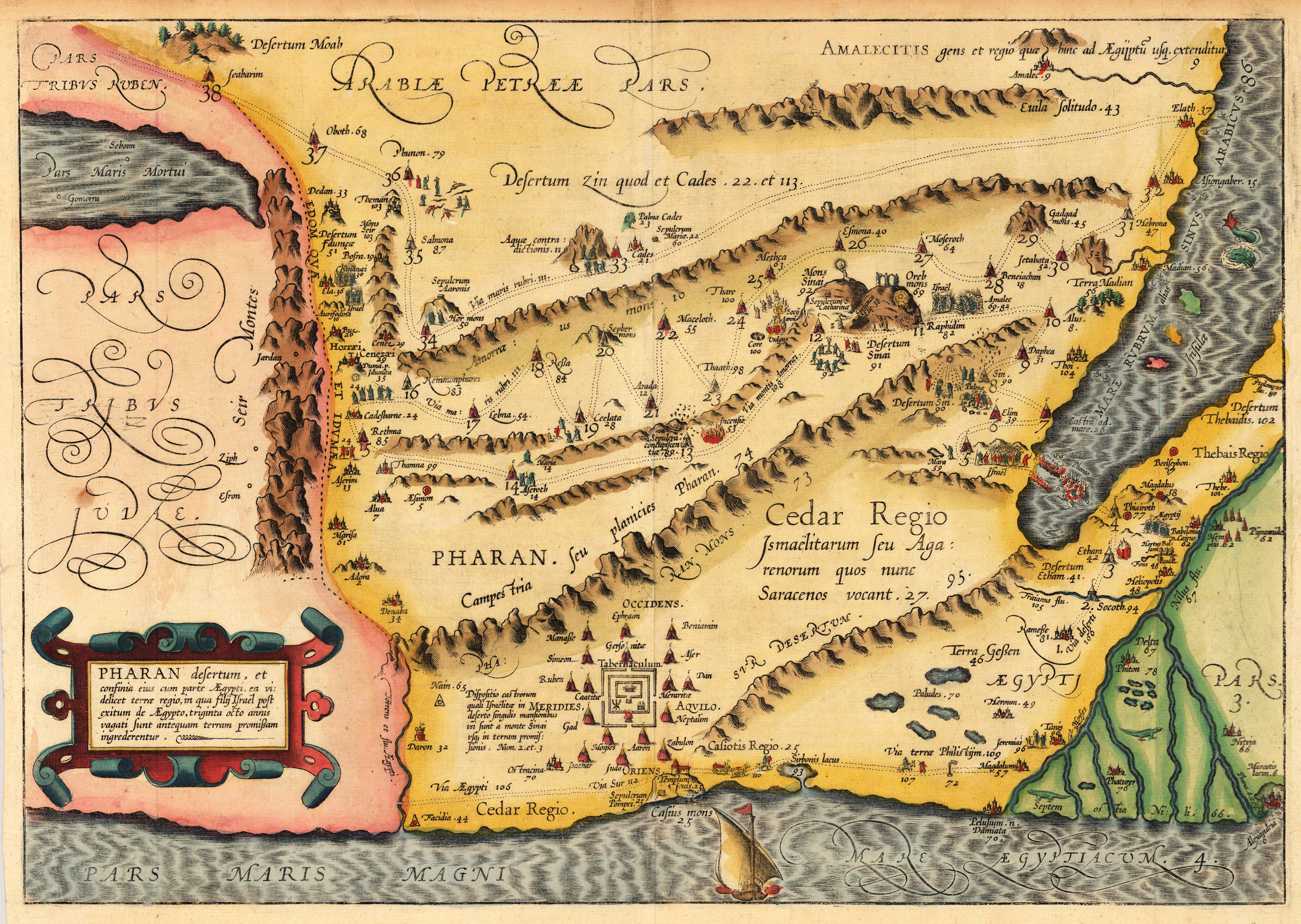
Copper engraving, hand colored in outline and wash. Tribe of Pharan This decorative map of the Holy Land is engraved by Christian Adrichom (Christiaan van Adrichems), who was born in Delft.
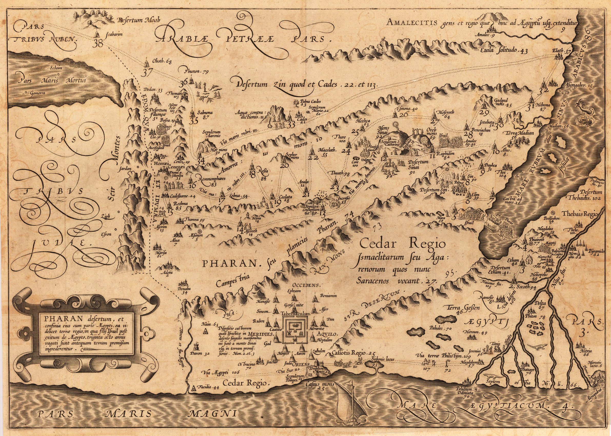
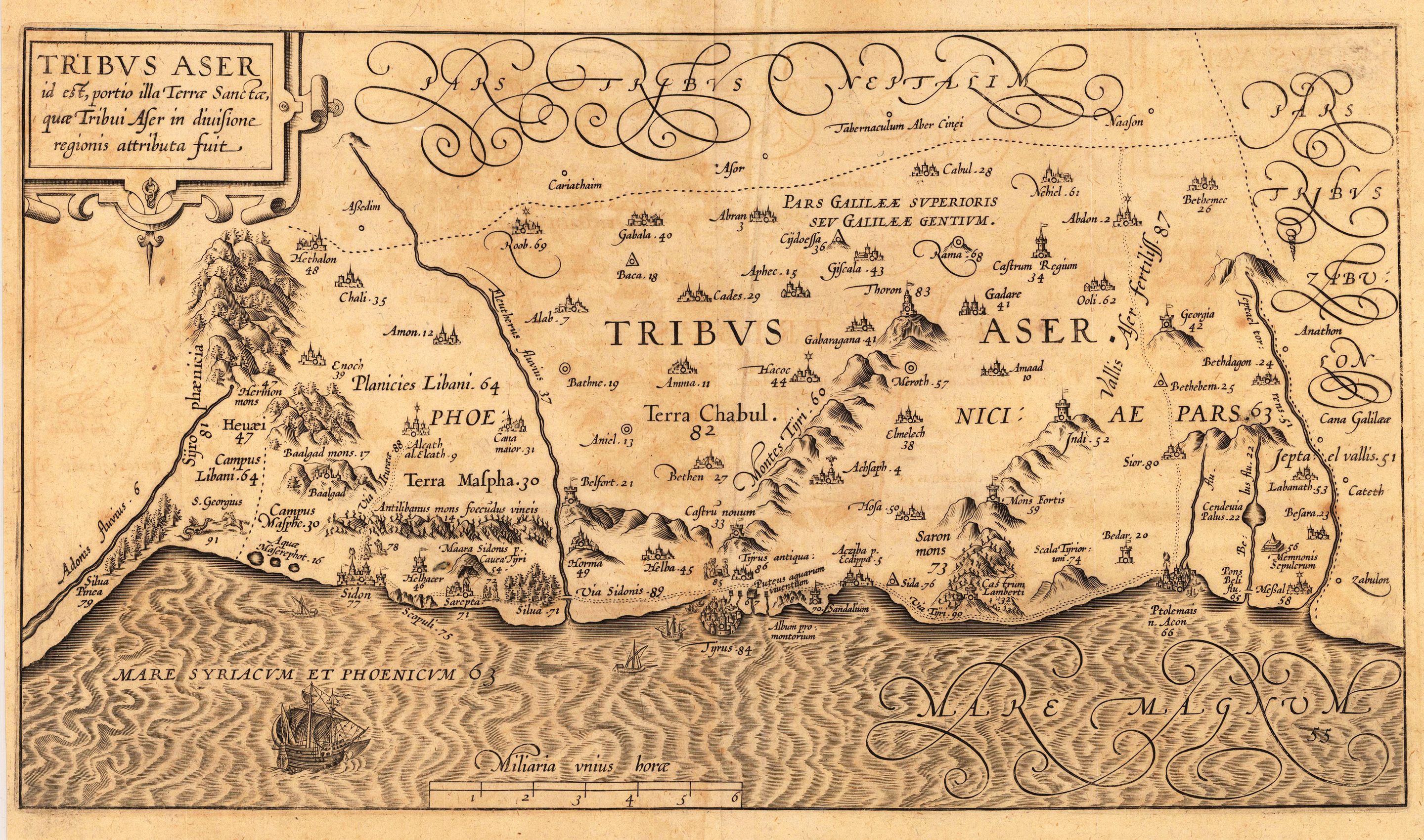
Copper engraving, uncolored as published. Tribe of Pharan This decorative map of the Holy Land is engraved by Christian Adrichom (Christiaan van Adrichems), who was born in Delft.
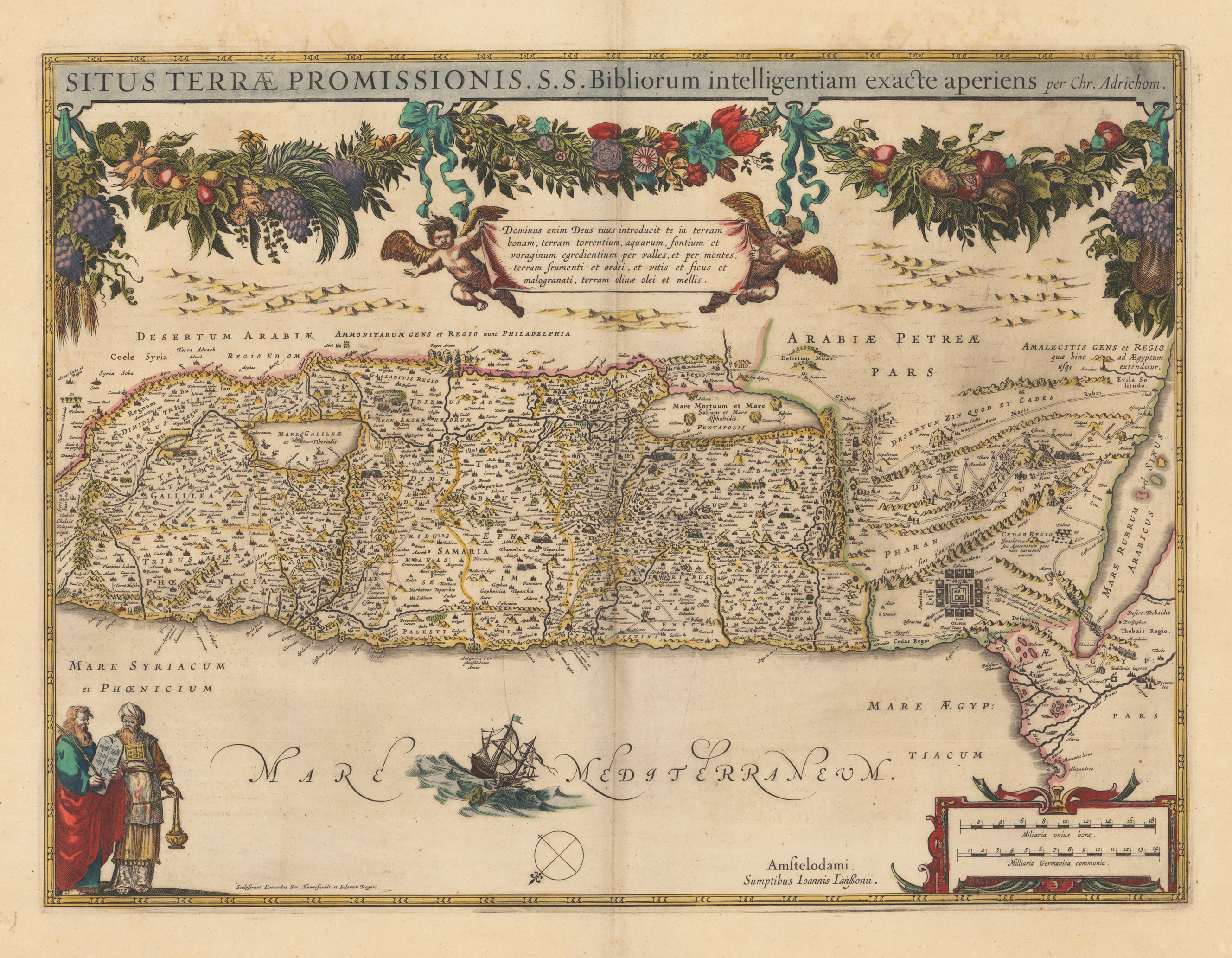
Original antique copper engraving, decorative hand colored in outline. A highly decorative map of the Holy Land, which is ornated at the top with a large floral ornament and two angels holding a text cartouche. The title is engraved at the top. The bottom is onated with a figurative cartouche and an ornated mileage scale. Jannson published this map of the Holy Land after the cartographic sources of Ch. Adrichom. Johannes Janssonius (1588, Arnhem – buried July 11, 1664, Amsterdam) (born Jan Janszoon, in English also Jan Jansson) was a Dutch cartographer and publisher who lived and worked in Amsterdam in the 17th century. Janssonius was born in Arnhem, the son of Jan Janszoon the Elder, a publisher and bookseller. In 1612 he married Elisabeth de Hondt, the daughter of Jodocus Hondius. He produced his first maps in 1616 of France and Italy. In 1623 Janssonius owned a bookstore in Frankfurt am Main, later also in Danzig, Stockholm, Copenhagen, Berlin, Königsberg, Geneva and Lyon. His wife Elisabeth died in 1627 and he married Elisabeth Carlier in 1629. He formed a partnership with his brother in law Henricus Hondius, and together they published atlases as Mercator/Hondius/Janssonius. Under the leadership of Janssonius the Hondius Atlas was steadily enlarged. Renamed Atlas Novus, it had three volumes in 1638, one fully dedicated to Italy. In 1646, a fourth volume came out with "English County Maps", a year after a similar issue by Joan Blaeu. Janssonius' maps are similar to those of Blaeu, and he is often accused of copying from his rival, but many of his maps predate those of Blaeu and/or covered different regions. By 1660, at which point the atlas bore the appropriate name "Atlas Major", there were 11 volumes, containing the work of about a hundred credited authors and engravers. It included a description of "most of the cities of the world" (Townatlas), of the waterworld (Atlas Maritimus in 33 maps), and of the Ancient World (60 maps). The eleventh volume was titled Atlas of the Heavens (a type of celestial cartography) by Andreas Cellarius. Editions were printed in Dutch, Latin, French, and a few times in German. After Janssonius's death, the publishing company was continued by his son-in law, Johannes van Waesbergen. The London bookseller Moses Pitt attempted publication of the Atlas Major in English, but ran out of resources after the fourth volume in 1683. (Wikipedia)
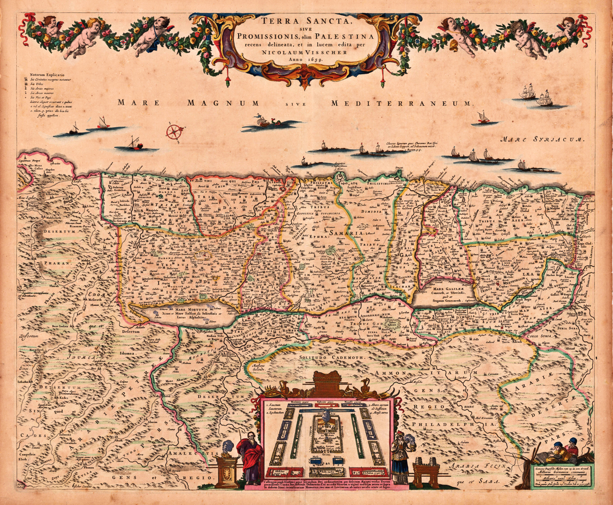
Copper engraving, hand colored in outline and wash when published. Old colored decorative antique map of Nicolaus Visscher's map of the Holy Land. This rare map is orientated to the West and shows the Holy Land divided up with the different ,Tribes of Israel'. Along the coast of the Mediterrarean Sea are several ships and a compass rose used. The highly decorative title cartouche is ornated with puttos and floral decorations. On the left side side to it the ,Notarum explicatio', a table listing with explanations for the various sizes of the cities and towns on the map. At the bottom we find in the centre a bird's eye view with the encampment of various tribes of Israel with the tabernacle in the middle. Allegoric figures (Moses and Aaron) tp the left and right. In the lower right corner a mileage scale with two people reading geographic books. Overall a beautiful old hand colored example of this important Dutch map of the Holy Land published in the 2nd half of the 17th century in Amsterdam.
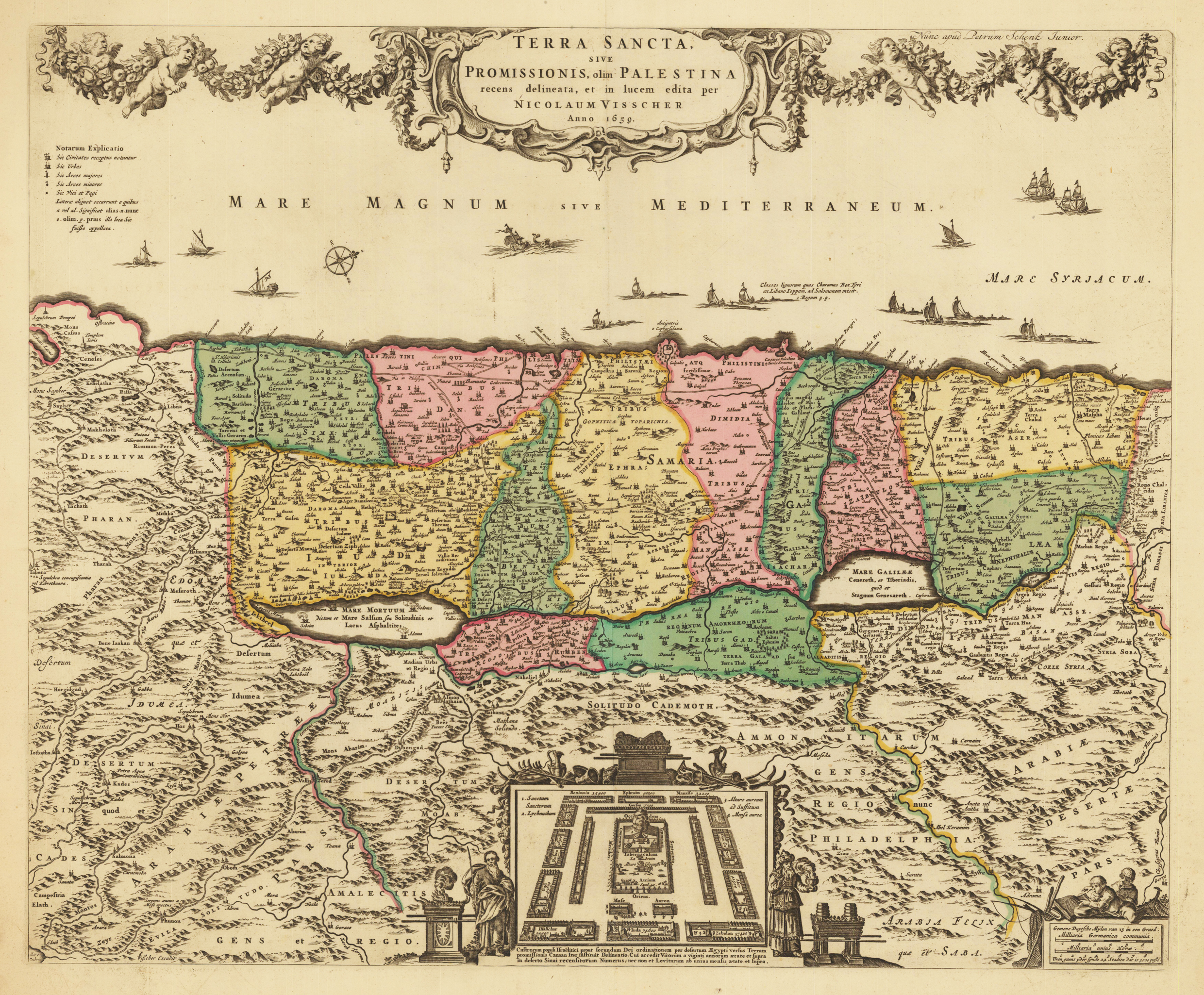
Copper engraving, hand colored in outline and wash when published. Old colored decorative antique map of Nicolaus Visscher's map of the Holy Land published by Petrus Schenk the younger ca. 1700-20 in Amsterdam. This rare map is orientated to the West and shows the Holy Land divided up with the different ,Tribes of Israel'. Along the coast of the Mediterrarean Sea are several ships and a compass rose used. The highly decorative title cartouche is ornated with puttos and floral decorations. On the left side side to it the ,Notarum explicatio', a table listing with explanations for the various sizes of the cities and towns on the map. At the bottom we find in the centre a bird's eye view with the encampment of various tribes of Israel with the tabernacle in the middle. Allegoric figures (Moses and Aaron) tp the left and right. In the lower right corner a mileage scale with two people reading geographic books. Overall a beautiful old hand colored example of this important Dutch map of the Holy Land published in the 2nd half of the 17th century in Amsterdam.
Copper engraving, uncolored as published. This decorative map of the Holy Land is engraved by Christian Adrichom (Christiaan van Adrichems), who was born in Delft.
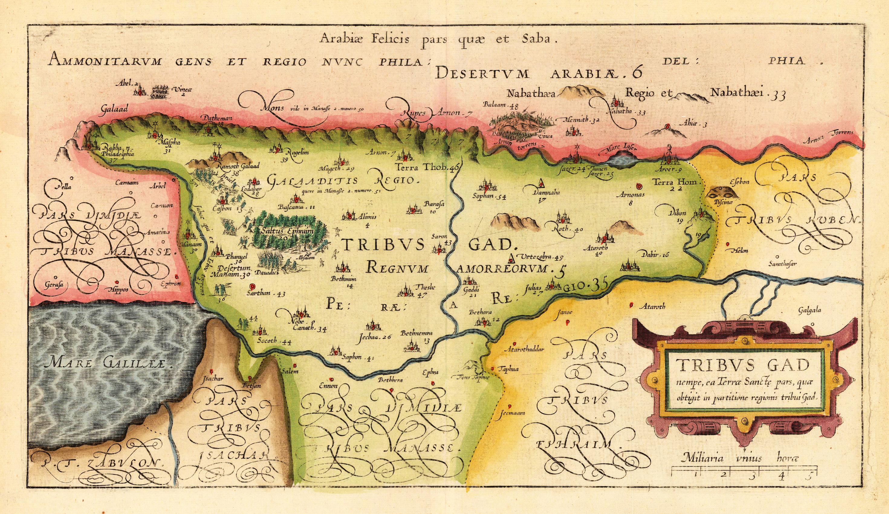
Copper engraving, hand colored in outline and wash. Tribe of Gad. This decorative map of the Holy Land is engraved by Christian Adrichom (Christiaan van Adrichems), who was born in Delft.