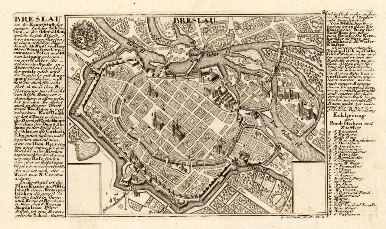
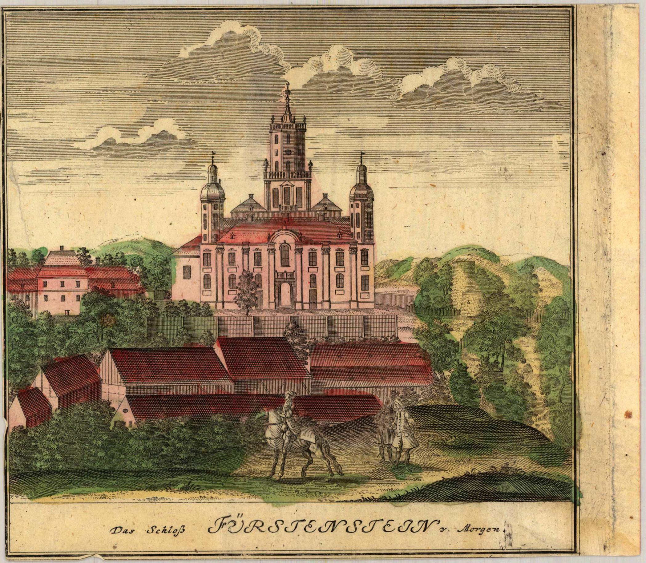
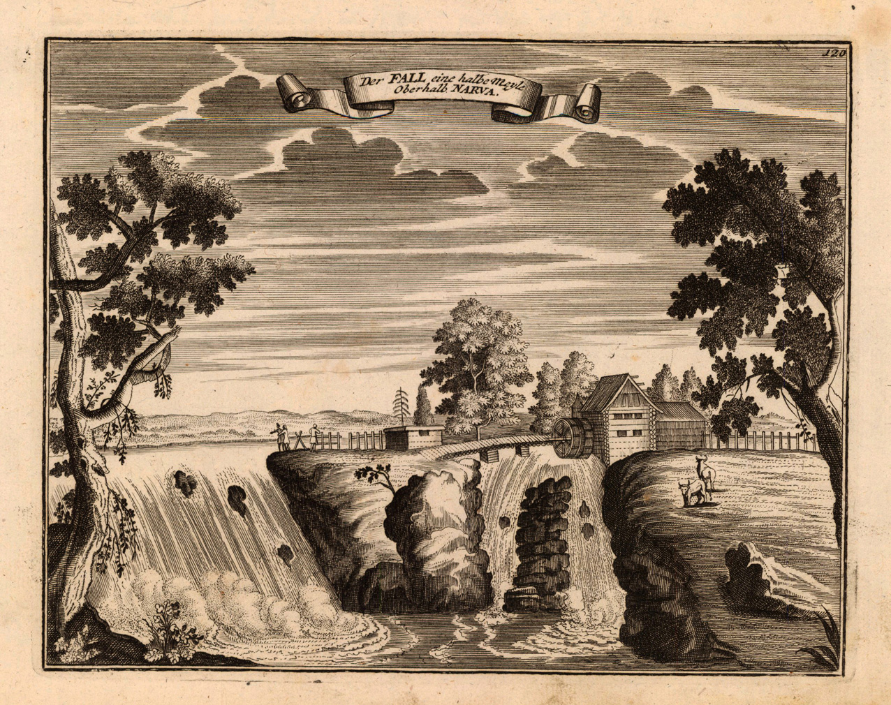
Copper engraving, uncolored as published. This fine engraving was published in Gabriel Bodenehr's famous serious "Europeans Macht und Pracht", a series of engravings depicting city views, plans, fortresses and castles in Europe. Many plates often are showing fortifications in Hungary and Southeast Europe, Spain, Belgium, Austria and Germany. Gabriel Bodenehr was during this period a successful publisher for maps and prints in Augsburg in Southern Germany.
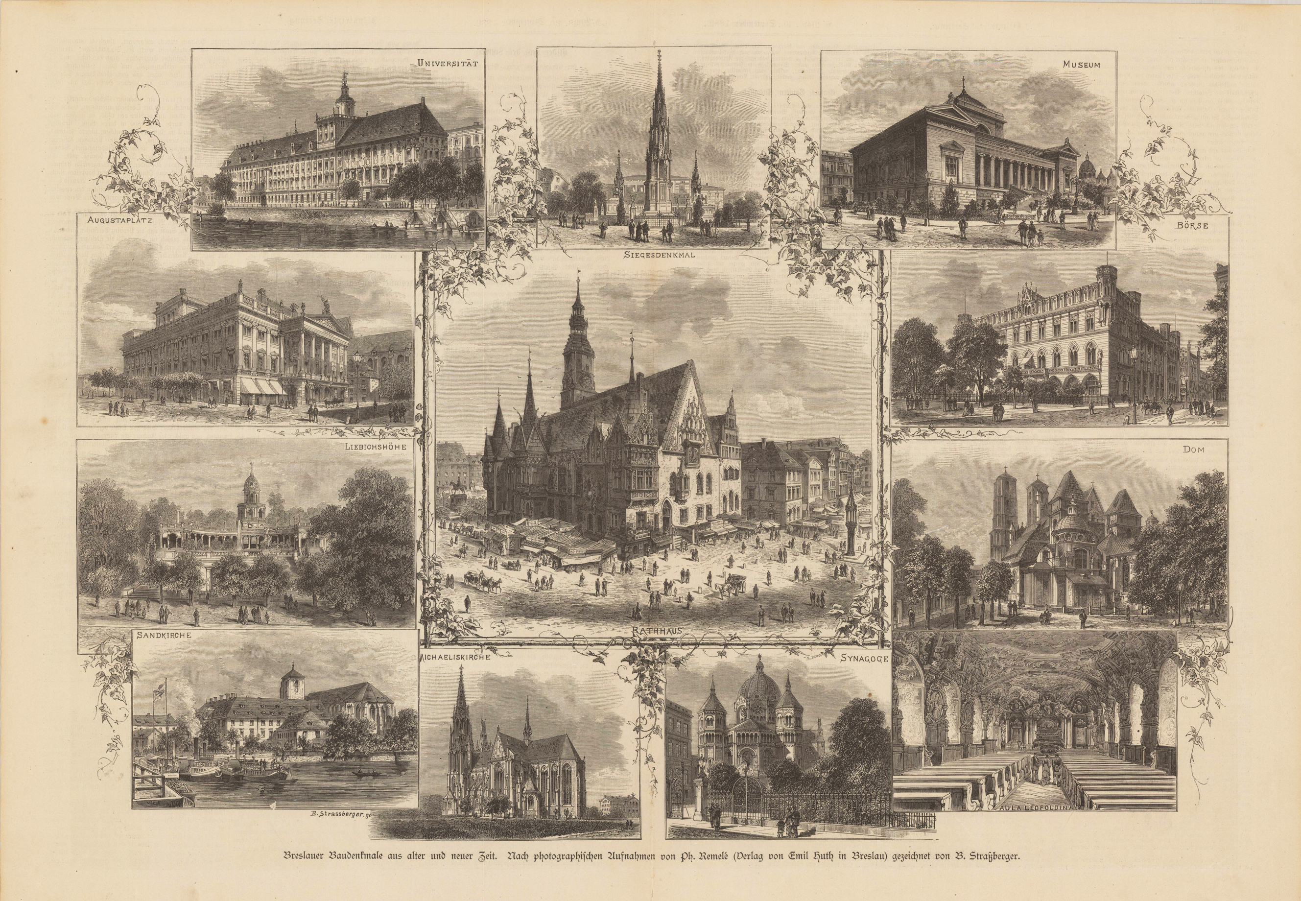
Original Holzschnitt nach photographischen Aufnahmen von Ph. Remelé, unkoloriert. Dargestellt werden (beginnend links oben) die Universität, das Siegesdenkmal, das Museum, die Börse, der Dom, die Aula der Leopoldina, die Synagoge, die Michaeliskirche, die Sandkirche, die Liebichhöhe und der Augustaplatz.
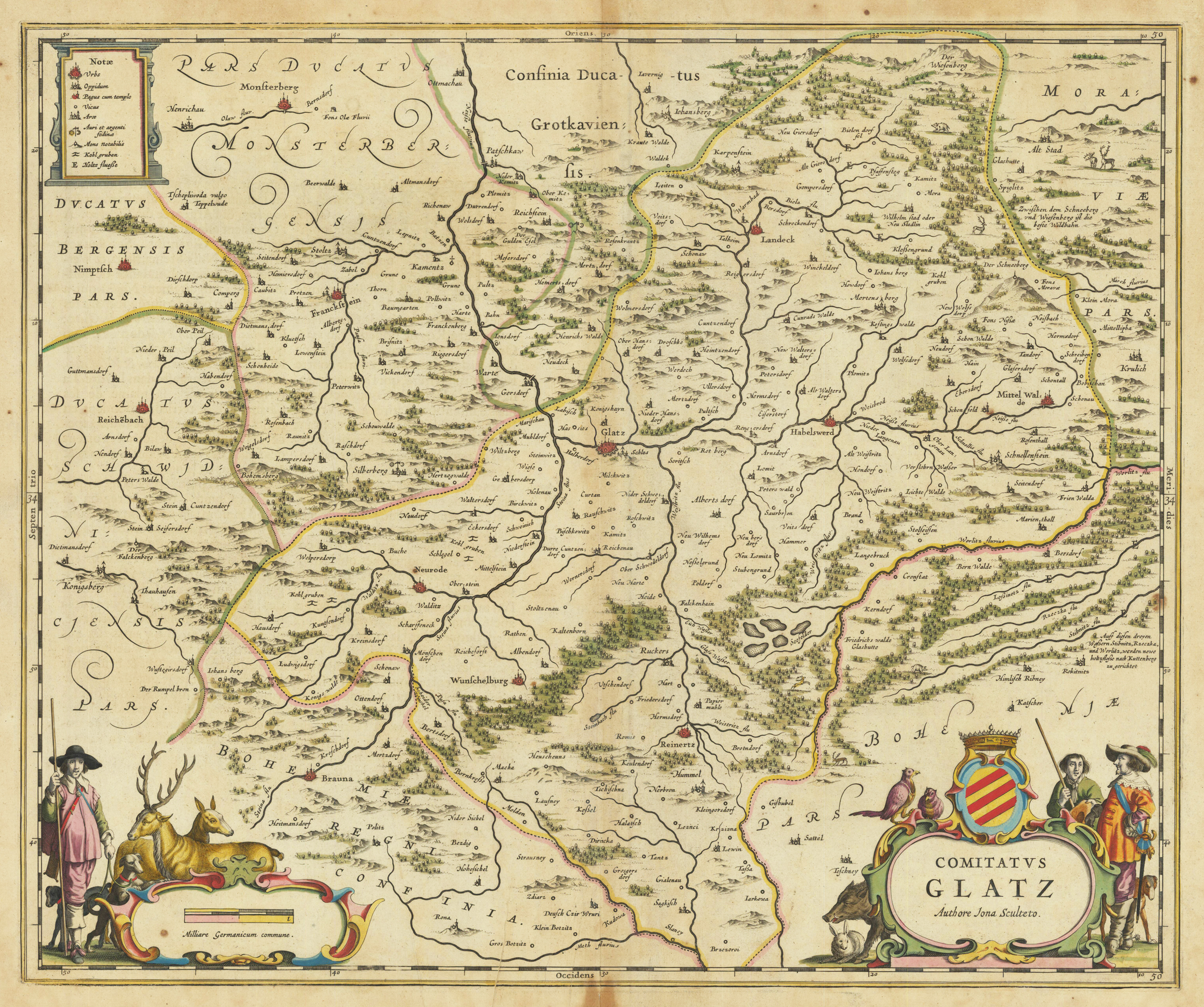
Copper engraving, hand colored in outline, when published in Joan Blaeu's ,Atlas Novus'. This fine antique map was for the first time published in 1640 towards 1659. This example was published in the French text edition in Amsterdam around 1643-50. The map shows the duchy of Glatz in Silesia with many detailed place names, rivers, mountains, woods, etc. The map is equipped with three cartouches. In the upper left corner we find a cartouche with the explanation for the map, in the lower left corner is a figurative cartouche with the mileage scale and in the lower right corner the allegoric title cartouche decorated with the coats of arms of Glatz together with hunters and animals. An interesting and detailed map of the duchy of Glatz in Silesia in a large scale with many details.
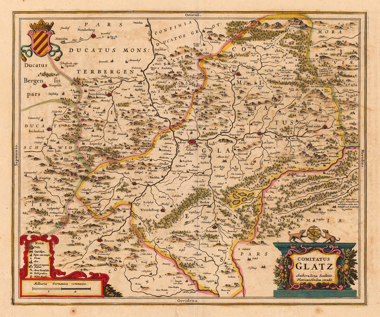
Copper engraving, hand colored in outline and wash when published. A detailed regional map of the principality of Glatz by Hendricus Hondius II (1597 – 16 August 1651), which was published in his atlas in Amsterdam around 1638 for the first time. The centre of the map with the city Glatz and the rivers Neisse, Steina and Biela. Further the map extends in the south from Mittenwalde to Reichenbach (duchy of Schweidnitz) in the north. With many engraved place names, villages, mountains and woods. Hendric Hondius engraved this regional map of the duchy of Glatz in Silesa after the cartographic information Joanus Scultetus, a Silesian cartographer (1603-1664). In the lower left corner with a small table of explanations, undrneath a mileage scale. At the bottom on the right side a colorful title cartouche and the coat of arms of Glatz (Klotzko) in the upper left corner.
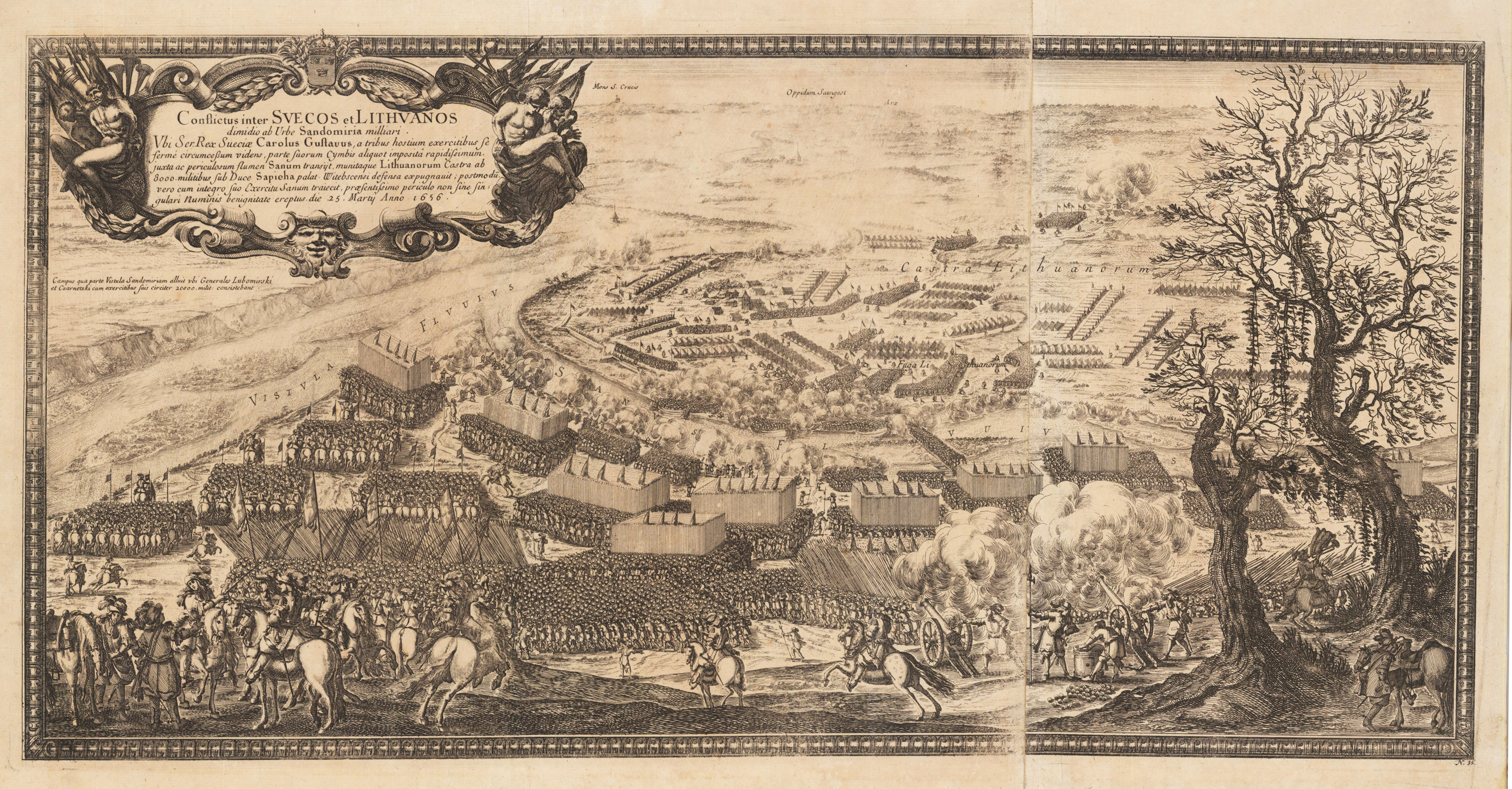
Original copper engraving. Published in Samuelis Liberi Baronis de Pufendorf De Rebus A Carolo Gustavo Sveciae Rege Gestis Commentariorum Libri Septem : Elegantissimis Tabulis Aeneis Exornati Cum Triplici Indice (1729)
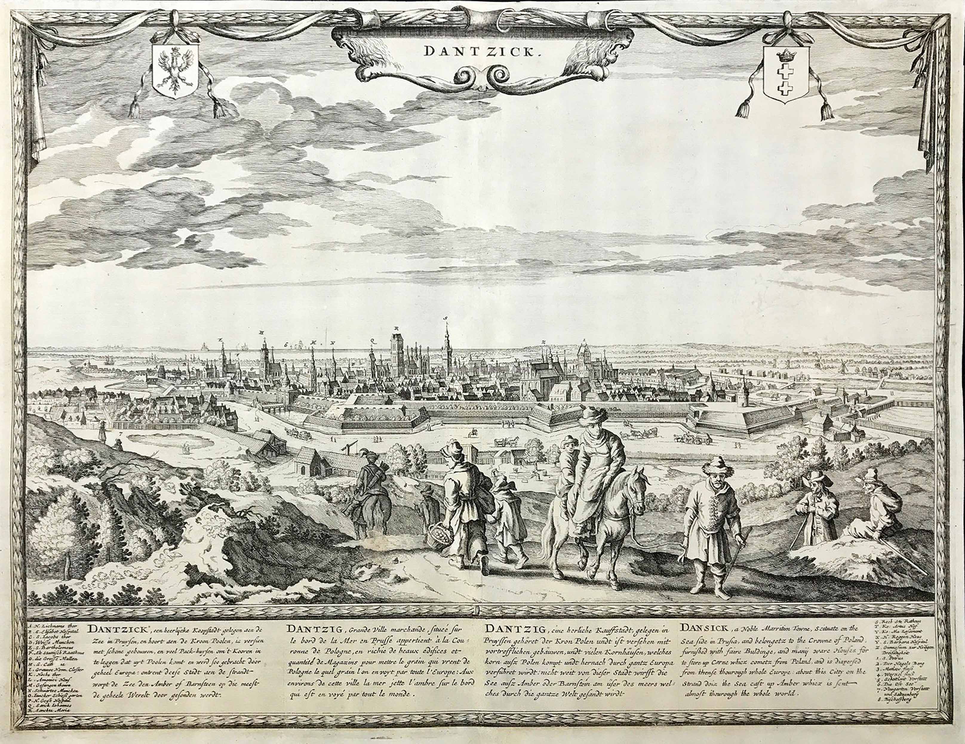
Original copper engraving, published in Amsterdam by Frederik de Wit. A large panoramic bird's eye map of the city of Danzig in Poland around 1690-95. This outstanding large and fine engraved outstanding panoramic plan of Danzig shows the city in a bird's eye perspective from the heights with rural people in the foreground. At the bottom of the map with detailled text descriptions in Dutch, French, German and English. To the left and right sides with key to the letters A-Z and numbers 1-8 to the right side of these descriptions. At the top engraved title „Dantzick" with the coat of arms of Poland and Dantzig (Gdansk).
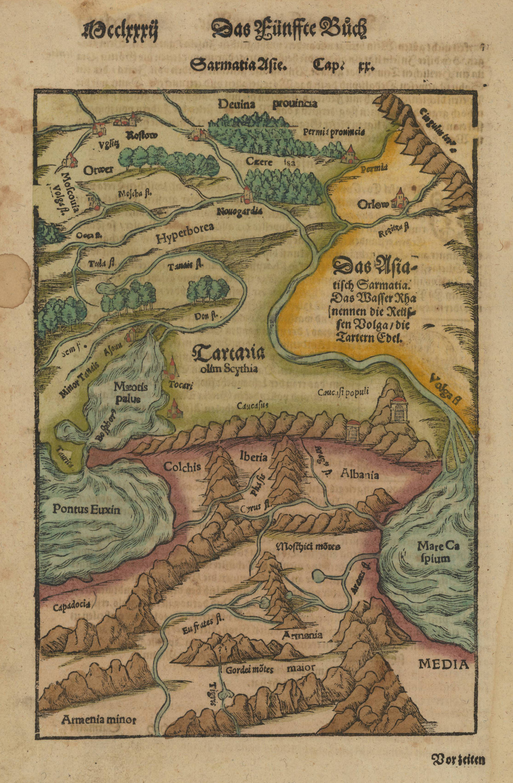
Woodcut map, finely hand colored in wash by a later hand. Published in the ,Cosmographia' by Sebastian Münster in Basel, German text edition 1574. Decorative hand colored woodcut map of the region Georgia, Armenia and Aserbaidschan with parts of Persia in the south and Russia in the north. Mountain chains, woods and very few place names are schematic shown on this old historic map. An interesting historic 16th century map of the region between the Black Sea and the Caspian Sea. This fine antique map was was published 1574 in a German text edition of Sebastian Münster's ,Cosmographia', the first detailed scientific and popular description of the world in Sebastian Münster's native language as well as a supreme effort of geographical study and literature of the Reformation period. One of the most popular treatises of the sixteenth and seventeenth centuries the Cosmographia reached a total of forty-six editions in six languages by 1650 each incorporating additions and revisions. Sebastian Münster was a professor of Hebrew at Basel university and a most distinguished Hebraist linguist mathematician and geographer. This encyclopedic work was his major undertaking. In its completion, which occupied him for fifteen years, Münster received the assistance of more than one hundred and twenty collaborators, who provided him with the most up-to-date information relating to the towns and places described. The scientifically most valuable sections are those which deal with Germany and Central Europe.
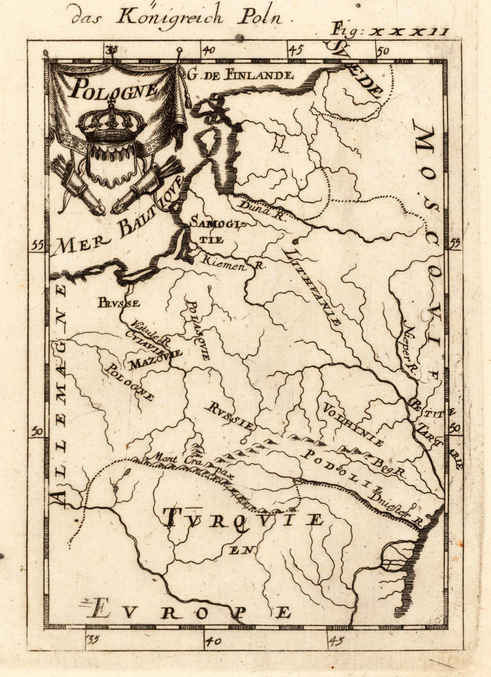
Copper engraving published in Allain M. Mallet's description of the world 'Description De L' Univers, Contenant Les Differents Systemes Du Monde, Les Cartes generales & particulieres ...'. French text edition with additional German titles on top. Fine engraved antique map, which shows the kingdom of Poland. With many engraved rivers and a few place names. In the upper left corner title cartouche with the crown of Poland.
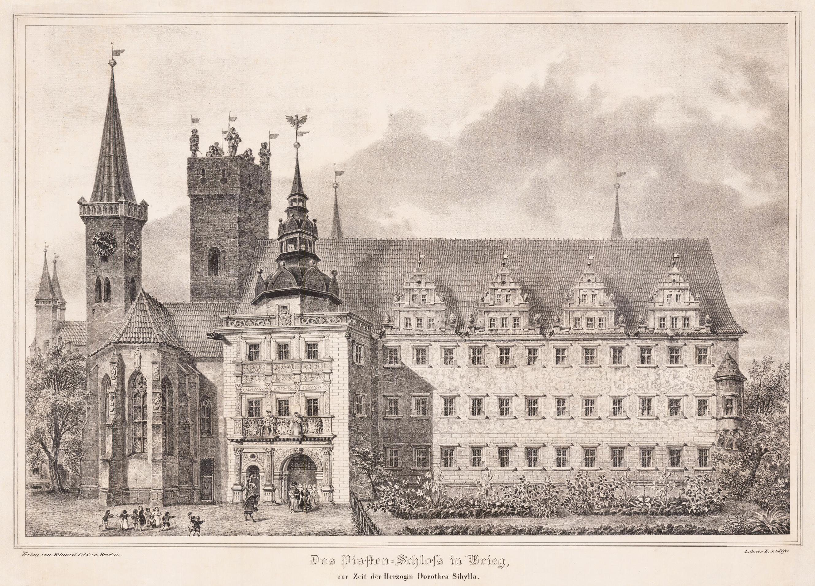
Original Lithograph. Palace of the Piast Dynasty in Brzeg (Brieg) at the time of Duchess Dorothea Sibylla (1590-1625). The palace was residence to the Silesian branch of the Polish Piast Dynasty, built in the first half of the 13th century. It counts amoung the most beautiful Renaissance palaces in Europe. Damaged several times in its history the palace was remodeled between 1966 and 1990 and is now home of the Museum of Silesian Piast Dynasty.
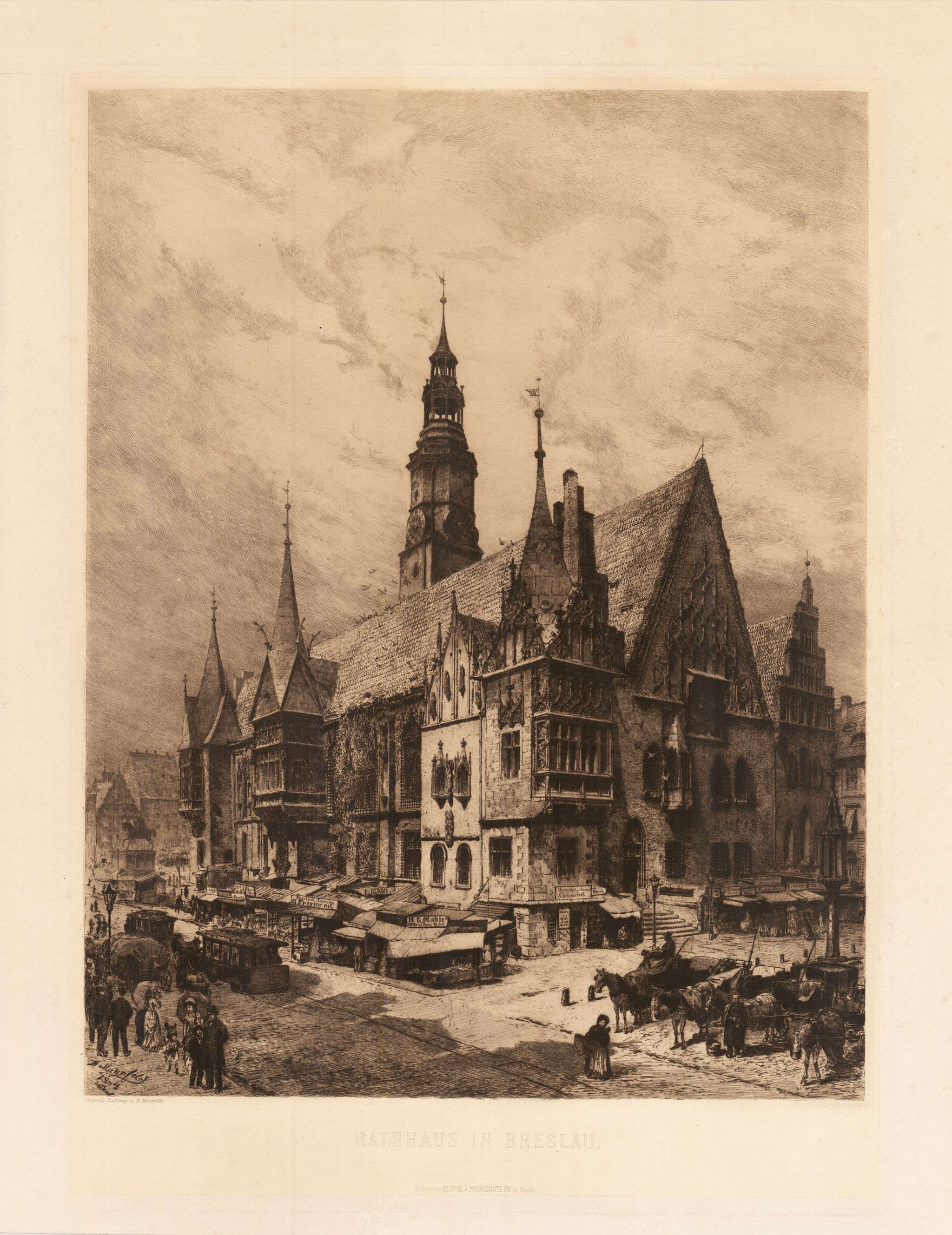
Original Kupferradierung, unkoloriert. Gedruckt auf Japan, montiert auf Papier. Diese feine Kupferradierung zeigt die typische Ansicht des Rathauses zu Bresslau in Polen. Das Breslauer Rathaus, auch Altes Rathaus, ist das Wahrzeichen der Stadt Breslau. Es ist eines der schönsten erhaltenen Gebäude im gotischen Stil in Polen und Europa. Es steht an der südöstlichen Ecke des Großen Rings. Die erste urkundliche Erwähnung des Rathauses stammt aus einer Mietrechnung für das Gebäude aus dem Jahr 1299. Dieser erste Bau hieß in der historischen Quelle Consistorium (lat. Aufstellungsort) und bestand aus einem Erdgeschoss, einem Keller und einer Halle mit einem Dach sowie einem nebenstehenden Westturm. Diese Räumlichkeiten bilden somit den ältesten Abschnitt des Rathauses. Zu dieser Zeit diente das Gebäude jedoch nicht als Verwaltungssitz, sondern vorwiegend dem Handel. Bis in das 16. Jahrhundert hinein erfolgten mehrere bauliche Erweiterungen und Umbauten, die den Bedürfnissen der jeweiligen Zeit entsprachen. Beispielsweise wurde das Bauwerk zwischen 1328 und 1333 erweitert; es erhielt ein zweites Geschoss, worin sich die Räumlichkeiten für den Stadtrat befanden. Ein Gerichtssaal wurde zwischen 1343 und 1357 im Erdgeschoss hinzugebaut. Weiterhin wurde der Westturm aufgestockt und erweitert. Dadurch etablierte sich das Gebäude als wichtige Instanz im Gerichts- und Verwaltungswesen der Stadt. Der größte Umbau des Gebäudes erfolgte zwischen 1470 und 1480, das Gebäude wurde um fast das Doppelte vergrößert und erhielt eine im spätgotischen Stil gestaltete Fassade. Weiterhin wurden reichverzierte Fußböden verlegt, neue Erker angebaut und der Nord- und Westtrakt mit neuen verzierten Giebeln ausgestattet. 1510 wurde der Große Saal im Inneren neu verputzt und mit dekorativen Malereien geschmückt. Des Weiteren wurde eine neue größere Schatzkammer gebaut. Im 17. und 18. Jahrhundert wurden am Gebäude selbst kaum noch Veränderungen vorgenommen. Zu Beginn des 19. Jahrhunderts entsprach das Gebäude nicht mehr den Anforderungen einer modernen Verwaltung. Das in die Jahre gekommene Gebäude wurde zu klein. Damit Platz für umfangreiche Umbauarbeiten geschaffen werden konnten, zog zunächst das Gericht in ein separates Gebäude um. Daraufhin wurde das Ratsgebäude ab 1808 aufwändig saniert und modernisiert. Es erhielt neuen Außenschmuck im Stil der Gotik. In den Jahren 1860 bis 1863 wurde neben dem vorhandenen Rathaus auf dem Grundstück des Leinwandhauses mit dem Neuen Rathaus eine neugotische Erweiterung nach den Entwürfen von Friedrich August Stüler gebaut. Das neue Ratsgebäude beherbergt Repräsentationsräume des Oberbürgermeisters und Tagungsräume des Stadtrates. Nach Eröffnung des neuen Hauses wurde das historische Rathaus 1865 von Carl Johann Bogislaw Lüdecke renoviert. Er ließ die nachträglich eingebauten Teilungswände entfernen und an der Nordseite ein neues Treppenhaus hinzufügen. Zu Beginn des 20. Jahrhunderts wurde das Rathaus umgebaut, weil es seine Verwaltungsfunktion schrittweise verloren hatte; es dient seitdem als Stadtmuseum. Während des Zweiten Weltkriegs wurde das Rathaus leicht beschädigt, allerdings wies das Dach erhebliche Schäden auf. In den Jahren 1949–1953 leitete Marcin Bukowski die Restaurierung des Gebäudes. Es gilt seither als ein Wahrzeichen der Stadt Breslau. Im historischen Bauwerk befindet sich das Museum der bürgerlichen Kunst (poln. Muzeum Sztuki Mieszczańskiej). In den Kellerräumen gibt es noch immer die seit mehr als 700 Jahren (von ca. 1275) existierende Bierwirtschaft Schweidnitzer Keller. (Wikipedia)
Original antique copper engraving, hand colored in outline and wash, when published. Depict one view (from nine) of the ,Scenographia Urbium Silesiae, tab. VI' published 1738 by Homann Heirs, engraved from F.B. Werner. Johann Baptist Homann (20 March 1664 – 1 July 1724) was a German geographer and cartographer, who also made maps of the Americas. Homann was born in Oberkammlach near Kammlach in the Electorate of Bavaria. Although educated at a Jesuit school, and preparing for an ecclesiastical career, he eventually converted to Protestantism and from 1687 worked as a civil law notary in Nuremberg. He soon turned to engraving and cartography; in 1702 he founded his own publishing house. Homann acquired renown as a leading German cartographer, and in 1715 was appointed Imperial Geographer by Emperor Charles VI. Giving such privileges to individuals was an added right that the Holy Roman Emperor enjoyed. In the same year he was also named a member of the Prussian Academy of Sciences in Berlin. Of particular significance to cartography were the imperial printing privileges (Latin: privilegia impressoria). These protected for a time the authors in all scientific fields such as printers, copper engravers, map makers and publishers. They were also very important as a recommendation for potential customers. In 1716 Homann published his masterpiece Grosser Atlas ueber die ganze Welt (Grand Atlas of all the World). Numerous maps were drawn up in cooperation with the engraver Christoph Weigel the Elder, who also published Siebmachers Wappenbuch. Homann died in Nuremberg in 1724. He was succeeded by his son Johann Christoph (1703-1730). The company carried on upon his death as Homann heirs company, managed by Johann Michael Franz and Johann Georg Ebersberger. After subsequent changes in management the company folded in 1852.[1] The company was known as "Homann Erben", "Homanniani Heredes", or "Heritiers de Homann" abroad. (Wikipedia)
Original antique copper engraving, uncolored as published. Decorative engraving of the city of Navra in Poland, published in Gabriel Bodenehr's famous serious "Europeans Macht und Pracht", a series of engravings depicting city views, plans, fortresses and castles in Europe. Many plates often are showing fortifications in Hungary and Southeast Europe, Spain, Belgium, Austria and Germany. Gabriel Bodenehr was during this period a successful publisher for maps and prints in Augsburg in Southern Germany. Gabriel Bodenehr the Elder (1664-1758 or 1673-1765) was a German map maker and member of a famous engraver and publisher family of Augsburg. His main work was "Atlas Curieux" first published 1704. He was the son of Johann Georg Bodenehr (1631-1703). Gabriel's son was Gabriel Bodenehr the Younger (1705–1792).
Original copper engraving, hand colored in wash and outline, when published. The Austrian cartographer Franz Joh. Josef von Reilly published around 1789 in Vienna a large amount of very detailed district maps of Central Europe. These maps are famous for their large scales and the many details they provide. Even tiny place names can be found on those maps, rivers, mountains, streets, monasteries are as well engraved. The maps, which Franz J. Reilly engraved, were especially designed for the Austrian Royal house and show countries, provinces and districts belonging to the 'Austrian-Hungarian Empire'.
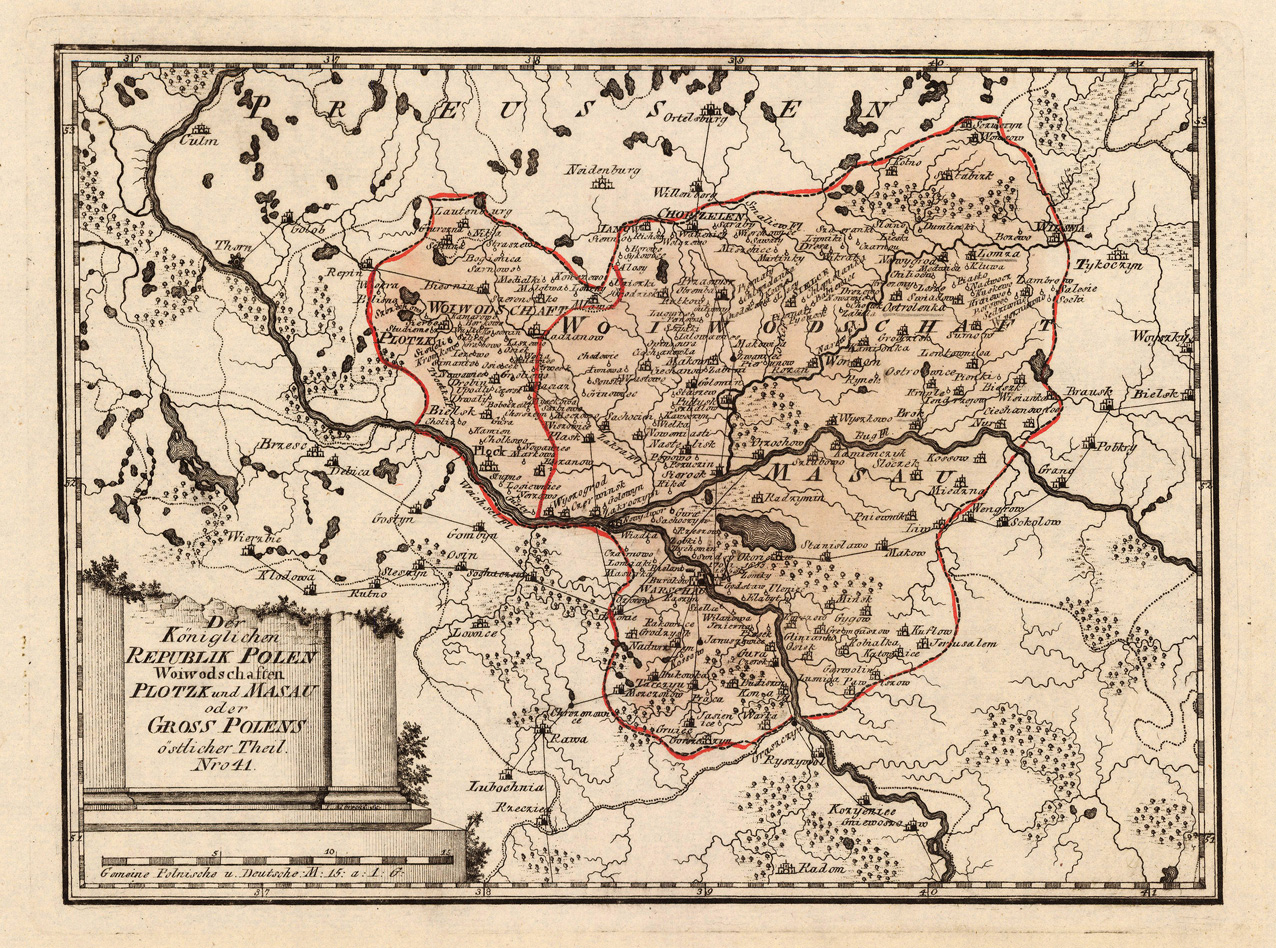
Original copper engraving, hand colored in wash and outline, when published. Detailed map showing the Woiwodschaft Plotzk and Masau in Poland. In the centre of the map is the river Weichsel with Warschau the capital of Poland. With many engraved place place like Warschau, Plotzk, Plock, Wilsnia and others. Mountains, rivers, lakes, woods, small villages, some streets etc. are engraved. An interesting map of the 'Woiwodschaft Plotzk and Masau' in Poland in a very detailed scale.
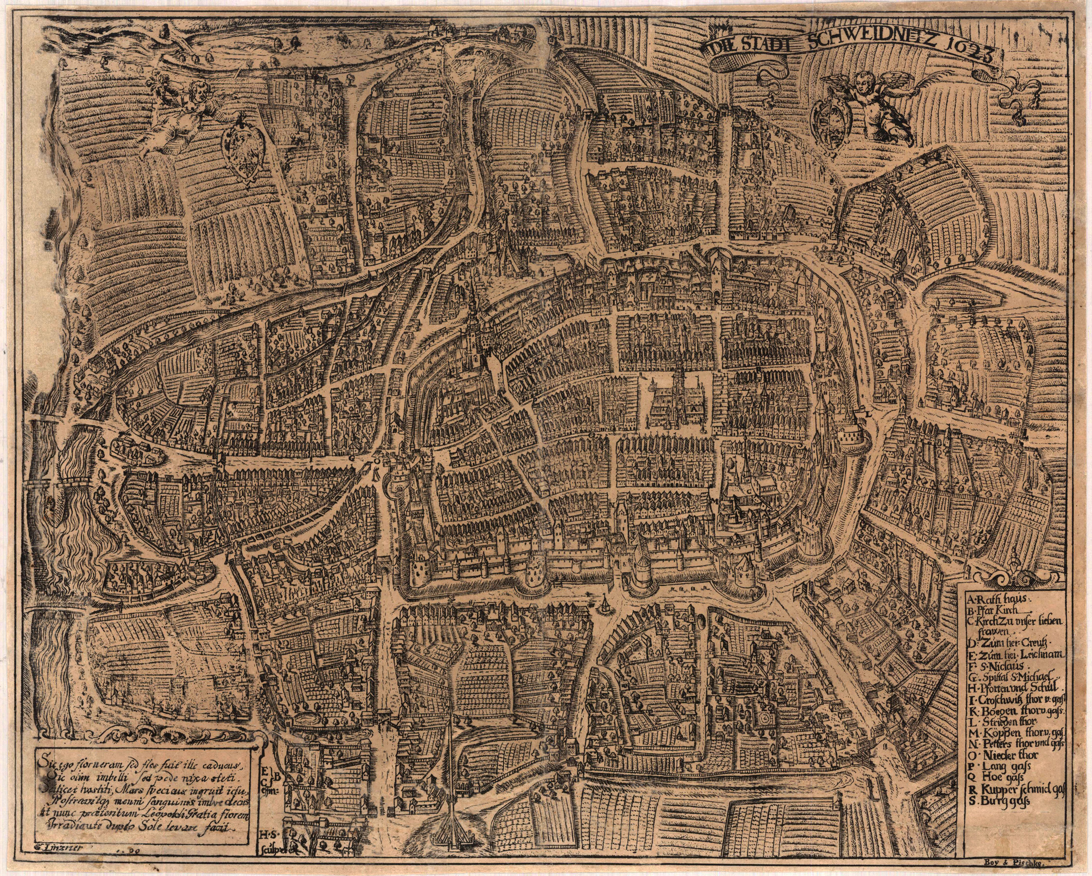
Original lithograph, uncolored when published. The lithograph shows Schweidnitz as a bird's eye city plan after a historic engraving of 1623 by Linzner. Lower left corner with descriptive Latin text in a table. Published and printed as a lithograph by Boy & Pischke around 1800 (?). Lower left corner with a table of explanations with a list of remarkable buildings and of the town.
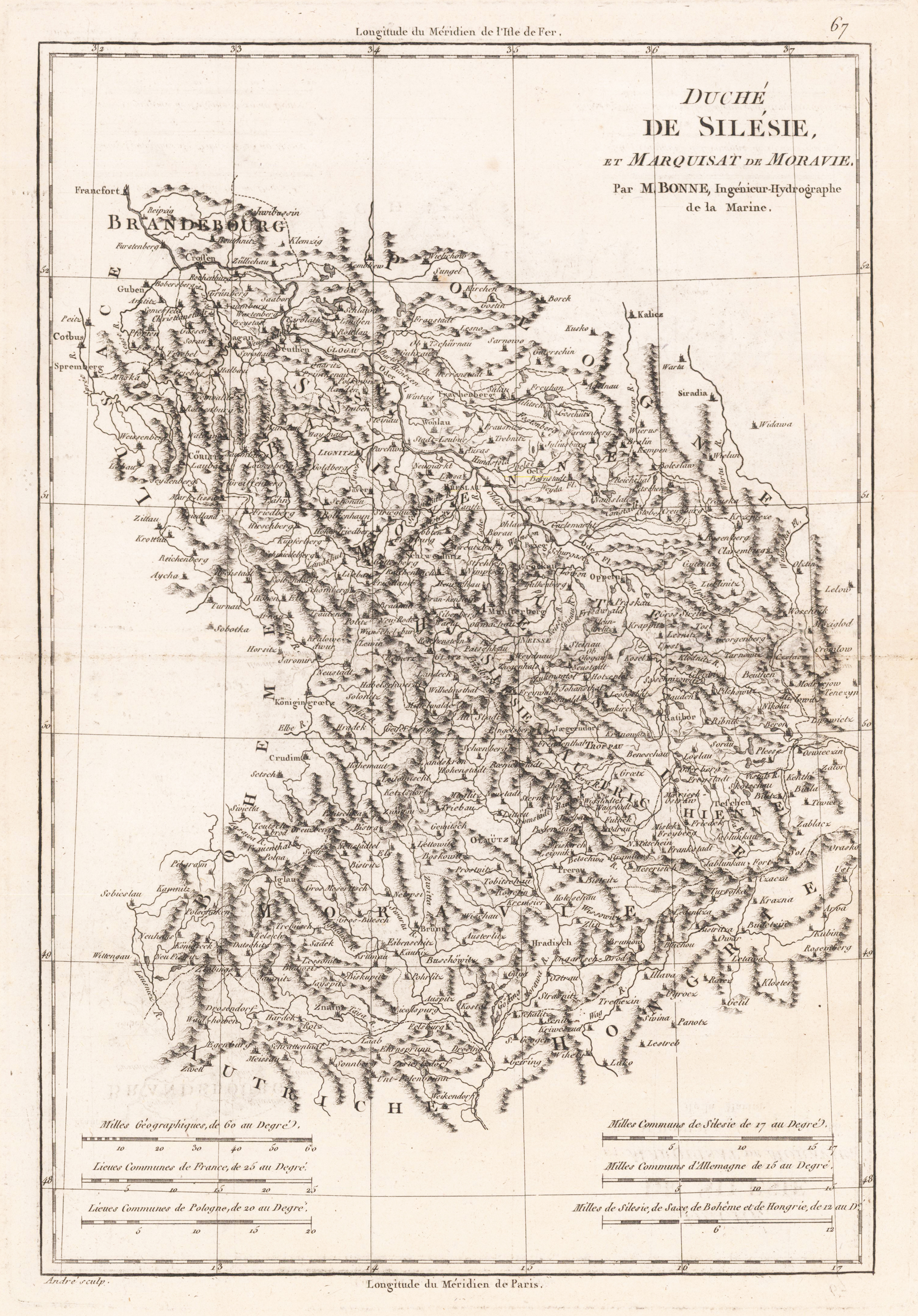
Original antique copper engraving, uncolored as published. Detailed antique map of the duchy of Silesia and margraviate of Moravia. With engraved political borders, cities, small place names, rivers and mountains.
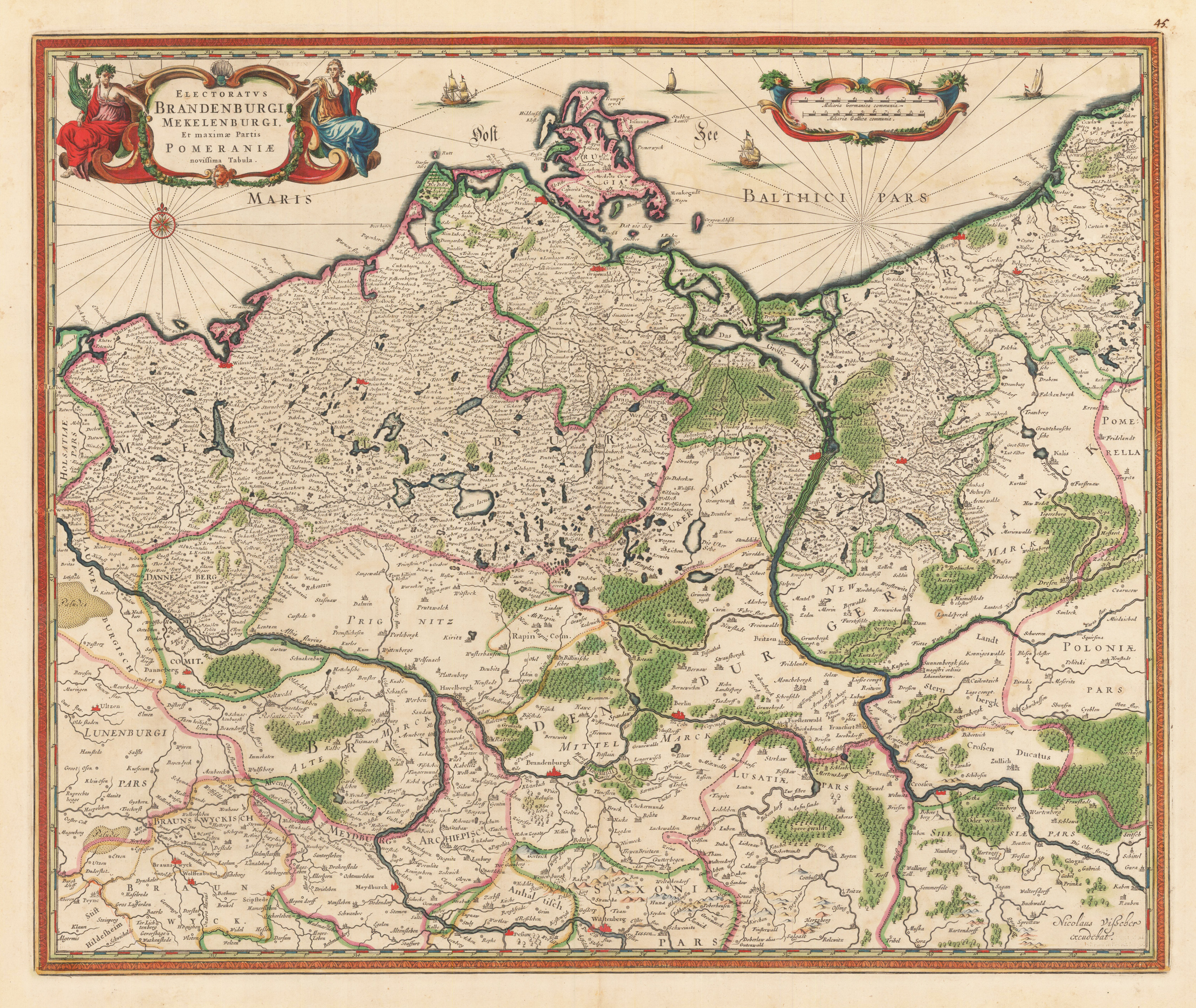
Original anitque copper engraving, hand colored in outline and wash when published. An interesting Visscher map of Brandenburg, including Mecklenburg and part of Pomerania. This map comes from Visscher's compiled 'Atlas Minor siue Geographia Compendiosa, Qua Orbis Terrarum, per paucas attamen novissimas tabulas ostenditu'. A decorative title cartouche with two female figures, presumably flora and fauna, adorns the upper left corner. A compass rose in the area of the Baltic Sea is engraved in the left corner under the cartridge. The original hand color looks fresh and beautiful; verso shows green oxidation. The Atlas Minor is a fine and comprehensive composite atlas and is one of a series of large atlases that were compiled and sold by art dealers and cartographers in the 17th century by the Visscher family. The factory founded by Nicholas Visscher is known for the high quality of the engraving, the exceptionally fine ornamentation and the precise geographical information.
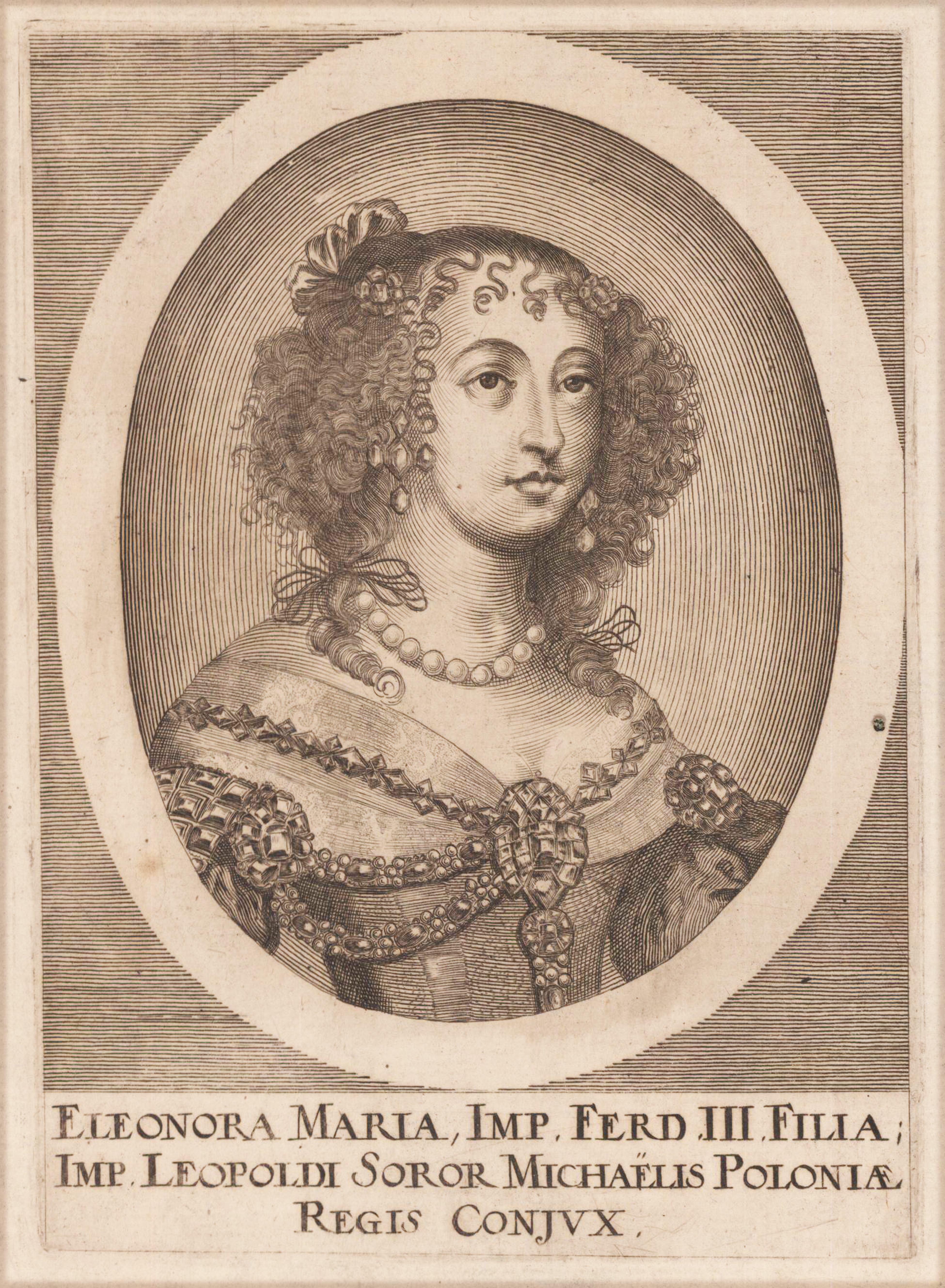
Original copper engraving. Published in Matthäus Merian's ,Theatrum Europeum' Volume 10 (1677) Eleonora Maria, Imp. Ferd. III branch, Imp. Leopoldi Soror, Michaelis Poloniae Regis Conjux, Queen of Poland, daughter of Emperor Ferdinand III. The wife of Micha Korybut Winiowiecki in the years 1670-1673. Two years after the king's death she left Poland in 1675; from 1678 the wife of Charles, prince of Lorraine.
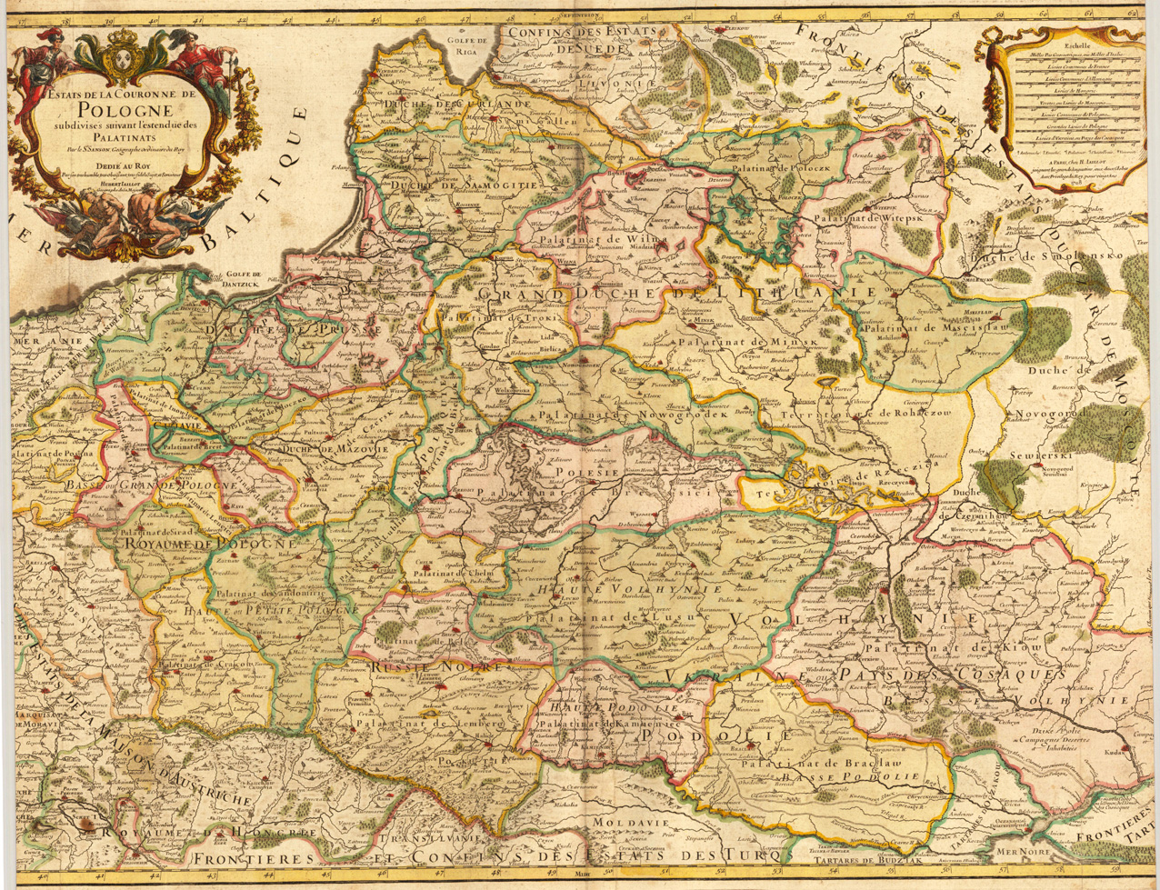
Copper engraving and hand colored fine example of a strong impression of this map. This issue is published and printed at Pierre Mortier in Amsterdam 1708 This map, printed from two plates, was first published in the 'Atlas Noveau ...' by Alexis Hubert Jaillot & N. Sanson. Fifth state. In the left upper corner ornated with a large decorative highly ornated allegoric figurative title-cartouche. Hubert Jaillot's map can be treated as a masterpiece of the French baroque cartography in the 17th century. It took Nicolaus Sanson and Hubert Jaillot a period of about fifteen years to complete this enormous work (c. 1681-96). The atlas was dedicated to Ludwig XIV.
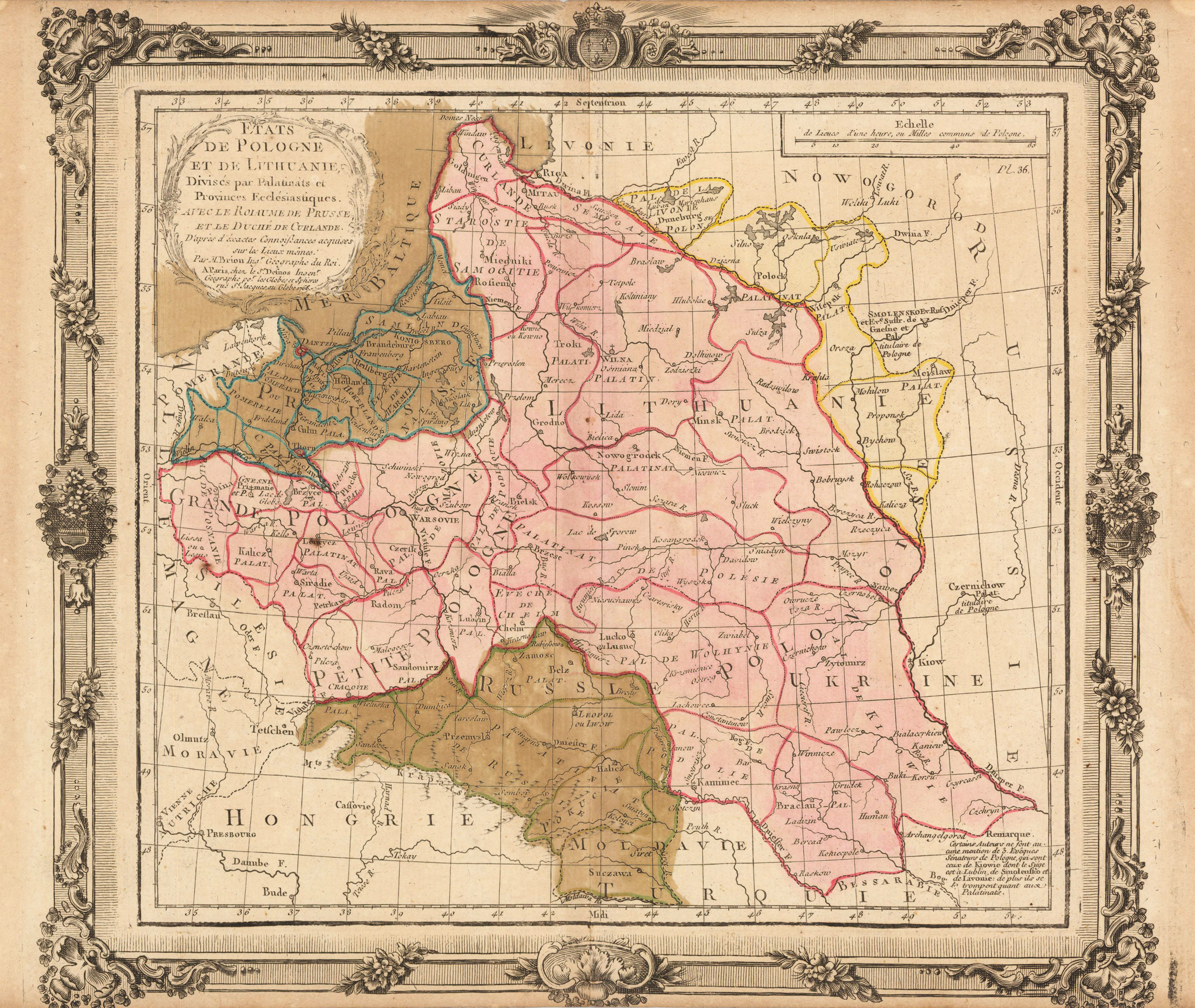
Original copper engraving, hand colored in outline and wash when published. This is Louis Brion de la Tour's map of the Polish Lithuanian empire similar to the second variant of the 3rd state (with date 1766 in the cartouche and plate no. 35 in the upper right corner). However here with plate no. 36 in the upper right corner not listed in "Images Poloniae".
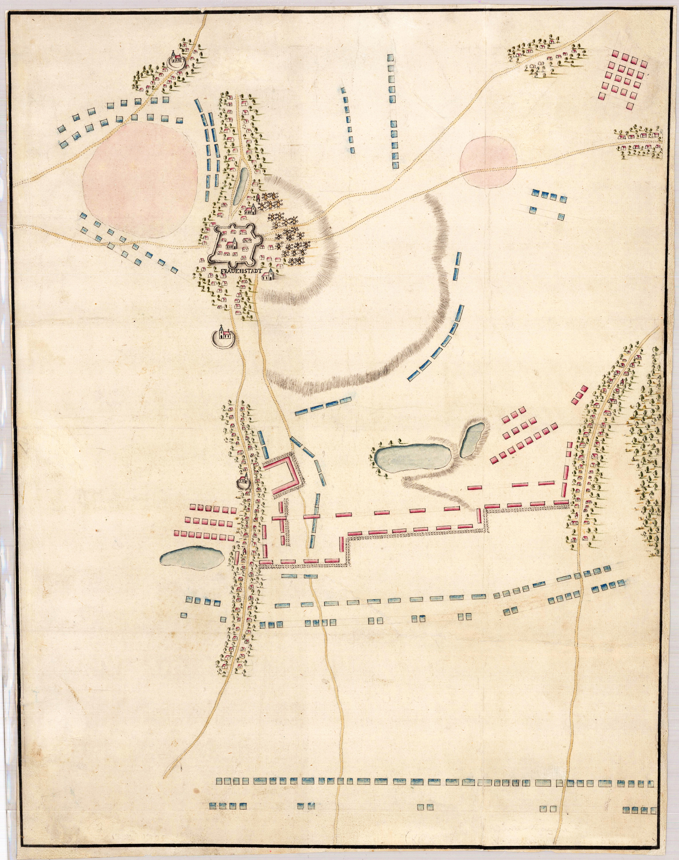
Manuscript map drawn in ink. The sketch shows the battlefield near Fraustadt on February 13th, 1706 how the Swedish army under Carl Gustav Rehnskiöld defeated a Saxonian-Russian army under General Johann Matthias near Fraustadt, these days called Wschowa, during the great nordic war. August II resisted, still possessing control of his native Saxony, but was decisively defeated at the Battle of Fraustadt in 1706, a battle sometimes compared to the Ancient Battle of Cannae due to the Swedish forces' use of double envelopment, with a deadly result for the Saxon army. August II was forced to sign the Treaty of Altranstädt in 1706 in which he made peace with the Swedish Empire, renounced his claims to the Polish crown, accepted Stanisław Leszczyński as king, and ended his alliance with Russia. (Wikipedia)
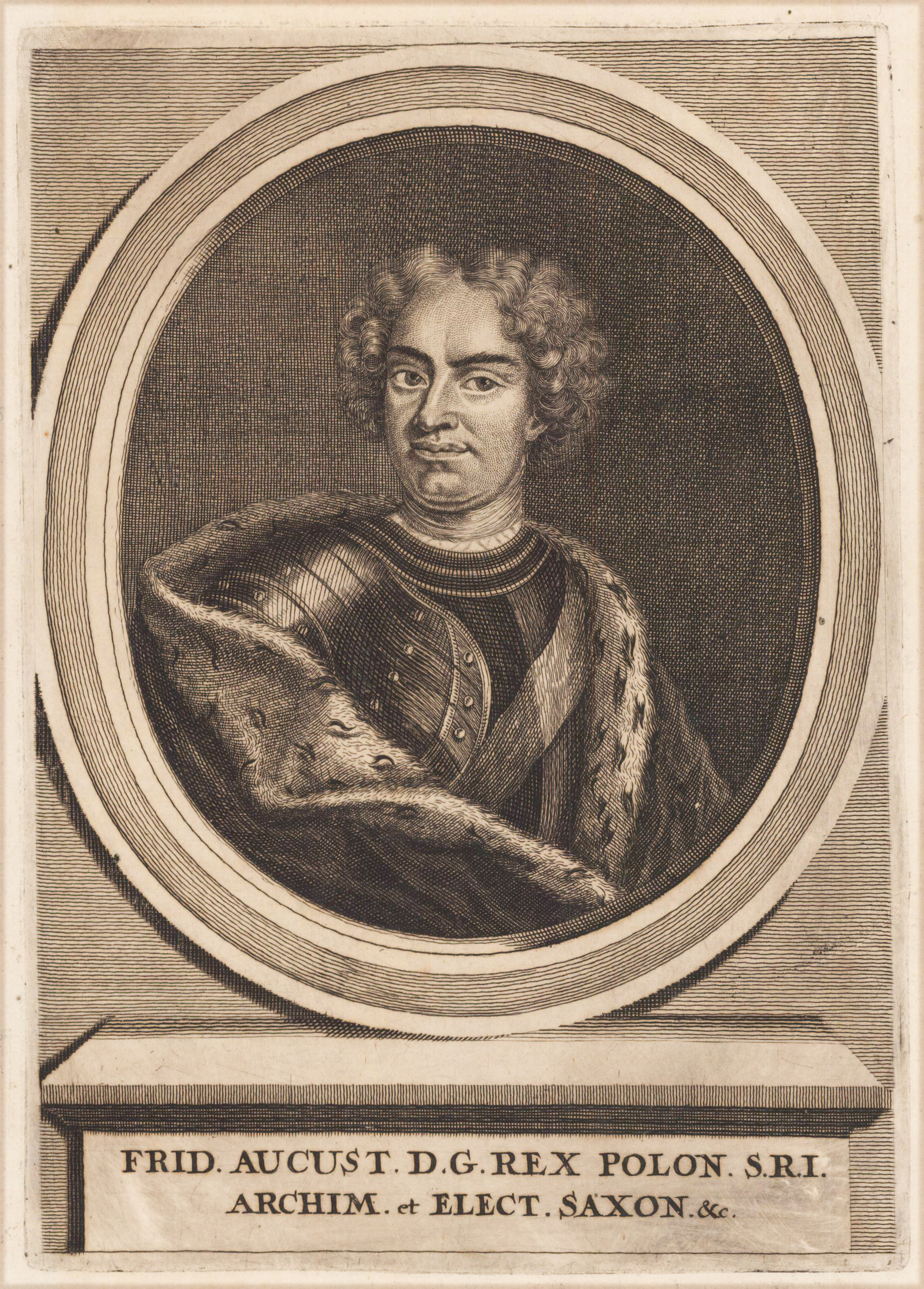
Original copper engraving. Published in Matthäus Merian's ,Theatrum Europeum' (1707) Engraving of Augustus II the Strong, King of Poland and Elector of Saxony. Bust length with curled hair, tie, armour, sash, and ermine mantle. Within an oval border with Latin inscription below. Plate from Theatrum Europaeum (1707).