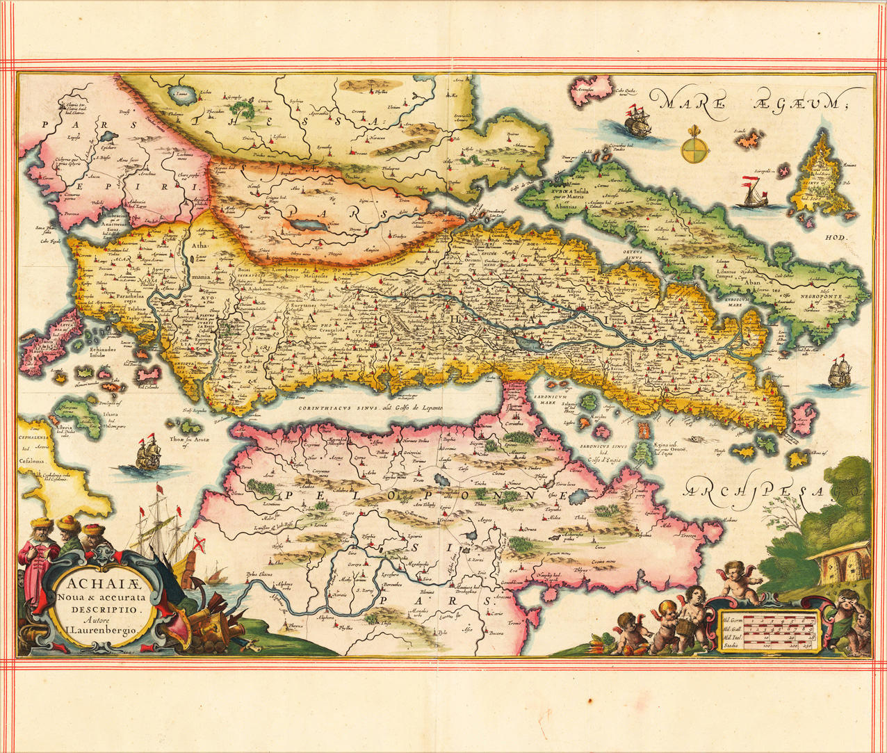
Original antique copper engraving, decorative hand colored in outline and wash. The map is ornated with two cartouches, in the lower left corner the title cartouche, on the lower right side a decorative cartouche with a mileage scale and angels. Villages and towns are shown as miniature views, as well rivers and mountains are engraved. Johannes Janssonius (1588, Arnhem – buried July 11, 1664, Amsterdam) (born Jan Janszoon, in English also Jan Jansson) was a Dutch cartographer and publisher who lived and worked in Amsterdam in the 17th century. Janssonius was born in Arnhem, the son of Jan Janszoon the Elder,[1] a publisher and bookseller. In 1612 he married Elisabeth de Hondt, the daughter of Jodocus Hondius. He produced his first maps in 1616 of France and Italy. In 1623 Janssonius owned a bookstore in Frankfurt am Main, later also in Danzig, Stockholm, Copenhagen, Berlin, Königsberg, Geneva and Lyon. Elisabeth Hondius died in 1627 and he remarried Elisabeth Carlier in 1629. In the 1630s he formed a partnership with his brother in law Henricus Hondius, and together they published atlases as Mercator/Hondius/Janssonius. Under the leadership of Janssonius the Hondius Atlas was steadily enlarged. Renamed Atlas Novus, it had three volumes in 1638, one fully dedicated to Italy. In 1646, a fourth volume came out with "English County Maps", a year after a similar issue by Joan Blaeu. Janssonius' maps are similar to those of Blaeu, and he is often accused of copying from his rival, but many of his maps predate those of Blaeu and/or covered different regions. By 1660, at which point the atlas bore the appropriate name "Atlas Major", there were 11 volumes, containing the work of about a hundred credited authors and engravers. It included a description of "most of the cities of the world" (Townatlas), of the waterworld (Atlas Maritimus in 33 maps), and of the Ancient World (60 maps). The eleventh volume was the Atlas of the Heavens by Andreas Cellarius. Editions were printed in Dutch, Latin, French, and a few times in German. After Janssonius's death, the publishing company was continued by his son-in law, Johannes van Waesbergen. The London bookseller Moses Pitt attempted publication of the Atlas Major in English, but ran out of resources after the fourth volume in 1683. (Wikipedia)
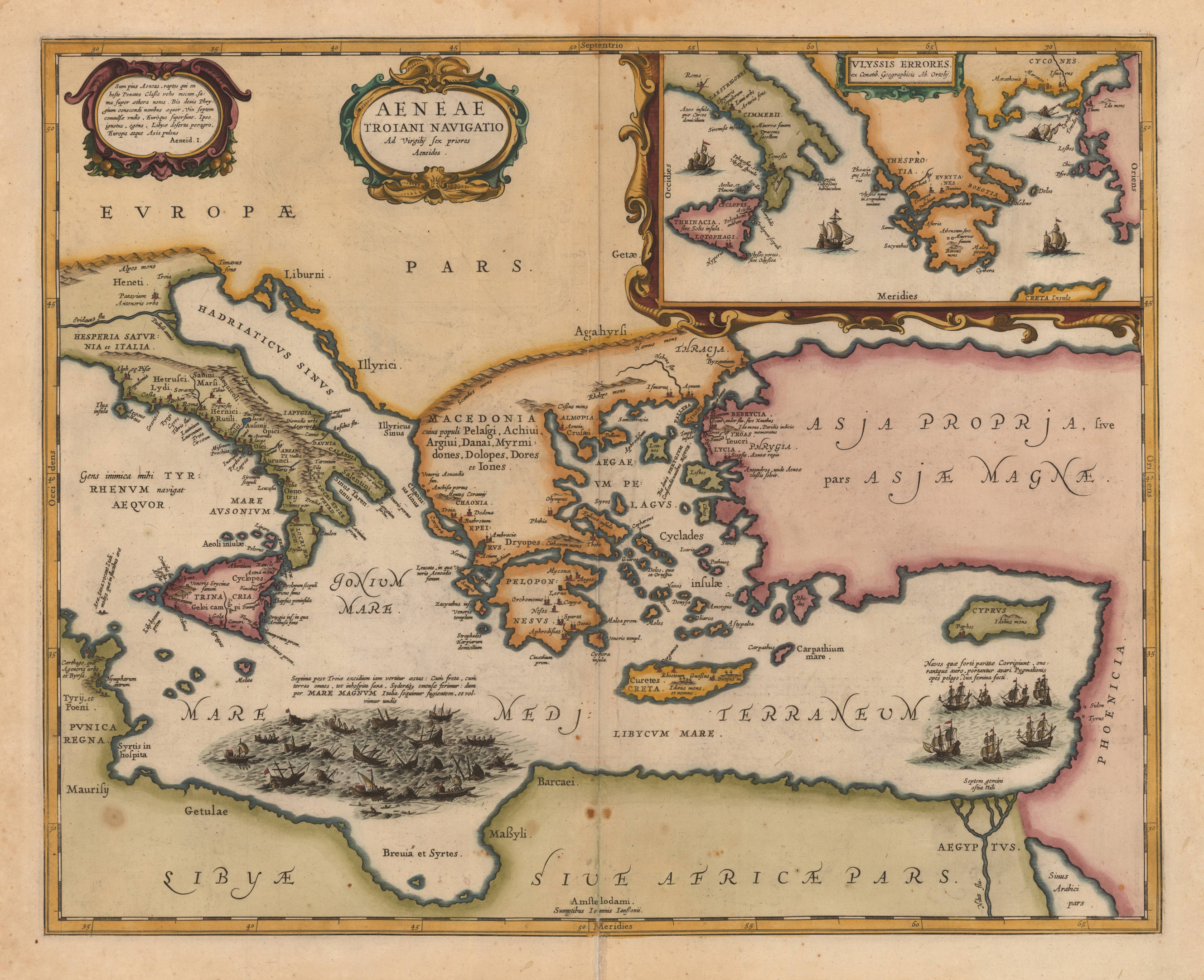
Original antique copper engraving, hand colored, verso blanc. A highly decorative map, which is ornated with a large decorative title cartouche at the upper centre. Equipped with an inset map in the upper right corner. Cartographical sources of this map: Aenaeas is reported to have roamed the seas for seven years, as described in the writings of Xenophon, Ovidius, Lycrophonous, but most extensively by Virgilius in his Aenaeas. In the course of these wanderings, only seven of the original twenty ships remainded, as may be seen on this map in the lower left part of the sea (Broe. 223). The map is ornated with three decorative renaissance cartouches, at the top in the centre the title cartouche, on the upper right a cartouche with a text dedication to Balthasar Robiano, underneath with the,privilegium' with date,1594' and at the bottom a cartouche with text from Vergil's Aenaeas. Johannes Janssonius (1588, Arnhem – buried July 11, 1664, Amsterdam) (born Jan Janszoon, in English also Jan Jansson) was a Dutch cartographer and publisher who lived and worked in Amsterdam in the 17th century. Janssonius was born in Arnhem, the son of Jan Janszoon the Elder,[1] a publisher and bookseller. In 1612 he married Elisabeth de Hondt, the daughter of Jodocus Hondius. He produced his first maps in 1616 of France and Italy. In 1623 Janssonius owned a bookstore in Frankfurt am Main, later also in Danzig, Stockholm, Copenhagen, Berlin, Königsberg, Geneva and Lyon. Elisabeth Hondius died in 1627 and he remarried Elisabeth Carlier in 1629. In the 1630s he formed a partnership with his brother in law Henricus Hondius, and together they published atlases as Mercator/Hondius/Janssonius. Under the leadership of Janssonius the Hondius Atlas was steadily enlarged. Renamed Atlas Novus, it had three volumes in 1638, one fully dedicated to Italy. In 1646, a fourth volume came out with "English County Maps", a year after a similar issue by Joan Blaeu. Janssonius' maps are similar to those of Blaeu, and he is often accused of copying from his rival, but many of his maps predate those of Blaeu and/or covered different regions. By 1660, at which point the atlas bore the appropriate name "Atlas Major", there were 11 volumes, containing the work of about a hundred credited authors and engravers. It included a description of "most of the cities of the world" (Townatlas), of the waterworld (Atlas Maritimus in 33 maps), and of the Ancient World (60 maps). The eleventh volume was the Atlas of the Heavens by Andreas Cellarius. Editions were printed in Dutch, Latin, French, and a few times in German. After Janssonius's death, the publishing company was continued by his son-in law, Johannes van Waesbergen. The London bookseller Moses Pitt attempted publication of the Atlas Major in English, but ran out of resources after the fourth volume in 1683. (Wikipedia)
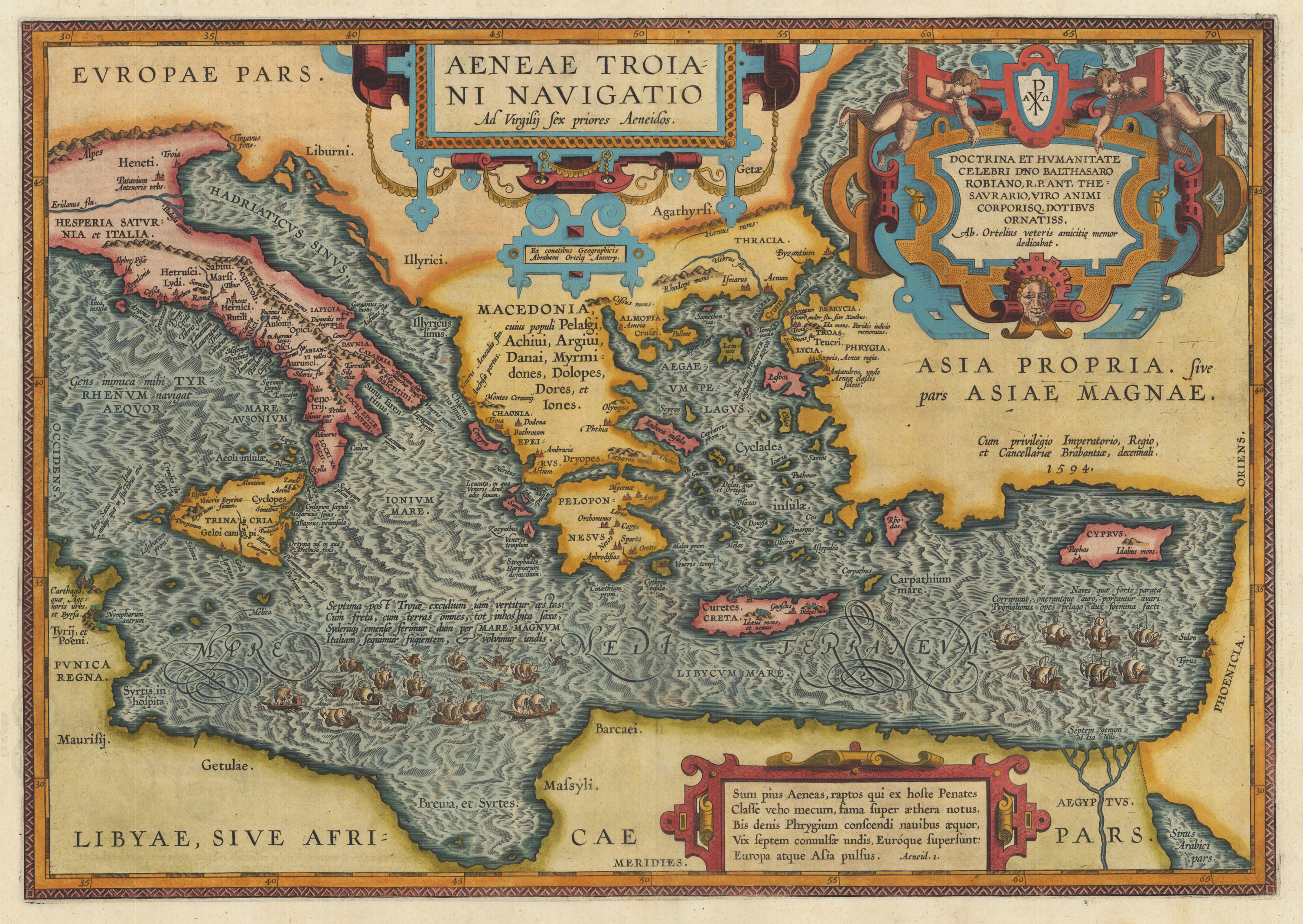
Original copper engraving, published 1612 in the famous historical atlas "Parergon" (Latin text-edition) by Abraham Ortelius. Finely later hand colored in wash and outline. Cartographical sources of this map: Aenaeas is reported to have roamed the seas for seven years, as described in the writings of Xenophon, Ovidius, Lycrophonous, but most extensively by Virgilius in his Aenaeas. In the course of these wanderings, only seven of the original twenty ships remainded, as may be seen on this map in the lower left part of the sea (Broe. 223). The map is ornated with three decorative renaissance cartouches, at the top in the centre the title cartouche, on the upper right a cartouche with a text dedication to Balthasar Robiano, underneath with the ,privilegium' with date ,1594' and at the bottom a cartouche with text from Vergil's Aenaeas. This antique map was published for the first time in 1595 in the edition of the ,Theatrum Orbis Terrarum' and was published until 1624 in the atlas ,Parergon' by A. Ortelius. Our example is here present in its second state of three published 1612 in historical atlas ,Parergon'. Verso with Latin descriptive text with illustrations of antique Roman coins.
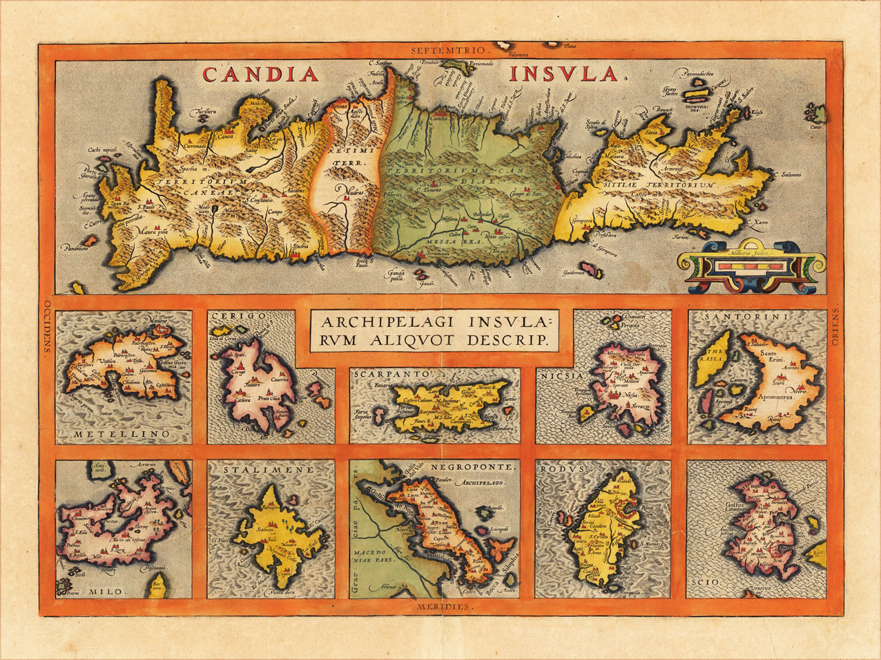
Original antique copper engraving, finely hand colored in wash and outline. Original copper engraving, published 1612 in the famous Vrients-edition of the 'Theatrum Orbis Terrarum'. Finely hand-colored in wash and outline. The decorative doublepage map is showing eleven maps of the Greek Archipelago in the Mediterranean. The title of the map appears in the centre, the upper part of the map is a large map of Candia (Crete), already with many names of villages and other small places. Below are ten more small insets of Greek islands in the Archipelago (Metellino, Cerigo, Scarpanto, Nicsia, Santorini, Milos, Stalimente, Negroponte, Rhodos and Scios). Ortelius was born on 14 April 1527 in the city of Antwerp, which was then in the Habsburg Netherlands (modern-day Belgium). The Orthellius family were originally from Augsburg, a Free imperial city of the Holy Roman Empire. In 1535, the family had fallen under suspicion of Protestantism. Following the death of Ortelius's father, his uncle Jacobus van Meteren returned from religious exile in England to take care of Ortelius. Abraham remained close to his cousin Emanuel van Meteren, who would later move to London. In 1575 he was appointed geographer to the king of Spain, Philip II, on the recommendation of Arias Montanus, who vouched for his orthodoxy. He travelled extensively in Europe and is specifically known to have traveled throughout the Seventeen Provinces; in southern, western, northern, and eastern Germany (e.g., 1560, 1575–1576); France (1559–1560); England and Ireland (1576); and Italy (1578, and perhaps twice or thrice between 1550 and 1558). Beginning as a map-engraver, in 1547 he entered the Antwerp Guild of Saint Luke as an illuminator of maps. He supplemented his income trading in books, prints, and maps, and his journeys included yearly visits to the Frankfurt book and print fair, where he met Gerardus Mercator in 1554. In 1560, however, when travelling with Mercator to Trier, Lorraine, and Poitiers, he seems to have been attracted, largely by Mercator's influence, towards the career of a scientific geographer. (Wikipedia)
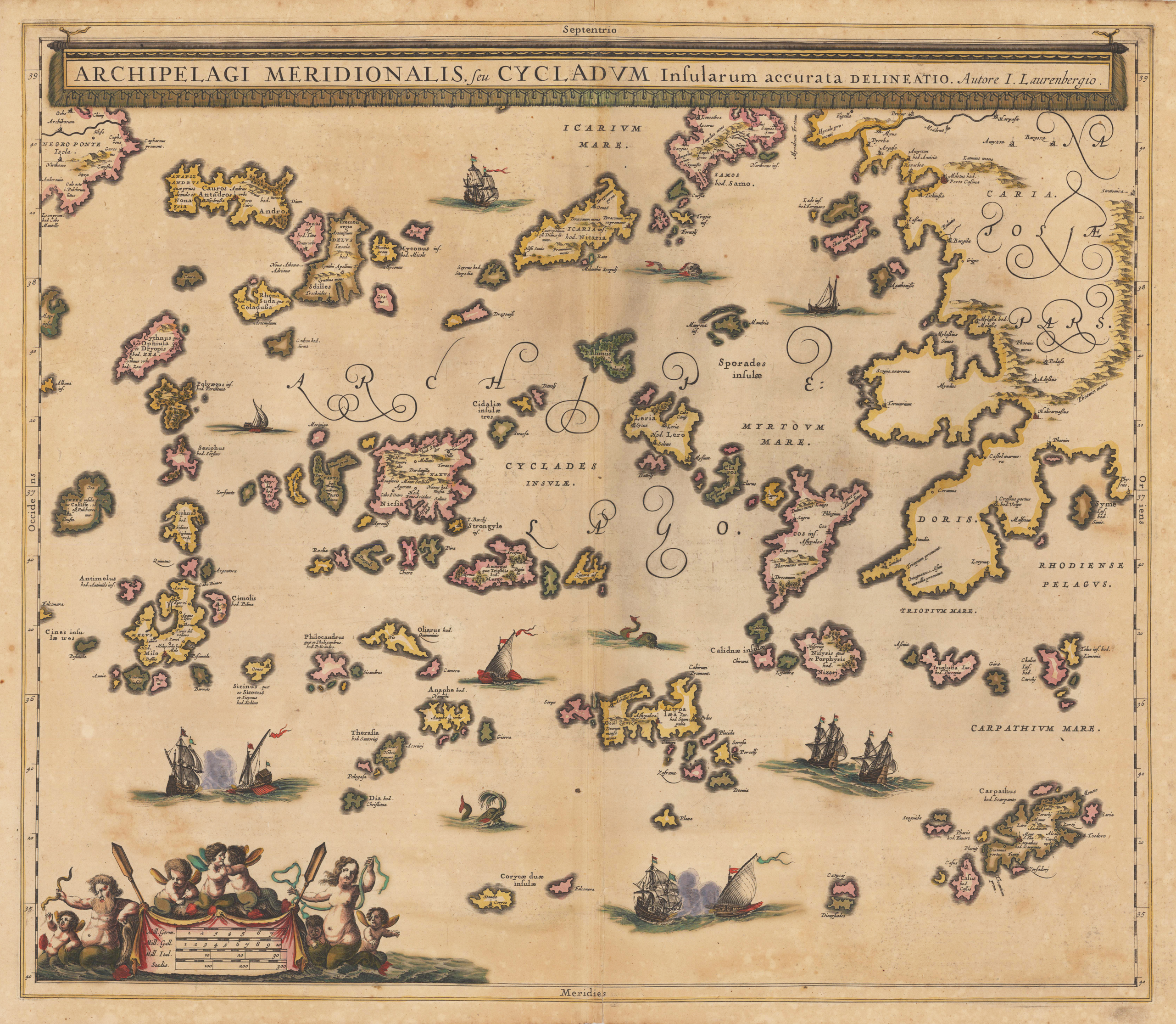
Original antique copper engraving, decorative hand colored in outline when published. Decorative map showing in Greece the Southern Aegean Islands with its neighbouring regions. A pretty accurate map with many engraved small islands and place names, as well mountains and rivers are shown on the map. The title cartouche is on the upper side of the map. In the lower left corner a decorative figurative ornated mileage scale. Johannes Janssonius (1588, Arnhem – buried July 11, 1664, Amsterdam) (born Jan Janszoon, in English also Jan Jansson) was a Dutch cartographer and publisher who lived and worked in Amsterdam in the 17th century. Janssonius was born in Arnhem, the son of Jan Janszoon the Elder, a publisher and bookseller. In 1612 he married Elisabeth de Hondt, the daughter of Jodocus Hondius. He produced his first maps in 1616 of France and Italy. In 1623 Janssonius owned a bookstore in Frankfurt am Main, later also in Danzig, Stockholm, Copenhagen, Berlin, Königsberg, Geneva and Lyon. His wife Elisabeth died in 1627 and he married Elisabeth Carlier in 1629. He formed a partnership with his brother in law Henricus Hondius, and together they published atlases as Mercator/Hondius/Janssonius. Under the leadership of Janssonius the Hondius Atlas was steadily enlarged. Renamed Atlas Novus, it had three volumes in 1638, one fully dedicated to Italy. In 1646, a fourth volume came out with "English County Maps", a year after a similar issue by Joan Blaeu. Janssonius' maps are similar to those of Blaeu, and he is often accused of copying from his rival, but many of his maps predate those of Blaeu and/or covered different regions. By 1660, at which point the atlas bore the appropriate name "Atlas Major", there were 11 volumes, containing the work of about a hundred credited authors and engravers. It included a description of "most of the cities of the world" (Townatlas), of the waterworld (Atlas Maritimus in 33 maps), and of the Ancient World (60 maps). The eleventh volume was titled Atlas of the Heavens (a type of celestial cartography) by Andreas Cellarius. Editions were printed in Dutch, Latin, French, and a few times in German. After Janssonius's death, the publishing company was continued by his son-in law, Johannes van Waesbergen. The London bookseller Moses Pitt attempted publication of the Atlas Major in English, but ran out of resources after the fourth volume in 1683. (Wikipedia)
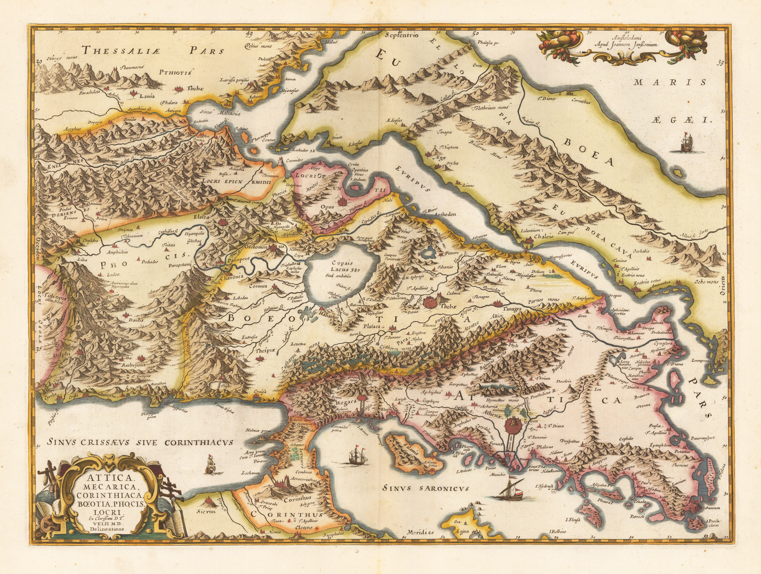
Original antique copper engraving, decorative hand colored in outline and wash. Verso blanc. A fine and detailled map of the regions of Attica, Corinth, Boeotia and the penninsula of Euböa. This highly decorative antique regional map is very detailled and provides a lot of information on smaller place names, historical sites. Mountains, woods, rivers and lakes with sailing ships are engraved.
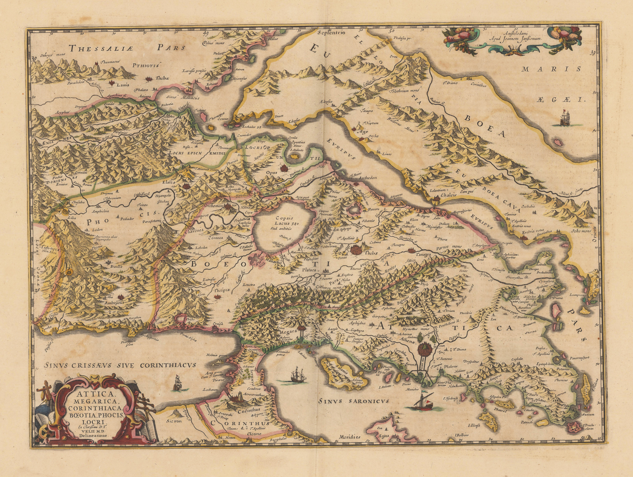
Original antique copper engraving, decorative hand colored in outline. A fine and detailled map of the regions of Attica, Corinth, Boeotia and the penninsula of Euböa. This highly decorative antique regional map is very detailled and provides a lot of information on smaller place names, historical sites. Mountains, woods, rivers and lakes with sailing ships are engraved. Johannes Janssonius (1588, Arnhem – buried July 11, 1664, Amsterdam) (born Jan Janszoon, in English also Jan Jansson) was a Dutch cartographer and publisher who lived and worked in Amsterdam in the 17th century. Janssonius was born in Arnhem, the son of Jan Janszoon the Elder, a publisher and bookseller. In 1612 he married Elisabeth de Hondt, the daughter of Jodocus Hondius. He produced his first maps in 1616 of France and Italy. In 1623 Janssonius owned a bookstore in Frankfurt am Main, later also in Danzig, Stockholm, Copenhagen, Berlin, Königsberg, Geneva and Lyon. His wife Elisabeth died in 1627 and he married Elisabeth Carlier in 1629. He formed a partnership with his brother in law Henricus Hondius, and together they published atlases as Mercator/Hondius/Janssonius. Under the leadership of Janssonius the Hondius Atlas was steadily enlarged. Renamed Atlas Novus, it had three volumes in 1638, one fully dedicated to Italy. In 1646, a fourth volume came out with "English County Maps", a year after a similar issue by Joan Blaeu. Janssonius' maps are similar to those of Blaeu, and he is often accused of copying from his rival, but many of his maps predate those of Blaeu and/or covered different regions. By 1660, at which point the atlas bore the appropriate name "Atlas Major", there were 11 volumes, containing the work of about a hundred credited authors and engravers. It included a description of "most of the cities of the world" (Townatlas), of the waterworld (Atlas Maritimus in 33 maps), and of the Ancient World (60 maps). The eleventh volume was titled Atlas of the Heavens (a type of celestial cartography) by Andreas Cellarius. Editions were printed in Dutch, Latin, French, and a few times in German. After Janssonius's death, the publishing company was continued by his son-in law, Johannes van Waesbergen. The London bookseller Moses Pitt attempted publication of the Atlas Major in English, but ran out of resources after the fourth volume in 1683. (Wikipedia)
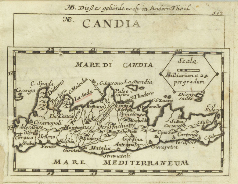
Original copper engraving, uncolored. Published in Pierre Du Val's atlas ,Anderer Theil der allgemeinen Weltbeschreibung von Europa' (German edition Nürnberg at Johann Hoffmann & Christoph Gerhard.
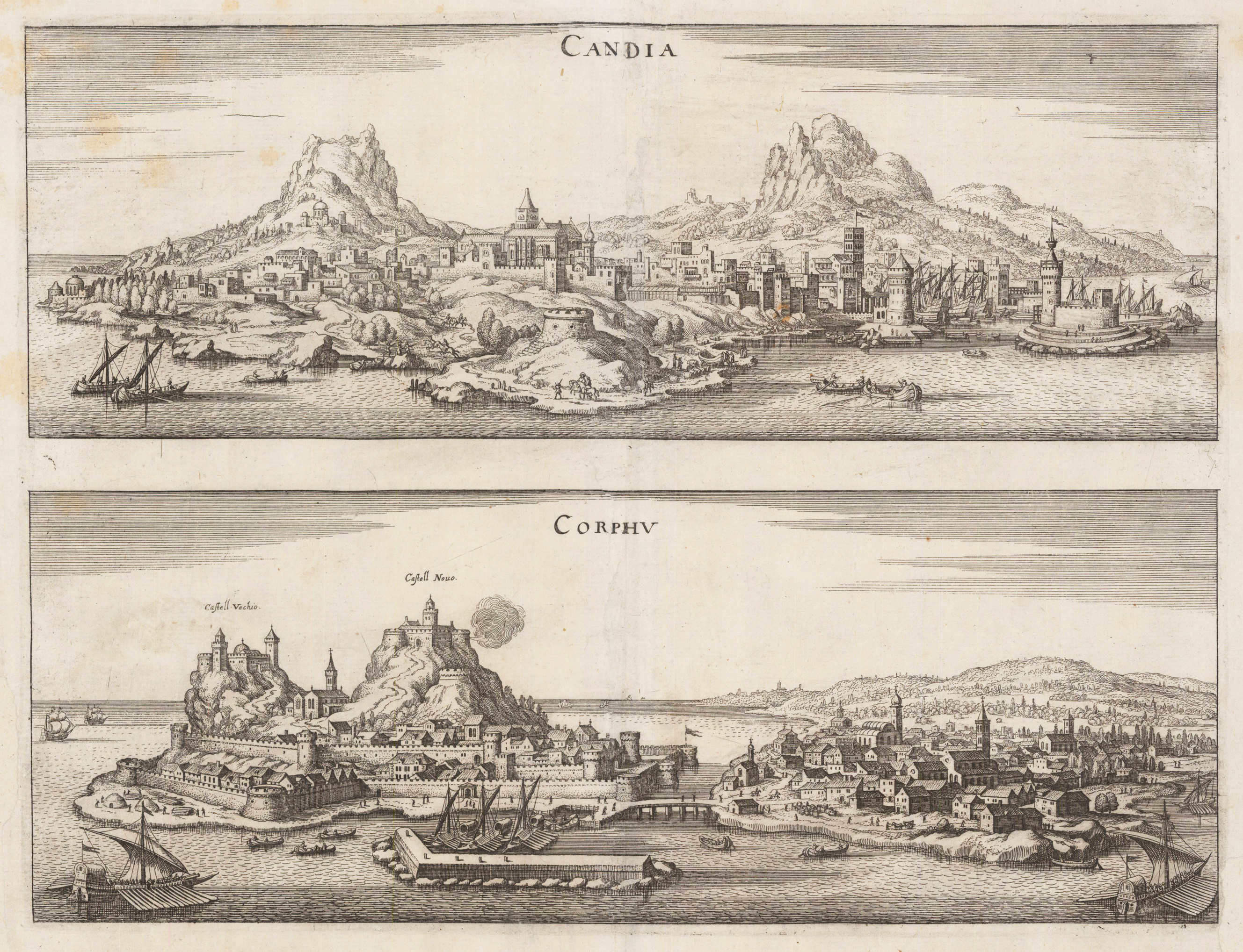
Original antique copper engraving published in Matthaeus Merian's ,Theatrum Europeanum'. Depicted are two views on one doublepage. At the top is the panoramic view of Heraklion on the island of Crete and the bottom the view of Corfu with its fortifications.
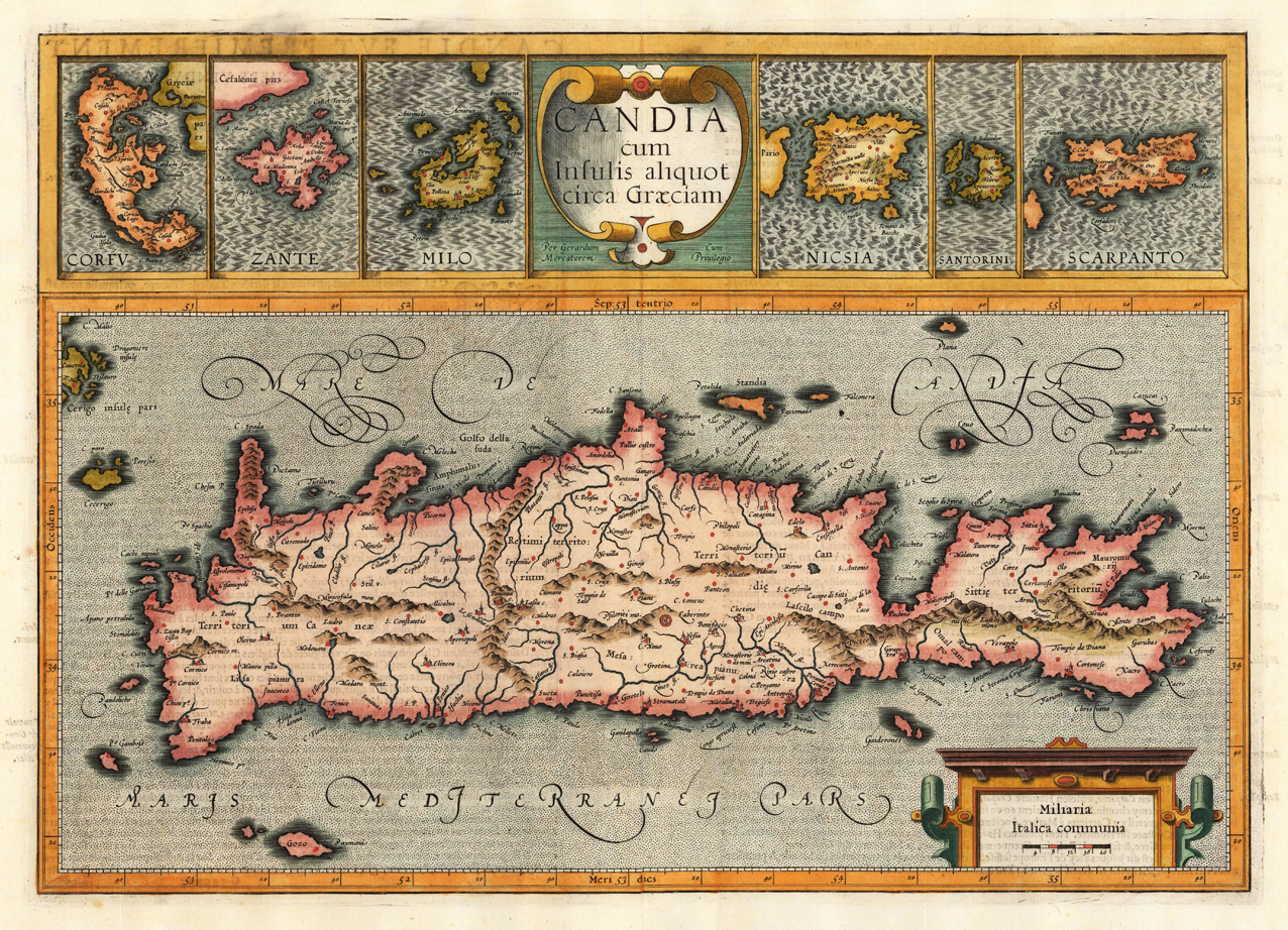
Copper engraving, hand colored in outline and wash. Published in the French text edition of the by Gerard Mercator 'Atlas sive cosmographicae meditationes de fabrica mundi ...' 1619 at Jodocus Hondius in Amsterdam.
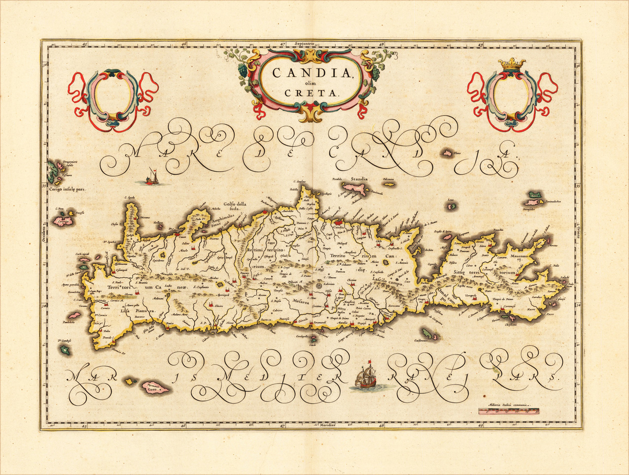
Engraved map in fine contemporary colors in outline and wash. Published in the edition of Blaeu's "Atlas Maior". The island of Crete is shown quite accurate with detailed engraved rivers, mountains and villages. Ornated with a nice allegoric cartouche, ships and shields for coat of arms. Joan Blaeu (23 September 1596 – 21 December 1673) was a Dutch cartographer born in Alkmaar, the son of cartographer Willem Blaeu. In 1620 he became a doctor of law but he joined the work of his father. In 1635 they published the Atlas Novus (full title: Theatrum orbis terrarum, sive, Atlas novus) in two volumes. Joan and his brother Cornelius took over the studio after their father died in 1638. Joan became the official cartographer of the Dutch East India Company. Blaeu's world map, Nova et Accuratissima Terrarum Orbis Tabula, incorporating the discoveries of Abel Tasman, was published in 1648. This map was revolutionary in that it "depicts the solar system according to the heliocentric theories of Nicolaus Copernicus, which show the earth revolving around the sun.... Although Copernicus's groundbreaking book On the Revolutions of the Spheres had been first printed in 1543, just over a century earlier, Blaeu was the first mapmaker to incorporate this revolutionary heliocentric theory into a map of the world." Blaeu's map was copied for the map of the world set into the pavement of the Groote Burger-Zaal of the new Amsterdam Town Hall, designed by the Dutch architect Jacob van Campen (now the Amsterdam Royal Palace), in 1655. Blaeu's Hollandia Nova was also depicted in his Archipelagus Orientalis sive Asiaticus published in 1659 in the Kurfürsten Atlas (Atlas of the Great Elector). and used by Melchisédech Thévenot to produce his map, Hollandia Nova—Terre Australe (1664). As Joan Blaeu, he also published the 12 volume "Le Grand Atlas, ou Cosmographie blaviane, en laquelle est exactement descritte la terre, la mer, et le ciel". One edition is dated 1663. That was folio (540 x 340 mm), and contained 593 engraved maps and plates. In March 2015, a copy was on sale for £750,000. Around 1649 Joan Blaeu published a collection of Dutch city maps named Toonneel der Steeden (Views of Cities). In 1651 he was voted into the Amsterdam council. In 1654 Joan published the first atlas of Scotland, devised by Timothy Pont. In 1662 he reissued the Atlas Novus, also known as Atlas Maior, in 11 volumes, and one for oceans.[citation needed] A cosmology was planned as their next project, but a fire destroyed the studio completely in 1672. (Wikipedia)
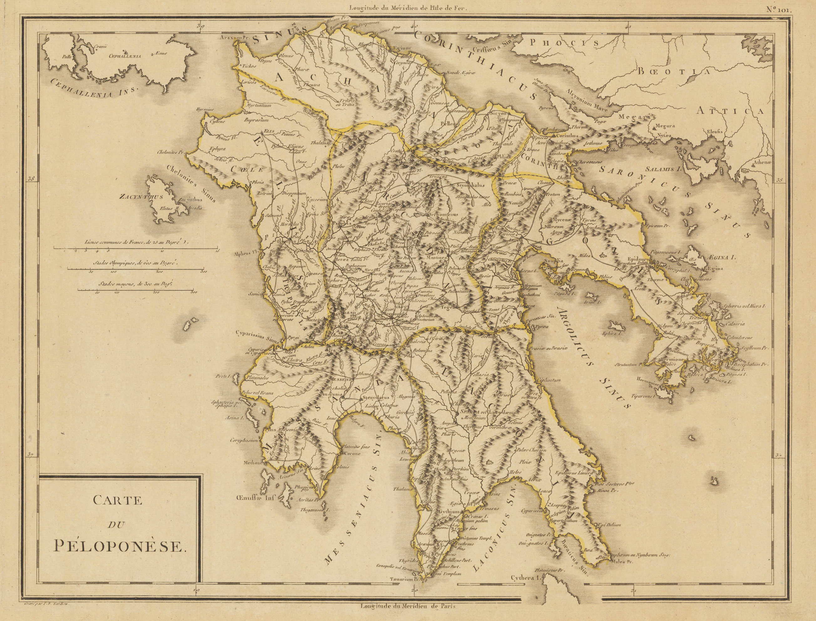
Original antique copper engraving, colored in outline when published. Antique map of the Peloponnes in Greece, hand colored in outline. Many place names, rivers and mountains are shown. Title cartouche in the lower left corner, mile sclae in the left sided middle. Pierre Antoine Tardieu, also known as P.F. Tardieu (March 9, 1784 in Paris – July 17, 1869 in Paris) was a French engraver, steel engraver and cartographer. Pierre Antoine Tardieu was born in his family's ancestral home on Place de Estrapade. He was taught his craft by his father, Antoine François Tardieu. He was the first of his family to carry out his maps in steel engraving. The extraordinary quality of his work even drew the attention of Alexander von Humboldt. In 1818 he married Eugénie-Isabelle de Bonnaire.[1] In the years 1832 to 1834 he was involved in several arms dealerships as a volunteer in the reintroduced Garde Nationale. During this time he also became an elementary school inspector. He also took part in the industrial exhibition in 1834, where he received the bronze medal from Louis-Philippe I for his work. In 1837 he was finally appointed Knight of the Legion of Honour. He worked in his father's workshop for a total of 25 years before becoming self-employed. However, he continued to live in the house where he was born until his death. In 1861 he retired at the age of 77.
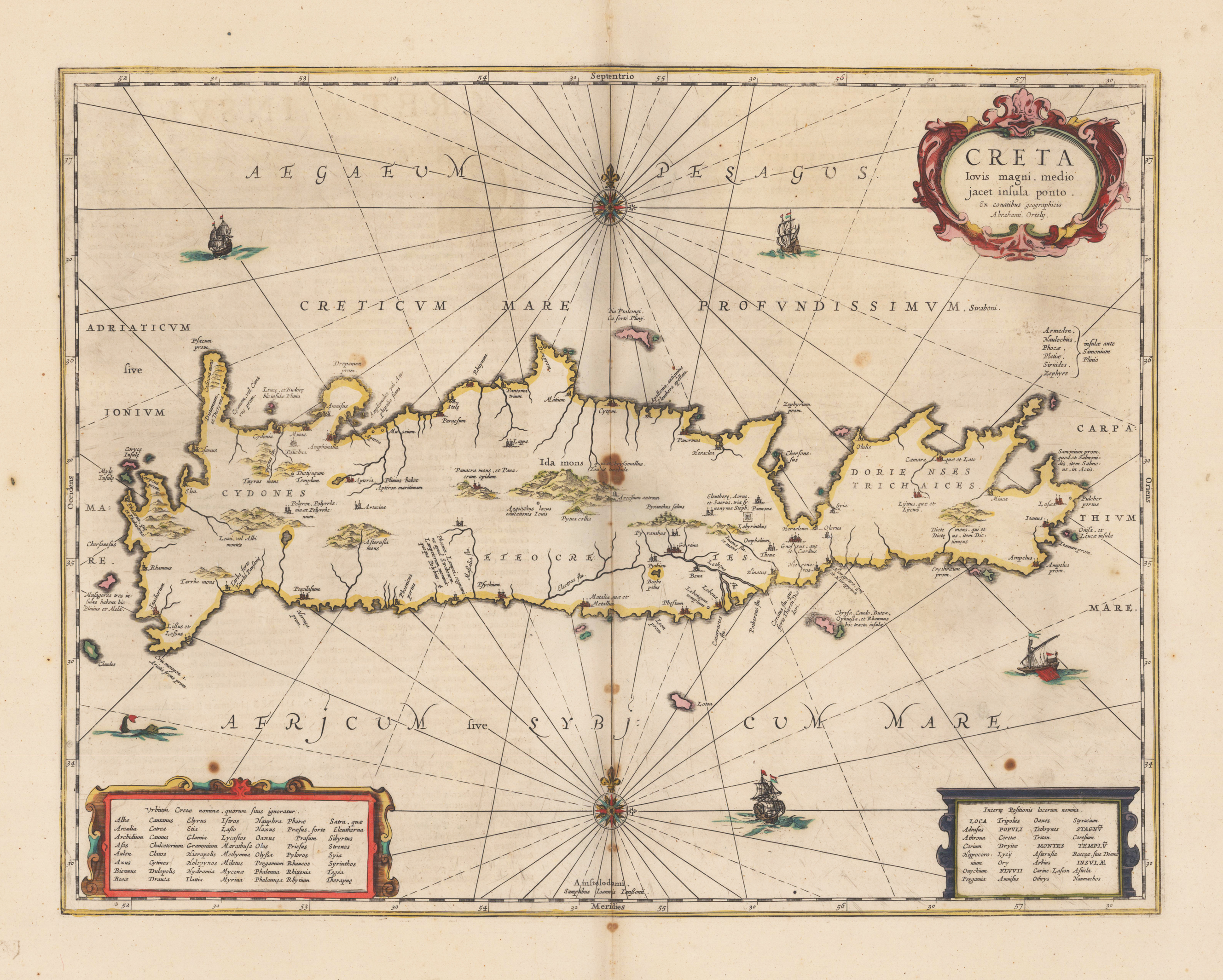
Original antique copper engraving, decorative hand colored in outline and wash. Map shows the Greek island of Crete with a title cartouche and two index cartouches. Furthermore, sailing ships, a sea monster and two compass roses. Johannes Janssonius (1588, Arnhem – buried July 11, 1664, Amsterdam) (born Jan Janszoon, in English also Jan Jansson) was a Dutch cartographer and publisher who lived and worked in Amsterdam in the 17th century. Janssonius was born in Arnhem, the son of Jan Janszoon the Elder, a publisher and bookseller. In 1612 he married Elisabeth de Hondt, the daughter of Jodocus Hondius. He produced his first maps in 1616 of France and Italy. In 1623 Janssonius owned a bookstore in Frankfurt am Main, later also in Danzig, Stockholm, Copenhagen, Berlin, Königsberg, Geneva and Lyon. His wife Elisabeth died in 1627 and he married Elisabeth Carlier in 1629. He formed a partnership with his brother in law Henricus Hondius, and together they published atlases as Mercator/Hondius/Janssonius. Under the leadership of Janssonius the Hondius Atlas was steadily enlarged. Renamed Atlas Novus, it had three volumes in 1638, one fully dedicated to Italy. In 1646, a fourth volume came out with "English County Maps", a year after a similar issue by Joan Blaeu. Janssonius' maps are similar to those of Blaeu, and he is often accused of copying from his rival, but many of his maps predate those of Blaeu and/or covered different regions. By 1660, at which point the atlas bore the appropriate name "Atlas Major", there were 11 volumes, containing the work of about a hundred credited authors and engravers. It included a description of "most of the cities of the world" (Townatlas), of the waterworld (Atlas Maritimus in 33 maps), and of the Ancient World (60 maps). The eleventh volume was titled Atlas of the Heavens (a type of celestial cartography) by Andreas Cellarius. Editions were printed in Dutch, Latin, French, and a few times in German. After Janssonius's death, the publishing company was continued by his son-in law, Johannes van Waesbergen. The London bookseller Moses Pitt attempted publication of the Atlas Major in English, but ran out of resources after the fourth volume in 1683. (Wikipedia)
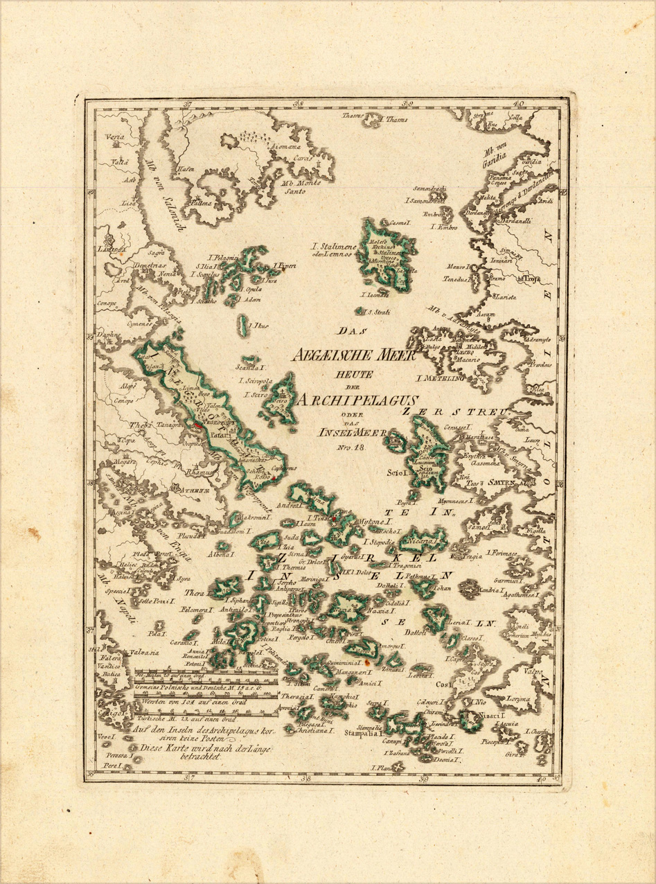
Original copper engraving, hand colored in wash and outline, when published. Decorative map of the Aegean Sea with the Greek islands. The Austrian cartographer Franz Joh. Josef von Reilly published around 1789 in Vienna a large amount of very detailed district maps of Central Europe. These maps are famous for their large scales and the many details they provide. Even tiny place names can be found on those maps, rivers, mountains, streets, monasteries are as well engraved. The maps, which Franz J. Reilly engraved, were especially designed for the Austrian Royal house and show countries, provinces and districts belonging to the 'Austrian-Hungarian Empire'.
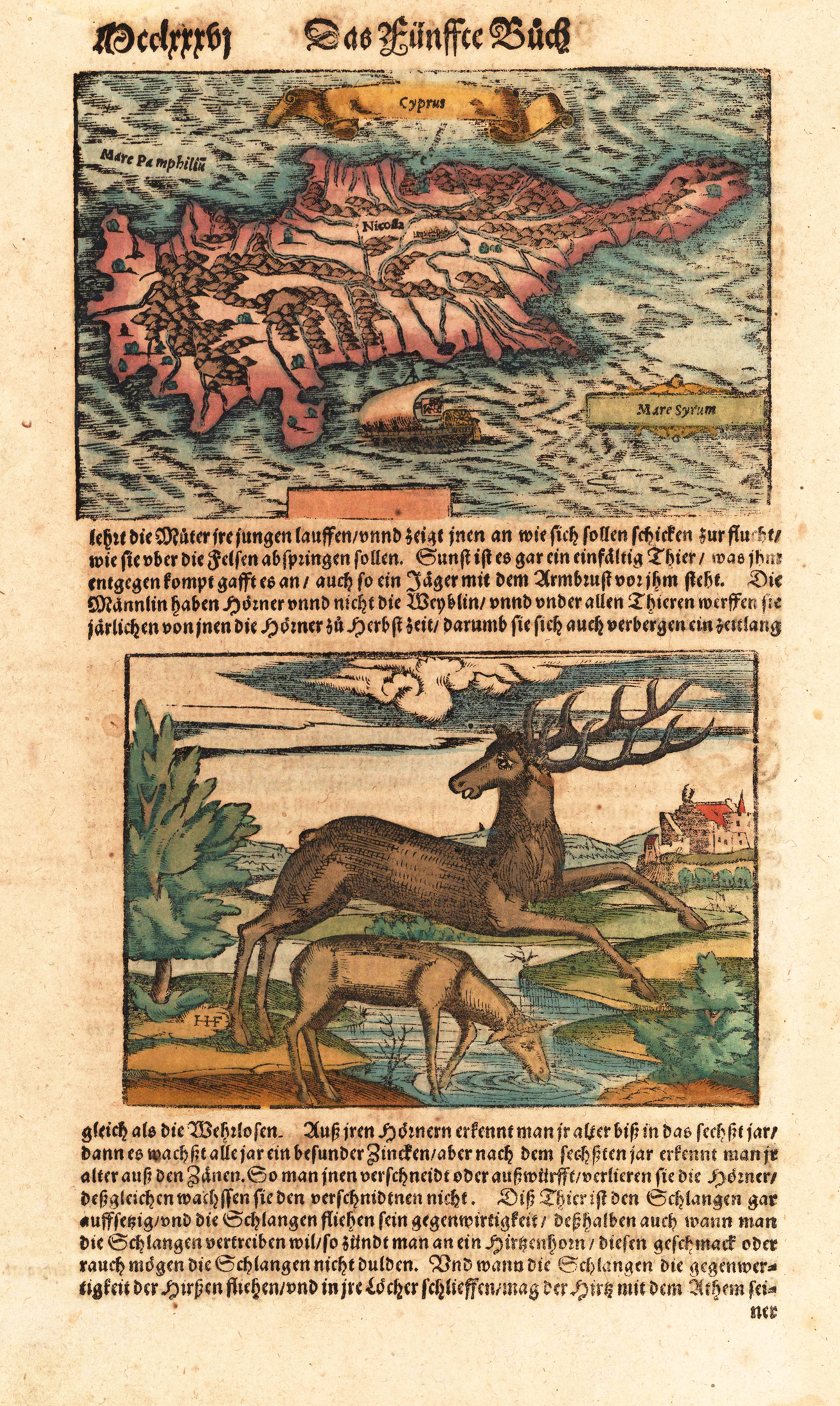
Woodcut hand colored in wash, published in Sebastian Münster's 'Cosmographia' around 1578. German text edition. Decorative fine map of Cyprus in the eastern Mediterranean Sea. Nicosia is named on the map. The German text page is relating to Sebastian Munster's description of Sweden and the woodcut illustration on the bottom of this page shows two north european reindeers. Among the descriptive text verso on the text sheet is a a chapter related to Cyprus. The 'Cosmographia' by Sebastian Münster was one of the most richest illustrated books with geographical content describing the world in the mid of the 16th century. It was published in Basel from 1544 onwards up to 1628 in various editions and different languages. Its content was enlarged from edition to edition to provide the reader with the newest information.
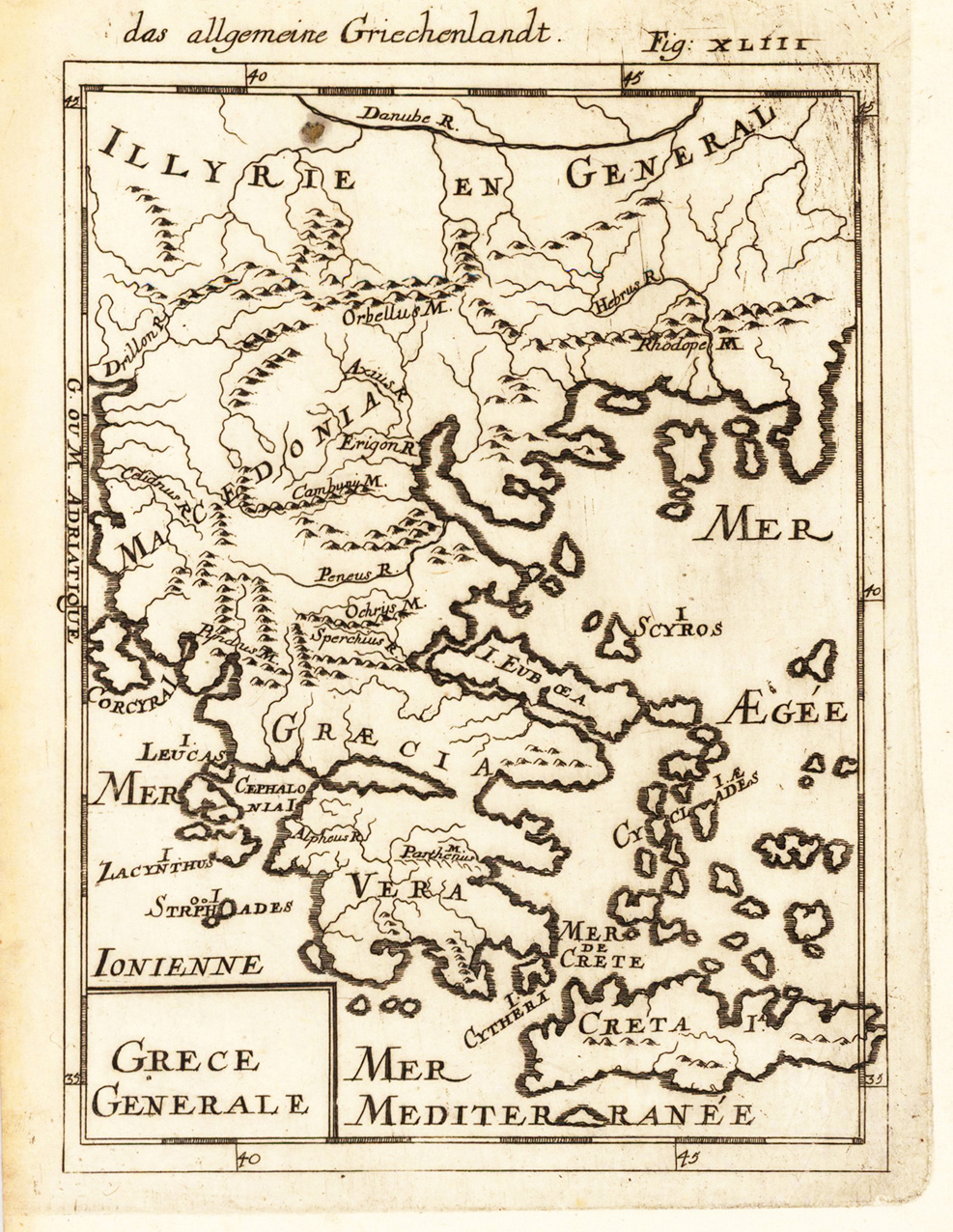
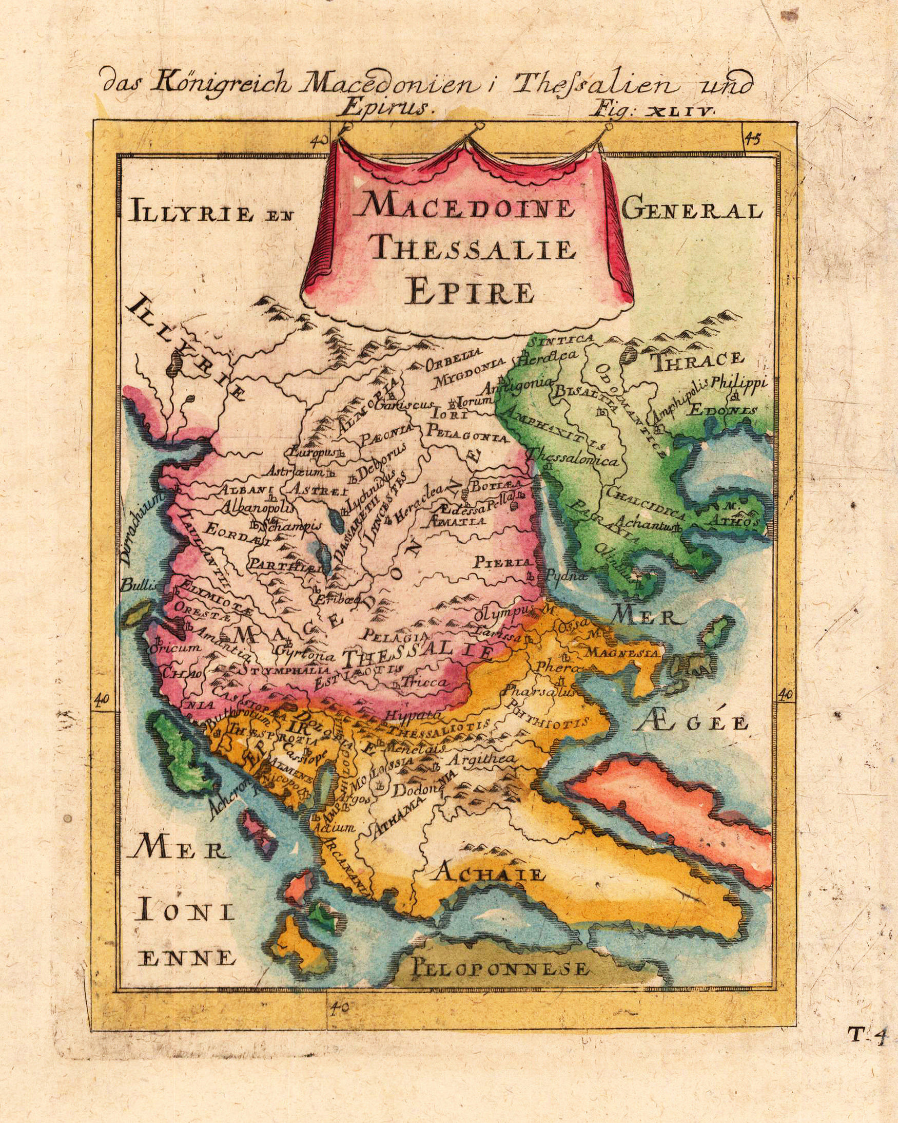
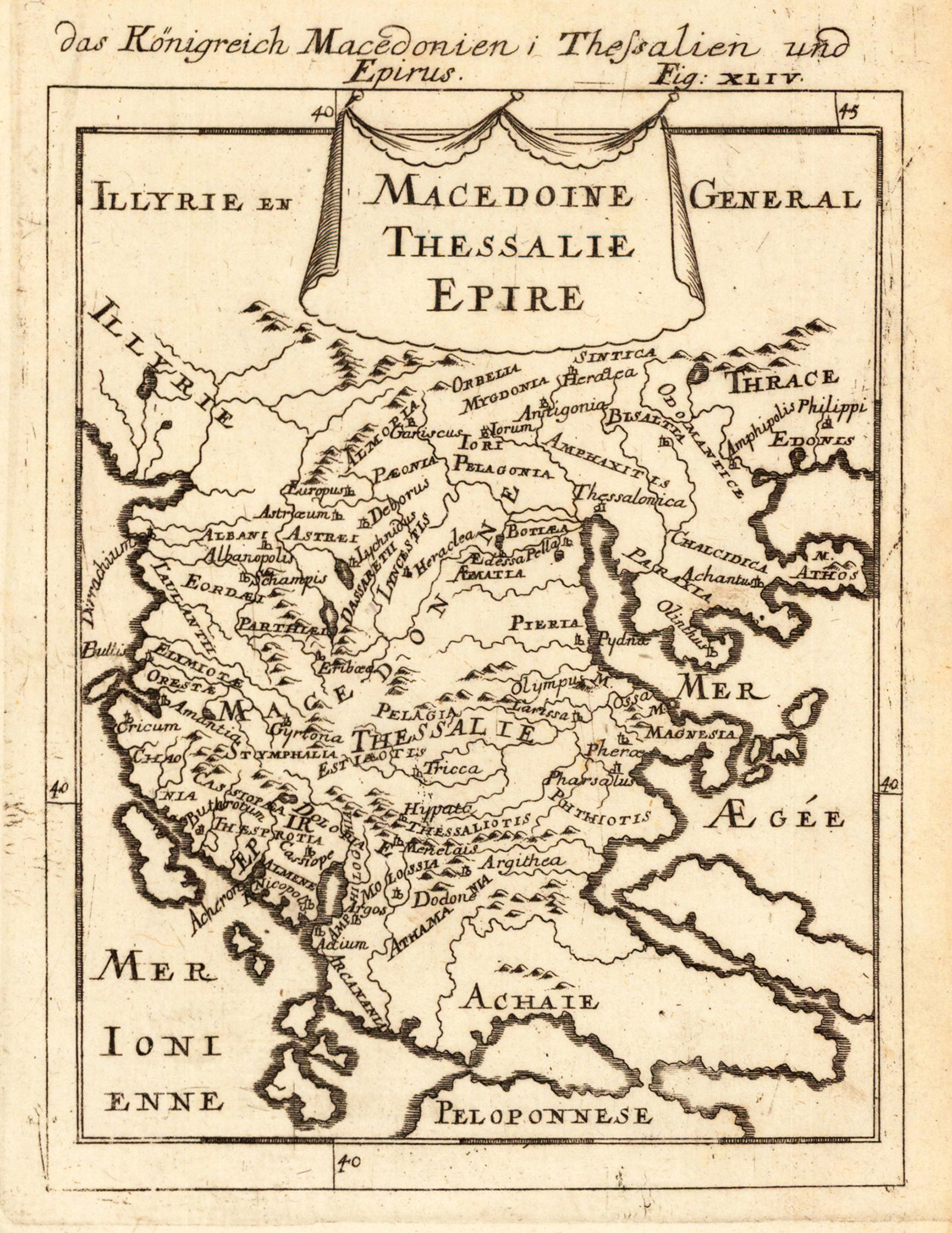
Copper engraving published in Allain M. Mallet's description of the world 'Description De L' Univers, Contenant Les Differents Systemes Du Monde, Les Cartes generales & particulieres ...'. French text edition with additional German titles on top. Small and quite detailled map of Macedonia, Thessalia and Epirus published 1686.
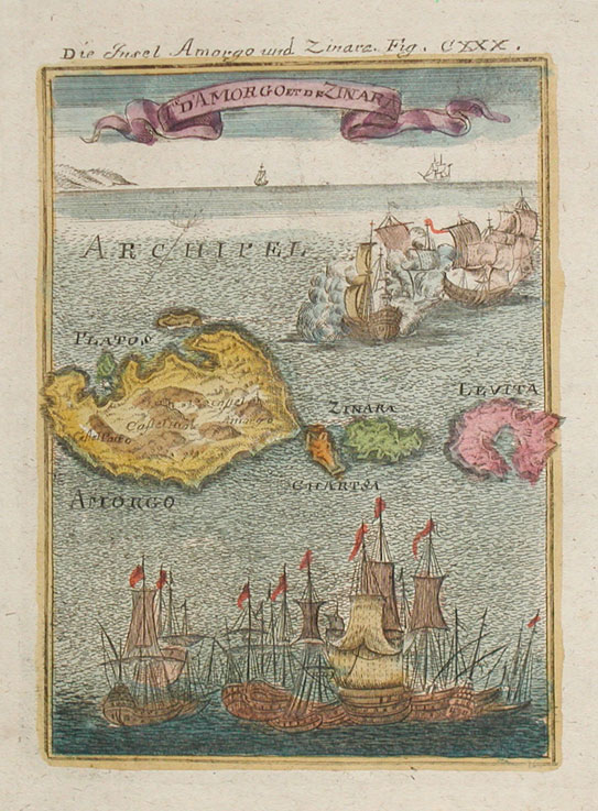
Copper-engraving, handcolored in wash and outline. This decorative map shows the Islands Amorgos and Zinara. Also are many sailing ships. At the map are also the Isands Levita, Latos and Arrorgo to see.
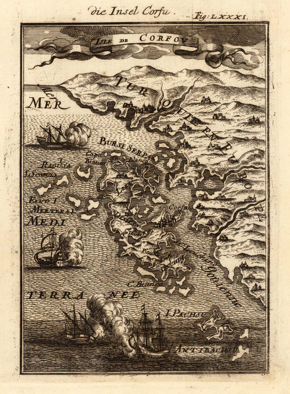
Copper-engraving, handcolored in wash and outline. Decorative bird's eye view of Corfu during the Turkish occupation, showing as well the neighbouring Greek mainland and Albania.
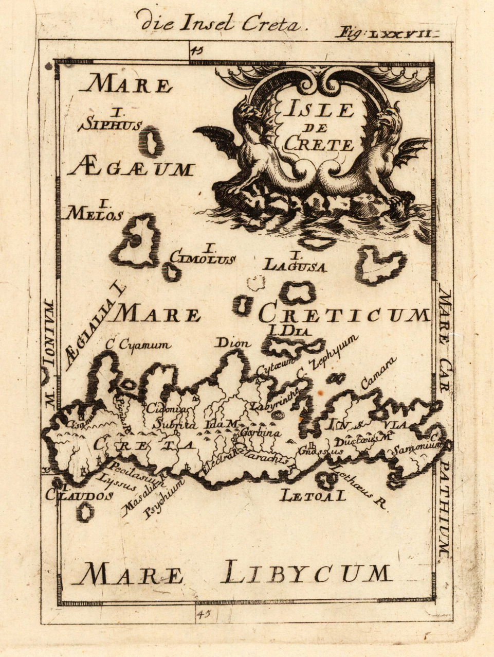
Copper engraving, uncolored as published. Small decorative map of Crete, ornated above with two seamonsters. Various place names are engraved on the map, as well other small islands named.
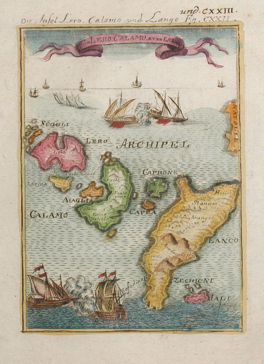
Copper-engraving, handcolored in wash and outline. This decorative map shows the Island Lero, Calamo and Lango. On the map are many sailing ships at the ocean which are fighting.
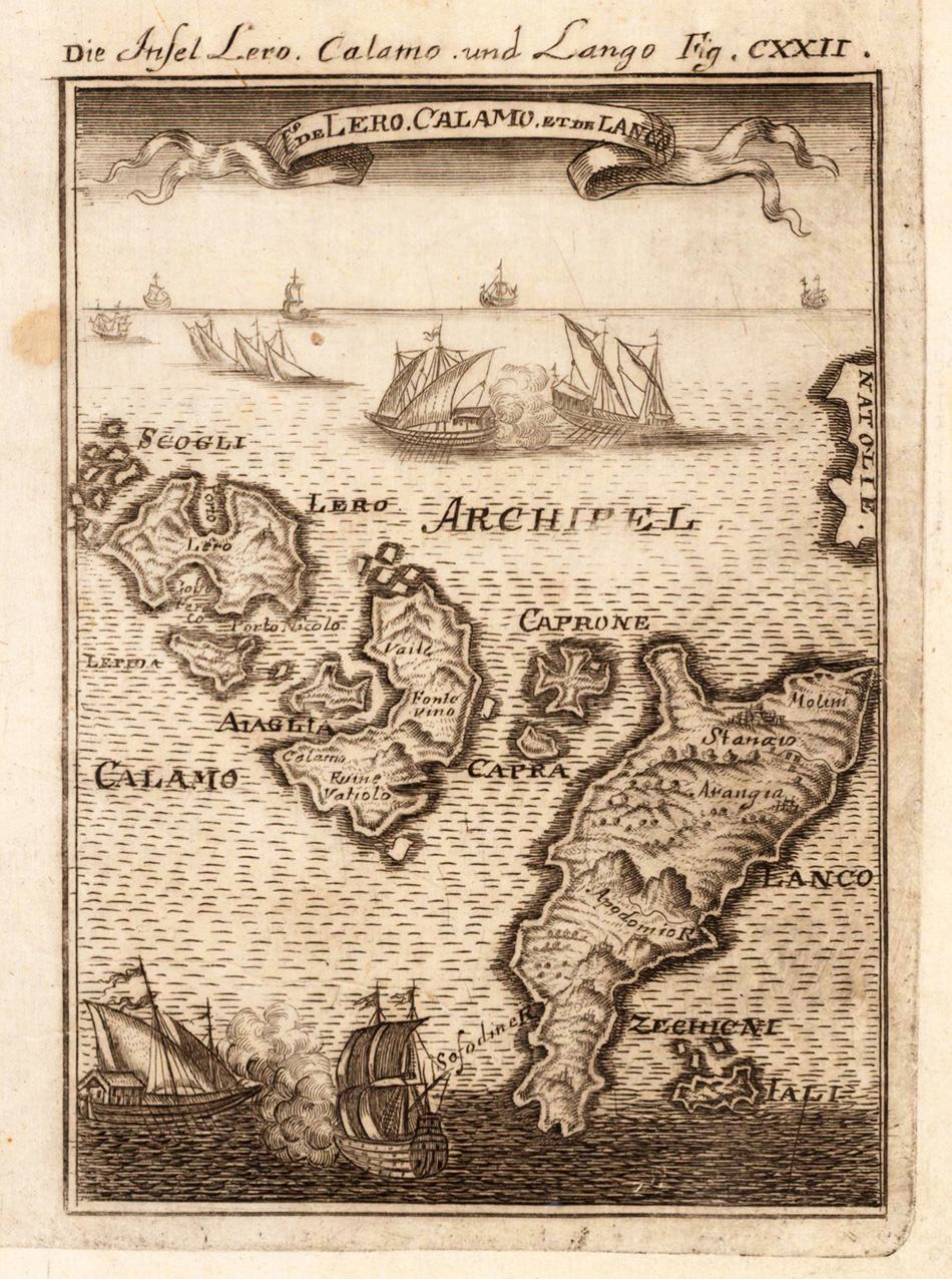
Copper engraving, uncolored as published. This decorative map shows the Island Lero, Calamo and Lango. On the map are many sailing ships at the ocean which are fighting.