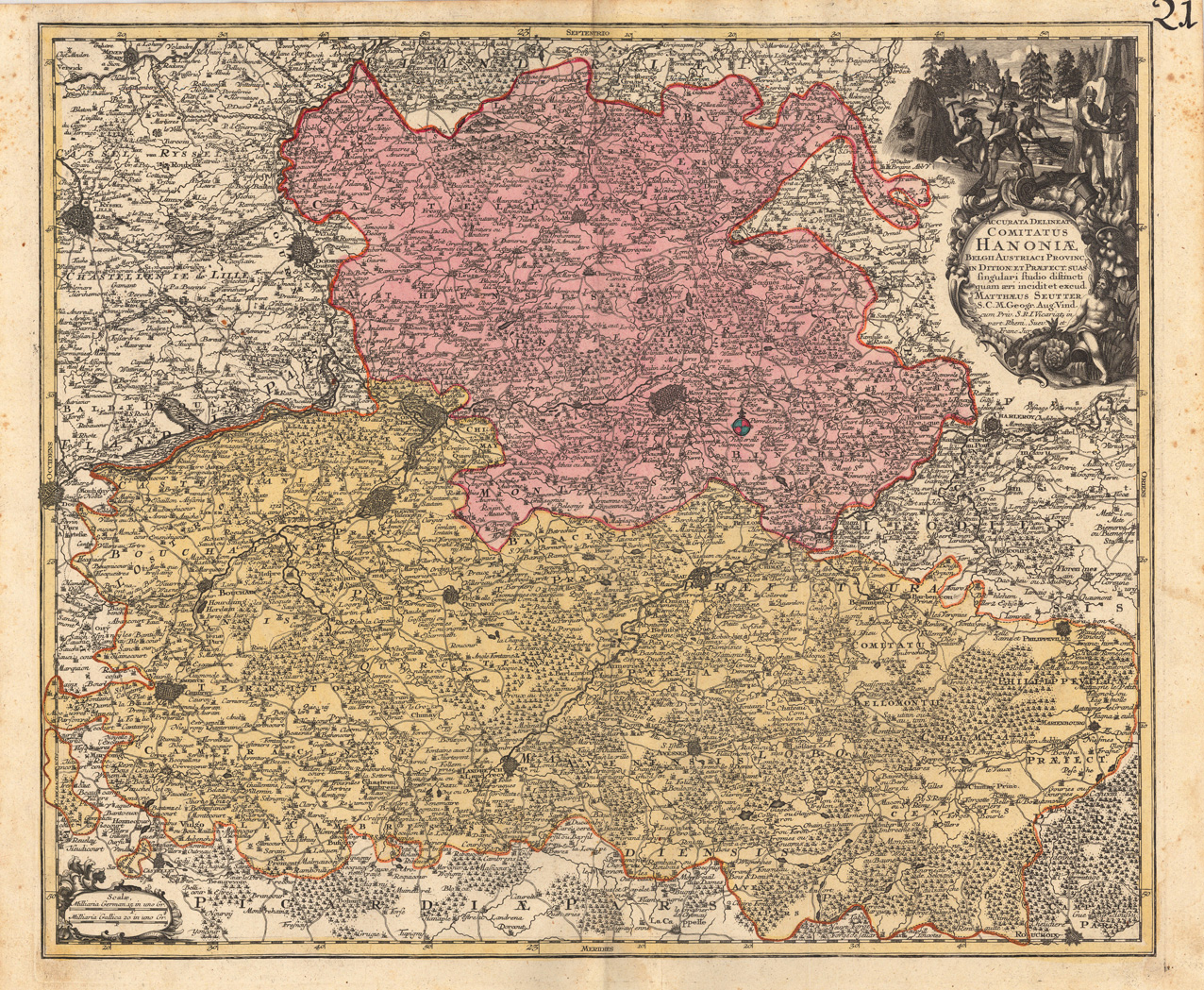
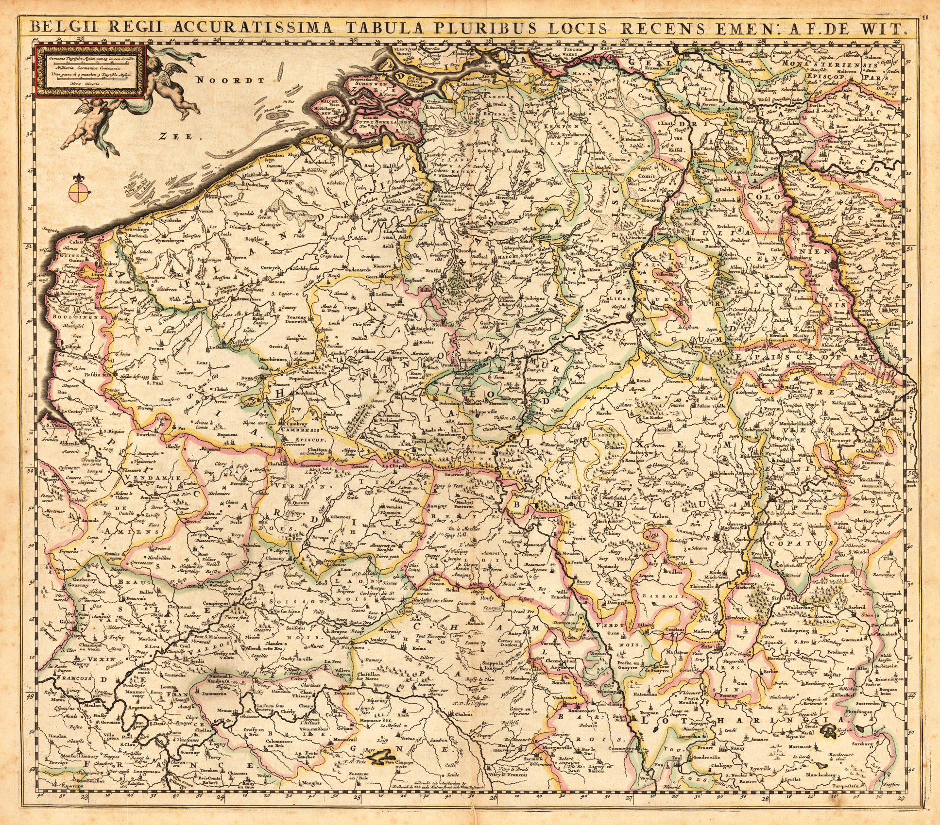
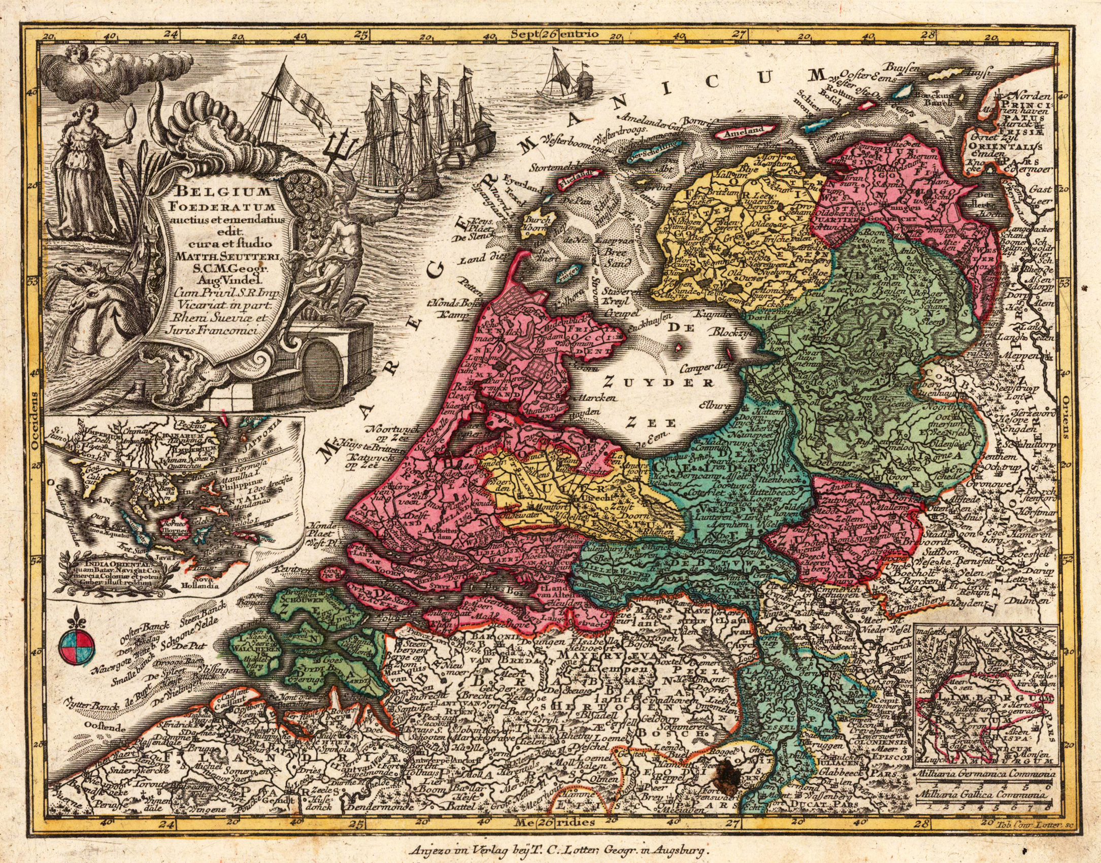
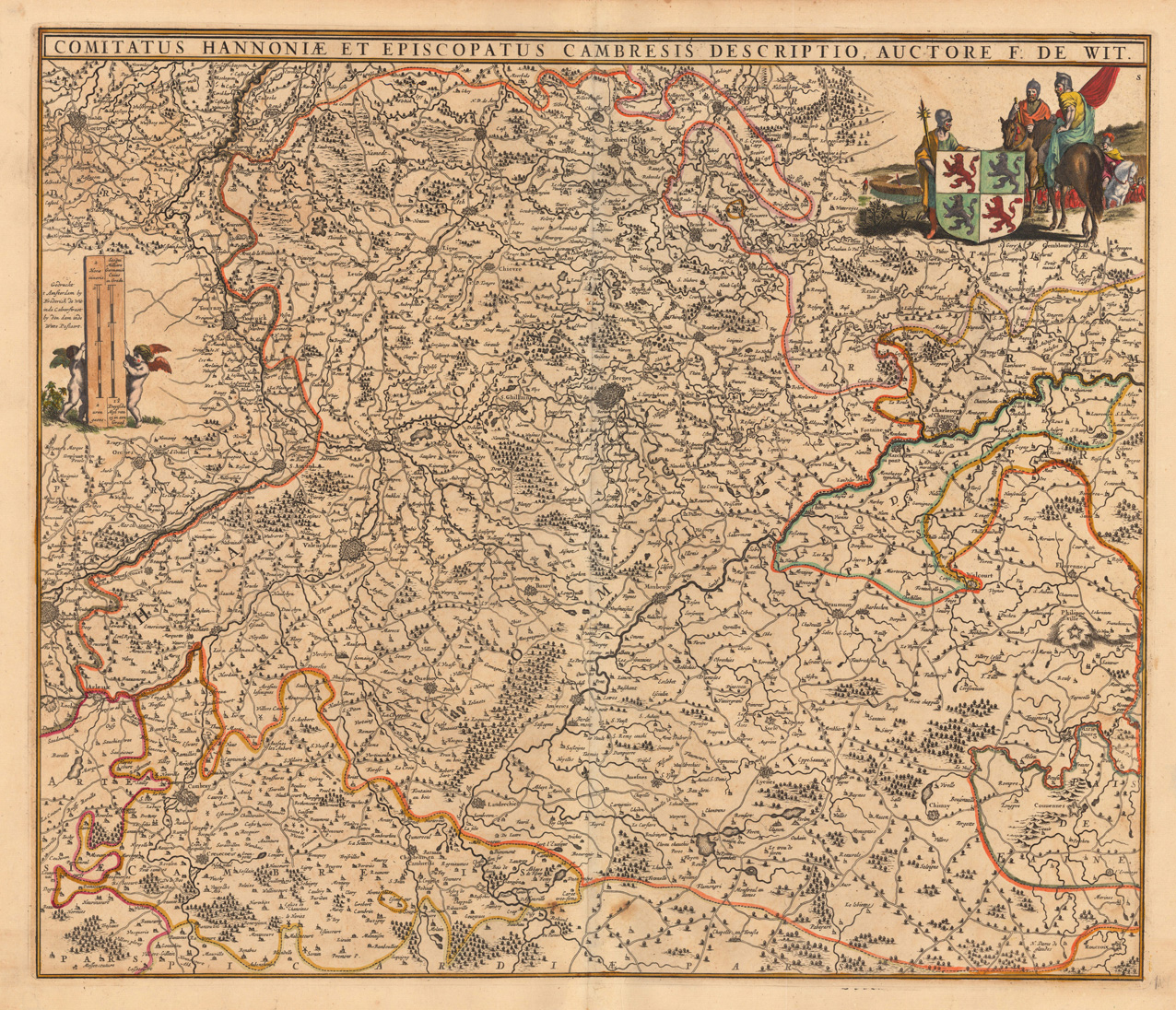
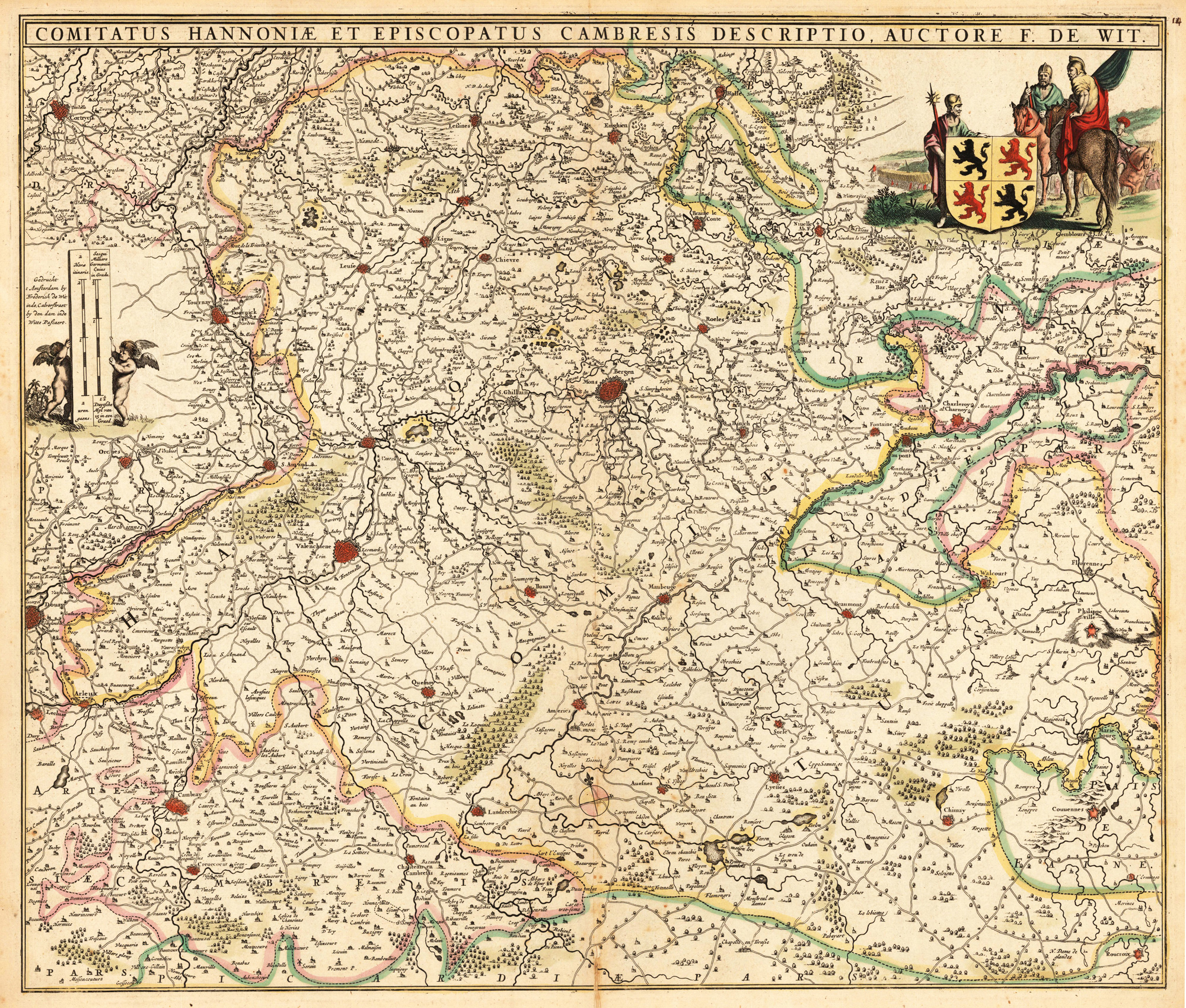
Copper-engraving, handcolored in outline and wash when published. With many engraved place names of smaller cities and villages, rivers and mountains are shown as well.
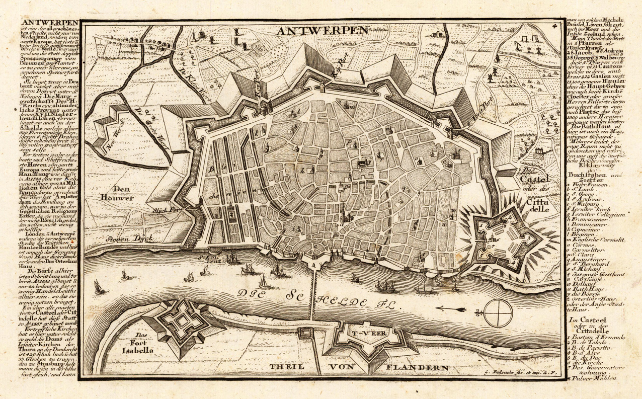
Copper engraving, uncolored as published. This fine engraving was published in Gabriel Bodenehr's famous serious "Europeans Macht und Pracht", a series of engravings depicting city views, plans, fortresses and castles in Europe. Many plates often are showing fortifications in Hungary and Southeast Europe, Spain, Belgium, Austria and Germany. Gabriel Bodenehr was during this period a successful publisher for maps and prints in Augsburg in Southern Germany.
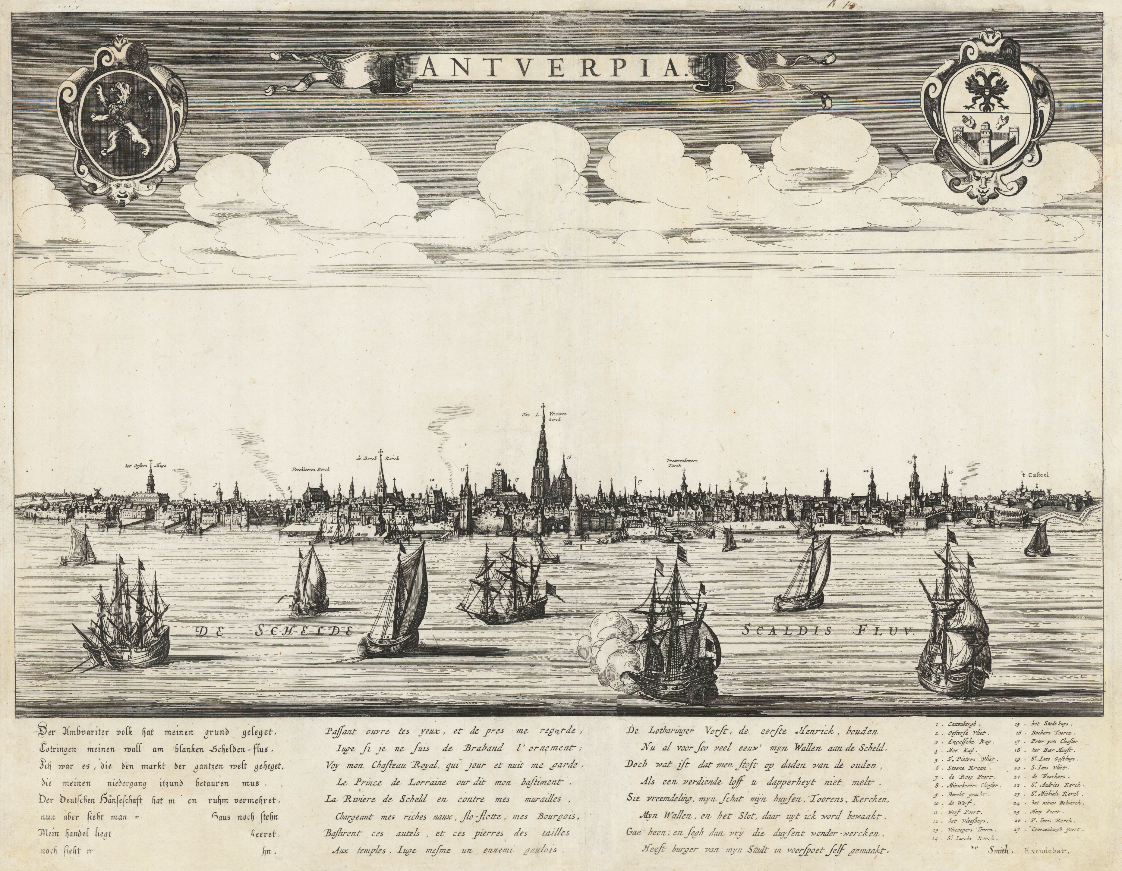
Original copper engraving, uncolored when published. Magnificent large panoramic view by Gerrit van Schagen of the city of Antwerpia. At the top in the centre a title banderole ,Antwerpia', in the upper right and left corner two coat of arms of the city of Antwerp and Belgium. In front of the Skyline of Antwerp are some sailing ships. At the bottom of the map with detailled text poems in Dutch, French and German. Towards the right side with key numbers 1-27 of the most important buildings in Antwerp.
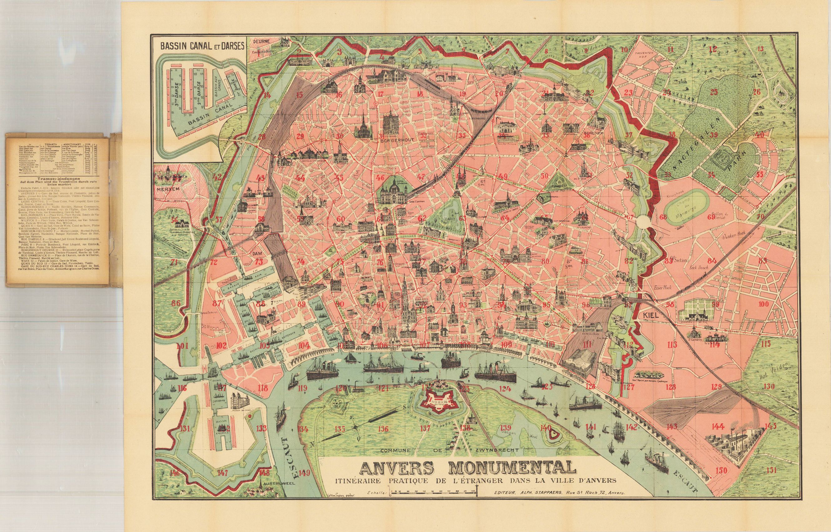
Reiseführer mit original antiker Lithographie. Plan Monumental de la ville d'Anvers. Faltkarte eingebunden in einen Reiseführer in deutsch, 40 S. Legende/Kartenschlüsselbroschüre vor großer farbig lithographierter Faltkarte. Karte aus der Vogelperspektive mit vielen bildhaften Gebäuden im Prospektprofil. Seltene Taschenfaltkarte von Antwerpen aus der Art-Deco-Ära. Taschenmappenhülle misst c. 6" H x 4 1/8" B. Kartenbereich misst c. 28 1/4" B x 23" H. Tooley's Dictionary of Mapmakers, nicht gefunden (!). [V48] Ein kurzes Präsentationsvideo dieses Artikels kann durch die Suche nach dem Titel des Angebots angezeigt werden.
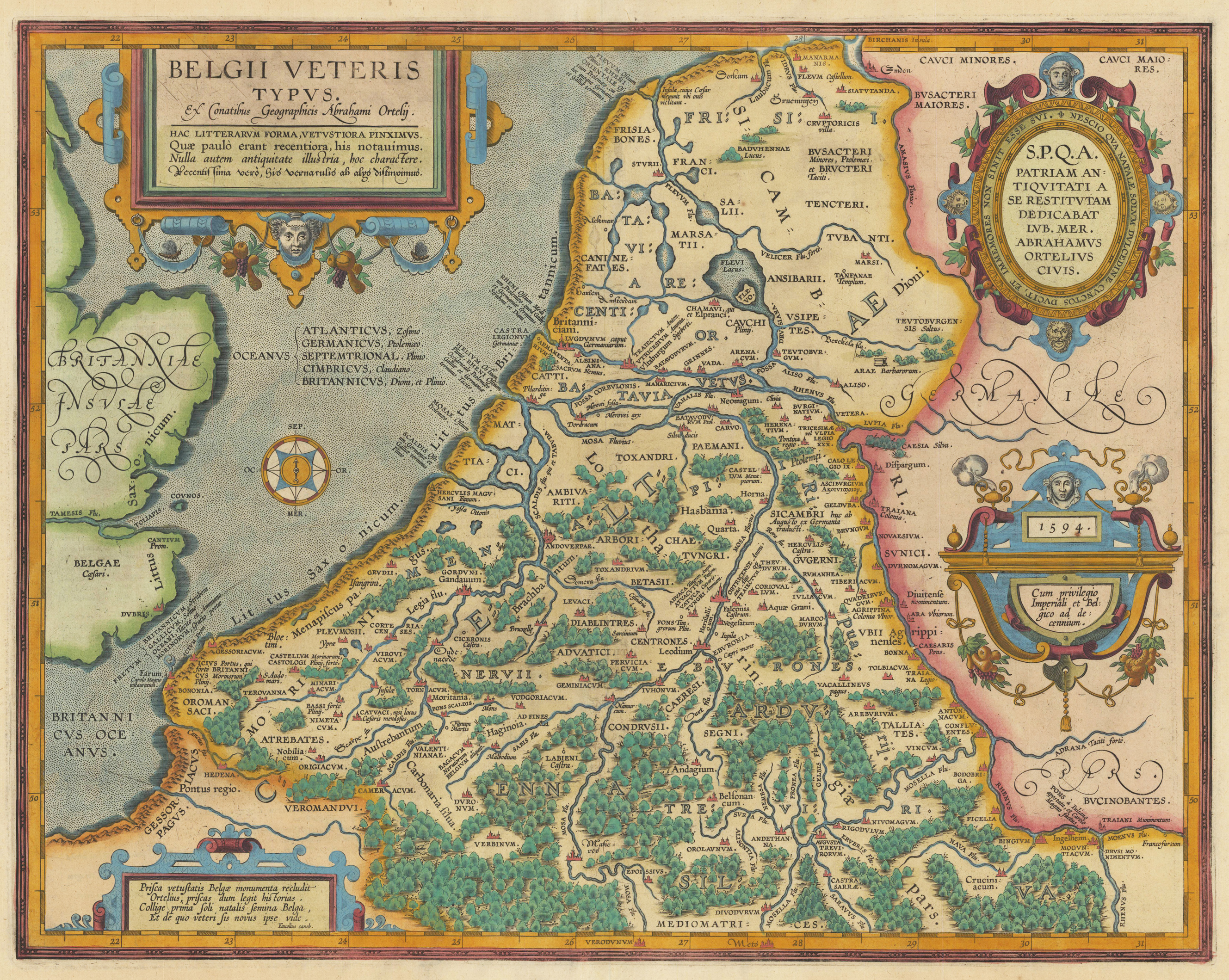
Original copper engraving, published 1612 in the famous historical Atlas "Parergon" (Latin text-edition) by Abraham Ortelius. Finely later hand-colored in wash and outline. Finely hand colored in wash and outline. This map is ornated with a title cartouche in the upper left corner and 3 additionals text cartouches on the right side and in the loer left corner. Below the title cartouche we find a compass card. Villages and towns are shown as miniature views.
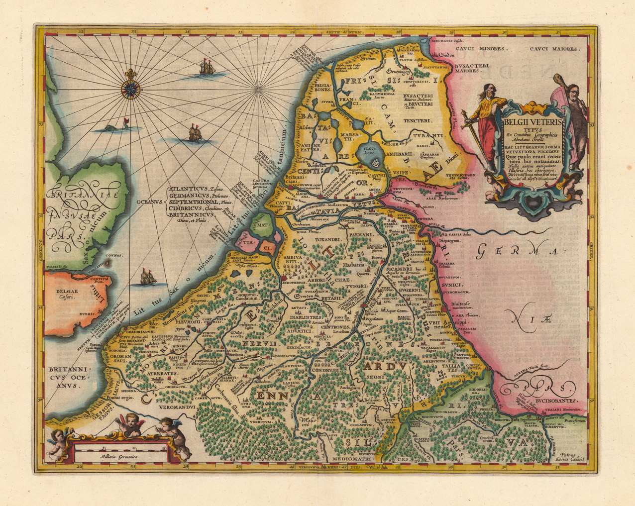
Original antique copper engraving, hand colored in outline when published. The third state of Jansson's 'Belgii Veteris ..' with the altered title cartouche now new engraved in the upper right corner. Johannes Janssonius (1588, Arnhem – buried July 11, 1664, Amsterdam) (born Jan Janszoon, in English also Jan Jansson) was a Dutch cartographer and publisher who lived and worked in Amsterdam in the 17th century. Janssonius was born in Arnhem, the son of Jan Janszoon the Elder,[1] a publisher and bookseller. In 1612 he married Elisabeth de Hondt, the daughter of Jodocus Hondius. He produced his first maps in 1616 of France and Italy. In 1623 Janssonius owned a bookstore in Frankfurt am Main, later also in Danzig, Stockholm, Copenhagen, Berlin, Königsberg, Geneva and Lyon. Elisabeth Hondius died in 1627 and he remarried Elisabeth Carlier in 1629. In the 1630s he formed a partnership with his brother in law Henricus Hondius, and together they published atlases as Mercator/Hondius/Janssonius. Under the leadership of Janssonius the Hondius Atlas was steadily enlarged. Renamed Atlas Novus, it had three volumes in 1638, one fully dedicated to Italy. In 1646, a fourth volume came out with "English County Maps", a year after a similar issue by Joan Blaeu. Janssonius' maps are similar to those of Blaeu, and he is often accused of copying from his rival, but many of his maps predate those of Blaeu and/or covered different regions. By 1660, at which point the atlas bore the appropriate name "Atlas Major", there were 11 volumes, containing the work of about a hundred credited authors and engravers. It included a description of "most of the cities of the world" (Townatlas), of the waterworld (Atlas Maritimus in 33 maps), and of the Ancient World (60 maps). The eleventh volume was the Atlas of the Heavens by Andreas Cellarius. Editions were printed in Dutch, Latin, French, and a few times in German. After Janssonius's death, the publishing company was continued by his son-in law, Johannes van Waesbergen. The London bookseller Moses Pitt attempted publication of the Atlas Major in English, but ran out of resources after the fourth volume in 1683. (Wikipedia)
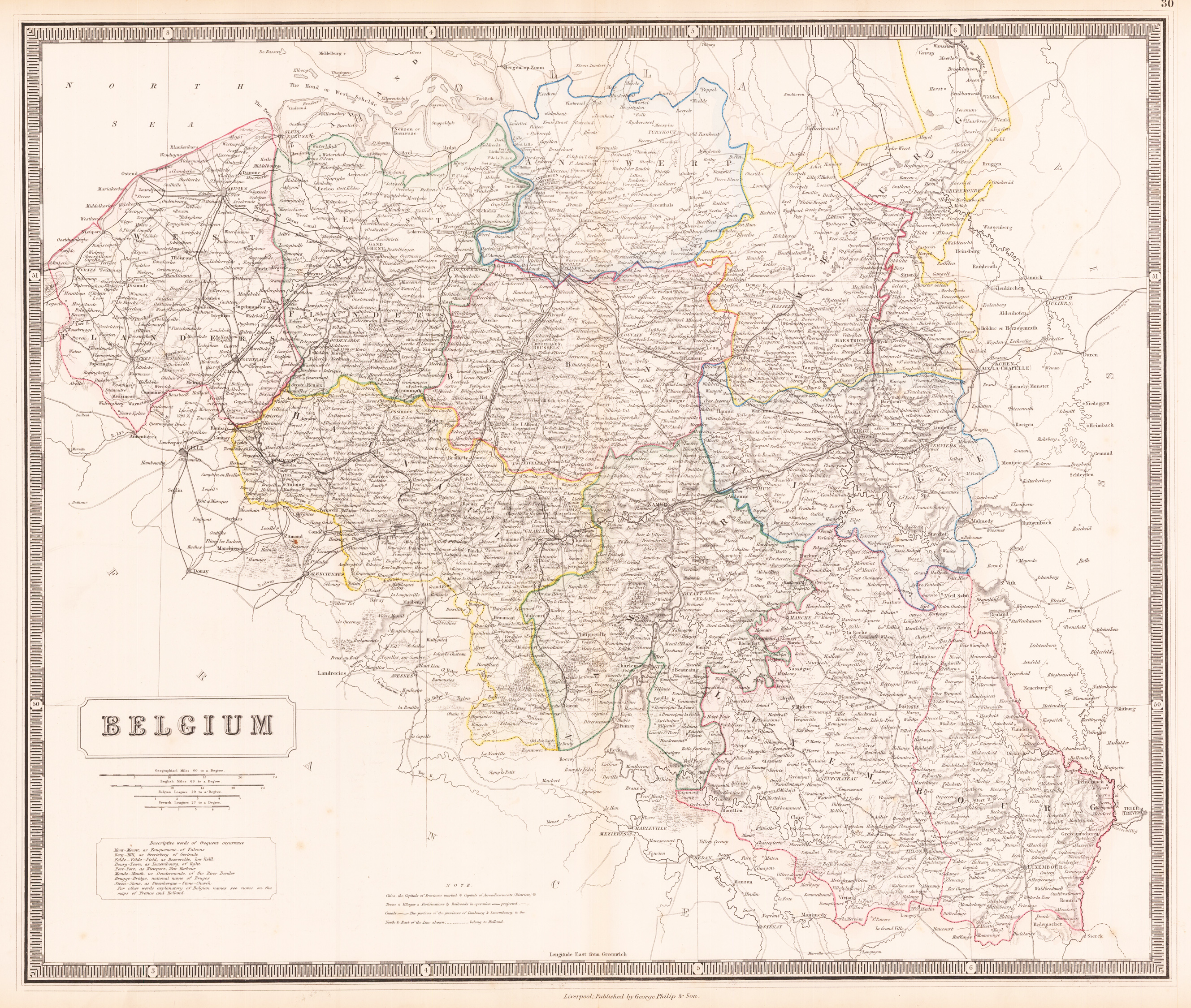
Lithograph, original hand colored in outline. Decorative double page hand colored lithograph antique map, showing detailed Belgum. Hand colored decorative in outline and wash when published, piano key border. Caxton Buildings, Liverpool, 1859. The printing works of George Philip & Son Ltd were situated here. Philip used cartographers such as John Bartholomew the elder, August Petermann, and William Hughes to produce maps on copper plates. Philip then had these printed and hand-coloured by his women tinters. By the time he produced his county maps of 1862 he was using machine coloured maps produced on power-driven lithographic presses. 'His maps ranged from the expensive Imperial Library Atlas (1864) to an atlas costing as little as 3d. and, although the bulk of his production was for the commercial, and particularly the educational market, he also produced important scientific maps, notably of North America, especially the Arctic and Pacific Northwest, and of the West Indies. The firm supplied atlases, geographical and history books, school textbooks, and an array of educational books and equipment. The company also produced textbooks for overseas countries, starting with an atlas for Australian schools in 1865 and for New Zealand in 1869. The demand from board schools, established after 1870, enabled further expansion in the market for general textbooks, school stationery, atlases and wall maps, etc Philip also employed many noted writers including the geographer and historian John Francon Williams who wrote, compiled and edited many books for the company from 1881 over a 20-year period. (Wikipedia)
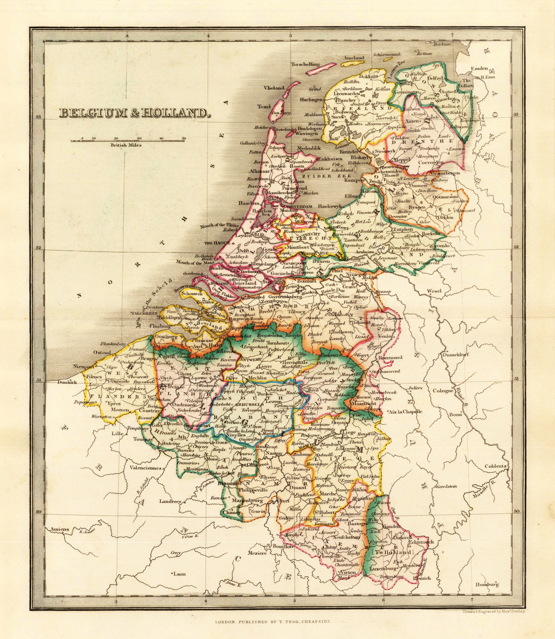
Engraved map, hand colored in wash and outline, when published. Nice and detailed map of Belgium and Holland, with engraved place names, rivers and political borders. Drawn and engraved by Alexander Findley in London.
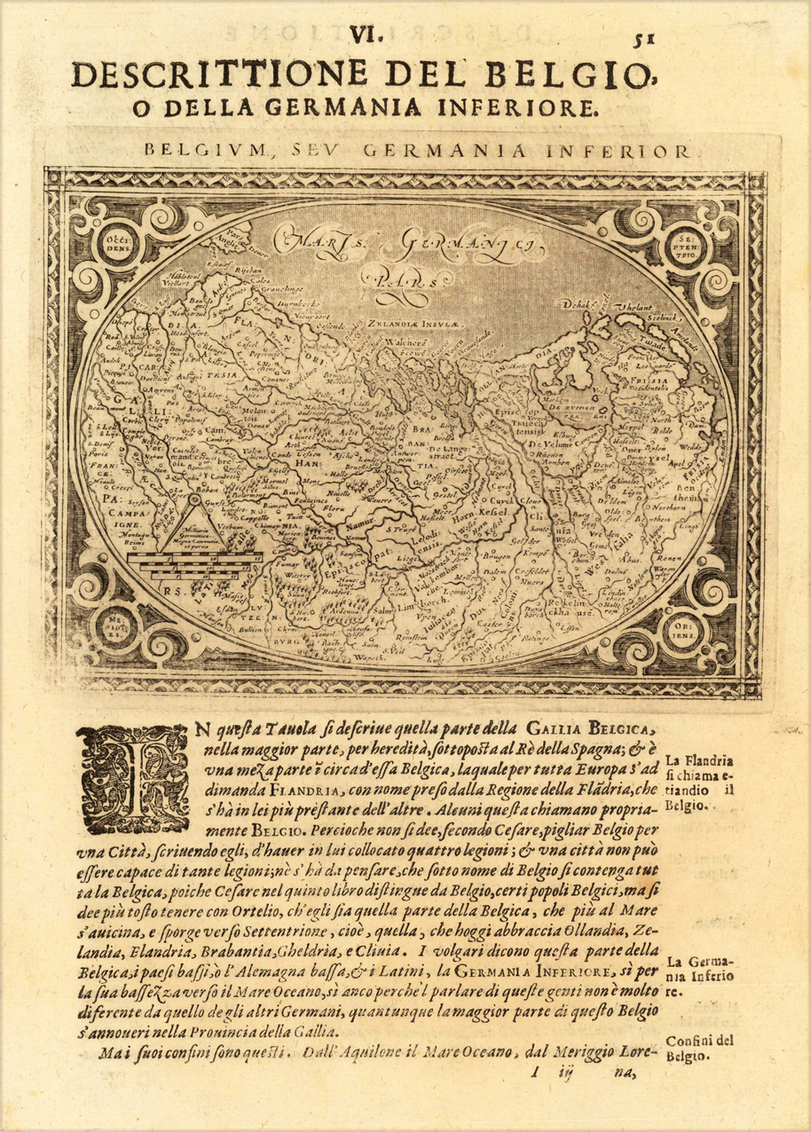
Fine copper-engraved map, printed into the full text page, published in 'Geografia ... Universale de la Terra', which was translated by Cernoti and published 1621 in Padua.
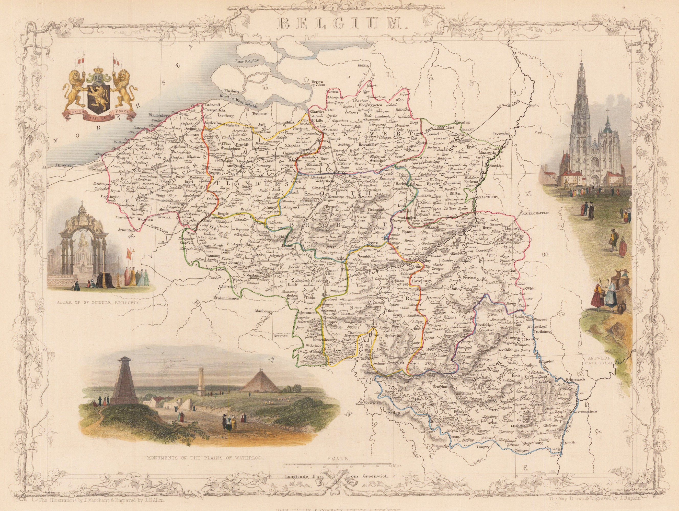
Steel engraving, hand colored in outline and wash.
John Tallis (7 November 1817 – 3 June 1876) was an English cartographic publisher. His company, John Tallis and Company, published views, maps and atlases in London from roughly 1838 to 1851.
Tallis set up as a publisher with Frederick Tallis in Cripplegate in 1842; the business moved to Smithfield in 1846, and was dissolved in 1849. From 1851 to 1854 Tallis operated as John Tallis and Company. He started The illustrated news of the world and national portrait gallery of eminent personages in 1858, selling it for £1,370 in 1861; it folded in 1863.
He lived in New Cross, South East London. His house on New Cross Road is listed as a Building of Special Architectural or Historic Interest, grade II. It has a blue plaque on the wall to signal the event.
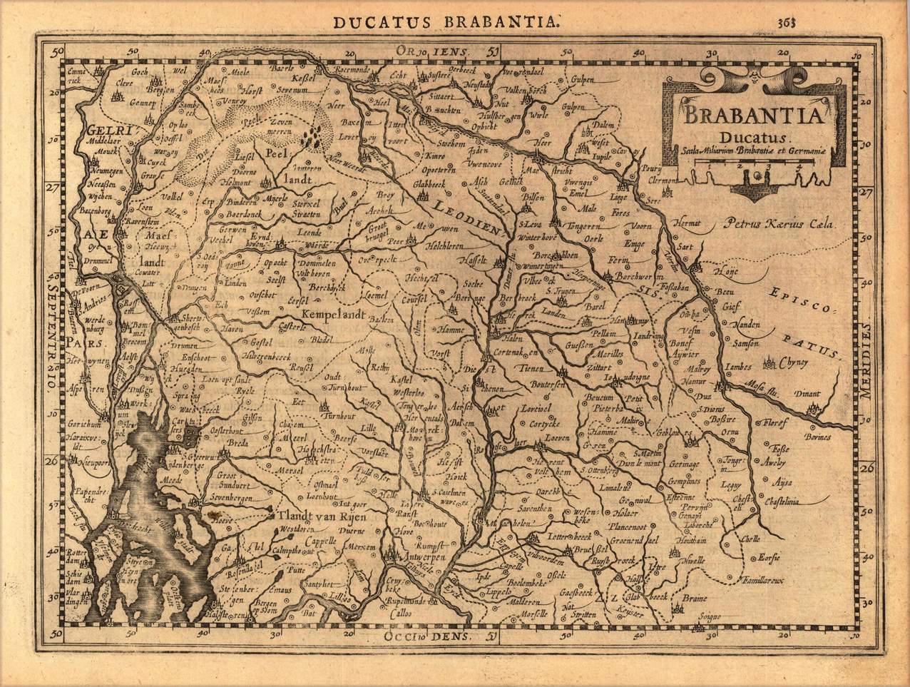
Original antique copper engraving, uncolored as published. A fine copy in a dark impression, full margins as published. This map shows the part of Belgum between Rotterdam and Dinant. The title cartouche including mileage scale is in the upper right corner. This is the first so-called Cloppenburgh editions which was a competive edition with new engraved maps in a larger format. Most of the maps were engraved by Pieter van den Keere. The Cloppenburgh edition was continued for a couple of years but seems to have been suppressed after 1636 ... . This is another Cloppenburgh edition, now with Latin text. The maps from the Appendix have been incorporated. The title-page is followed by a dedication to Prince Frederik Hendrik, dated 1632 and signed by Johannes Cloppenburgh. (Koeman Atlantes Neerlandici). Gerardus Mercator (5 March 1512 – 2 December 1594) was a 16th-century geographer, cosmographer and cartographer from the County of Flanders. He is most renowned for creating the 1569 world map based on a new projection which represented sailing courses of constant bearing (rhumb lines) as straight lines—an innovation that is still employed in nautical charts. Mercator was one of the pioneers of cartography and is widely considered the most notable figure of the school in its golden age (approximately 1570s–1670s). In his own day, he was a notable as maker of globes and scientific instruments. In addition, he had interests in theology, philosophy, history, mathematics and geomagnetism. He was also an accomplished engraver and calligrapher. Unlike other great scholars of the age he travelled little and his knowledge of geography came from his library of over one thousand books and maps, from his visitors and from his vast correspondence (in six languages) with other scholars, statesmen, travellers, merchants and seamen. Mercator's early maps were in large formats suitable for wall mounting but in the second half of his life, he produced over 100 new regional maps in a smaller format suitable for binding into his Atlas of 1595. This was the first appearance of the word Atlas in reference to a book of maps. However, Mercator used it as a neologism for a treatise (Cosmologia) on the creation, history and description of the universe, not simply a collection of maps. He chose the word as a commemoration of the Titan Atlas, "King of Mauretania", whom he considered to be the first great geographer. A large part of Mercator's income came from sales of his terrestrial and celestial globes. For sixty years they were considered the finest in the world, and were sold in such great numbers that there are many surviving examples. This was a substantial enterprise involving the manufacture of the spheres, printing the gores, building substantial stands, packing and distributing all over Europe. He was also renowned for his scientific instruments, particularly his astrolabes and astronomical rings used to study the geometry of astronomy and astrology. Mercator wrote on geography, philosophy, chronology and theology. All of the wall maps were engraved with copious text on the region concerned. As an example the famous world map of 1569 is inscribed with over five thousand words in fifteen legends. The 1595 Atlas has about 120 pages of maps and illustrated title pages but a greater number of pages are devoted to his account of the creation of the universe and descriptions of all the countries portrayed. His table of chronology ran to some 400 pages fixing the dates (from the time of creation) of earthly dynasties, major political and military events, volcanic eruptions, earthquakes and eclipses. He also wrote on the gospels and the old testament. Mercator was a devout Christian born into a Catholic family at a time when Martin Luther's Protestantism was gaining ground. He never declared himself as a Lutheran but he was clearly sympathetic and he was accused of heresy by Catholic authorities; after six months in prison he was released unscathed. This period of persecution is probably the major factor in his move from Catholic Leuven (Louvain) to a more tolerant Duisburg, in the Holy Roman Empire, where he lived for the last thirty years of his life. Walter Ghim, Mercator's friend and first biographer, describes him as sober in his behaviour, yet cheerful and witty in company, and never more happy than in debate with other scholars. Above all he was pious and studious until his dying days. (Wikipedia)
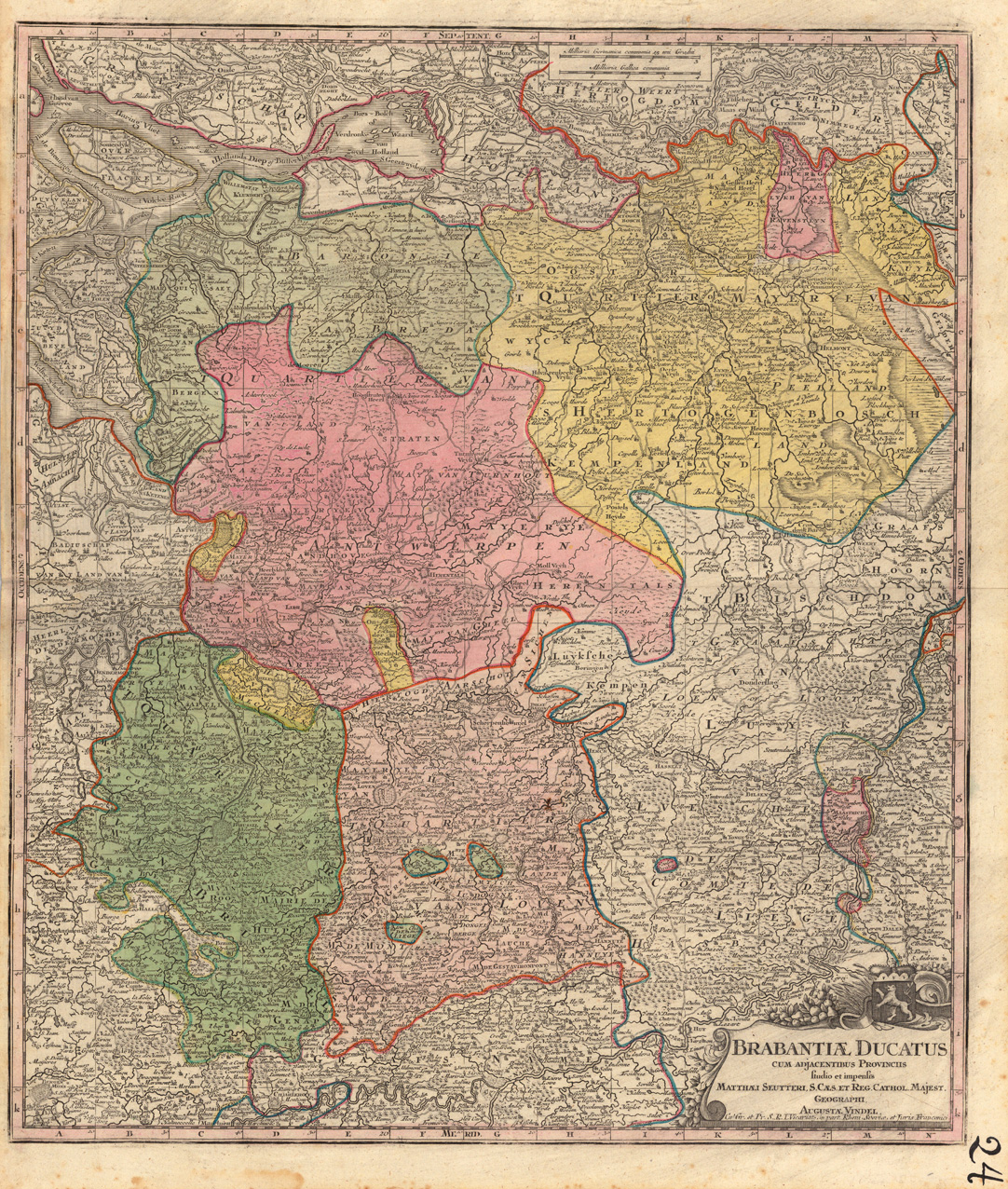
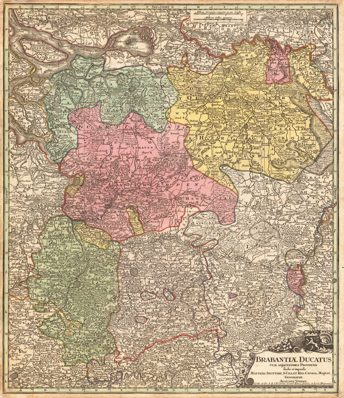
Copper-engraving, handcolored in wsh and outline when published. Detailed map of the duchy of Brabant with the neighbouring provinces. Political borders are drawn in outline colors. With many place names, rivers, lakes, mountains, woods, etc.
Copper engraving, hand colored in wsh and outline when published. Detailed map of the duchy of Brabant with the neighboring provinces. Political borders are drawn in outline colors. With many place names, rivers, lakes, mountains, woods, etc.
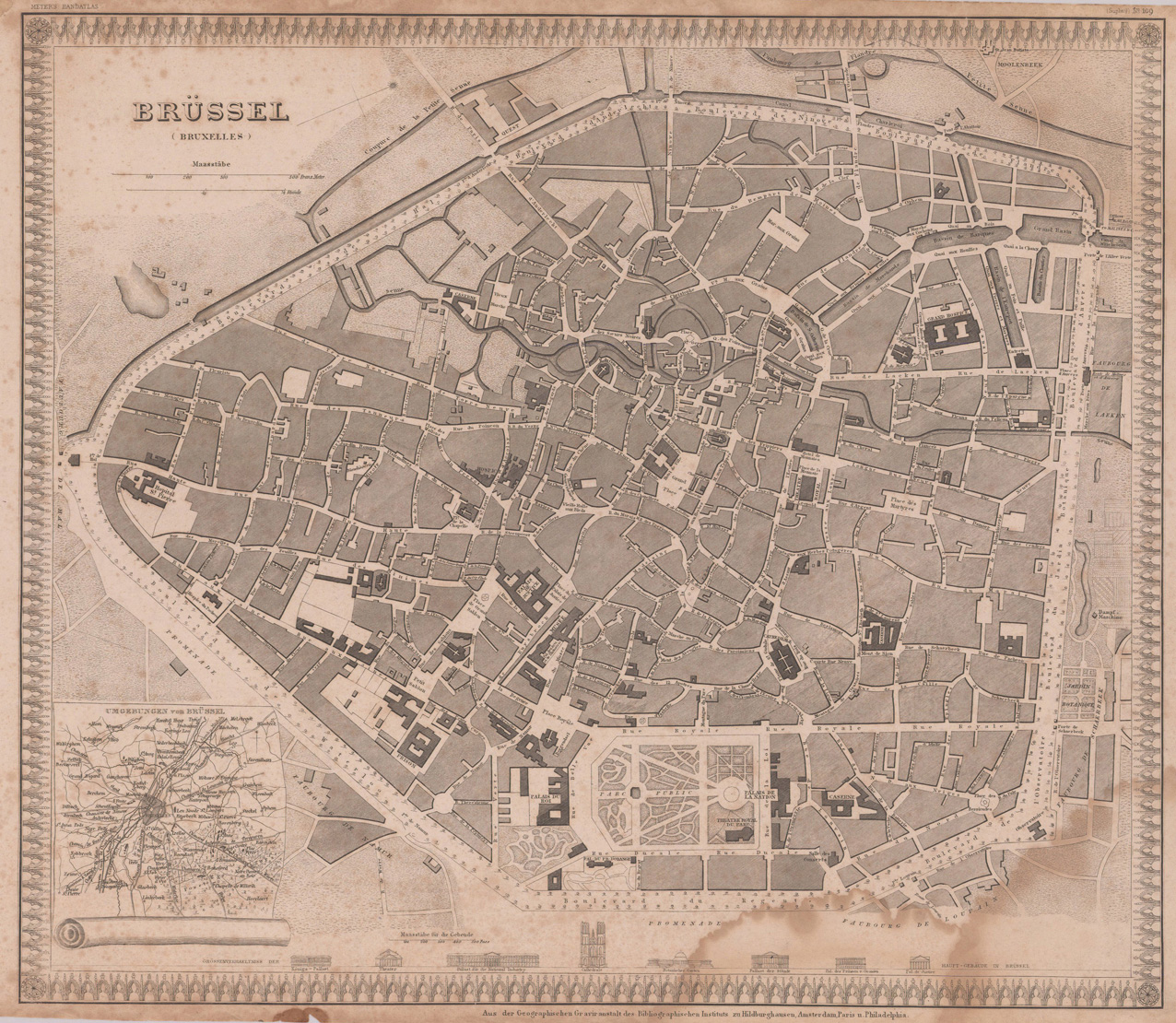
Steel engraving, uncolored as published. Accurate and decorative plan of Brussels with many details on streets, places, buildings, parks, etc. Ornated in the lower left corner with a inset map of the surroundings of Brussels.
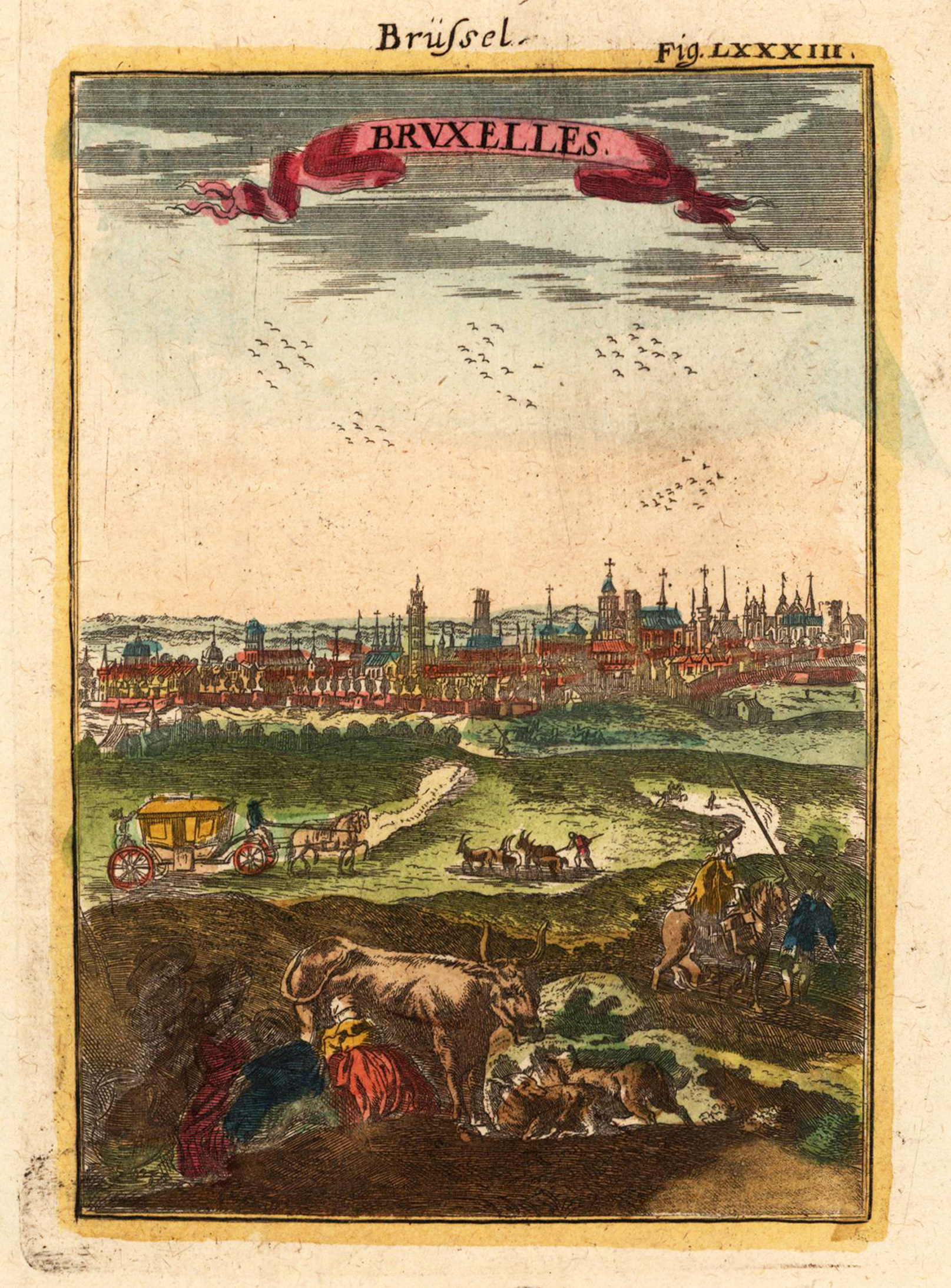
Copper engraving, hand colored in wash and outline, published in Allain Manesson Mallet's description of the world. Decorative map which shows Brussels. In the background you look to the town Brussels. In the foreground are many people who works.
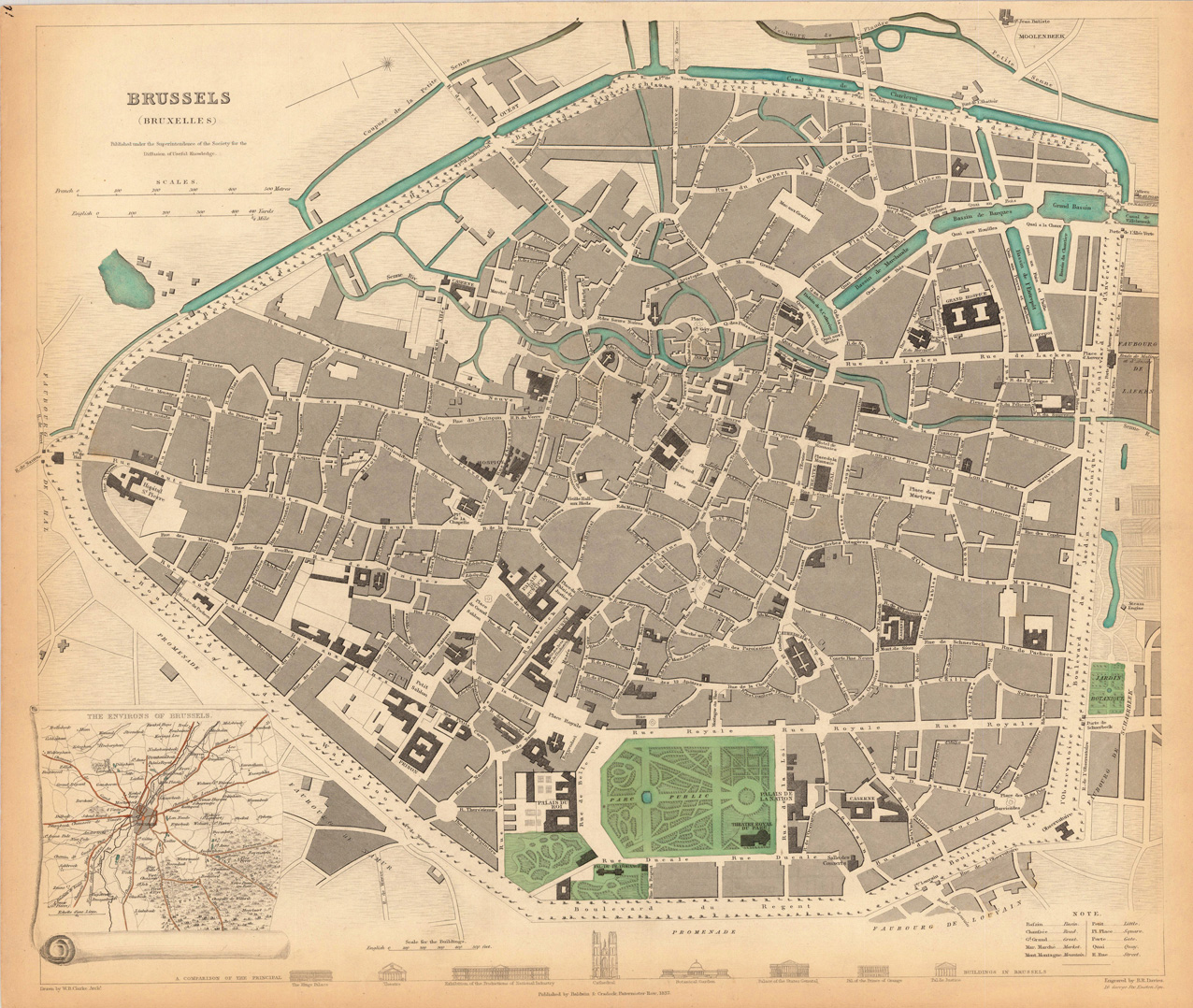
Steel engraving, hand colored in outline when published. A very detailed plan of the city of Brussels. The map is very detailed engraved with many street names, gardens, places, etc. In the lower left corner we find an inset map which shows 'The Environs of Brussels'.
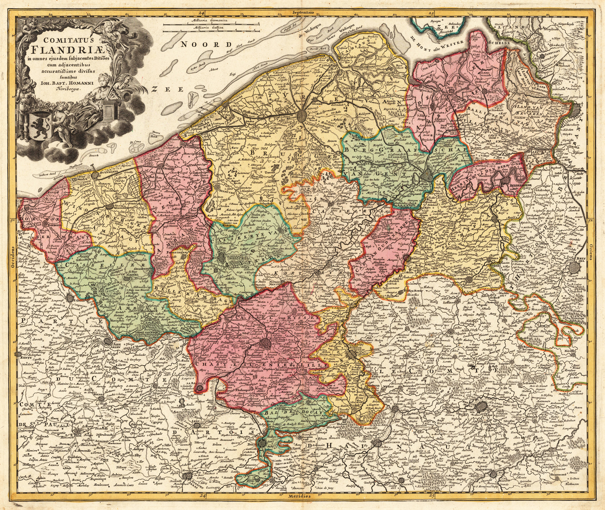
Original antique copper engraving, hand colored in outline and wash when published. This map of Flanders shows the coastline of the North Sea between Gravelines and the Scheldt estuary, with Antwerp and Brussels to the east. With a beautiful title cartouche to the upper left corner. Johann Baptist Homann (20 March 1664 – 1 July 1724) was a German geographer and cartographer, who also made maps of the Americas. Homann was born in Oberkammlach near Kammlach in the Electorate of Bavaria. Although educated at a Jesuit school, and preparing for an ecclesiastical career, he eventually converted to Protestantism and from 1687 worked as a civil law notary in Nuremberg. He soon turned to engraving and cartography; in 1702 he founded his own publishing house. Homann acquired renown as a leading German cartographer, and in 1715 was appointed Imperial Geographer by Emperor Charles VI. Giving such privileges to individuals was an added right that the Holy Roman Emperor enjoyed. In the same year he was also named a member of the Prussian Academy of Sciences in Berlin. Of particular significance to cartography were the imperial printing privileges (Latin: privilegia impressoria). These protected for a time the authors in all scientific fields such as printers, copper engravers, map makers and publishers. They were also very important as a recommendation for potential customers. In 1716 Homann published his masterpiece Grosser Atlas ueber die ganze Welt (Grand Atlas of all the World). Numerous maps were drawn up in cooperation with the engraver Christoph Weigel the Elder, who also published Siebmachers Wappenbuch. Homann died in Nuremberg in 1724. He was succeeded by his son Johann Christoph (1703-1730). The company carried on upon his death as Homann heirs company, managed by Johann Michael Franz and Johann Georg Ebersberger. After subsequent changes in management the company folded in 1852.[1] The company was known as "Homann Erben", "Homanniani Heredes", or "Heritiers de Homann" abroad. (Wikipedia)
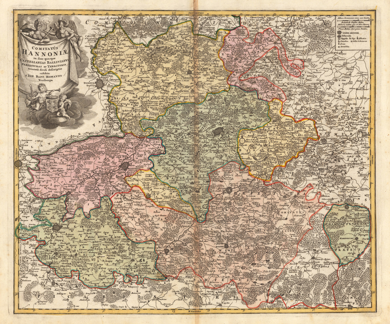
Original antique copper engraving, hand colored in outline and wash when published. This decorative map shows Hannonia in Belgium. The map is equipped with many place names, rivers, woods, towns, etc. In the upper left corner we see a large figurative title cartouche and in the upper right corner a small cartouche with a mileage scale and the sign explanation of the map. The map shows in different colours the regions. Johann Baptist Homann (20 March 1664 – 1 July 1724) was a German geographer and cartographer, who also made maps of the Americas. Homann was born in Oberkammlach near Kammlach in the Electorate of Bavaria. Although educated at a Jesuit school, and preparing for an ecclesiastical career, he eventually converted to Protestantism and from 1687 worked as a civil law notary in Nuremberg. He soon turned to engraving and cartography; in 1702 he founded his own publishing house. Homann acquired renown as a leading German cartographer, and in 1715 was appointed Imperial Geographer by Emperor Charles VI. Giving such privileges to individuals was an added right that the Holy Roman Emperor enjoyed. In the same year he was also named a member of the Prussian Academy of Sciences in Berlin. Of particular significance to cartography were the imperial printing privileges (Latin: privilegia impressoria). These protected for a time the authors in all scientific fields such as printers, copper engravers, map makers and publishers. They were also very important as a recommendation for potential customers. In 1716 Homann published his masterpiece Grosser Atlas ueber die ganze Welt (Grand Atlas of all the World). Numerous maps were drawn up in cooperation with the engraver Christoph Weigel the Elder, who also published Siebmachers Wappenbuch. Homann died in Nuremberg in 1724. He was succeeded by his son Johann Christoph (1703-1730). The company carried on upon his death as Homann heirs company, managed by Johann Michael Franz and Johann Georg Ebersberger. After subsequent changes in management the company folded in 1852.[1] The company was known as "Homann Erben", "Homanniani Heredes", or "Heritiers de Homann" abroad. (Wikipedia)