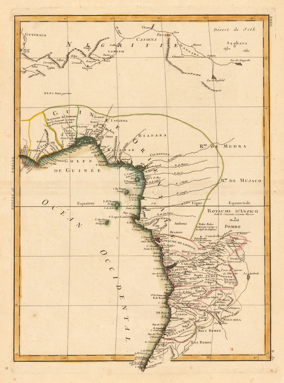
Copper engraving, hand colored in outline when published. This decorative map shows the central Westcoast of Africa with Guinea and the Kongo. The map is equipped with many many place names, names of rivers, mountains, etc. Rigobert Bonne (1727-1794) was a French cartographer of the late 18th century. He studied in Paris and practiced cartography. He became a skilled cartographer and hydrographer and became a royal hydrographer at the ,Depot de la Marine' in 1773. In 1780 he engraved and published the maps for Abbe Raynal's work ,Atlas de Toutes Les Parties Connues du Globe Terrestre'. He also published many charts for the ,Depot de la Marine', further he engraved the maps for the ,Atlas Encyclopedique' in 1788 together with Nicholas Desmarest.
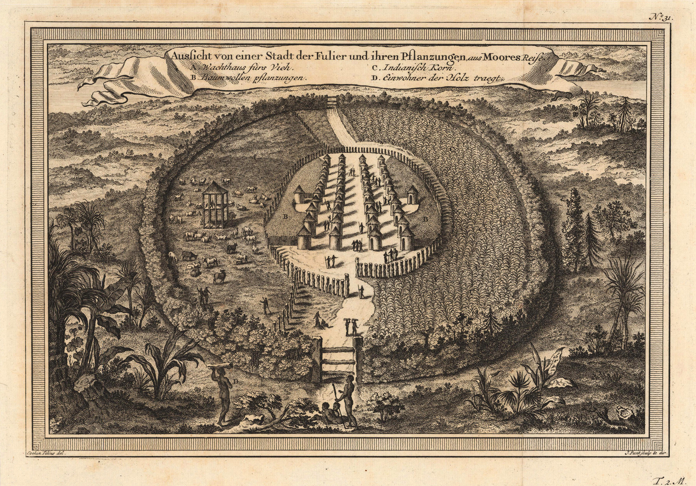
Copper engraving, uncolored as published. This decorative map shows a bird's eye view of the town Fulier with its cotton plantation At the upper side we look at a bandarole cartouche with the title and explanation of this view in German text. A fine detailed and interesting map engraved by Bellin after earlier voyages. Published in the German edition by Schwabe in Leipzig of Bellin's travel books.
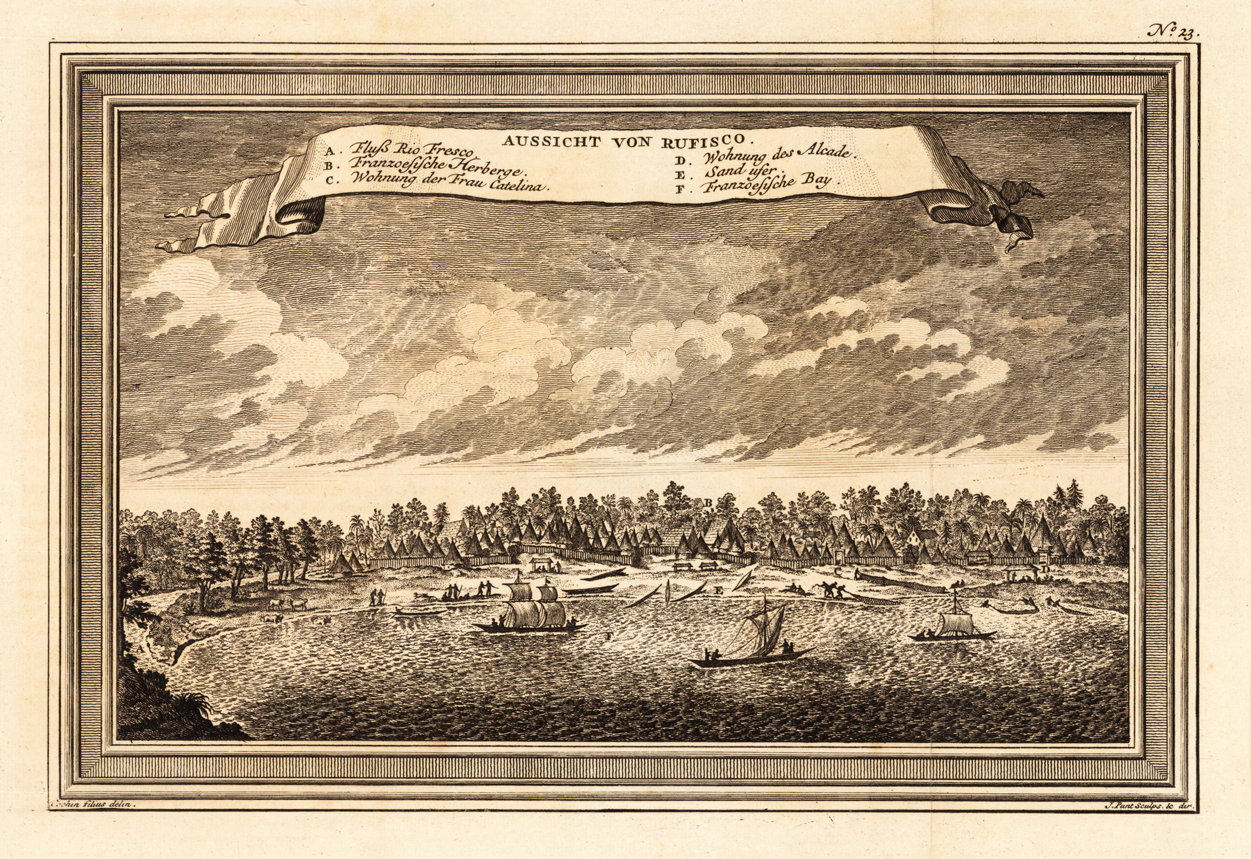
Copper engraving, uncolored as published. This decorative map shows a view of Rufisco in Senegal seen from the river Fresco. A fine detailed and interesting map engraved by Bellin after earlier voyages. Published in the German edition by Schwabe in Leipzig of Bellin's travel books.
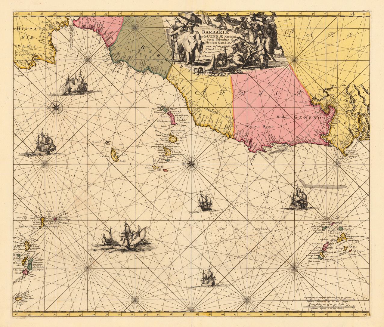
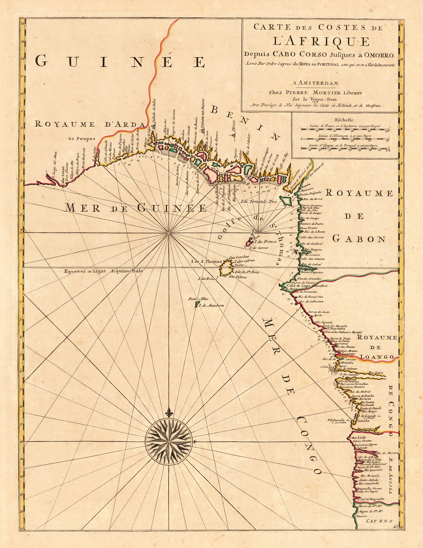
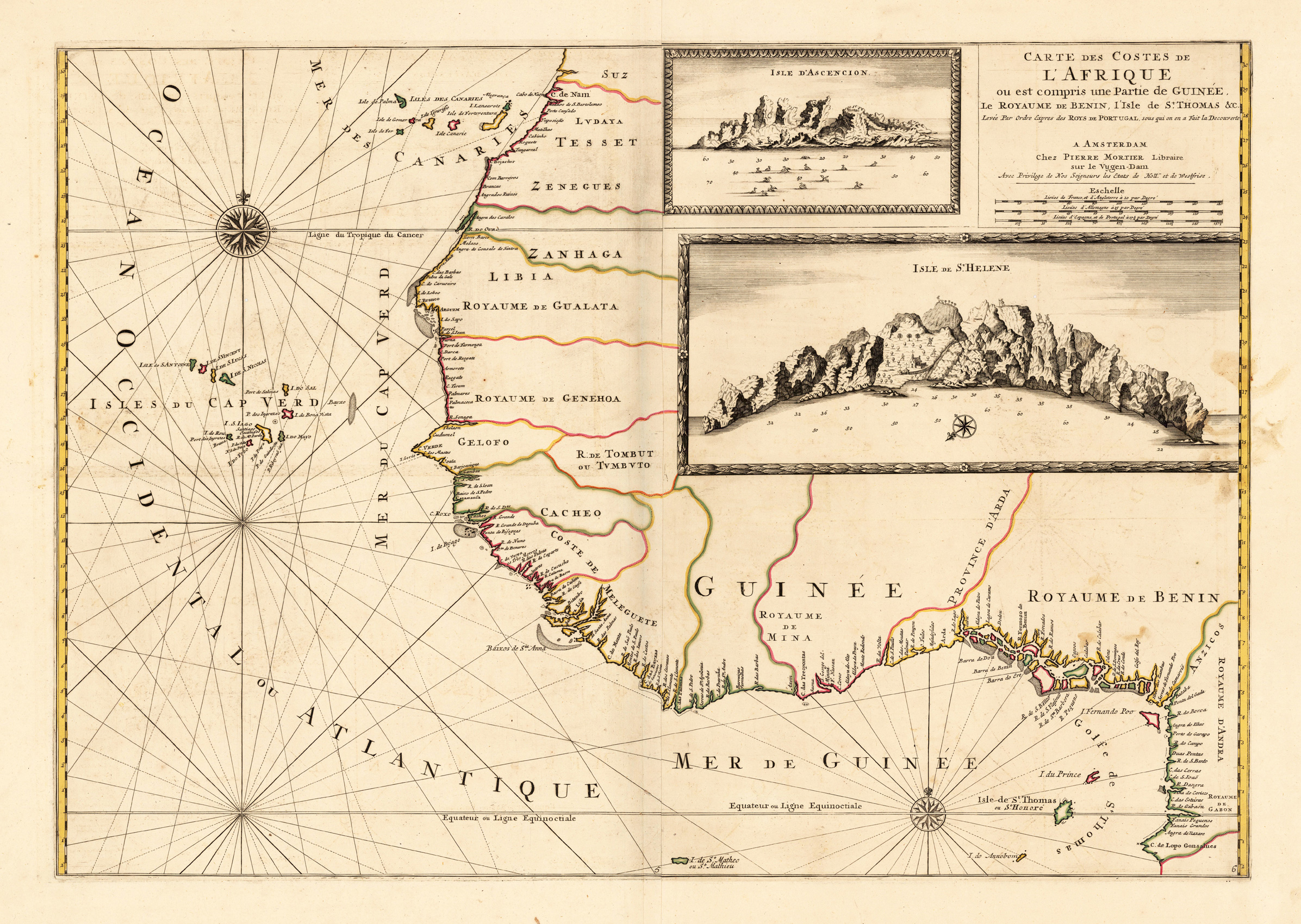
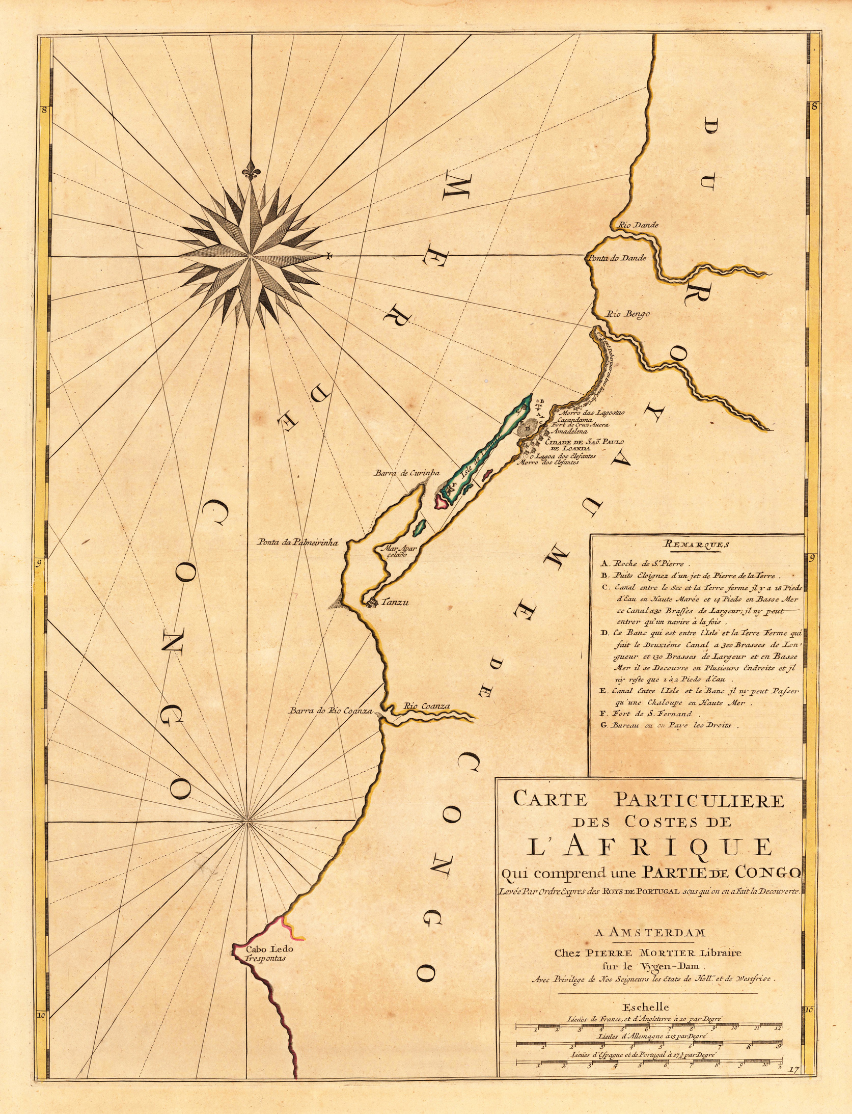
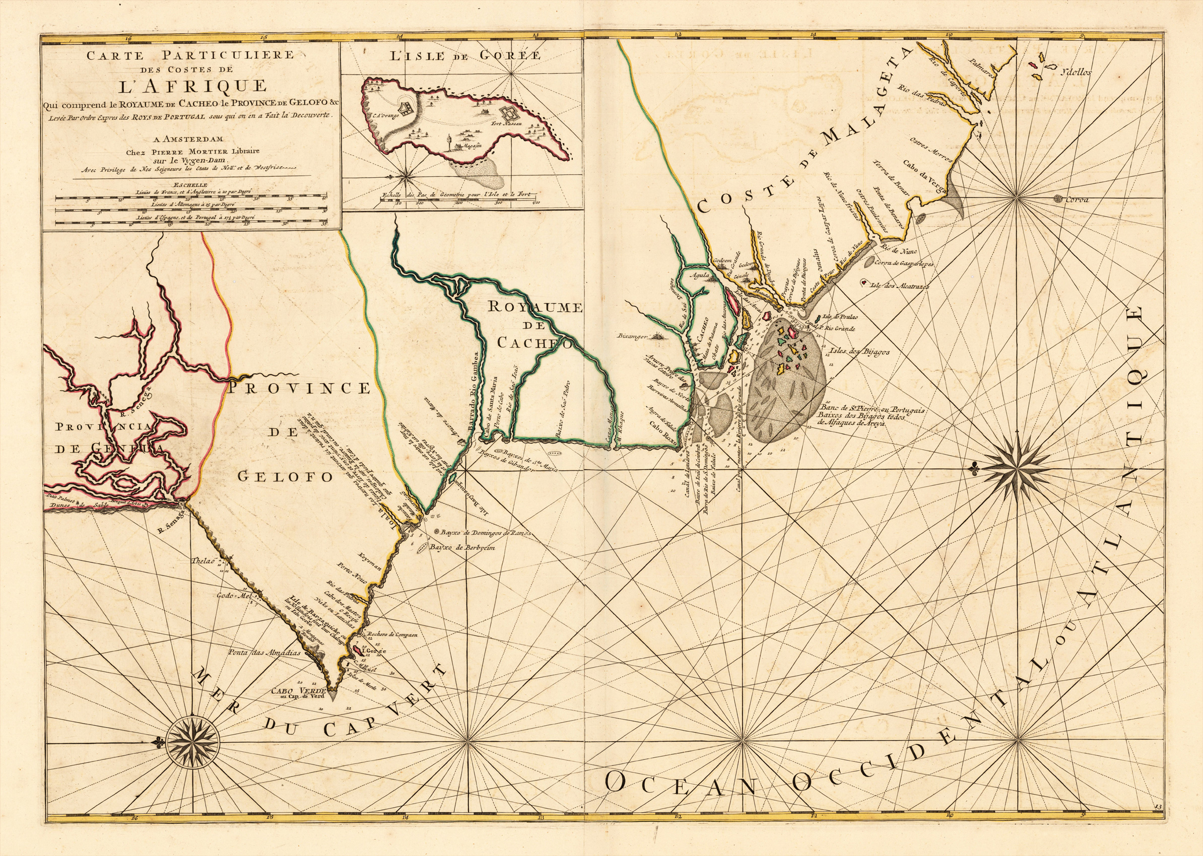
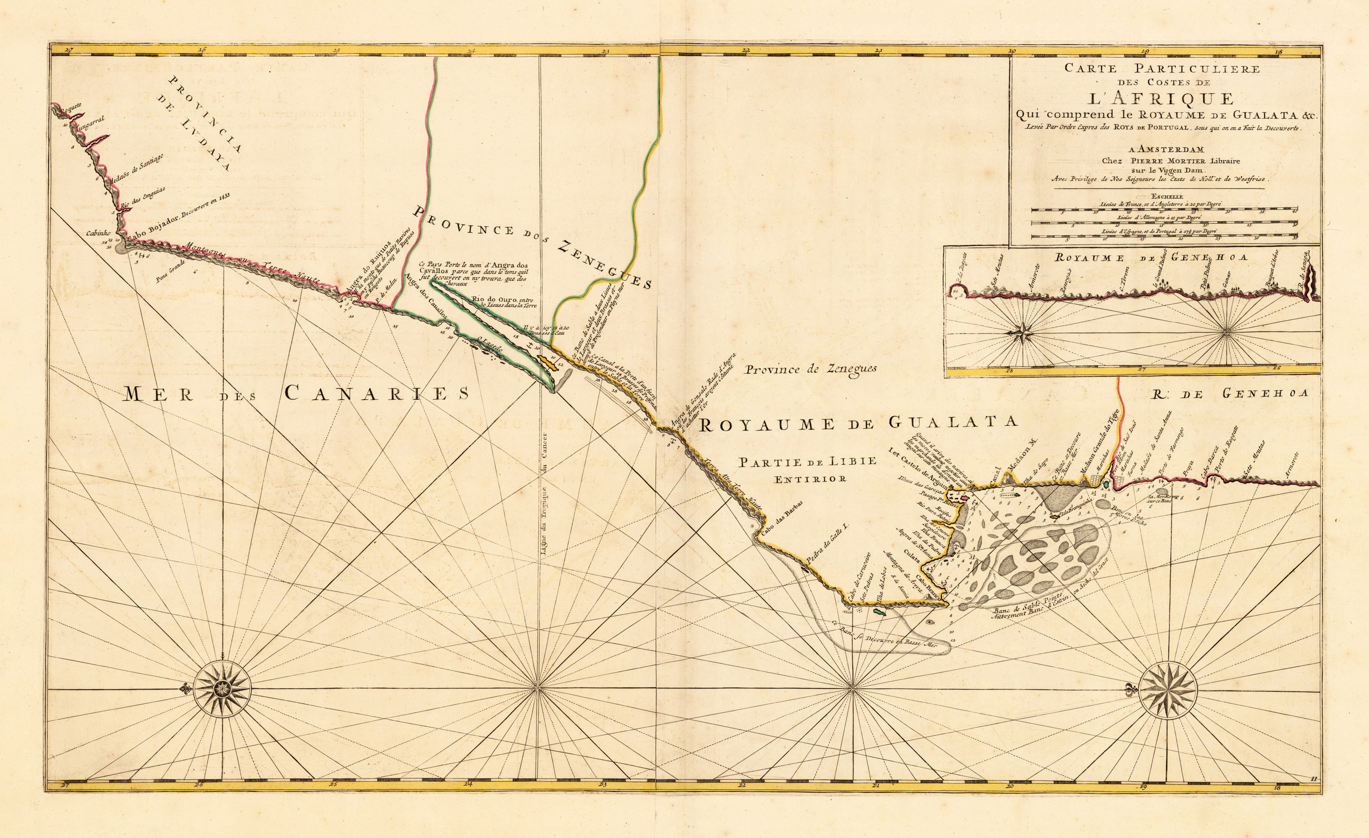
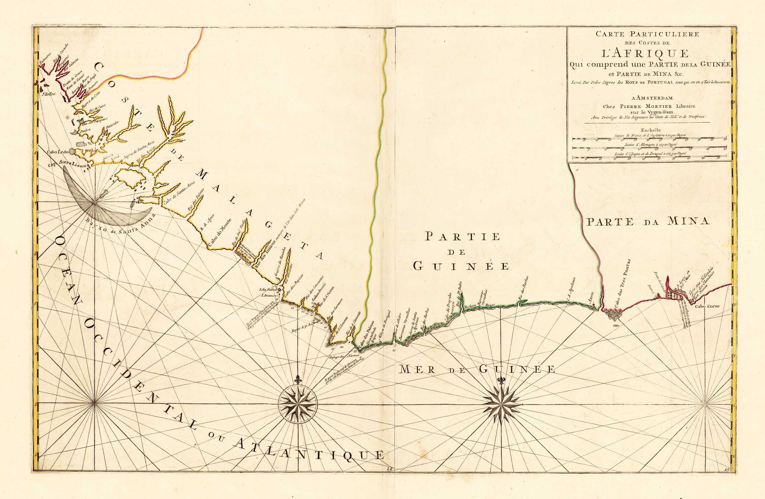
Copper-engraving, hand colored in outline and wash when published. Large and decorative sea chart showing West Africa with the Canary and Cap Verden Islands in the Atlantic Ocean. The map is equipped with two compass roses and several sailing boats. Published around 1700 in Louis Renard's famous sea-atlas. Louis Renard received the copperplates of Frederic De Witt´s sea-atlas and did only minor modifications in the engraved titles. The image of the map is orientated with the North to the East.
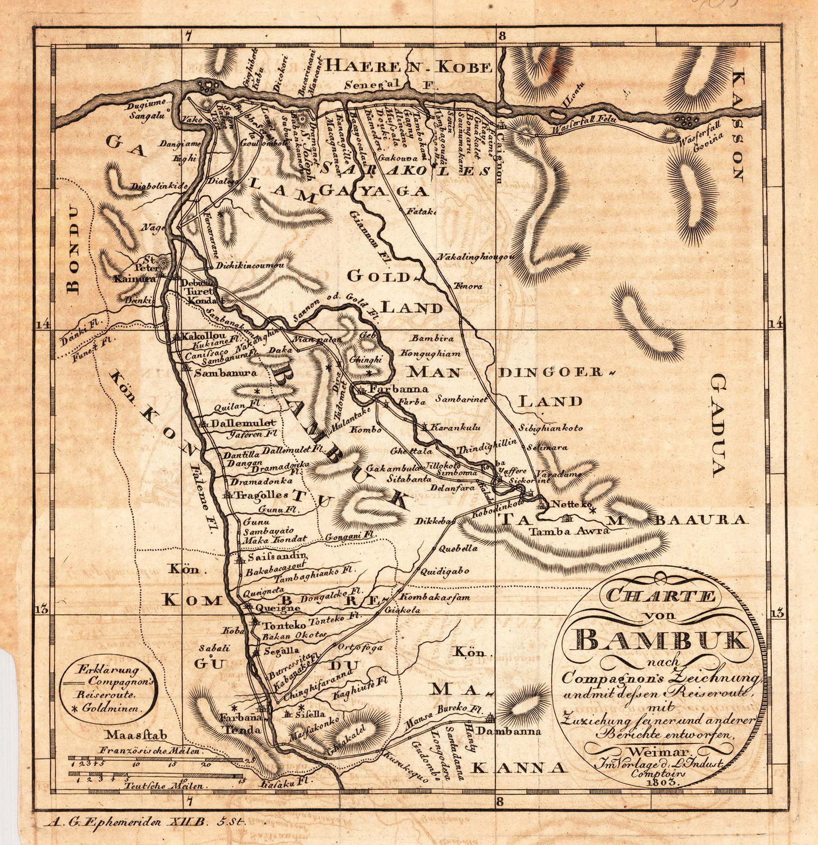
Copper engraving, uncolored as published. Detailed map of Bambuk based on Compagnon's sketch and travel route. This small map shows the confluence of the river Senegal and Falme, further its shows details of roads, rivers and gold mines.
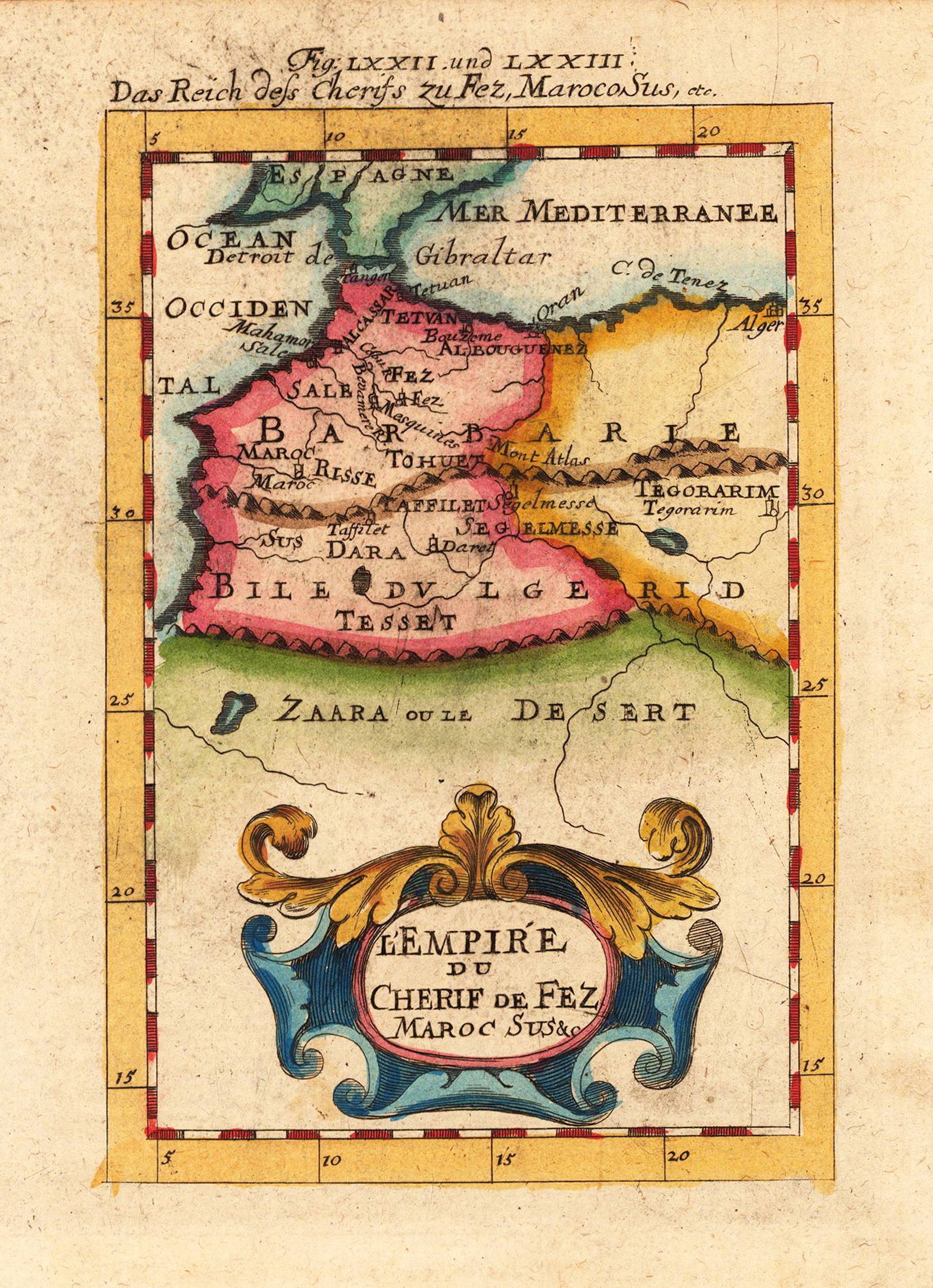
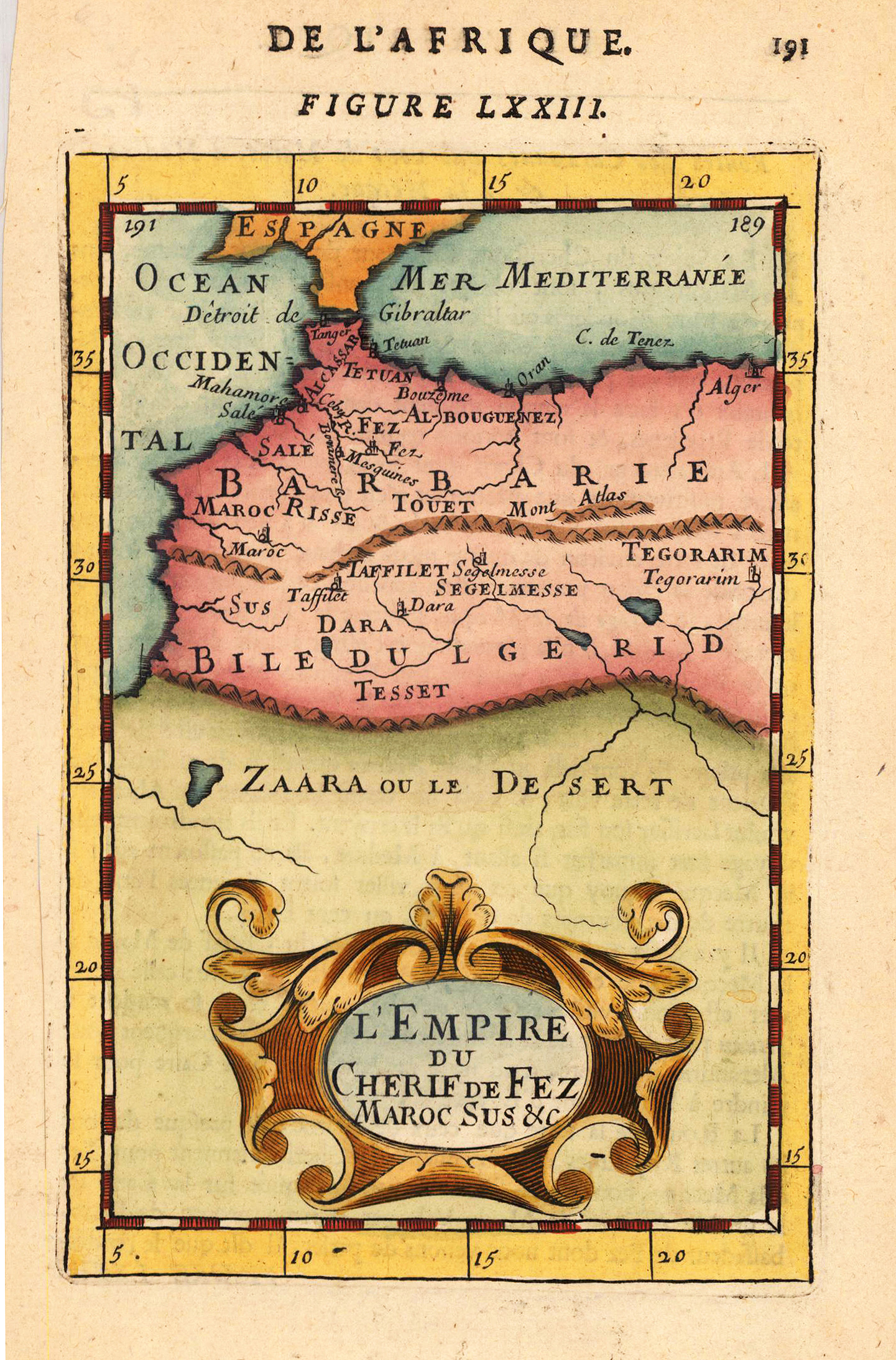
Copper engraving, hand colored in wash and outline, published in Allain Manesson Mallet's description of the world. A beautiful antique map of Marocco, showing the kingdom of Fez.
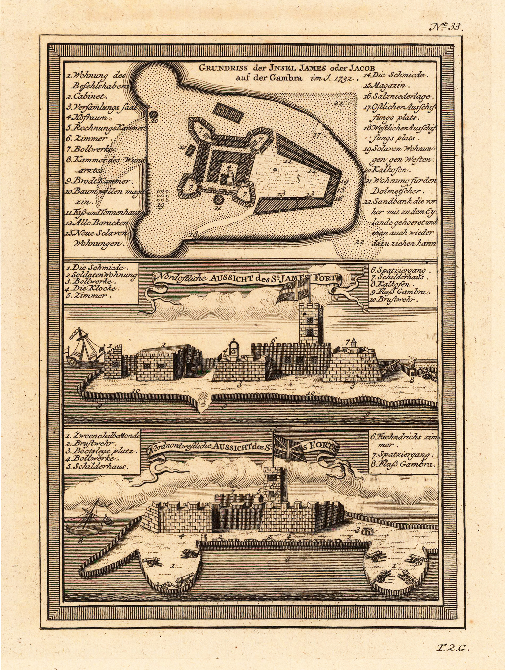
Copper engraving, uncolored as published. This decorative map shows a ground plan from the island of St. James. The map has three parts on the map. One shows the ground plan of the island St. James, one the Northeast view from the St. James forts and the third the North-northwest view of the St. James fort. A fine detailed and interesting map engraved by Bellin after earlier voyages. Published in the German edition by Schwabe in Leipzig of Bellin's travel books.
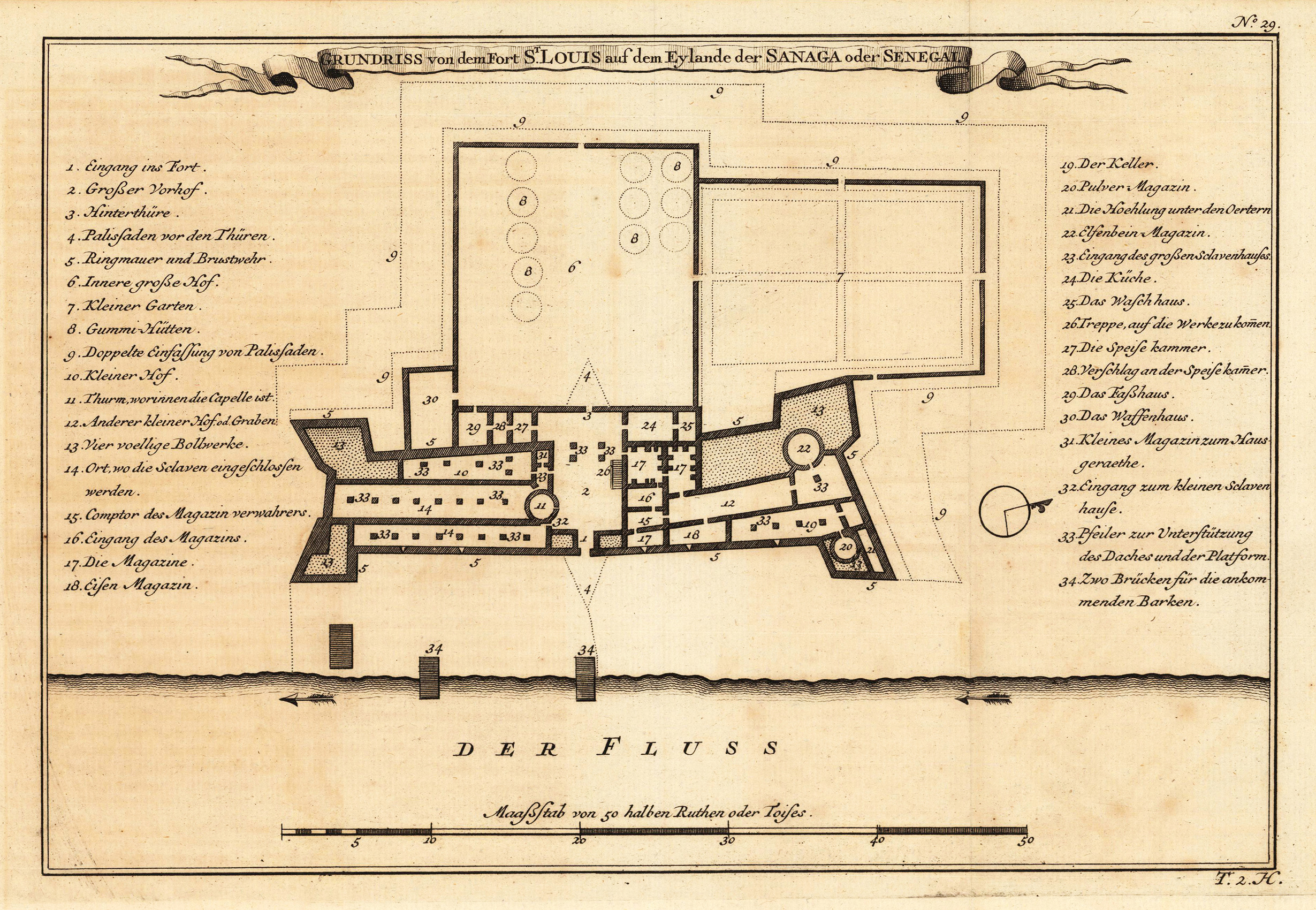
Copper engraving, uncolored as published. This map shows the groundplan of the Fort St. Louis in Sanaga. In the left and right side we find the explanation of this map in German text. A fine detailed and interesting map engraved by Bellin after earlier voyages. Published in the German edition by Schwabe in Leipzig of Bellin's travel books.
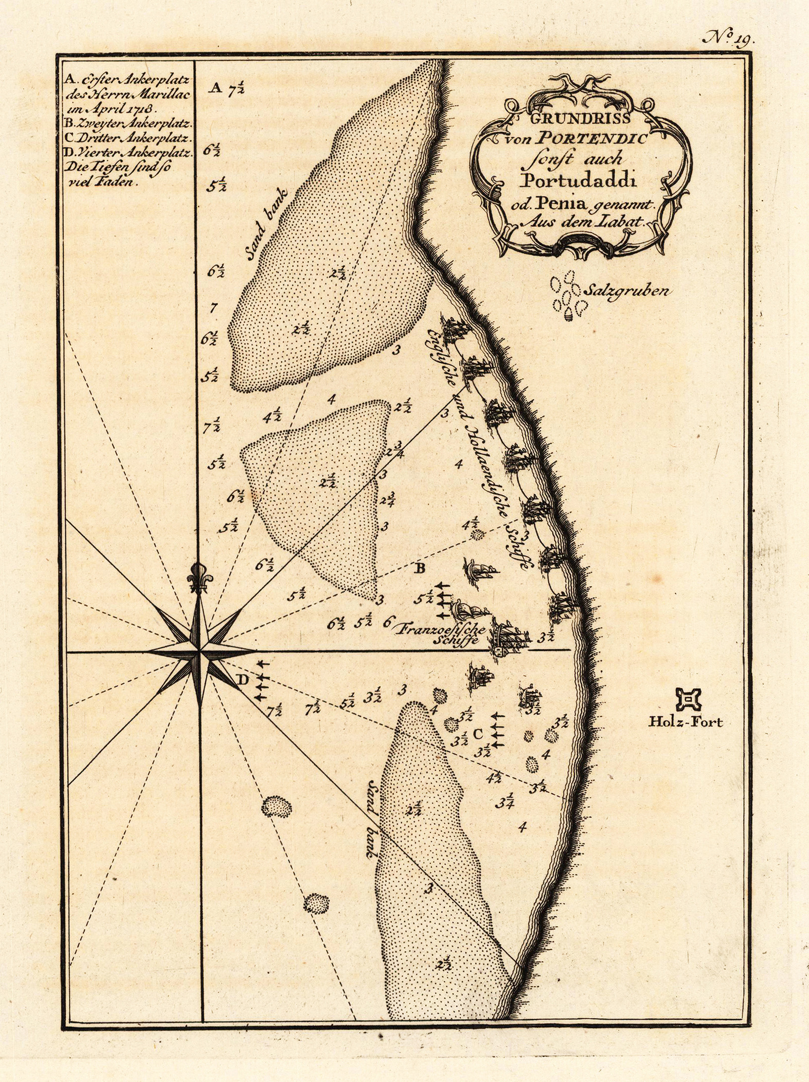
Copper engraving, uncolored as published. This interesting map shows a ground plan of Portendic (Portudaddi), a French trading station on the West coast of Africa. At the left side we see a compass rose and depths in the sea. A fine detailed and interesting map engraved by Bellin after earlier voyages. Published in the German edition by Schwabe in Leipzig of Bellin's travel books.
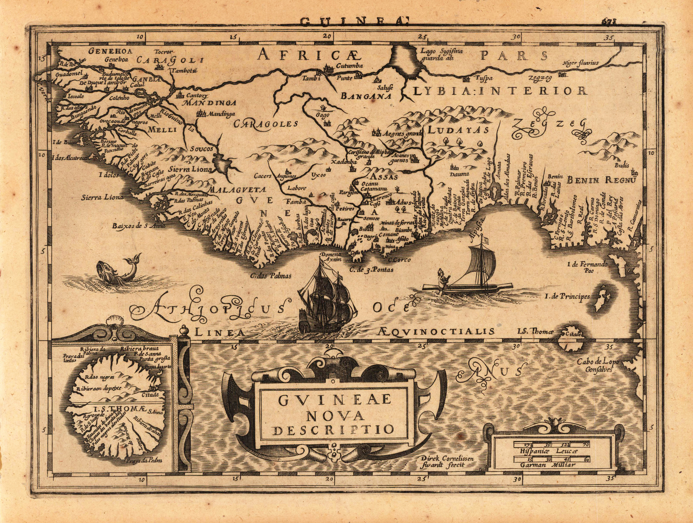
Original antique copper engraving, uncolored as published. A fine copy in a dark impression, full margins as published. Decorative map of the West African Coast from Senegal to Cape Lopez, just below the equator, and includes Guinea with parts of Benin and Lybia. In the lower left corner detailed inset of St. Thomas. Engraved are towns, villages, landmarks, mountains and rivers. A fine copy in a dark impression, full margins as published. This is the first so-called Cloppenburgh editions which was a competive edition with new engraved maps in a larger format. Most of the maps were engraved by Pieter van den Keere. The Cloppenburgh edition was continued for a couple of years but seems to have been suppressed after 1636 ... This is another Cloppenburgh edition, now with Latin text. The maps from the Appendix have been incorporated. The title-page is followed by a dedication to Prince Frederik Hendrik, dated 1632 and signed by Johannes Cloppenburgh. (Koeman Atlantes Neerlandici). Gerardus Mercator (5 March 1512 – 2 December 1594) was a 16th-century geographer, cosmographer and cartographer from the County of Flanders. He is most renowned for creating the 1569 world map based on a new projection which represented sailing courses of constant bearing (rhumb lines) as straight lines—an innovation that is still employed in nautical charts. Mercator was one of the pioneers of cartography and is widely considered the most notable figure of the school in its golden age (approximately 1570s–1670s). In his own day, he was a notable as maker of globes and scientific instruments. In addition, he had interests in theology, philosophy, history, mathematics and geomagnetism. He was also an accomplished engraver and calligrapher. Unlike other great scholars of the age he travelled little and his knowledge of geography came from his library of over one thousand books and maps, from his visitors and from his vast correspondence (in six languages) with other scholars, statesmen, travellers, merchants and seamen. Mercator's early maps were in large formats suitable for wall mounting but in the second half of his life, he produced over 100 new regional maps in a smaller format suitable for binding into his Atlas of 1595. This was the first appearance of the word Atlas in reference to a book of maps. However, Mercator used it as a neologism for a treatise (Cosmologia) on the creation, history and description of the universe, not simply a collection of maps. He chose the word as a commemoration of the Titan Atlas, "King of Mauretania", whom he considered to be the first great geographer. A large part of Mercator's income came from sales of his terrestrial and celestial globes. For sixty years they were considered the finest in the world, and were sold in such great numbers that there are many surviving examples. This was a substantial enterprise involving the manufacture of the spheres, printing the gores, building substantial stands, packing and distributing all over Europe. He was also renowned for his scientific instruments, particularly his astrolabes and astronomical rings used to study the geometry of astronomy and astrology. Mercator wrote on geography, philosophy, chronology and theology. All of the wall maps were engraved with copious text on the region concerned. As an example the famous world map of 1569 is inscribed with over five thousand words in fifteen legends. The 1595 Atlas has about 120 pages of maps and illustrated title pages but a greater number of pages are devoted to his account of the creation of the universe and descriptions of all the countries portrayed. His table of chronology ran to some 400 pages fixing the dates (from the time of creation) of earthly dynasties, major political and military events, volcanic eruptions, earthquakes and eclipses. He also wrote on the gospels and the old testament. Mercator was a devout Christian born into a Catholic family at a time when Martin Luther's Protestantism was gaining ground. He never declared himself as a Lutheran but he was clearly sympathetic and he was accused of heresy by Catholic authorities; after six months in prison he was released unscathed. This period of persecution is probably the major factor in his move from Catholic Leuven (Louvain) to a more tolerant Duisburg, in the Holy Roman Empire, where he lived for the last thirty years of his life. Walter Ghim, Mercator's friend and first biographer, describes him as sober in his behaviour, yet cheerful and witty in company, and never more happy than in debate with other scholars. Above all he was pious and studious until his dying days.
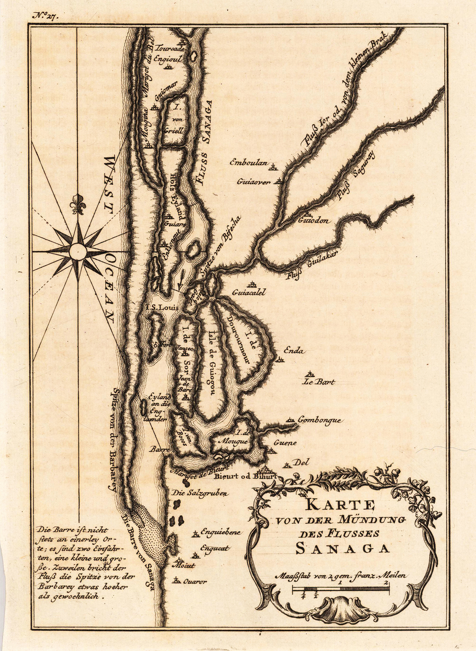
Copper engraving, uncolored as published. This antique map shows detailed the mouth of the river of Sanaga (Senegal). A fine detailed and interesting map engraved by Bellin after earlier voyages. Published in the German edition by Schwabe in Leipzig of Bellin's travel books.
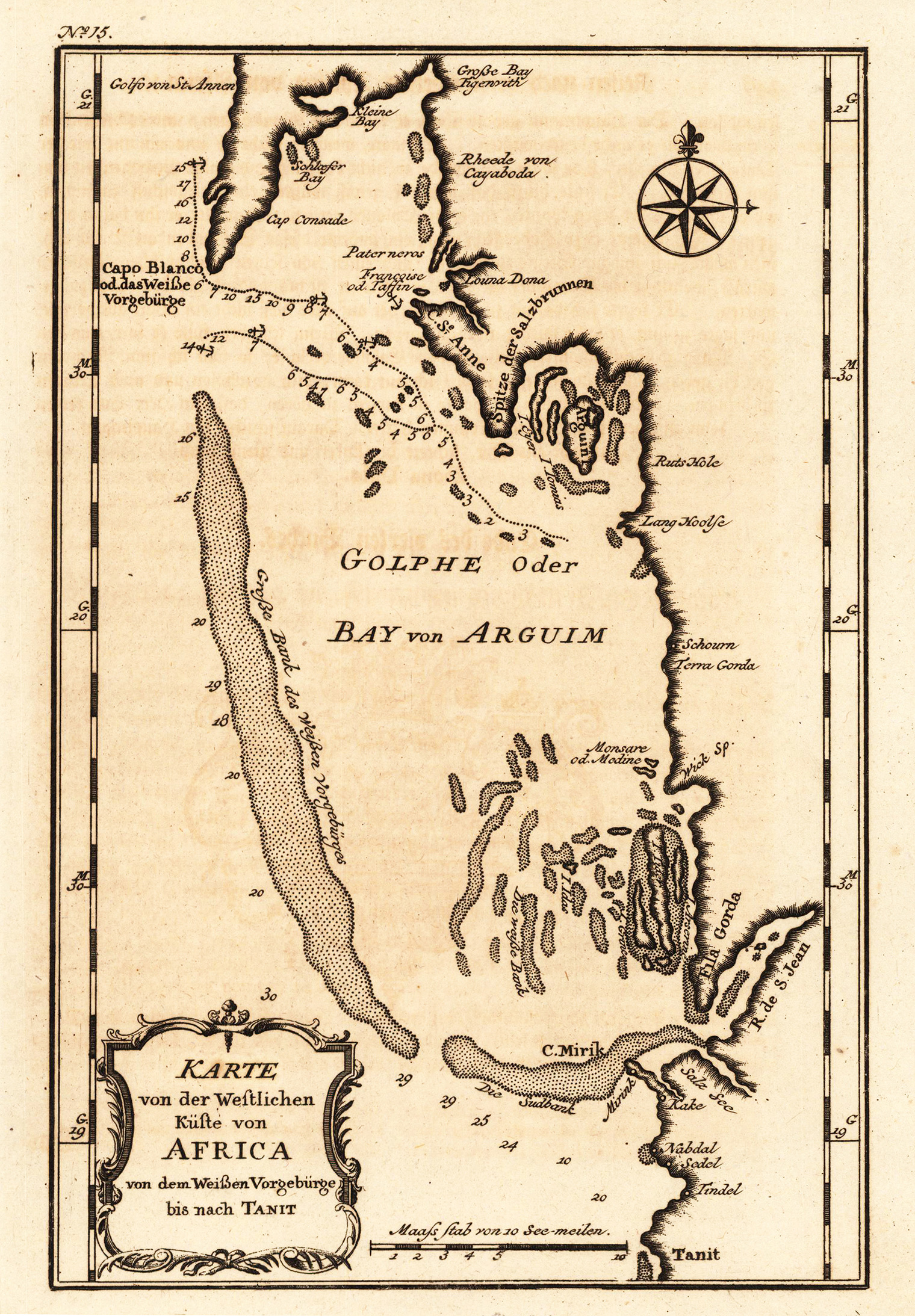
Copper engraving, uncolored as published. A very nice and detailed map, which shows the Bay of Arguim. In the lower left corner we see the title cartouche with a mileage scale. In the upper right corner we see a compass rose. A fine detailed and interesting map engraved by Bellin after earlier voyages. Published in the German edition by Schwabe in Leipzig of Bellin's travel books.
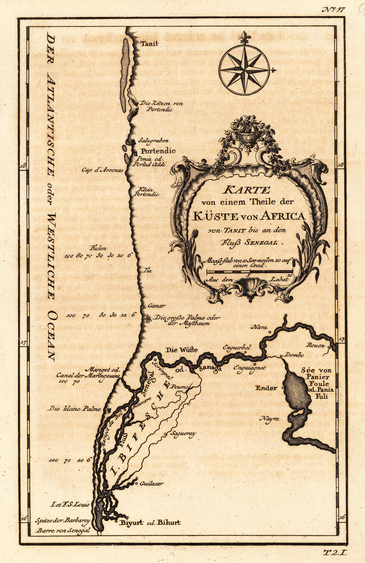
Copper engraving, uncolored as published. This decorative map shows a part of the coast of West Africa with the mouth of the river Senegal. The map is equipped with a compass rose in the upper right corner and an allegoric title cartouche. A fine detailed and interesting map engraved by Bellin after earlier voyages. Published in the German edition by Schwabe in Leipzig of Bellin's travel books.
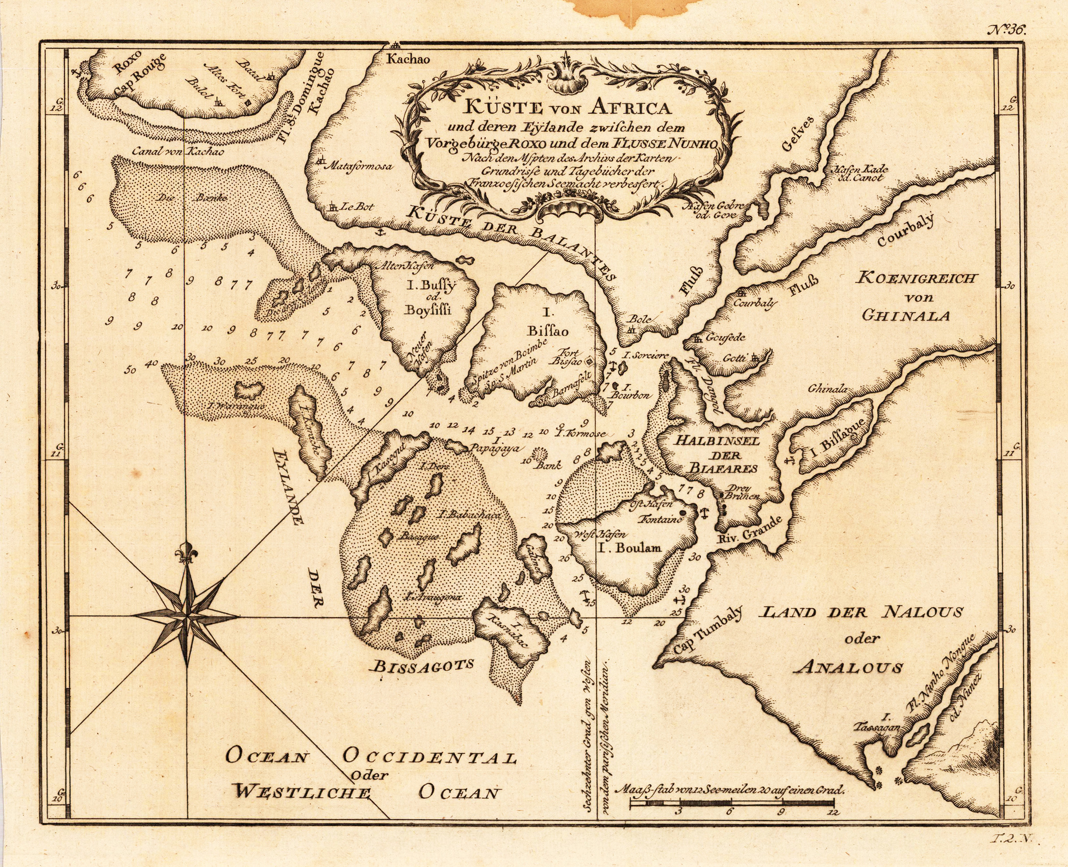
Copper engraving, uncolored as published. A fine detailed and interesting map engraved by Bellin after earlier voyages. Published in the German edition by Schwabe in Leipzig of Bellin's travel books.
Copper engraving, hand colored in wash and outline, published in Allain Manesson Mallet's description of the world. A beautiful antique map of Marocco, showing the kingdom of Fez.
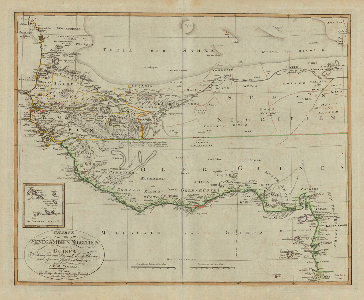
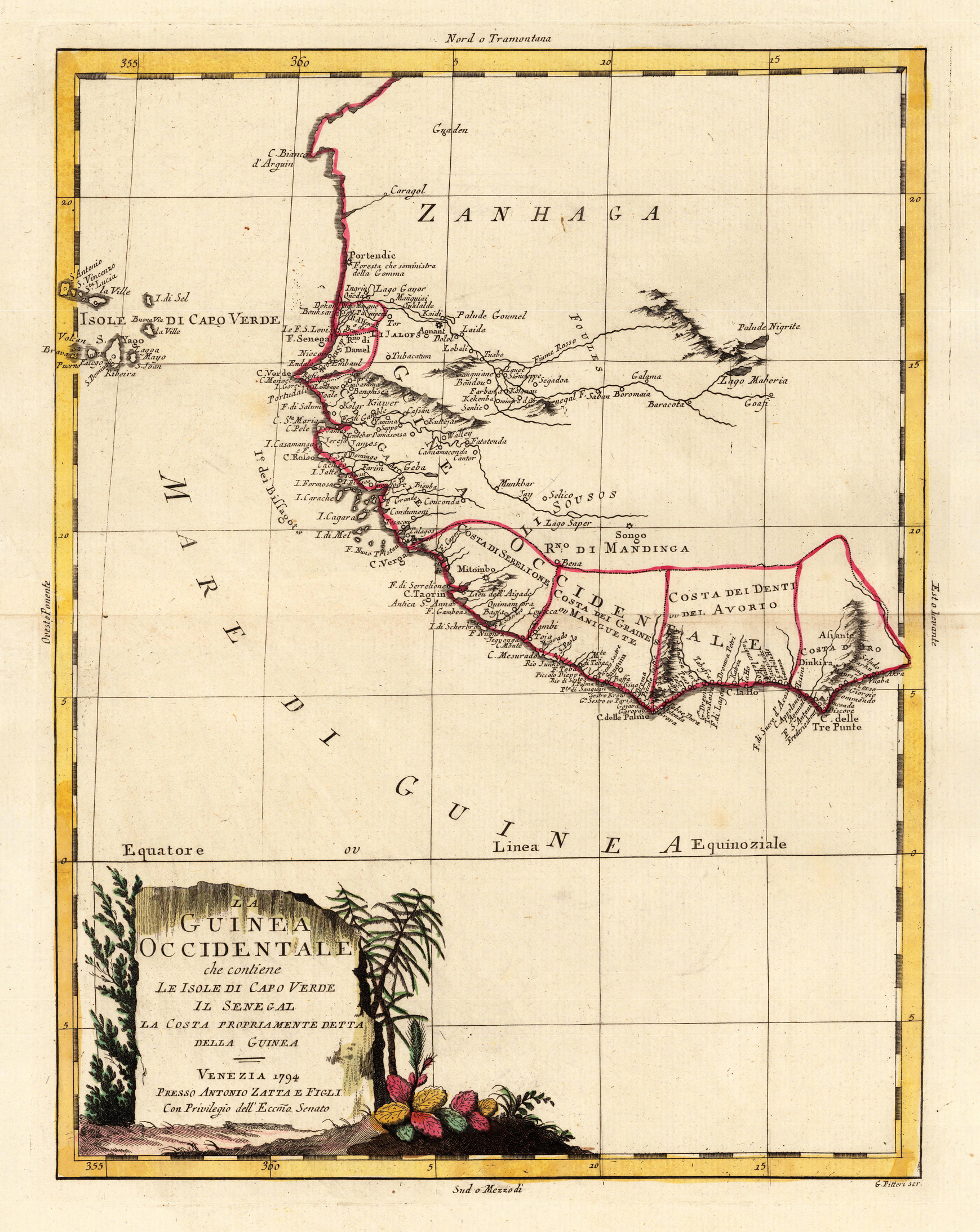
Copper engraving, in contemporary original color in outline. Published in Zatta's "Atlante Novissimo". Decorative map of Guinea in West Africa. The map covers the region from the Cap Verde Islands, the Sahara towards Sierra Leone. Equipped with a decorative title cartouche.