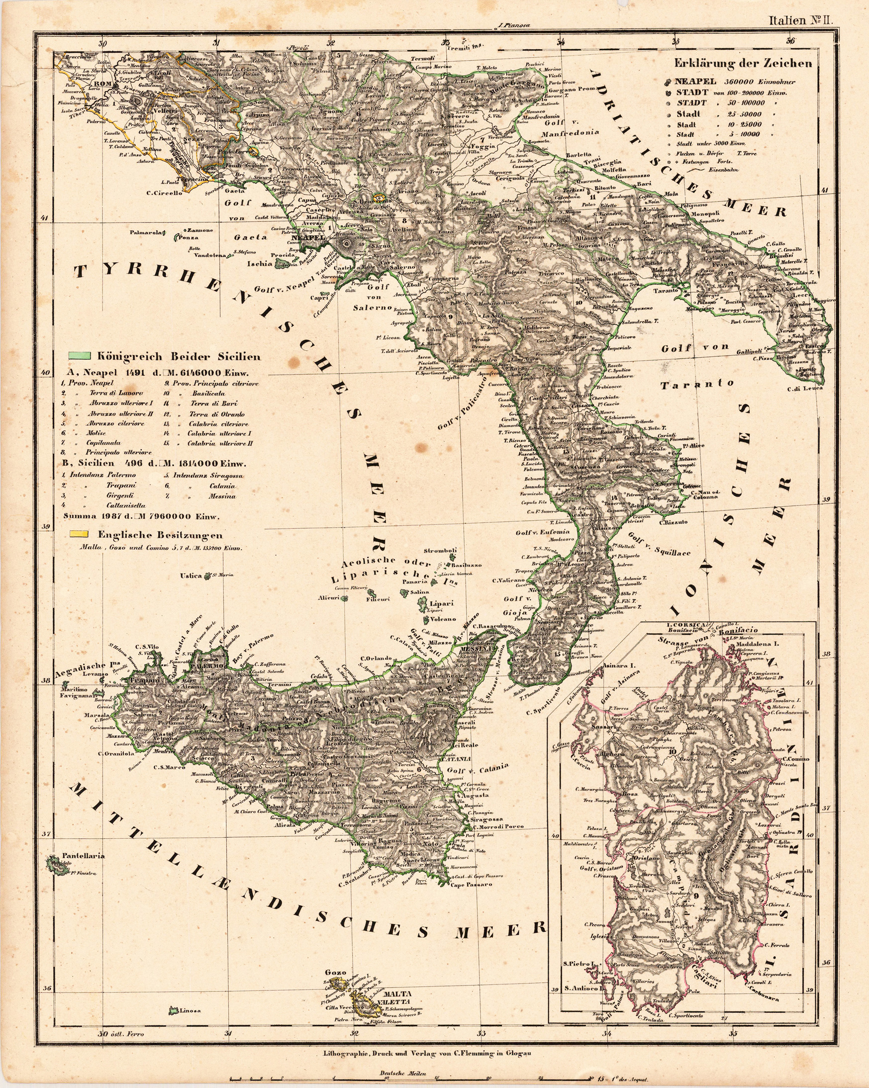
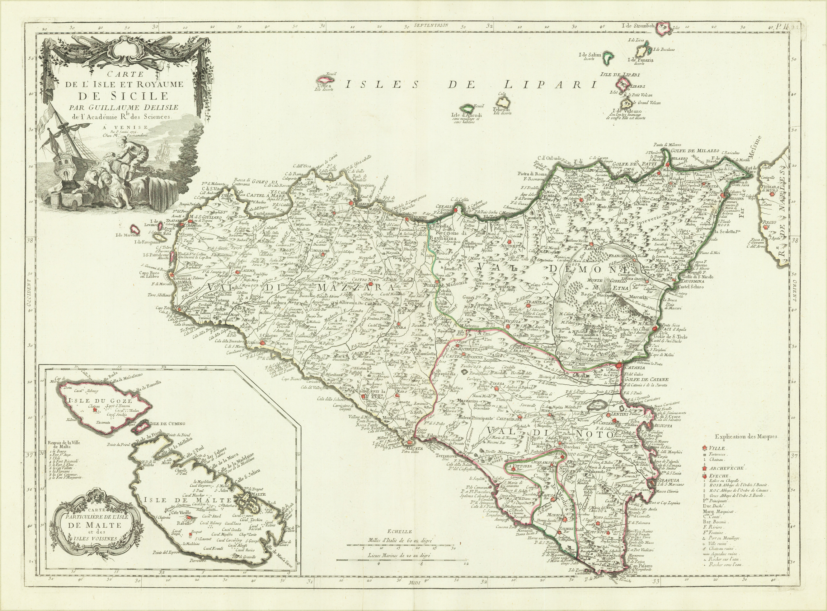
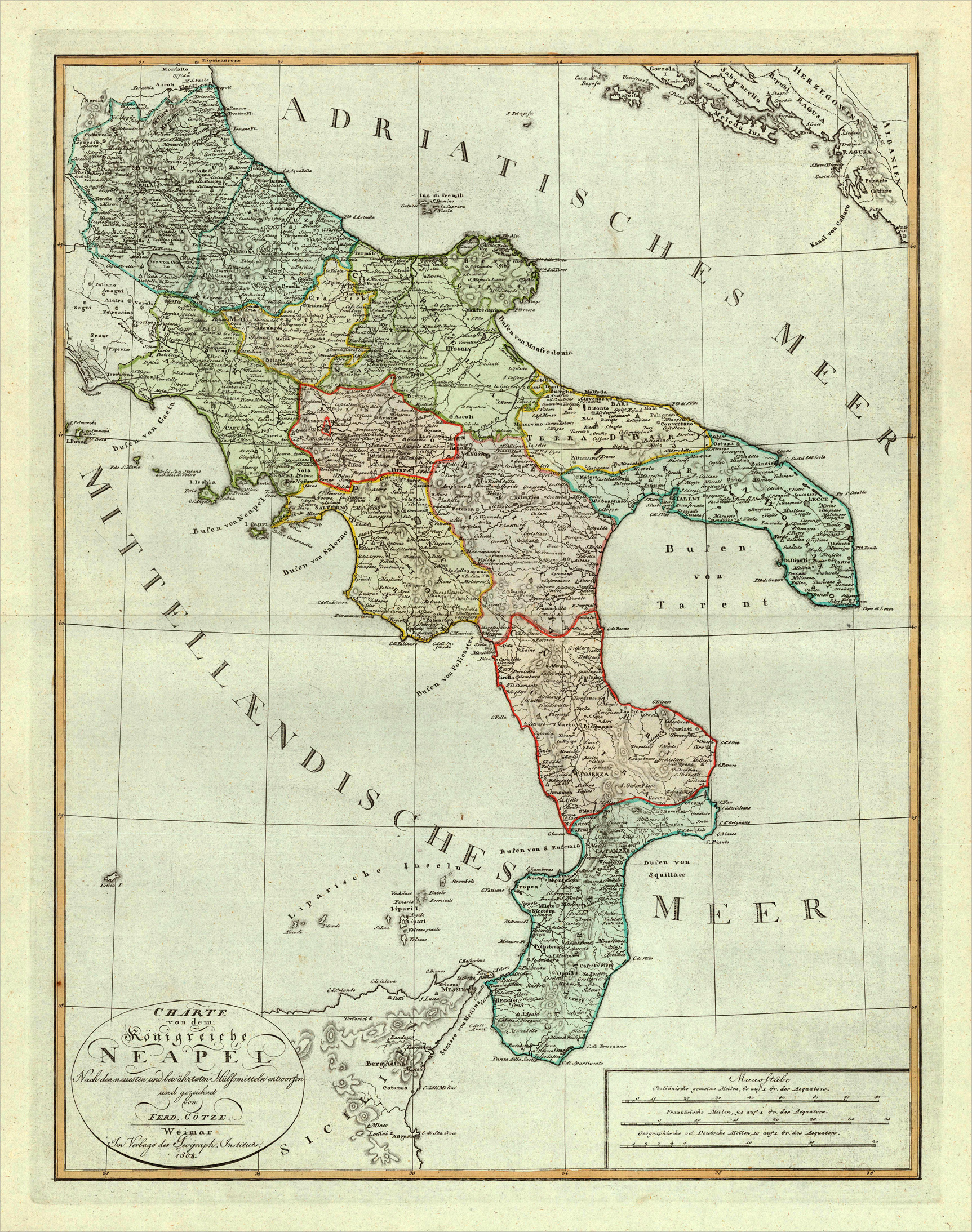
Original lithograph, hand colored in outline when published. Detailled map is showing the kingdom of Naples, Sicily, Malta and the kingdom of Sardegnia drawn by F. Handtke. With many place names, rivers, mountains and streets. At the left side a table of explanations.
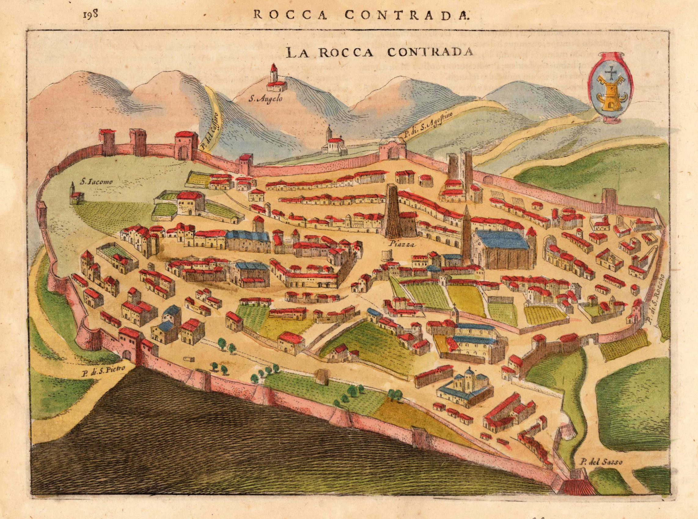
Copper engraving, finely hand colored. This historic city view of Rocca Contrada shows the old fortified town with its walls and its nearby surrounding as a bird's eye view. Streets, places, towers, churches, etc. are detailed shown. This rare historic town view was engraved by Jodocus Hondius and was published in this rare combination of an atlas and town book 'Nova et Accurata Italiae Hodiernae Descriptio ...' for the first time in 1627. This city view is decorative ornated with a renaissance title cartouche. Further this antique print is highly decorative engraved and some of the town views from 'Nova et Accurata Italiae ...' are engraved after earlier city views from the famous series 'Civitates Orbis Terrarum' by Braun & Hogenberg. Also they are occasionally ornated with rural figures in the foreground, a coat of arms, ships or a decorative landscape. This antique print is finely hand colored in wash and outline. Printed on good paper on the full sheet as published.
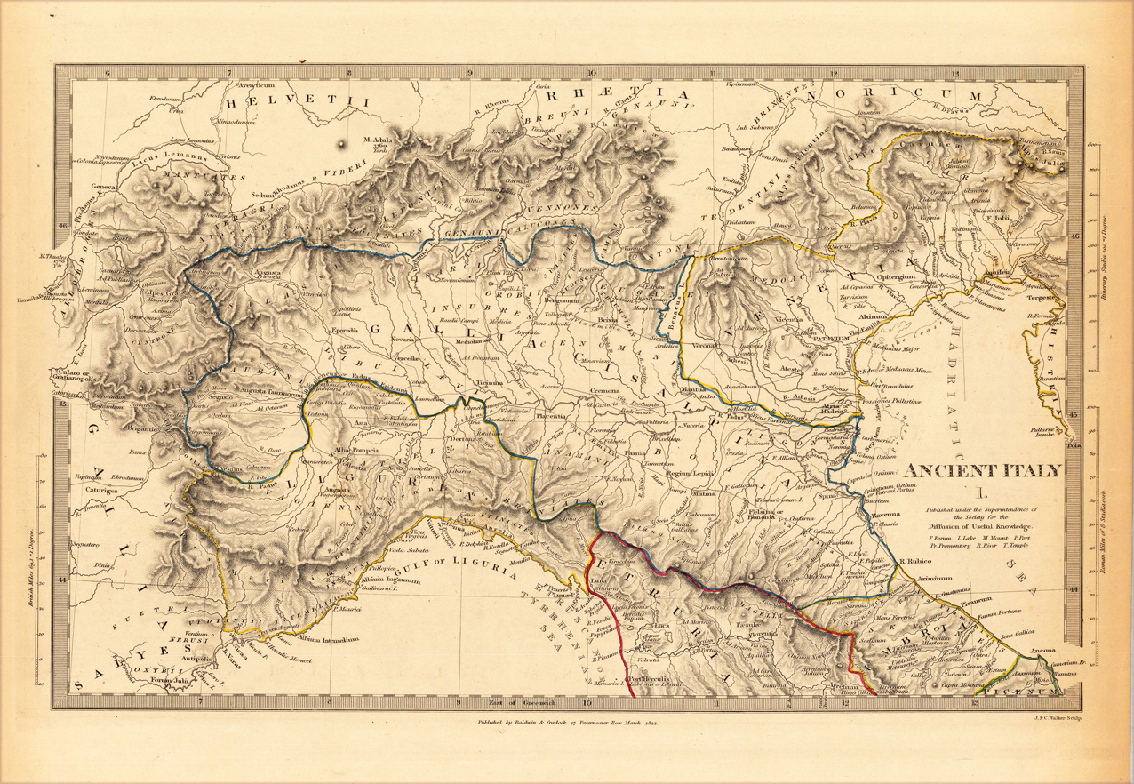
Steel engraving, hand colored in outline when published. This decorative map shows Italy. Some regions are engraved which are Gallia, Salyes, Liguria, Gallia Cisalpina, Etruria, Venetia, Helvetii, Rhaetia, Noricum. Inside the map are many small place names, rivers, engraved. At the map also to see is the Gulf of Liguria and the Hadriantic Sea. Along the coast are many place names engraved. At the left and right side from the map are mileage scale to see.
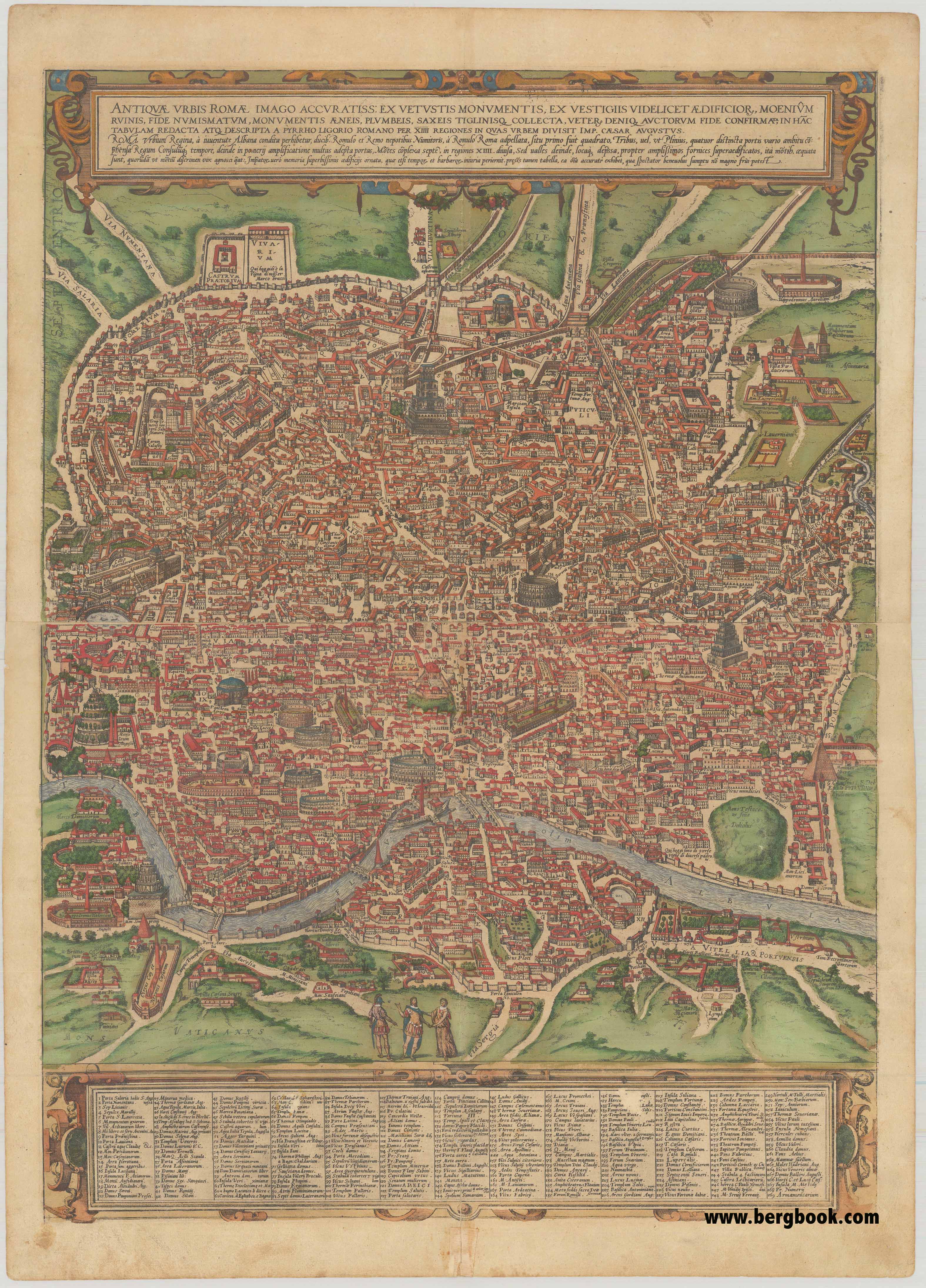
Original antique copper engraving in beautiful old color. Printed and published in "Civitates Orbis Terrarum" published in six parts between 1572 and 1617 by Georg Braun (1541-1622) and Frans Hogenberg (1535-1590). The engraving printed from two plates and joined together. Rome is shown from the west in a bird's-eye view that was a major achievement in its day. It shows the most important buildings and installations, including the Colosseum, Circus Maximus (used for chariot races), Obelisk, Pantheon of Agrippa, Trajan's Column, Roman Forum, Imperial Forums, various hippodromes and temples. The three figures in Roman garb in the foreground underscore the aim of meticulous reconstruction.
Georg Braun (also Brunus, Bruin; 1541 – 10 March 1622) was a topo-geographer. From 1572 to 1617 he edited the Civitates orbis terrarum, which contains 546 prospects, bird's-eye views and maps of cities from all around the world. He was the principal editor of the work, he acquired the tables, hired the artists, and wrote the texts. He died as an octogenarian in 1622, as the only survivor of the original team to witness the publication of volume VI in 1617.
Braun was born and died in Cologne. His principal profession was as a Catholic cleric. However, he spent thirty-seven years as canon and dean at the church, St. Maria ad Gradus, in Cologne. His six-volume work was inspired by Sebastian Münster's Cosmographia. In form and layout it resembles the 1570 Theatrum orbis terrarum by Abraham Ortelius, as Ortelius was interested in a complementary companion for the Theatrum.
The Braun publication set new standards in cartography for over 100 years. Frans Hogenberg (1535–1590, from Mechelen) created the tables for volumes I through IV, and Simon van den Neuwel created those for volumes V and VI. Other contributors were Joris Hoefnagel, Jacob Hoefnagel, cartographer Daniel Freese, and Heinrich Rantzau. Works by Jacob van Deventer, Sebastian Münster, and Johannes Stumpf were also used. Primarily European cities are depicted in the publication; however, Cairo Casablanca and Mexico City as well as Cuzco on one sheet are also included in volume I, whereas Tunis is featured in volume II
Frans Hogenberg (1535–1590) was a Flemish and German painter, engraver, and mapmaker.
Hogenberg was born in Mechelen in Flanders as the son of Nicolaas Hogenberg. In 1568 he was banned from Antwerp by the Duke of Alva and travelled to London, where he stayed a few years before emigrating to Cologne. He is known for portraits and topographical views as well as historical allegories. He also produced scenes of contemporary historical events.
Hogenberg died in Cologne. (Wikipedia)
Original anitque copper engraving. Title in German in a garland at top center; in the foreground soldiers in battle; in the center, fortress of San Francesco, near Gravere in Val di Susa. Above the rock overlooking the hamlet of Bastia, the fortress of San Francesco was built in 1592 according to a design by Gabrio Busca, Carlo Emanuele I's military engineer. Taking advantage of the relief, a simple parapet running along the edge with turrets at the corners was created. Inside there are two barracks to accommodate the garrisons and a chapel. Access was possible via a path leading up the eastern slope of the cliff. It was part of the three fortresses of Gravera, with Rocca di Molaro and Monmorone, used to defend the border with the Dauphiné, where the Savoy tried in vain to stop the French armies of Cardinal Richelieu and Marshal de Catinat in 1629 and 1690.
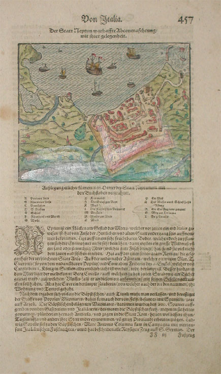
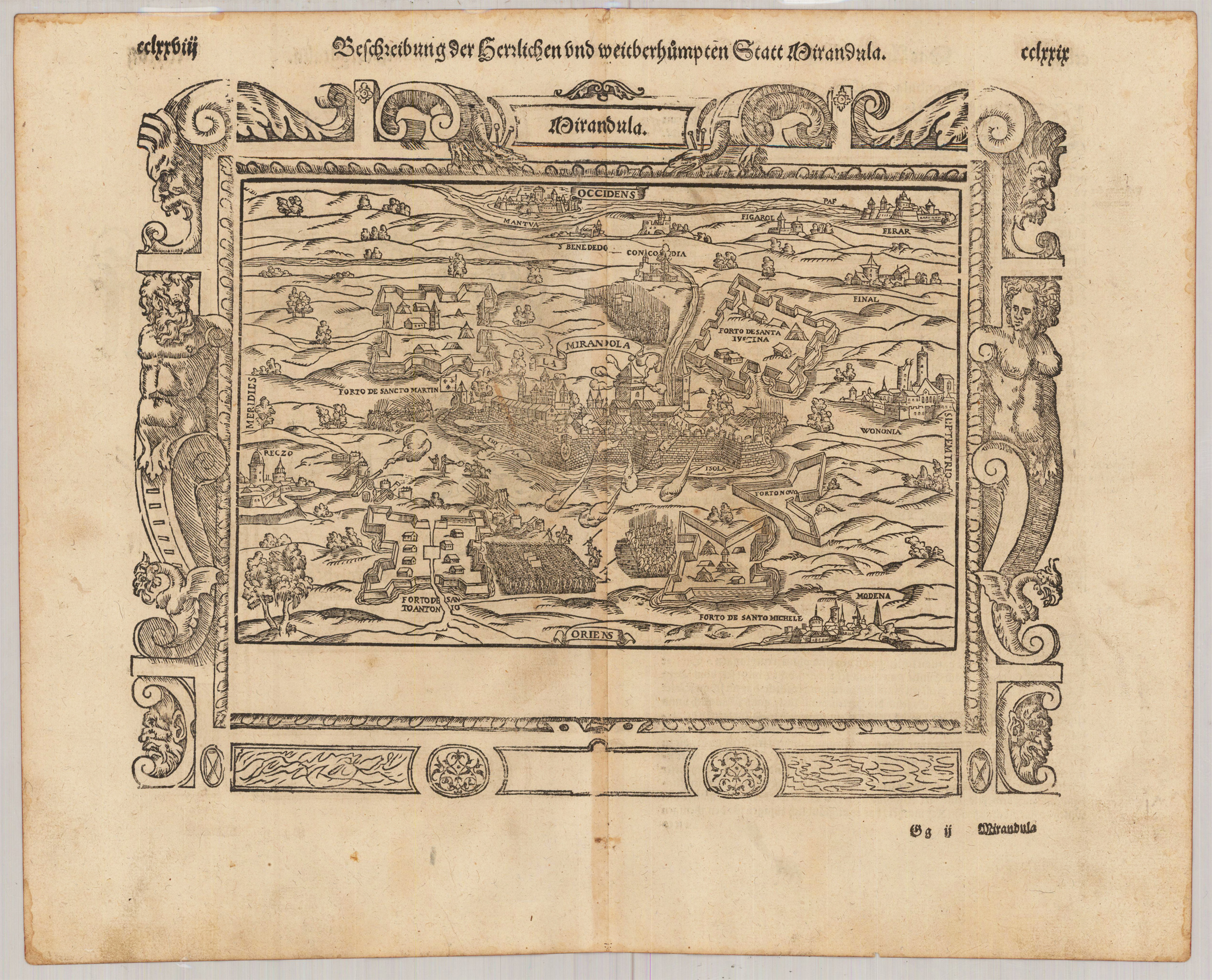
Decorative woodcut map, published in a German text edition of the ,Cosmographia' by Sebastian Münster 1578. A fine bird's eye view of the siege of the city of Mirandula with troops ans fortifications, in the background two small views of Mantua and Ferrara, in the foreground in the lower right corner a small view of Modena. The 'Cosmographia' by Sebastian Münster was one of the most richest illustrated books with geographical content describing the world in the mid of the 16th century. It was published in Basel from 1544 onwards up to 1628 in various editions and different languages. Its content was enlarged from edition to edition to provide the reader with the newest information.
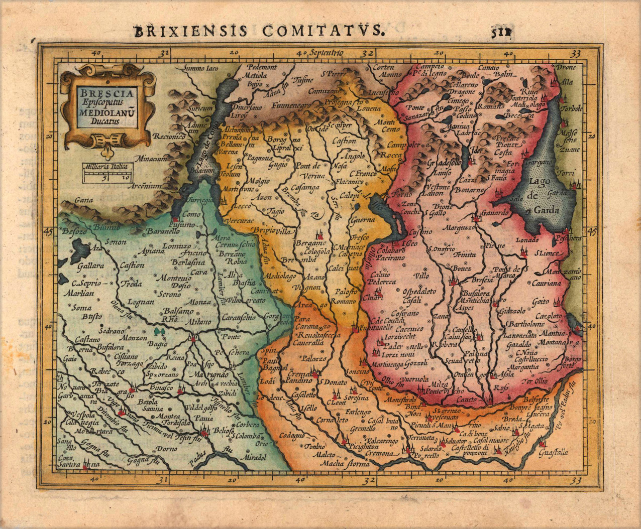
Copper engraving, hand colored in outline and wash. Decorative map of the episcopate of Brescia and duchy of Milano published in Gerard Mercator's 'Atlas Minor'.
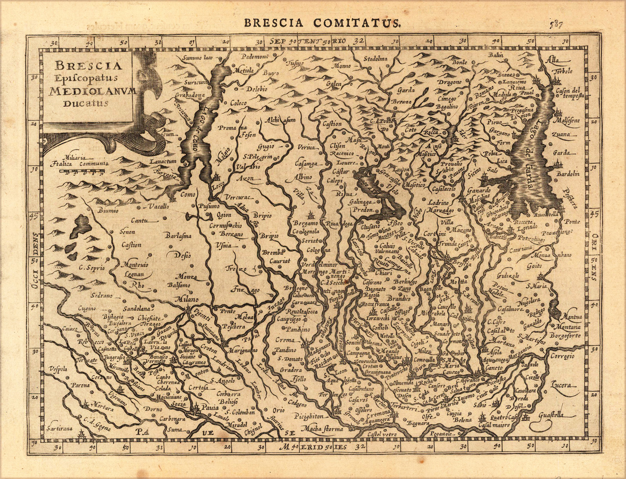
Original antique copper engraving, uncolored as published. A fine copy in a dark impression, full margins as published. The map shows the area from Metiola (Mezzola) in the north to Castelvetro in the south, from Vespola in the west to the lake Garda in the east. This is the first so-called Cloppenburgh editions which was a competive edition with new engraved maps in a larger format. Most of the maps were engraved by Pieter van den Keere. The Cloppenburgh edition was continued for a couple of years but seems to have been suppressed after 1636 ... . This is another Cloppenburgh edition, now with Latin text. The maps from the Appendix have been incorporated. The title-page is followed by a dedication to Prince Frederik Hendrik, dated 1632 and signed by Johannes Cloppenburgh. (Koeman Atlantes Neerlandici). Gerardus Mercator (5 March 1512 – 2 December 1594) was a 16th-century geographer, cosmographer and cartographer from the County of Flanders. He is most renowned for creating the 1569 world map based on a new projection which represented sailing courses of constant bearing (rhumb lines) as straight lines—an innovation that is still employed in nautical charts. Mercator was one of the pioneers of cartography and is widely considered the most notable figure of the school in its golden age (approximately 1570s–1670s). In his own day, he was a notable as maker of globes and scientific instruments. In addition, he had interests in theology, philosophy, history, mathematics and geomagnetism. He was also an accomplished engraver and calligrapher. Unlike other great scholars of the age he travelled little and his knowledge of geography came from his library of over one thousand books and maps, from his visitors and from his vast correspondence (in six languages) with other scholars, statesmen, travellers, merchants and seamen. Mercator's early maps were in large formats suitable for wall mounting but in the second half of his life, he produced over 100 new regional maps in a smaller format suitable for binding into his Atlas of 1595. This was the first appearance of the word Atlas in reference to a book of maps. However, Mercator used it as a neologism for a treatise (Cosmologia) on the creation, history and description of the universe, not simply a collection of maps. He chose the word as a commemoration of the Titan Atlas, "King of Mauretania", whom he considered to be the first great geographer. A large part of Mercator's income came from sales of his terrestrial and celestial globes. For sixty years they were considered the finest in the world, and were sold in such great numbers that there are many surviving examples. This was a substantial enterprise involving the manufacture of the spheres, printing the gores, building substantial stands, packing and distributing all over Europe. He was also renowned for his scientific instruments, particularly his astrolabes and astronomical rings used to study the geometry of astronomy and astrology. Mercator wrote on geography, philosophy, chronology and theology. All of the wall maps were engraved with copious text on the region concerned. As an example the famous world map of 1569 is inscribed with over five thousand words in fifteen legends. The 1595 Atlas has about 120 pages of maps and illustrated title pages but a greater number of pages are devoted to his account of the creation of the universe and descriptions of all the countries portrayed. His table of chronology ran to some 400 pages fixing the dates (from the time of creation) of earthly dynasties, major political and military events, volcanic eruptions, earthquakes and eclipses. He also wrote on the gospels and the old testament. Mercator was a devout Christian born into a Catholic family at a time when Martin Luther's Protestantism was gaining ground. He never declared himself as a Lutheran but he was clearly sympathetic and he was accused of heresy by Catholic authorities; after six months in prison he was released unscathed. This period of persecution is probably the major factor in his move from Catholic Leuven (Louvain) to a more tolerant Duisburg, in the Holy Roman Empire, where he lived for the last thirty years of his life. Walter Ghim, Mercator's friend and first biographer, describes him as sober in his behaviour, yet cheerful and witty in company, and never more happy than in debate with other scholars. Above all he was pious and studious until his dying days. (Wikipedia)
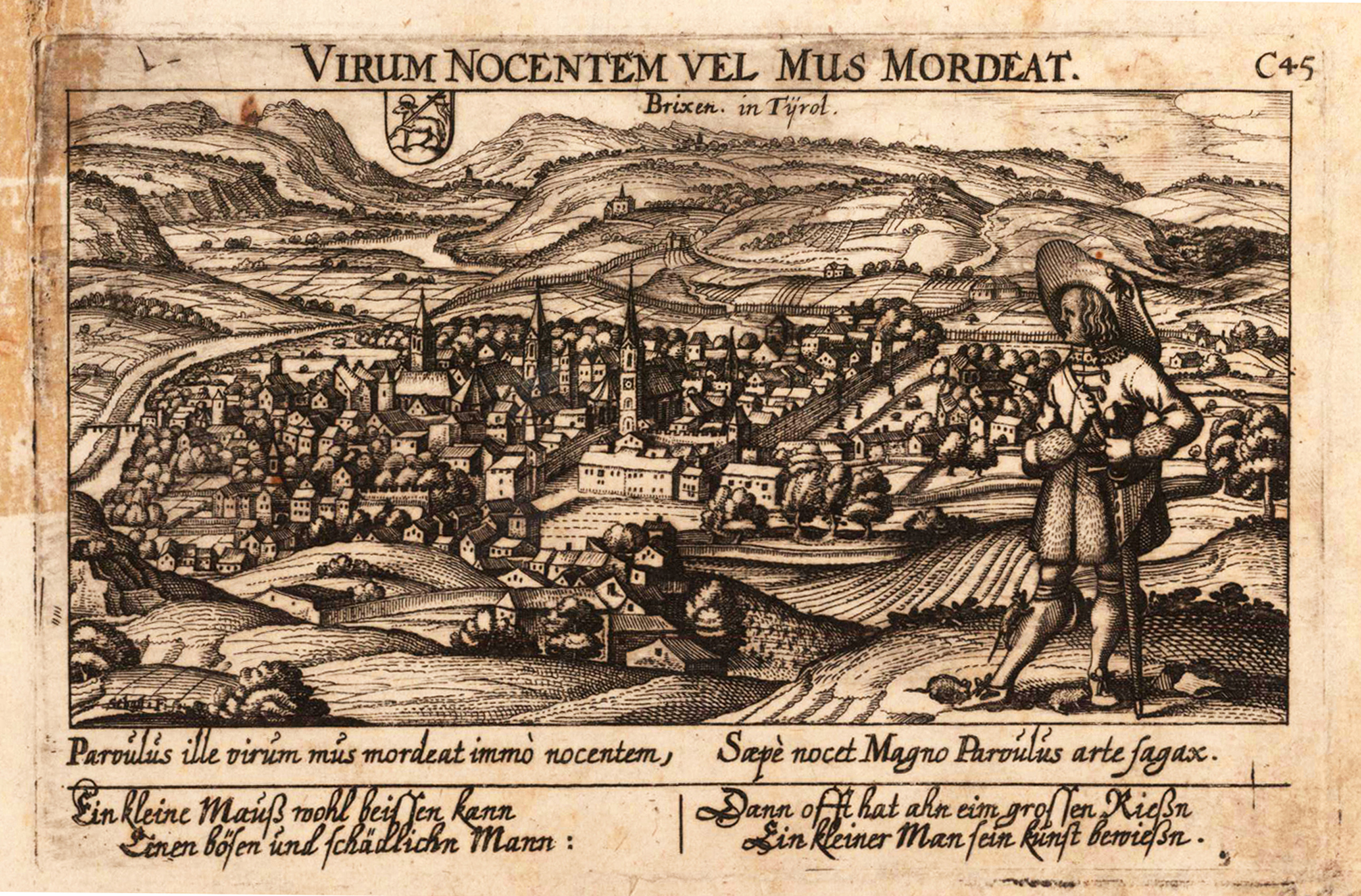
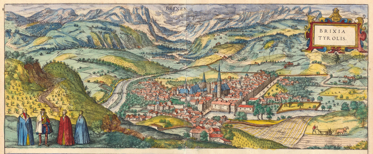
Original antique copper engraving, hand colored in wash, published 1617 in the townbook 'Civitates Orbis Terrarum' by Braun and Hogenberg. The entire series of the 'Civitates Orbis Terrarum' comprised six volumes and was published and printed from 1572 towards 1619. Decorative panoramic city view of the city of Brixen in South Tyrol with the rivers Eisak and Rienz. The landscape is ornated in the background with the alps, as well wine yards in the foreground. The view of the city is pretty accurate with the churches, the bridge and the surrounding walls.
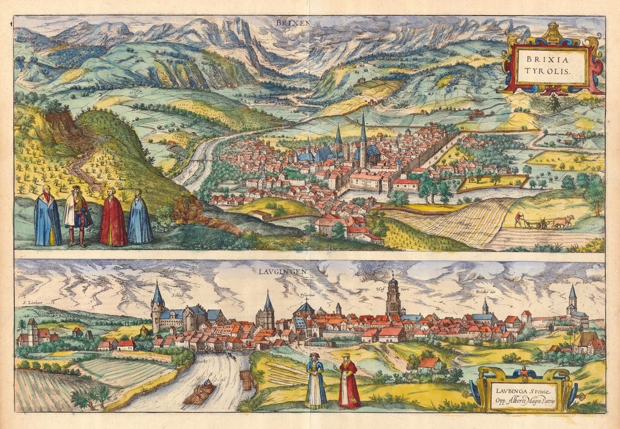
Original copper-engraving, handcolored in wash, published 1617 in the townbook 'Civitates Orbis Terrarum' by Braun and Hogenberg. The entire series of the 'Civitates Orbis Terrarum' comprised six volumes and was published and printed from 1572 towards 1619. Two decorative city views on one doublepage. Decorative panoramic city view of the city of Brixen in South Tyrol with the rivers Eisak and Rienz. The landscape is ornated in the background with the alps, as well wine yards in the foreground. The view of the city is pretty accurate with the churches, the bridge and the surrounding walls. The second view on this doublepage is Lauingen on the Danube in Suevia. Georg Braun (also Brunus, Bruin; 1541 – 10 March 1622) was a topo-geographer. From 1572 to 1617 he edited the Civitates orbis terrarum, which contains 546 prospects, bird's-eye views and maps of cities from all around the world. He was the principal editor of the work, he acquired the tables, hired the artists, and wrote the texts. He died as an octogenarian in 1622, as the only survivor of the original team to witness the publication of volume VI in 1617. Braun was born and died in Cologne. His principal profession was as a Catholic cleric. However, he spent thirty-seven years as canon and dean at the church, St. Maria ad Gradus, in Cologne. His six-volume work was inspired by Sebastian Münster's Cosmographia. In form and layout it resembles the 1570 Theatrum orbis terrarum by Abraham Ortelius, as Ortelius was interested in a complementary companion for the Theatrum. The Braun publication set new standards in cartography for over 100 years. Frans Hogenberg (1535–1590, from Mechelen) created the tables for volumes I through IV, and Simon van den Neuwel created those for volumes V and VI. Other contributors were Joris Hoefnagel, Jacob Hoefnagel, cartographer Daniel Freese, and Heinrich Rantzau. Works by Jacob van Deventer, Sebastian Münster, and Johannes Stumpf were also used. Primarily European cities are depicted in the publication; however, Cairo Casablanca and Mexico City as well as Cuzco on one sheet are also included in volume I, whereas Tunis is featured in volume II. Frans Hogenberg (1535–1590) was a Flemish and German painter, engraver, and mapmaker. Hogenberg was born in Mechelen in Flanders as the son of Nicolaas Hogenberg. In 1568 he was banned from Antwerp by the Duke of Alva and travelled to London, where he stayed a few years before emigrating to Cologne. He is known for portraits and topographical views as well as historical allegories. He also produced scenes of contemporary historical events. Hogenberg died in Cologne. (Wikipedia)
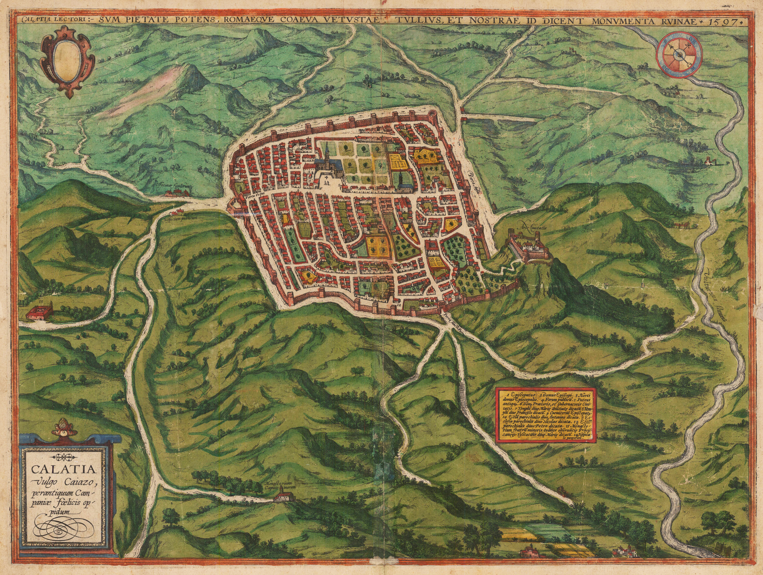
Original antique copper engraving, hand colored in outline and wash when published. Decorative city map of Caiazzo. The plan is included in the" Civitates Orbis Terrarum ", the first atlas devoted exclusively to the plans and views of the most important cities in the world. It was printed in six volumes between 1572 and 1617 and was very popular. So much so that several editions were printed which were translated into Latin, German and French. In 1572, George Braun (1541-1622), a clergyman of the city, published the first of the six volumes of the "Civitates" Orbis Terrarum "in Cologne., which contains a total of over 500 perspectives, bird's eye views and maps of cities from all over the world, the last volume of which was published in 1617. Fransz Hogenberg (1535-1590) made the plates for the first four books and Simon van den Neuwel (Novellanus, active from 1580) those for volumes V and VI. Georg Braun (also Brunus, Bruin; 1541 – 10 March 1622) was a topo-geographer. From 1572 to 1617 he edited the Civitates orbis terrarum, which contains 546 prospects, bird's-eye views and maps of cities from all around the world. He was the principal editor of the work, he acquired the tables, hired the artists, and wrote the texts. He died as an octogenarian in 1622, as the only survivor of the original team to witness the publication of volume VI in 1617. Braun was born and died in Cologne. His principal profession was as a Catholic cleric. However, he spent thirty-seven years as canon and dean at the church, St. Maria ad Gradus, in Cologne. His six-volume work was inspired by Sebastian Münster's Cosmographia. In form and layout it resembles the 1570 Theatrum orbis terrarum by Abraham Ortelius, as Ortelius was interested in a complementary companion for the Theatrum. The Braun publication set new standards in cartography for over 100 years. Frans Hogenberg (1535–1590, from Mechelen) created the tables for volumes I through IV, and Simon van den Neuwel created those for volumes V and VI. Other contributors were Joris Hoefnagel, Jacob Hoefnagel, cartographer Daniel Freese, and Heinrich Rantzau. Works by Jacob van Deventer, Sebastian Münster, and Johannes Stumpf were also used. Primarily European cities are depicted in the publication; however, Cairo Casablanca and Mexico City as well as Cuzco on one sheet are also included in volume I, whereas Tunis is featured in volume II Frans Hogenberg (1535–1590) was a Flemish and German painter, engraver, and mapmaker. Hogenberg was born in Mechelen in Flanders as the son of Nicolaas Hogenberg. In 1568 he was banned from Antwerp by the Duke of Alva and travelled to London, where he stayed a few years before emigrating to Cologne. He is known for portraits and topographical views as well as historical allegories. He also produced scenes of contemporary historical events. Hogenberg died in Cologne. (Wikipedia)
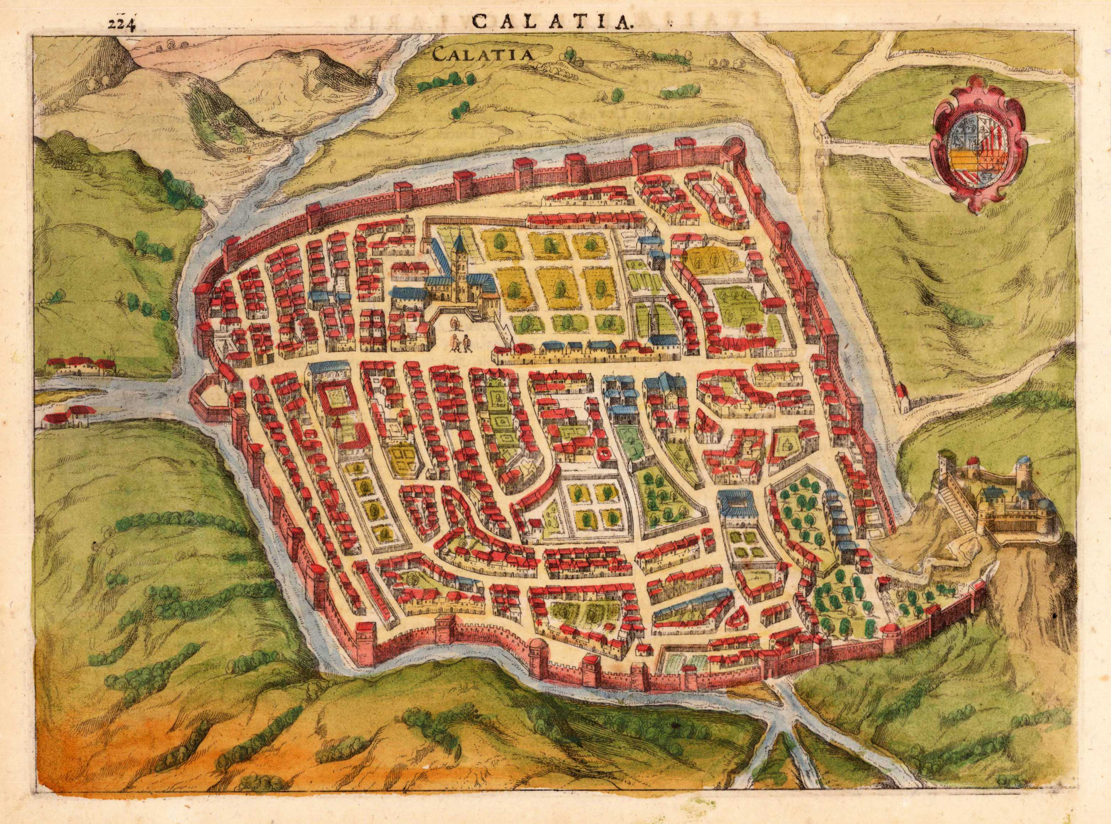
Copper engraving, finely hand colored. This historic city view of Calatia shows the old fortified town with its walls and its nearby surrounding as a bird's eye view. Streets, places, towers, churches, etc. are detailed shown. This rare historic town view was engraved by Jodocus Hondius and was published in this rare combination of an atlas and town book 'Nova et Accurata Italiae Hodiernae Descriptio ...' for the first time in 1627. This city view is decorative ornated with a renaissance title cartouche. Further this antique print is highly decorative engraved and some of the town views from 'Nova et Accurata Italiae ...' are engraved after earlier city views from the famous series 'Civitates Orbis Terrarum' by Braun & Hogenberg. Also they are occasionally ornated with rural figures in the foreground, a coat of arms, ships or a decorative landscape. This antique print is finely hand colored in wash and outline. Printed on good paper on the full sheet as published.
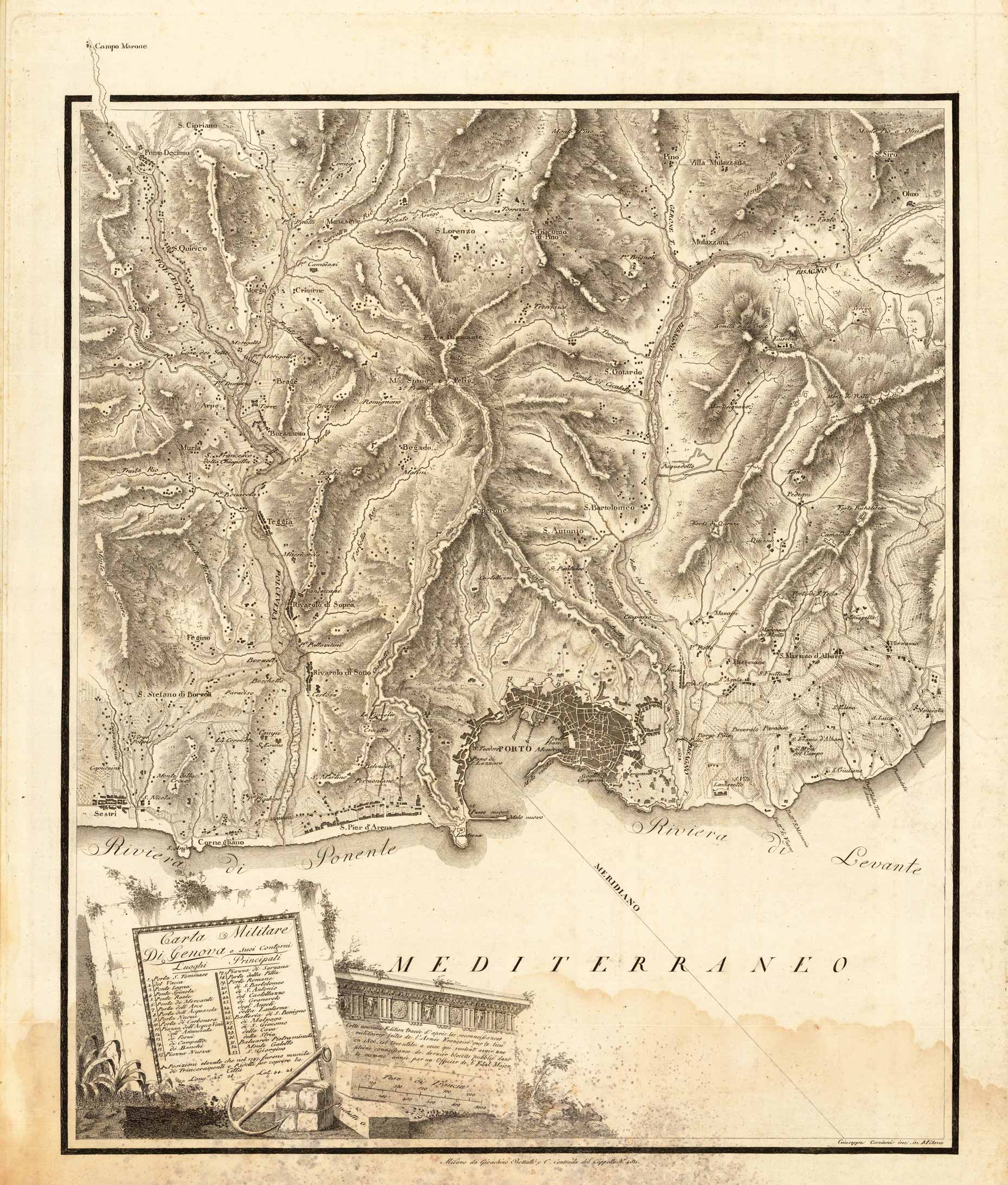
Copper engraving, uncolored as published. An unusual and separately issued military map of Genua with its port and the surrounding into the mountains towards Pino and S. Lorenzo. The map includes many topographical details. The title cartouche with a table listing 33 gates, places and more. Equipped with a mileage scale and an anchor for decoration.
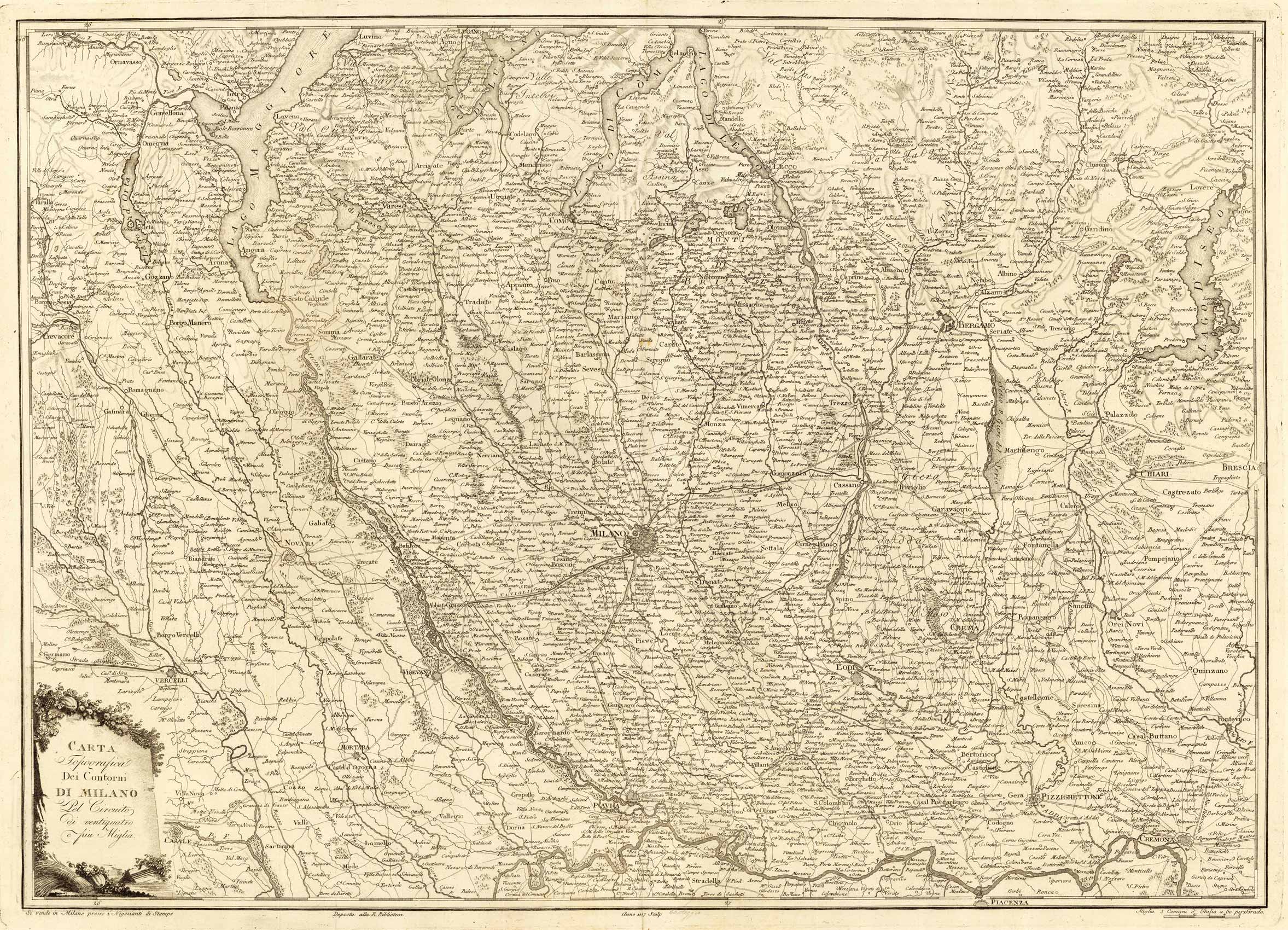
Copper engraving, uncolored as published. A fine and unusual map depicting Northern Italy with Milan in its center. The map includes Bergamo towards Brescia, also it extends in the west towards the Lago d' Orta and the Lago Maggiore. Rare map of Northern Italy individual published and printed in Milan.
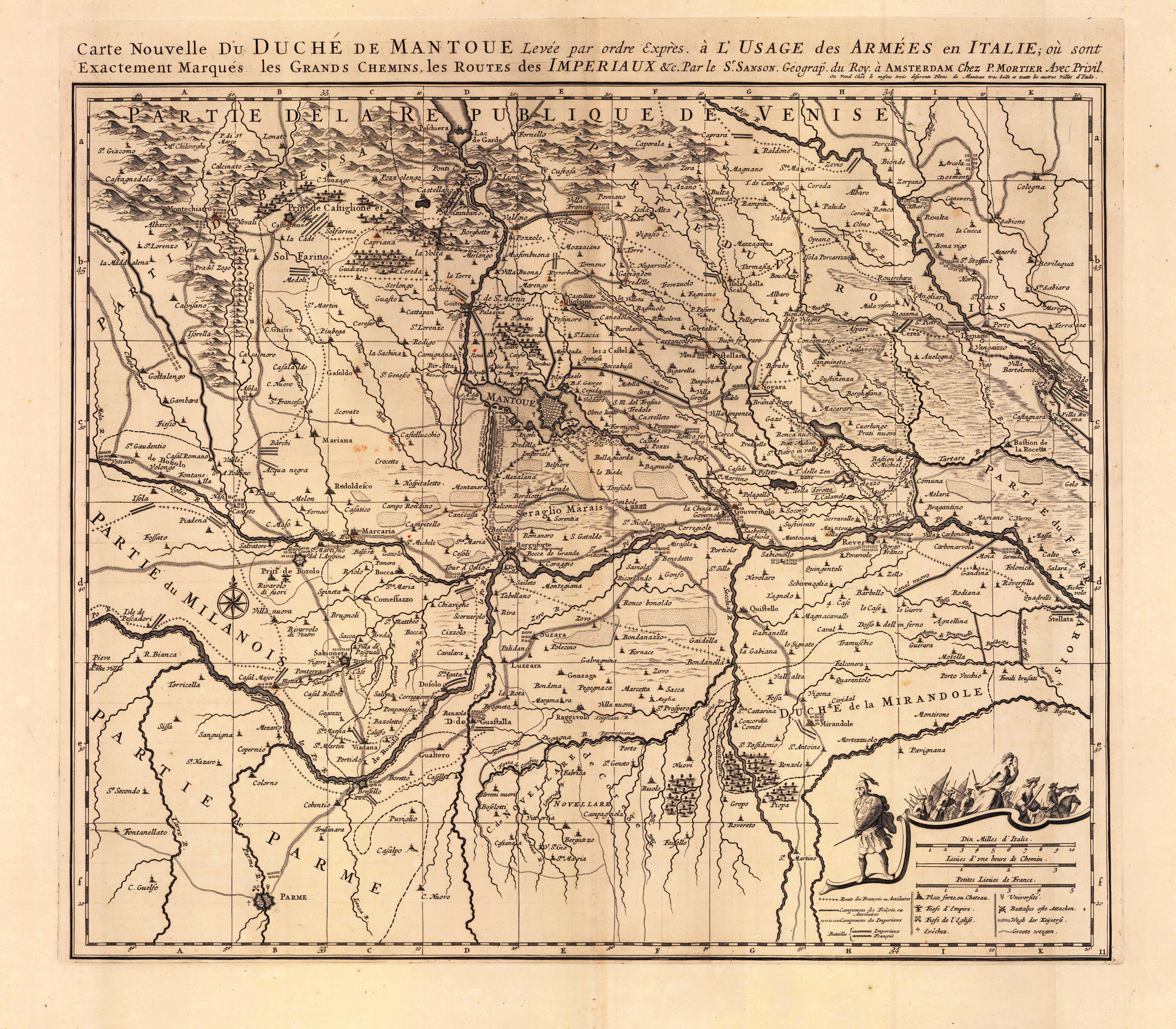
Copper engraving, uncolored as published. Large detailed and interesting map by the famous French cartographer Nicolaus Sanson published in the famous sea atlas 'Le Neptune francois ...' in Amsterdam at Pierre Mortier. This interesting and large map was originally first published in the 'Atlas Noveau ...' by Alexis Hubert Jaillot & N. Sanson in Paris 1683-89. Alexis Hubert Jaillot & Nicolaus Jaillot worked as a royal cartographers for the French royal house for king Louis XIV. His maps published for the 'Atlas Nouveau ...' can be regarded as masterpieces of cartography in France in the ending 18th century. Also the maps impress by their accuracy and are providing an enormous amount of place names, monasteries, rivers, trails, fortifications, etc. Shown is the duchy of Mantua (Mantova) in Northern Italy. Mantua is shown prominently in the center of the map. The map provides many place names, detailed information on the river system also in the lower right corner a cartouche with a mileage scale and a table of explanations.
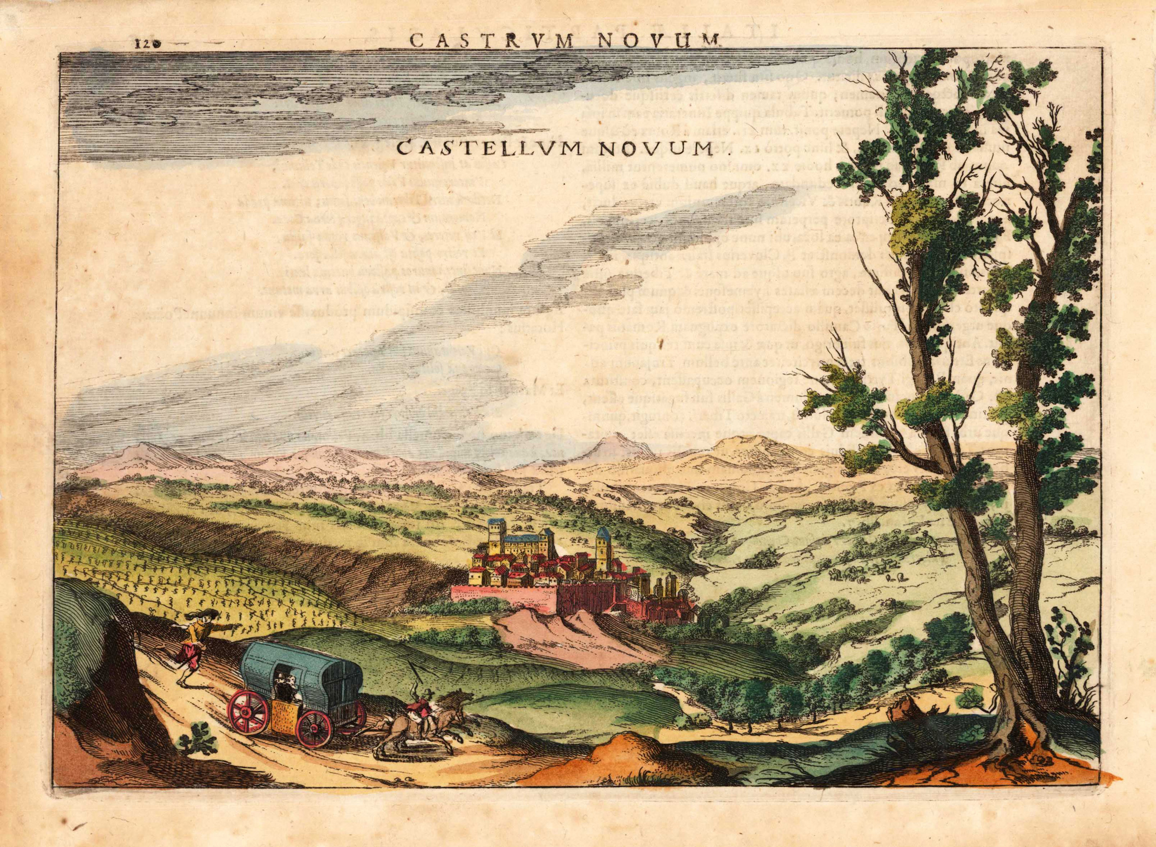
Copper engraving, finely hand colored. This historic city view of Castella Nova shows a panoramic view towards the old fortified town with its walls and its nearby surrounding. Houses, towers, churches, city walls etc. are detailed shown. This rare historic town view was engraved by Jodocus Hondius and was published in this rare combination of an atlas and town book 'Nova et Accurata Italiae Hodiernae Descriptio ...' for the first time in 1627. This city view is decorative ornated with a renaissance title cartouche. Further this antique print is highly decorative engraved and some of the town views from 'Nova et Accurata Italiae ...' are engraved after earlier city views from the famous series 'Civitates Orbis Terrarum' by Braun & Hogenberg. Also they are occasionally ornated with rural figures in the foreground, a coat of arms, ships or a decorative landscape. This antique print is finely hand colored in wash and outline. Printed on good paper on the full sheet as published.