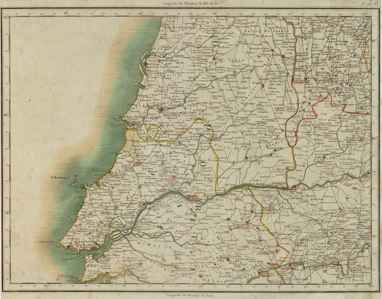
Copper-engraving, handcolored in outline when published. Detailed regional map showing Lisboa and the region north and east of it. With many place names, streets, rivers, etc.
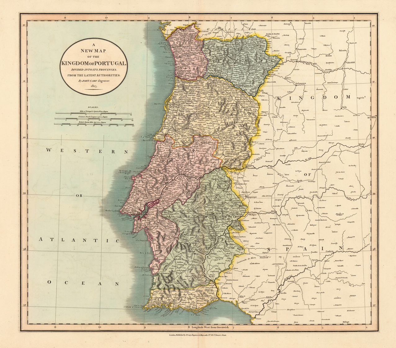
Copper-engraving, hand colored in outline when published. This map shows the Kingdom of Portugal and his provinces. In the upper left corner we found the title cartouche and the mileage scale. Also is the Atlantic Ocean at the left side engraved. At the right side is the Kingdom of Spain engraved.
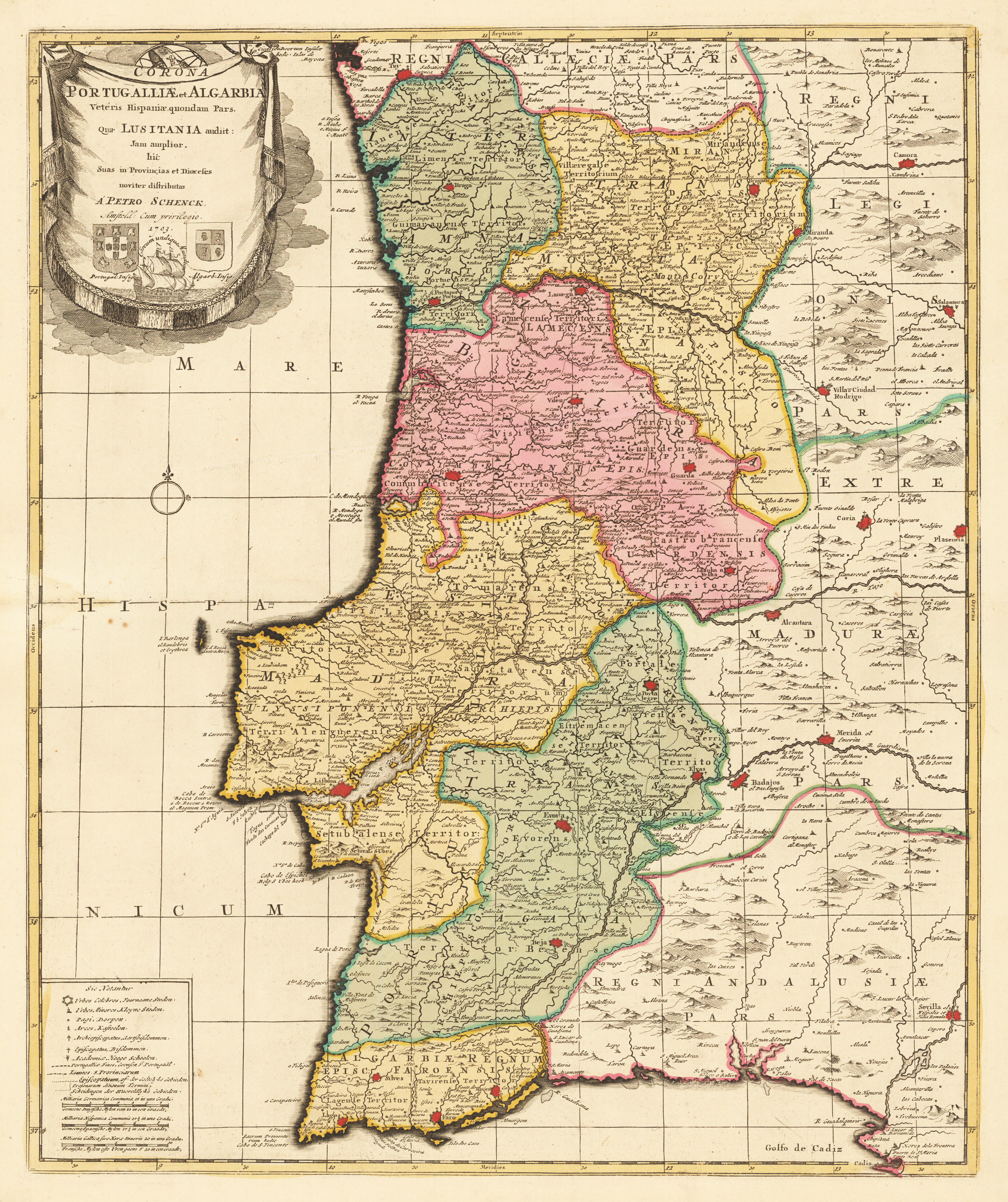
Copper engraving, hand colored in outline and wash when published. A fine antique map by the Dutch mapmaker and publisher Petrus Schenck showing Portugal and the Algarve. In the upper left corner is the cartouche with the coats of arms of Portugal, the Algarve together with a Spanish sailing vessell.
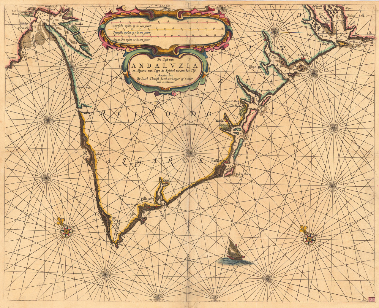
Detailled handcoloured sea-chart showing the Portugese coastline from Setubal S. Vves along the Algarve towards Palos in the South. Villa Nova, Faro, Tavilla and Aimonte are prominently displayed. Ornated with a large decorative handcoloured title cartouche in the upper center, above there is a large milage scale to convert Dutch, Spanish, English & French leagues to degrees. Further on the chart is ornated with two compass roses and a ship.
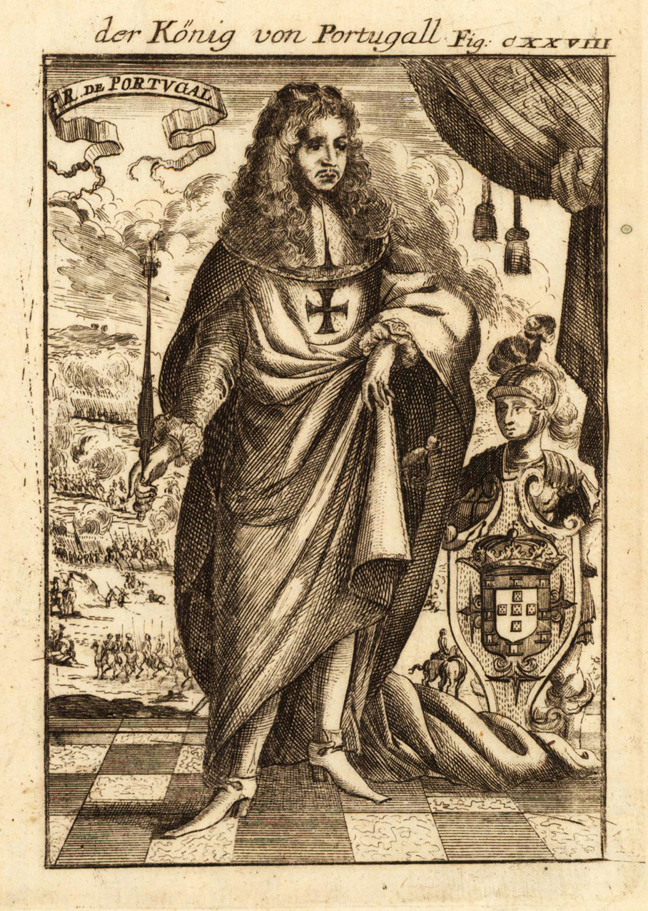
Copper engraving published in Allain M. Mallet's description of the world 'Description De L' Univers, Contenant Les Differents Systemes Du Monde, Les Cartes generales & particulieres ...'. French text edition with additional German titles on top.
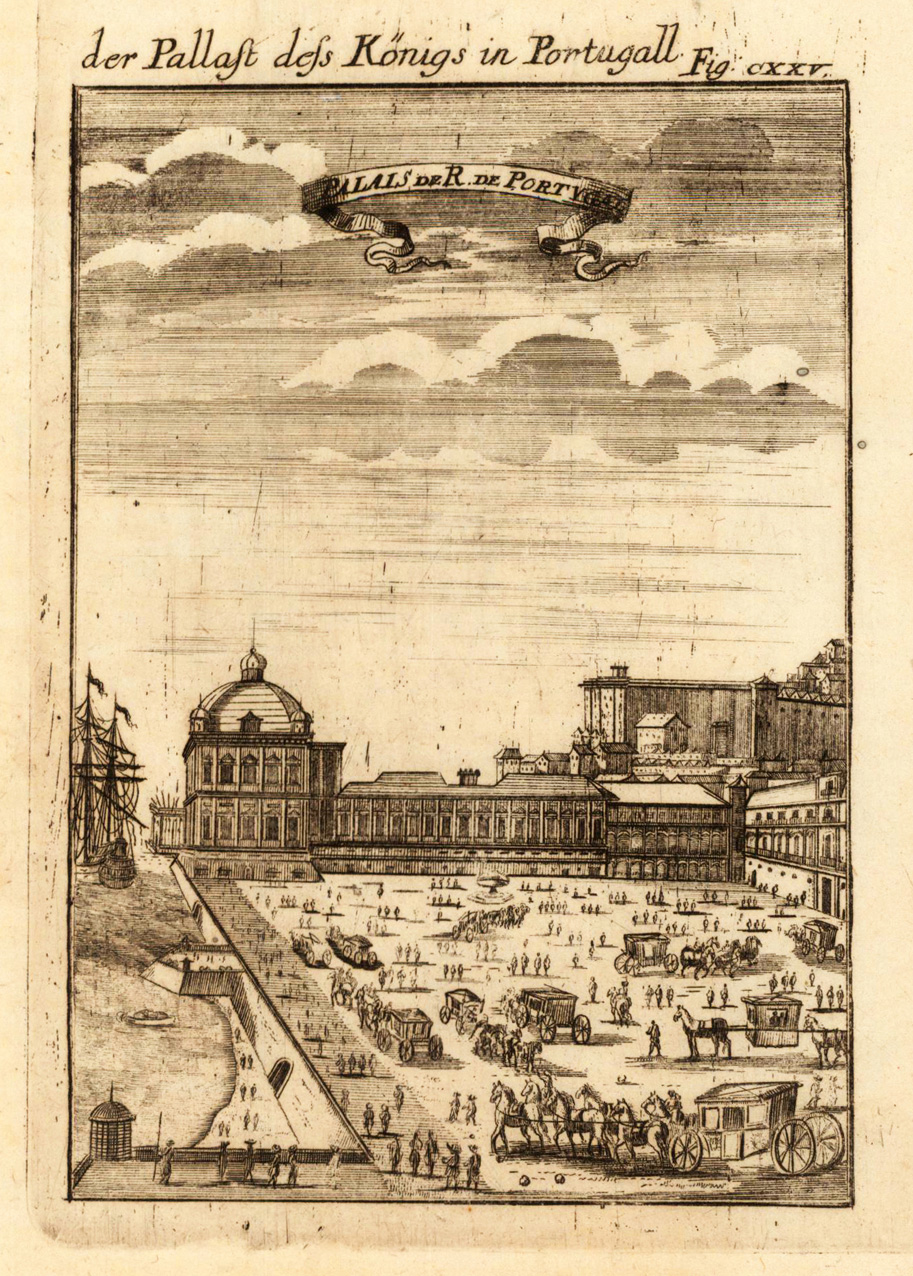
Copper engraving published in Allain M. Mallet's description of the world 'Description De L' Univers, Contenant Les Differents Systemes Du Monde, Les Cartes generales & particulieres ...'. French text edition with additional German titles on top.
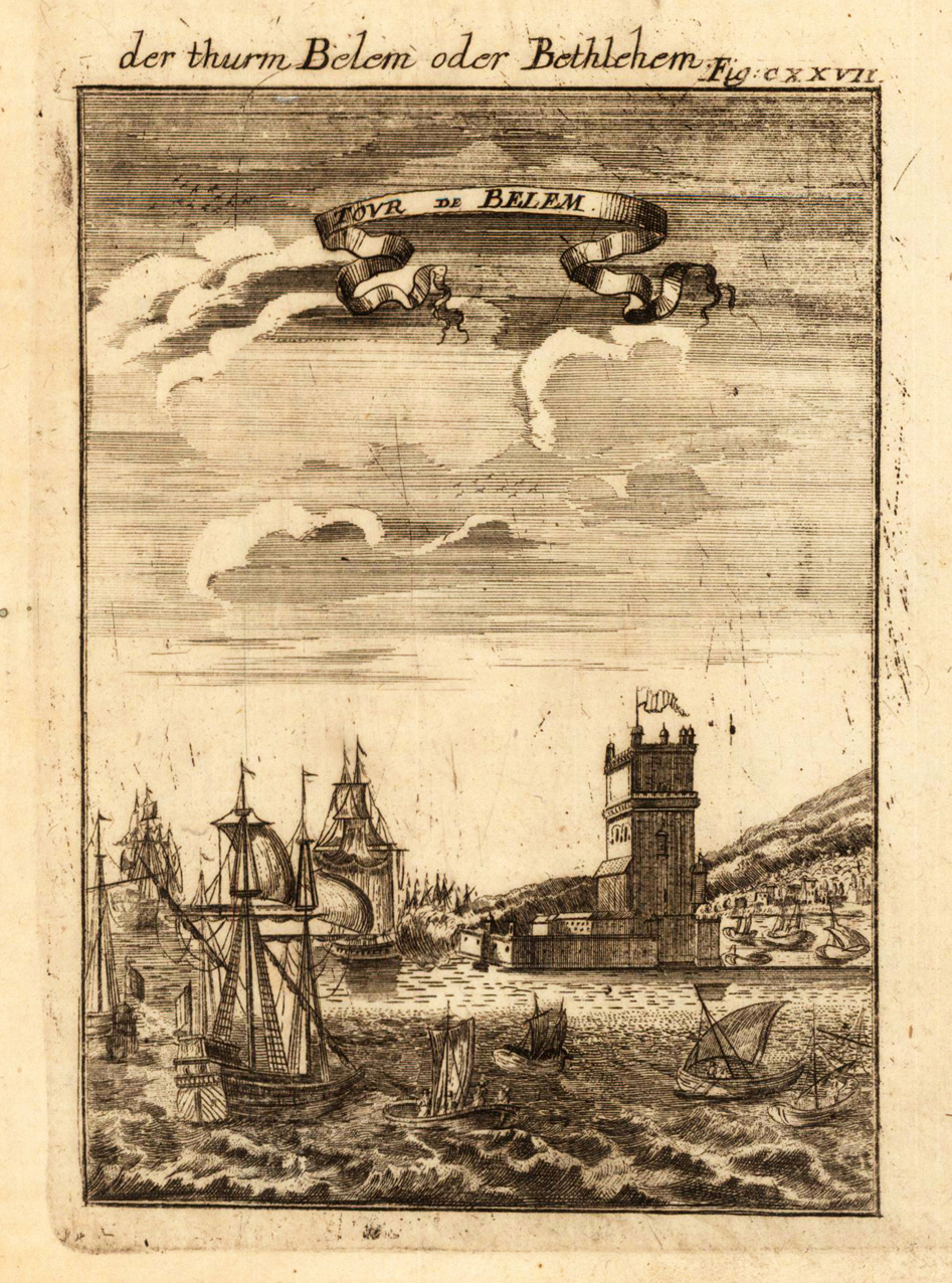
Copper engraving published in Allain M. Mallet's description of the world 'Description De L' Univers, Contenant Les Differents Systemes Du Monde, Les Cartes generales & particulieres ...'. French text edition with additional German titles on top. View of the tower of Belem (Jeronimos monastry in Lisboa).
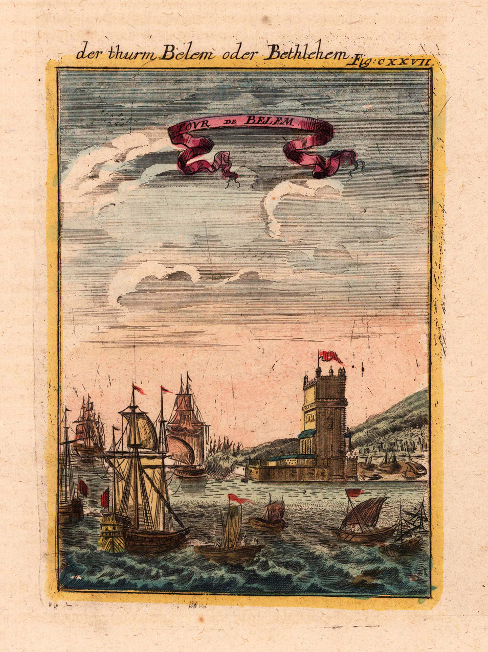
Copper engraving, hand colored in wash and outline, published in Allain Manesson Mallet's description of the world. This antique map shows us the tower of Belem. In the foreground the harbor with sailing ships.
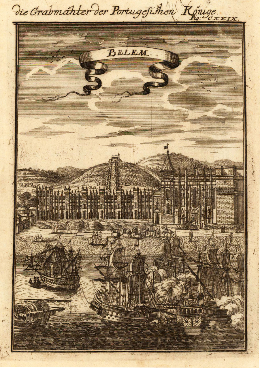
Copper engraving published in Allain M. Mallet's description of the world 'Description De L' Univers, Contenant Les Differents Systemes Du Monde, Les Cartes generales & particulieres ...'. French text edition with additional German titles on top. View of Belem (Jeronimos monastry in Lisboa) with the graves of the Portugese kings. In the foreground sailing firing their canons.
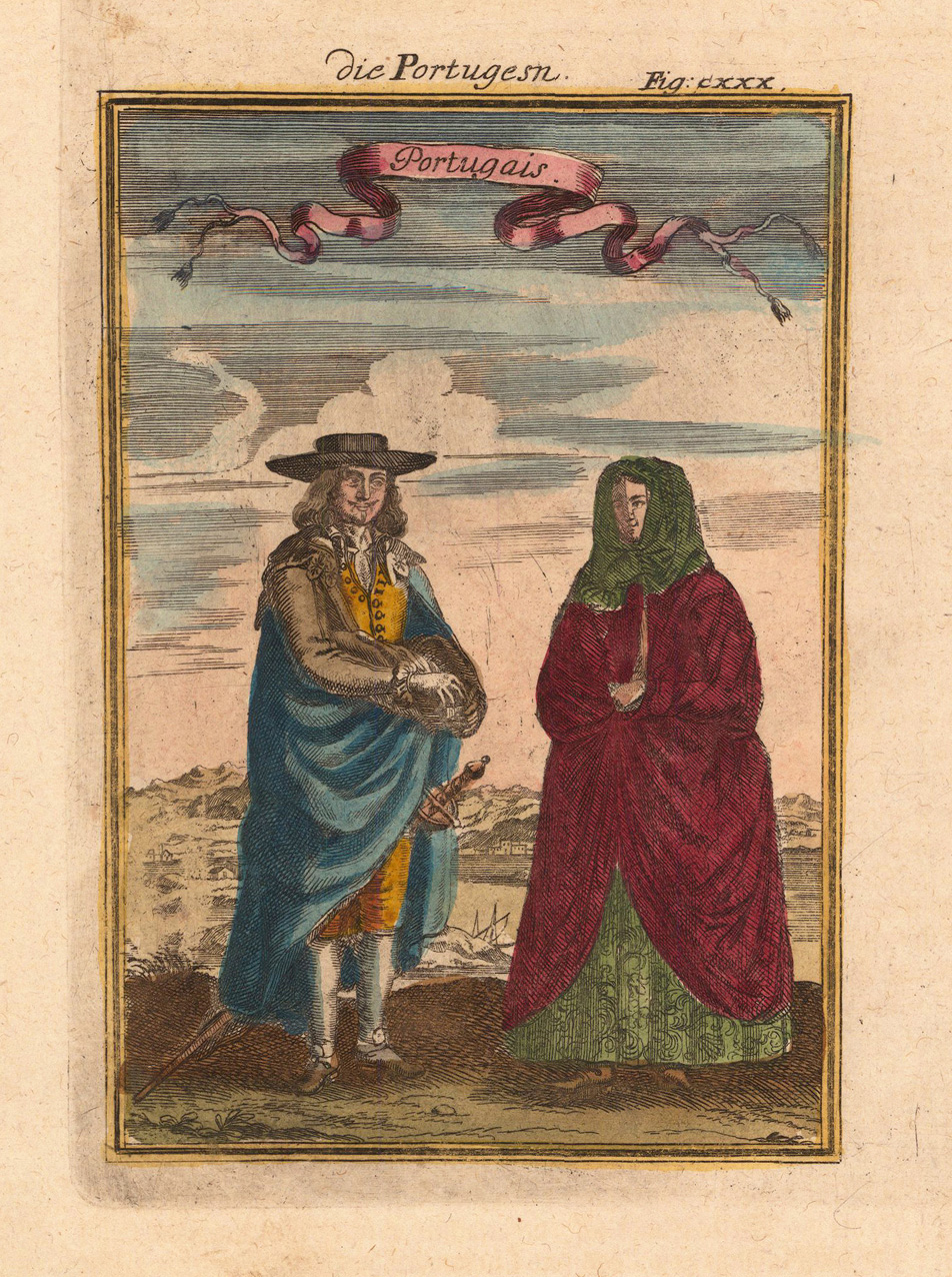
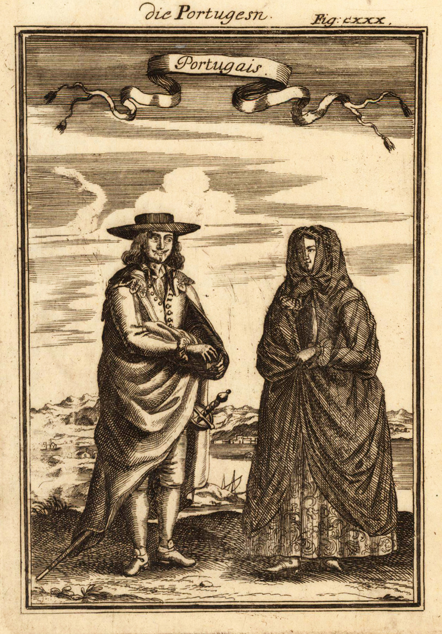
Copper-engraving, handcolored in wash and outline, published in Allain M. Mallet's description of the world. Decorative scene showing two Portugese citizens in their costumes.
Copper engraving published in Allain M. Mallet's description of the world 'Description De L' Univers, Contenant Les Differents Systemes Du Monde, Les Cartes generales & particulieres ...'. French text edition with additional German titles on top.
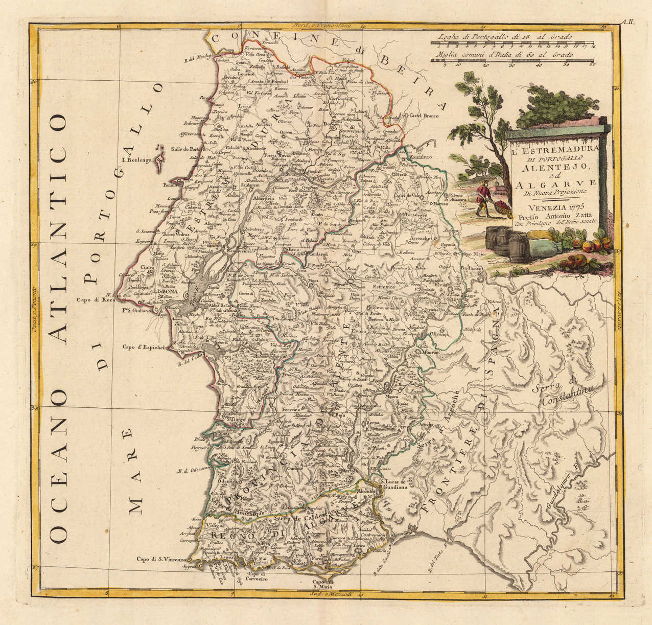
Copper engraving, in contemporary original color in outline. Published in Zatta's "Atlante Novissimo". Decorative map by the famous late 18th century north-italian cartographer Antonio Zatta. With many names of villages, as well engraved mountains and rivers are showns. The handcolored engraved title cartouche ornated with a landscape. A small milage scale.
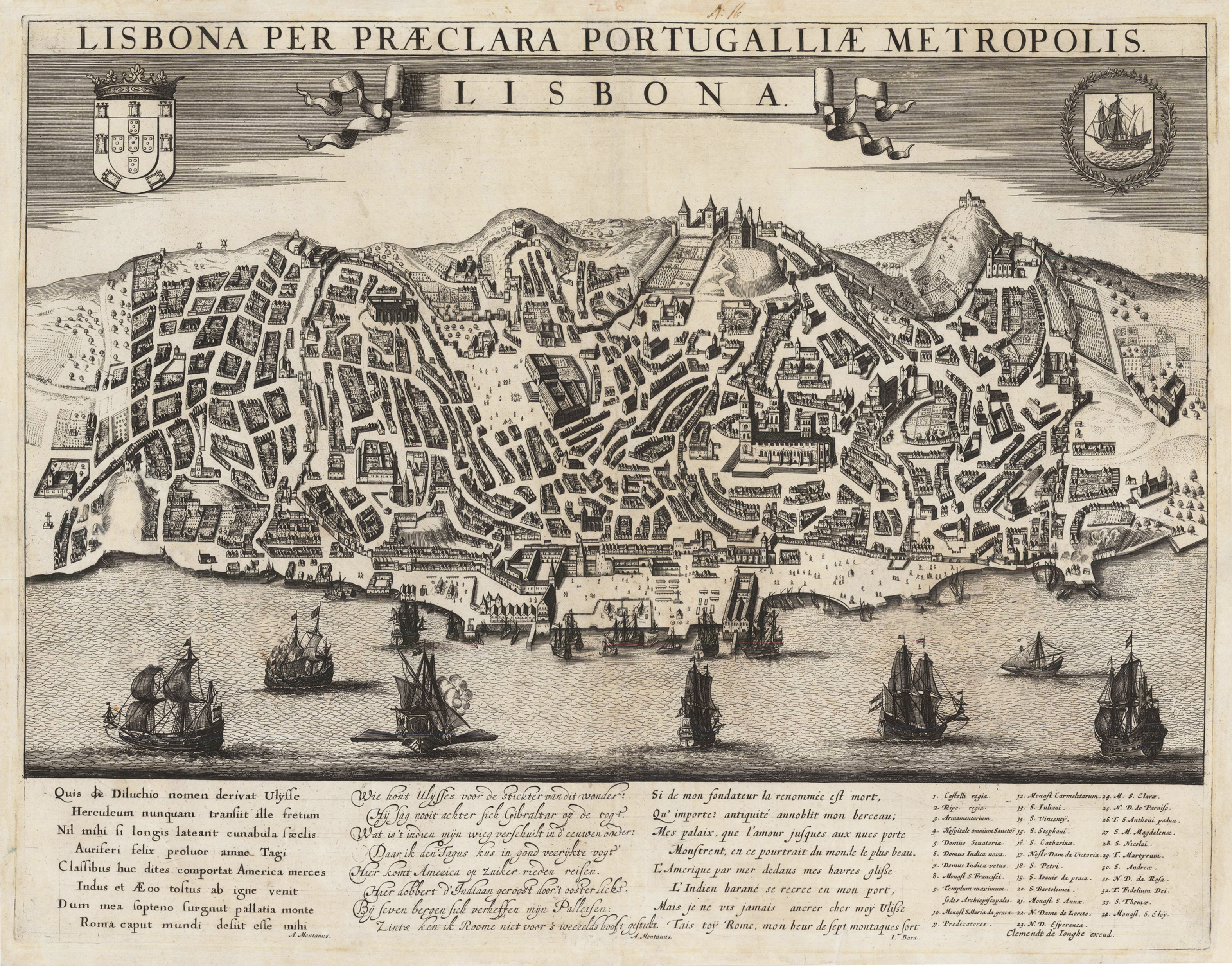
Original copper engraving, uncolored when published. This antique plan depicts a bird's eye view of the city of Lisboa with the town wall and the surrounding. On the top are the coat of arms of Lisboa and Portugal. At the bottom of the map with detailled text poems in Dutch, German and Latin by A. Montanus and I. Bara. Towards the right side with key numbers 1-34 of the buildings in Lisboa. This rare engraving was published c. 1690-95 by the famous Dutch map maker Frederic de Wit in Amsterdam. It seems, that it was published rarely and appeared only in very few Dutch atlases by Clemendt de Jonghe.
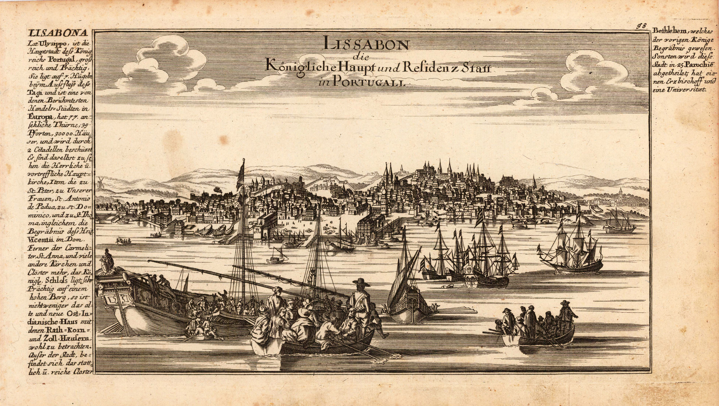
Original antique copper engraving, uncolored as published. This fine engraving shows the Portuguese capital city Lissbon and was published in Gabriel Bodenehr's famous serious "Europeans Macht und Pracht", a series of engravings depicting city views, plans, fortresses and castles in Europe. Many plates often are showing fortifications in Hungary and Southeast Europe, Spain, Belgium, Austria and Germany. Gabriel Bodenehr was during this period a successful publisher for maps and prints in Augsburg in Southern Germany. Gabriel Bodenehr the Elder (1664-1758 or 1673-1765) was a German map maker and member of a famous engraver and publisher family of Augsburg. His main work was "Atlas Curieux" first published 1704. He was the son of Johann Georg Bodenehr (1631-1703). Gabriel's son was Gabriel Bodenehr the Younger (1705–1792).
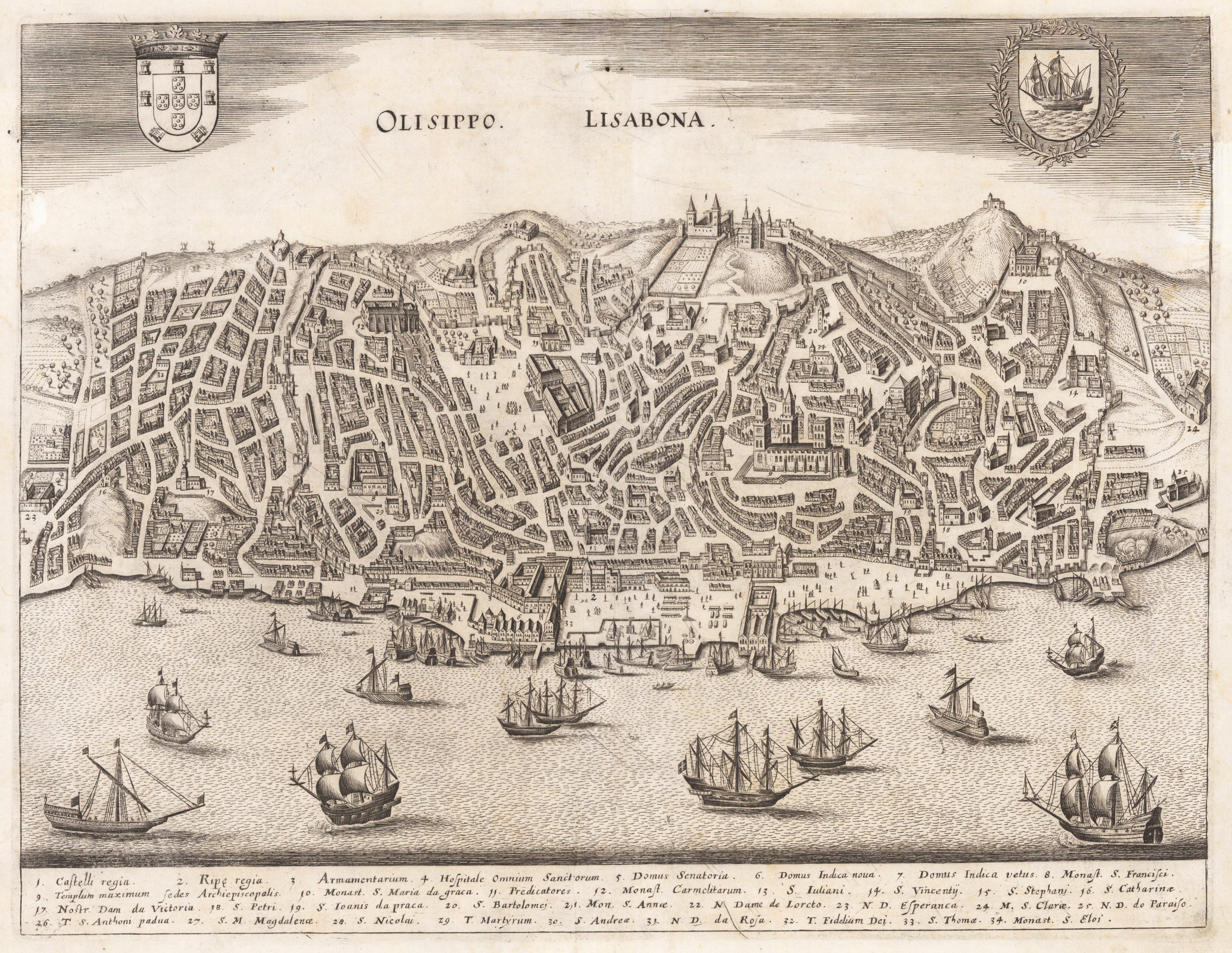
Original antique copper engraving. General view from a half bird's eye view of the Portuguese city of Lisbon. Michael Wening (born July 11, 1645 in Nuremberg; † April 18, 1718 in Munich) was court engraver for Elector Ferdinand Maria of Bavaria and his successor, Elector Max Emanuel. Wening's main work, Historico-Topographica Descriptio, shows 846 topographical views of Bavaria and is considered the most comprehensive description of the region in early modern Europe. Michael Wening was born in Nuremberg in 1645 as the son of the pig butcher Balthasar Wening and his wife Katharina. There he learned the craft of engraving. There is evidence of his stay in Munich since 1669, after he moved there from his hometown in 1668. In Munich, Wening converted from Protestantism to the Catholic Church. In 1671 he received permanent residency with Munich citizenship and married Anna Maria Mörl on January 27, 1671. At around the same time he found an irregular job at court, where as Fourier he was responsible for organizing trips and receptions. In the years that followed, Wening worked for various clients - including small orders. After he increasingly received orders as an engraver, he was appointed court engraver in 1675. Towards the end of the 1670s, Wening ran his own publishing house, where he successfully published illustrated calendars for over ten years. A series of copper engravings that he published in 1680 on the occasion of Elector Max Emanuel's 18th birthday and his assumption of power aroused his interest and led to the artist's success. In the same year, Wening was awarded the court office of an electoral "knight's room porter". During the Turkish Wars, the engraver documented Elector Max Emanuel's war successes. During this time, Wening created many battle depictions from the Turkish Wars for Elector Max Emanuel, which are still valued by historians today because they illustrate the events of that time. At the beginning of 1696, Wening suggested to his elector that he publish a topographical work with views and descriptions of all the cities, monasteries and castles in Bavaria. The models were works such as the Topographia Germaniae by Matthäus Merian, the Austrian topographies by Georg Matthäus Vischer and the never-printed preliminary work on the Latin topography of Bavaria by Philipp Apian. (Wikipedia)
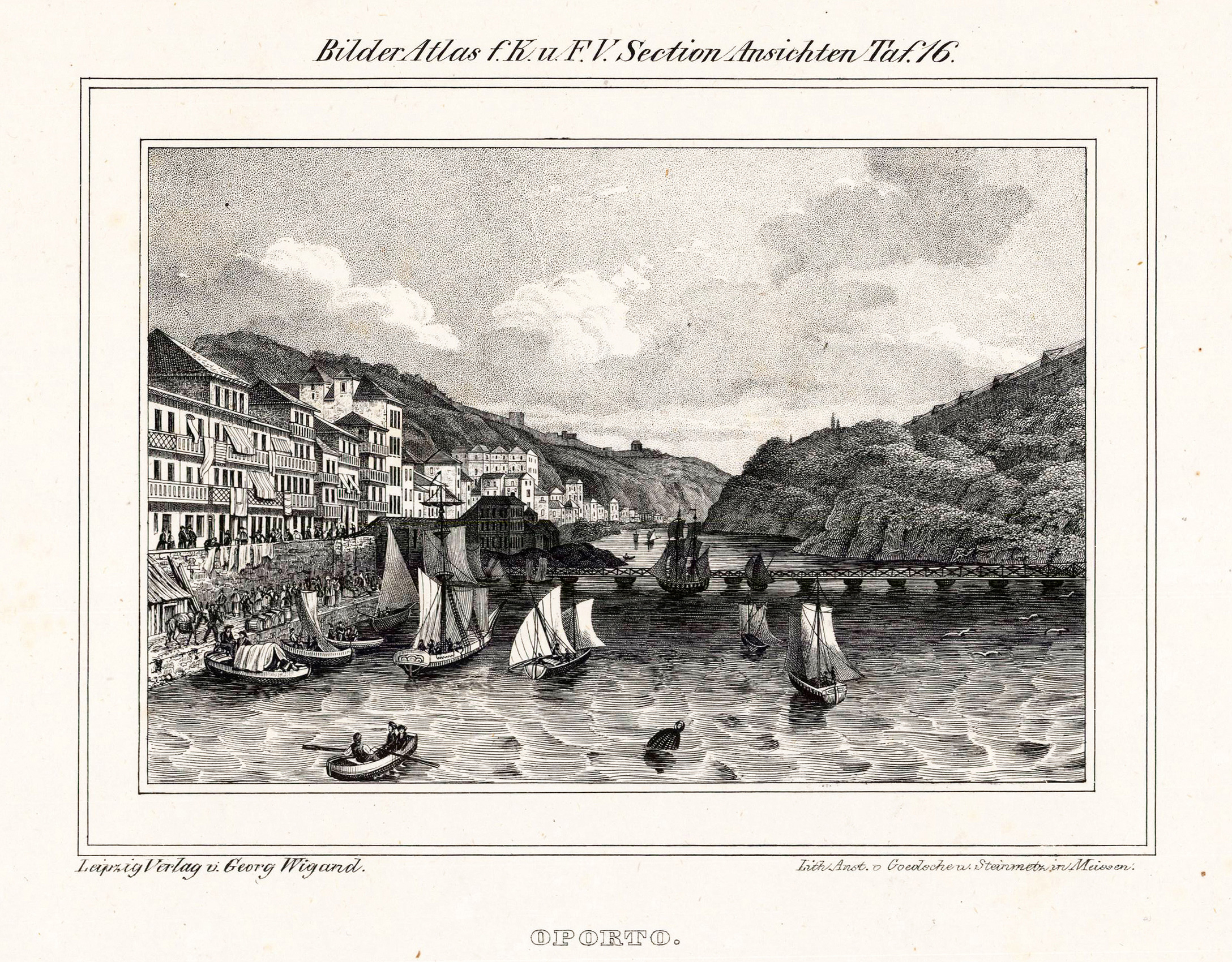
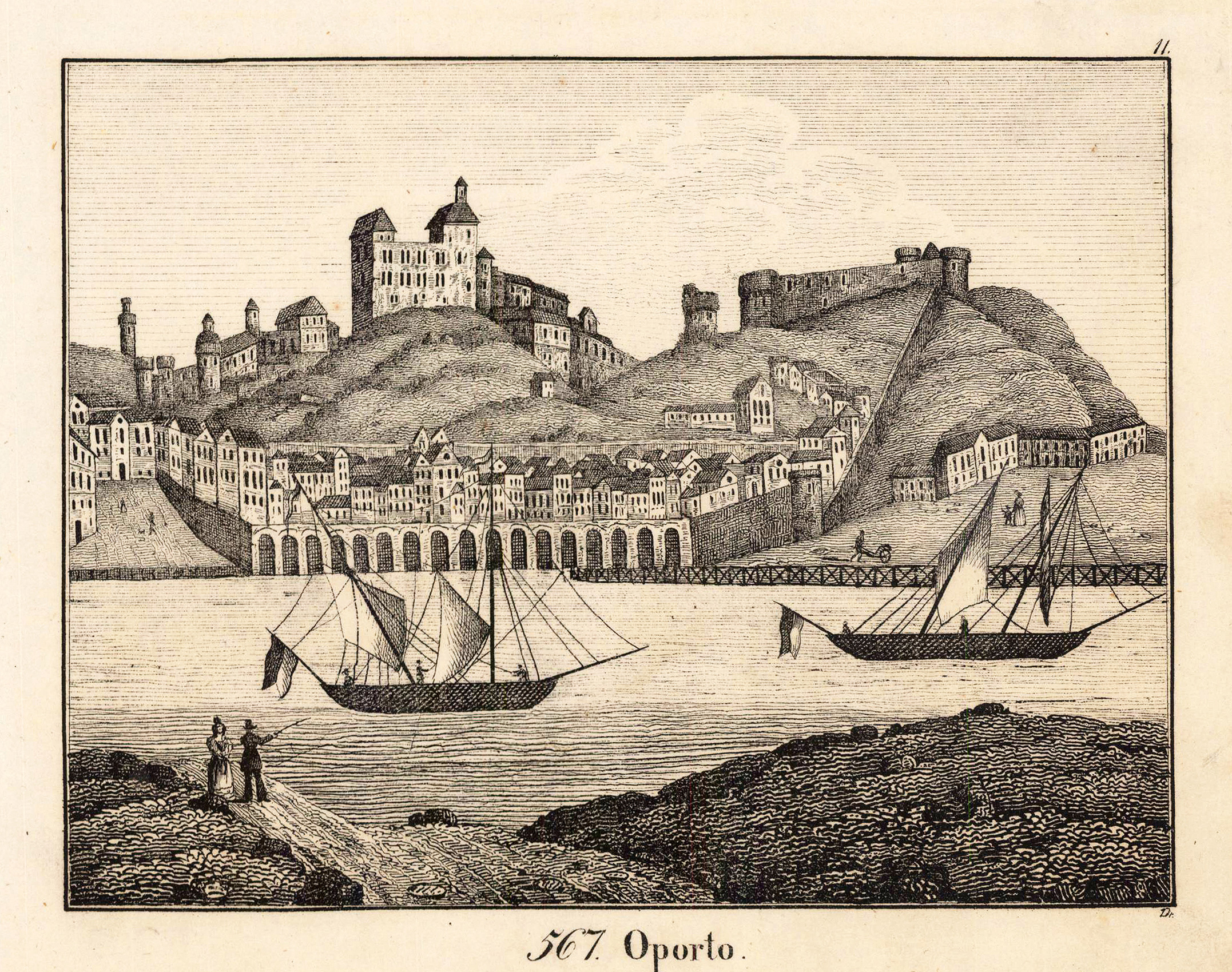
Lithograph, uncolored as published. Drawn after a sketch by Droese. View across the sea towards the city of Oporto in Portugal. Published in ,Neue Bildergallerie für die Jugend' in Gotha at Hellfrath.
Copper engraving, hand colored in outline, when published. Decorative map of Portugal. Divided up by outline color in its political regions. The map is giving many information on old cities and villages, as well mountains and rivers are shown. In the upper left corner ornated with a floral title cartouche, a milage scale in the lower left corner.