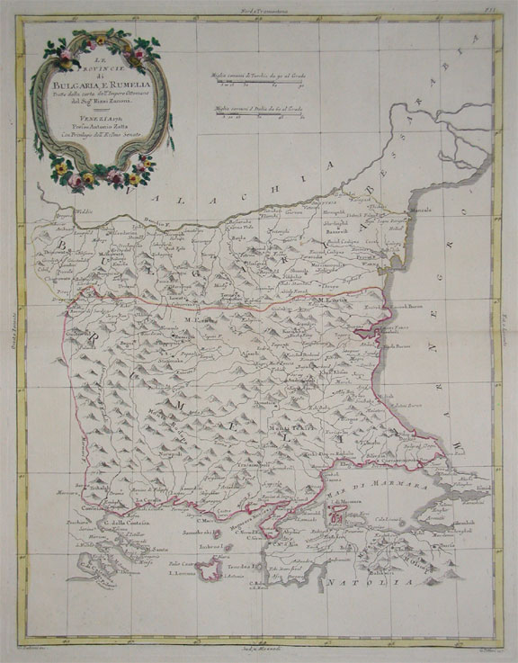
Copper engraving, in contemporary original color in outline. Published in Zatta's 'Atlante Novissimo'. Decorative map by the famous late 18th century north-italian cartographer Antonio Zatta. With many names of villages, as well engraved mountains and rivers are shown. The hand colored engraved title cartouche floral ornated. Two small mileage scales.
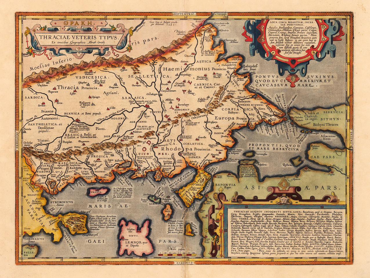
Original antique copper engraving, published 1624 in the famous historical Atlas "Parergon" (Latin text-edition) by Abraham Ortelius. Finely hand colored in wash and outline. Fine and early historical map on Thracia. The area on this map covers mainly Thracia in Northern Greece and parts of Romania. The map is ornated with three cartouches, in the upper left corner the title cartouche, on the lower and upper right side we find text cartouches. Villages and towns are shown as miniature views. Ortelius was born on 14 April 1527 in the city of Antwerp, which was then in the Habsburg Netherlands (modern-day Belgium). The Orthellius family were originally from Augsburg, a Free imperial city of the Holy Roman Empire. In 1535, the family had fallen under suspicion of Protestantism. Following the death of Ortelius's father, his uncle Jacobus van Meteren returned from religious exile in England to take care of Ortelius. Abraham remained close to his cousin Emanuel van Meteren, who would later move to London. In 1575 he was appointed geographer to the king of Spain, Philip II, on the recommendation of Arias Montanus, who vouched for his orthodoxy. He travelled extensively in Europe and is specifically known to have traveled throughout the Seventeen Provinces; in southern, western, northern, and eastern Germany (e.g., 1560, 1575–1576); France (1559–1560); England and Ireland (1576); and Italy (1578, and perhaps twice or thrice between 1550 and 1558). Beginning as a map-engraver, in 1547 he entered the Antwerp Guild of Saint Luke as an illuminator of maps. He supplemented his income trading in books, prints, and maps, and his journeys included yearly visits to the Frankfurt book and print fair, where he met Gerardus Mercator in 1554. In 1560, however, when travelling with Mercator to Trier, Lorraine, and Poitiers, he seems to have been attracted, largely by Mercator's influence, towards the career of a scientific geographer. (Wikipedia)
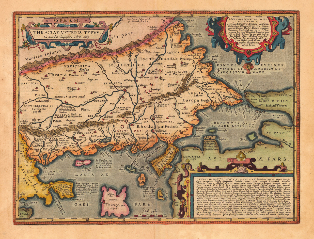
Original copper engraving, published 1624 in the famous historical Atlas "Parergon" (Latin text-edition) by Abraham Ortelius. Finely hand colored in wash and outline. Fine and early historical map on Thracia. The area on this map covers mainly Thracia in Northern Greece and parts of Romania. The map is ornated with three cartouches, in the upper left corner the title cartouche, on the lower and upper right side we find text cartouches. Villages and towns are shown as miniature views. Ortelius was born on 14 April 1527 in the city of Antwerp, which was then in the Habsburg Netherlands (modern-day Belgium). The Orthellius family were originally from Augsburg, a Free imperial city of the Holy Roman Empire. In 1535, the family had fallen under suspicion of Protestantism. Following the death of Ortelius's father, his uncle Jacobus van Meteren returned from religious exile in England to take care of Ortelius. Abraham remained close to his cousin Emanuel van Meteren, who would later move to London. In 1575 he was appointed geographer to the king of Spain, Philip II, on the recommendation of Arias Montanus, who vouched for his orthodoxy. He travelled extensively in Europe and is specifically known to have traveled throughout the Seventeen Provinces; in southern, western, northern, and eastern Germany (e.g., 1560, 1575–1576); France (1559–1560); England and Ireland (1576); and Italy (1578, and perhaps twice or thrice between 1550 and 1558). Beginning as a map-engraver, in 1547 he entered the Antwerp Guild of Saint Luke as an illuminator of maps. He supplemented his income trading in books, prints, and maps, and his journeys included yearly visits to the Frankfurt book and print fair, where he met Gerardus Mercator in 1554. In 1560, however, when travelling with Mercator to Trier, Lorraine, and Poitiers, he seems to have been attracted, largely by Mercator's influence, towards the career of a scientific geographer. (Wikipedia)
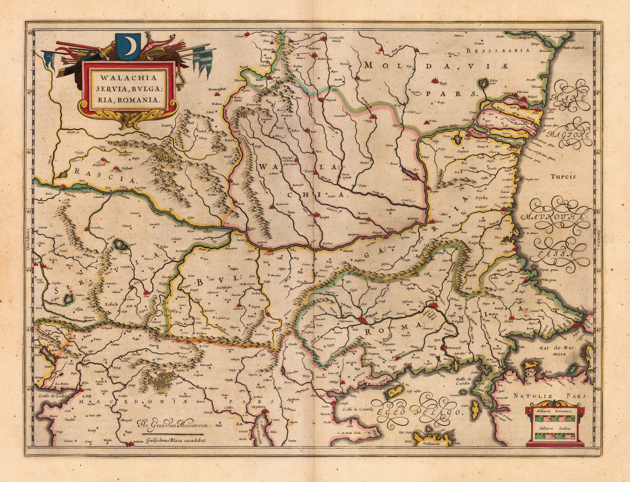
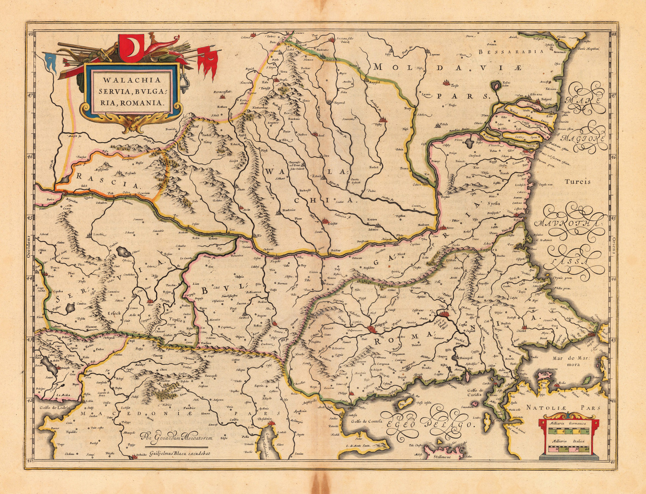
Original antique copper engraving, hand colored in outline published in Joan Blaeu's 'Atlas Novus'. Published in Blaeu's 'Atlas Major' (Latin edition), a very fine copy in excellent contemporary hand-color. This antique map shows Walachia, Serbia, Bulgaria and Romania in Southeast Europe. This map is with many details engraved, rivers, mountains, place names, etc. In the left upper corner is a allegoric title cartouche (weapons to the Turkish war) and in the right lower side is a little mileage scale. Joan Blaeu (23 September 1596 – 21 December 1673) was a Dutch cartographer born in Alkmaar, the son of cartographer Willem Blaeu. In 1620 he became a doctor of law but he joined the work of his father. In 1635 they published the Atlas Novus (full title: Theatrum orbis terrarum, sive, Atlas novus) in two volumes. Joan and his brother Cornelius took over the studio after their father died in 1638. Joan became the official cartographer of the Dutch East India Company. Blaeu's world map, Nova et Accuratissima Terrarum Orbis Tabula, incorporating the discoveries of Abel Tasman, was published in 1648. This map was revolutionary in that it "depicts the solar system according to the heliocentric theories of Nicolaus Copernicus, which show the earth revolving around the sun.... Although Copernicus's groundbreaking book On the Revolutions of the Spheres had been first printed in 1543, just over a century earlier, Blaeu was the first mapmaker to incorporate this revolutionary heliocentric theory into a map of the world." Blaeu's map was copied for the map of the world set into the pavement of the Groote Burger-Zaal of the new Amsterdam Town Hall, designed by the Dutch architect Jacob van Campen (now the Amsterdam Royal Palace), in 1655. Blaeu's Hollandia Nova was also depicted in his Archipelagus Orientalis sive Asiaticus published in 1659 in the Kurfürsten Atlas (Atlas of the Great Elector). and used by Melchisédech Thévenot to produce his map, Hollandia Nova—Terre Australe (1664). As Joan Blaeu, he also published the 12 volume "Le Grand Atlas, ou Cosmographie blaviane, en laquelle est exactement descritte la terre, la mer, et le ciel". One edition is dated 1663. That was folio (540 x 340 mm), and contained 593 engraved maps and plates. In March 2015, a copy was on sale for £750,000. Around 1649 Joan Blaeu published a collection of Dutch city maps named Toonneel der Steeden (Views of Cities). In 1651 he was voted into the Amsterdam council. In 1654 Joan published the first atlas of Scotland, devised by Timothy Pont. In 1662 he reissued the Atlas Novus, also known as Atlas Maior, in 11 volumes, and one for oceans.[citation needed] A cosmology was planned as their next project, but a fire destroyed the studio completely in 1672. (Wikipedia)
Original antique copper engraving, hand colored in outline published in Joan Blaeu's 'Atlas Novus'. This antique map shows Walachei in Southeastern Europe. The map is equipped with many details like mountains, rivers, place names, woods, etc. In the upper left corner we find the allegoric title cartouche. A small mileage scale is in the lower right corner in a cartouche. Joan Blaeu (23 September 1596 – 21 December 1673) was a Dutch cartographer born in Alkmaar, the son of cartographer Willem Blaeu. In 1620 he became a doctor of law but he joined the work of his father. In 1635 they published the Atlas Novus (full title: Theatrum orbis terrarum, sive, Atlas novus) in two volumes. Joan and his brother Cornelius took over the studio after their father died in 1638. Joan became the official cartographer of the Dutch East India Company. Blaeu's world map, Nova et Accuratissima Terrarum Orbis Tabula, incorporating the discoveries of Abel Tasman, was published in 1648. This map was revolutionary in that it "depicts the solar system according to the heliocentric theories of Nicolaus Copernicus, which show the earth revolving around the sun.... Although Copernicus's groundbreaking book On the Revolutions of the Spheres had been first printed in 1543, just over a century earlier, Blaeu was the first mapmaker to incorporate this revolutionary heliocentric theory into a map of the world." Blaeu's map was copied for the map of the world set into the pavement of the Groote Burger-Zaal of the new Amsterdam Town Hall, designed by the Dutch architect Jacob van Campen (now the Amsterdam Royal Palace), in 1655. Blaeu's Hollandia Nova was also depicted in his Archipelagus Orientalis sive Asiaticus published in 1659 in the Kurfürsten Atlas (Atlas of the Great Elector). and used by Melchisédech Thévenot to produce his map, Hollandia Nova—Terre Australe (1664). As Joan Blaeu, he also published the 12 volume "Le Grand Atlas, ou Cosmographie blaviane, en laquelle est exactement descritte la terre, la mer, et le ciel". One edition is dated 1663. That was folio (540 x 340 mm), and contained 593 engraved maps and plates. In March 2015, a copy was on sale for £750,000. Around 1649 Joan Blaeu published a collection of Dutch city maps named Toonneel der Steeden (Views of Cities). In 1651 he was voted into the Amsterdam council. In 1654 Joan published the first atlas of Scotland, devised by Timothy Pont. In 1662 he reissued the Atlas Novus, also known as Atlas Maior, in 11 volumes, and one for oceans.[citation needed] A cosmology was planned as their next project, but a fire destroyed the studio completely in 1672. (Wikipedia)