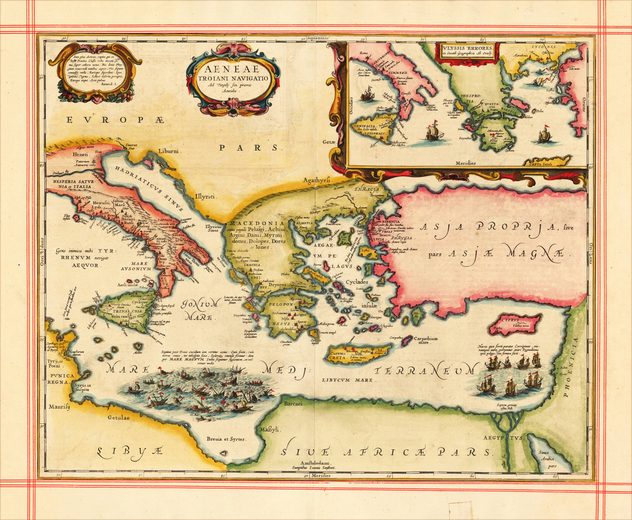
Original antique copper engraving, decorative hand colored in outline and wash. A highly decorative map, which is ornated with a large decorative title cartouche at the upper centre. Equipped with an inset map in the upper right corner. Johannes Janssonius (1588, Arnhem – buried July 11, 1664, Amsterdam) (born Jan Janszoon, in English also Jan Jansson) was a Dutch cartographer and publisher who lived and worked in Amsterdam in the 17th century. Janssonius was born in Arnhem, the son of Jan Janszoon the Elder,[1] a publisher and bookseller. In 1612 he married Elisabeth de Hondt, the daughter of Jodocus Hondius. He produced his first maps in 1616 of France and Italy. In 1623 Janssonius owned a bookstore in Frankfurt am Main, later also in Danzig, Stockholm, Copenhagen, Berlin, Königsberg, Geneva and Lyon. Elisabeth Hondius died in 1627 and he remarried Elisabeth Carlier in 1629. In the 1630s he formed a partnership with his brother in law Henricus Hondius, and together they published atlases as Mercator/Hondius/Janssonius. Under the leadership of Janssonius the Hondius Atlas was steadily enlarged. Renamed Atlas Novus, it had three volumes in 1638, one fully dedicated to Italy. In 1646, a fourth volume came out with "English County Maps", a year after a similar issue by Joan Blaeu. Janssonius' maps are similar to those of Blaeu, and he is often accused of copying from his rival, but many of his maps predate those of Blaeu and/or covered different regions. By 1660, at which point the atlas bore the appropriate name "Atlas Major", there were 11 volumes, containing the work of about a hundred credited authors and engravers. It included a description of "most of the cities of the world" (Townatlas), of the waterworld (Atlas Maritimus in 33 maps), and of the Ancient World (60 maps). The eleventh volume was the Atlas of the Heavens by Andreas Cellarius. Editions were printed in Dutch, Latin, French, and a few times in German. After Janssonius's death, the publishing company was continued by his son-in law, Johannes van Waesbergen. The London bookseller Moses Pitt attempted publication of the Atlas Major in English, but ran out of resources after the fourth volume in 1683. (Wikipedia)
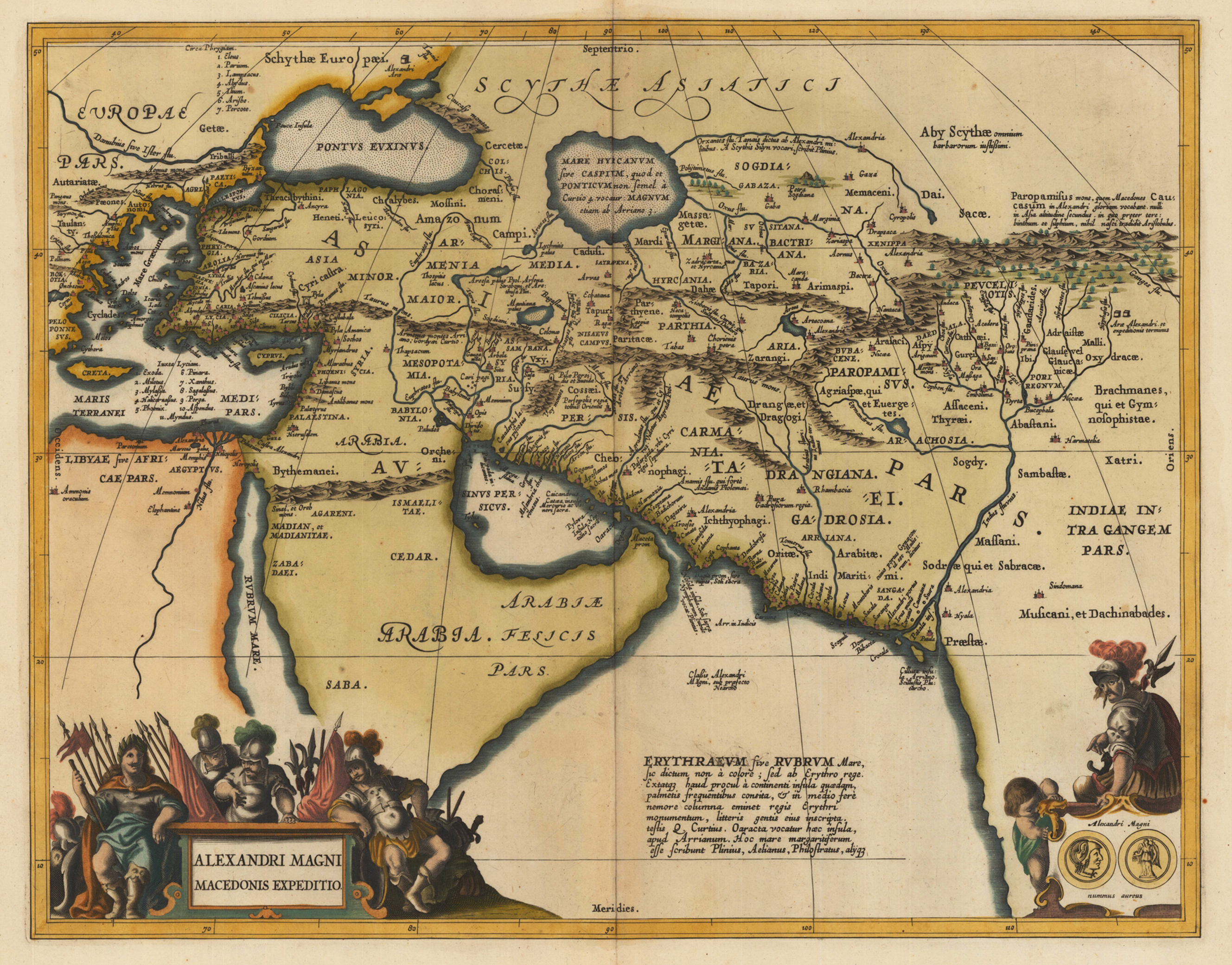
Copper engraving, decorative hand colored in outline and wash. Published in a Latin text edition of Joan. Jansson's historical Atlas, verso blank. The map shows the region covered by Alexander the Great, ornated with two cartouches. In the lower left corner the title cartouche, on the lower right side a small decorative cartouche showing coins and a warrior. Villages and towns are shown as miniature views, as well rivers and mountains are engraved.
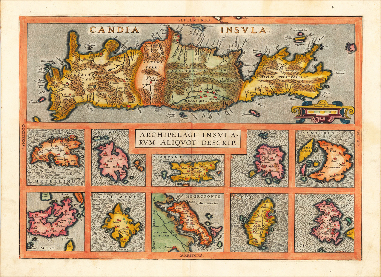
Original antique copper engraving, published 1598 in a French edition of the "Theatrum Orbis Terrarum". Finely hand-colored in wash and outline. Decorative map showing eleven maps of the Greek Archipelago in the Mediterranean on one doublepage plate. The title of the map appears in the centre, the upper part of the map is a large map of Candia (Crete), already with many names of villages and other small places. Below are ten more small insets of Greek islands in the Archipelago (Metellino, Cerigo, Scarpanto, Nicsia, Santorini, Milos, Stalimente, Negroponte, Rhodos and Scios). Ortelius was born on 14 April 1527 in the city of Antwerp, which was then in the Habsburg Netherlands (modern-day Belgium). The Orthellius family were originally from Augsburg, a Free imperial city of the Holy Roman Empire. In 1535, the family had fallen under suspicion of Protestantism. Following the death of Ortelius's father, his uncle Jacobus van Meteren returned from religious exile in England to take care of Ortelius. Abraham remained close to his cousin Emanuel van Meteren, who would later move to London. In 1575 he was appointed geographer to the king of Spain, Philip II, on the recommendation of Arias Montanus, who vouched for his orthodoxy. He travelled extensively in Europe and is specifically known to have traveled throughout the Seventeen Provinces; in southern, western, northern, and eastern Germany (e.g., 1560, 1575–1576); France (1559–1560); England and Ireland (1576); and Italy (1578, and perhaps twice or thrice between 1550 and 1558). Beginning as a map-engraver, in 1547 he entered the Antwerp Guild of Saint Luke as an illuminator of maps. He supplemented his income trading in books, prints, and maps, and his journeys included yearly visits to the Frankfurt book and print fair, where he met Gerardus Mercator in 1554. In 1560, however, when travelling with Mercator to Trier, Lorraine, and Poitiers, he seems to have been attracted, largely by Mercator's influence, towards the career of a scientific geographer. (Wikipedia)
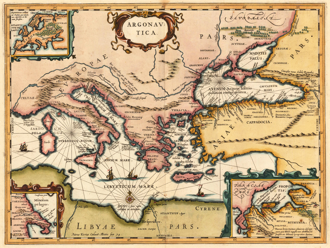
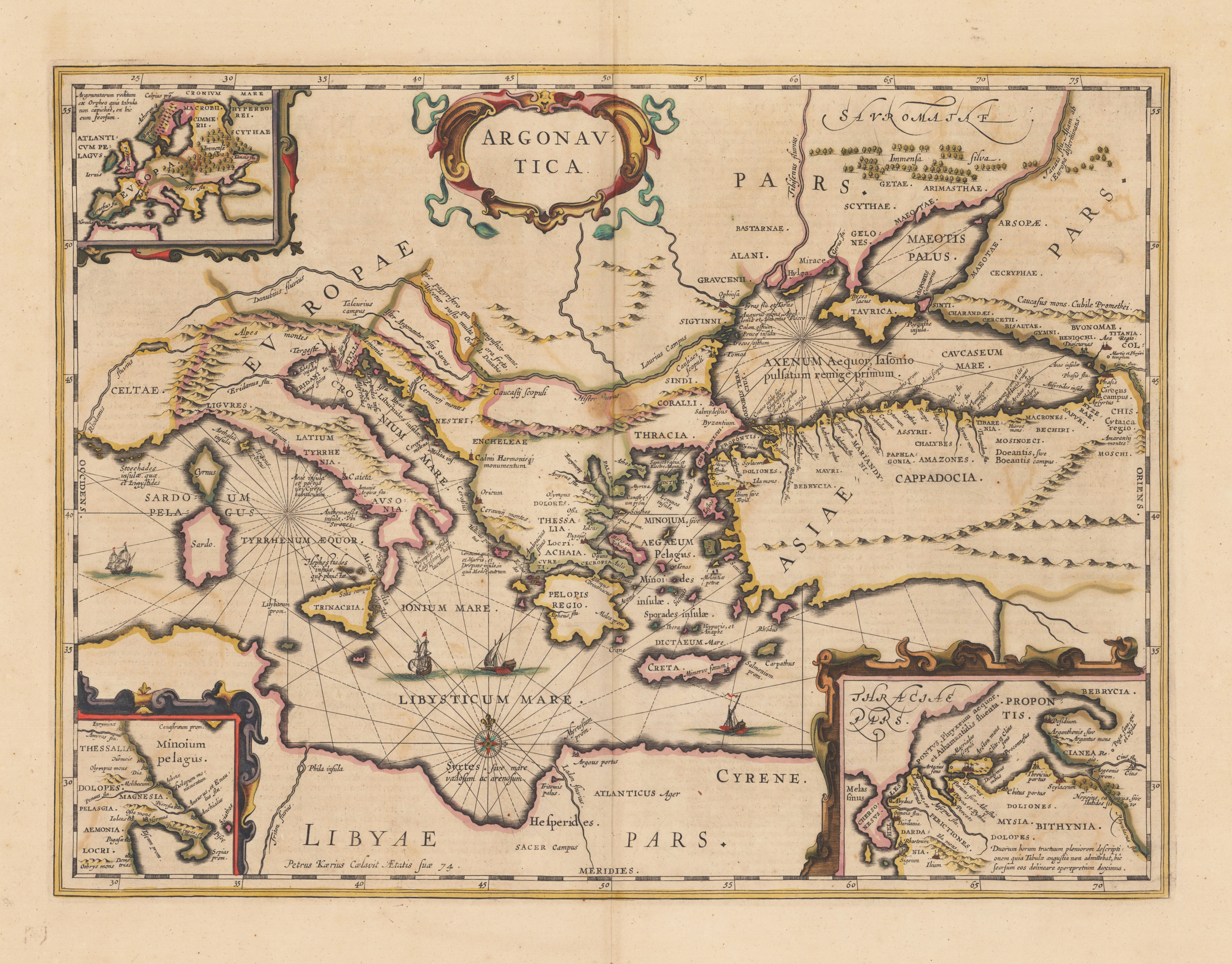
Copper engraving, decorative hand colored in outline and wash. Published in a Latin text edition of Joan. Jansson's historical Atlas, verso blank. A highly decorative map, which is ornated with a large decorative title cartouche at the upper centre. Equipped with three inset maps: Europe, 'Minoium pelagus' and 'Propontis' (Sea of Marmara).
Original antique copper engraving, decorative hand colored in outline. Published in a Latin text edition of J. Jansson's historical Atlas. A highly decorative map, which is ornated with a large decorative title cartouche at the upper centre. Equipped with three inset maps: Europe, 'Minoium pelagus' and 'Propontis' (Sea of Marmara). Johannes Janssonius (1588, Arnhem – buried July 11, 1664, Amsterdam) (born Jan Janszoon, in English also Jan Jansson) was a Dutch cartographer and publisher who lived and worked in Amsterdam in the 17th century. Janssonius was born in Arnhem, the son of Jan Janszoon the Elder, a publisher and bookseller. In 1612 he married Elisabeth de Hondt, the daughter of Jodocus Hondius. He produced his first maps in 1616 of France and Italy. In 1623 Janssonius owned a bookstore in Frankfurt am Main, later also in Danzig, Stockholm, Copenhagen, Berlin, Königsberg, Geneva and Lyon. His wife Elisabeth died in 1627 and he married Elisabeth Carlier in 1629. He formed a partnership with his brother in law Henricus Hondius, and together they published atlases as Mercator/Hondius/Janssonius. Under the leadership of Janssonius the Hondius Atlas was steadily enlarged. Renamed Atlas Novus, it had three volumes in 1638, one fully dedicated to Italy. In 1646, a fourth volume came out with "English County Maps", a year after a similar issue by Joan Blaeu. Janssonius' maps are similar to those of Blaeu, and he is often accused of copying from his rival, but many of his maps predate those of Blaeu and/or covered different regions. By 1660, at which point the atlas bore the appropriate name "Atlas Major", there were 11 volumes, containing the work of about a hundred credited authors and engravers. It included a description of "most of the cities of the world" (Townatlas), of the waterworld (Atlas Maritimus in 33 maps), and of the Ancient World (60 maps). The eleventh volume was titled Atlas of the Heavens (a type of celestial cartography) by Andreas Cellarius. Editions were printed in Dutch, Latin, French, and a few times in German. After Janssonius's death, the publishing company was continued by his son-in law, Johannes van Waesbergen. The London bookseller Moses Pitt attempted publication of the Atlas Major in English, but ran out of resources after the fourth volume in 1683. (Wikipedia)
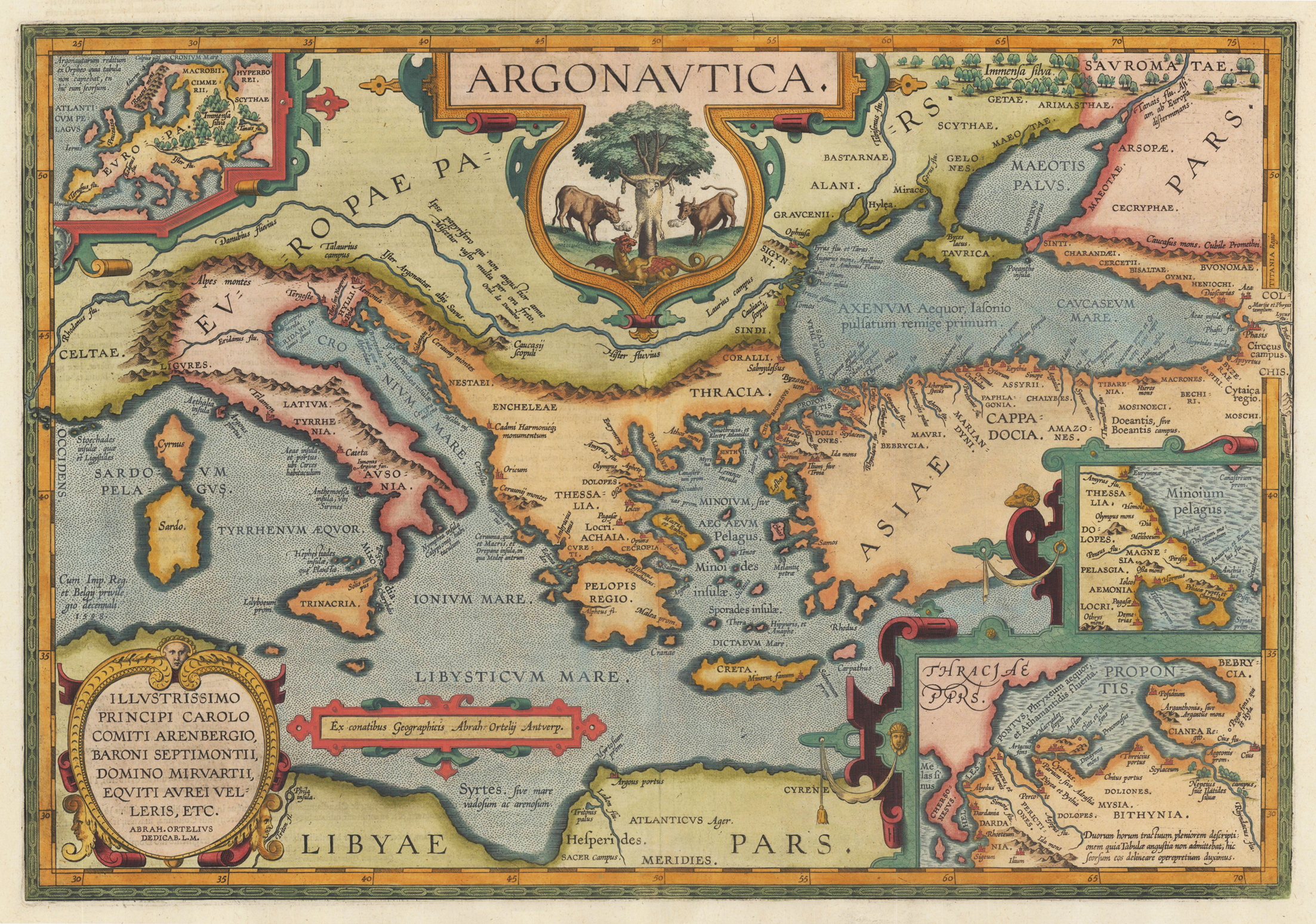
Original copper engraving, published 1612 in the famous historical Atlas "Parergon" (Latin text-edition) by Abraham Ortelius. Finely later hand-colored in wash and outline. Ortelius is here depicting the roaming of Iason and his companions in their quest for the Golden Fleece, on their ship named Argo. Ortelius, basing himself on a host of classical authors, counts more then 80 Argonauts by name, and provides sources for each of them as he established them in ancient writings (Broe.). In the top centre of this historical map we find a decorative title cartouche ornated with animals, in the lower left corner a text cartouche with dedication by Abraham Ortelius to duke Carol of Arenberg. The map shows three inset maps, one in the upper left corner (a map of ancient Europe), two in the lower left corner (Central Greece and the Sea of Marmara).
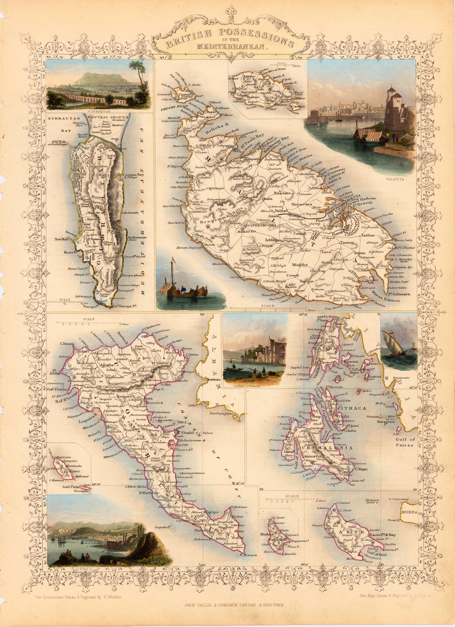
Steel engraving, hand colored in outline and wash. Decorative arranged map showing British possessions in the Mediterranean Sea. Four maps on one sheet: Malta & Gozo with an inset view of La Valetta. - Gibraltar with a panoramic inset view - Corfu with the neighboring island Paxo, equipped with an inset view of the city of Corfu - the islands Cephalonia, Zantos, Cerigo and Ithaca, equipped with an inset view of Ithaca. All maps engraved with many details of place names, rivers, mountains and streets. A highly decorative map.
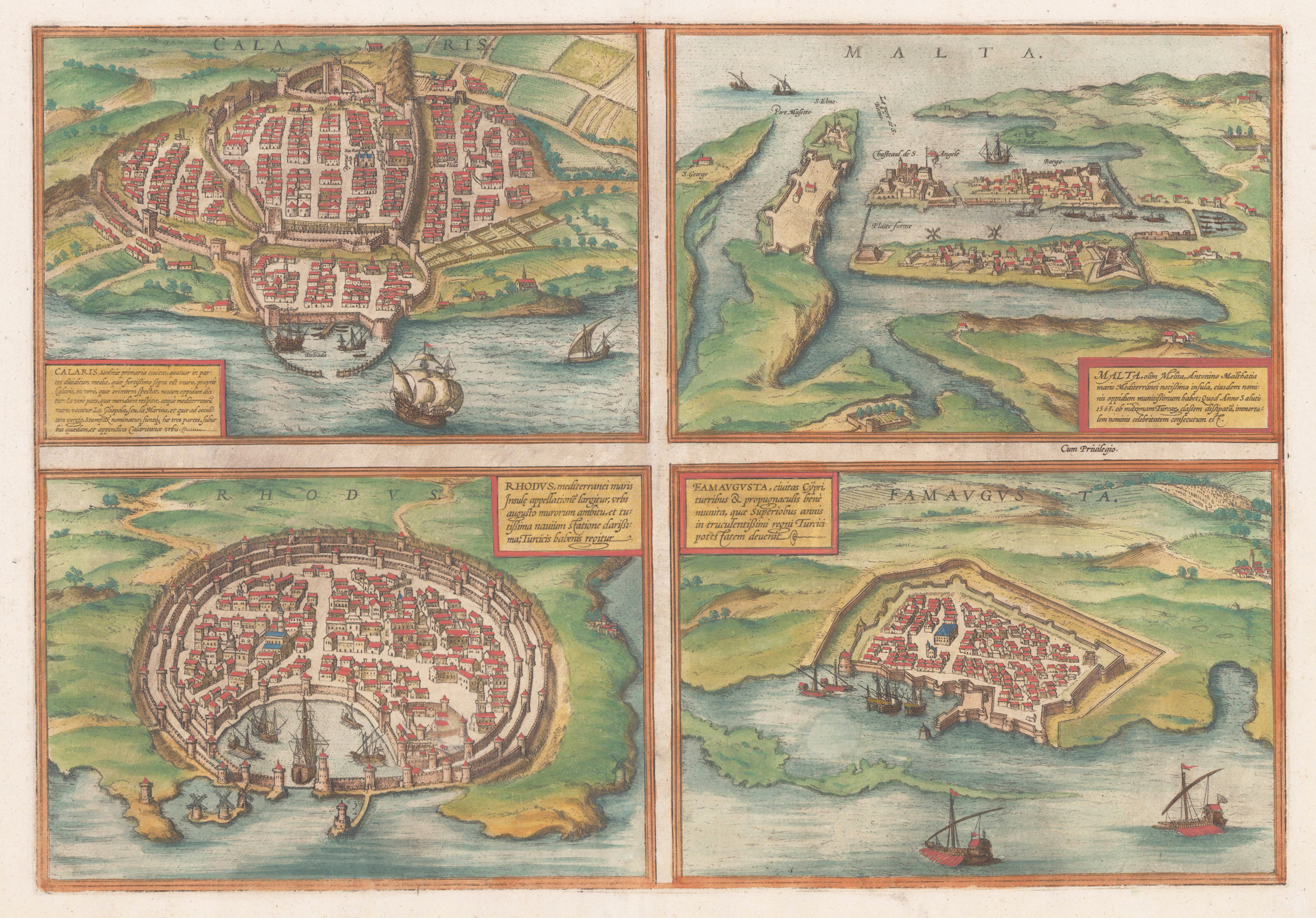
Copper engraving, hand colored in outline and wash, published in a Latin text edition of the townbook "Civitates Orbis Terrarum" by Georg Braun and Franz Hogenberg. The entire series of the 'Civitates Orbis Terrarum' comprised six volumes and was published and printed from 1572 towards 1619. Detailed bird's eye views of four major fortified cities on islands in the Mediterranean Sea. Depicted are the city of Calaris in Sardegnia, Malta, Rhodos and Famagusta in Cyprus.
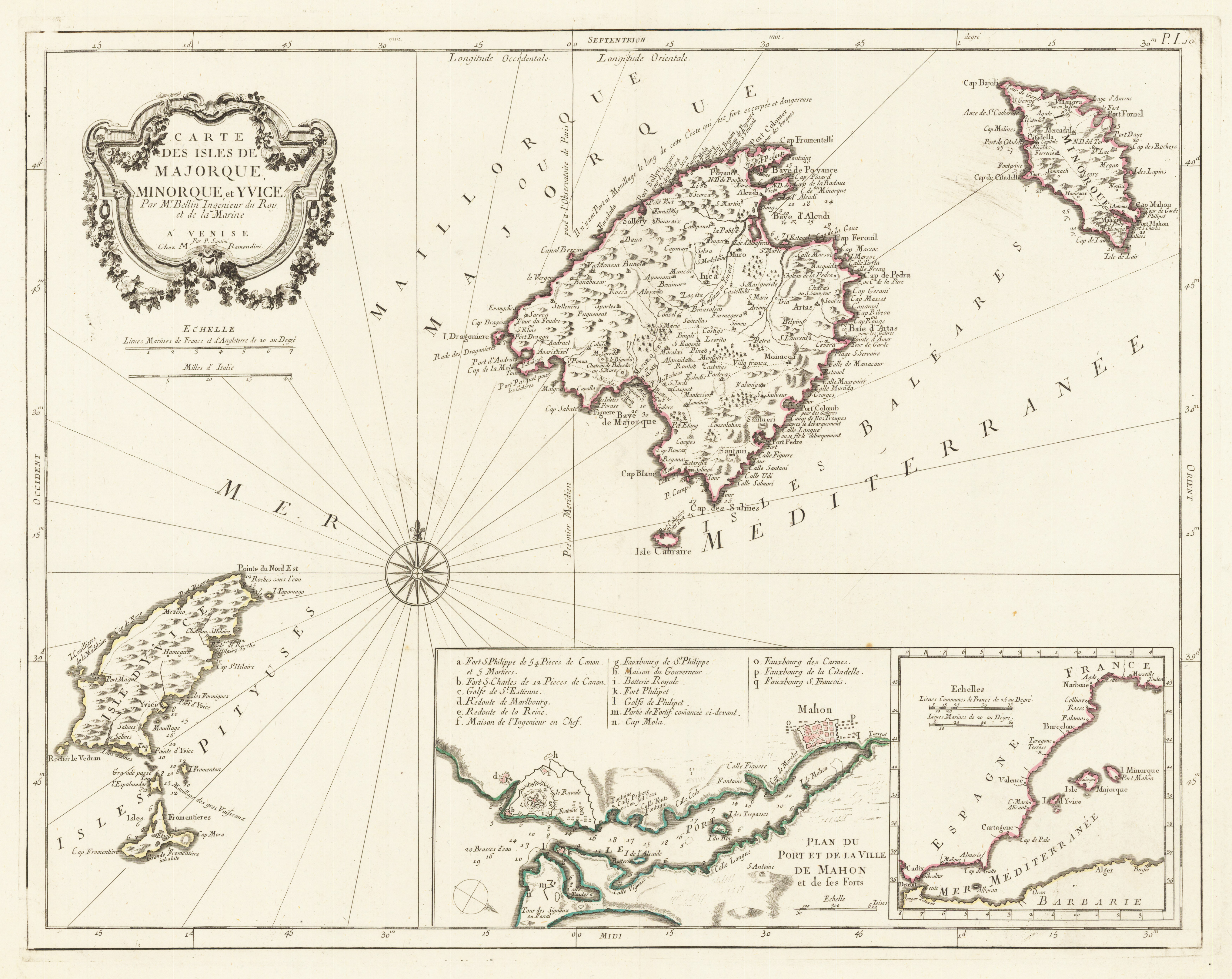
Copper engraving, hand colored in outline. This beautiful antique map shows the islands Mallorca, Minorca, Isles Pityses, an inset map with parts of the spanish coast and the fort Mahon. The decorative title cartouche and two mileage scales (french and italian) are in the upper left corner. A compass rose is in the middle of the left part on the map. The map first appeared in Santini's Atlas Universel in 1776-79 in Paris. In 1784 Santini sold the plates of the maps to M. Remondini, who published then these maps in Venice with his additional imprint in the title cartouches.
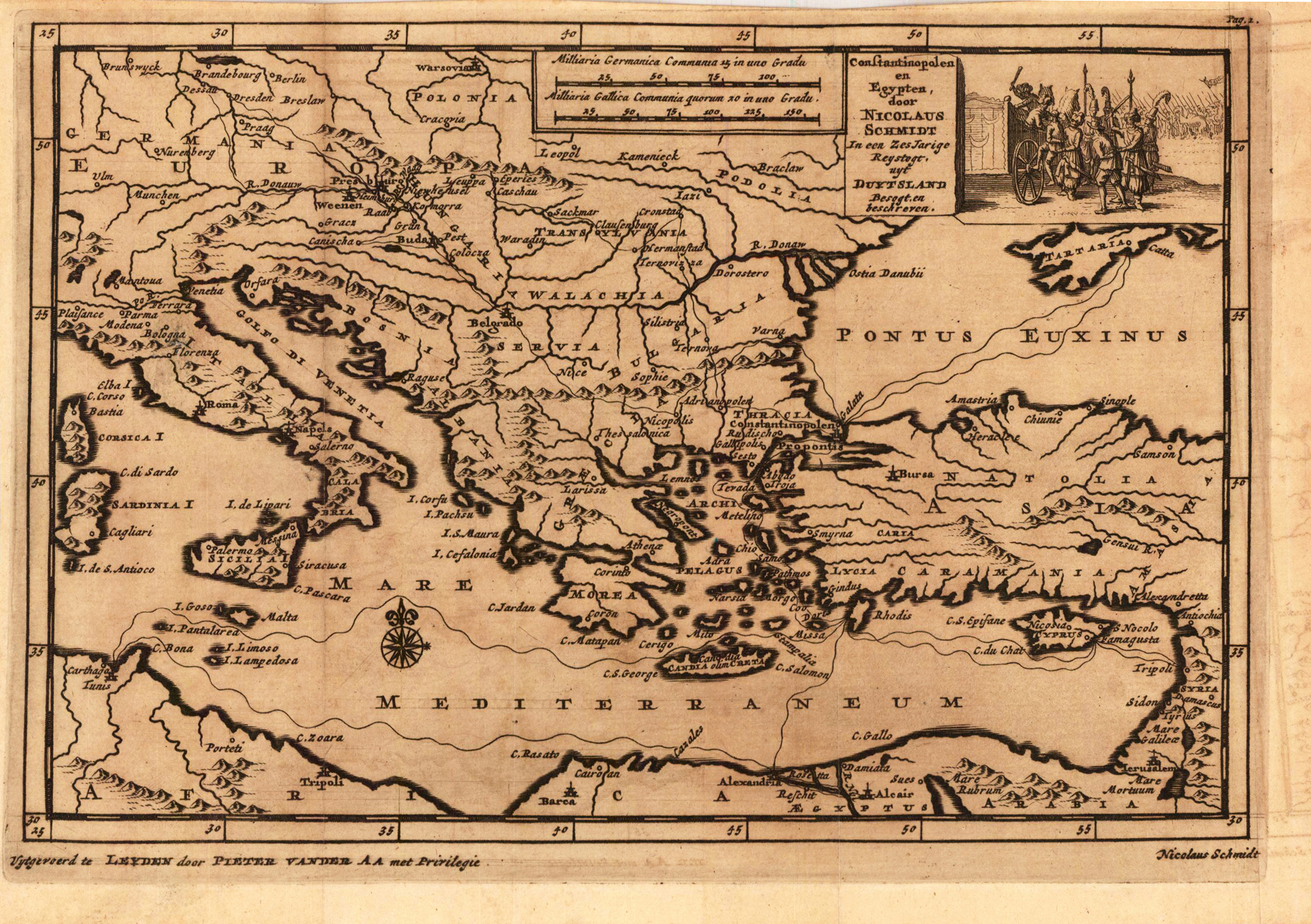
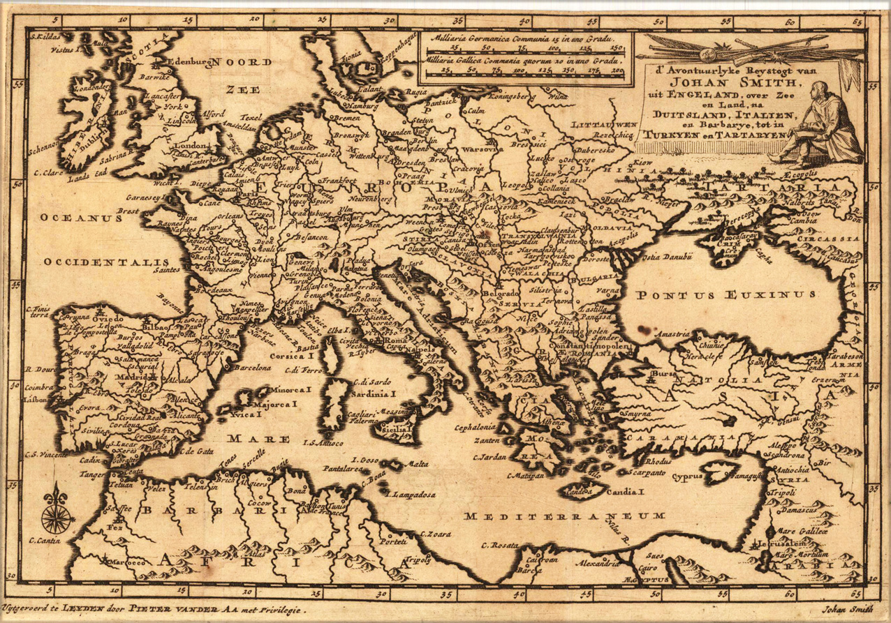
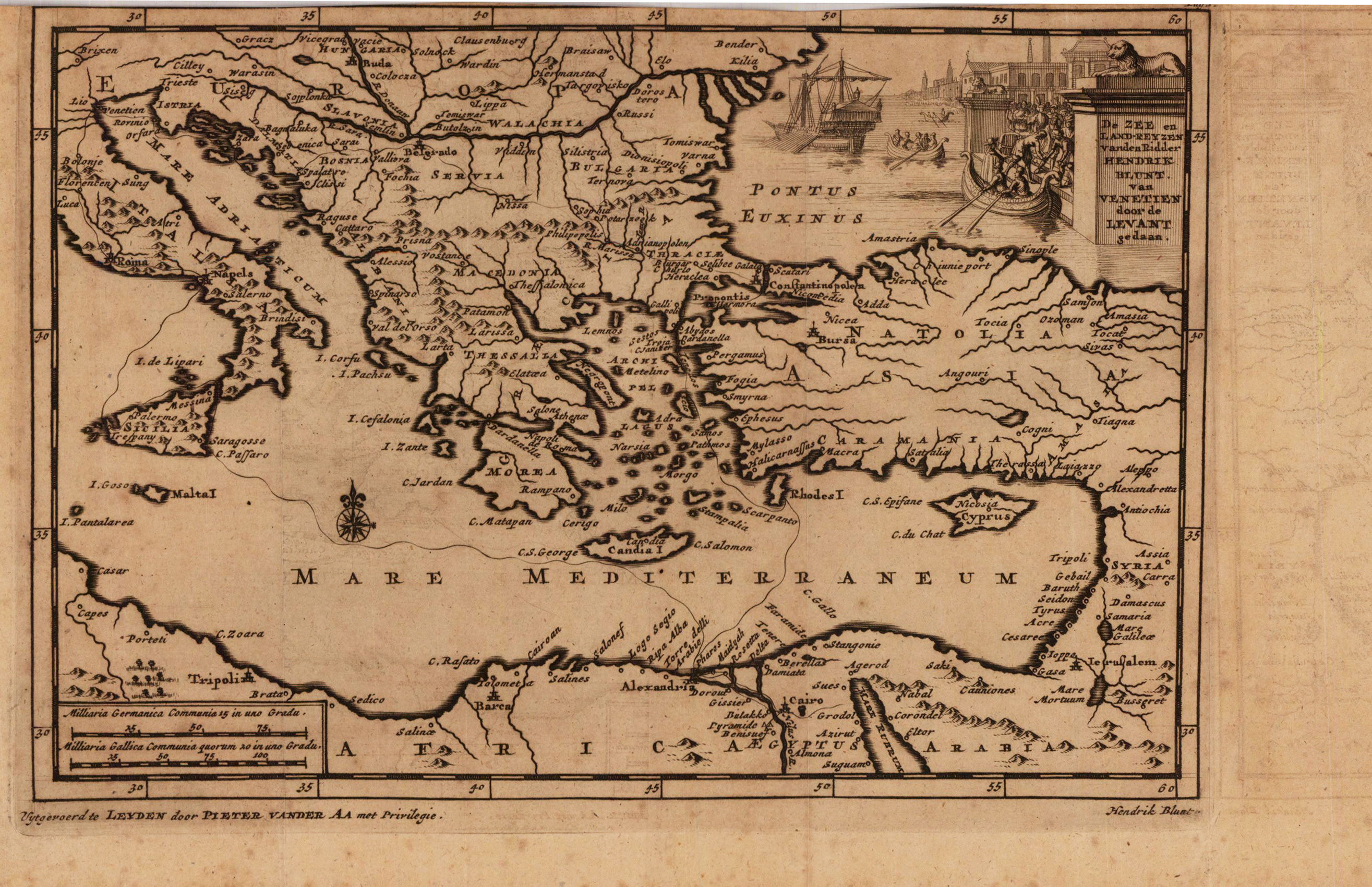
Original copper-engraving, uncoloured as published. The famous Dutch publisher and mapmaker Pieter Van der Aa (1659 Leiden - 1733 Leiden) published during the period 1882-1733, an enormous quantity of printed matter (Koeman). This map was actually published in the first edition of his travelbooks Naauwkeurige versameling der gedenk-waardigste zee en landreysen na Oost en West-Indien, in Leiden 1706-08.
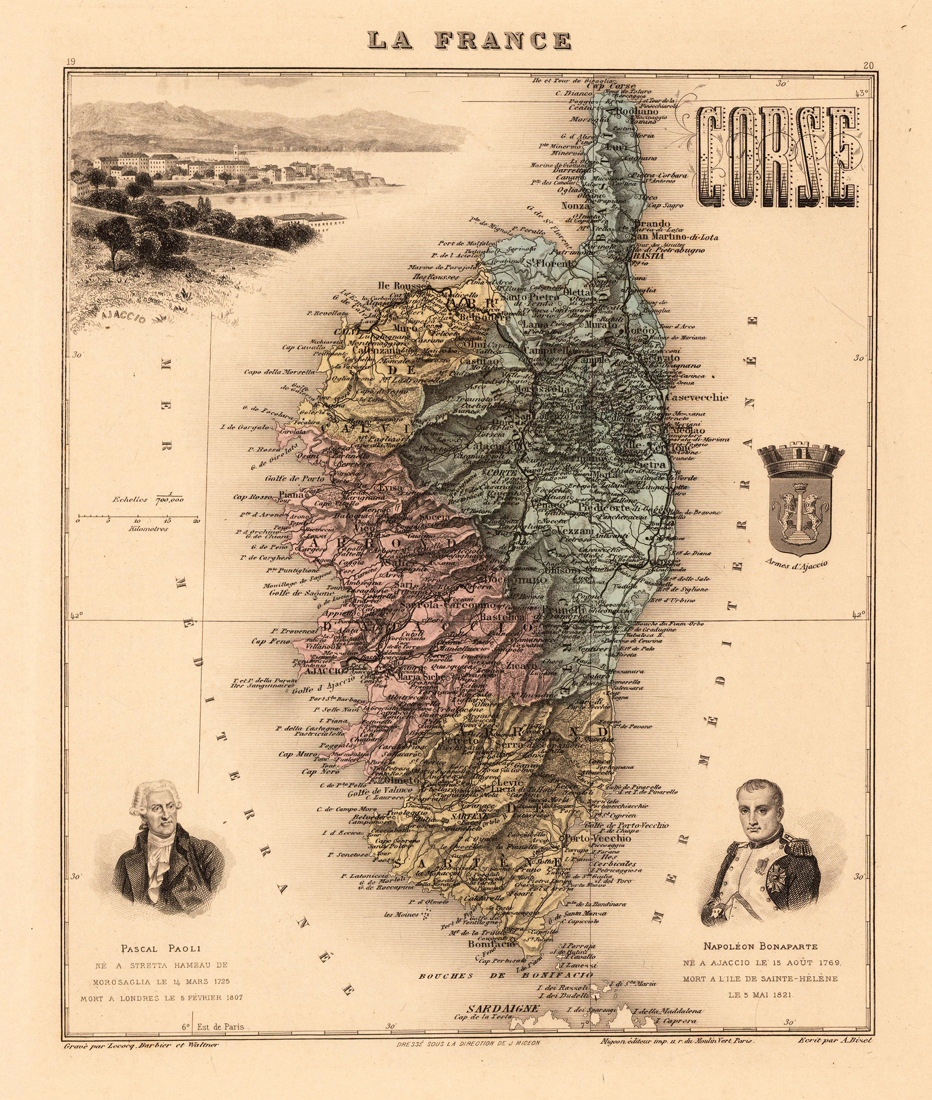
Steel engraving, hand colored in outline and wash when published. Detailed map of the French colony Corsica. The decorative map of Corsica is nicely and detailed engraved, many place names, rivers, mountains and other details are engraved. A pretty nineteenth century collector's piece.
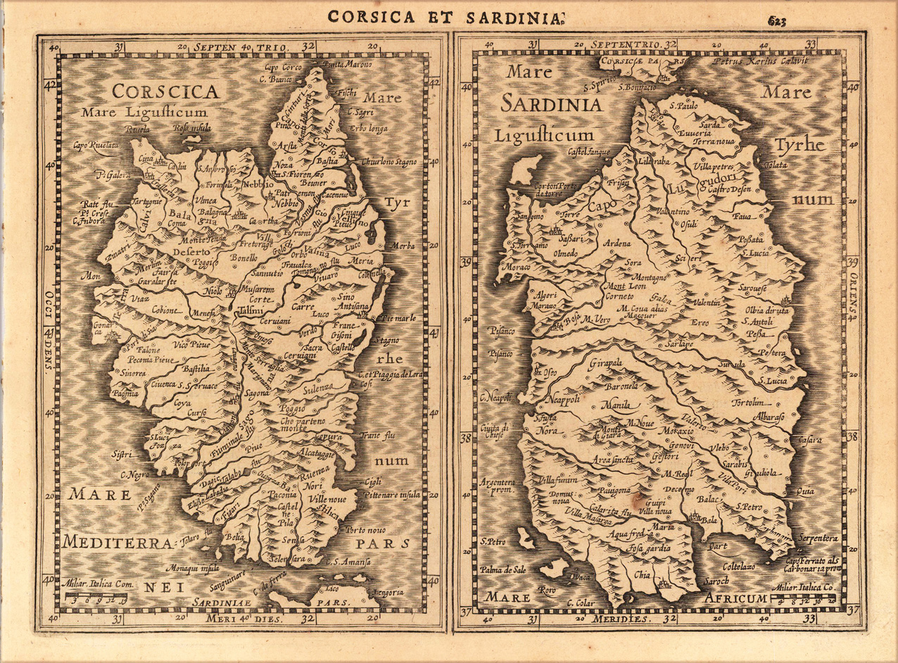
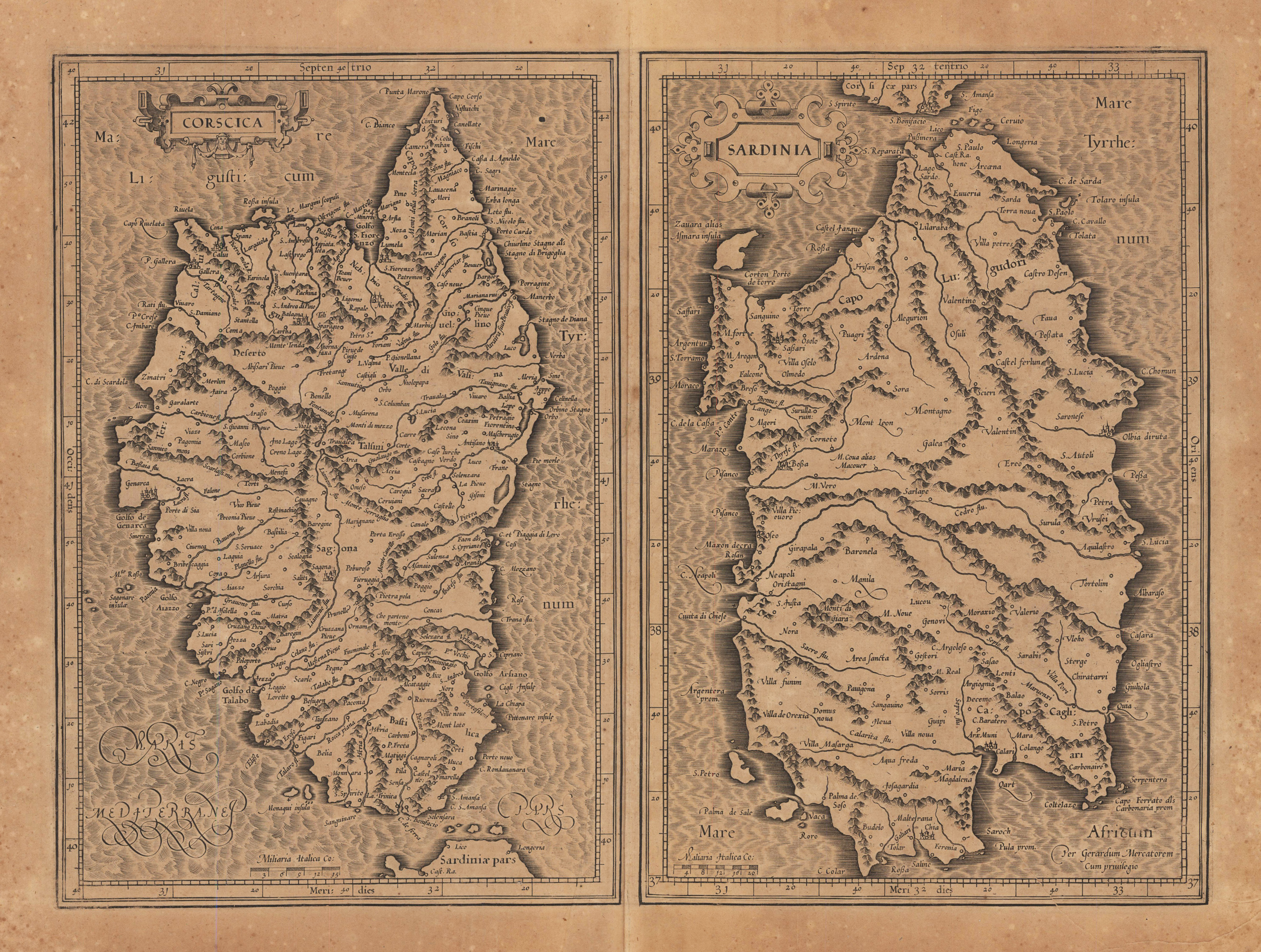
Original antique copper engraving, uncolored as published. A fine copy in a dark impression, full margins as published. This is an engraved map of the islands of Corsica and Sardinia. The two maps are on one folio sheet. This is the first so-called Cloppenburgh editions which was a competive edition with new engraved maps in a larger format. Most of the maps were engraved by Pieter van den Keere. The Cloppenburgh edition was continued for a couple of years but seems to have been suppressed after 1636 ... . This is another Cloppenburgh edition, now with Latin text. The maps from the Appendix have been incorporated. The title-page is followed by a dedication to Prince Frederik Hendrik, dated 1632 and signed by Johannes Cloppenburgh. (Koeman Atlantes Neerlandici). Gerardus Mercator (5 March 1512 – 2 December 1594) was a 16th-century geographer, cosmographer and cartographer from the County of Flanders. He is most renowned for creating the 1569 world map based on a new projection which represented sailing courses of constant bearing (rhumb lines) as straight lines—an innovation that is still employed in nautical charts. Mercator was one of the pioneers of cartography and is widely considered the most notable figure of the school in its golden age (approximately 1570s–1670s). In his own day, he was a notable as maker of globes and scientific instruments. In addition, he had interests in theology, philosophy, history, mathematics and geomagnetism. He was also an accomplished engraver and calligrapher. Unlike other great scholars of the age he travelled little and his knowledge of geography came from his library of over one thousand books and maps, from his visitors and from his vast correspondence (in six languages) with other scholars, statesmen, travellers, merchants and seamen. Mercator's early maps were in large formats suitable for wall mounting but in the second half of his life, he produced over 100 new regional maps in a smaller format suitable for binding into his Atlas of 1595. This was the first appearance of the word Atlas in reference to a book of maps. However, Mercator used it as a neologism for a treatise (Cosmologia) on the creation, history and description of the universe, not simply a collection of maps. He chose the word as a commemoration of the Titan Atlas, "King of Mauretania", whom he considered to be the first great geographer. A large part of Mercator's income came from sales of his terrestrial and celestial globes. For sixty years they were considered the finest in the world, and were sold in such great numbers that there are many surviving examples. This was a substantial enterprise involving the manufacture of the spheres, printing the gores, building substantial stands, packing and distributing all over Europe. He was also renowned for his scientific instruments, particularly his astrolabes and astronomical rings used to study the geometry of astronomy and astrology. Mercator wrote on geography, philosophy, chronology and theology. All of the wall maps were engraved with copious text on the region concerned. As an example the famous world map of 1569 is inscribed with over five thousand words in fifteen legends. The 1595 Atlas has about 120 pages of maps and illustrated title pages but a greater number of pages are devoted to his account of the creation of the universe and descriptions of all the countries portrayed. His table of chronology ran to some 400 pages fixing the dates (from the time of creation) of earthly dynasties, major political and military events, volcanic eruptions, earthquakes and eclipses. He also wrote on the gospels and the old testament. Mercator was a devout Christian born into a Catholic family at a time when Martin Luther's Protestantism was gaining ground. He never declared himself as a Lutheran but he was clearly sympathetic and he was accused of heresy by Catholic authorities; after six months in prison he was released unscathed. This period of persecution is probably the major factor in his move from Catholic Leuven (Louvain) to a more tolerant Duisburg, in the Holy Roman Empire, where he lived for the last thirty years of his life. Walter Ghim, Mercator's friend and first biographer, describes him as sober in his behaviour, yet cheerful and witty in company, and never more happy than in debate with other scholars. Above all he was pious and studious until his dying days. (Wikipedia)
Original antique copper engraving, uncolored. Gerardus Mercator (5 March 1512 – 2 December 1594) was a Flemish geographer, cosmographer and cartographer. He is most renowned for creating the 1569 world map based on a new projection which represented sailing courses of constant bearing (rhumb lines) as straight lines—an innovation that is still employed in nautical charts. Mercator was a notable maker of globes and scientific instruments. In addition, he had interests in theology, philosophy, history, mathematics and geomagnetism. He was also an accomplished engraver and calligrapher. Unlike other great scholars of the age, he travelled little and his knowledge of geography came from his library of over a thousand books and maps, from his visitors and from his vast correspondence (in six languages) with other scholars, statesmen, travellers, merchants and seamen. Mercator's early maps were in large formats suitable for wall mounting but in the second half of his life, he produced over 100 new regional maps in a smaller format suitable for binding into his Atlas of 1595. This was the first appearance of the word Atlas in reference to a book of maps. However, Mercator used it as a neologism for a treatise (Cosmologia) on the creation, history and description of the universe, not simply a collection of maps. He chose the word as a commemoration of the Titan Atlas, "King of Mauretania", whom he considered to be the first great geographer. A large part of Mercator's income came from sales of terrestrial and celestial globes. For sixty years they were considered the finest in the world, and were sold in such numbers that there are many surviving examples. This was a substantial enterprise involving the manufacture of the spheres, printing the gores, building substantial stands, packing and distributing them all over Europe. He was also renowned for his scientific instruments, particularly his astrolabes and astronomical rings used to study the geometry of astronomy and astrology. Mercator wrote on geography, philosophy, chronology and theology. All of the wall maps were engraved with copious text on the region concerned. As an example, the famous world map of 1569 is inscribed with over five thousand words in fifteen legends. The 1595 Atlas has about 120 pages of maps and illustrated title pages, but a greater number of pages are devoted to his account of the creation of the universe and descriptions of all the countries portrayed. His table of chronology ran to some 400 pages fixing the dates (from the time of creation) of earthly dynasties, major political and military events, volcanic eruptions, earthquakes and eclipses. He also wrote on the gospels and the Old Testament. Mercator was a devout Christian born into a Catholic family at a time when Martin Luther's Protestantism was gaining ground. He never declared himself as a Lutheran but was clearly sympathetic, and he was accused of heresy by Catholic authorities; after six months in prison he was released unscathed. This period of persecution is probably the major factor in his move from Catholic Leuven (Louvain) to a more tolerant Duisburg, in the Holy Roman Empire, where he lived for the last thirty years of his life. Walter Ghim, Mercator's friend and first biographer, describes him as sober in his behavior, yet cheerful and witty in company, and never more happy than in debate with other scholars. (Wikipedia)
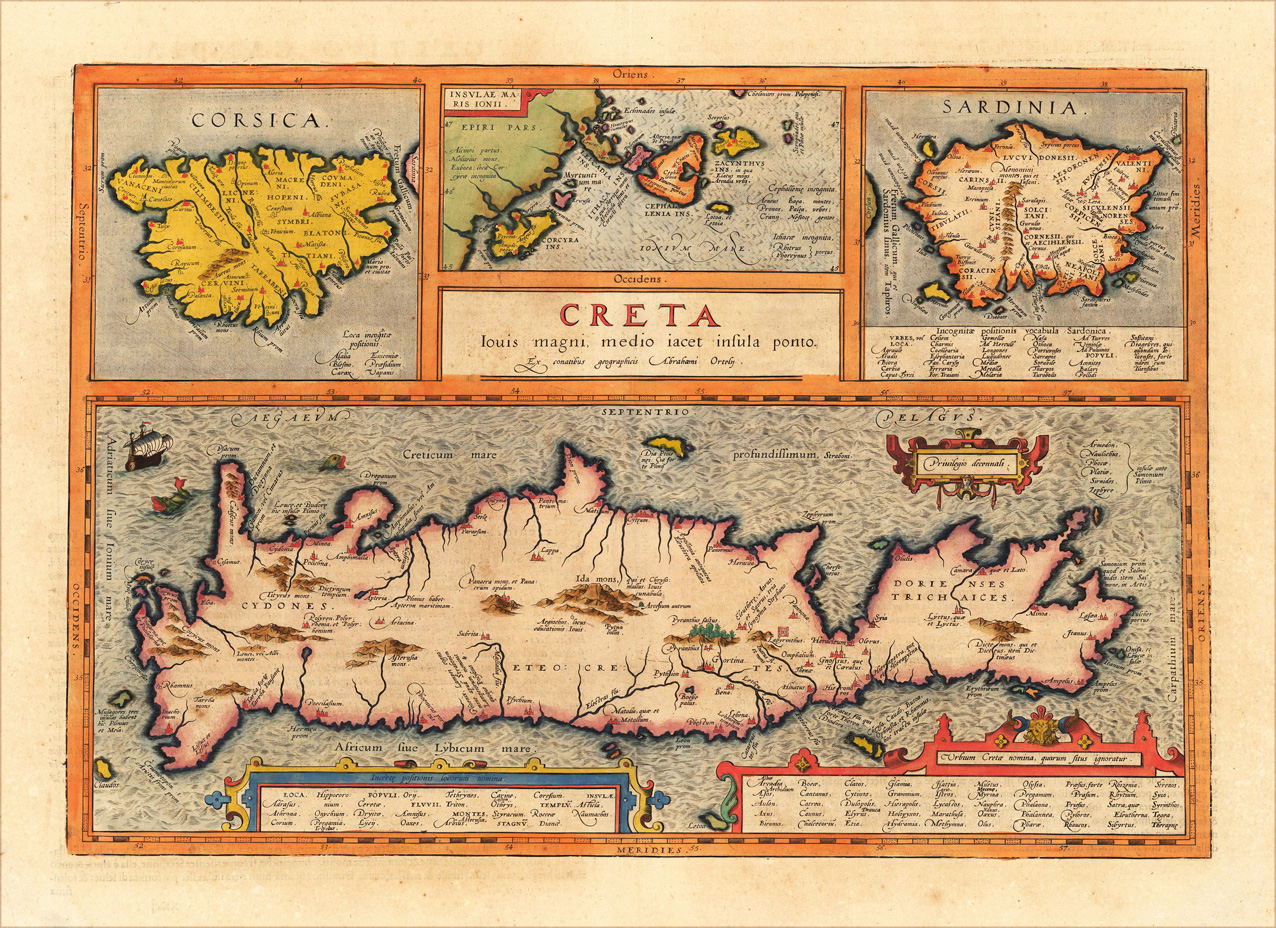
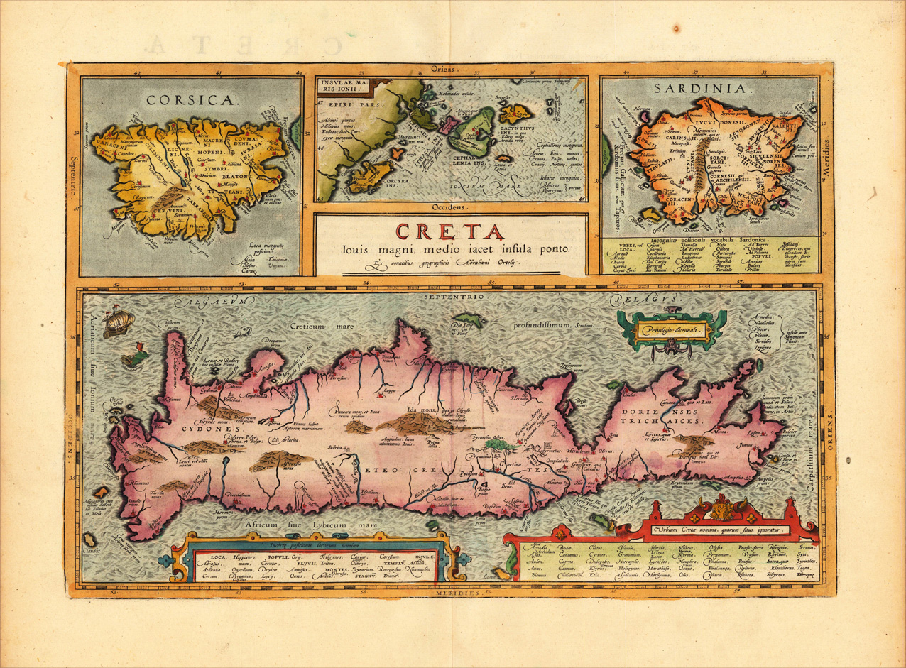
Original antique copper engraving, decorative hand colored. Published 1612 in the historical Atlas "Parergon" by Abraham Ortelius bound with his famous "Theatrum Orbis Terrarum". Finely hand-colored in wash and outline. Four maps on one plate: Corsica, the Ionian Islands (Cephalonia, Zacynthus, Corcyra), Sardinia and Crete. Villages and towns are shown as miniature views, moreover the map at the bottom is ornated with ships, sea monsters and animals. At the bottom we find two cartouches with listings of antique place names and explanations. A very good example in excellent condition. Ortelius was born on 14 April 1527 in the city of Antwerp, which was then in the Habsburg Netherlands (modern-day Belgium). The Orthellius family were originally from Augsburg, a Free imperial city of the Holy Roman Empire. In 1535, the family had fallen under suspicion of Protestantism. Following the death of Ortelius's father, his uncle Jacobus van Meteren returned from religious exile in England to take care of Ortelius. Abraham remained close to his cousin Emanuel van Meteren, who would later moved to London. In 1575 he was appointed geographer to the king of Spain, Philip II, on the recommendation of Arias Montanus, who vouched for his orthodoxy. He travelled extensively in Europe and is specifically known to have traveled throughout the Seventeen Provinces; in southern, western, northern, and eastern Germany (e.g., 1560, 1575–1576); France (1559–1560); England and Ireland (1576); and Italy (1578, and perhaps twice or thrice between 1550 and 1558). Beginning as a map-engraver, in 1547 he entered the Antwerp Guild of Saint Luke as an illuminator of maps. He supplemented his income trading in books, prints, and maps, and his journeys included yearly visits to the Frankfurt book and print fair, where he met Gerardus Mercator in 1554. In 1560, however, when travelling with Mercator to Trier, Lorraine, and Poitiers, he seems to have been attracted, largely by Mercator's influence, towards the career of a scientific geographer. (Wikipedia)
Original copper engraving, published 1624 in the famous historical Atlas "Parergon" (Latin text-edition) by Abraham Ortelius. Finely later hand-colored in wash and outline. Four maps on one plate: Corsica, the Ionian Islands (Cephalonia, Zacynthus, Corcyra), Sardinia and Crete. Villages and towns are shown as miniature views, moreover the map at the bottom is ornated with ships, sea monsters and animals. At the bottom we find two cartouches with listings of antique place names and explanations. Ortelius was born on 14 April 1527 in the city of Antwerp, which was then in the Habsburg Netherlands (modern-day Belgium). The Orthellius family were originally from Augsburg, a Free imperial city of the Holy Roman Empire. In 1535, the family had fallen under suspicion of Protestantism. Following the death of Ortelius's father, his uncle Jacobus van Meteren returned from religious exile in England to take care of Ortelius. Abraham remained close to his cousin Emanuel van Meteren, who would later move to London. In 1575 he was appointed geographer to the king of Spain, Philip II, on the recommendation of Arias Montanus, who vouched for his orthodoxy. He travelled extensively in Europe and is specifically known to have traveled throughout the Seventeen Provinces; in southern, western, northern, and eastern Germany (e.g., 1560, 1575–1576); France (1559–1560); England and Ireland (1576); and Italy (1578, and perhaps twice or thrice between 1550 and 1558). Beginning as a map-engraver, in 1547 he entered the Antwerp Guild of Saint Luke as an illuminator of maps. He supplemented his income trading in books, prints, and maps, and his journeys included yearly visits to the Frankfurt book and print fair, where he met Gerardus Mercator in 1554. In 1560, however, when travelling with Mercator to Trier, Lorraine, and Poitiers, he seems to have been attracted, largely by Mercator's influence, towards the career of a scientific geographer. (Wikipedia)
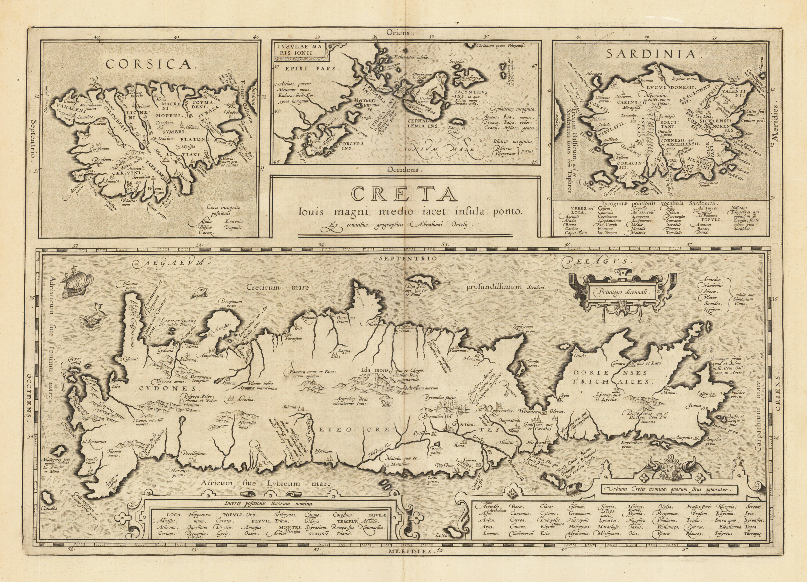
Original copper engraving, published 1624 in the famous historical Atlas "Parergon" (Latin text-edition) by Abraham Ortelius. Four maps on one plate: Corsica, the Ionian Islands (Cephalonia, Zacynthus, Corcyra), Sardinia and Crete. Villages and towns are shown as miniature views, moreover the map at the bottom is ornated with ships, sea monsters and animals. At the bottom we find two cartouches with listings of antique place names and explanations. Ortelius was born on 14 April 1527 in the city of Antwerp, which was then in the Habsburg Netherlands (modern-day Belgium). The Orthellius family were originally from Augsburg, a Free imperial city of the Holy Roman Empire. In 1535, the family had fallen under suspicion of Protestantism. Following the death of Ortelius's father, his uncle Jacobus van Meteren returned from religious exile in England to take care of Ortelius. Abraham remained close to his cousin Emanuel van Meteren, who would later moved to London. In 1575 he was appointed geographer to the king of Spain, Philip II, on the recommendation of Arias Montanus, who vouched for his orthodoxy. He travelled extensively in Europe and is specifically known to have traveled throughout the Seventeen Provinces; in southern, western, northern, and eastern Germany (e.g., 1560, 1575–1576); France (1559–1560); England and Ireland (1576); and Italy (1578, and perhaps twice or thrice between 1550 and 1558). Beginning as a map-engraver, in 1547 he entered the Antwerp Guild of Saint Luke as an illuminator of maps. He supplemented his income trading in books, prints, and maps, and his journeys included yearly visits to the Frankfurt book and print fair, where he met Gerardus Mercator in 1554. In 1560, however, when travelling with Mercator to Trier, Lorraine, and Poitiers, he seems to have been attracted, largely by Mercator's influence, towards the career of a scientific geographer. (Wikipedia)
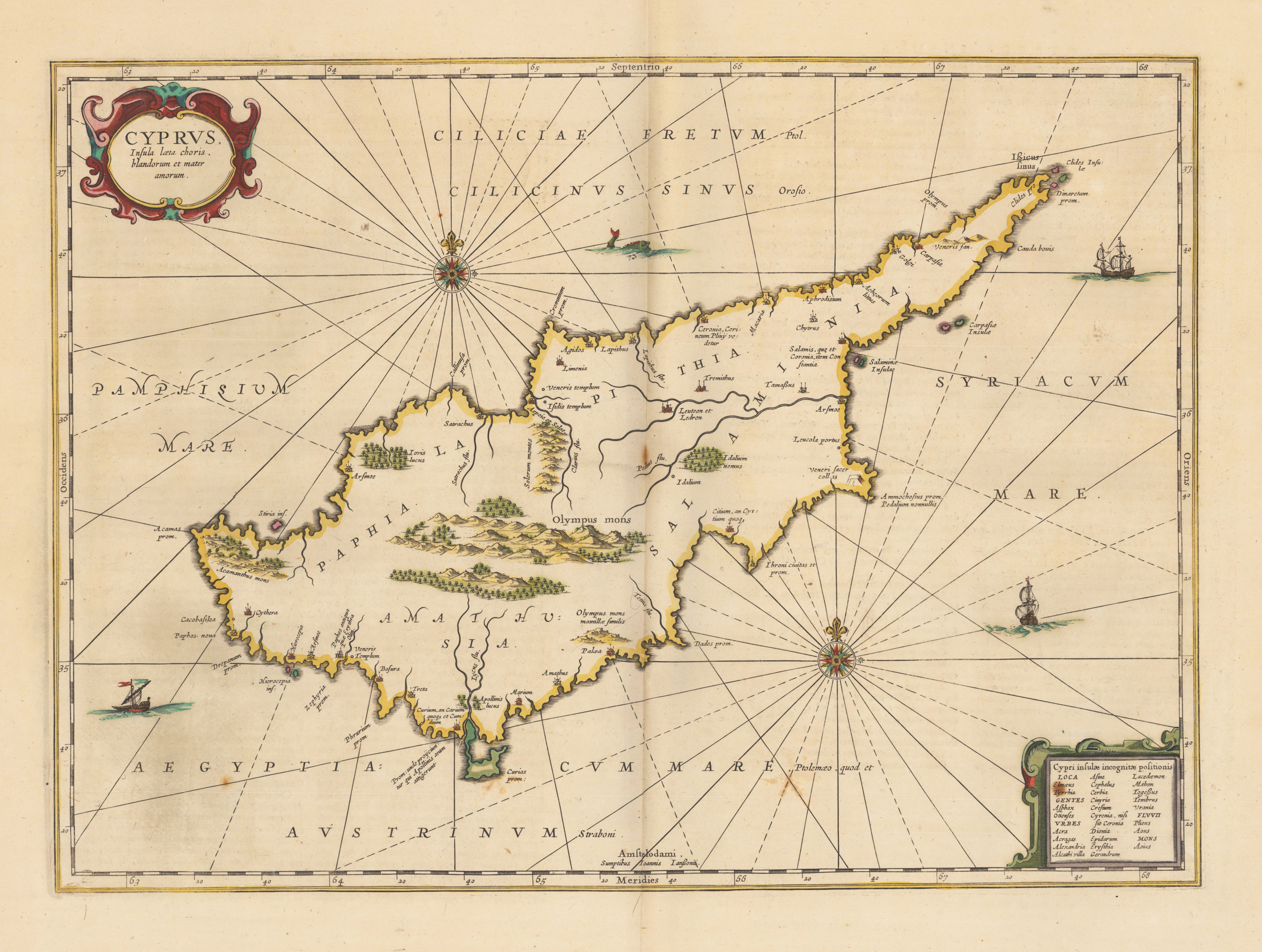
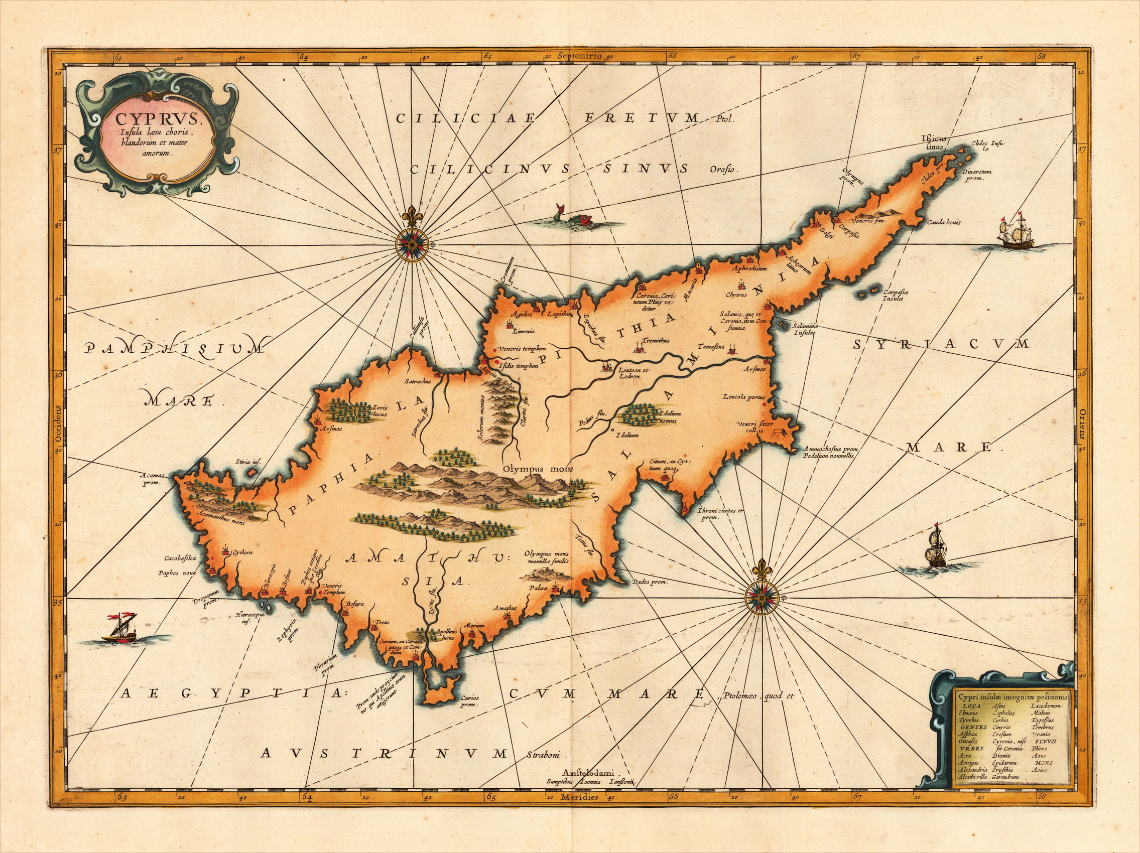
Original antique copper engraving, hand colored in outline and wash when published. A highly decorative map of Cyprus, published in Jansson's historical Atlas "Accuratissima Orbis Antiqui". This example was published in one of Jansson's deluxe editions, which were ruled in red. With engraved names of the provinces in Cyprus, mountains and some place names along the coasts. Verso Latin text. Johannes Janssonius (1588, Arnhem – buried July 11, 1664, Amsterdam) (born Jan Janszoon, in English also Jan Jansson) was a Dutch cartographer and publisher who lived and worked in Amsterdam in the 17th century. Janssonius was born in Arnhem, the son of Jan Janszoon the Elder, a publisher and bookseller. In 1612 he married Elisabeth de Hondt, the daughter of Jodocus Hondius. He produced his first maps in 1616 of France and Italy. In 1623 Janssonius owned a bookstore in Frankfurt am Main, later also in Danzig, Stockholm, Copenhagen, Berlin, Königsberg, Geneva and Lyon. His wife Elisabeth died in 1627 and he married Elisabeth Carlier in 1629. He formed a partnership with his brother in law Henricus Hondius, and together they published atlases as Mercator/Hondius/Janssonius. Under the leadership of Janssonius the Hondius Atlas was steadily enlarged. Renamed Atlas Novus, it had three volumes in 1638, one fully dedicated to Italy. In 1646, a fourth volume came out with "English County Maps", a year after a similar issue by Joan Blaeu. Janssonius' maps are similar to those of Blaeu, and he is often accused of copying from his rival, but many of his maps predate those of Blaeu and/or covered different regions. By 1660, at which point the atlas bore the appropriate name "Atlas Major", there were 11 volumes, containing the work of about a hundred credited authors and engravers. It included a description of "most of the cities of the world" (Townatlas), of the waterworld (Atlas Maritimus in 33 maps), and of the Ancient World (60 maps). The eleventh volume was titled Atlas of the Heavens (a type of celestial cartography) by Andreas Cellarius. Editions were printed in Dutch, Latin, French, and a few times in German. After Janssonius's death, the publishing company was continued by his son-in law, Johannes van Waesbergen. The London bookseller Moses Pitt attempted publication of the Atlas Major in English, but ran out of resources after the fourth volume in 1683. (Wikipedia)
Copper engraving, hand colored in outline and wash when published. A highly decorative map of Cyprus, published in Jansson's historical Atlas 'Accuratissima Orbis Antiqui'. Latin text edition. With engraved names of the provinces in Cyprus, mountains, woods and some place names along the coasts. A beautiful hand colored example of this decorative map. In the Mediterrarean Sea with three engraved sailing ships, two compass roses and a sea monster.
Original copper-engraving, uncoloured as published. The famous Dutch publisher and mapmaker Pieter Van der Aa (1659 Leiden - 1733 Leiden) published 'during the period 1882-1733, an enormous quantity of printed matter' (Koeman). This map was actually published in the first edition of his travelbooks 'Naauwkeurige versameling der gedenk-waardigste zee en landreysen na Oost en West-Indien', in Leiden 1706-08.
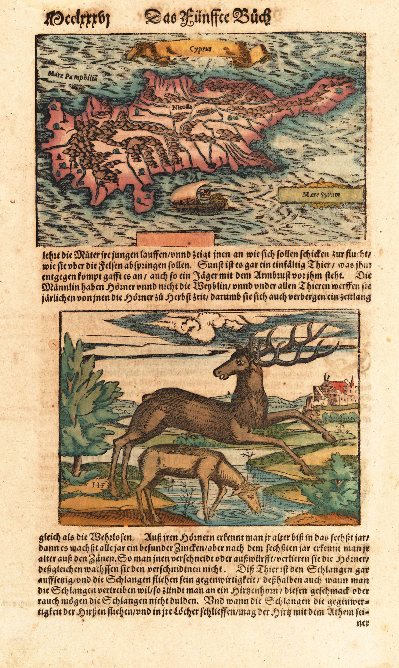
Woodcut hand colored in wash, published in Sebastian Münster's 'Cosmographia' around 1578. German text edition. Decorative fine map of Cyprus in the eastern Mediterranean Sea. Nicosia is named on the map. The German text page is relating to Sebastian Munster's description of Sweden and the woodcut illustration on the bottom of this page shows two north european reindeers. Among the descriptive text verso on the text sheet is a a chapter related to Cyprus. The 'Cosmographia' by Sebastian Münster was one of the most richest illustrated books with geographical content describing the world in the mid of the 16th century. It was published in Basel from 1544 onwards up to 1628 in various editions and different languages. Its content was enlarged from edition to edition to provide the reader with the newest information.
Original copper-engraving, uncoloured as published. The famous Dutch publisher and mapmaker Pieter Van der Aa (1659 Leiden - 1733 Leiden) published during the period 1882-1733, an enormous quantity of printed matter (Koeman). This map was actually published in the first edition of his travelbooks Naauwkeurige versameling der gedenk-waardigste zee en landreysen na Oost en West-Indien, in Leiden 1706-08.
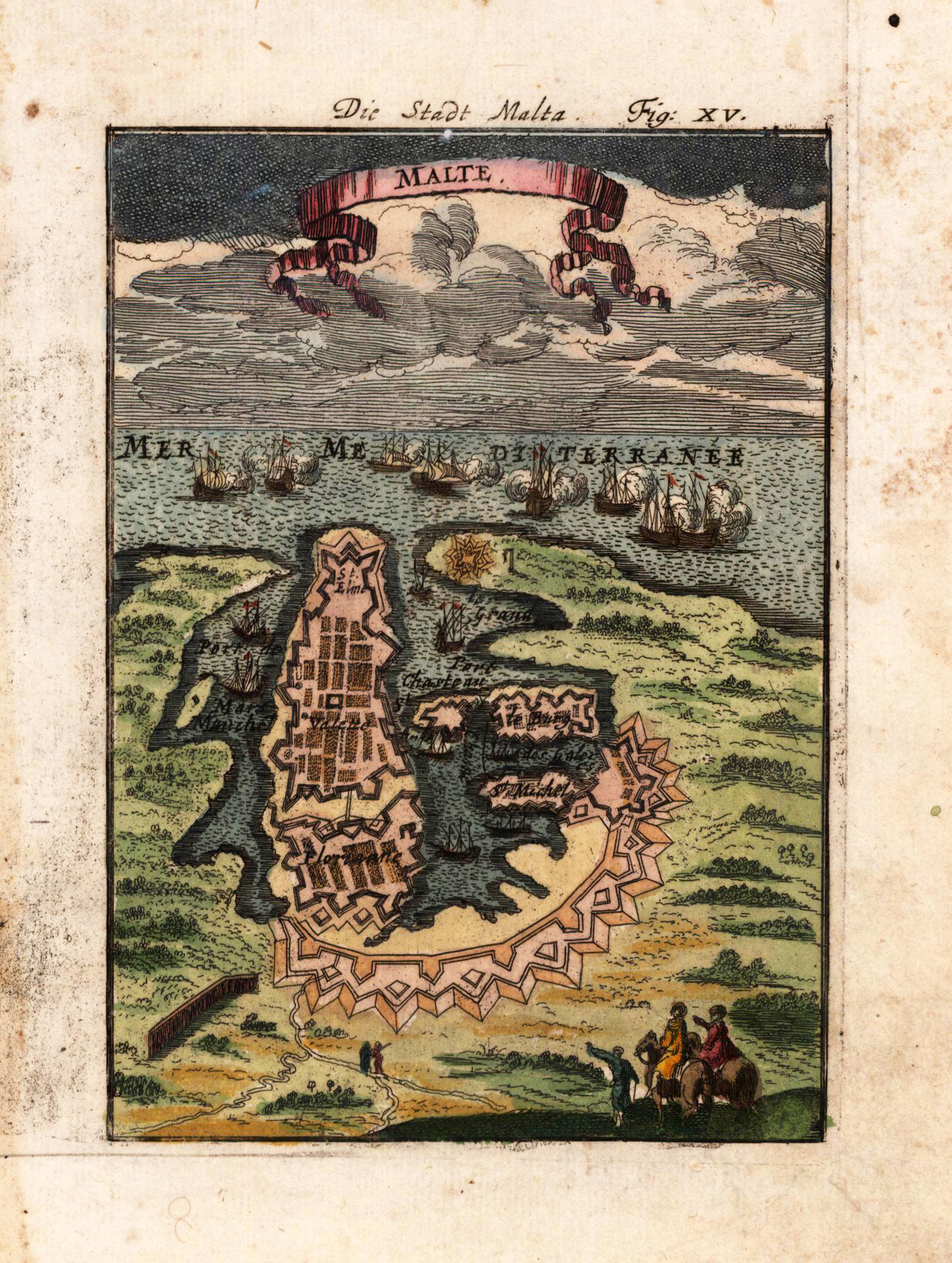
Copper engraving, hand colored in wash and outline. This decorative map shows the town Malta. In the background we look to the ocean and in the foreground we see a beautiful landscape with peoples.
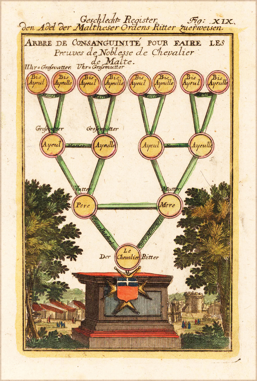
Copper engraving, hand colored in wash and outline. This decorative engraving shows a heraldic family tree of the aristocracy of the 'Chevaliers de Malta'.