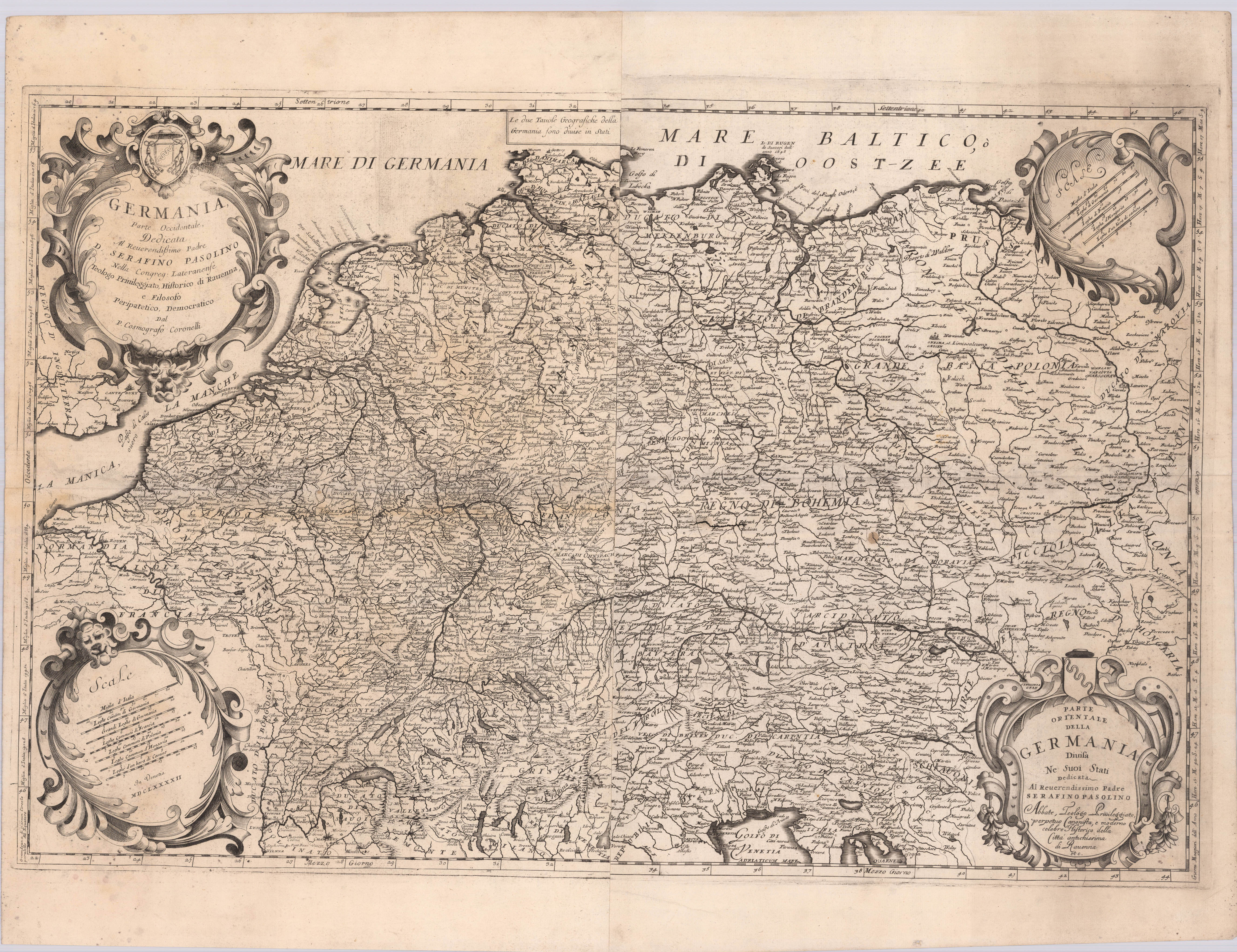
Engraved map printed by 4 plates on 2 sheets. Two title cartouches and two mile markers in 4 decorative cartouches in the corners. Kupferstichkarte, gedruckt v. 4 Platten auf 2 Blatt. In den Ecken zwei Titelkartuschen und zwei Meilenzeiger in 4 dekorativen Kartuschen. Germany is shown with neighboring countries. On the backside there is a engraving of the island of Gotland and one of the city of Kiel. The Italian cartographer Vincenzo Coronelli was particularly impressive in his map design. Like Jaillot, he also worked at the court of Louis XIV. His maps are still considered a masterpiece of baroque map art. Uncolored copy in very good condition with a strong impression. Dargestellt wird Deutschland mit angrenzenden Ländern. Auf der Rückseite befinden sich jeweils eine Abbildung der Insel Gotland und der Stadt Kiel. Der italienische Kartograph Vincenzo Coronelli bestach insbesondere in seiner Gestaltung der Karten, auch er war wie Jaillot am Hof Ludwig XIV. tätig. Seine Karten gelten bis heute noch als ein Meisterwerk der barocken Kartenkunst. Unkoloriertes Exemplar in sehr gutem Zustand, mit in einem kräftigen Abdruck.
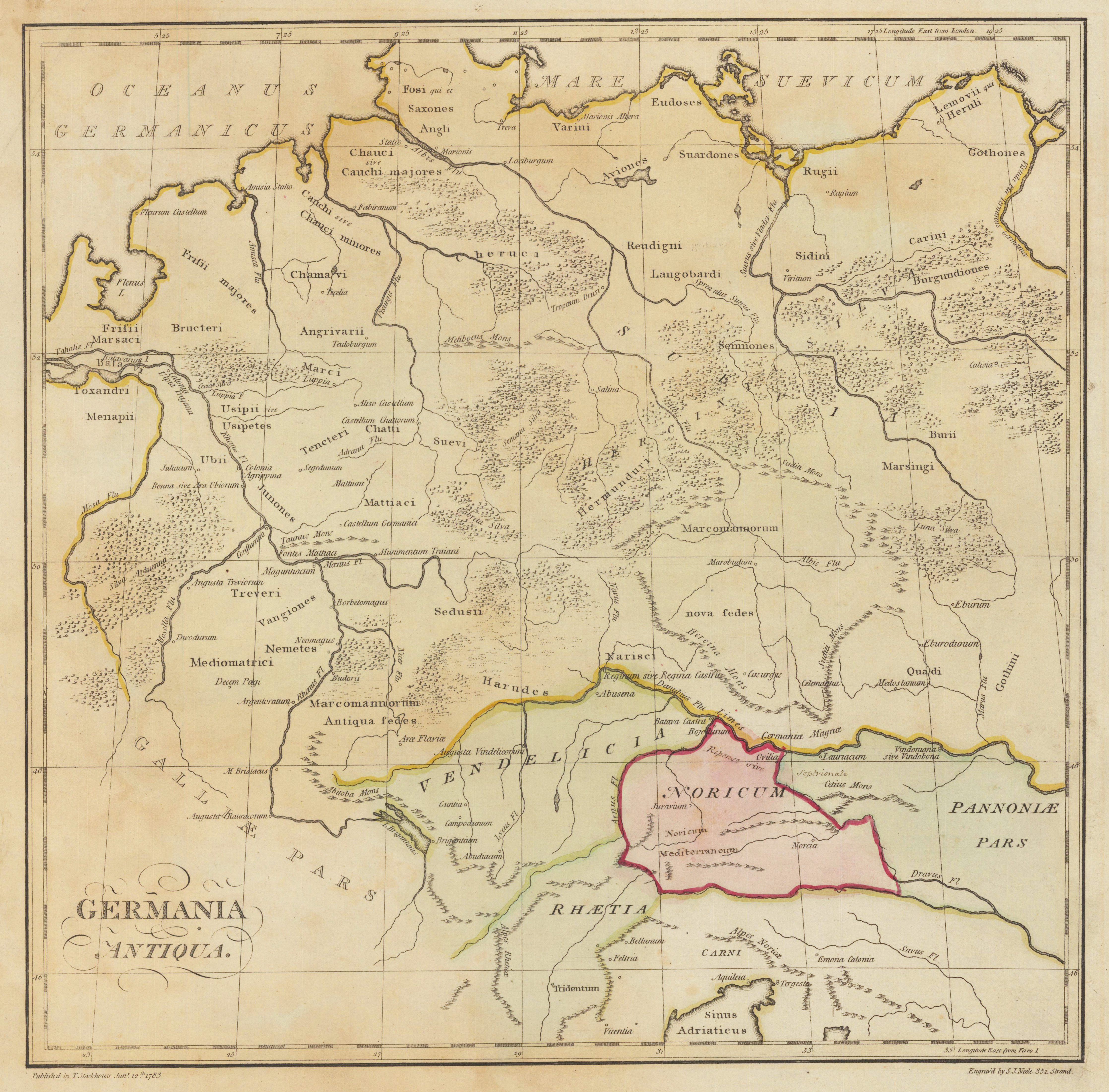
Original antike Kupferstichkarte in Grenz- und Flächenkolorit. Das Kartenbild reicht von der Nord- und Ostsee bis hin zum nördlichsten Teil der Adria. Im linken unteren Bildbereich ist der Titel eingraviert.
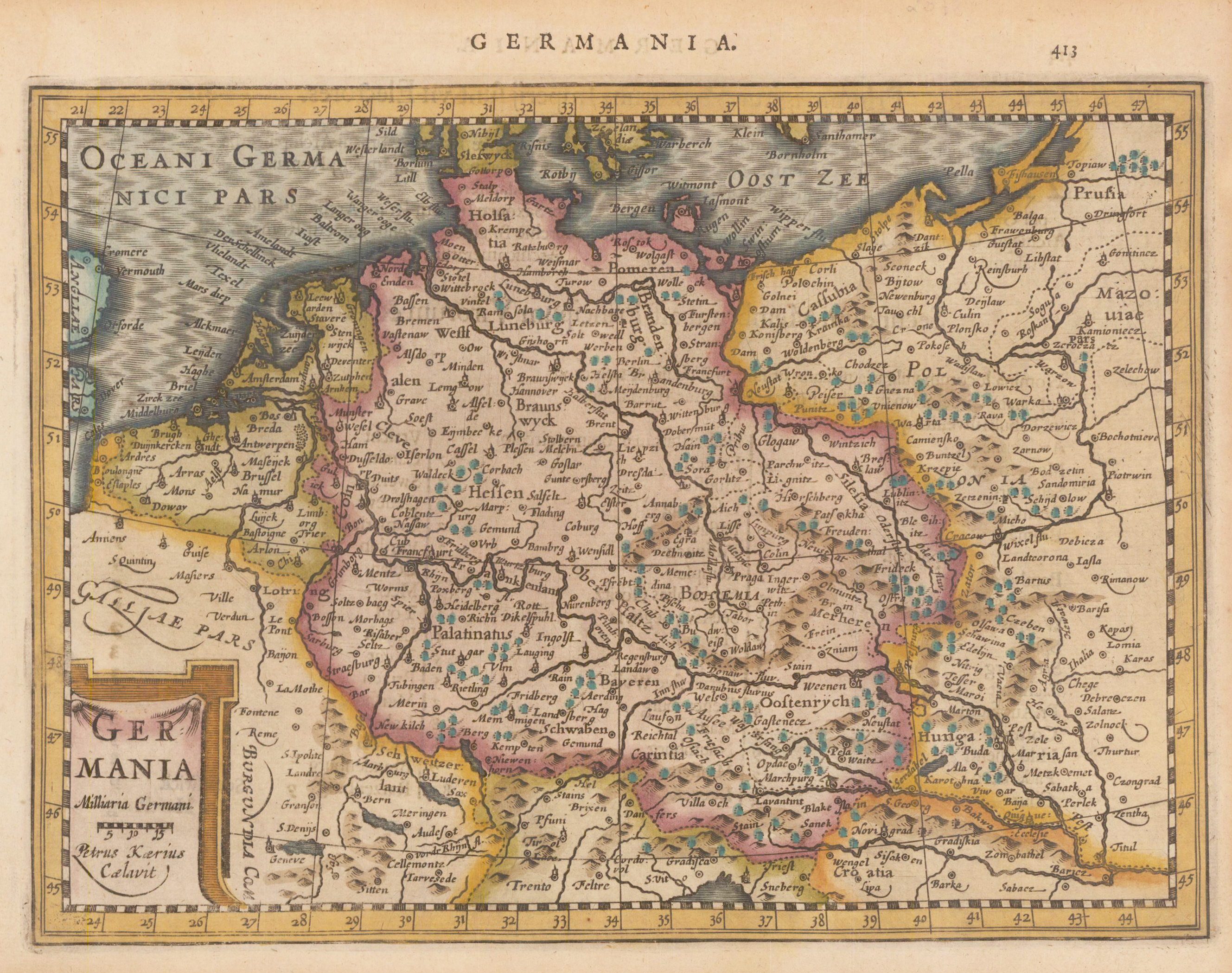
Original antiker Kupferstich in späterem Handkolorit. Diese kleine dekorative Landkarte zeigt Deutschland und Teile der umliegenden Länder, wie die Niederlande, Frankreich, Polen und Ungarn. Die Titelkartusche inklusive Meilenzeiger sind unten links eingraviert. Über dem Kartenbild ein weiterer Titel ,Germania' und die Seitenzahl 413. Pieter van den Keere, auch Peter bzw. Petrus Kaerius, (* 1570 in Gent; † 1630 in Gent) war ein belgischer Kupferstecher und Verleger. Pieter van den Keere wird 1570 als Sohn des Buchdruckers und Schriftgießers Hendric van den Keere dem Jüngeren in Gent geboren. Aufgrund religiöser Unruhen und Verfolgungen flieht er nach London, wo er als Kupferstecher tätig ist. Seine frühesten Stiche sind in John Nordens Speculum Britanniae (1593) zu finden, darunter Ansichten von London und der Westminsterabtei aus der Vogelperspektive. Um 1595 kehrt Pieter van den Keere wieder nach Holland zurück und lässt sich in Amsterdam nieder, wo er bis zu seinem Tod lebt und arbeitet. Als erstes erscheint dort die Nova totius Europae descriptio in Kooperation mit Jodocus Hondius. Neben seiner Tätigkeit als Kupferstecher tritt er ab 1609 auch als Verleger in Erscheinung. So liefert er u. a. 1613 der Rotterdamer Admiralität mehrere Globen. 1617 erscheint der Atlas der Niederlande Germania inferior mit seinem Namen als Verfasser und mit einigen Karten, die seine volle Stechersignatur zeigen. Neben verschiedenen topografischen Einzelblättern, u. a. von Amsterdam (1618), Nürnberg (1619) und dem Herzogtum Württemberg (1619), sticht Van den Keere 1621 eine Weltkarte (Nova totius terrarum orbis), die bei Jan Janszoon in Amsterdam erscheint. Nach 1620 scheint er vor allem einen regen Kupferstichhandel zu betreiben, zumindest weist ein 1623 aufgenommenes Inventar einen reichen Vorrat an entsprechenden Arbeiten auf. Er stirbt 1630 in Gent.
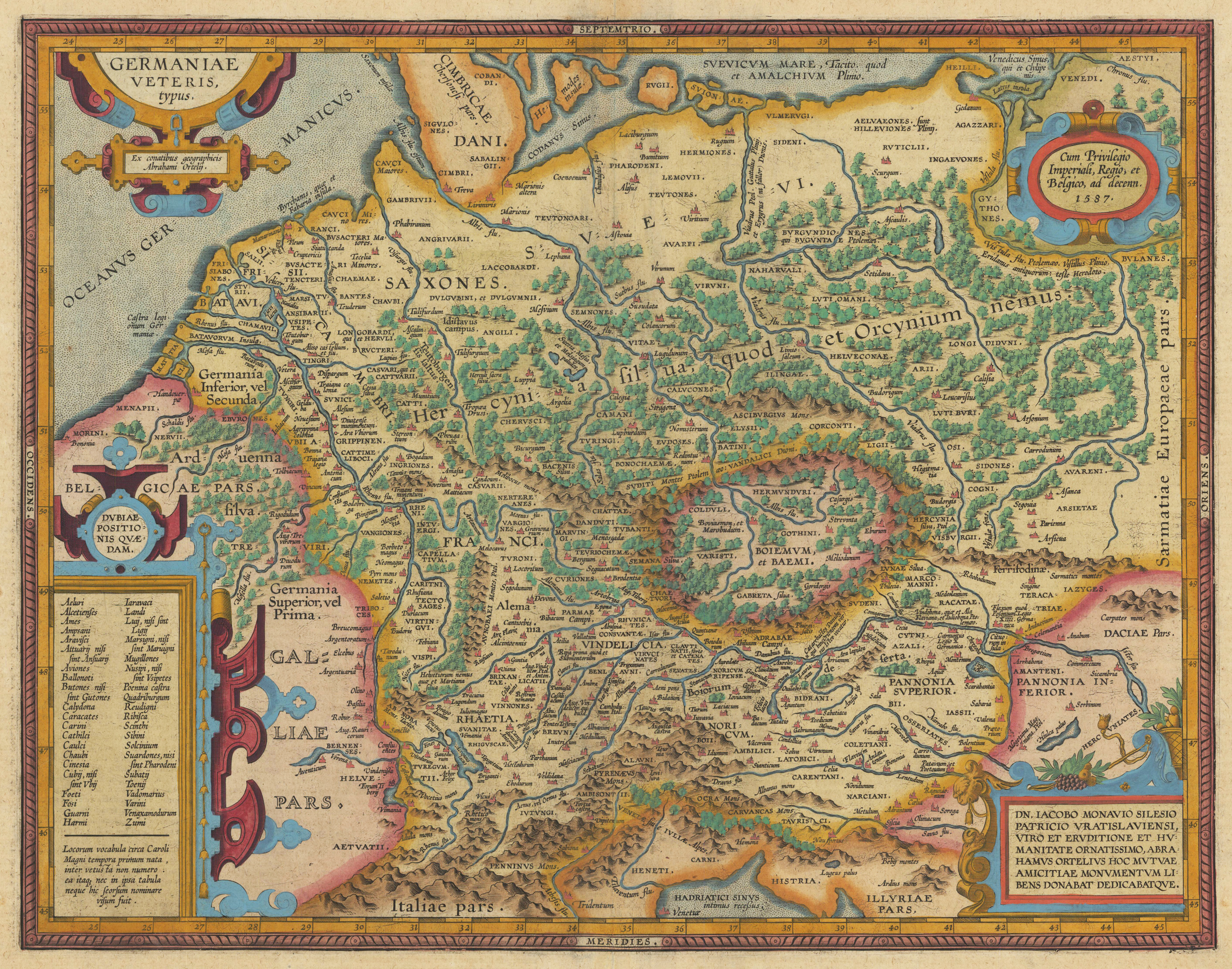
Original antique copper engraving, published 1612 in the famous historical Atlas "Parergon" (Latin text-edition) by Abraham Ortelius. Finely later hand-colored in wash and outline. Finely hand colored in wash and outline. The map is ornated 4 cartouches: a title cartouche in the upper left corner, a small oval cartouche with the "privilegium" on the upper right side, two text cartouches in the lower right and left corners. Villages and towns are shown as miniature views. Ortelius was born on 14 April 1527 in the city of Antwerp, which was then in the Habsburg Netherlands (modern-day Belgium). The Orthellius family were originally from Augsburg, a Free imperial city of the Holy Roman Empire. In 1535, the family had fallen under suspicion of Protestantism. Following the death of Ortelius's father, his uncle Jacobus van Meteren returned from religious exile in England to take care of Ortelius. Abraham remained close to his cousin Emanuel van Meteren, who would later move to London. In 1575 he was appointed geographer to the king of Spain, Philip II, on the recommendation of Arias Montanus, who vouched for his orthodoxy. He travelled extensively in Europe and is specifically known to have traveled throughout the Seventeen Provinces; in southern, western, northern, and eastern Germany (e.g., 1560, 1575–1576); France (1559–1560); England and Ireland (1576); and Italy (1578, and perhaps twice or thrice between 1550 and 1558). Beginning as a map-engraver, in 1547 he entered the Antwerp Guild of Saint Luke as an illuminator of maps. He supplemented his income trading in books, prints, and maps, and his journeys included yearly visits to the Frankfurt book and print fair, where he met Gerardus Mercator in 1554. In 1560, however, when travelling with Mercator to Trier, Lorraine, and Poitiers, he seems to have been attracted, largely by Mercator's influence, towards the career of a scientific geographer. (Wikipedia)
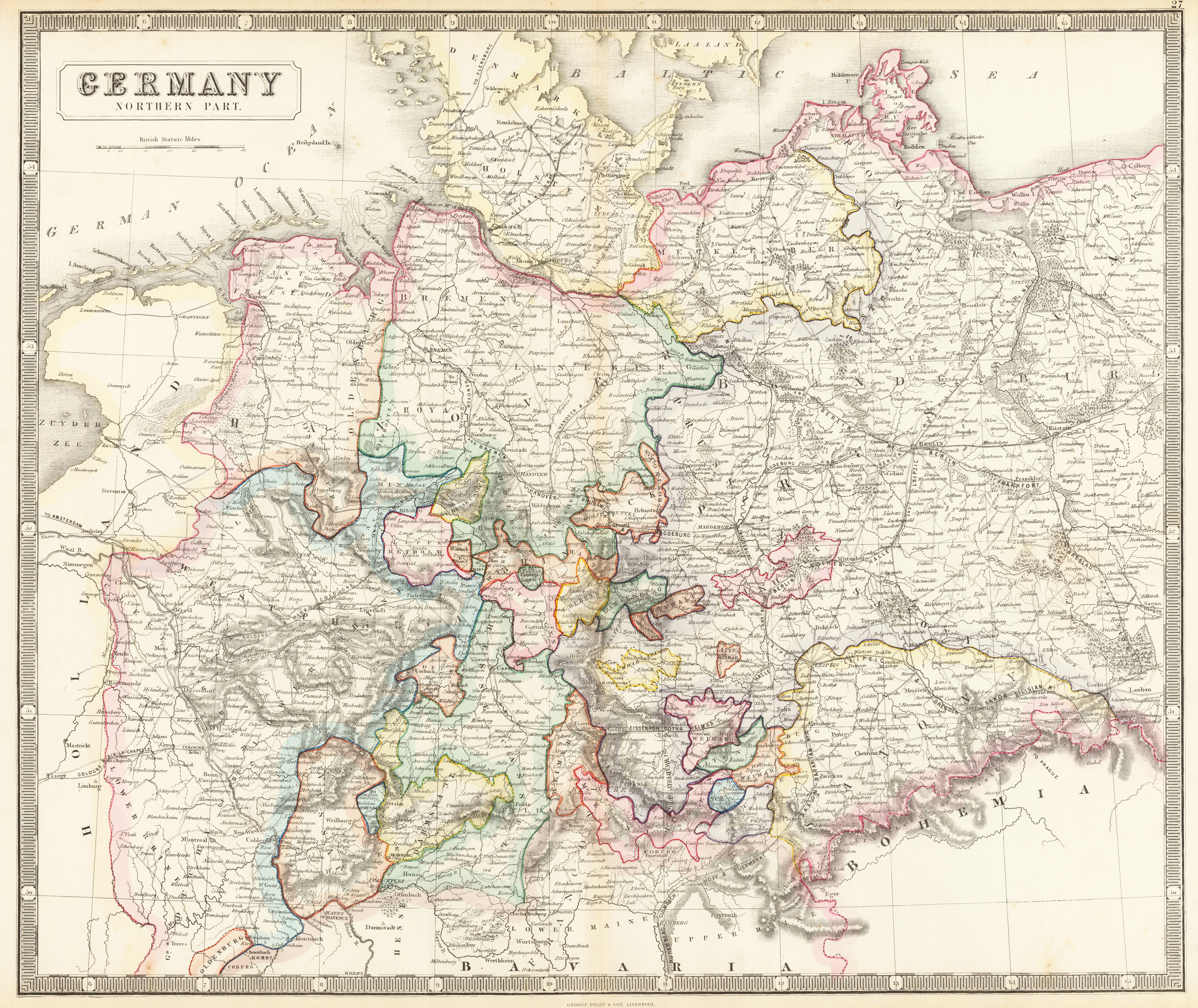
Lithograph, original hand colored in outline. Decorative double page hand colored lithograph antique map, showing detailed the northern part of Germany until to Würzburg in the south. Hand colored decorative in outline and wash when published, piano key border. Caxton Buildings, Liverpool, 1859. The printing works of George Philip & Son Ltd were situated here. Philip used cartographers such as John Bartholomew the elder, August Petermann, and William Hughes to produce maps on copper plates. Philip then had these printed and hand-coloured by his women tinters. By the time he produced his county maps of 1862 he was using machine coloured maps produced on power-driven lithographic presses. 'His maps ranged from the expensive Imperial Library Atlas (1864) to an atlas costing as little as 3d. and, although the bulk of his production was for the commercial, and particularly the educational market, he also produced important scientific maps, notably of North America, especially the Arctic and Pacific Northwest, and of the West Indies. The firm supplied atlases, geographical and history books, school textbooks, and an array of educational books and equipment. The company also produced textbooks for overseas countries, starting with an atlas for Australian schools in 1865 and for New Zealand in 1869. The demand from board schools, established after 1870, enabled further expansion in the market for general textbooks, school stationery, atlases and wall maps, etc Philip also employed many noted writers including the geographer and historian John Francon Williams who wrote, compiled and edited many books for the company from 1881 over a 20-year period. (Wikipedia)
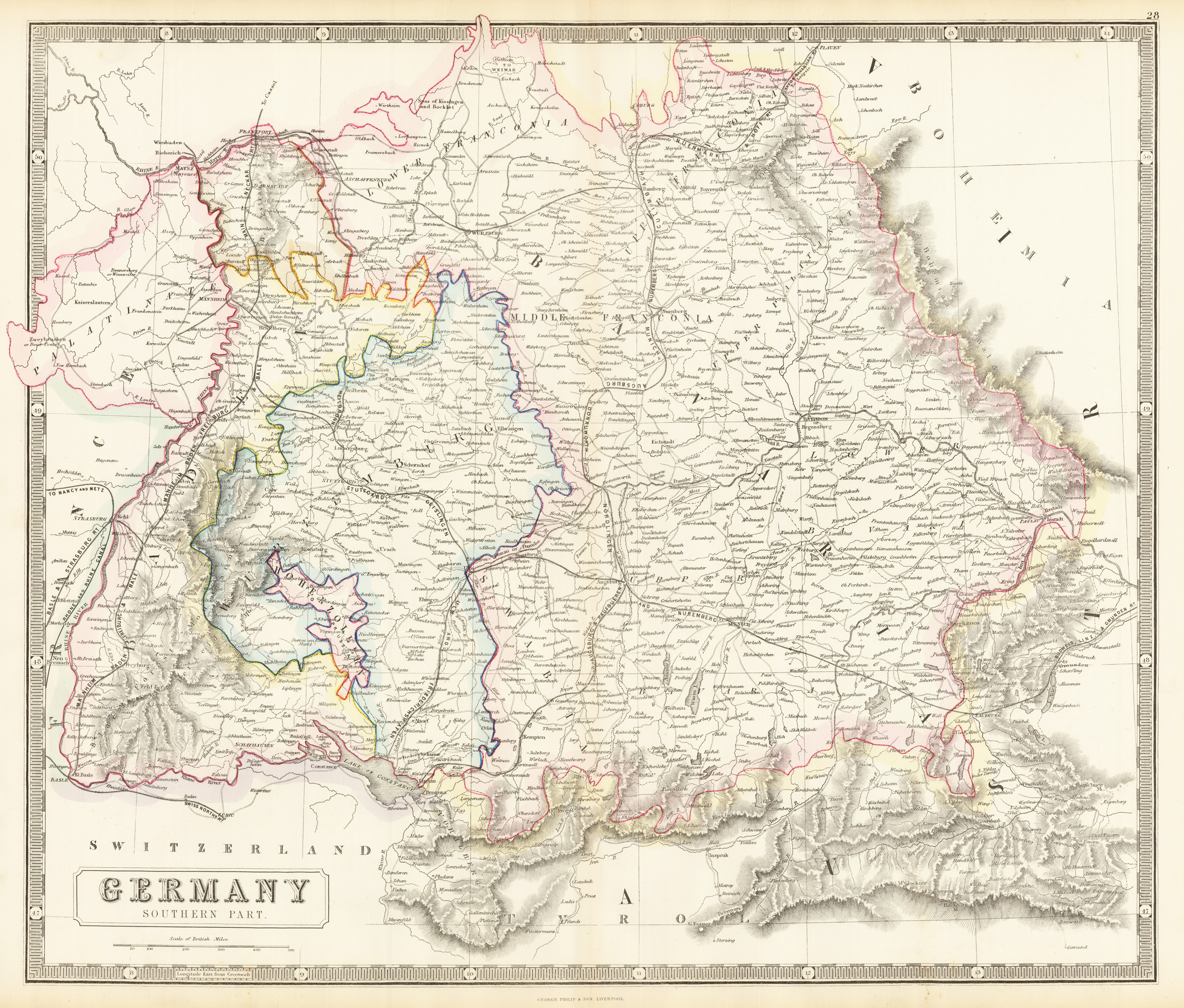
Lithograph, original hand colored in outline. Decorative double page hand colored lithograph antique map, showing detailed the southern part of Germany from Plauen (Eastern Germany) in the north, including a part of Austria in the south. Hand colored decorative in outline and wash when published, piano key border. Caxton Buildings, Liverpool, 1859. The printing works of George Philip & Son Ltd were situated here. Philip used cartographers such as John Bartholomew the elder, August Petermann, and William Hughes to produce maps on copper plates. Philip then had these printed and hand-coloured by his women tinters. By the time he produced his county maps of 1862 he was using machine coloured maps produced on power-driven lithographic presses. 'His maps ranged from the expensive Imperial Library Atlas (1864) to an atlas costing as little as 3d. and, although the bulk of his production was for the commercial, and particularly the educational market, he also produced important scientific maps, notably of North America, especially the Arctic and Pacific Northwest, and of the West Indies. The firm supplied atlases, geographical and history books, school textbooks, and an array of educational books and equipment. The company also produced textbooks for overseas countries, starting with an atlas for Australian schools in 1865 and for New Zealand in 1869. The demand from board schools, established after 1870, enabled further expansion in the market for general textbooks, school stationery, atlases and wall maps, etc Philip also employed many noted writers including the geographer and historian John Francon Williams who wrote, compiled and edited many books for the company from 1881 over a 20-year period. (Wikipedia)
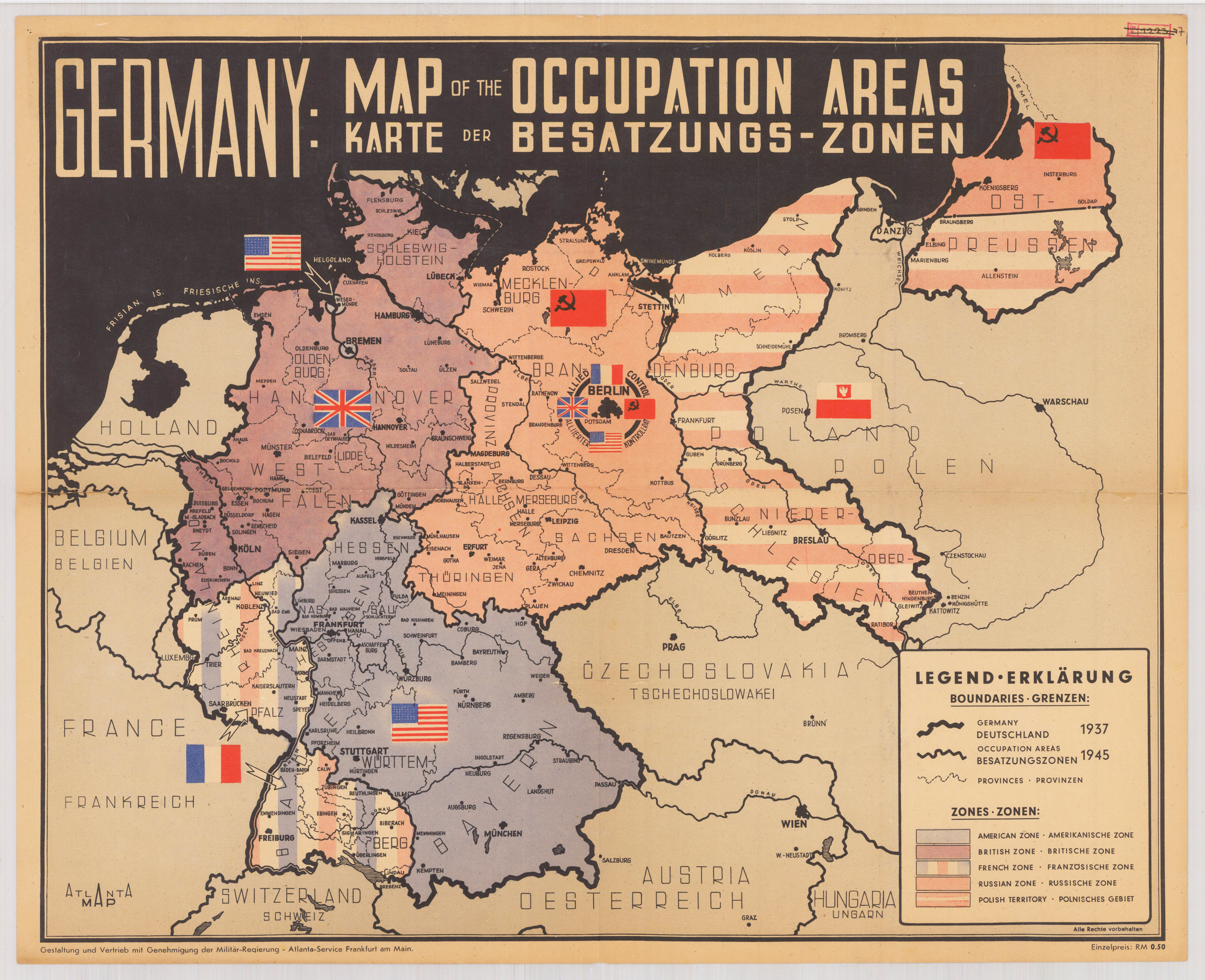
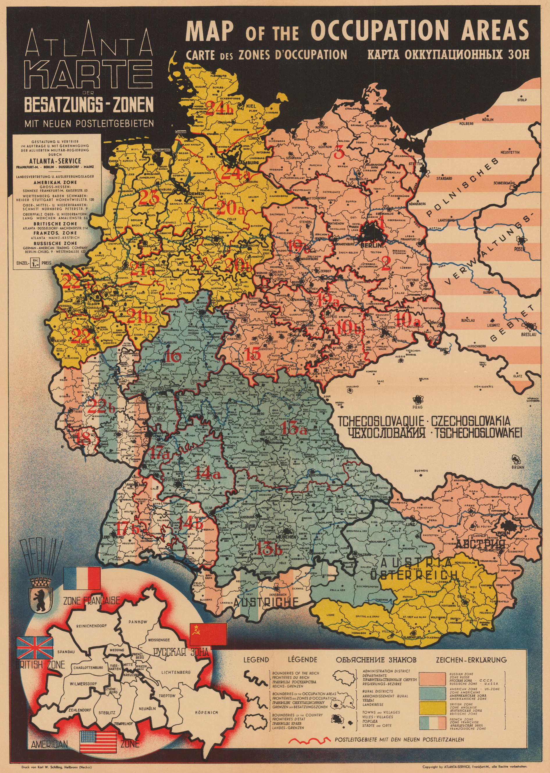
Original lithograph from 1945. Important monument of the division of Germany after the Second World War. Shows the occupation zones of America, Britain, France, Russia and the olish territory of the year 1945, by the flags of each country. A Legend in the lower right corner explains the boundaries and zones of the occupyiong power.
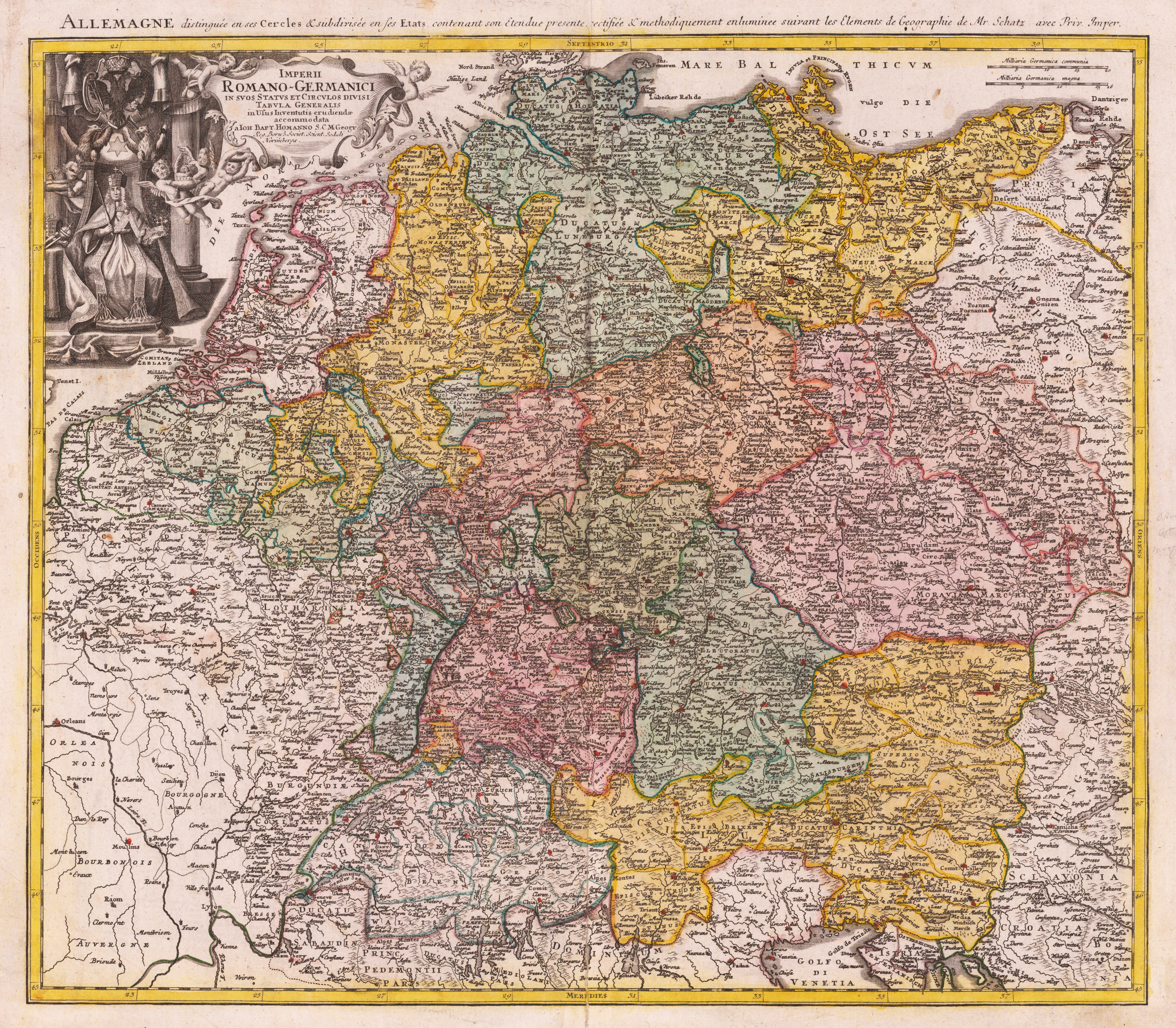
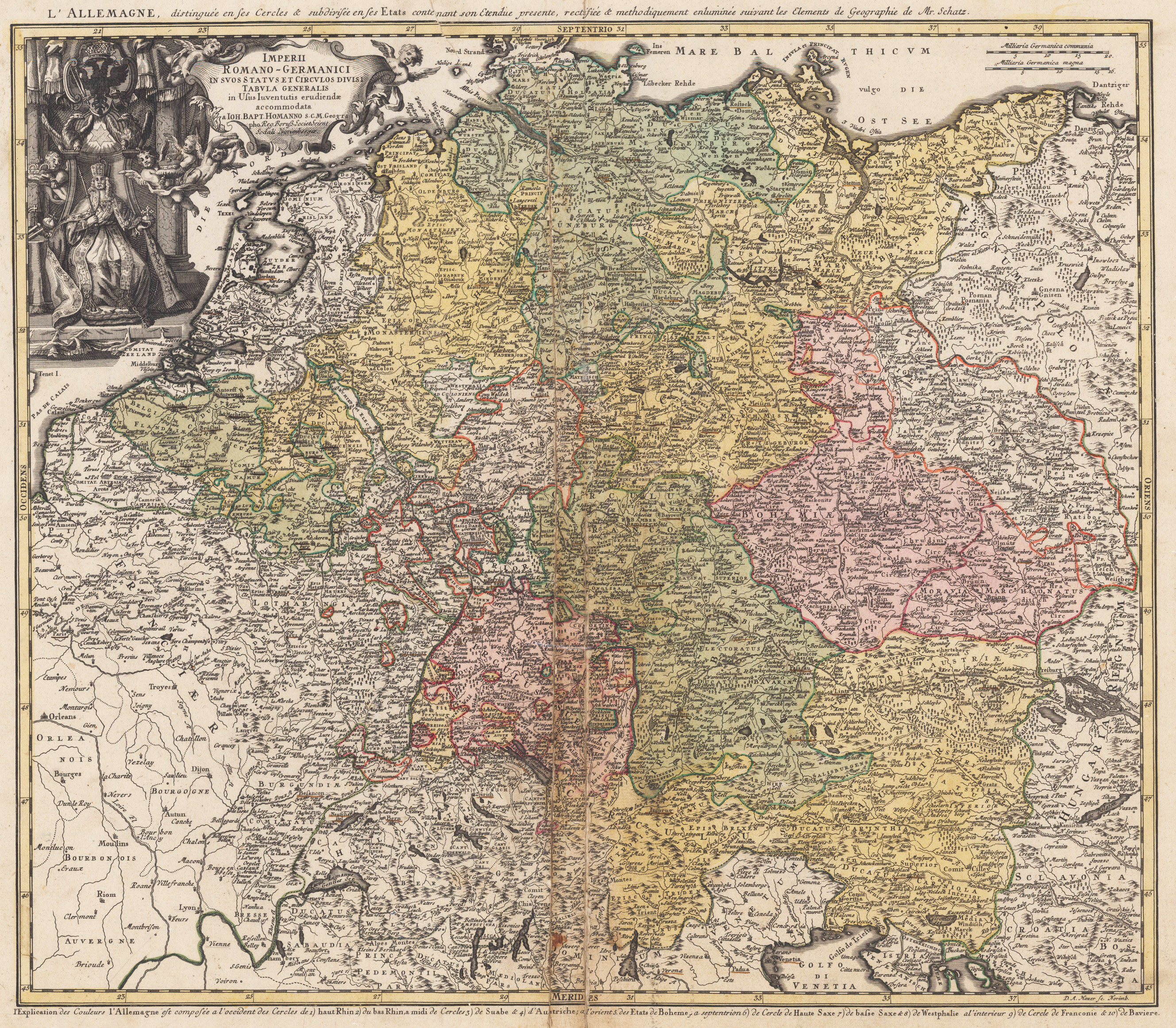
Original copper engraving, hand colored in outline and wash when published. The map depicts the Holy Roman Empire around 1741. It shows Germany, Austria, Bohemia and parts of the Low Countries with its political borders hand colored when published in outline and wash belonging to the Holy-Roman-Empire. Further the map includes parts of the neighboring countries as France, Switzerland, Northern Italy, Prussia and Poland and Hungary. A detailed antique map with many engraved place names, rivers, lakes, mountains. In the upper left corner with decorative title cartouche showing the emperor of the Holy-Roman-Empire (Karl VII.) surrounded by puttos and above the eagle of the Holy Roman Empire.
Original copper engraving, hand colored in outline and wash when published. The map depicts the Holy Roman Empire around 1741. It shows Germany, Austria, Bohemia and parts of the Low Countries with its political borders hand colored when published in outline and wash belonging to the Holy-Roman-Empire. Further the map includes parts of the neighboring countries as France, Switzerland, Northern Italy, Prussia and Poland and Hungary. A detailed antique map with many engraved place names, rivers, lakes, mountains. In the upper left corner with decorative title cartouche showing the emperor of the Holy-Roman-Empire (Karl VII.) surrounded by puttos and above the eagle of the Holy Roman Empire.
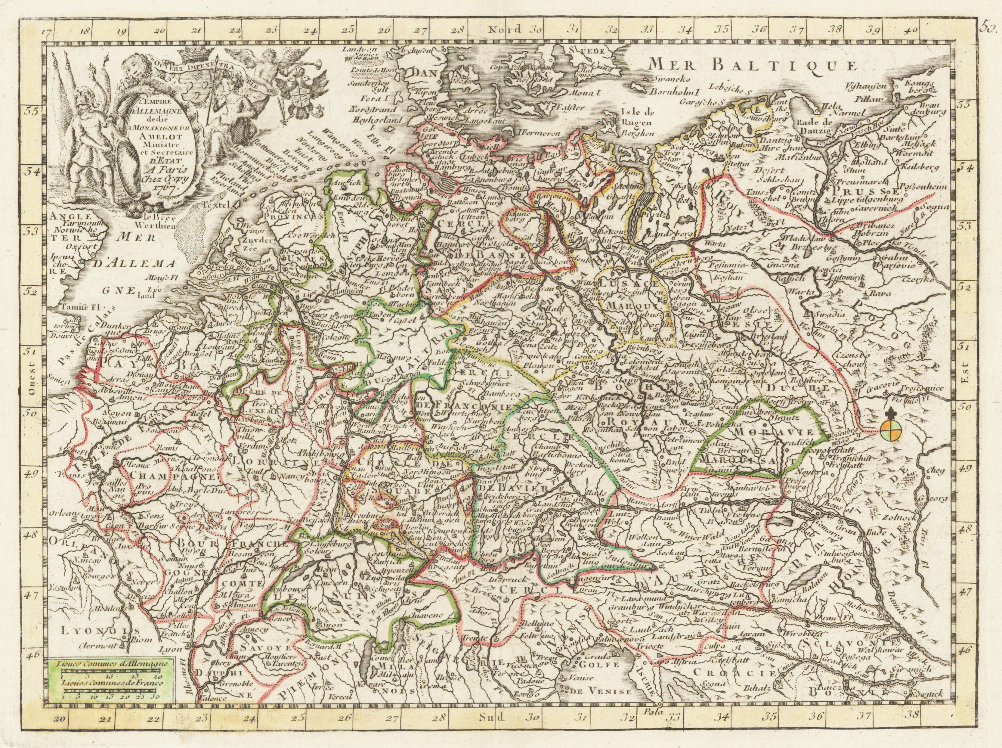
Original Kupferstich in zeitgenössischem Grenzkolorit. Dargestellt wird das Deutsche Reich mit seinen Staaten, Fürstentümern und souveränen Hoheitsgebieten. Das Gebiet von der dänischen Grenze bis Norditalien, von Polen/Ungarn bis England/Frankreich. Im linken oberen Eck befindet sich die dekorative Titelkartusche umrahmt von Soldaten, einem Löwen, einem Engel und zwei Wappen. Links unten im Eck ist eine deutscher und ein deutscher Meilenanzeiger eingraviert.
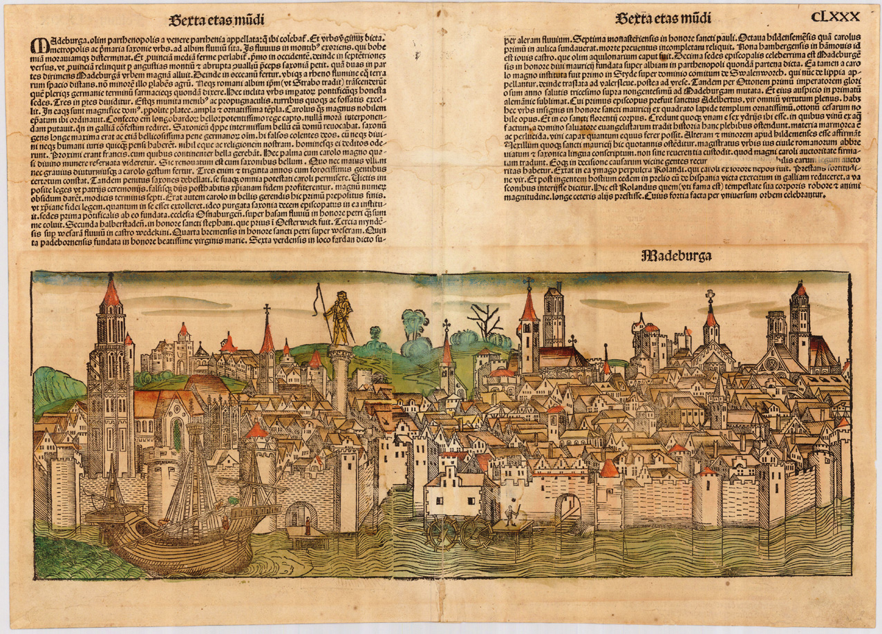
Original woodcut from the famous Nurnberg Chronicle, printed in Nürnberg in December 1493. This plate was exactly published and printed in December 1493 in Nurnberg at Anton Koberger. Decorative hand colored view across the river Elbe towards the medieval town Magdeburg in Sachsen Anhalt.
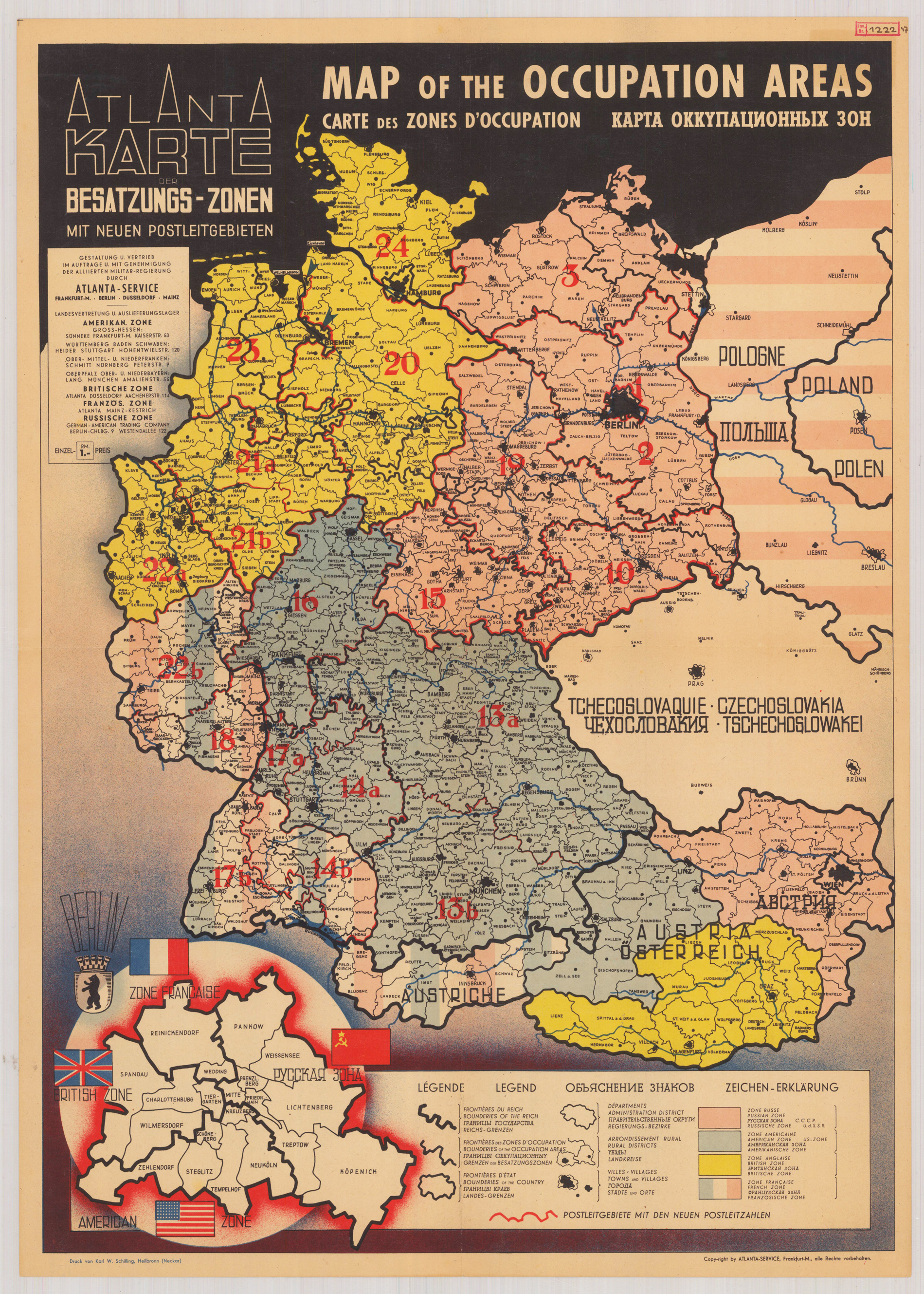
Original lithograph in color. Important monument of the division after the Second World War of Germany. Shows postal codes in allied occupation zones in Germany from 1945 until 1949. An Inset map in the left lower left corner shows the postal codes in Berlin, divided between American, French, British and Russian occupation zones.
Original lithograph in color. Important monument of the division after the Second World War of Germany. Shows postal codes in allied occupation zones in Germany from 1945 until 1949. An Inset map in the left lower left corner shows the postal codes in Berlin, divided between American, French, British and Russian occupation zones.
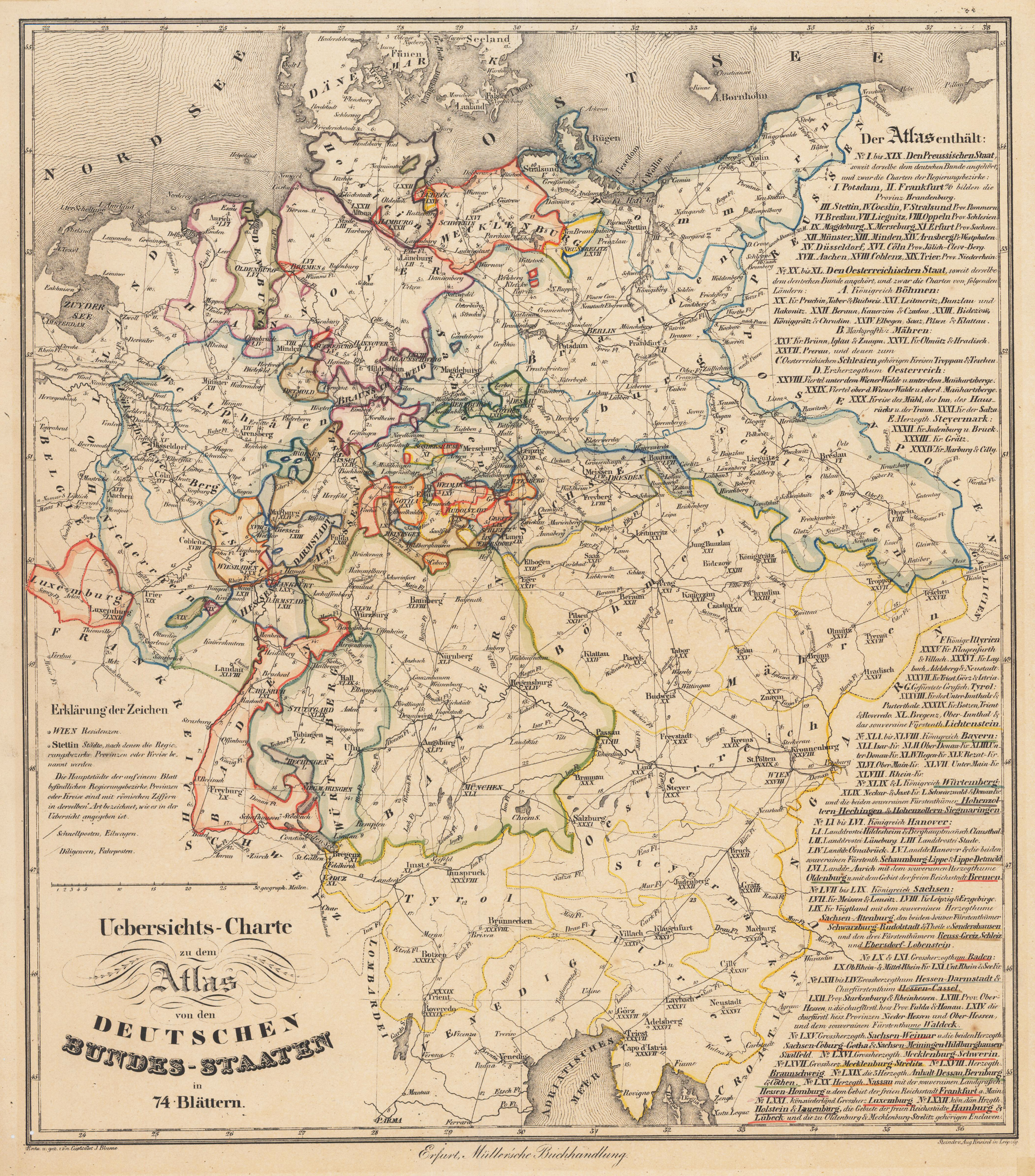
Original Lithographie in zeitgenössischem Grenzkolorit. Die Karte zeigt das Gebiet von der Nordsee bis zur Adria. Sie ist das Übersichtsblatt von 74 einzelnen Karten.