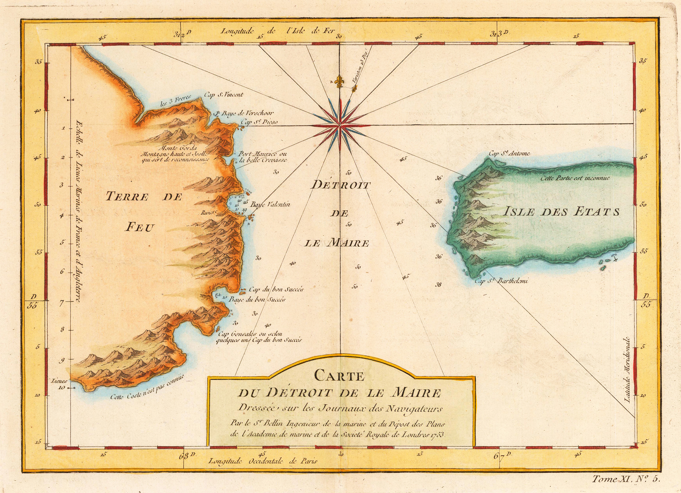
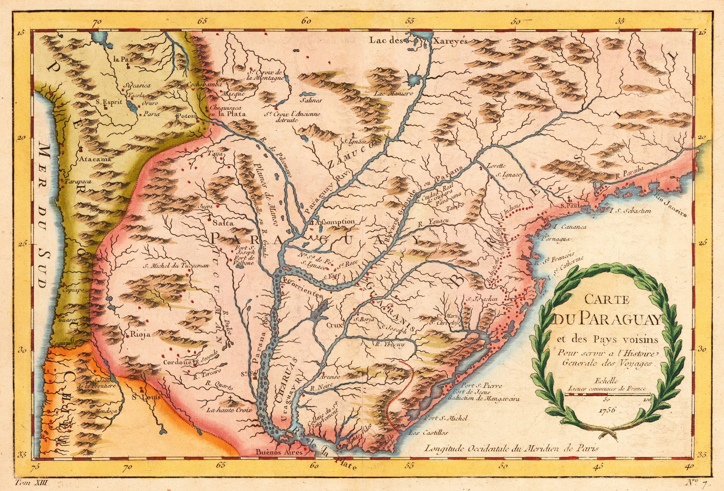
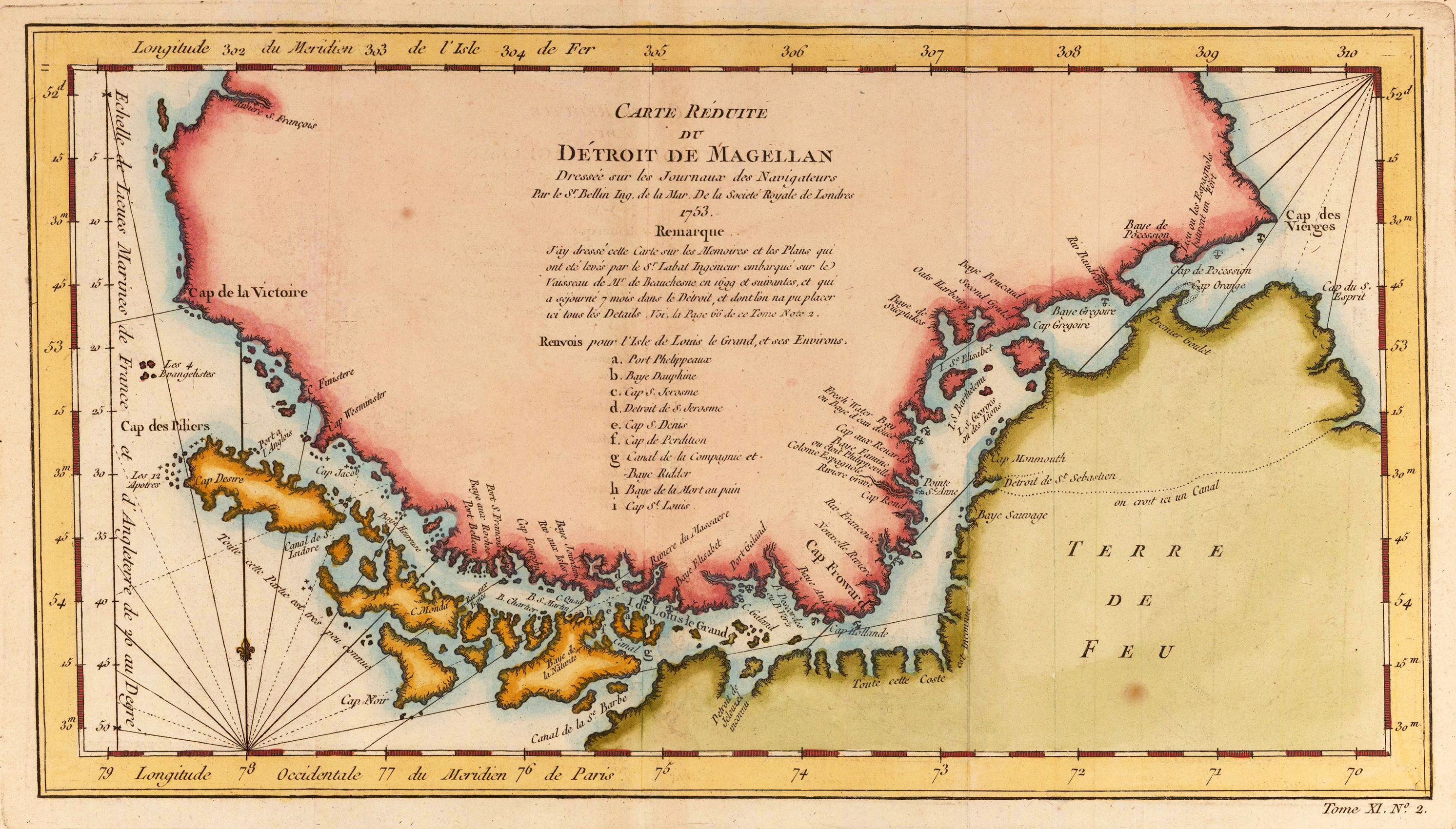
Copper engraving, uncolored as published. A fine detailed and interesting map engraved by Bellin after earlier voyages. Published in the German edition by Schwabe in Leipzig of Bellin's travel books.
Original antique copper engraving, hand colored. This decorative antique map shows the view of the Dutch Fleet in the harborthe city of St. Augustinho in Brazil with ships in foreground.
Johannes Janssonius (1588, Arnhem – buried July 11, 1664, Amsterdam) (born Jan Janszoon, in English also Jan Jansson) was a Dutch cartographer and publisher who lived and worked in Amsterdam in the 17th century.
Janssonius was born in Arnhem, the son of Jan Janszoon the Elder, a publisher and bookseller. In 1612 he married Elisabeth de Hondt, the daughter of Jodocus Hondius. He produced his first maps in 1616 of France and Italy. In 1623 Janssonius owned a bookstore in Frankfurt am Main, later also in Danzig, Stockholm, Copenhagen, Berlin, Königsberg, Geneva and Lyon. His wife Elisabeth died in 1627 and he married Elisabeth Carlier in 1629. He formed a partnership with his brother in law Henricus Hondius, and together they published atlases as Mercator/Hondius/Janssonius.
Under the leadership of Janssonius the Hondius Atlas was steadily enlarged. Renamed Atlas Novus, it had three volumes in 1638, one fully dedicated to Italy. In 1646, a fourth volume came out with "English County Maps", a year after a similar issue by Joan Blaeu. Janssonius' maps are similar to those of Blaeu, and he is often accused of copying from his rival, but many of his maps predate those of Blaeu and/or covered different regions. By 1660, at which point the atlas bore the appropriate name "Atlas Major", there were 11 volumes, containing the work of about a hundred credited authors and engravers. It included a description of "most of the cities of the world" (Townatlas), of the waterworld (Atlas Maritimus in 33 maps), and of the Ancient World (60 maps). The eleventh volume was titled Atlas of the Heavens (a type of celestial cartography) by Andreas Cellarius. Editions were printed in Dutch, Latin, French, and a few times in German.
After Janssonius's death, the publishing company was continued by his son-in law, Johannes van Waesbergen. The London bookseller Moses Pitt attempted publication of the Atlas Major in English, but ran out of resources after the fourth volume in 1683. (Wikipedia)
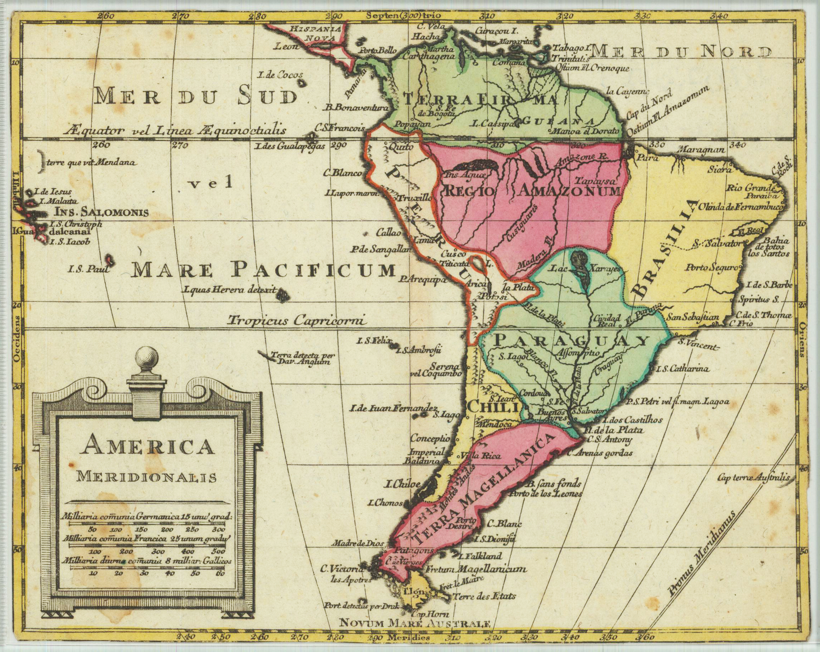
Original copper engraving, hand colored in outline and wash when published. An unusual small map of South America not listed in various collections. According to the style of the engraving the map could be published either in Germany or England in the 2nd half of the 18th century. Many engraved names of cities and towns, rivers. A little cartouche is in the lower left side with three different small mileage scales.
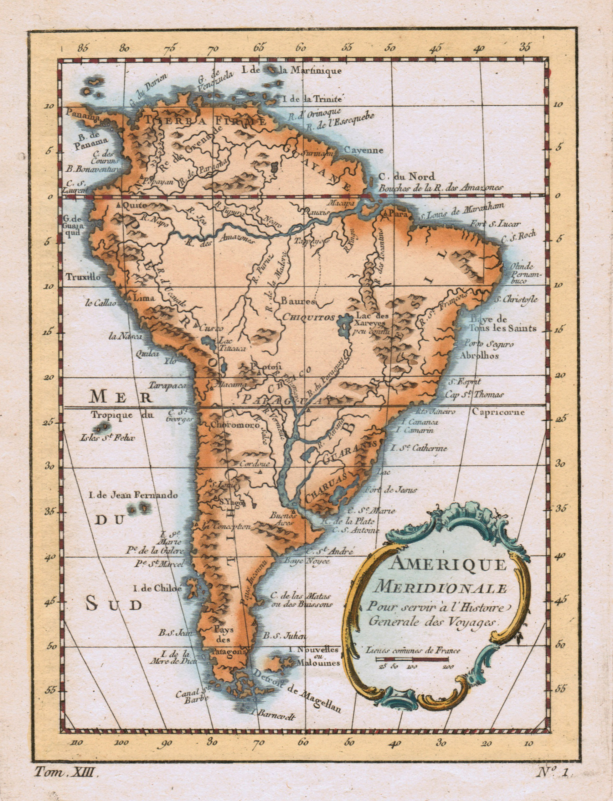
Copper engraving, hand colored in wash. Decorative map of South America published ca. 1760 in an atlas by Nicolaus Bellin. South America is nicely depicted with its rivers and mountains, further islands and place names are shown along the coast line. Jacques Nicolas Bellin (1703-1772) was one of the most important French cartographers of the mid-eighteenth century. He was appointed the first Ingenieur Hydrographe de la Marine, and also Official Hydrographer to the French King. Nicolaus Bellin produced a substantial number of important separately issued maps, particularly reflecting continuing discoveries and political events in the Americas. His maps and charts were finely engraved and produced, and set a high standard of accuracy.
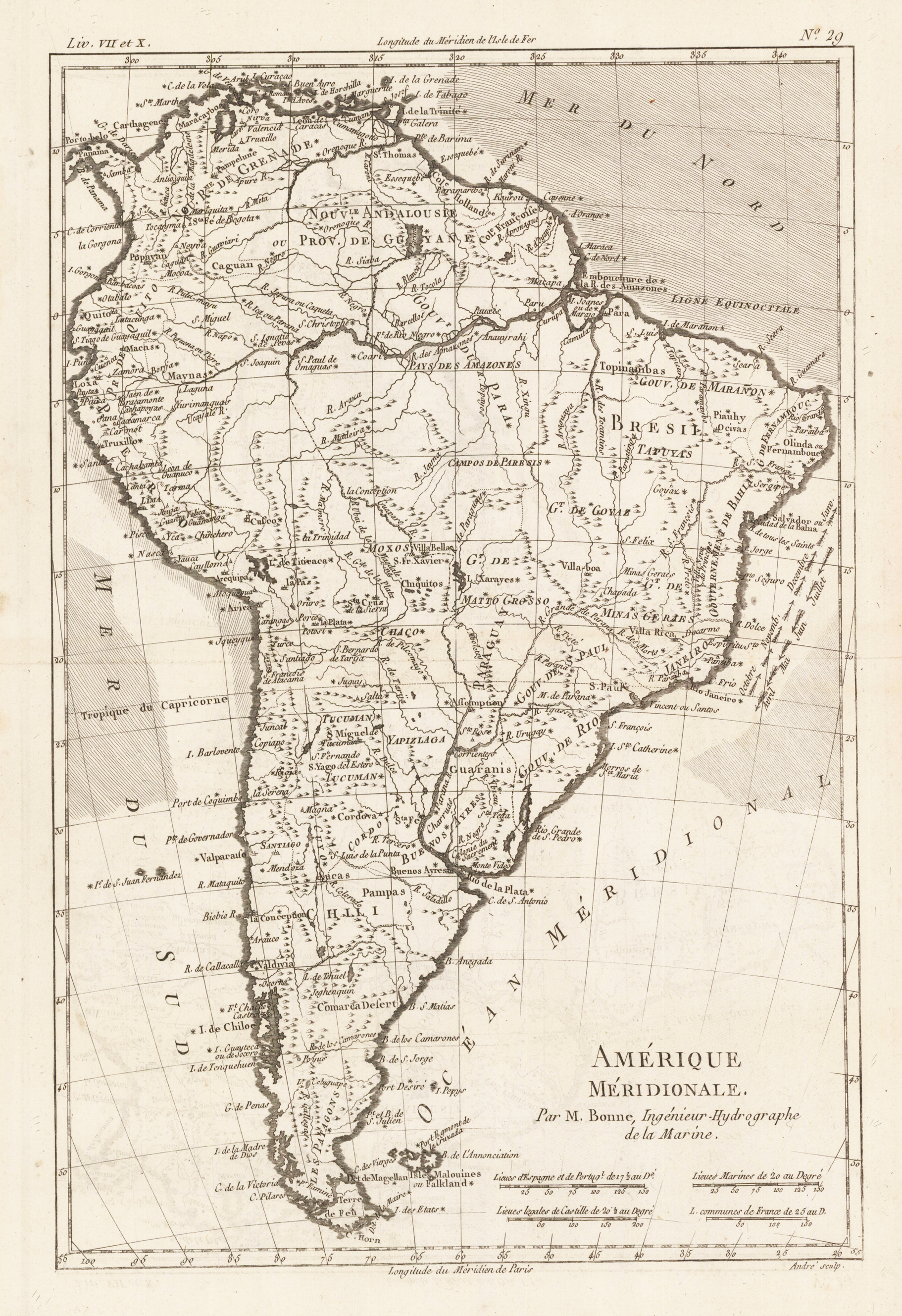
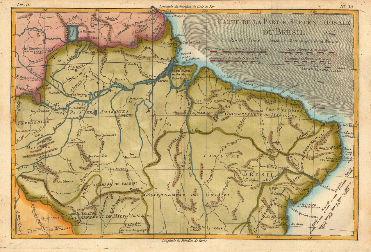
Orinigal antique copper engraving, uncolored. Rigobert Bonne (1727-1794) was a French cartographer of the late 18th century. He studied in Paris and practiced cartography. He became a skilled cartographer and hydrographer and became a royal hydrographer at the ,Depot de la Marine' in 1773. In 1780 he engraved and published the maps for Abbe Raynal's work ,Atlas de Toutes Les Parties Connues du Globe Terrestre'. He also published many charts for the ,Depot de la Marine', further he engraved the maps for the ,Atlas Encyclopedique' in 1788 together with Nicholas Desmarest.
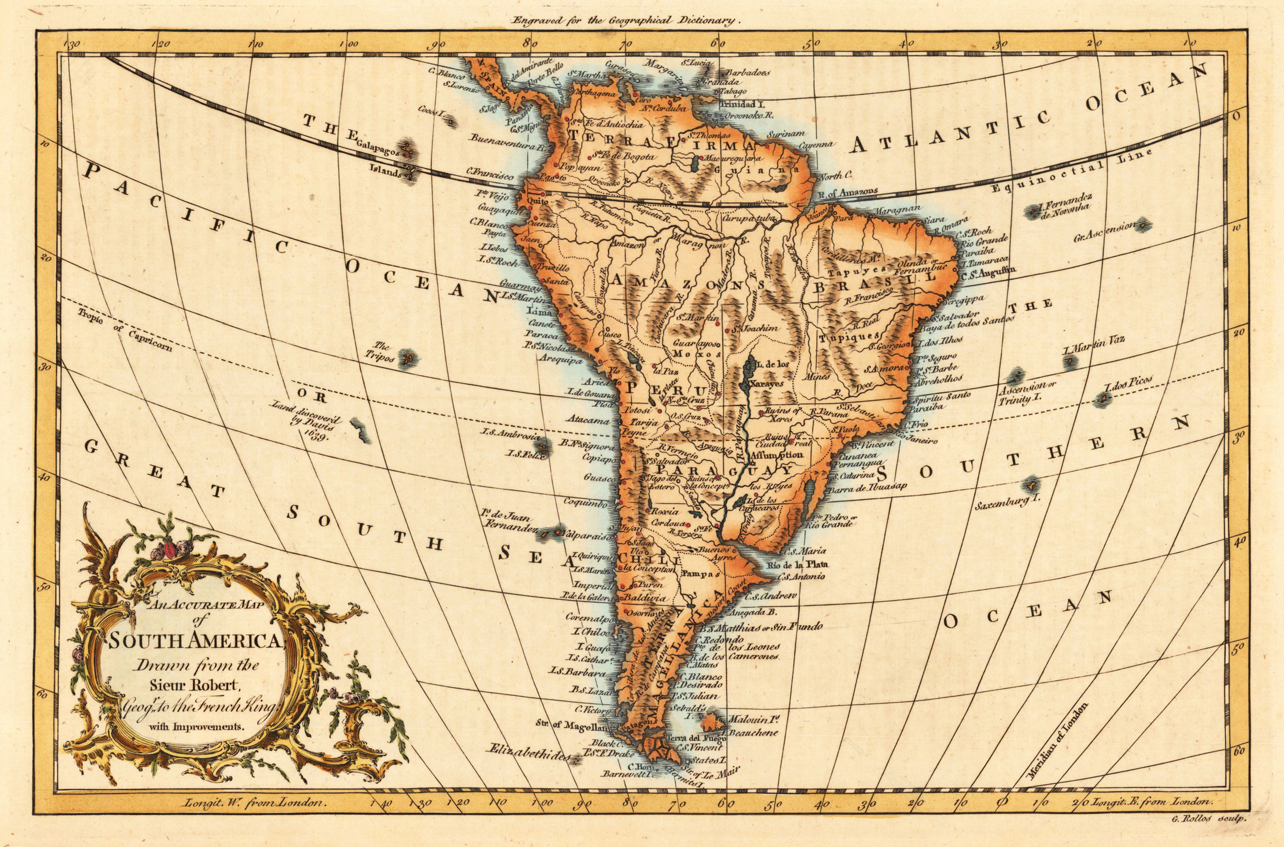
Copper engraving, hand colored in outline and wash. Published in London and engraved for the 'New Geographical Dictionary'. Engraved by G. Rollos. Decorative small map of South America.
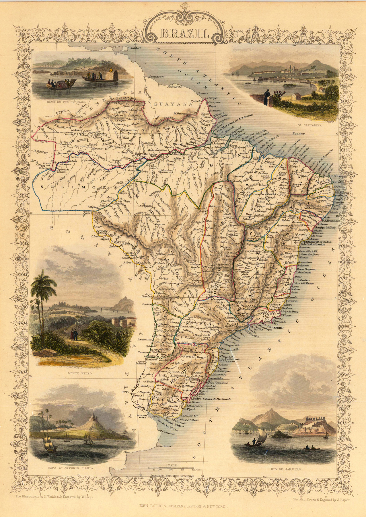
Steel engraving, hand colored in outline and wash. The fine engraved map is showing Brazil with many details, the South Atlantic Ocean and the North Atlantic Ocean. The map is decorated with five finely hand colored engraved vignettes: boats on the Rio Negro, Cape St. Antonio Bahia, city views from St. Catharina, Rio de Janeiro and Monte Video. The actual map was drawn and engraved by J. Rapkin. The illustrations were engraved by various artists: R. Radclyffe, W. Lacy, J. Rogers, J. H. Kernot, J. B. Allen, T. Fleming, H. Winkles, R. Baker after drawings by H. Warren, H. Winkles and H. Wray.
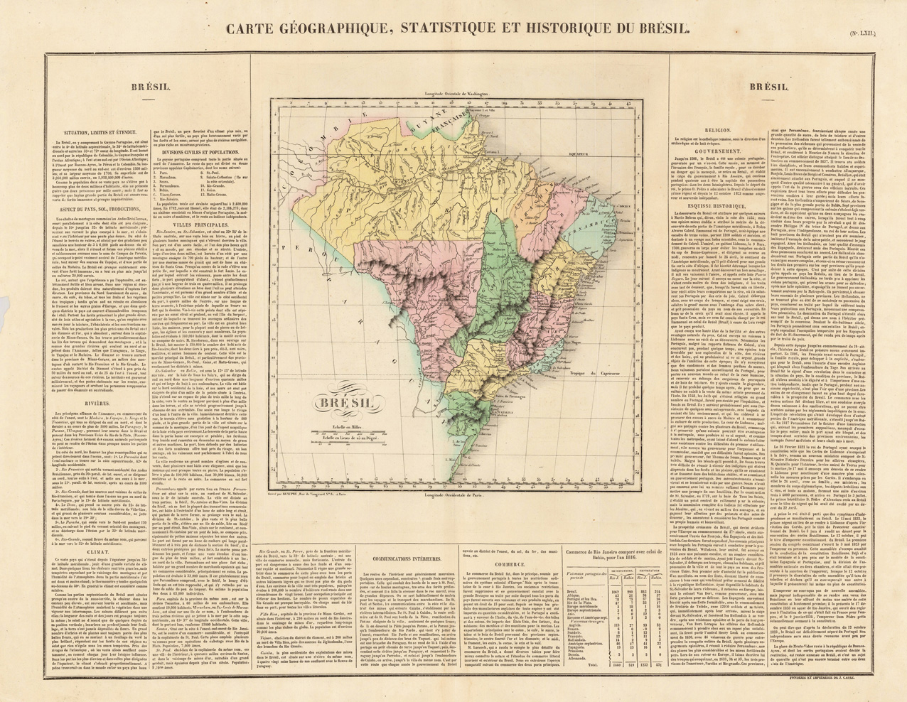
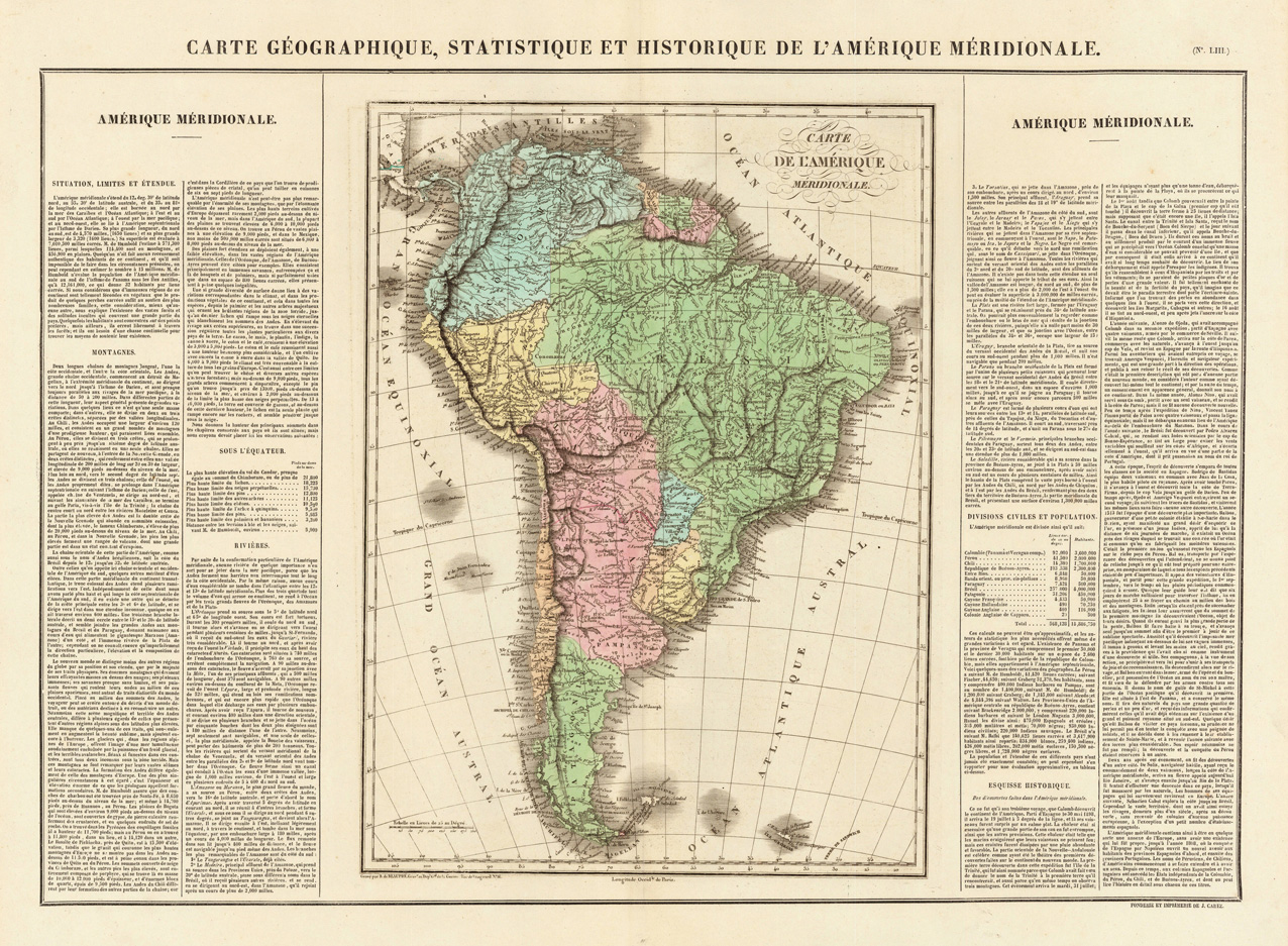
Fine engraved map of Brazil, divided in its various regions. With many place names, rivers and mountains. The map is surrounded by descriptive text on Brazil, providing information on the climate, the rivers, cities and its history. French edition of the 1822 in Philadelphia published map by Carey & Lea. The map was engraved by B. de Beaupre.
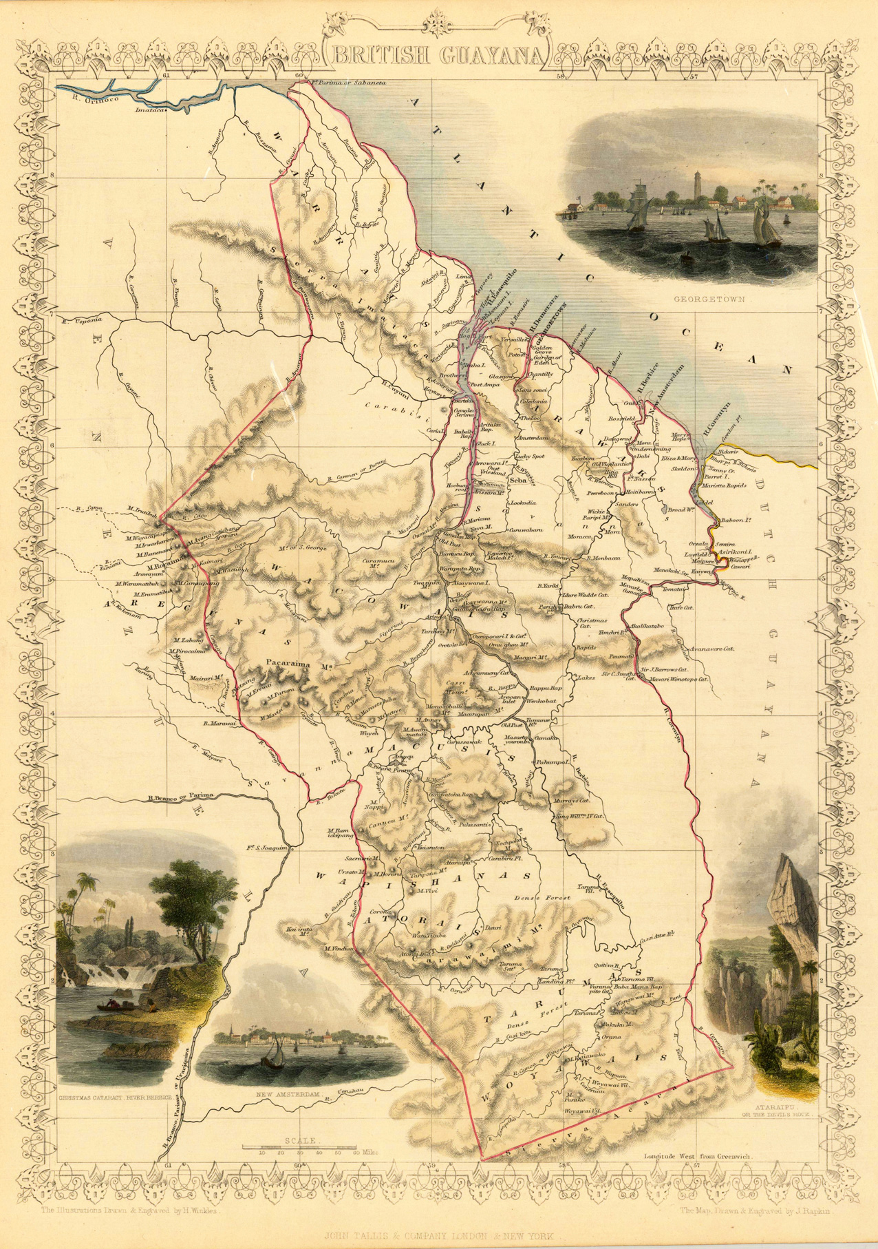
Steel engraving, hand colored in outline and wash. A decorative antique map of British Guayana with many details. We do find engraved place names, rivers, lakes and mountains. The map is decorated with four finely hand colored engraved vignettes: of the river Berbice, Ataraipu or the Devil's Rock and Georgetown. The actual map was drawn and engraved by J. Rapkin. The illustrations were engraved by various artists: R. Radclyffe, W. Lacy, J. Rogers, J. H. Kernot, J. B. Allen, T. Fleming, H. Winkles, R. Baker after drawings by H. Warren, H. Winkles and H. Wray.
Copper engraving, hand colored in outline and wash. Rigobert Bonne (1727-1794) was a French cartographer of the late 18th century. He studied in Paris and practiced cartography. He became a skilled cartographer and hydrographer and became a royal hydrographer at the ,Depot de la Marine' in 1773. In 1780 he engraved and published the maps for Abbe Raynal's work ,Atlas de Toutes Les Parties Connues du Globe Terrestre'. He also published many charts for the ,Depot de la Marine', further he engraved the maps for the ,Atlas Encyclopedique' in 1788 together with Nicholas Desmarest.
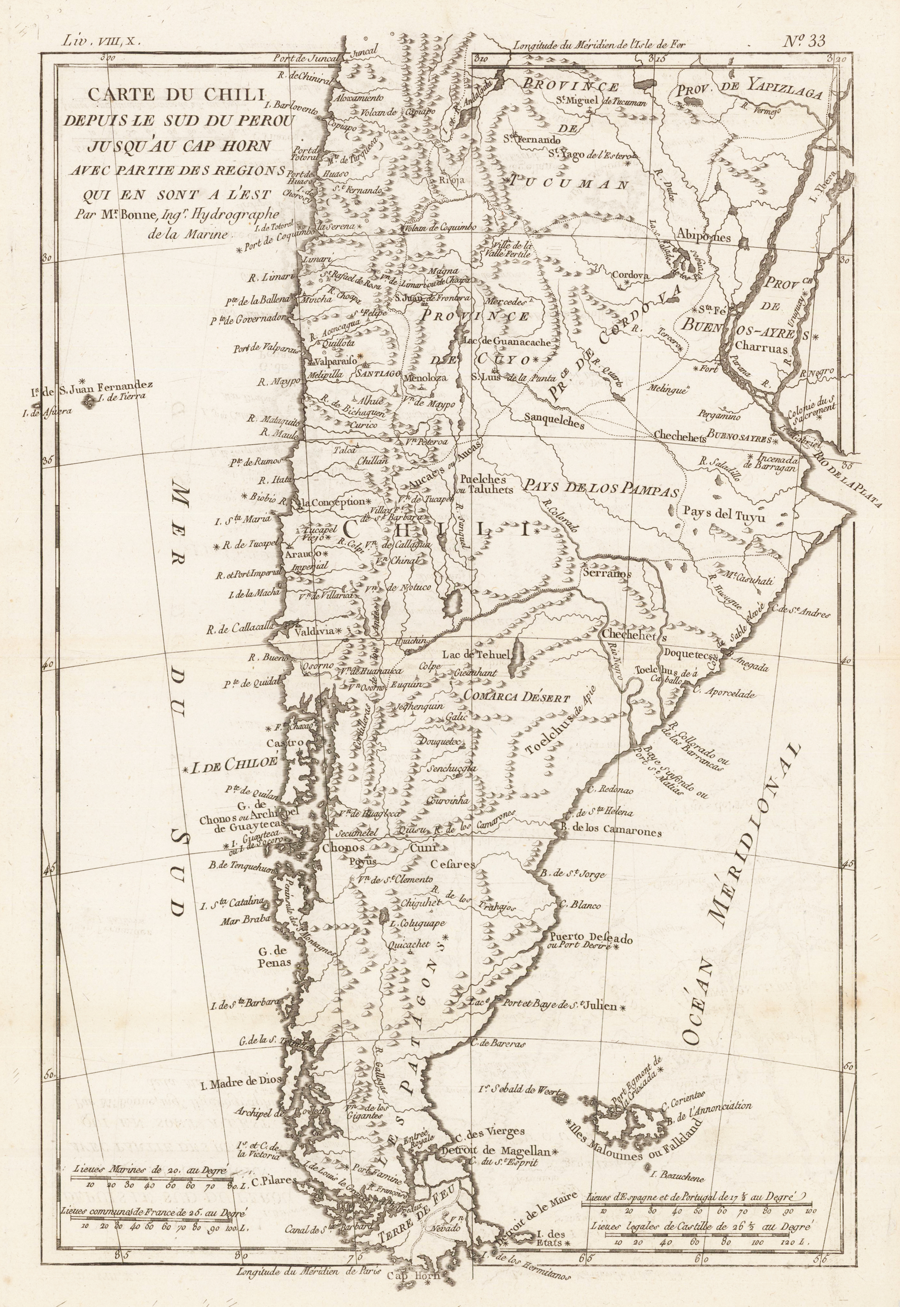
Orinigal antique copper engraving, uncolored. The decorative map is showing Chili, Patagonia, the Magellan Street and the Falkland Islands. Rigobert Bonne (1727-1794) was a French cartographer of the late 18th century. He studied in Paris and practiced cartography. He became a skilled cartographer and hydrographer and became a royal hydrographer at the ,Depot de la Marine' in 1773. In 1780 he engraved and published the maps for Abbe Raynal's work ,Atlas de Toutes Les Parties Connues du Globe Terrestre'. He also published many charts for the ,Depot de la Marine', further he engraved the maps for the ,Atlas Encyclopedique' in 1788 together with Nicholas Desmarest.
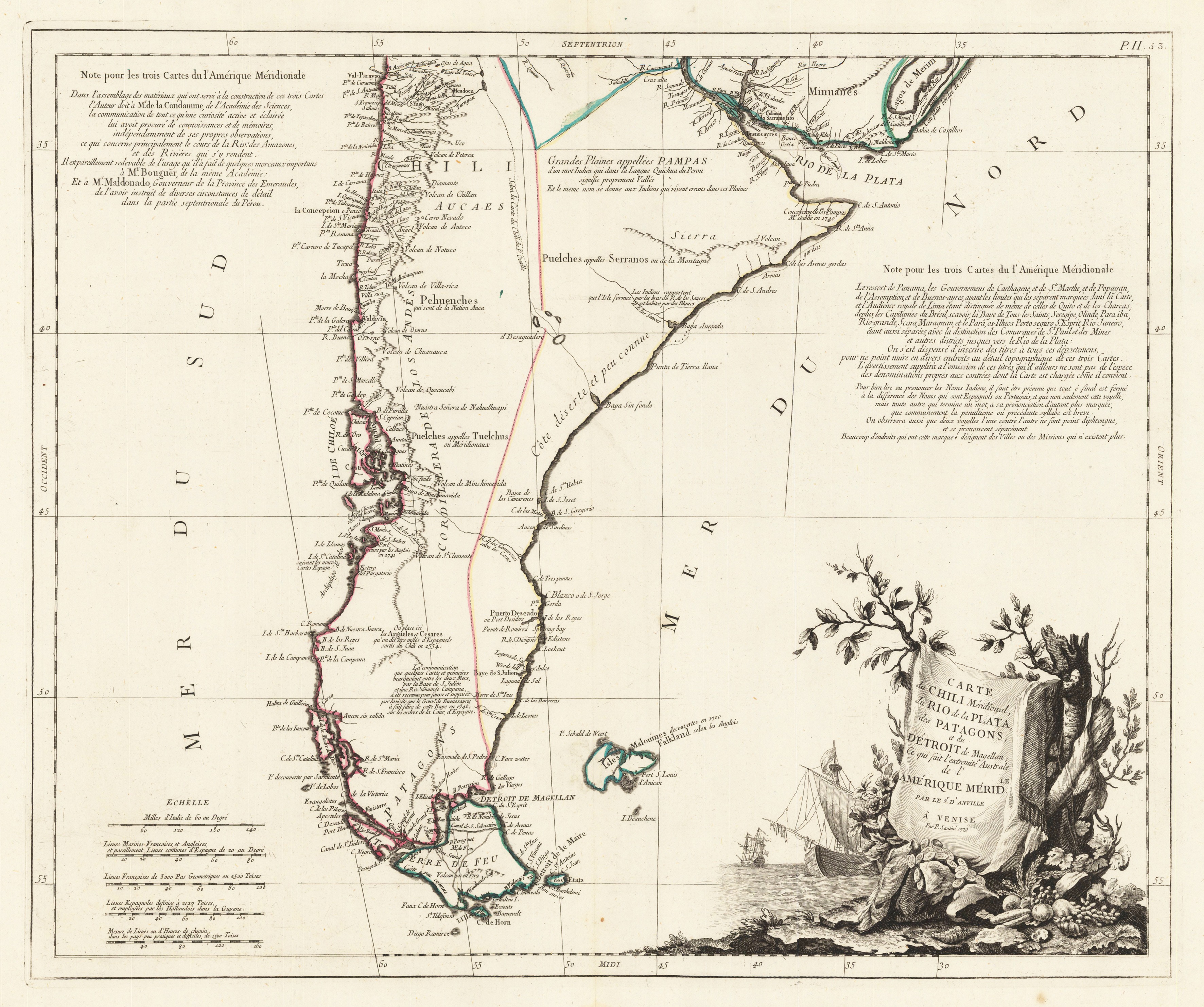
Copper engraving, hand colored in outline. The map first appeared in Santini's Atlas Universel in 1776-79 in Paris. In 1784 Santini sold the plates of the maps to M. Remondini, who published then these maps in Venice with his additional imprint in the title cartouches.
Copper engraving, hand colored in outline when published. Fine engraved map of Columbo, divided in its various regions. With many place names, rivers and mountains. The map is surrounded by descriptive text on Columbo, providing information on the climate, the rivers, cities and its history.French edition of the 1822 in Philadelphia published map by Carey & Lea. The map was engraved by B. de Beaupre.
Copper engraving, handcolored in outline and wash when published.
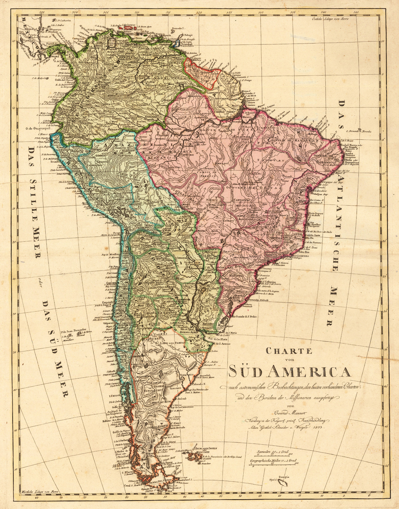
Konrad Mannert (* 17. April 1756 in Altdorf bei Nürnberg; † 27. September 1834 in München) war ein deutscher Historiker und Geograph.
Konrad Mannert was the son of the barber and surgeon Johann Heinrich Mannert. As a child he attended the Altdorf city school and then the St. Sebald school in Nuremberg. In 1778 he began studying at the University of Altdorf. In 1783 he became a master. From 1784 he worked as a teacher at the Sebalder School, and from 1786 as a teacher and librarian at the Egidiengymnasium in Nuremberg. In March 1797 he received the position of full professor of history and oriental languages at Altdorf University. In 1803 the Homann map office in Nuremberg gave him scientific management. He published numerous maps with this publishing house. However, the arrangement seems to have expired around 1807. In 1805 he went to the University of Würzburg as a professor. In 1807 he moved to the new Bavarian Central University in Landshut as a professor of history and geography, and then moved the university to Munich in 1826. In 1827 he became a full member of the Bavarian Academy of Sciences and retired in 1828.
Mannert was married to Ursula Jacobina Nagel, a daughter of the theologian Johann Andreas Michael Nagel.
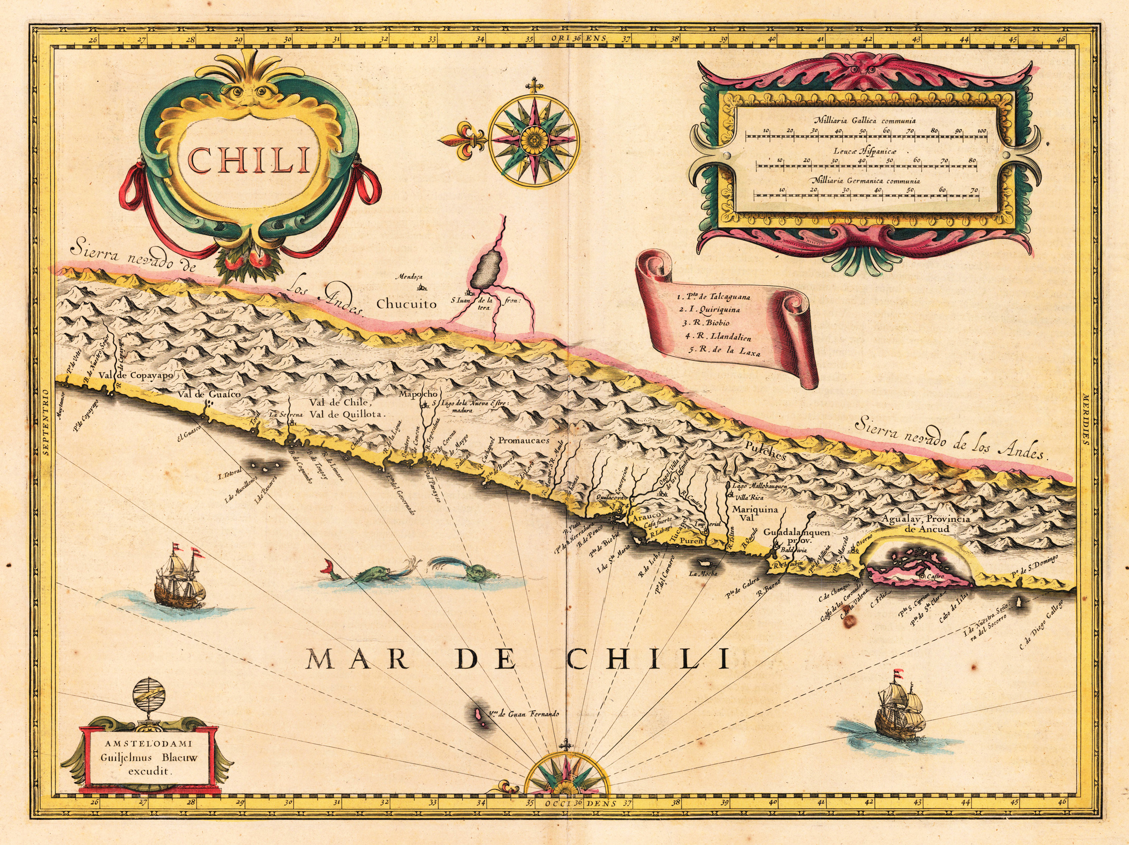
Engraved map in fine contemporary colors in outline and wash. Published in the edition of Blaeu's "Atlas Maior". This nice map shows the coast of Chili. Ornated with a nice allegoric cartouche, ships and shields for coat of arms. Joan Blaeu (23 September 1596 – 21 December 1673) was a Dutch cartographer born in Alkmaar, the son of cartographer Willem Blaeu. In 1620 he became a doctor of law but he joined the work of his father. In 1635 they published the Atlas Novus (full title: Theatrum orbis terrarum, sive, Atlas novus) in two volumes. Joan and his brother Cornelius took over the studio after their father died in 1638. Joan became the official cartographer of the Dutch East India Company. Blaeu's world map, Nova et Accuratissima Terrarum Orbis Tabula, incorporating the discoveries of Abel Tasman, was published in 1648. This map was revolutionary in that it "depicts the solar system according to the heliocentric theories of Nicolaus Copernicus, which show the earth revolving around the sun.... Although Copernicus's groundbreaking book On the Revolutions of the Spheres had been first printed in 1543, just over a century earlier, Blaeu was the first mapmaker to incorporate this revolutionary heliocentric theory into a map of the world." Blaeu's map was copied for the map of the world set into the pavement of the Groote Burger-Zaal of the new Amsterdam Town Hall, designed by the Dutch architect Jacob van Campen (now the Amsterdam Royal Palace), in 1655. Blaeu's Hollandia Nova was also depicted in his Archipelagus Orientalis sive Asiaticus published in 1659 in the Kurfürsten Atlas (Atlas of the Great Elector). and used by Melchisédech Thévenot to produce his map, Hollandia Nova—Terre Australe (1664). As Joan Blaeu, he also published the 12 volume "Le Grand Atlas, ou Cosmographie blaviane, en laquelle est exactement descritte la terre, la mer, et le ciel". One edition is dated 1663. That was folio (540 x 340 mm), and contained 593 engraved maps and plates. In March 2015, a copy was on sale for £750,000. Around 1649 Joan Blaeu published a collection of Dutch city maps named Toonneel der Steeden (Views of Cities). In 1651 he was voted into the Amsterdam council. In 1654 Joan published the first atlas of Scotland, devised by Timothy Pont. In 1662 he reissued the Atlas Novus, also known as Atlas Maior, in 11 volumes, and one for oceans.[citation needed] A cosmology was planned as their next project, but a fire destroyed the studio completely in 1672. (Wikipedia)

![[South America]](https://bergbook-sw6.1drop.dev/media/bf/8e/17/1713265453/21905.jpg "21905")
![Afbeeldinge vande Cabo St. Augustin Met haer forten [St. Augustine, Brazil]](https://bergbook-sw6.1drop.dev/media/22/cb/3f/1713265566/34072.jpg "34072")