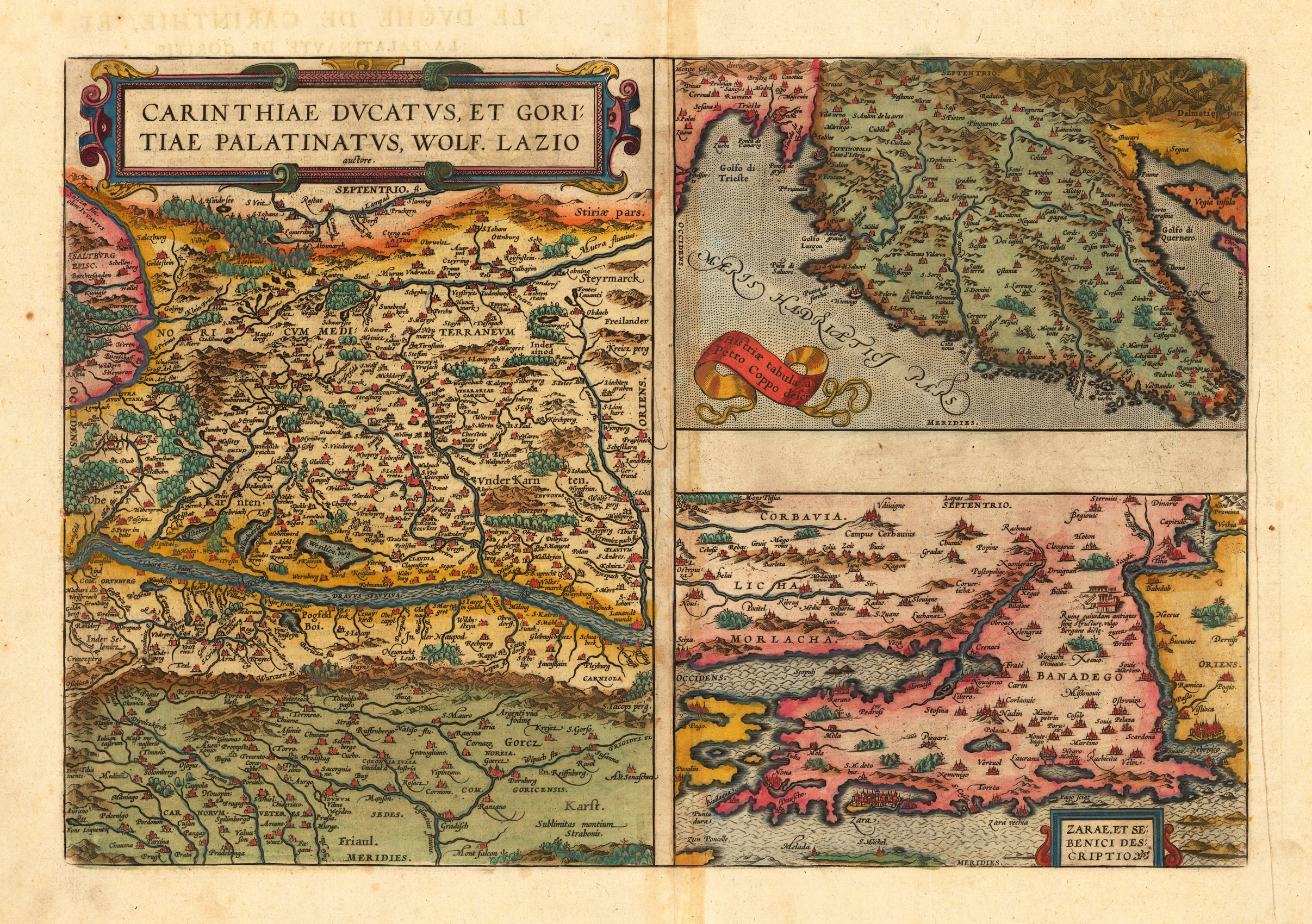
Original copper engraving, published 1598 in a French edition of the "Theatrum Orbis Terrarum". Finely hand-colored in wash and outline. There are three maps on one plate, each showing a title cartouche. Villages and towns are shown as miniature views. Ortelius was born on 14 April 1527 in the city of Antwerp, which was then in the Habsburg Netherlands (modern-day Belgium). The Orthellius family were originally from Augsburg, a Free imperial city of the Holy Roman Empire. In 1535, the family had fallen under suspicion of Protestantism. Following the death of Ortelius's father, his uncle Jacobus van Meteren returned from religious exile in England to take care of Ortelius. Abraham remained close to his cousin Emanuel van Meteren, who would later move to London. In 1575 he was appointed geographer to the king of Spain, Philip II, on the recommendation of Arias Montanus, who vouched for his orthodoxy. He travelled extensively in Europe and is specifically known to have traveled throughout the Seventeen Provinces; in southern, western, northern, and eastern Germany (e.g., 1560, 1575–1576); France (1559–1560); England and Ireland (1576); and Italy (1578, and perhaps twice or thrice between 1550 and 1558). Beginning as a map-engraver, in 1547 he entered the Antwerp Guild of Saint Luke as an illuminator of maps. He supplemented his income trading in books, prints, and maps, and his journeys included yearly visits to the Frankfurt book and print fair, where he met Gerardus Mercator in 1554. In 1560, however, when travelling with Mercator to Trier, Lorraine, and Poitiers, he seems to have been attracted, largely by Mercator's influence, towards the career of a scientific geographer. (Wikipedia)
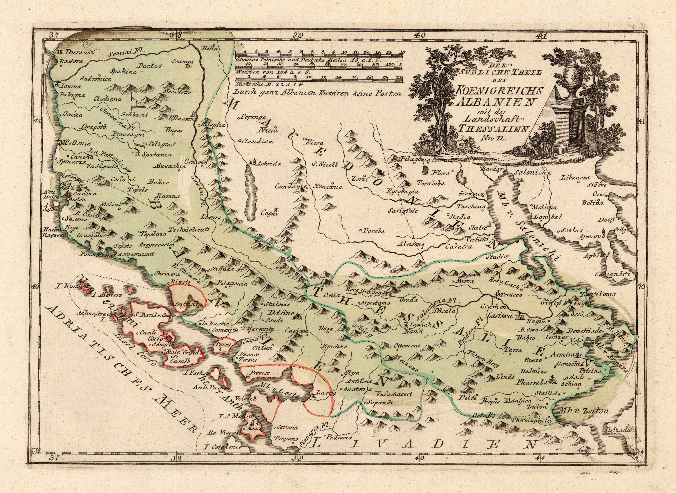
Original copper engraving, hand colored in wash and outline, when published. This detailed map shows Albanien with Tessalien and Macedonien. The map is equipped with many mountains, rivers, lakes and the island Corfu, etc. The Austrian cartographer Franz Joh. Josef von Reilly published around 1789 in Vienna a large amount of very detailed district maps of Central Europe. These maps are famous for their large scales and the many details they provide. Even tiny place names can be found on those maps, rivers, mountains, streets, monasteries are as well engraved. The maps, which Franz J. Reilly engraved, were especially designed for the Austrian Royal house and show countries, provinces and districts belonging to the 'Austrian-Hungarian Empire'.
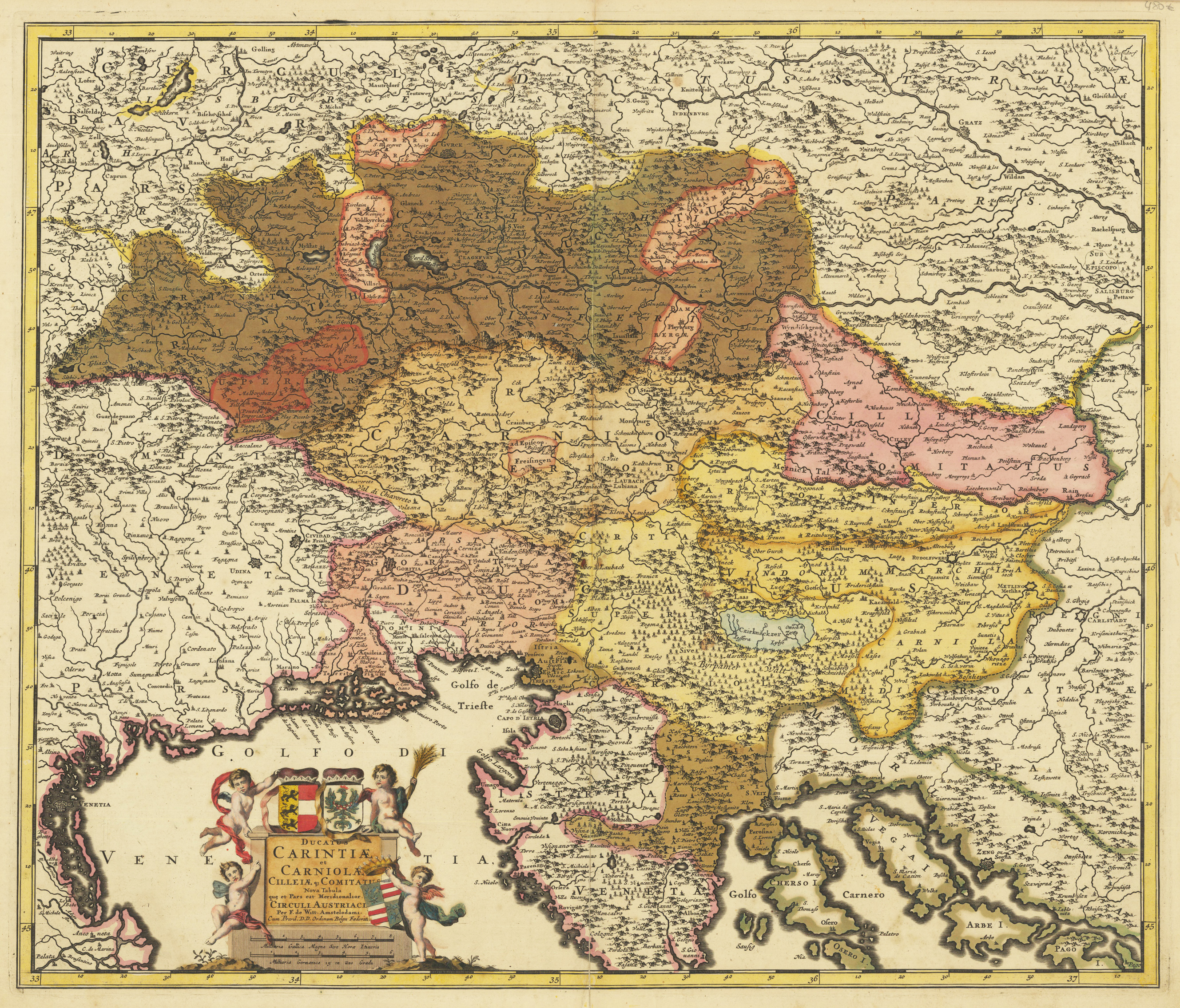
Original copper engraving, hand colored in outline and wash when published. Decorative detailled map showing 'Carintiae and Carniola' with its neighbouring regions Slovenia, Croatia abnd Istria. In the lower left side we find a rich ornated title cartouche, with an allegoric scene and coat of arms the duchies Carintiae and Carniola. In full original body colour and outline colour, when published. Many historical names are on the map found, as well names of historical tribes.
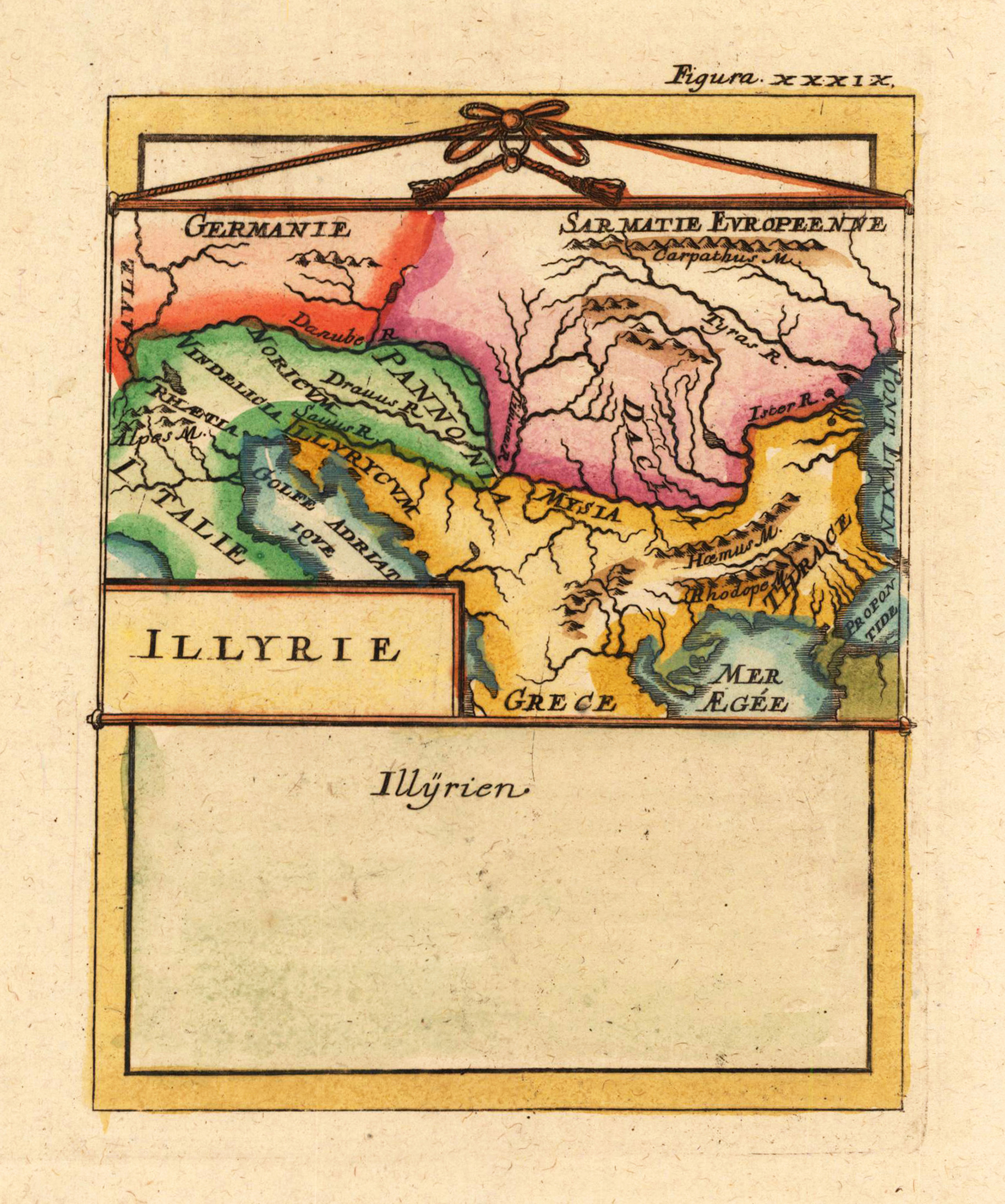
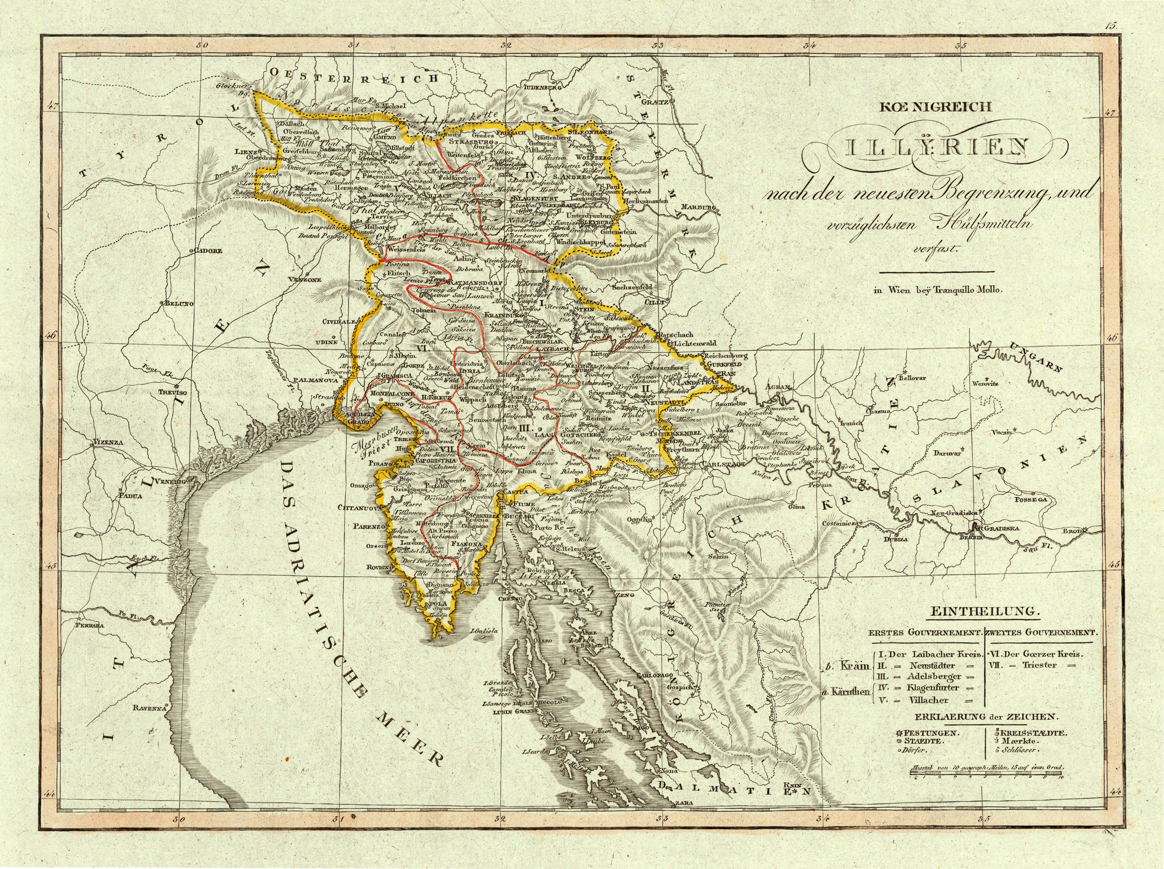
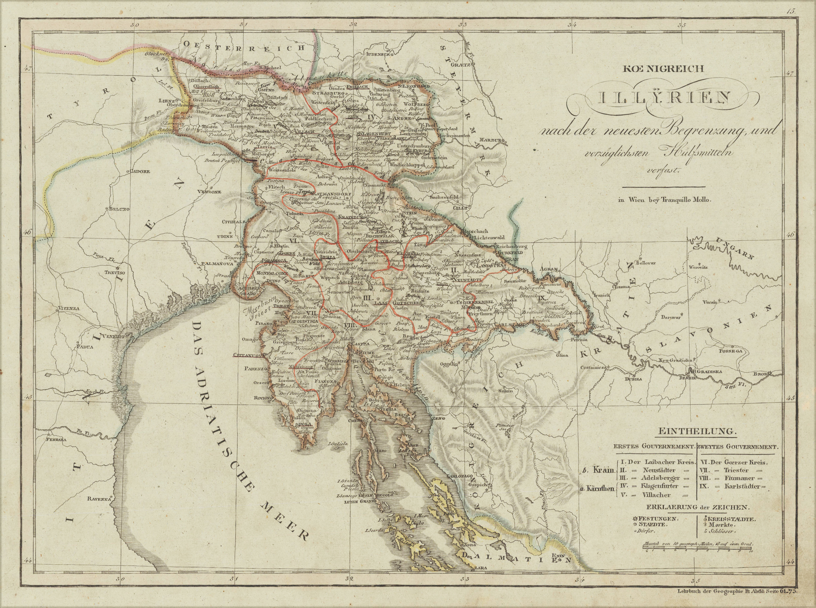
Original antique copper engraving, hand colored in outline and wash, when published. This decorative map shows the kingdom of Illyria. The map is equipped with many place names, rivers, streets, political borders and an explanation of this map. Tranquillo Maria Laurentio Mollo (August 10, 1767 - March 29, 1837) was Vienna based Swiss/Italian graphic designer, printer, art and music dealer, and publisher active in the late 18th and early 20th centuries. From about 1792 Mollo worked with the Vienna firm Artaria and Company. In 1798 he separated from Artaria to found, along with partner Franz Bernardini, his own music, art, and map publishing company, T. Mollo and Co. The partner collapsed after one year and Mollo took a new partner, Domenico Artaria, a scion of the Artaria family. In 1802 Mollo and Domenico acquired Artaria and Company from Carlo Artaria. Domenico and Mollo parted ways in 1804, after which Mollo published independently. Under his own imprint, he became one of Austria's most important globe and map publishers. He collaborated extensively with English and French publishers to bring French material to his work. Among his more significant collaborators was the Vienna publisher Joseph Dirwaldt. In 1832 Mollo passed the company to his sons, Eduard (1799-1842) and Florian Mollo (1803-1869). The Mollo brothers ran the business until 1839, three years after Tranquillo Mollo's death, before dividing the concern into separate business. Mollo married Dorothea Defelavis († 29. Juli 1822). (Wikipedia)
Copper engraving, in contemporary original color in outline. This decorative map shows the kingdom of Illyria. The map is equipped with many place names, rivers, streets, political borders and an explanation of this map.
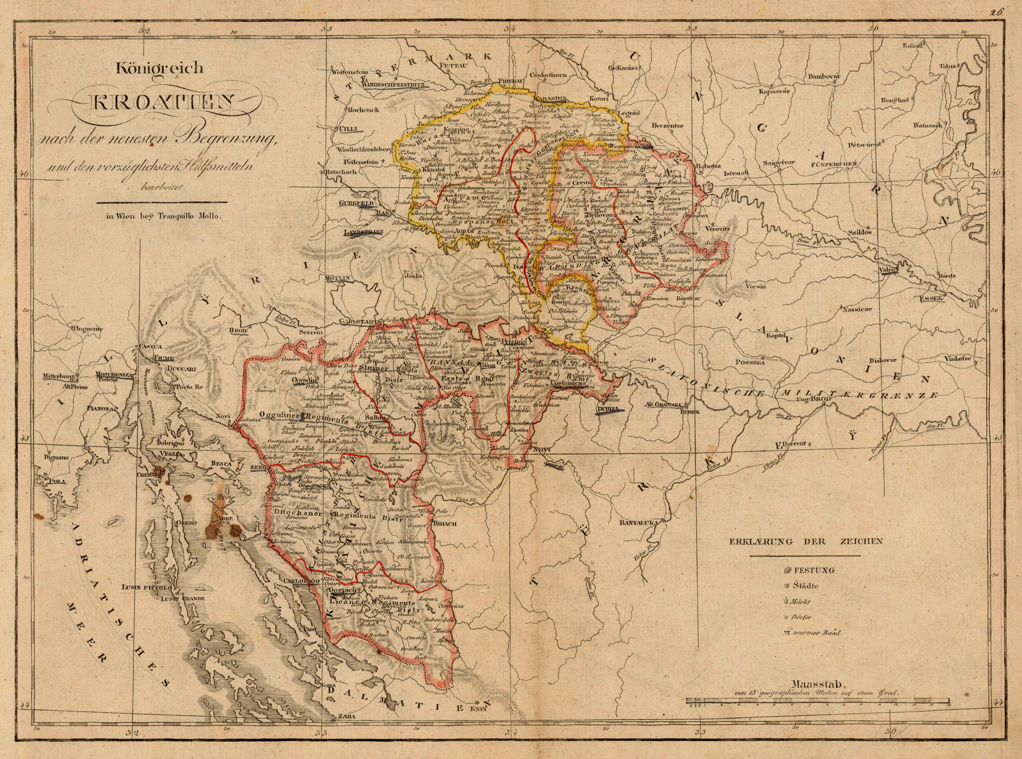
Original antique copper engraving, hand colored in outline and wash, when published. An interesting map by the famous Austrian cartographer and publisher Tranquillo Mollo. This decorative map shows the kingdom of Croatia. The map is equipped with many place names, rivers, and the explanation of this map and a mileage scale. Tranquillo Maria Laurentio Mollo (August 10, 1767 - March 29, 1837) was Vienna based Swiss/Italian graphic designer, printer, art and music dealer, and publisher active in the late 18th and early 20th centuries. From about 1792 Mollo worked with the Vienna firm Artaria and Company. In 1798 he separated from Artaria to found, along with partner Franz Bernardini, his own music, art, and map publishing company, T. Mollo and Co. The partner collapsed after one year and Mollo took a new partner, Domenico Artaria, a scion of the Artaria family. In 1802 Mollo and Domenico acquired Artaria and Company from Carlo Artaria. Domenico and Mollo parted ways in 1804, after which Mollo published independently. Under his own imprint, he became one of Austria's most important globe and map publishers. He collaborated extensively with English and French publishers to bring French material to his work. Among his more significant collaborators was the Vienna publisher Joseph Dirwaldt. In 1832 Mollo passed the company to his sons, Eduard (1799-1842) and Florian Mollo (1803-1869). The Mollo brothers ran the business until 1839, three years after Tranquillo Mollo's death, before dividing the concern into separate business. Mollo married Dorothea Defelavis († 29. Juli 1822). (Wikipedia)
Original antique copper engraving, published 1612 in the famous historical Atlas "Parergon" (Latin text-edition) by Abraham Ortelius. Finely later hand-colored in wash and outline. Abraham Ortelius's beautiful map of the Adriatic Sea with its neighbouring countries Croatia, Slovenia, Serbia, Montenegro, Albania and the northern part of Macedonia. The Adriatic coastline is well engraved with islands, place names and rivers towards the sea. Decorated with sailing ships in the sea. The antique map is equipped with three renaissance cartouches with descriptive text. Ortelius was born on 14 April 1527 in the city of Antwerp, which was then in the Habsburg Netherlands (modern-day Belgium). The Orthellius family were originally from Augsburg, a Free imperial city of the Holy Roman Empire. In 1535, the family had fallen under suspicion of Protestantism. Following the death of Ortelius's father, his uncle Jacobus van Meteren returned from religious exile in England to take care of Ortelius. Abraham remained close to his cousin Emanuel van Meteren, who would later move to London. In 1575 he was appointed geographer to the king of Spain, Philip II, on the recommendation of Arias Montanus, who vouched for his orthodoxy. He travelled extensively in Europe and is specifically known to have traveled throughout the Seventeen Provinces; in southern, western, northern, and eastern Germany (e.g., 1560, 1575–1576); France (1559–1560); England and Ireland (1576); and Italy (1578, and perhaps twice or thrice between 1550 and 1558). Beginning as a map-engraver, in 1547 he entered the Antwerp Guild of Saint Luke as an illuminator of maps. He supplemented his income trading in books, prints, and maps, and his journeys included yearly visits to the Frankfurt book and print fair, where he met Gerardus Mercator in 1554. In 1560, however, when travelling with Mercator to Trier, Lorraine, and Poitiers, he seems to have been attracted, largely by Mercator's influence, towards the career of a scientific geographer. (Wikipedia)
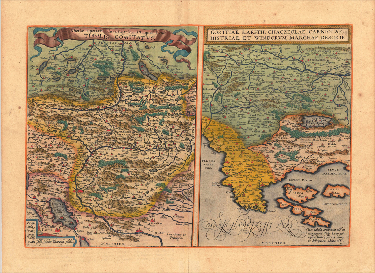
Original copper engraving, published 1612 in the famous Vrients-edition of the "Theatrum Orbis Terrarum". Finely hand-coloured in wash and outline. Two maps on one doublepage plate, each one of them showing a title cartouche at the top centre. Villages and towns are shown as miniature views, as well mountains and rivers are shown. The both maps are engraved after Wolfgang Lazius. This example is in very decorative colours and in excellent condition, however the hand colour is probably done by a later hand. On the full sheet as published. The detailled map on the Duchy of Tirol, is mainly showing South Tirol with the area Insbruck, Trient, the Lago de Garda towards Verona in the South. The other map is showing the area Carniola, Istria and the so called 'Windisch Mark'. Ortelius was born on 14 April 1527 in the city of Antwerp, which was then in the Habsburg Netherlands (modern-day Belgium). The Orthellius family were originally from Augsburg, a Free imperial city of the Holy Roman Empire. In 1535, the family had fallen under suspicion of Protestantism. Following the death of Ortelius's father, his uncle Jacobus van Meteren returned from religious exile in England to take care of Ortelius. Abraham remained close to his cousin Emanuel van Meteren, who would later move to London. In 1575 he was appointed geographer to the king of Spain, Philip II, on the recommendation of Arias Montanus, who vouched for his orthodoxy. He travelled extensively in Europe and is specifically known to have traveled throughout the Seventeen Provinces; in southern, western, northern, and eastern Germany (e.g., 1560, 1575–1576); France (1559–1560); England and Ireland (1576); and Italy (1578, and perhaps twice or thrice between 1550 and 1558). Beginning as a map-engraver, in 1547 he entered the Antwerp Guild of Saint Luke as an illuminator of maps. He supplemented his income trading in books, prints, and maps, and his journeys included yearly visits to the Frankfurt book and print fair, where he met Gerardus Mercator in 1554. In 1560, however, when travelling with Mercator to Trier, Lorraine, and Poitiers, he seems to have been attracted, largely by Mercator's influence, towards the career of a scientific geographer. (Wikipedia)
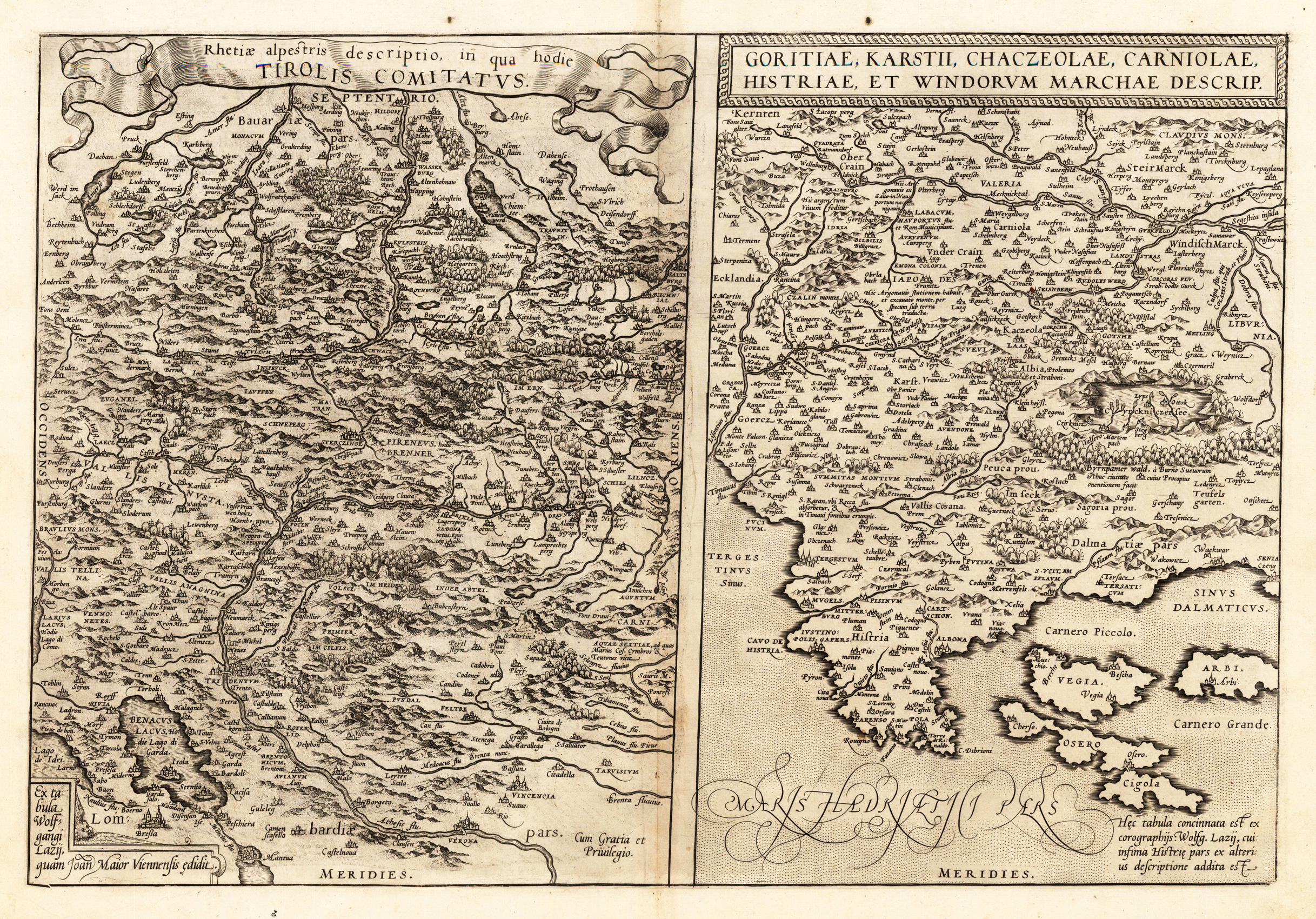
Original antique copper engraving, published 1573 in Antwerp in the famous Atlas 'Theatrum Orbis Terrarum'. German text edition. Uncolored example. Two maps on one double page plate, each one of them showing a title cartouche at the top centre. Villages and towns are shown as miniature views, as well mountains and rivers are shown. The both maps are engraved after Wolfgang Lazius. On the full sheet as published. The detailed map on the Duchy of Tirol, is mainly showing South Tirol with the area Innsbruck, Trient, the Lago de Garda towards Verona in the South. The other map is showing the area Carniola, Istria and the so called 'Windisch Mark'. Ortelius was born on 14 April 1527 in the city of Antwerp, which was then in the Habsburg Netherlands (modern-day Belgium). The Orthellius family were originally from Augsburg, a Free imperial city of the Holy Roman Empire. In 1535, the family had fallen under suspicion of Protestantism. Following the death of Ortelius's father, his uncle Jacobus van Meteren returned from religious exile in England to take care of Ortelius. Abraham remained close to his cousin Emanuel van Meteren, who would later move to London. In 1575 he was appointed geographer to the king of Spain, Philip II, on the recommendation of Arias Montanus, who vouched for his orthodoxy. He travelled extensively in Europe and is specifically known to have traveled throughout the Seventeen Provinces; in southern, western, northern, and eastern Germany (e.g., 1560, 1575–1576); France (1559–1560); England and Ireland (1576); and Italy (1578, and perhaps twice or thrice between 1550 and 1558). Beginning as a map-engraver, in 1547 he entered the Antwerp Guild of Saint Luke as an illuminator of maps. He supplemented his income trading in books, prints, and maps, and his journeys included yearly visits to the Frankfurt book and print fair, where he met Gerardus Mercator in 1554. In 1560, however, when travelling with Mercator to Trier, Lorraine, and Poitiers, he seems to have been attracted, largely by Mercator's influence, towards the career of a scientific geographer. (Wikipedia)
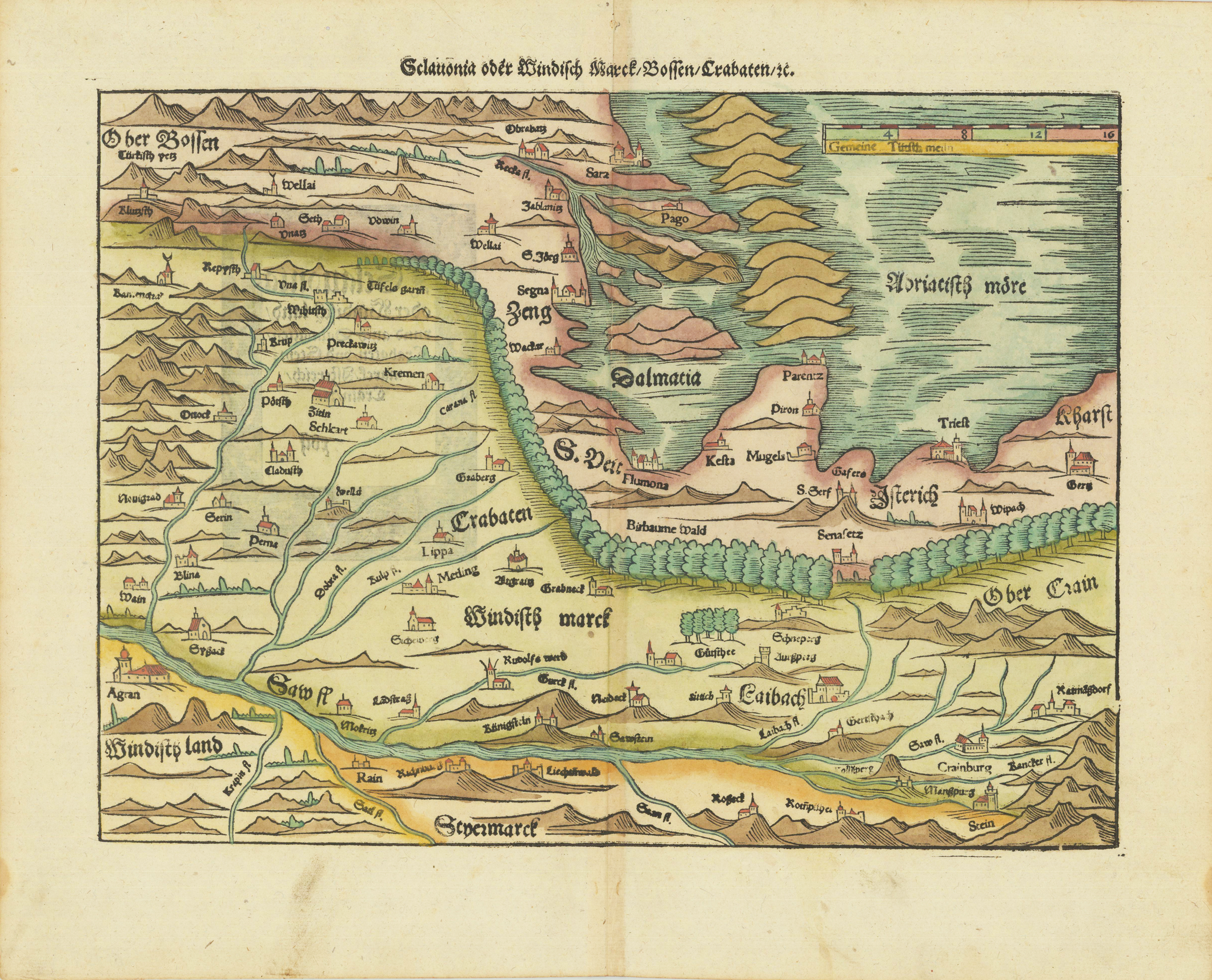
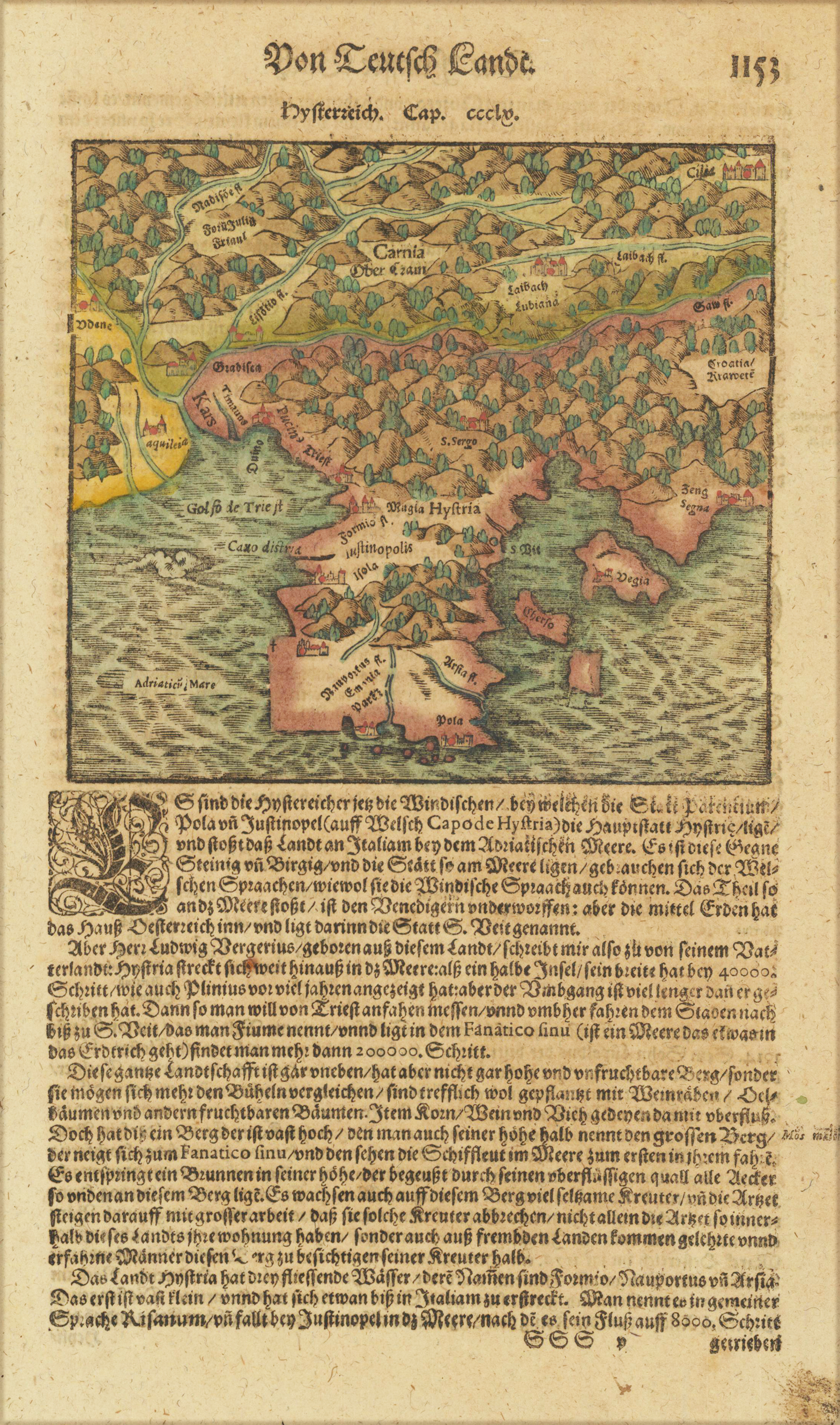
Woodcut map, finely hand colored in wash by a later hand. Published in the ,Cosmographia' by Sebastian Münster in Basel, German text edition 1578. Early and decorative woodcut map orientated from the north to the south depicting of the regions in Carniola, Slovenia, Illyria and the neighboring Croatia. Mountain chains, woods and very few place names are schematic shown on this old historic map. Cities and villages are shown as miniature city views. An interesting historic 16th century map of the region Windic March, the gulf of Triest and parts of Dalmatia. Verso illustrated with a decorative woodcut bordure, probably cut by the famous 16th century woodcutter Hans Holbein. Nearly none of the captivating woodcut borders verso are repeating, they are mainly shaped by allegoric scenes, coat of arms or wonderful initials. This fine antique map was was published 1574 in a German text edition of Sebastian Münster's ,Cosmographia', the first detailed scientific and popular description of the world in Sebastian Münster's native language as well as a supreme effort of geographical study and literature of the Reformation period. One of the most popular treatises of the sixteenth and seventeenth centuries the Cosmographia reached a total of forty-six editions in six languages by 1650 each incorporating additions and revisions. Sebastian Münster was a professor of Hebrew at Basel university and a most distinguished Hebraist linguist mathematician and geographer. This encyclopedic work was his major undertaking. In its completion, which occupied him for fifteen years, Münster received the assistance of more than one hundred and twenty collaborators, who provided him with the most up-to-date information relating to the towns and places described. The scientifically most valuable sections are those which deal with Germany and Central Europe.
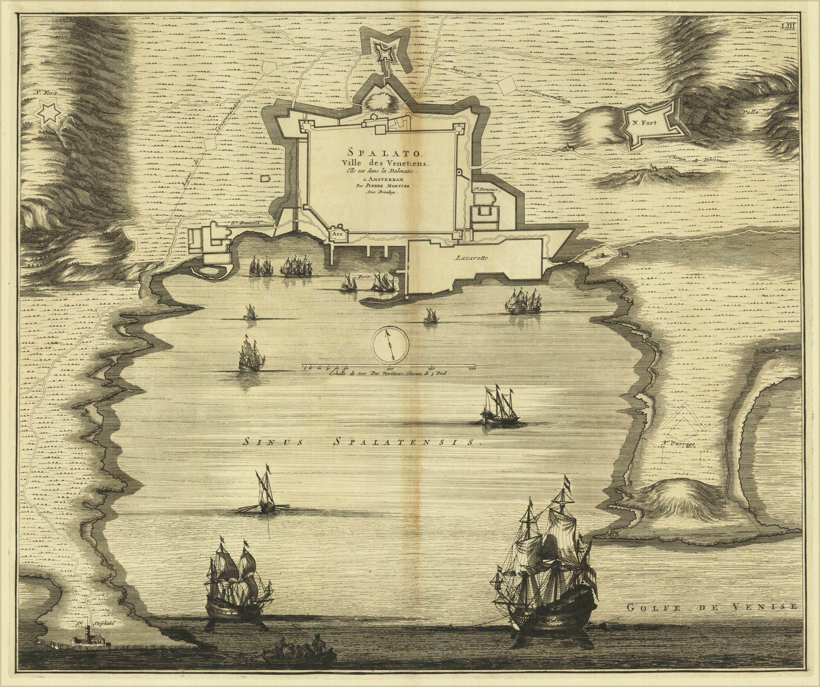
Original copper engraving. Uncolored. Fascinating plant of Split enriched by ships sailing in the Gulf of Venice. Mortier, publisher active in Amsterdam at the beginning of the century, reprinted the "Theatrum CivitatumÖItaliae" of Blaeu in 1663, adding a fourth volume, relating to northern Italy and Tuscany.
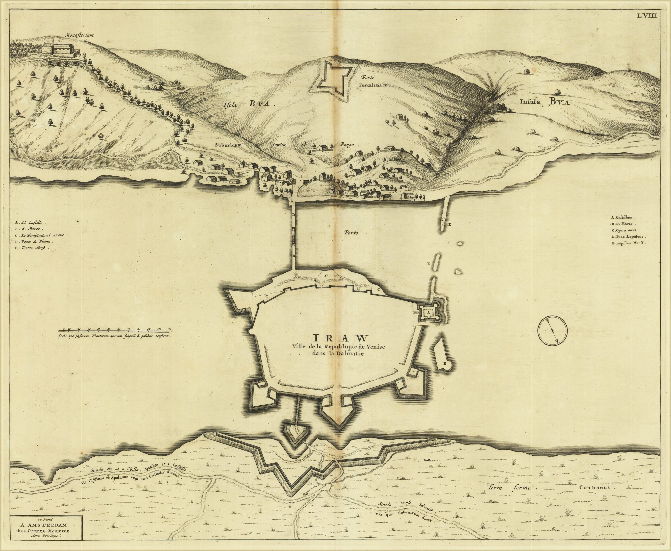
Original copper engraving. Uncolored. Fascinating plant of Traw and the Bua island. Mortier, publisher active in Amsterdam at the beginning of the century, reprinted the "Theatrum Civitatum ... Italiae" of Blaeu in 1663 adding a fourth volume, relating to northern Italy, Dalmatia, Greece and Tuscany. Beautiful specimen with wide margins.
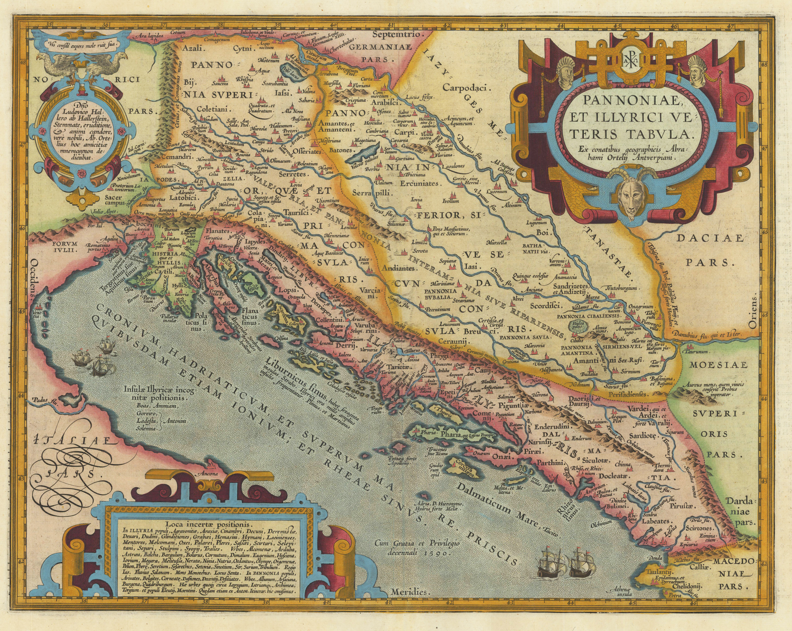
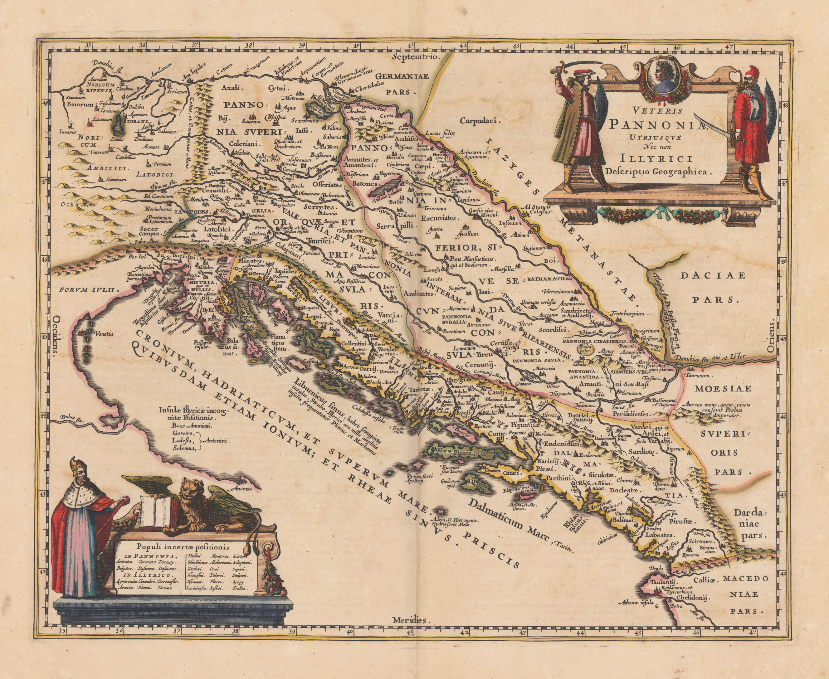
Original antique copper engraving, decorative hand colored in outline when published. The map is ornated with a decorative allegoric ornated title cartouche in the upper right corner. Villages and towns are shown as miniature views, as well rivers and mountains are engraved. In the lower left corner we find a cartouche providing information on the population of Pannonia and Illyricum.
Woodcut map, finely hand colored in wash by a later hand. Published in the ,Cosmographia' by Sebastian Münster in Basel, German text edition 1574. Early and decorative woodcut map of the regions in Carniola, Slovenia, Illyria and the neighboring Croatia. Mountain chains, woods and very few place names are schematic shown on this old historic map. An interesting historic 16th century map of the region around Illyria and the gulf of Triest. This fine antique map was was published 1574 in a German text edition of Sebastian Münster's ,Cosmographia', the first detailed scientific and popular description of the world in Sebastian Münster's native language as well as a supreme effort of geographical study and literature of the Reformation period. One of the most popular treatises of the sixteenth and seventeenth centuries the Cosmographia reached a total of forty-six editions in six languages by 1650 each incorporating additions and revisions. Sebastian Münster was a professor of Hebrew at Basel university and a most distinguished Hebraist linguist mathematician and geographer. This encyclopedic work was his major undertaking. In its completion, which occupied him for fifteen years, Münster received the assistance of more than one hundred and twenty collaborators, who provided him with the most up-to-date information relating to the towns and places described. The scientifically most valuable sections are those which deal with Germany and Central Europe.