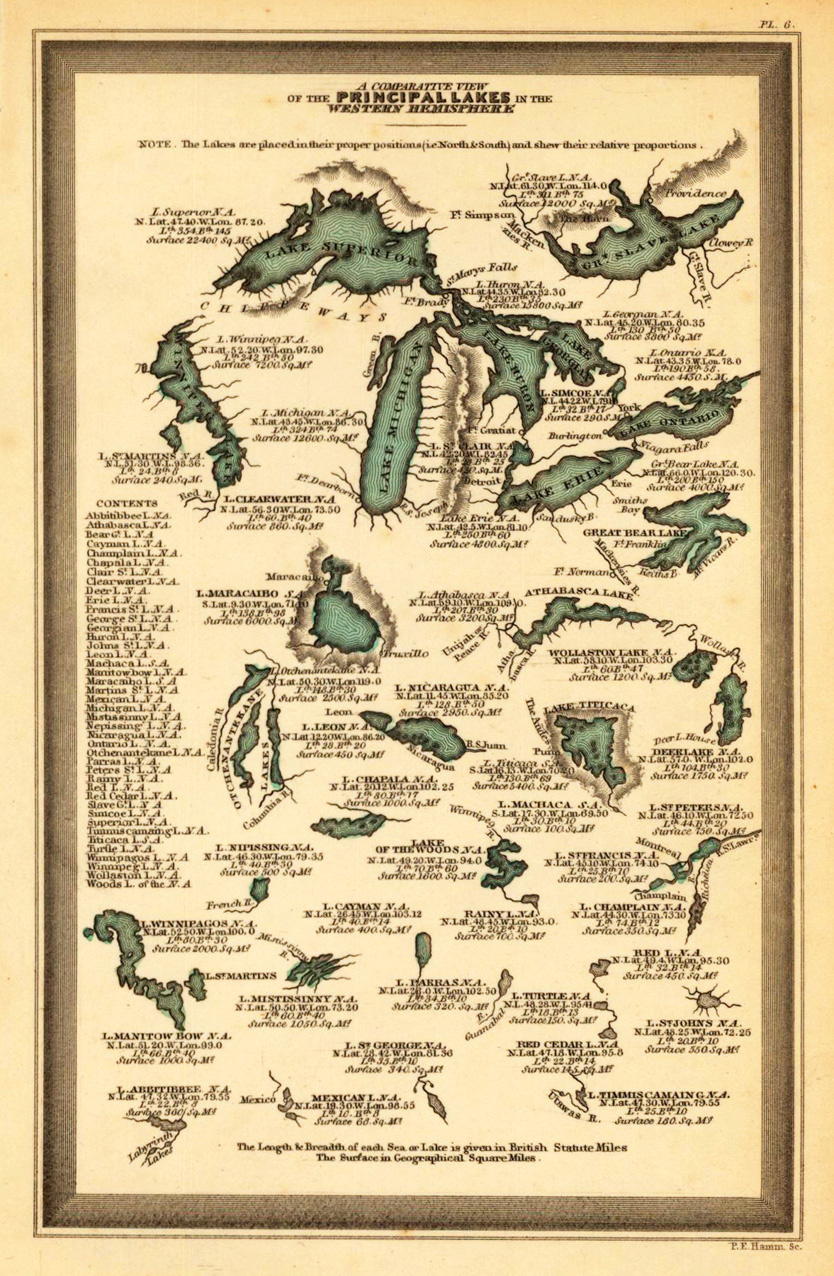
Steel engraving, hand colored in outline and wash when published. Engraved by P.E. Hamm. This fine small engraved old map shows a comparative view of the principal lakes in the Western Hemisphere. This rare antique original map was published by Carey & Lea in Philadelphia in a small pocket atlas. Detailed engraved with place names, rivers and mountain chains.
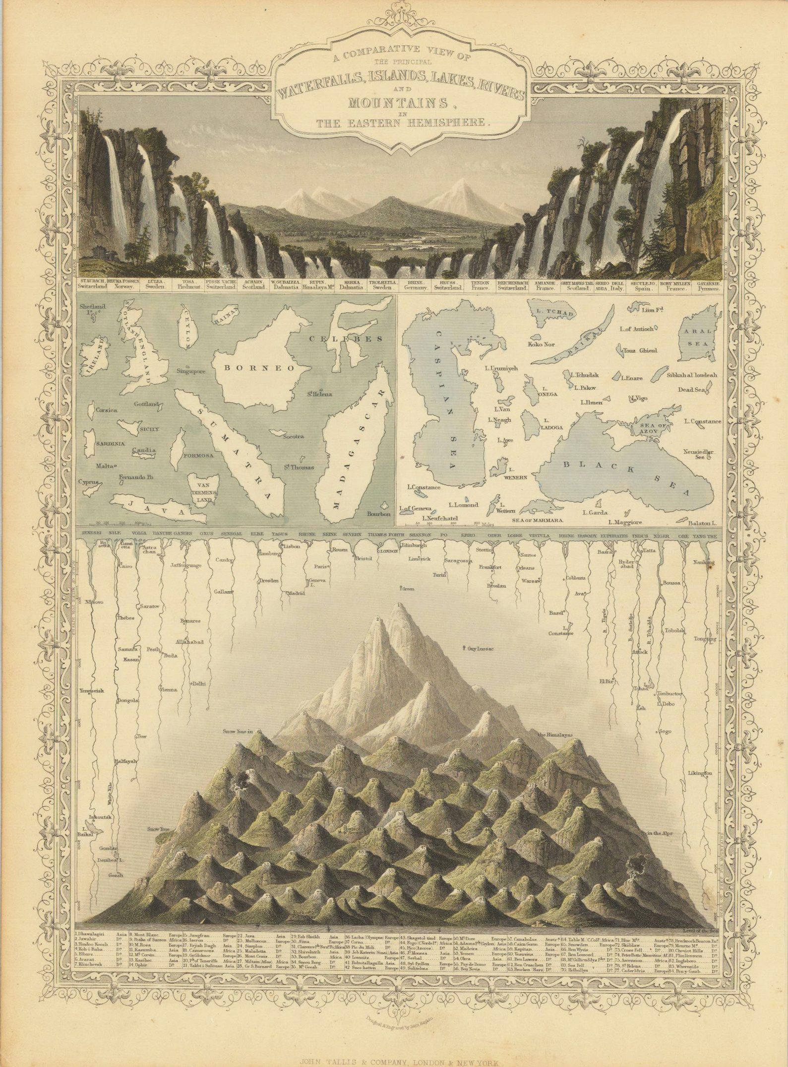
Steel engraving, hand colored in outline and wash. A beautiful hand colored example of John Tallis's map showing a comparative view of the principal waterfalls, islands, lakes, rivers and mountains in the Eastern Hemisphere. A the top a fine engraved panoramic scence comparing the waterfalls of the Eastern Hemisphere. Among them Missouri, Niagara Falls, Catskill, etc. At the bottom a comparative view of the mountains in North and South America.
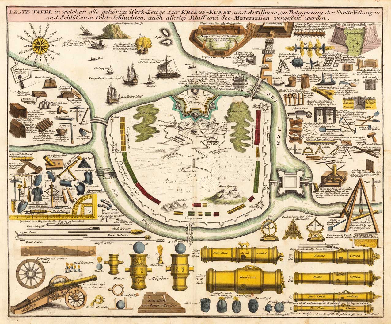
Original antique copper engraving, hand colored in outline and wash when published. Large, old colored copper engraving with numerous illustrations of the siege and war technique by Johann Baptist Homann. These include various war equipment such as cannons, mortars, battle axes, different types of ships, and terrain sketches with positions. Published in Nuremberg around 1720. The impressive sheet was occasionally linked to the large Atlas by Homann Atlas novus terrarum orbis imperia regna et status exactis tabulis geographice demonstrans, but is very rare to find. Johann Christoph Weigel, known as Christoph Weigel the Elder (9 November 1654 – 5 February 1725), was a German engraver, art dealer and publisher. He was born at Redwitz, Free imperial city of Eger in Egerland, and died in Nuremberg, aged 70. The cartographer Weigel worked around 1719 in Nürnberg and his maps are showing the typical style of this period in map making in Southern German. He worked very close as with Johann B. Homann in Nürnberg. All his maps were hand colored in outline and decorative body color immediatelly in his printing house, after they were printed.
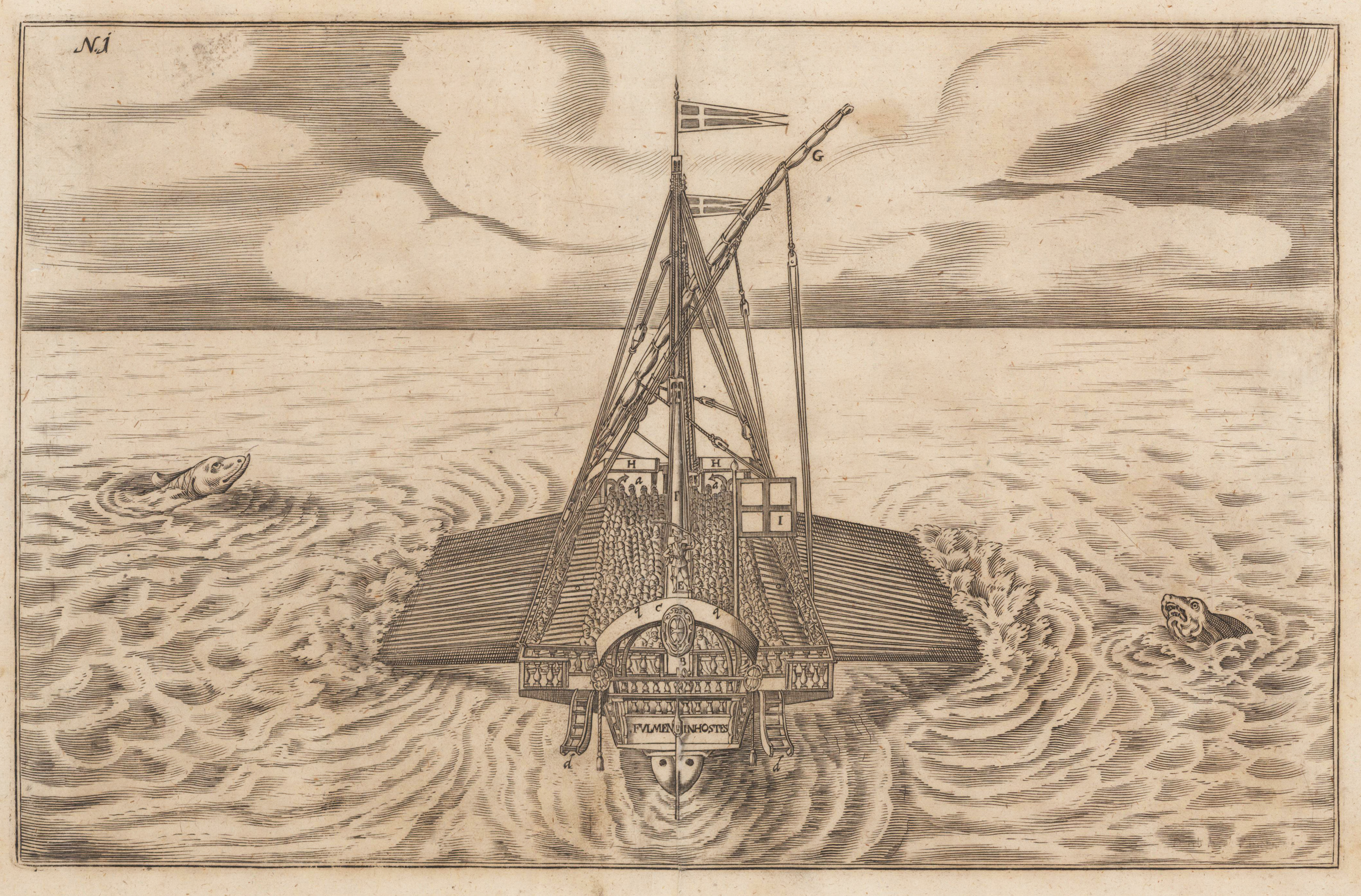
Original antique copper engraving, uncolored. Copper engraving from Johann Christoph Wagners,Delinatio Provinciarum Pannoniae Et Imperii Turcici In Oriente'. Duoblesheet with an old battleship in the foreground, a so-called,galley', crowded with people. On both sides are seamonsters with their heads turned to the ship.
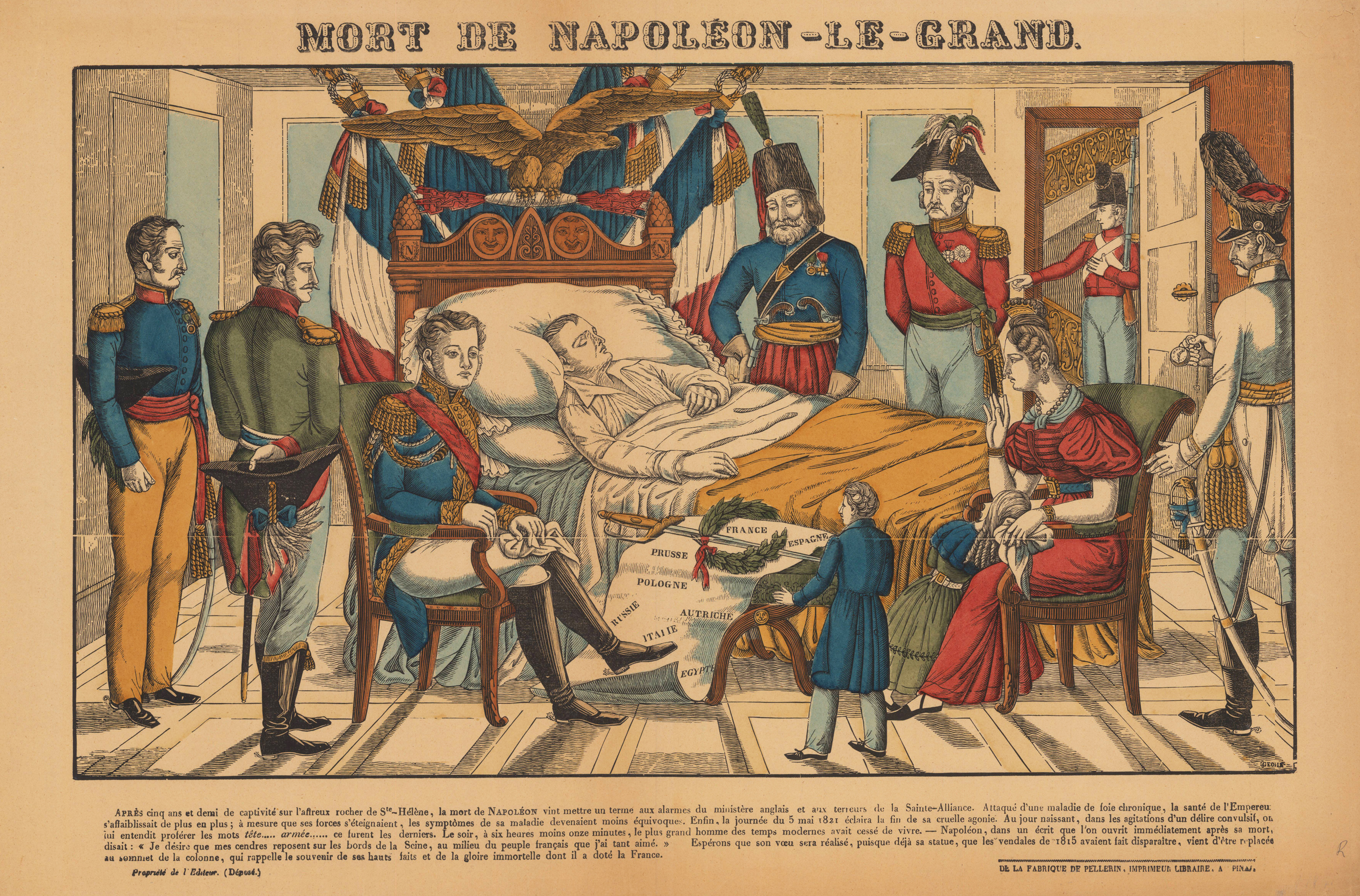
Original antique wood cut, hand colored. The former French Emperor died on Saturday, May 5, 1821, after five and a half years of exile on Saint Helena. At his bedside were his most loyal friends, those who have accompanied him to the end. Among them, Henri-Gatien Bertrand, was seated near him. We find in the image the members of his family whom he brought with him in Bonaparte's exile, including Fanny Bertrand and her children Hortense and Henri. On a stool, at the bottom center of the image, is the Emperor's Austerlitz sword, accompanied by a laurel wreath. They are both based on a list of the territories conquered by Napoleon. This print can be found in a multitude of forms among painters of the time, such as Charles de Steuben.
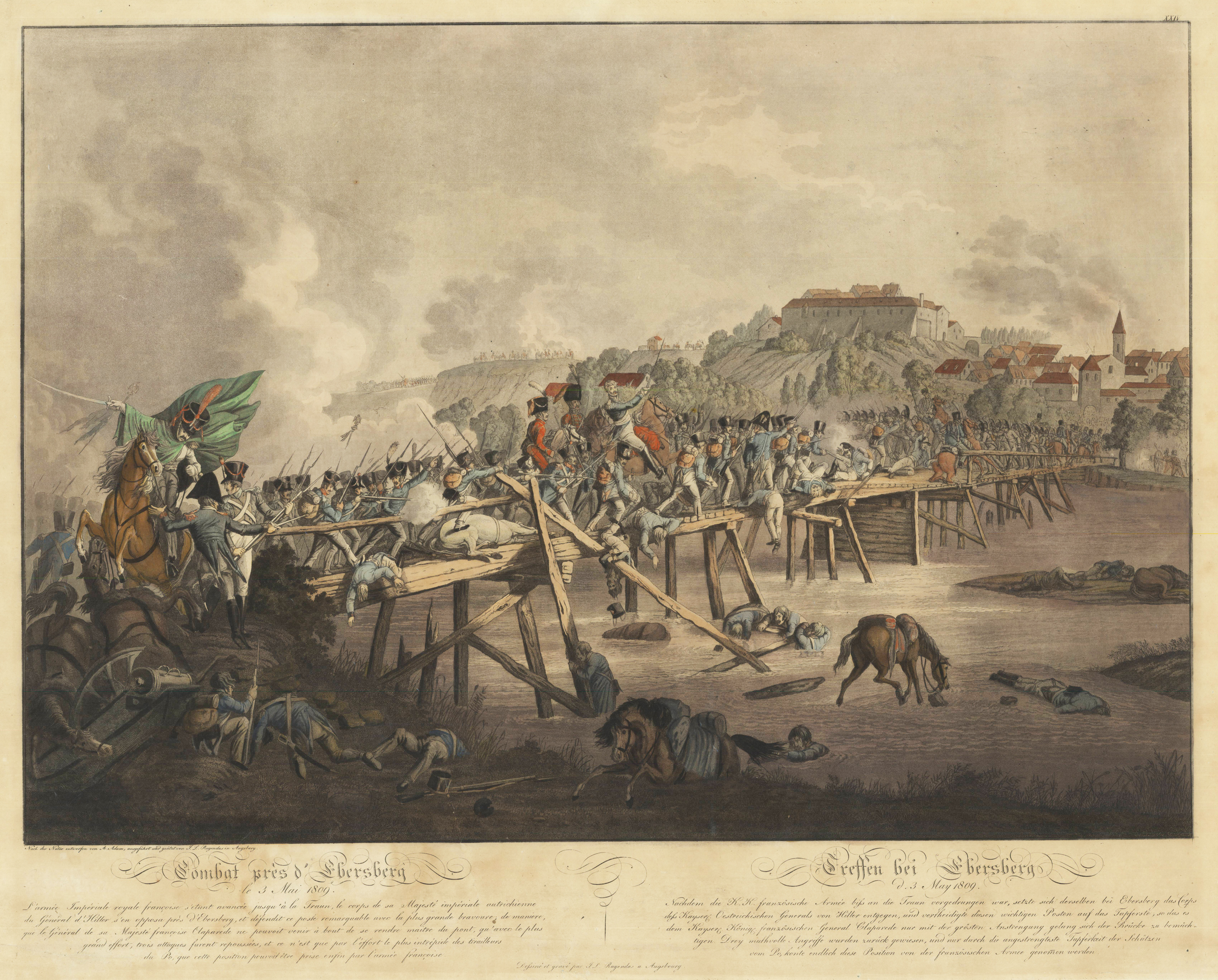
Original Kupferradierung mit Aquatinta, altkoloriert. Dargestellt wird die Einnahme und Erstürmung der Stadt Ebersberg am 3. Mai 1809 durch die französischen Truppen. Fine aquatint in original hand color by the famous German painter Johann Lorenz Rugendas from Augsburg. J.L. Rugendas made the drawings for his famous serious of the Napoleonic battles himself and the sketches were mostly drawn at the authentic locations. He used for his copper engravings the aquatint technique, which allowed only a very small edition of examples to print. It is said that the Napoleonic battle scenes by Rugendas only were published in a number of 150 to 300 copies depending on the battle.
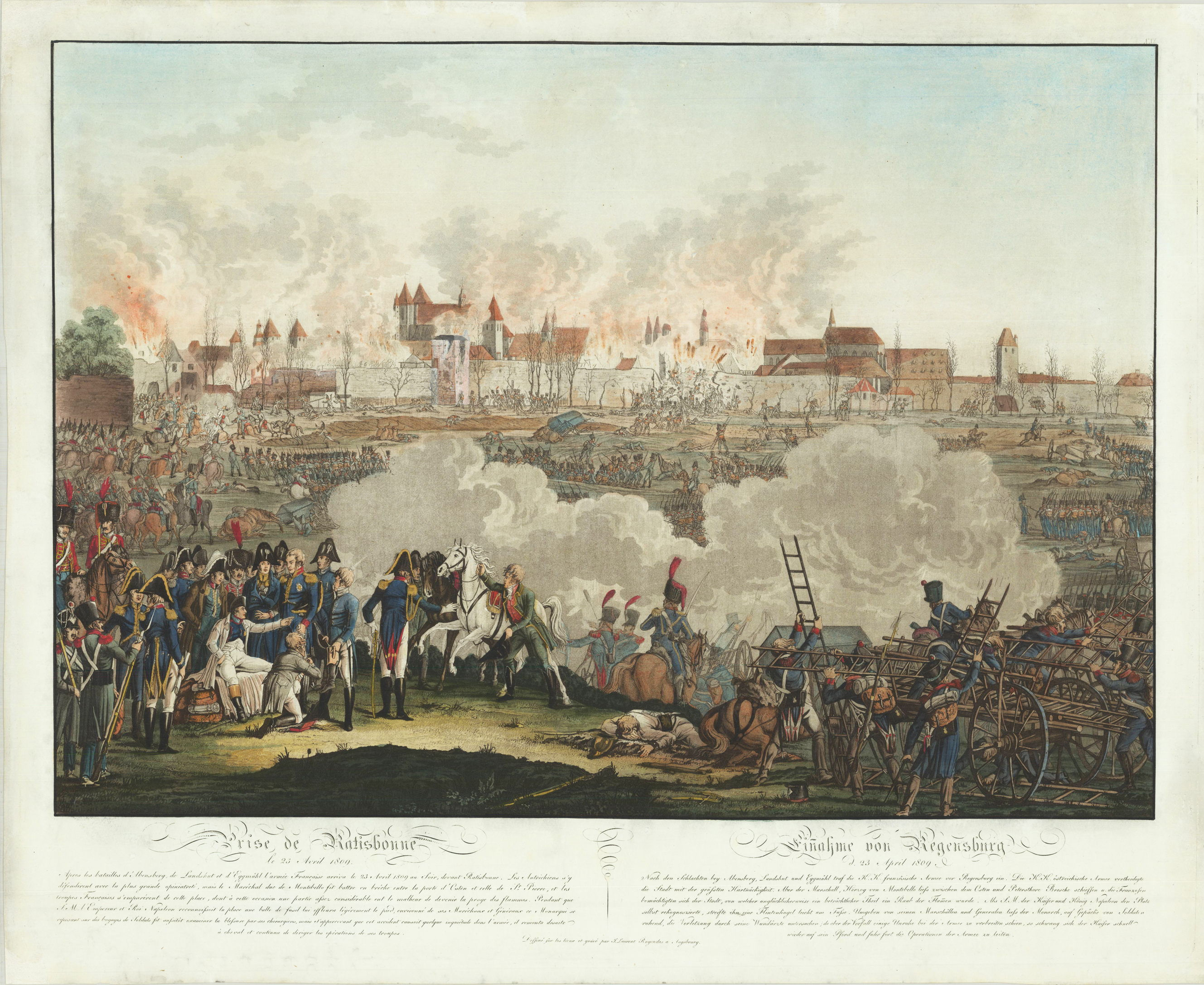
Original Kupferradierung mit Aquatinta, altkoloriert. Dargestellt wird die Einnahme und Erstürmung der Stadt Regensburg am 23. April 1809 durch die französischen Truppen. Im Vordergrund wird der am Fuß verwundete franz. Kaiser und Heerführer Napoleon I. umgeben von seinem Arzt und seinen Marschällen dargestellt. Fine aquatint in original hand color by the famous German painter Johann Lorenz Rugendas from Augsburg. J.L. Rugendas made the drawings for his famous serious of the Napoleonic battles himself and the sketches were mostly drawn at the authentic locations. He used for his copper engravings the aquatint technique, which allowed only a very small edition of examples to print. It is said that the Napoleonic battle scenes by Rugendas only were published in a number of 150 to 300 copies depending on the battle.
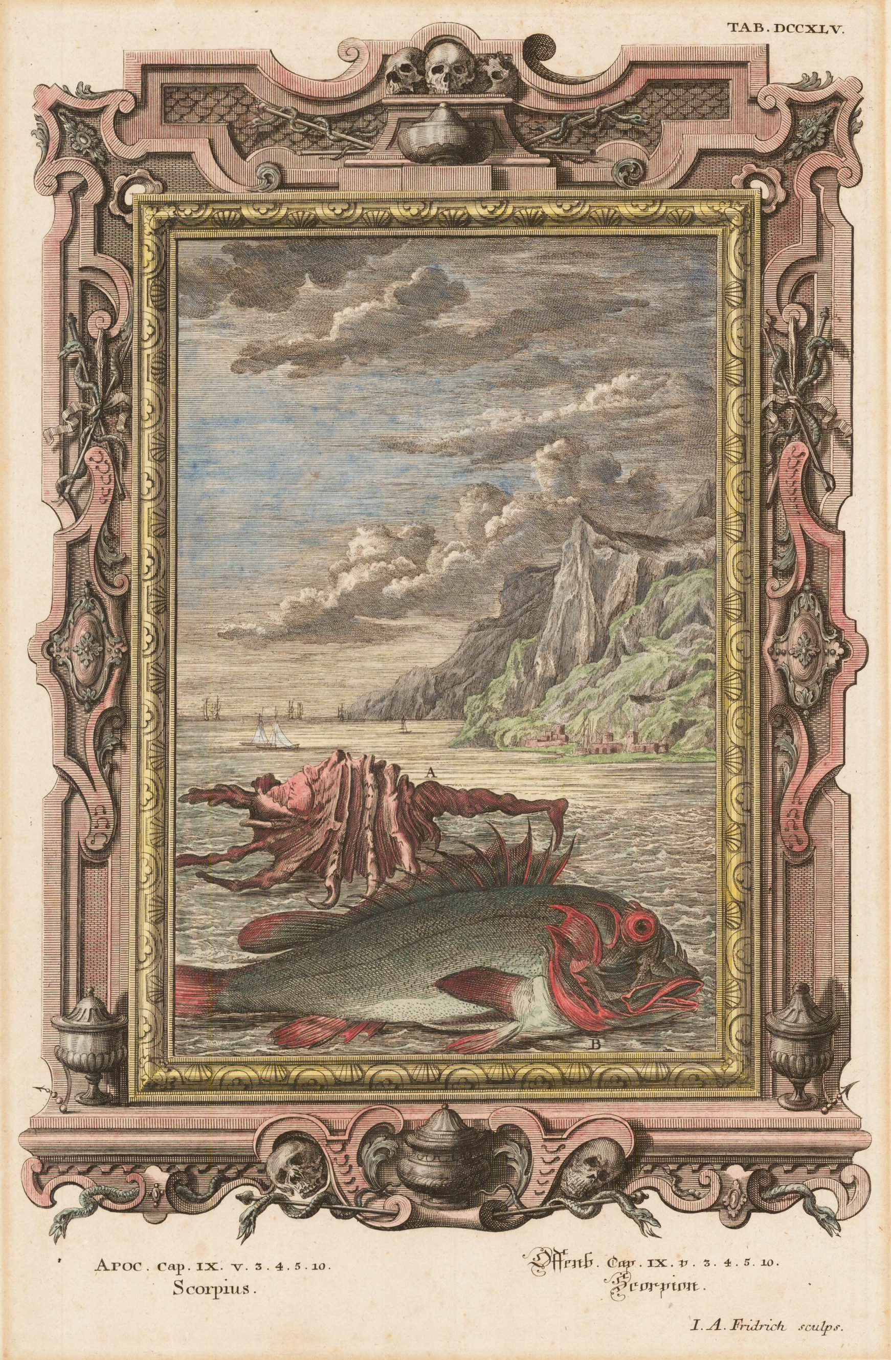
Original antiker Kupferstich in zeitgenössischem Kolorit, erschienen in der Physica Sacra 1732. Kupferstich aus der Bilderbibel (Physica Sacra) von Scheuchzer. Zu sehen ist ein Skorpion als Drachenfisch verkleidet vor einer Meereslandschaft. Scheuchzer glaubte das Alte Testament sei eine sachliche Darstellung der Geschichte, der Welt. Er initiierte ein großes Projekt zur Erklärung biblischer Ereignisse in Bezug auf Physik, Medizin und Naturgeschichte. Sein Ziel war es, die Existenz Gottes durch die Wissenschaft zu beweisen, aber die Schweizer Behörden verweigerten ihm zunächst die Erlaubnis, sie zu veröffentlichen. Schließlich wurde eine üppig illustrierte Ausgabe dieses außergewöhnlichen Werkes, wie es zwischen 1731 und 1735 im großen deutschen Verlag Augsburg gedruckt. Unter dem Titel,Jobi physica sacra' oder,Hiobs Natur-Wissenschaft' verglichen mit der Gegenwart wurde das Werk als Physica Sacra oder Kupfer-Bibel bekannt. Es wurde berühmt für seine kunstvollen Illustrationen, in denen jede biblische Geschichte mit einem architektonischen Rand eingerahmt war, der Details enthielt, die für das abgebildete Kapitel relevant waren. Hergestellt von 'I. A. Fridrich 'nach' Jakob Scheuchzer '. Johann Jakob Scheuchzer (1672-1733) war ausgebildeter Arzt mit starkem Interesse an Naturgeschichte und Paläontologie. Als Sohn eines Arztes in der Schweiz geboren, studierte er an der Universität in Deutschland und kehrte später nach Zürich zurück, um eine Professur für Mathematik zu übernehmen. Wie viele Wissenschaftler dieser Zeit betrachtete er das Alte Testament als eine sachliche Darstellung der Erdgeschichte. Auf seinen ausgedehnten Reisen sammelte er eine der größten Fossiliensammlungen des 18. Jahrhunderts. Er stellte die Hypothese auf, dass alle Pflanzen bei der in der Bibel beschriebenen Flut umgekommen waren und entdeckte, was er für das Fossil eines menschlichen Flutopfers hielt. In seinem Meisterwerk, Physica Sacra, beschreibt er seine Theorie ausführlich unter Bezugnahme auf die King-James-Bibel von 1611. Das Buch war eine Sensation und wurde gleichzeitig in Latein, Deutsch und Französisch veröffentlicht, jede Ausgabe mit genau den gleichen Tafeln. Seine Theorien wurden erst durch die Arbeit von Cuvier widerlegt.
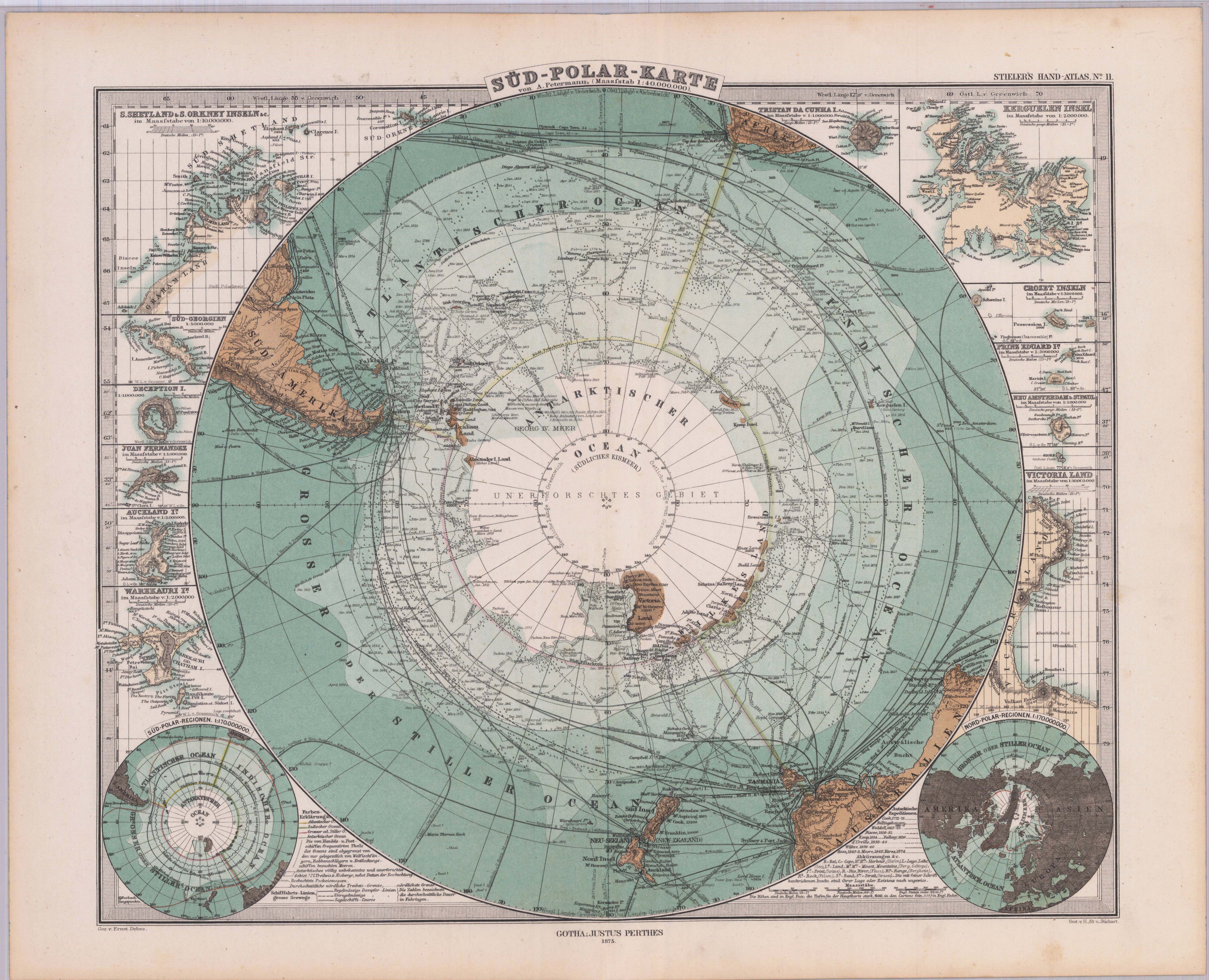
Original antique lithograph, original color. Engraved by H. Alt and Stichart, after a drawing by Ernst Debes. The map depicts routes of marine exploration and discovery as well as unique details of different islands surrounding the South Pole. On the right side is an inset of different islands such as Prince Edward Island, Tristan da Cunha Island, Victoria Land, etc. and a map of the Southern Hemisphere. The upper left of the map shows the islands of Orkney Islands and South Shetland. The discovery dates of different regions of the South Pole can be found on the map as well as the South Pole in the centre which was still unexplored at this time. Furthermore green lines can be seen on the map which indicate the movement of the ice.