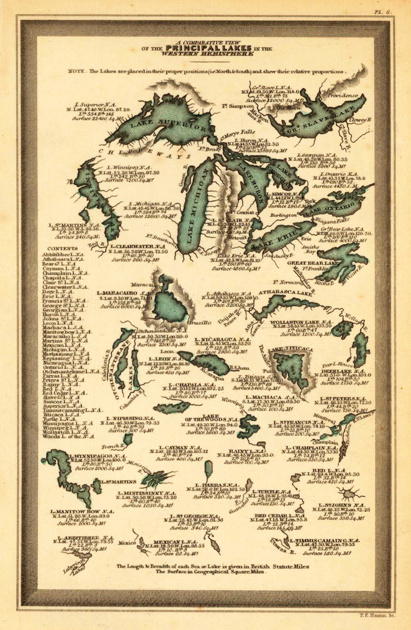
Steel engraving, hand colored in outline and wash when published. Engraved by P.E. Hamm. This fine small engraved old map shows a comparative view of the principal lakes in the Western Hemisphere. This rare antique original map was published by Carey & Lea in Philadelphia in a small pocket atlas. Detailed engraved with place names, rivers and mountain chains.
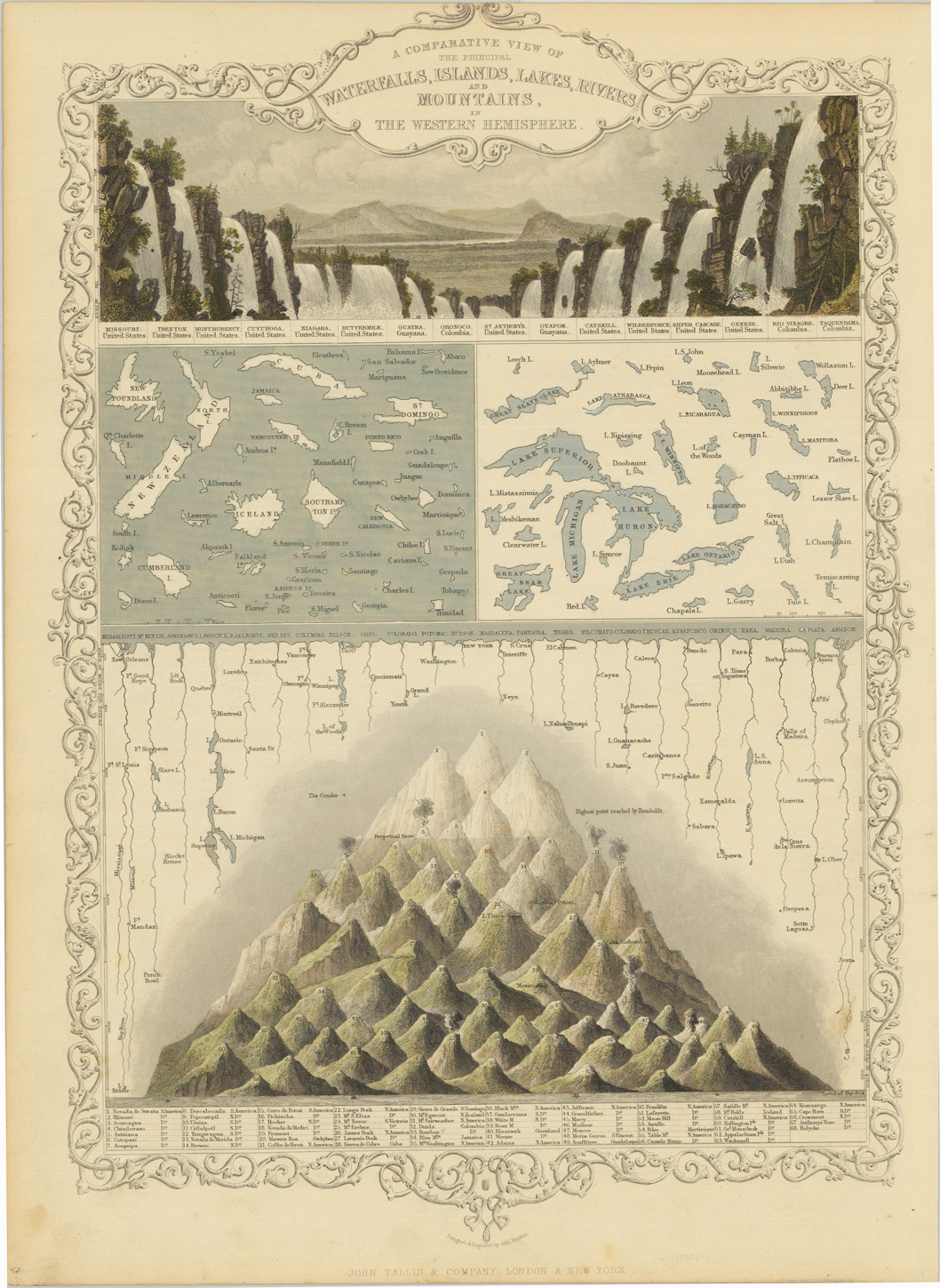
Steel engraving, hand colored in outline and wash. A beautiful hand colored example of John Tallis's map showing a comparative view of the principal waterfalls, islands, lakes, rivers and mountains in the Eastern Hemisphere. A the top a fine engraved panoramic scence comparing the waterfalls of the Eastern Hemisphere. Among them Missouri, Niagara Falls, Catskill, etc. At the bottom a comparative view of the mountains in North and South America.
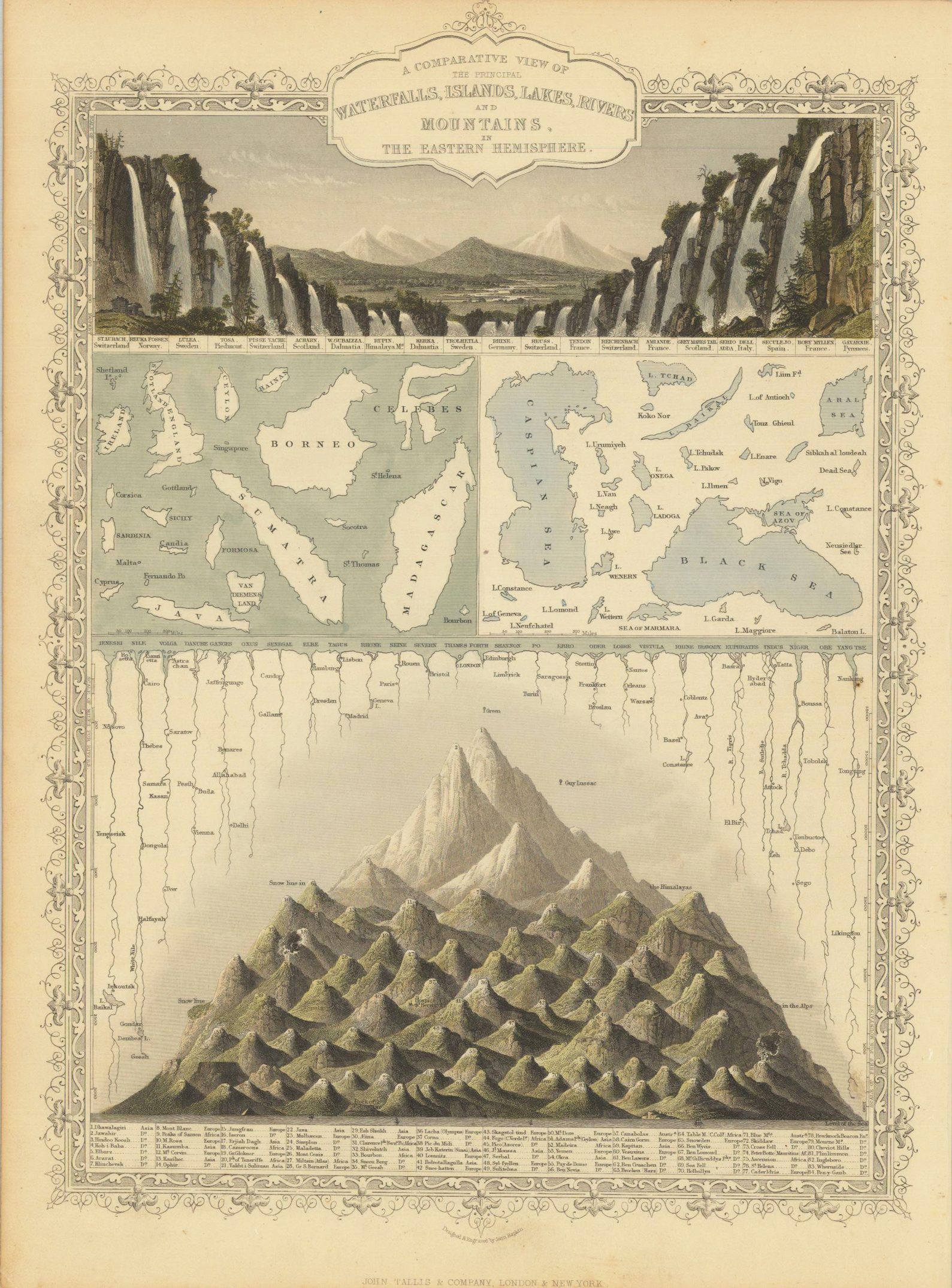
Steel engraving, hand colored in outline and wash. A beautiful hand colored example of John Tallis's map showing a comparative view of the principal waterfalls, islands, lakes, rivers and mountains in the Western Hemisphere. A the top a fine engraved panoramic scence comparing the waterfalls of the Western Hemisphere. Among them Reuka Fossen (Norway), Kerka (Dalmatia), Reichenbach (Switzerland), etc. At the bottom a comparative view of the mountains from Europe towards Asia including snow lines, above the rivers and lakes.
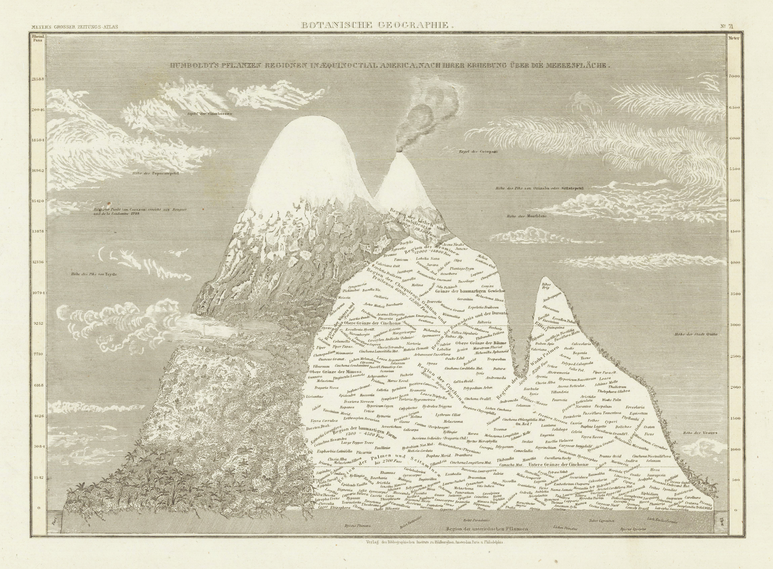
Steel engraving, uncolored as published. Example of a mountain, showing the distribution of plant species from sea level up to the height of 7000 meters.
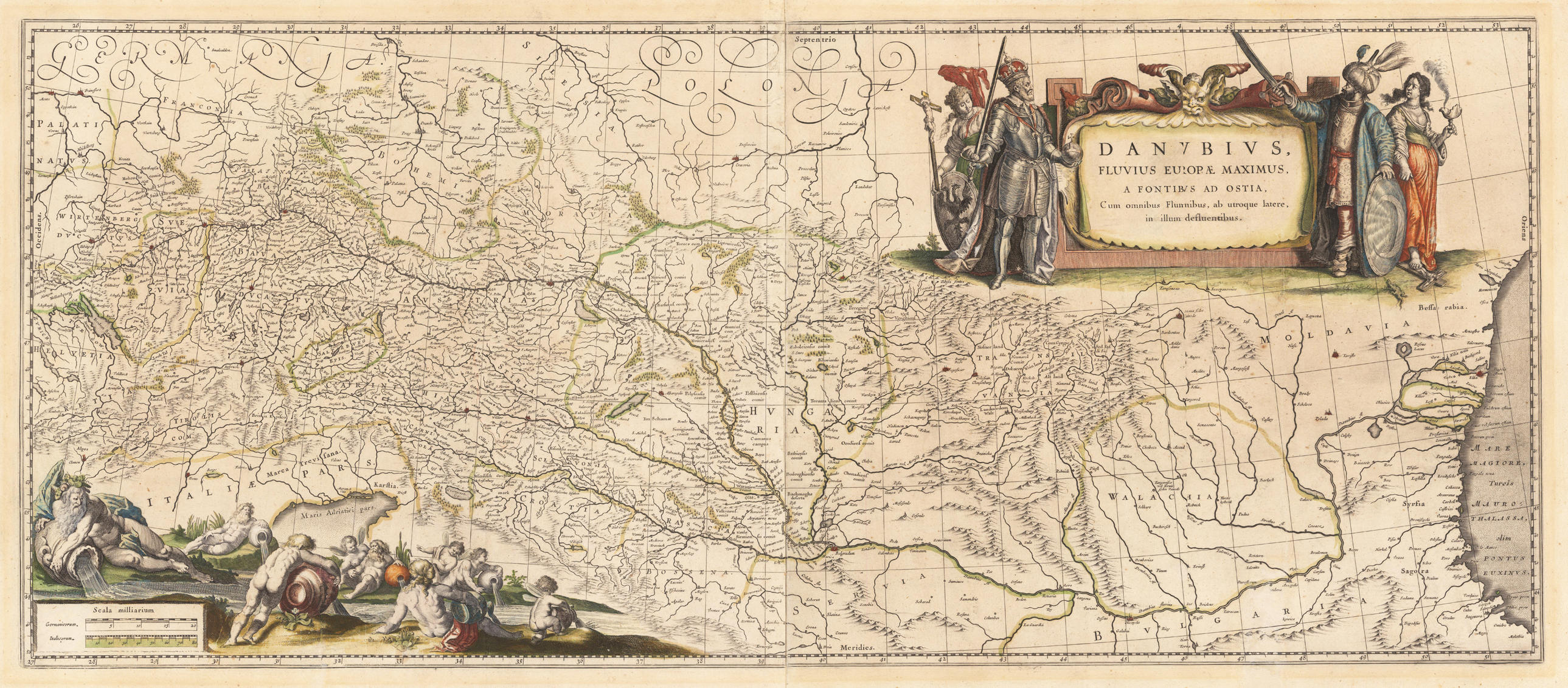
Original antique copper engraving, hand colored in outline and wash when published. Published in the atlas by Joan and Guijelmus Blaeu in Amsterdam around 1635-65. A highly decorative map of the river Danube from the its source in the,Black Forest' towards the mouth of the Danube into the Black Sea. In the upper right corner with a large allegoric title cartouche with the Christian ruler and the ruler of the Turkish empire. The lower left corner with a highly decorative title cartouche with an allegory on the river Danube showing several gods filling water into the source of the river Danube. Many engraved place names, as well river names including neighboring countries as Switzerland, Austria and Bohemia. Printed from two plates, published between 1635 onwards in Blaeu's Theatrum and from 1658 to 1670 in Blaeu's famous,Atlas Maior'. This example was printed ca. 1645. Verso blank.
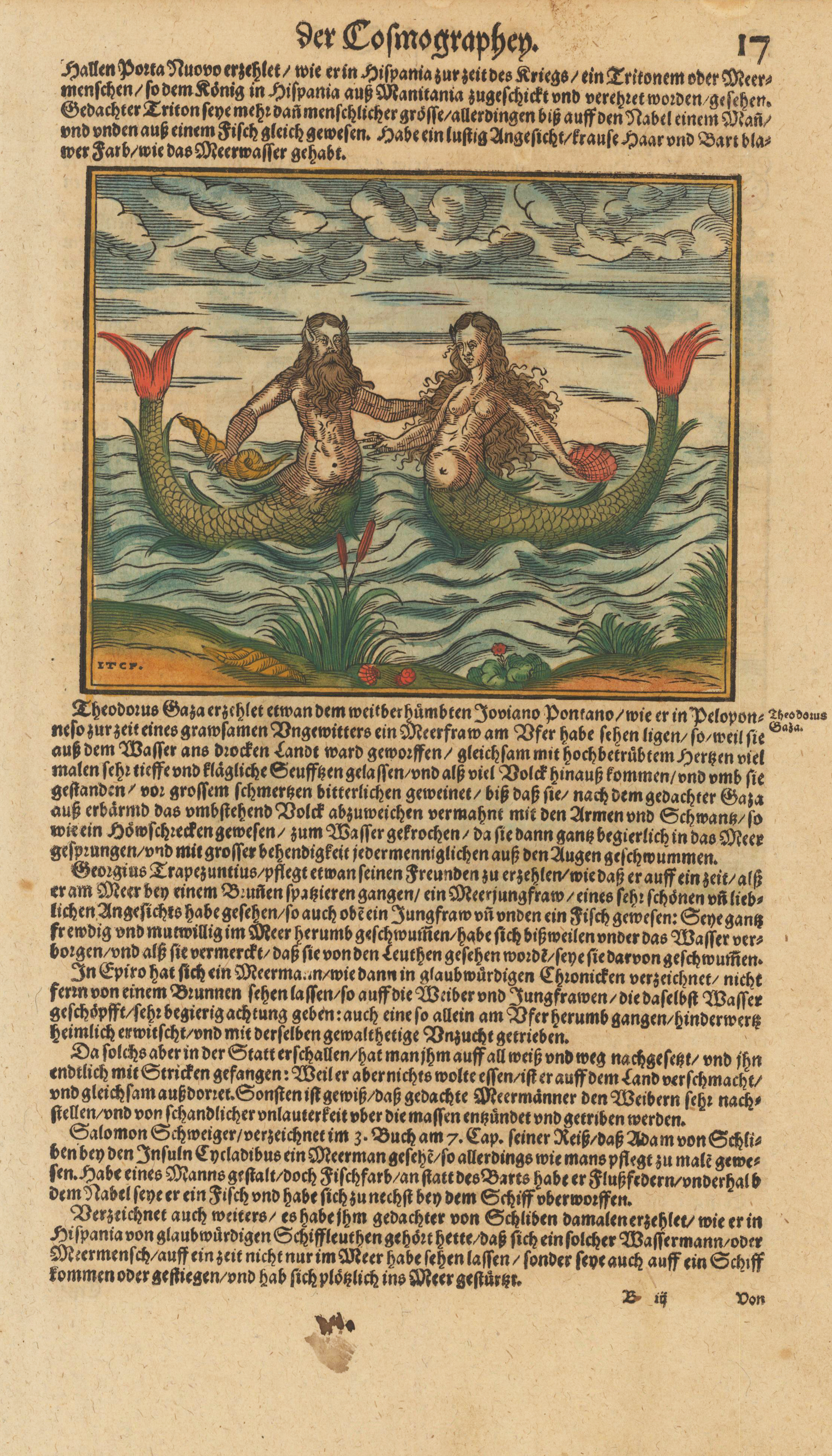
Woodcut map, finely hand colored in wash by a later hand. Decorative hand colored woodcut map, published in a German text edition of the 'Cosmographia' by Sebastian Münster. One side shows a Mermaid and a Merman. On the reverse is a large depiction of a sailing ship with soldiers firing cannons.
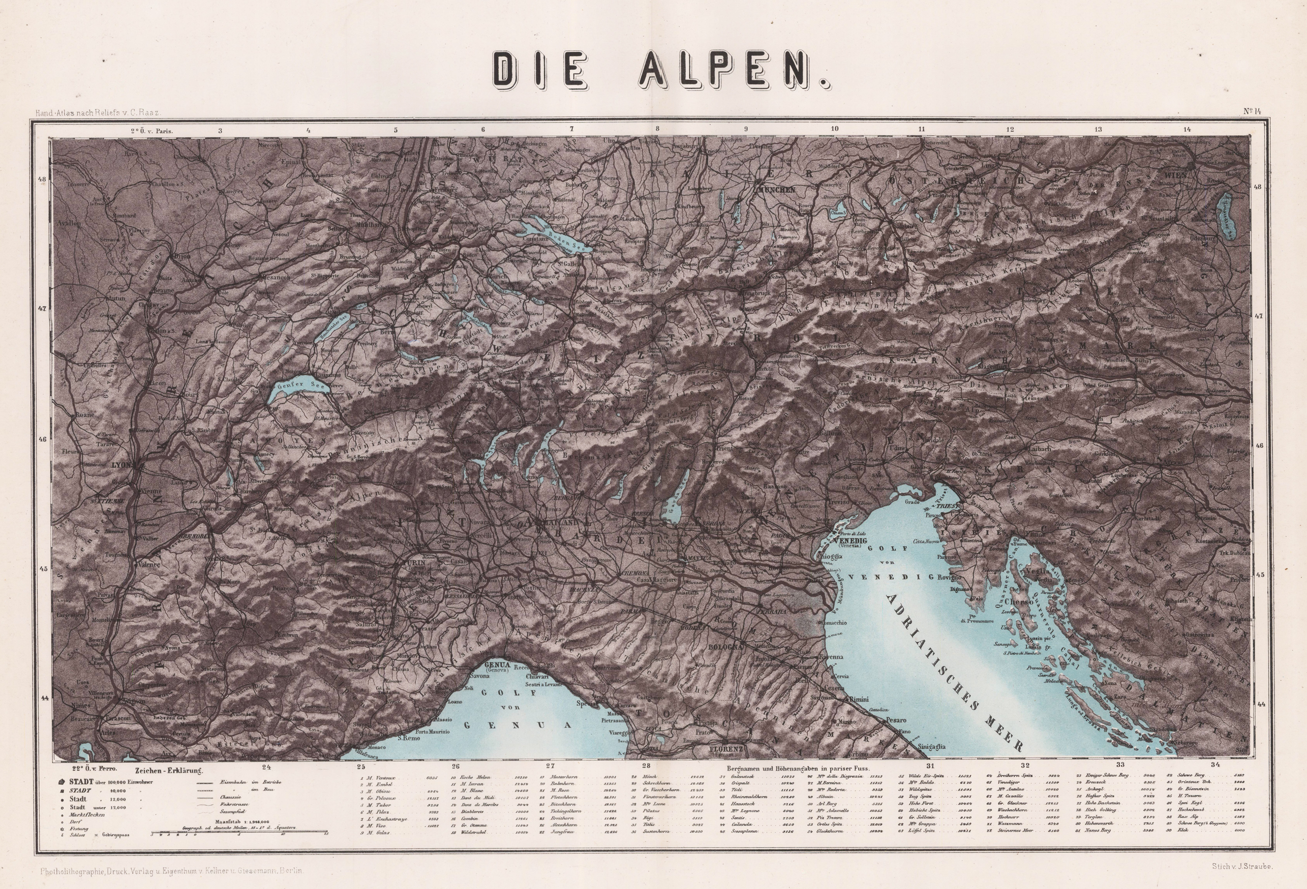
Original Lithograph, printed in colors. Map of the Alps by J. Straube. Depicted are the Alps with the Gulf of Venice and the Gulf of Genua. On the left side is the french part, in the lower middle the italian part, in the upper middle the german and austrian part and on the right side are Hungary, Croatia and the Turkey. City and place names as well as rivers, lakes and other bodies of water are listed in detail, as well as the military lines. Below the map is an explanation of symbols in German as well as the mountain items and altitude information in Parisian feet. Scale 1: 1,984,000 in German miles.
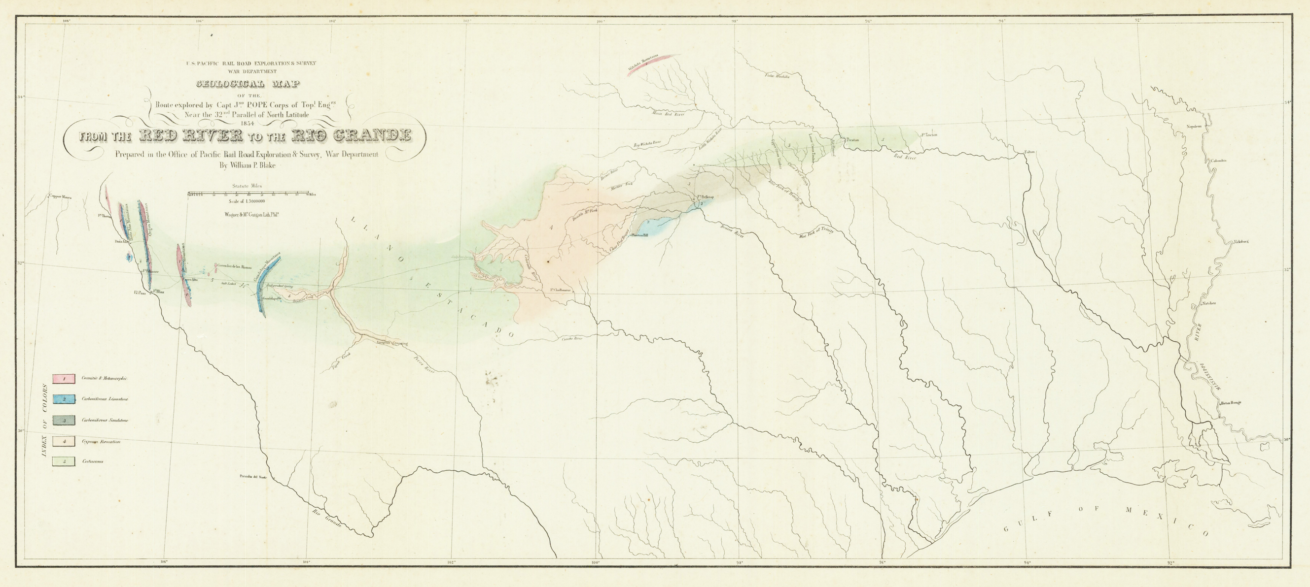
Original lithograph, hand colored in wash when published. This early geological map depitcs the Witchita Mountains in the north, El Paso in the west to the Missisippi River in the east and the Gulf of Mexico in the south. At the left side with find a color explanation key for the various geological formations. On the upper left side is the cartouche with the mileage scale. This geological map was prepared to accompany Blake's report of the transcontinental railroad.
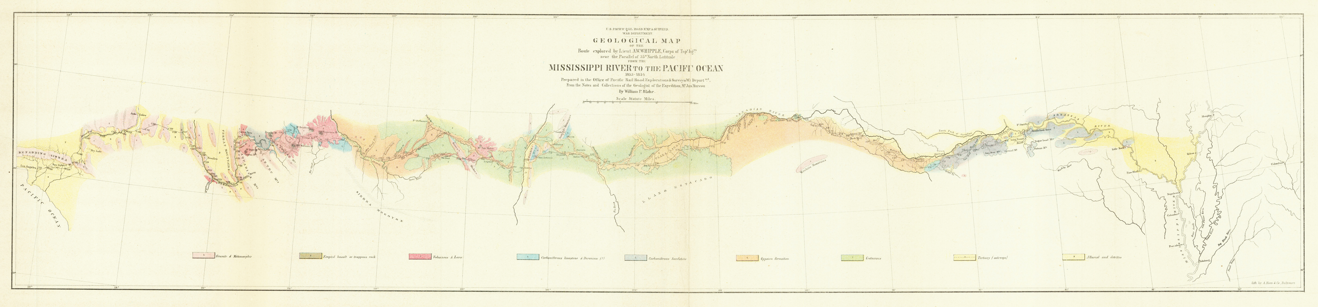
Original lithograph, hand colored in wash when published. This early geological map depitcs the Mississippi River to the Pacific Ocean. On the upper side is the title with the mileage scale. A talbe of content with ten different types of stones is on the upper left side of the map. This geological map was prepared to accompany Blake's report of the transcontinental railroad.
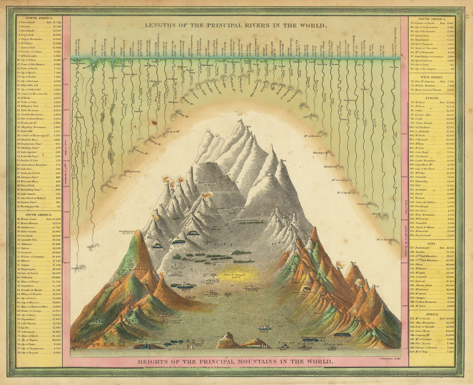
Engraved map, hand colored in outline and wash when published. A highly interesting antique map showing the principal mountains and rivers of the world. Left and right side with given elevations of cities, mountains, rivers, volcanoes, mines, etc. Very colorful hand colored and rich in fine engraved details. This map was published 1846 in Philadelphia by Samuel Augustus Mitchell in his atlas ,A New Universal Atlas containing maps of the various Empires, Kingdoms, States and Republics of the World'. Samuel Augustus Mitchell was starting around 1831 his business as a publisher of atlases and folded maps. Around 1845 he was aquiring the rights from Henry S. Tanner's famous ,New Universal Atlas' from Carey & Hart, who had already the copyright from Tanner in posession. Samuel August Mitchell changed many of the maps, also the printing technique to lithography and published then his atlas in 1846. The atlas was carried on with changes in the maps in several editions until 1850. Then the rights were sold on to Thomas, Cowperthwait & Co.
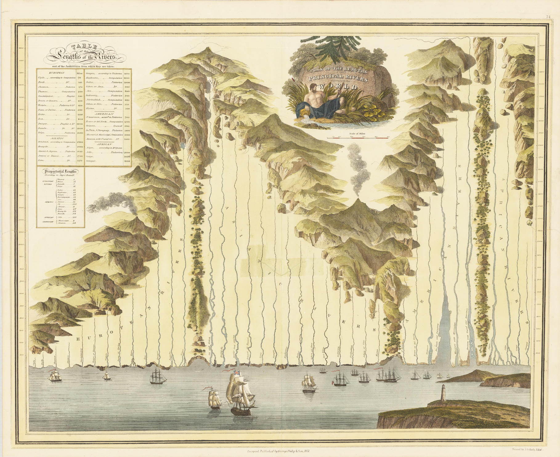
Original hand colored copper engraving. This beautiful plan depicts the largest and famous rivers around the world. Listed on that map the are European, Asian, American and African rivers. On the top is a very decorative title cartouche. In the upper left corner a table of all these rivers with each length. Between the rivers are mountain chains with some vulcanoes and trees. On the lower bottom is the ocean and the mouts of each river. Some sailing ships and a lighthouse on a rock are engraved. A large fine and decorative soughtafter map by the famous mapmaker George Philip & Son printed by J. Gellatly in Edinbourgh.
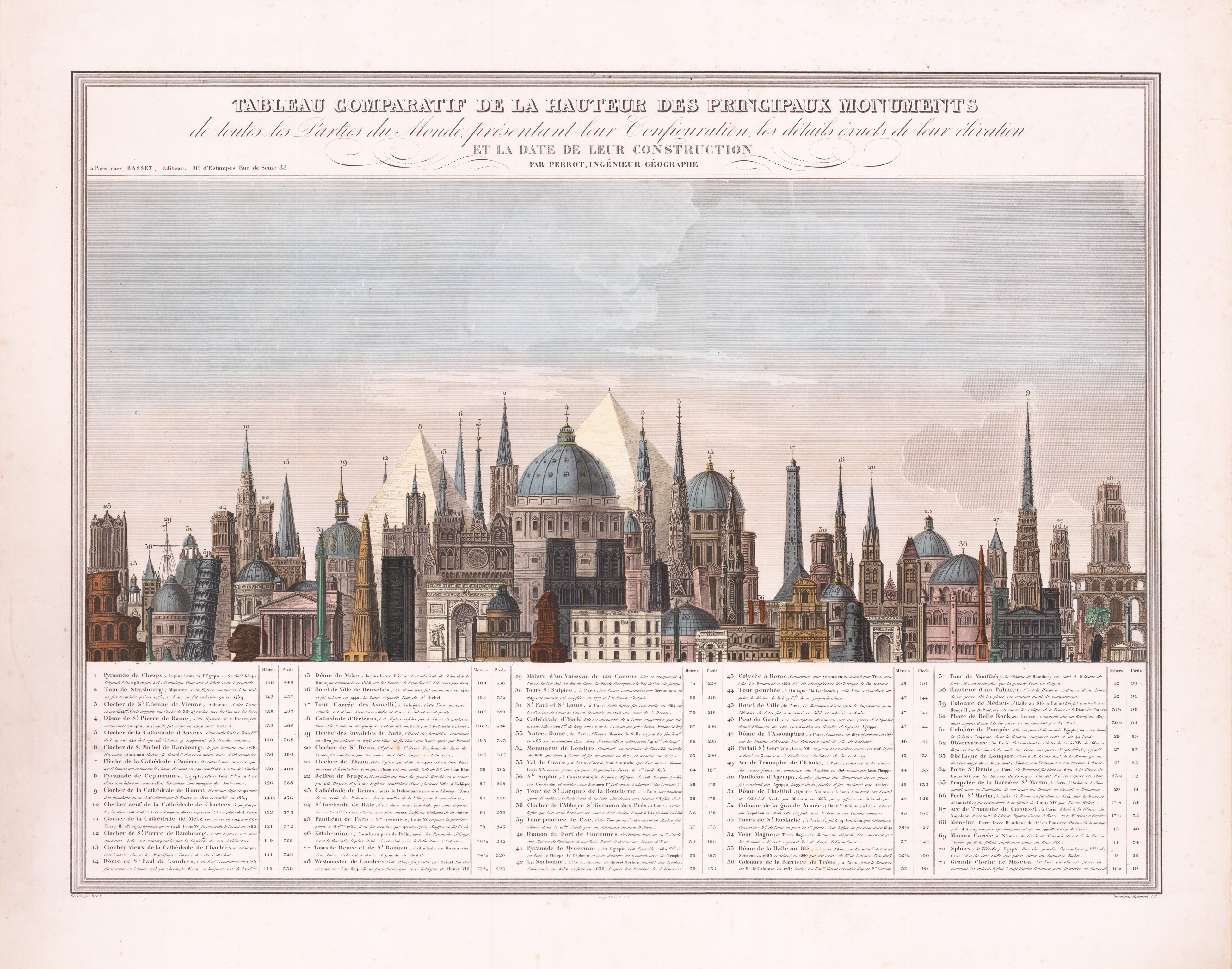
This is a comparative chart of the heights of the monuments of the world, it depicts 71 different numerically identified monuments located throughout the world, although the majority are in Europe, and the majority of those are located in France. A table, situated in the bottom quarter of the chart, bears the name, location, height, and a small note about each of the 71 monuments. The monuments represented include the Pyramids at Giza, numerous bell towers of churches and cathedrals throughout Europe, such as those at Vienna, Rouen , Chartres, Hamburg, and Reims, Westminster in London, Notre-Dame de Paris, and the Arc de Triomphe to name only a few. Each of the monuments is depicted in profile, allowing for easy recognition of each of them. Aristide Michel Perrot (1793 - 1879) was a French geographer, cartographer, and essayist active during the 19th century. Perrot specialized in miniature maps that appear in numerous French atlases. Perrot was also a prolific writer and his works include geographic lexicons and several essays.
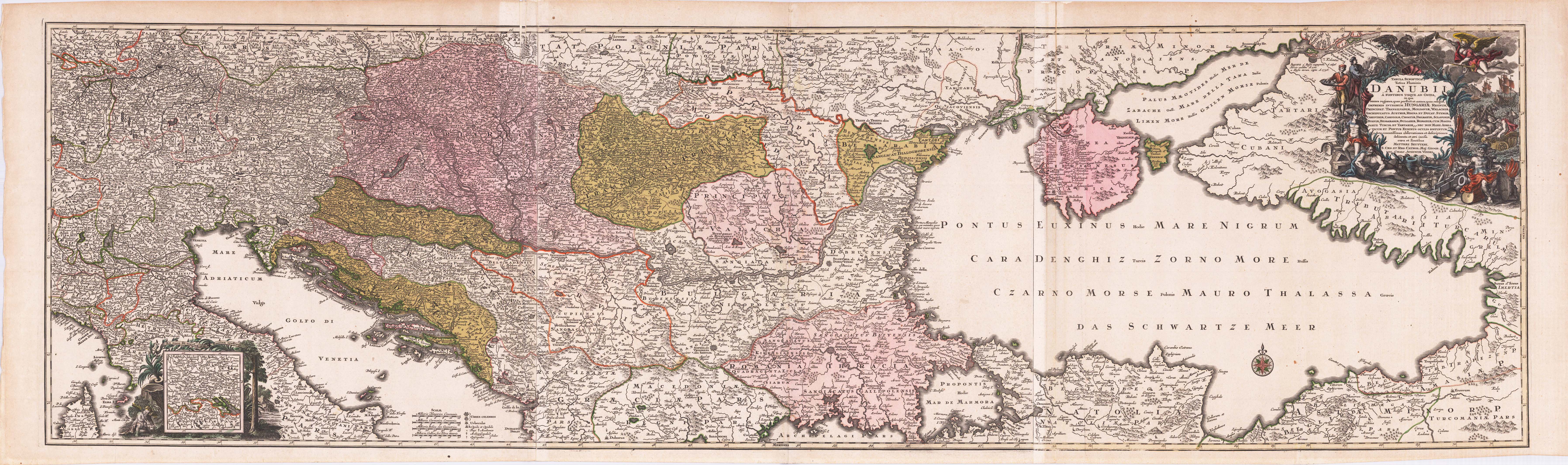
Copper engraving, handcolored in outline and wash when published. Course of the river Danube printed from three plates; published by Matthäus Seutter around 1720 in Augsburg. This antique map is depicting the course of the Danube from the source to the estuary in the Black Sea, the copper engraving consists of three separate plates combined together to display the complete large map of the river Danube. With many place names and details like streets, woods, mountains, rivers, lakes etc. In the upper right corner with a large decorative allegoric title cartouche. In the lower left corner a mileage scale, below with a table of explanations, further with a small inset map showing the area of the source of the river Danube. Old colored as published, the three plates joined together partially with small creases or minor losses. Matthäus Seutter (September 20, 1678 – March 1757) was one of the most important and prolific German map publishers of the 18th century. Seutter started his career as an apprentice brewer. Apparently uninspired by the beer business, Seutter left his apprenticeship and moved to Nuremberg where he apprenticed as an engraver under the tutelage of the prominent J. B. Homann. Sometime in the early 18th century Seutter left Homann to establish his own independent cartographic publishing firm in Augsburg. Though he struggled in the early years of his independence, Seutter's engraving skill and commitment to diversified map production eventually gained him a substantial following. Most of Seutter's maps were heavily based upon, if not copies of, earlier work done by the Homann and Delisle firms.[citation needed] By 1732 Seutter was one of the most prolific publishers of his time and was honored by the German Emperor Charles VI with the title of,Imperial Geographer'. Seutter continued to publish until his death, at the height of his career, in 1757. The Seutter firm continued under Seutter's wastrel son Albrecht Carl until his death in 1762. Following Albrecht's death, the firm was divided between the established Probst firm and the emerging firm of Tobias Conrad Lotter. Lotter, Matthäus Seutter's son in law, was a master engraver and worked on behalf of the Seutter firm. Lotter would eventually become one of the most prominent cartographers of his day.
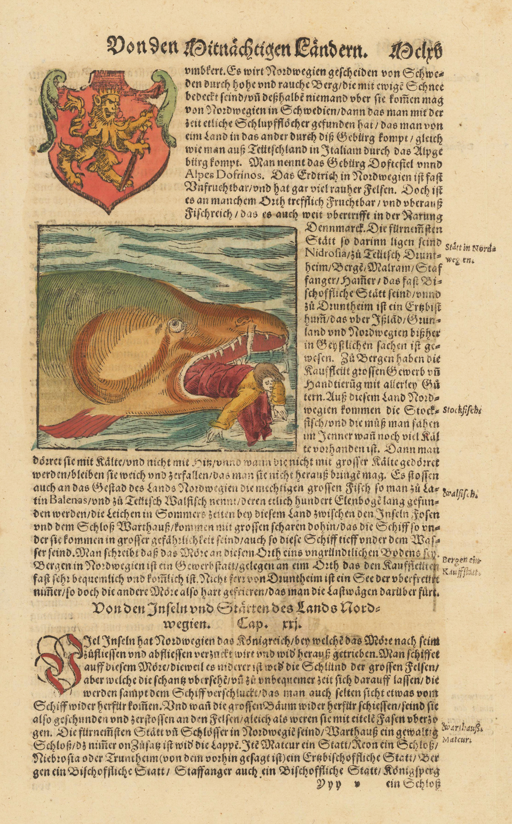
Woodcut map, finely hand colored in wash by a later hand. The German text page is relating to Sebastian Munster's description of Sweden and the woodcut illustration on this page shows a sea monster that eats a human.