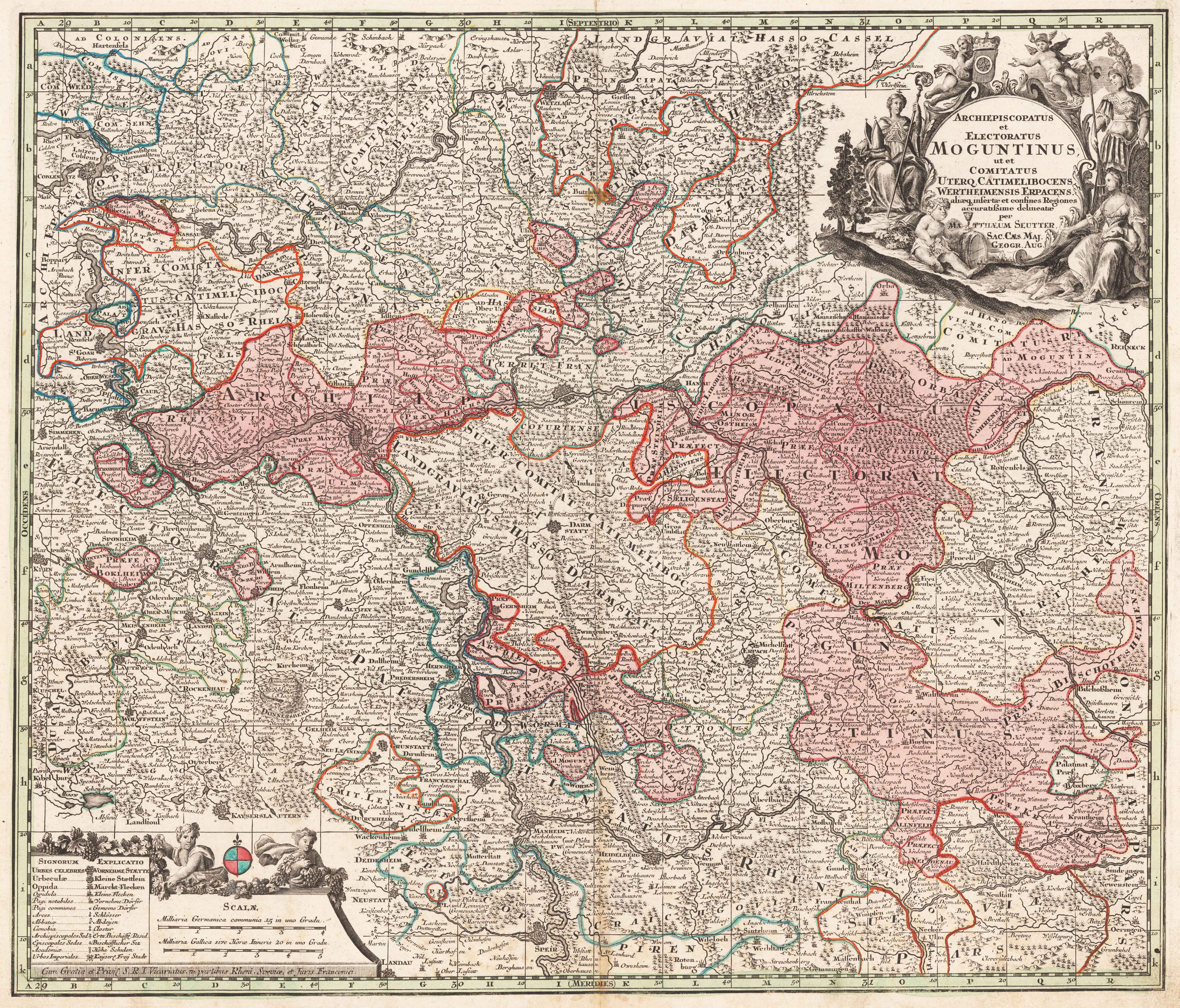
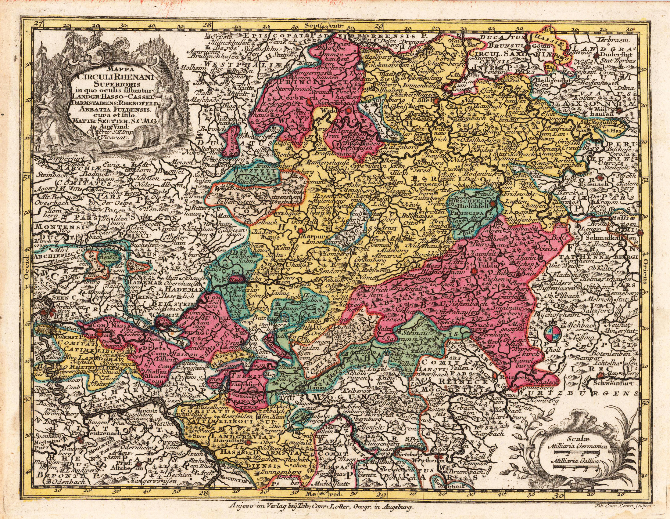
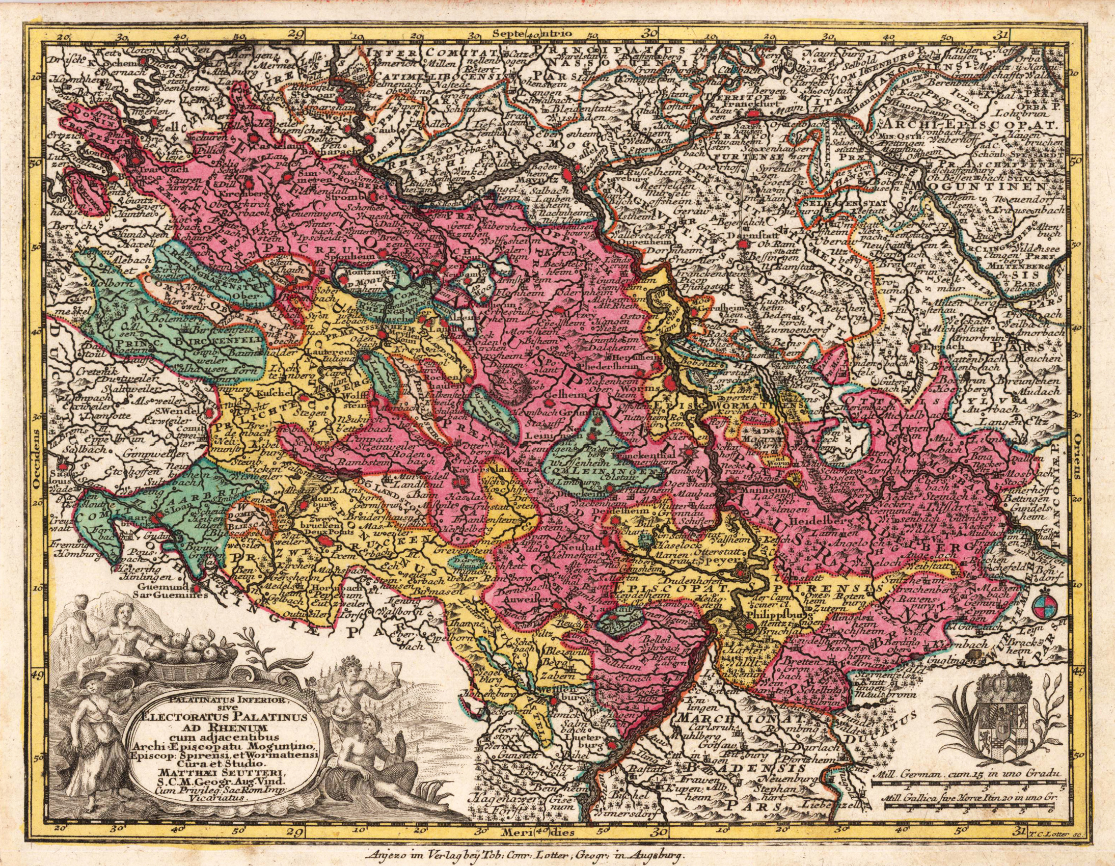
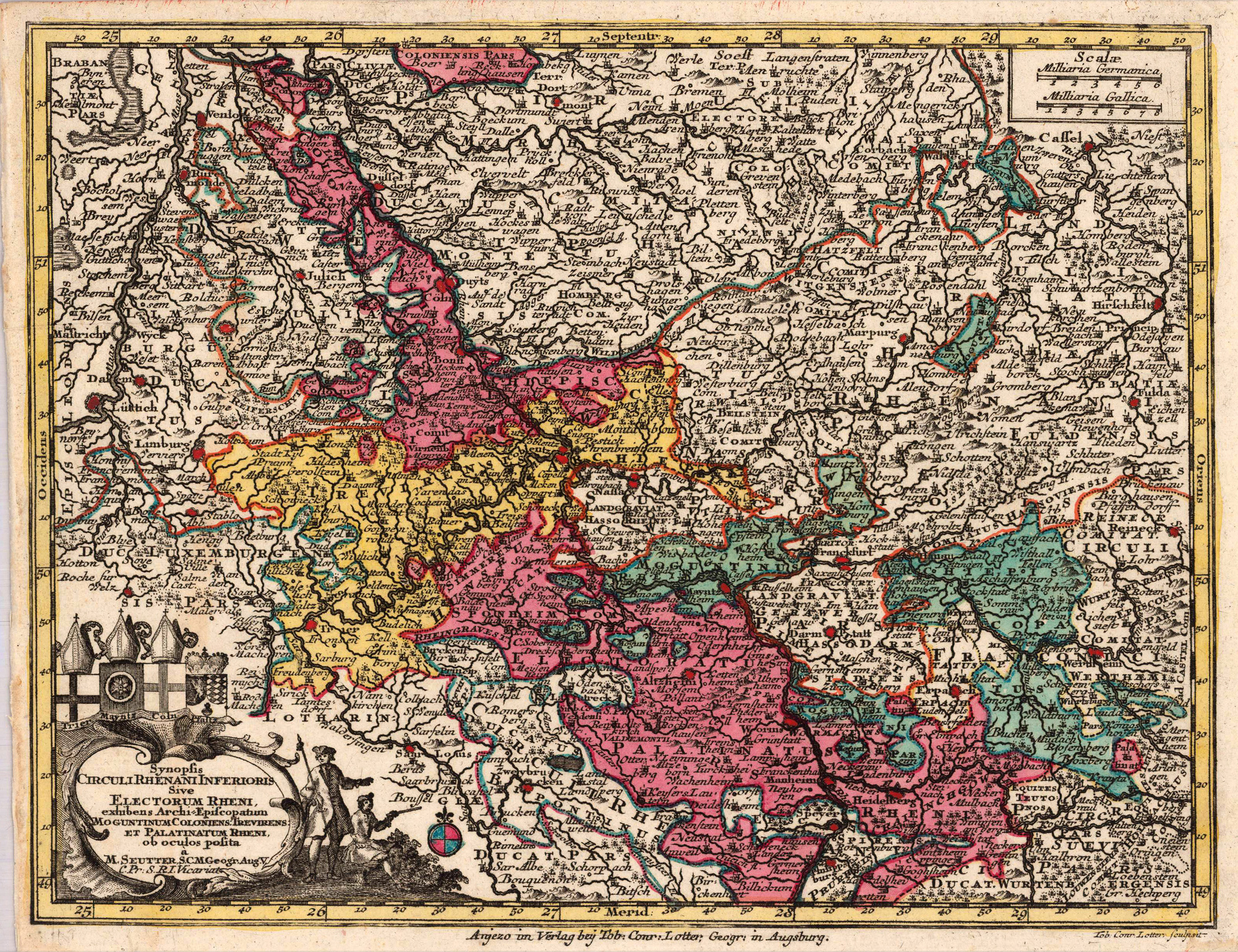
Original antique copper engraving, original color in outline and wash when published. The antique map by Matthäus Seutter shows the Archbishopric and Electorate of Mainz and the County of Wertheim. A detailed map of Mainz, divided up into its various political regions in outline and wash color of the period when published.With many engraved place names, villages, castles, monasteries, rivers, lakes, mountains, etc. Matthäus Seutter (September 20, 1678 – March 1757) was one of the most important and prolific German map publishers of the 18th century. Seutter started his career as an apprentice brewer. Apparently uninspired by the beer business, Seutter left his apprenticeship and moved to Nuremberg where he apprenticed as an engraver under the tutelage of the prominent J. B. Homann. Sometime in the early 18th century Seutter left Homann to establish his own independent cartographic publishing firm in Augsburg. Though he struggled in the early years of his independence, Seutter's engraving skill and commitment to diversified map production eventually gained him a substantial following. Most of Seutter's maps were heavily based upon, if not copies of, earlier work done by the Homann and Delisle firms.[citation needed] By 1732 Seutter was one of the most prolific publishers of his time and was honored by the German Emperor Charles VI with the title of,Imperial Geographer'. Seutter continued to publish until his death, at the height of his career, in 1757. The Seutter firm continued under Seutter's wastrel son Albrecht Carl until his death in 1762. Following Albrecht's death, the firm was divided between the established Probst firm and the emerging firm of Tobias Conrad Lotter. Lotter, Matthäus Seutter's son in law, was a master engraver and worked on behalf of the Seutter firm. Lotter would eventually become one of the most prominent cartographers of his day.
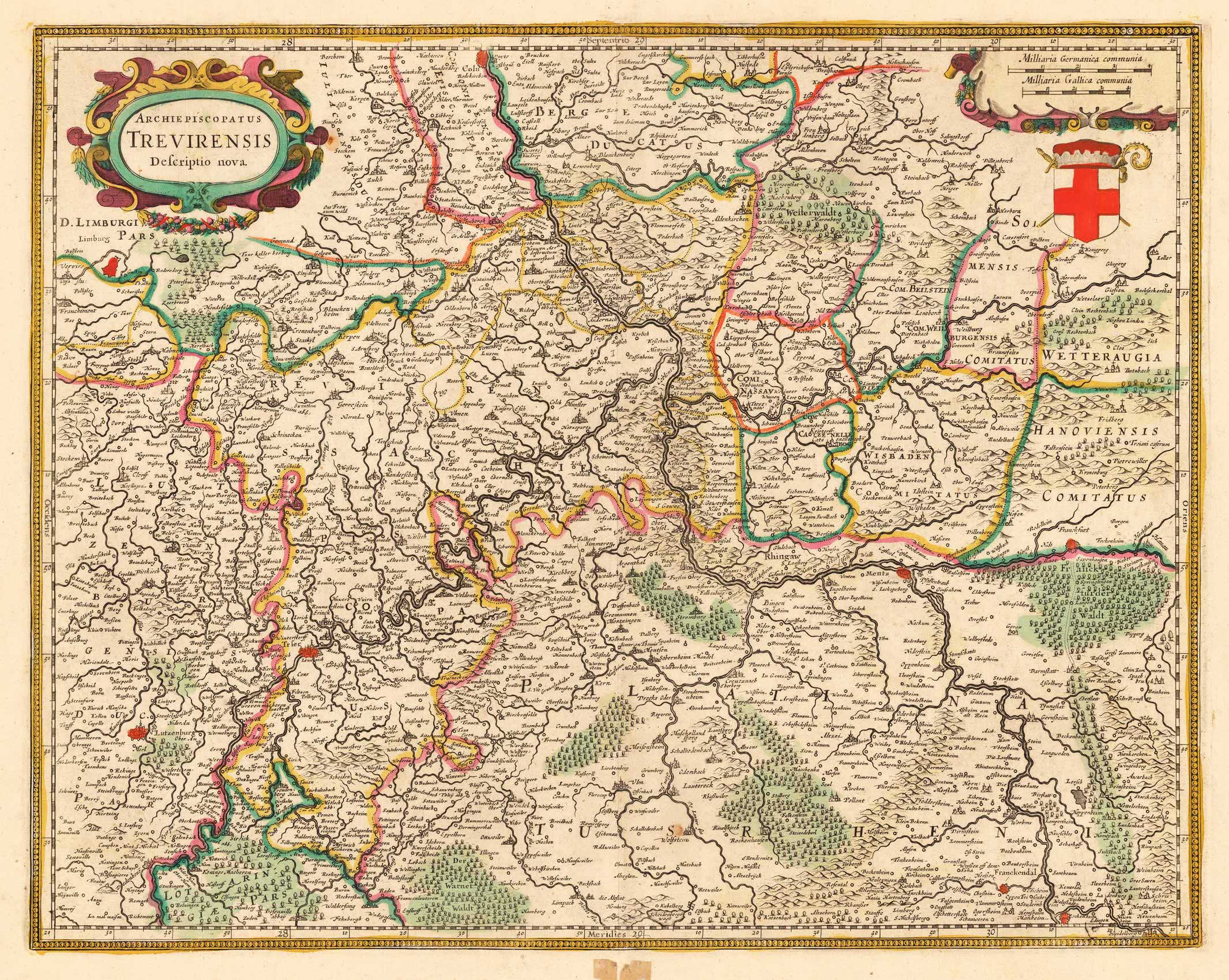
Copper-engraving, hand-colored in outline. Decorative map of the archbishopric of Trier, ornated with a decorative title-cartouche in the upper left corner and a cartouche with a milage scale and coat of arms in the upper right corner. A detailled map of the western part of Rheinland Pfalz, showing the area along the river Mosel and the Rhine from Cologne to Heidelberg in the south. With engraved political borders and naming many small duchies. Many place names, mountains, woods and rivers are shown on the map.
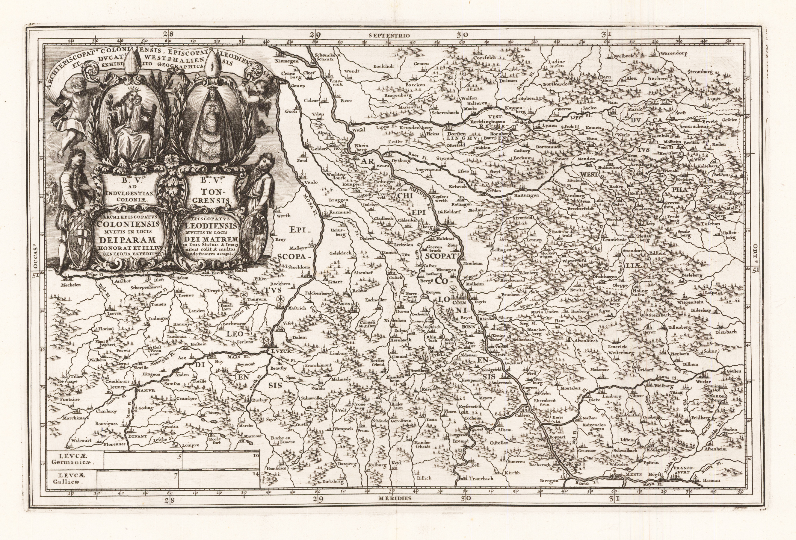
Original antiker Kupferstich, unkoloriert. Das Kartenbild zeigt den Bereich vom niederländischen Nijmegen im Norden bis Frankfurt am Main im Süden und vom belgischen Mecheln im Westen bis nach Gießen/Hessen im Osten. Links oben ist die große dekorative Kartusche gehalten von zwei Putti eingraviert. Links unten wurden zwei Meilenzeiger angebracht. Verlegt von 'Heinrich Scherer' nach einem anonymen Künstler. Heinrich Scherer (1628-1704) war bis etwa 1680 Professor für Hebräisch, Mathematik und Ethik an der Universität Dillingen. Danach erhielt er wichtige Positionen als Amtslehrer der königlichen Fürsten von Mantua und Bayern. Während seiner Zeit in München als Hauslehrer des Fürstenhauses von Bayern fand sein Lebenswerk als Kartograph Anerkennung und Anerkennung. Scherers Weltatlas, der Atlas Novus, erstmals zwischen 1702 und 1710 in München erschienen und in einer zweiten Auflage zwischen 1730 und 1737 neu aufgelegt, bildet ein einzigartig ungewöhnliches, geradezu revolutionäres Werk für die Entwicklung der europäischen Kartografie zu Beginn des 18. Jahrhunderts.
Copper engraving, hand colored in outline when published. Decorative map of the river Mosel with the archbishopric of Trier, ornated with a large decorative allegoric title-cartouche in the upper left corner. A very detailed map of the western part of Rheinland Pfalz, showing the area along the river Mosel and the Rhine from Bonn to Ingelheim in the south. With engraved political borders and naming many small duchies and territories. Many place names, mountains, woods and rivers are shown on the map, already streets are here in this map engraved. A very detailed map, throughout in a fine engraving. In the lower center a small mileage scale with a putto holding a coat of arms.
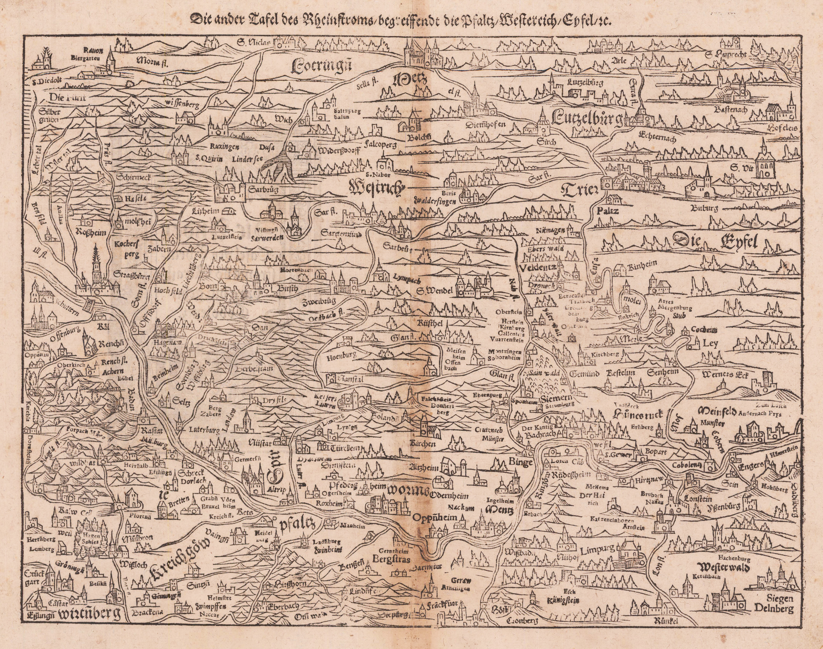
Holzschnittkarte erschienen in der Cosmographia von Sebastian Münster, deutsche Ausgabe. Die Landkarte zeigt den Rheinlauf von südlich Straßburg bis kurz vor Bonn mit Teilen der Vogesen, des Schwarzwaldes, der Rheinpfalz, des Odenwaldes, des Hunsrücks, des Taunus und der Eifel. Der Rhein verläuft auf der Karte von links nach rechts. Die Karte ist somit nach Westen ausgerichtet, Norden befindet sich rechts. Sie wird begrenzt durch Weißenburg, die Ardennen, Siegen / Dillenburg und Esslingen. Sie ist der mittlere Teil einer dreiteiligen Rheinlaufkarte.
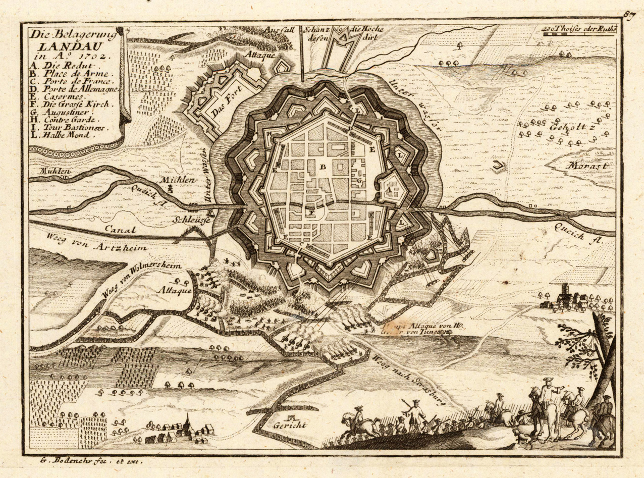
Original antique copper engraving, uncolored as published. This detailed map shows the city of Landau with its city wall and the surrounding area. At the top left, the cartouche with alphabetic explanation A-L for the most important buildings in the city. This fine engraving was published in Gabriel Bodenehr's famous serious "Europeans Macht und Pracht", a series of engravings depicting city views, plans, fortresses and castles in Europe. Many plates often are showing fortifications in Hungary and Southeast Europe, Spain, Belgium, Austria and Germany. Gabriel Bodenehr was during this period a successful publisher for maps and prints in Augsburg in Southern Germany. Gabriel Bodenehr the Elder (1664-1758 or 1673-1765) was a German map maker and member of a famous engraver and publisher family of Augsburg. His main work was "Atlas Curieux" first published 1704. He was the son of Johann Georg Bodenehr (1631-1703). Gabriel's son was Gabriel Bodenehr the Younger (1705–1792).
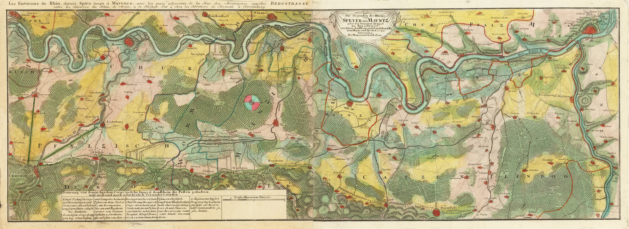
Original Kupferstich in zeitgenössischem Grenz- und Flächenkolorit. Die Karte von 2 Platten gedruckt mit zusätzlicher Titelkopfleiste ('Les Environs du Rhin, depuis Spire iusqu à Mayence, avec les pais adjacents de la Rue des Montagnes appelée Bergstrasse entre les Rivieres du Rhin, de Main et de Neckar. Par et chez les Heretiers de Homan à Norimberg') Zeigt das Gebiet zwischen Heidelberg, Darmstadt, Mainz und Speyer und die Truppen des Polnische Thronfolgekrieg, auch Erbfolgekrieg genannt (1733–1738), in der Region im Jahr 1735. Der Krieg ging um die Thronfolge Polens nach dem Tod Augusts II. (des Starken). 1733 erklärte Frankreich Kaiser Karl VI. und Russland unter Kaiserin Anna den Krieg. Die Kriegshandlungen fanden hauptsächlich an der Rhein-Grenze statt. Den Franzosen gelang unter anderem die Eroberung der Festungen Kehl und Philippsburg. Johann Baptist Homann (* 20. März 1664 in Oberkammlach, heute Teil von Kammlach im Landkreis Unterallgäu; † 1. Juli 1724 in Nürnberg) war ein deutscher Kartograph, Verleger, Kupferstecher und fertigte Globen. Das Geburtsdatum von Johann Baptist (Baptista) Homann war lange Zeit nicht sicher zu ermitteln. Eine amtliche Bestätigung, die sein Vater eingeholt hatte, fand sich im Staatsarchiv Nürnberg. Durch sie ist das Geburtsdatum 20. März 1664 eindeutig belegt. Homann wurde zunächst in einer Jesuitenschule erzogen und doch wollte er Dominikaner werden. Letztlich aber trat er zum Protestantismus über und wurde 1687 Notar in Nürnberg. Bald jedoch wandte er sich dem Kupfer- und Landkartenstich zu. Von 1693 bis 1695 war er in Wien, dann wieder in Nürnberg und um 1698 stach er Landkarten in Leipzig. Im Jahr 1702 gründete er einen Handel und einen Verlag für Kartographie in Nürnberg, der zahlreiche Globen und Karten publizierte. Die Karten Homanns wurden in verschiedenen Atlanten kombiniert, aber auch einzeln verkauft. Homann lieferte etwa 200 Karten, darunter den Großen Atlas über die ganze Welt in 126 Blättern (1716) und den Atlas methodicus (1719) in 18 Blättern. Bekannt wurde seine Phantasiekarte accurata tabulae utopiae vom Schlaraffenland nach der fiktiven Reisebeschreibung Johann Andreas Schnebelin († 1706). Daneben fertigte er auch Armillarsphären und andere mechanische Kunstwerke. Die Karten Weihnachtsflut in Niederdeutschland (1717), Herzogtümer Bremen und Verden und Umgebungsplan von Bremen mit einer Stadtansicht (um 1720) stammen von ihm. Homann unterbot die Preise der holländischen und französischen Verleger und wurde im Deutschland des 18. Jahrhunderts der bedeutendste Herausgeber von Landkarten und Atlanten. Seine Karten waren mit reichem künstlerischem Beiwerk sowie historischen und ethnographischen Abbildungen ausgestattet. Im Jahr 1715 wurde Homann zum Mitglied der Königlichen Akademie der Wissenschaften zu Berlin gewählt und auch zum kaiserlichen Geographen am Hof Karls VI. ernannt. Er arbeitete sehr eng mit dem schon damals bekannten Nürnberger Kupferstecher Christoph Weigel (1654–1725) zusammen. Sein Kleiner Atlas scholasticus von 18 Charten von 1710 war accomodirt durch den Leipziger Schulbuchautor Johann Hübner (1668–1731) und der 1719 herausgebrachte Atlas methodicus war nach Hübnerischer Lehrart eingerichtet. Johann Baptist Homann starb am 1. Juli 1724. Sein Unternehmen ging auf seinen Sohn Johann Christoph Homann (1703–1730) über. Dieser starb jedoch bereits sechs Jahre später. Er hatte seine beiden Geschäftsführer, Johann Georg Ebersberger (oder Ebersperger) und Johann Michael Franz zu Erben der Handlung eingesetzt. Nach seinem Tod wurde das Unternehmen unter dem Namen „Homanns Erben" (auch „Homannsche Erben" oder „Homännische Erben", franz. Heritiers de Homann, lat. Homannianos Heredes) fortgeführt. In der Mitte des 18. Jahrhunderts waren weiterhin renommierte Gelehrte wie z. B. Johann Michael Franz, Tobias Mayer, Johann Gabriel Doppelmayr, Georg Moritz Lowitz, Johann Hübner und Johann Gottfried Gregorii für das Unternehmen tätig. Die lange und wechselvolle Erfolgsgeschichte des Branchenprimus endete erst 1848 mit dem Tod des letzten Besitzers Christoph Franz Fembo. Eine Büste des Johann Baptist Homann fand Aufstellung in der Ruhmeshalle in München. Die Büste wurde 1944 zerstört und bislang nicht restauriert oder nachgebildet. Heute erinnert eine Gedenktafel daran.
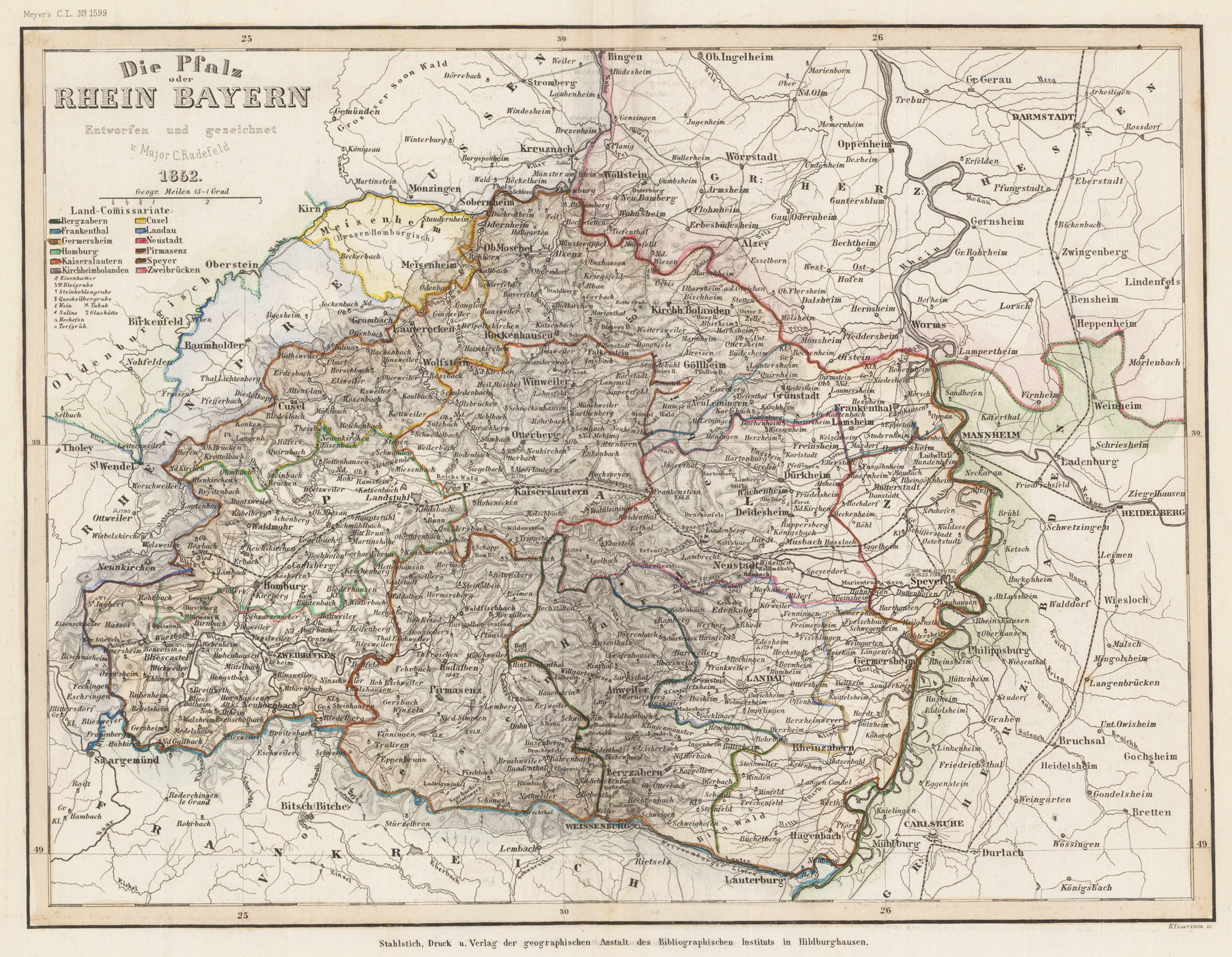
Original Stahlstich in zeitgenössischem Grenz- und Flächenkolorit. Das Kartenbild zeigt die Gegend zwischen Bingen im Norden und Lauterburg im Süden, Saargmünd im Westen und Heidelberg im Osten. Der Titel wurde oben links graviert und eine Farbtabelle der Land-Comissariate darunter.
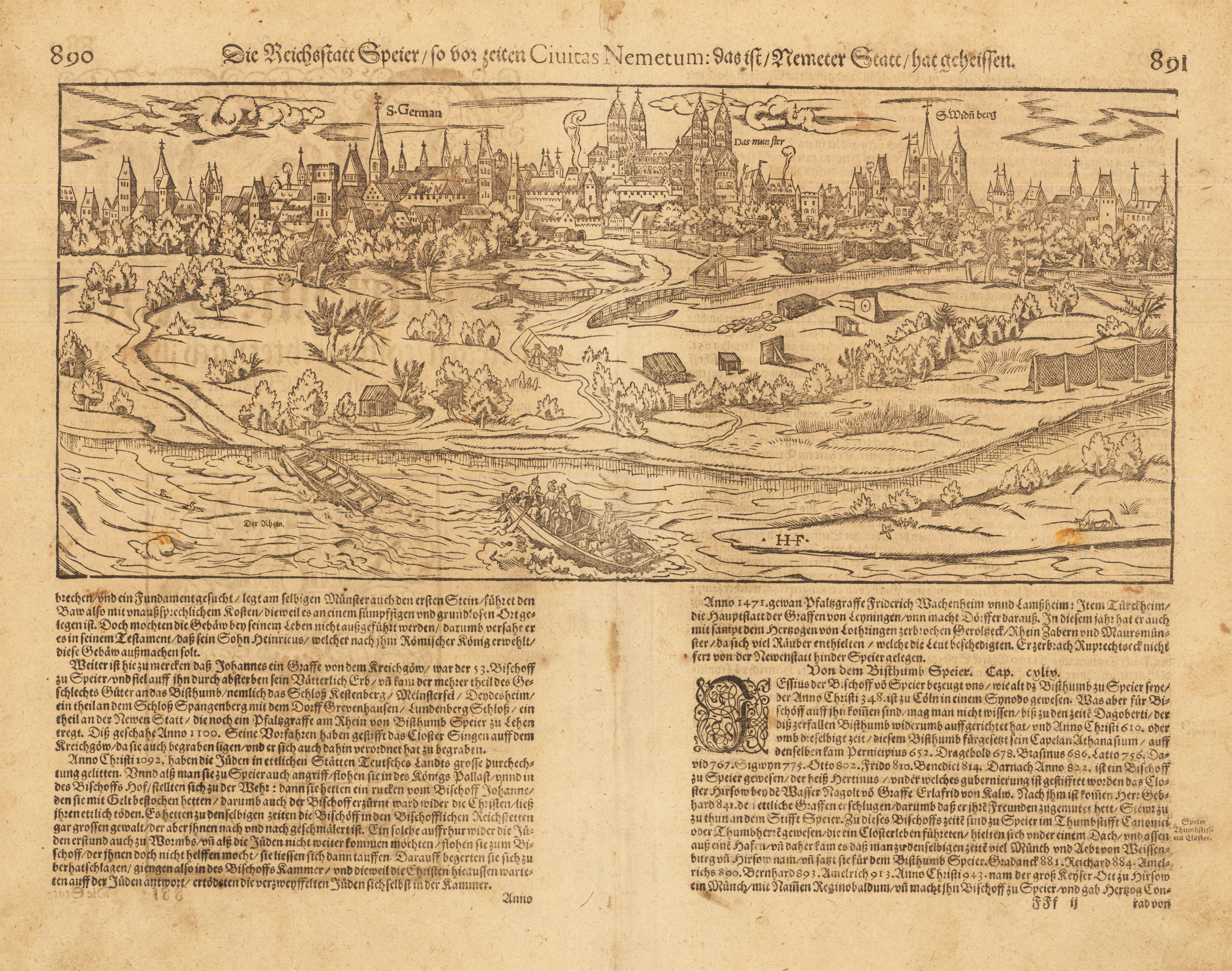
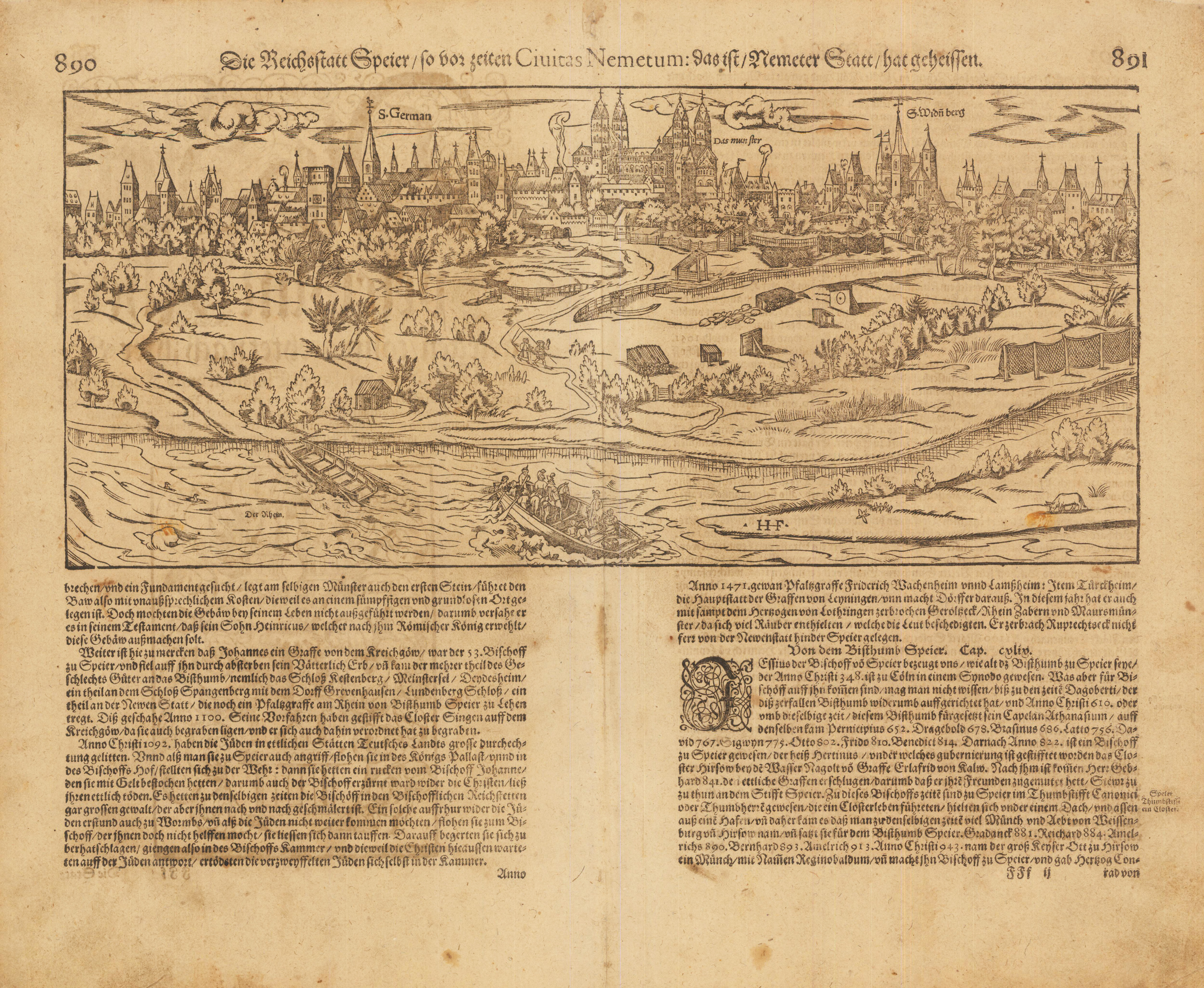
Woodcut map, uncolored as publishedin the,Cosmographia' by Sebastian Münster in Basel, German text edition 1578. Decorative bird's eye panoramic city view of Speyer on the river Rhine. This view of Speyer is one of the earliest city views of Speyer in the 16th century published in the, Cosmographia' by Sebastian Münster. Speyer in the Rheinland-Pfalz is depicted here with rural landscape in the foreground. The woodcut shows here the city of Speyer with its surrounding city walls. Churches, towers and buildings are detailed shown and fine engraved. Dekoratives Stadtpanorama von Speyer in der Rheinpfalz aus der Vogelperspektive. Diese Ansicht von Speyer ist eine der frühesten Ansichten von Speyer im 16. Jahrhundert, die in der Cosmographia von Sebastian Münster veröffentlicht wurde. Speyer in der Rheinland-Pfalz ist hier mit ländlicher Landschaft im Vordergrund dargestellt. Der Holzschnitt zeigt die Stadt Speyer mit der umgebenden Stadtmauer. Kirchen, Türme und Gebäude sind detailliert dargestellt und fein graviert. Verso illustrated with a large woodcut with the coat of arms of the imperial city of Speyer.
Woodcut map, uncolored as published in the,Cosmographia' by Sebastian Münster in Basel, German text edition 1578. Decorative bird's eye panoramic city view of Speyer on the river Rhine. This view of Speyer is one of the earliest city views of Speyer in the 16th century published in the, Cosmographia' by Sebastian Münster. Speyer in the Rheinland-Pfalz is depicted here with rural landscape in the foreground. The woodcut shows here the city of Speyer with its surrounding city walls. Churches, towers and buildings are detailed shown and fine engraved. Dekoratives Stadtpanorama von Speyer in der Rheinpfalz aus der Vogelperspektive. Diese Ansicht von Speyer ist eine der frühesten Ansichten von Speyer im 16. Jahrhundert, die in der Cosmographia von Sebastian Münster veröffentlicht wurde. Speyer in der Rheinland-Pfalz ist hier mit ländlicher Landschaft im Vordergrund dargestellt. Der Holzschnitt zeigt die Stadt Speyer mit der umgebenden Stadtmauer. Kirchen, Türme und Gebäude sind detailliert dargestellt und fein graviert. Sebastian Münster (20 January 1488 – 26 May 1552) was a German cartographer, cosmographer, and a Christian Hebraist scholar. His work, the Cosmographia from 1544, was the earliest German description of the world.He was born in Ingelheim, near Mainz, the son of Andreas Münster. His parents and other ancestors were farmers. In 1505, he entered the Franciscan order. Four years later, he entered a monastery where he became a student of Konrad Pelikan for five years. Münster completed his studies at the University of Tübingen in 1518. His graduate adviser was Johannes Stöffler. He left the Franciscans for the Lutheran Church in order to accept an appointment at the Reformed Church-dominated University of Basel in 1529.[2][4] He had long harboured an interest in the Lutherans, and during the German Peasants' War, as a monk, he had been repeatedly attacked. A professor of Hebrew, and a disciple of Elias Levita, he edited the Hebrew Bible (2 vols. fol., Basel, 1534–1535), accompanied by a Latin translation and a large number of annotations. He was the first German to pmmatica Chaldaica (Basel, 1527). His lexicographical labours included a Dictionarium Chaldaicum (1527), and a Dictionarium trilingue for Latin, Greek, and Hebrew in 1530. He released a Mappa Europae (map of Europe) in 1536. In 1537 he published a Hebrew Gospel of Matthew which he had obtained from Spanish Jews he had converted. In 1540 he published a Latin edition of Ptolemy's Geographia with illustrations. The 1550 edition contains cities, portraits, and costumes. These editions, printed in Germany, are the most valued of this work. Other writings that followed are Horologiographia (a treatise on dialling – constructing sundials, Basel, 1531), and Organum Uranicum (a treatise on the planetary motions, 1536). His Cosmographia of 1544 was the earliest German-language description of the world. It had numerous editions in different languages including Latin, French, Italian, English, and even Czech. The Cosmographia was one of the most successful and popular works of the 16th century. It passed through 24 editions in 100 years.[6] This success was due to the fascinating woodcuts (some by Hans Holbein the Younger, Urs Graf, Hans Rudolph Manuel Deutsch, and David Kandel), in addition to including the first to introduce "separate maps for each of the four continents known then – America, Africa, Asia and Europe."[7] It was most important in reviving geography in 16th-century Europe. The last German edition was published in 1628, long after his death. Münster was also known as translator of the Hebrew Bible (Hebraica Biblia). His edition was published in two volumes (1546) in Basel. The first volume contains Genesis-2 Kings, following the order of the Masoretic codices. The second volume contains The Prophets (Major and Minor), The Psalms, Job, Proverb, Daniel, Chronicles, and the Five Scrolls (The Song of Songs, Ruth, Lamentations, Ecclesiastes and Esther). His Rudimenta Mathematica was published in Basel in 1551. He died at Basel of the plague in 1552. His tombstone described him as the Ezra and the Strabo of the Germans. Produce an edition of the Hebrew Bible. (Wikipedia)
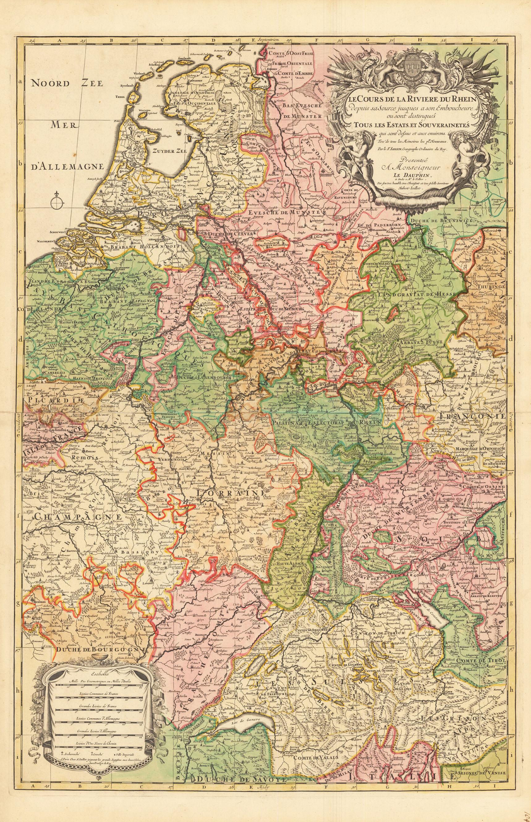
Kupferstichkarte, in zeitgenössischem Grenzkolorit. Mit großer, prächtiger, allegorischer Kartusche, sowie Meilenzeiger mit Legende. Erschienen im großen Atlas Atlas Nouveau contenant.. von Nicolaus Sanson u. Hubert Jaillot. Dargestellt wird der Bereich vom Genver See bis zur Nordsee. Westlich von Sens in der Champagne bis Eichstätt im Osten. Der Atlas Nouveau... entstand als Auftragsarbeit für Ludwig XIV. und nahm einen Zeitraum von über 10 Jahren in Anspruch und gilt bis heute noch als eine Meisterleistung der französischen Kartographie des 17. Jahrhunderts. Das Kartenbild sorgfältig u. übersichtlich ausgearbeitet.
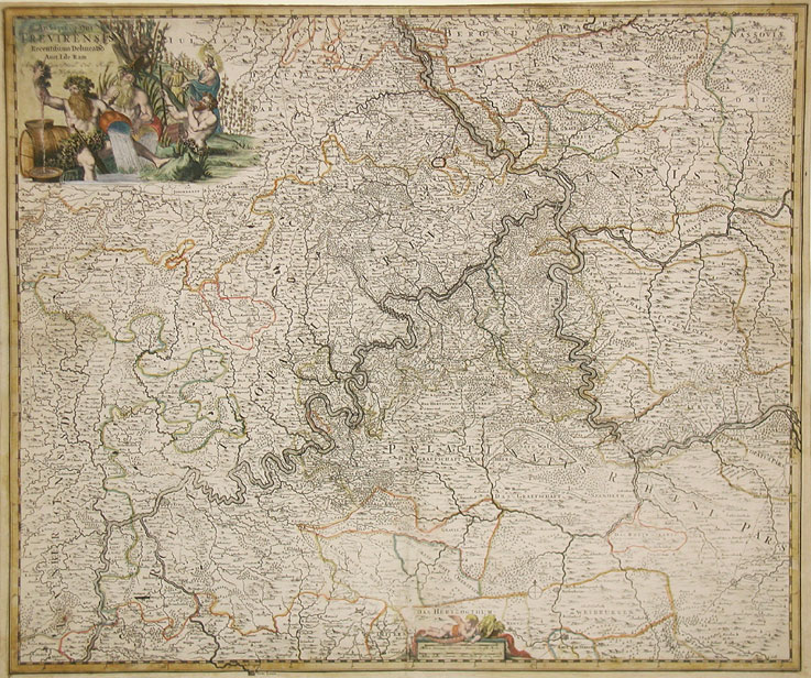
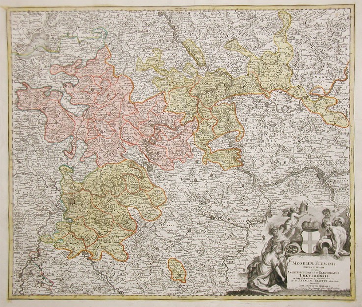
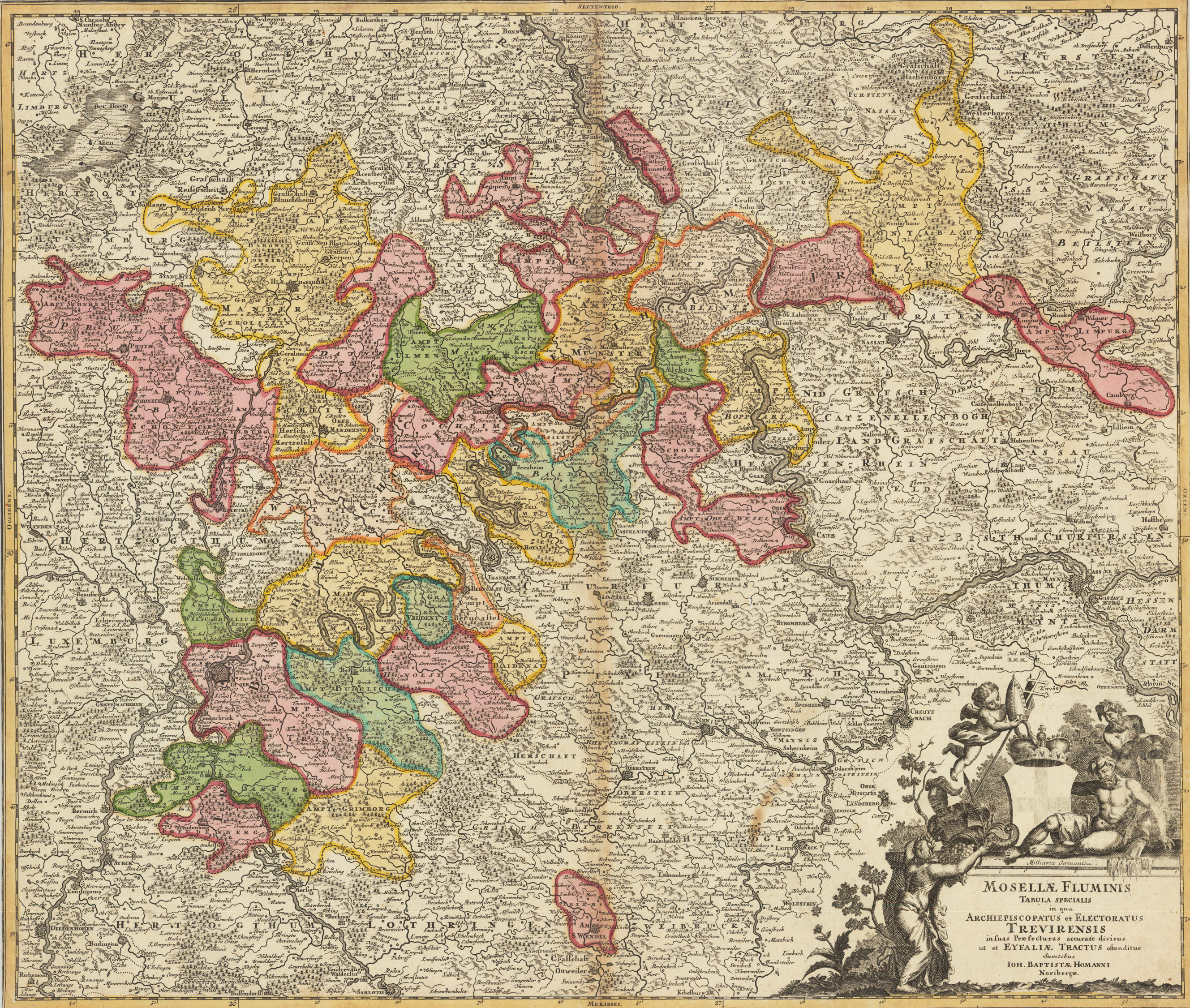
Original antique copper engraving in full contemporary hand color in wash and outline when published. Decorative map of the river Mosel with the archbishopric of Trier, ornated with a large decorative allegoric title-cartouche in the lower right corner. A detailled map of the western part of Rheinland Pfalz, showing the area along the river Mosel and the Rhine from Bonn to Oppenheim in the south. With engraved political borders and naming many small duchies. Many place names, mountains, woods and rivers are shown on the map. A very detailled map. Johann Baptist Homann (20 March 1664 – 1 July 1724) was a German geographer and cartographer, who also made maps of the Americas. Homann was born in Oberkammlach near Kammlach in the Electorate of Bavaria. Although educated at a Jesuit school, and preparing for an ecclesiastical career, he eventually converted to Protestantism and from 1687 worked as a civil law notary in Nuremberg. He soon turned to engraving and cartography; in 1702 he founded his own publishing house. Homann acquired renown as a leading German cartographer, and in 1715 was appointed Imperial Geographer by Emperor Charles VI. Giving such privileges to individuals was an added right that the Holy Roman Emperor enjoyed. In the same year he was also named a member of the Prussian Academy of Sciences in Berlin. Of particular significance to cartography were the imperial printing privileges (Latin: privilegia impressoria). These protected for a time the authors in all scientific fields such as printers, copper engravers, map makers and publishers. They were also very important as a recommendation for potential customers. In 1716 Homann published his masterpiece Grosser Atlas ueber die ganze Welt (Grand Atlas of all the World). Numerous maps were drawn up in cooperation with the engraver Christoph Weigel the Elder, who also published Siebmachers Wappenbuch. Homann died in Nuremberg in 1724. He was succeeded by his son Johann Christoph (1703-1730). The company carried on upon his death as Homann heirs company, managed by Johann Michael Franz and Johann Georg Ebersberger. After subsequent changes in management the company folded in 1852.[1] The company was known as "Homann Erben", "Homanniani Heredes", or "Heritiers de Homann" abroad. (Wikipedia)
Original Kupferstich in zeitgenössischem Grenz- und Flächenkolorit. Zeigt den Mosellauf von Diedenhofen bis zur Mündung in den Rhein bei Koblenz mit der Eifel und dem Erzbistum und Kurfürstentum Trier. Der Rhein ist von Oppenheim bis Bonn dargestellt und die Saar von Saarlouis an. Dargestellt wird das Gebiet von Vianden im Westen bis Hofheim im Osten. Von Bonn im Norden bis Saarlouis im Süden. Unten rechts große Textkartusche mit heraldischem und figürlichem Schmuck "Mosellae Fluminis Tabula Specialis : in qua Archiepiscopatus et Electoratus Trevirensis in suas Praefecturas accurate divisus ut et Eyfaliae Tractus ostenditur / Sumtibus Ioh. Baptistae Homanni". Johann Baptist Homann (* 20. März 1664 in Oberkammlach, heute Teil von Kammlach im Landkreis Unterallgäu; † 1. Juli 1724 in Nürnberg) war ein deutscher Kartograph, Verleger, Kupferstecher und fertigte Globen. Das Geburtsdatum von Johann Baptist (Baptista) Homann war lange Zeit nicht sicher zu ermitteln. Eine amtliche Bestätigung, die sein Vater eingeholt hatte, fand sich im Staatsarchiv Nürnberg. Durch sie ist das Geburtsdatum 20. März 1664 eindeutig belegt. Homann wurde zunächst in einer Jesuitenschule erzogen und doch wollte er Dominikaner werden. Letztlich aber trat er zum Protestantismus über und wurde 1687 Notar in Nürnberg. Bald jedoch wandte er sich dem Kupfer- und Landkartenstich zu. Von 1693 bis 1695 war er in Wien, dann wieder in Nürnberg und um 1698 stach er Landkarten in Leipzig. Im Jahr 1702 gründete er einen Handel und einen Verlag für Kartographie in Nürnberg, der zahlreiche Globen und Karten publizierte. Die Karten Homanns wurden in verschiedenen Atlanten kombiniert, aber auch einzeln verkauft. Homann lieferte etwa 200 Karten, darunter den Großen Atlas über die ganze Welt in 126 Blättern (1716) und den Atlas methodicus (1719) in 18 Blättern. Bekannt wurde seine Phantasiekarte accurata tabulae utopiae vom Schlaraffenland nach der fiktiven Reisebeschreibung Johann Andreas Schnebelin († 1706). Daneben fertigte er auch Armillarsphären und andere mechanische Kunstwerke. Die Karten Weihnachtsflut in Niederdeutschland (1717), Herzogtümer Bremen und Verden und Umgebungsplan von Bremen mit einer Stadtansicht (um 1720) stammen von ihm. Homann unterbot die Preise der holländischen und französischen Verleger und wurde im Deutschland des 18. Jahrhunderts der bedeutendste Herausgeber von Landkarten und Atlanten. Seine Karten waren mit reichem künstlerischem Beiwerk sowie historischen und ethnographischen Abbildungen ausgestattet. Im Jahr 1715 wurde Homann zum Mitglied der Königlichen Akademie der Wissenschaften zu Berlin gewählt und auch zum kaiserlichen Geographen am Hof Karls VI. ernannt. Er arbeitete sehr eng mit dem schon damals bekannten Nürnberger Kupferstecher Christoph Weigel (1654–1725) zusammen. Sein Kleiner Atlas scholasticus von 18 Charten von 1710 war accomodirt durch den Leipziger Schulbuchautor Johann Hübner (1668–1731) und der 1719 herausgebrachte Atlas methodicus war nach Hübnerischer Lehrart eingerichtet. Johann Baptist Homann starb am 1. Juli 1724. Sein Unternehmen ging auf seinen Sohn Johann Christoph Homann (1703–1730) über. Dieser starb jedoch bereits sechs Jahre später. Er hatte seine beiden Geschäftsführer, Johann Georg Ebersberger (oder Ebersperger) und Johann Michael Franz zu Erben der Handlung eingesetzt. Nach seinem Tod wurde das Unternehmen unter dem Namen „Homanns Erben" (auch „Homannsche Erben" oder „Homännische Erben", franz. Heritiers de Homann, lat. Homannianos Heredes) fortgeführt. In der Mitte des 18. Jahrhunderts waren weiterhin renommierte Gelehrte wie z. B. Johann Michael Franz, Tobias Mayer, Johann Gabriel Doppelmayr, Georg Moritz Lowitz, Johann Hübner und Johann Gottfried Gregorii für das Unternehmen tätig. Die lange und wechselvolle Erfolgsgeschichte des Branchenprimus endete erst 1848 mit dem Tod des letzten Besitzers Christoph Franz Fembo. Eine Büste des Johann Baptist Homann fand Aufstellung in der Ruhmeshalle in München. Die Büste wurde 1944 zerstört und bislang nicht restauriert oder nachgebildet. Heute erinnert eine Gedenktafel daran.
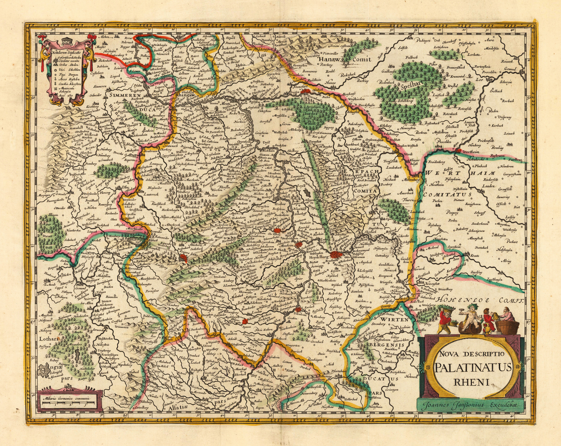
Copper engraving, hand colored in outline when published. Published 1630 for the first time in an ,Appendix atlas volume' by Joan. Janssonius in Amsterdam. The map appeared in various editions until 1644. This antique map shows detailed the Rheinpfalz in Germany. The centre of the map shows Kaiserslautern and Heidelberg. This antique map is equipped with many place names, rivers, woods, mountains and lakes, etc. A highly decorative old map with a decorative title cartouche and a small table with explanations.
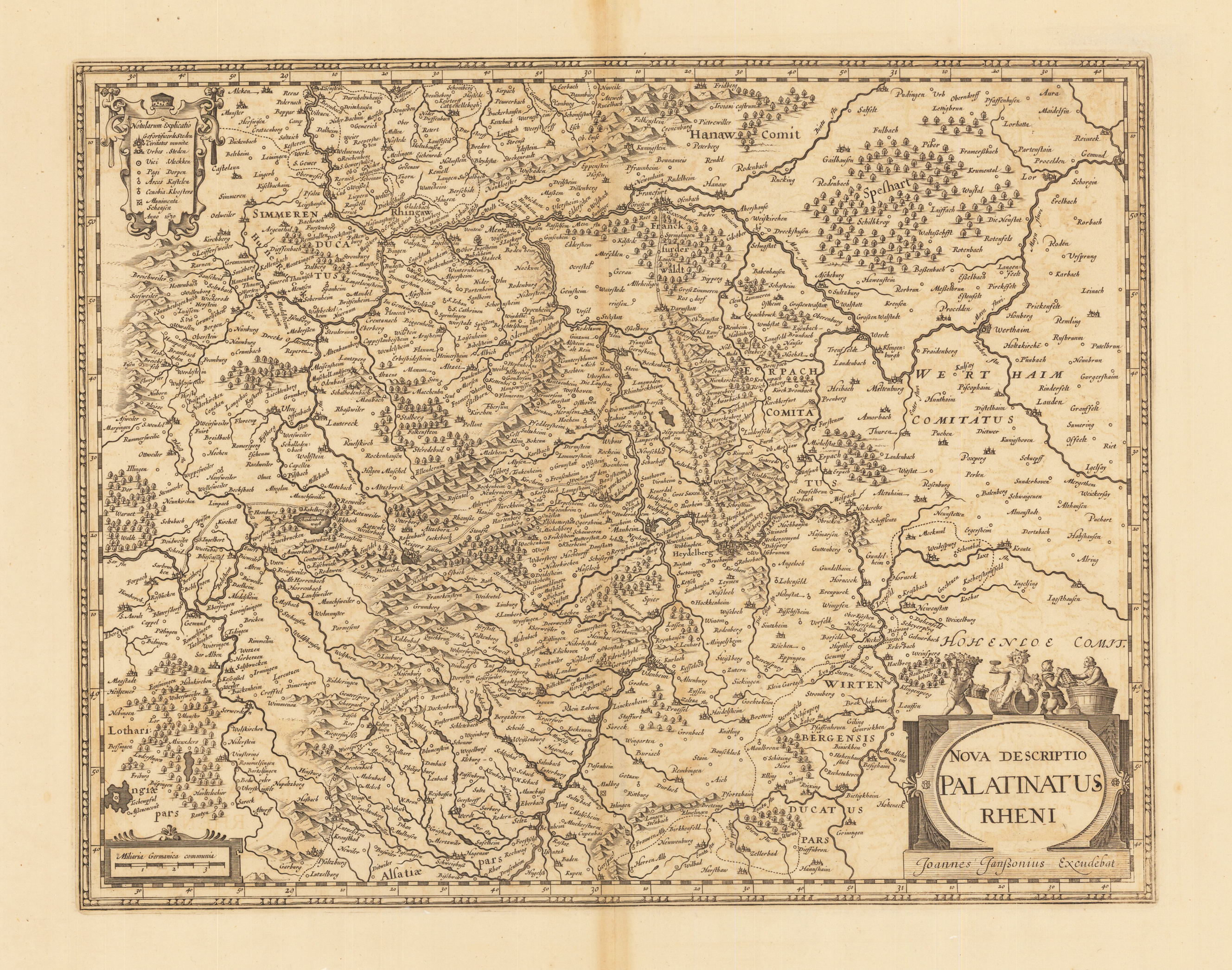
Copper engraving, uncolored as published. Published verso without text around 1630-32 in an appendix atlas volume by Joan Janssonius. The map was later on published in various text editions until 1644. A decorative antique map of the Rhine Palatinate with Saarland, Rheingau, Odenwald and North Baden. Heidelberg in the centre of the map. With an engraved title cartouche at the bottom right, a mileage indicator and engraved explanations on the left. Johann Janssonius (* 1588 in Arnhem, † 1664 in Amsterdam), actually Jan Janszoon, other spellings Jan Jansz., Joan, Johannes, Ioannis, Io (h) annem; Ianssonii, Ianßonium or Jansonium) was a Dutch cartographer, publisher and manufacturer of globes. Janssonius also continued the publication of Mercator-Hondius' atlases. In 1612 he married the daughter Elisabeth of Jodocus Hondius (1563-1612). Since Hondius was the owner of Gerardus Mercator's printing plates, they worked together after Jodocus Hondius 'death with his sons Jodocus II and Henricus on new editions of Mercator's Atlas. In 1633 the second volume of the atlas was published. This is often referred to as Mercator-Hondius-Janssonius. The most important work by Jan Janssonius is the Atlas Theater du Monde, published in 1639 in three volumes. Due to the constant additions, the atlas had eleven volumes in 1662. He developed into the fiercest competitor of Joan Blaeus (1596–1673) work Theatrum Orbis Terrarum. After Jansson's death, the company was continued by his brother-in-law Waesberg. In 1694 the printing plates of Janssonius were made by Peter Schenk the Elder. Ä. (approx. 1660–1711) acquired. (Wikipedia)
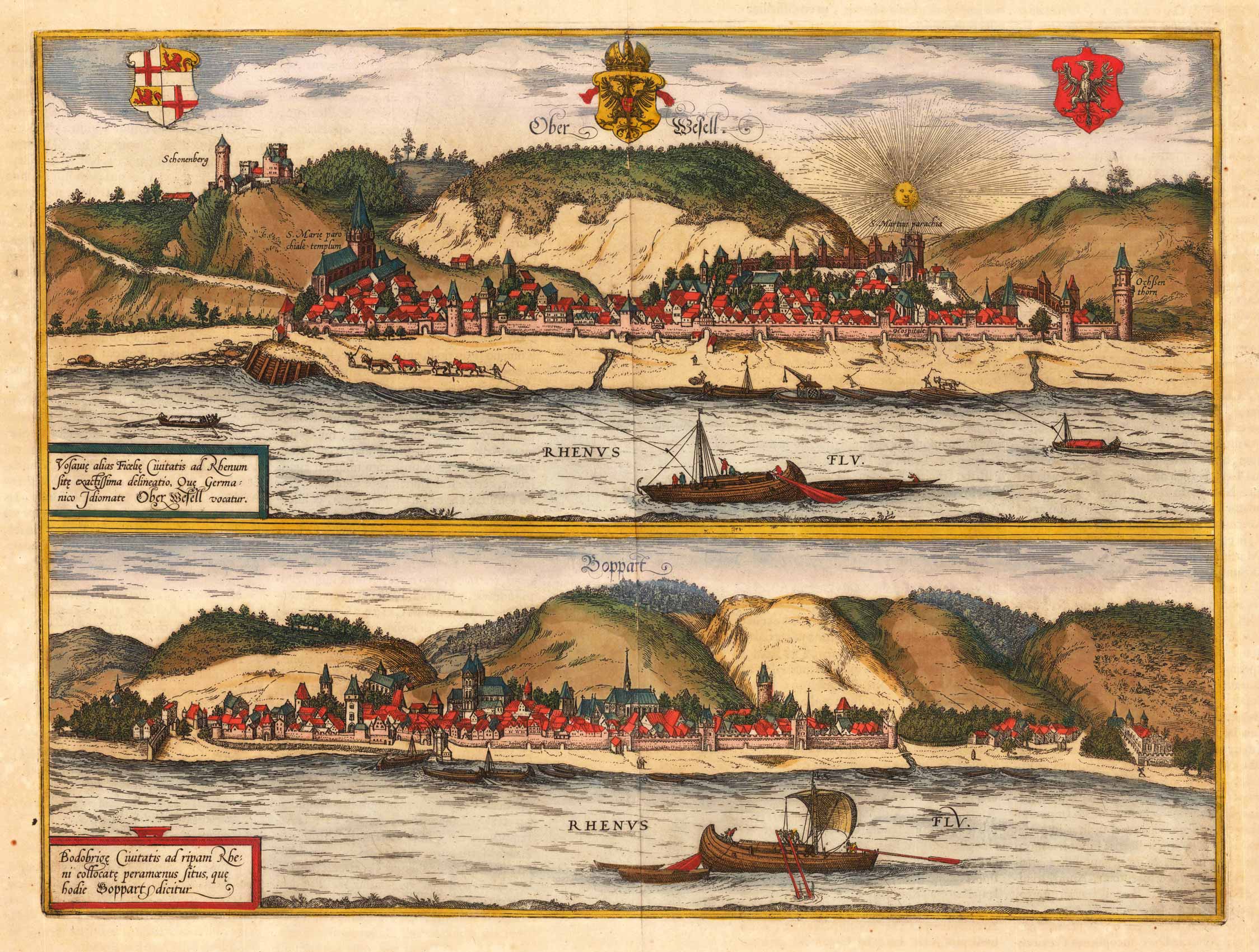
Original antique copper engraving, hand colored in outline when published. Published in a Latin text edition of Joan. Jansson's famous historical Atlas. The plate was first published in the townbooks ,Civitates Orbis Terrarum' by Braun & Hogenberg. The plates were later aquired by J. Janssonius and were published in his townbooks 1657 in Amsterdam. Johannes Janssonius (1588, Arnhem – buried July 11, 1664, Amsterdam) (born Jan Janszoon, in English also Jan Jansson) was a Dutch cartographer and publisher who lived and worked in Amsterdam in the 17th century. Janssonius was born in Arnhem, the son of Jan Janszoon the Elder,[1] a publisher and bookseller. In 1612 he married Elisabeth de Hondt, the daughter of Jodocus Hondius. He produced his first maps in 1616 of France and Italy. In 1623 Janssonius owned a bookstore in Frankfurt am Main, later also in Danzig, Stockholm, Copenhagen, Berlin, Königsberg, Geneva and Lyon. Elisabeth Hondius died in 1627 and he remarried Elisabeth Carlier in 1629. In the 1630s he formed a partnership with his brother in law Henricus Hondius, and together they published atlases as Mercator/Hondius/Janssonius. Under the leadership of Janssonius the Hondius Atlas was steadily enlarged. Renamed Atlas Novus, it had three volumes in 1638, one fully dedicated to Italy. In 1646, a fourth volume came out with "English County Maps", a year after a similar issue by Joan Blaeu. Janssonius' maps are similar to those of Blaeu, and he is often accused of copying from his rival, but many of his maps predate those of Blaeu and/or covered different regions. By 1660, at which point the atlas bore the appropriate name "Atlas Major", there were 11 volumes, containing the work of about a hundred credited authors and engravers. It included a description of "most of the cities of the world" (Townatlas), of the waterworld (Atlas Maritimus in 33 maps), and of the Ancient World (60 maps). The eleventh volume was the Atlas of the Heavens by Andreas Cellarius. Editions were printed in Dutch, Latin, French, and a few times in German. After Janssonius's death, the publishing company was continued by his son-in law, Johannes van Waesbergen. The London bookseller Moses Pitt attempted publication of the Atlas Major in English, but ran out of resources after the fourth volume in 1683. (Wikipedia)
Copper engraving, hand colored in outline and wash when published. A nice and detailed small map of the lower Rhine circles showing the area from east of Heidelberg towards Saarlouis. It extends in the north towards St. Goar on the river Rhine. Many engraved place names, streets, rivers, lakes and mountains. The various regions are shown in fine hand color in outline and wash. Ornated with a nice allegoric title cartouche showing an allegoric scene on the wine region.
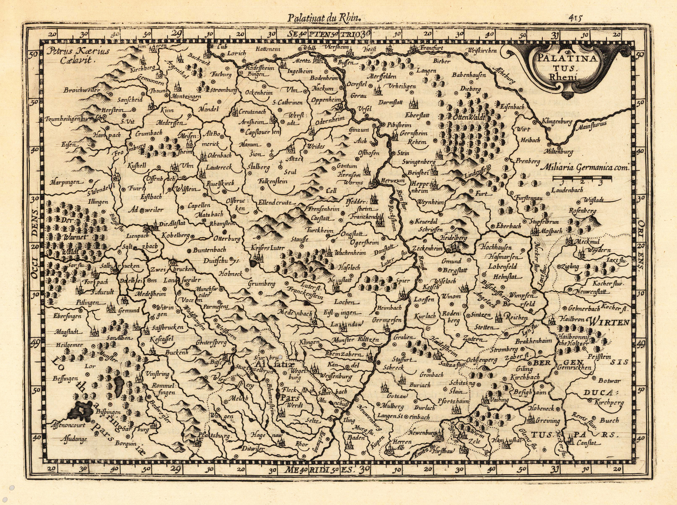
Published in the first Cloppenburgh edition of Gerhard Mercator's "Atlas Minor" in 1630, verso descriptive text. This is the first so-called Cloppenburgh editions which was a competive edition with new engraved maps in a larger format. Most of the maps were engraved by Pieter van den Keere. The Cloppenburg edition was continued for a couple of years but seems to have been suppressed after 1636 ... (Koeman Atlantes Neerlandici). A fine copy in a dark impression, full margins as published.
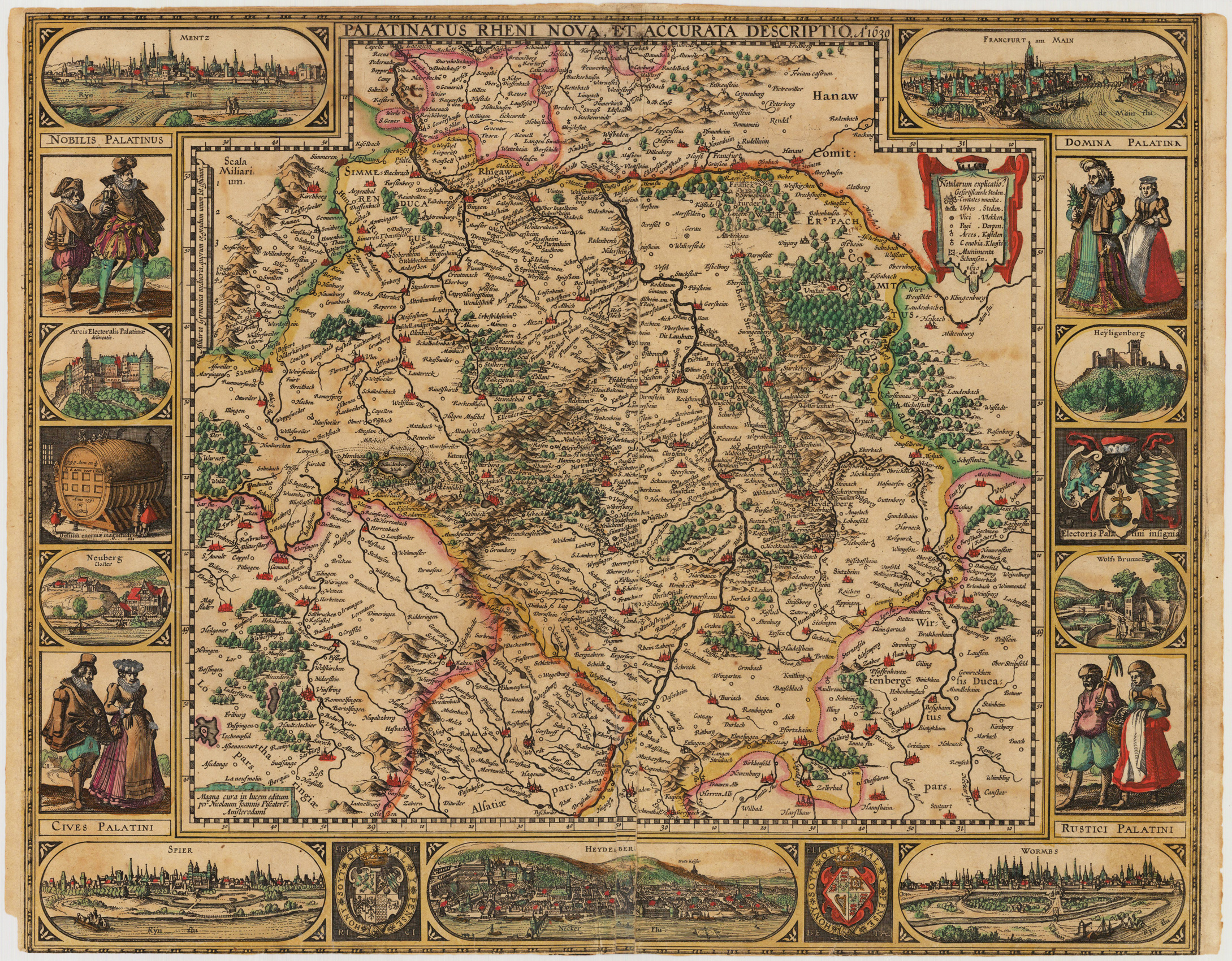
Copper engraving, hand colored in outline and wash when published. Highly decorative map of 'Rheinland Pfalz' equipped with decorative engraved borders showing city views, costumes of representations of nobles, citizens and farmers and coat of arms. Among the engraved city views we find Mainz, Frankfurt a. Main, Speyer, Heidelberg and Worms. Further the 'Heidelberger Fass' and other small views among these Wolf Fontain, Heyligenberg, Kloster Neuburg, etc. The map was first issued in 1621, then re-issued in 1630, 1652. This is the 2nd state published in 1630.
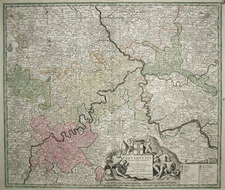
Copper-engraving, hand-colored in outline and wash, when published. Decorative map of the archbishopric of Trier, ornated with a decorative allegoric title-cartouche in the lower center together with a milage scale and a table of explanations. A detailled map of the western part of Rheinland Pfalz, showing the area along the river Mosel and the Rhine from Bonn to Oppenheim in the south. With engraved political borders and naming many small duchies. Many place names, mountains, woods and rivers are shown on the map. A very detailled map.
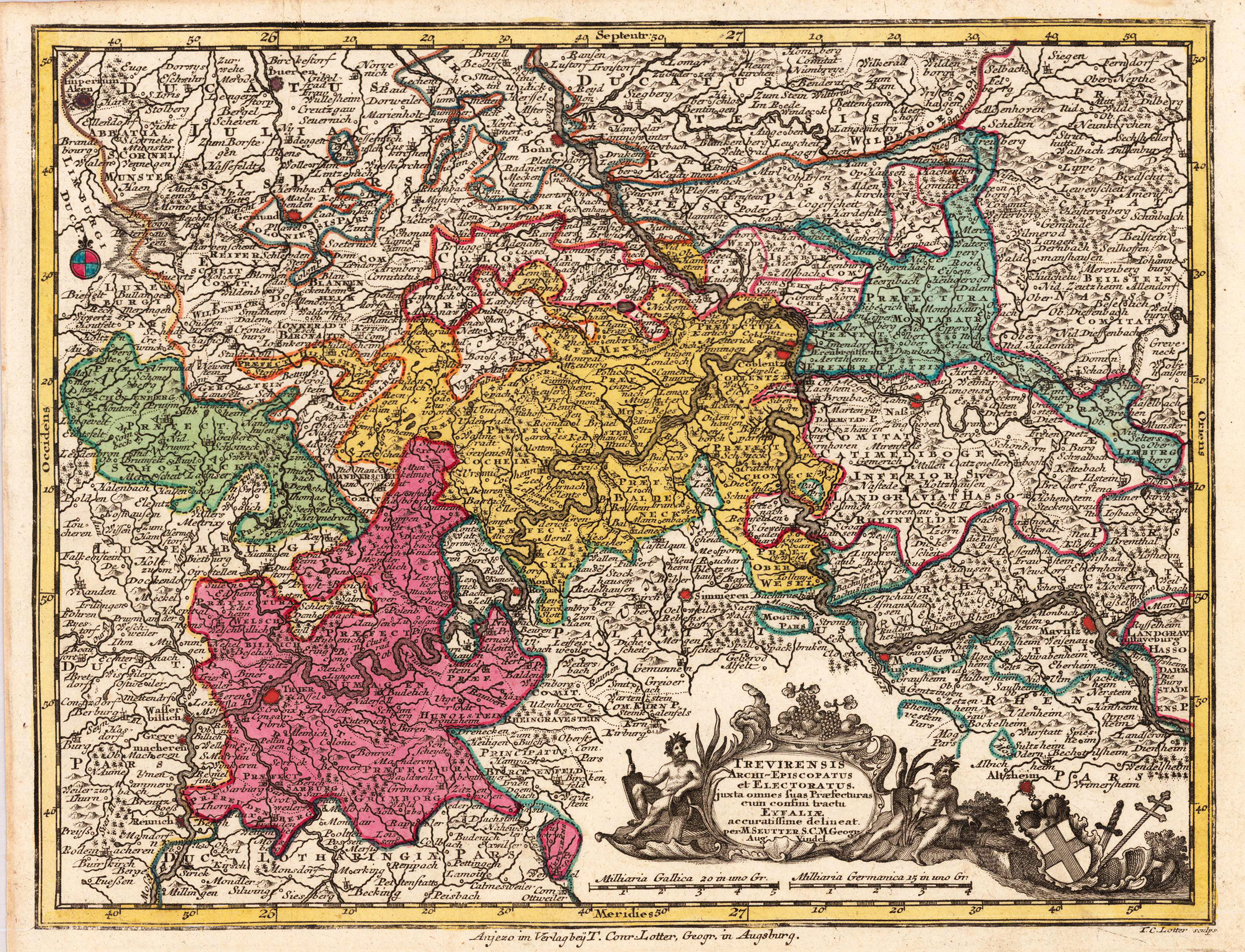
Original Kupferstichkarte, in zeitgenössischem Grenz- und Flächenkolorit. Dargestellt wird das Erzbistum Trier mit Koblenz im Zentrum des Kartenbildes. Dekorative kleinformatige Karte, gedruckt und verlegt bei Tobias Conrad Lotter um 1756 in Augsburg.
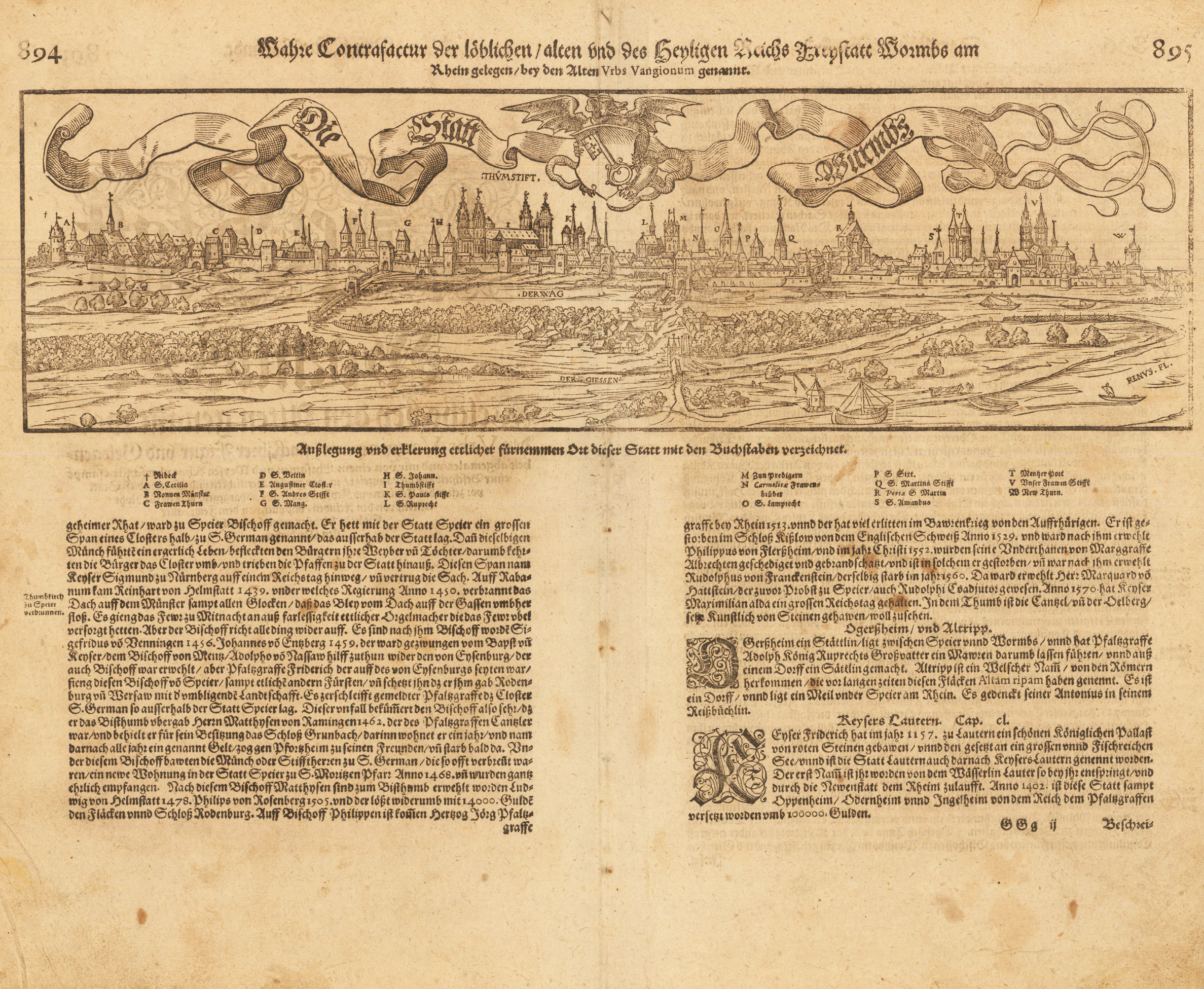
Woodcut map, uncolored as publishedin the,Cosmographia' by Sebastian Münster in Basel, German text edition 1578. Decorative bird's eye panoramic city view of Worms on the river Rhine. This view of Worms is one of the earliest city views of Worms in the 16th century published in the, Cosmographia' by Sebastian Münster. Worms in the Rheinland-Pfalz is depicted here with rural landscape in the foreground. The woodcut shows here the city of Worms with its surrounding city walls. Churches, towers and buildings are detailed shown and fine engraved. Dekoratives Stadtpanorama von Worms in der Rheinpfalz aus der Vogelperspektive. Diese Ansicht von Worms ist eine der frühesten Ansichten von Worms im 16. Jahrhundert, die in der Cosmographia von Sebastian Münster veröffentlicht wurde. Worms in der Rheinland-Pfalz ist hier mit ländlicher Landschaft im Vordergrund dargestellt. Der Holzschnitt zeigt die Stadt Worms mit der umgebenden Stadtmauer. Kirchen, Türme und Gebäude sind detailliert dargestellt und fein graviert.