
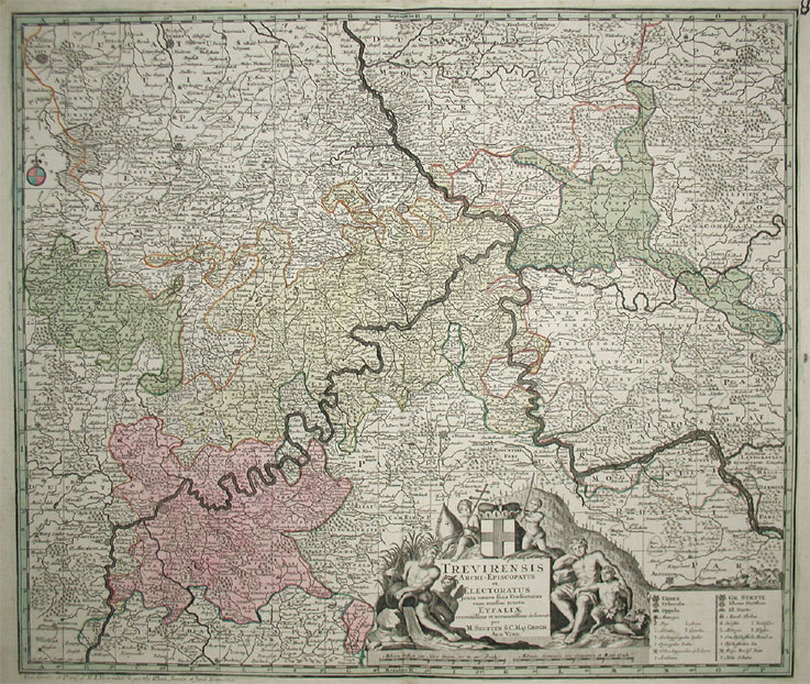
Trevirensis Archi-Episcopatus et Electoratus juxta omnes suas Praefecturas cum confini tractu Eyfaliae recentissime et accuratissime delineat. Per M. Seutter S.C. Maj. Geogr. Aug. Vind.
Product information: Trevirensis Archi-Episcopatus et Electoratus juxta omnes suas Praefecturas cum confini tractu Eyfaliae recentissime et accuratissime delineat. Per M. Seutter S.C. Maj. Geogr. Aug. Vind.
Copper-engraving, hand-colored in outline and wash, when published. Decorative map of the archbishopric of Trier, ornated with a decorative allegoric title-cartouche in the lower center together with a milage scale and a table of explanations. A detailled map of the western part of Rheinland Pfalz, showing the area along the river Mosel and the Rhine from Bonn to Oppenheim in the south. With engraved political borders and naming many small duchies. Many place names, mountains, woods and rivers are shown on the map. A very detailled map.
Properties
| Category: | Rheinland-Pfalz |
|---|---|
| Issue date: | 1720-30 |
| Published place: | Augsburg |
| Publisher: | M. Seutter |
| Technique: | Copper engraving / Original color. |
| Type: | Antique Map, map |