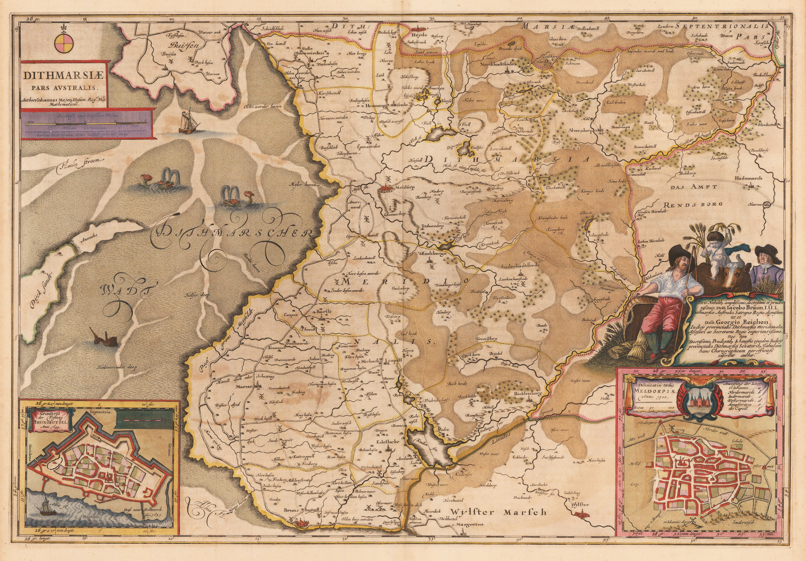
Copper engraving, hand colored in outline and wash when published. Published in the,Atlas Major' by Guiljelmus & Joan Blaeu, French text edition. A highly detailed decorative antique map of the southern part of Dithmarschen in Holstein. This extremly detailed antique map depicts the region around Meldorf, Brunsbüttel and extends towards the Amt Rendsburg. In the lower corners two inset plans of Meldorf and Brünsbüttel with its city walls. The Dittmarscher Tideland in the North Sea is beautiful decorated with sea monsters (whales) and a sunken ship. Engraved after the cartographic sources by Johannes Mejer from Husum. Old colored example, cartouches partly heightened in gold.
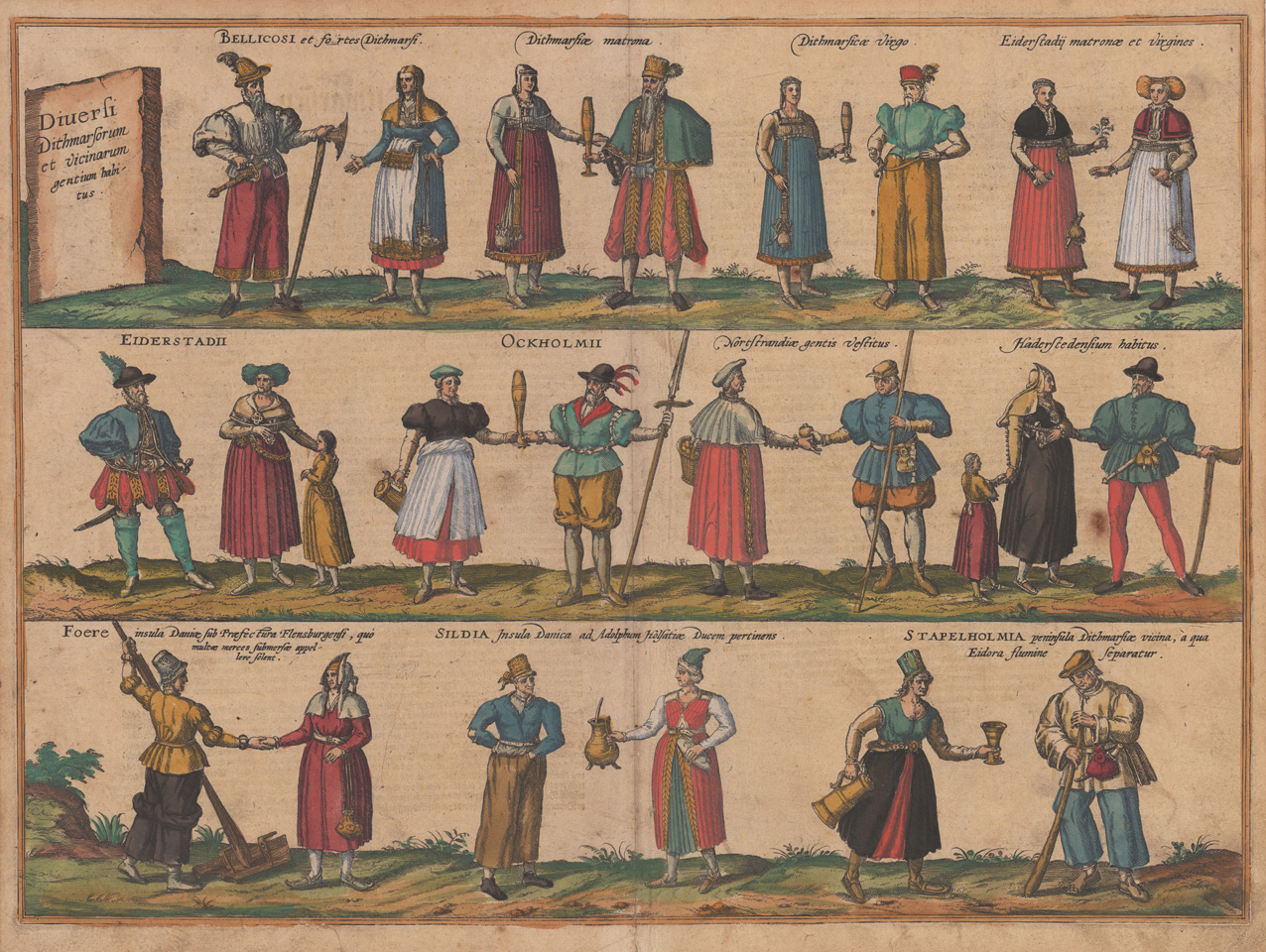
Original copper engraving, later hand colored, published 1572-78 in volume I of the town book 'Civitates Orbis Terrarum' by Braun and Hogenberg. The entire series of the 'Civitates Orbis Terrarum' comprised six volumes and was published and printed from 1572 towards 1619. Verschiedene Kostüme aus Dithmarschen und Umgebung. Zu jedem Kostümsatz gibt es einen kleinen Kommentar. Die Figuren sind von links nach rechts: bewaffnete Männer, verheiratete und unverheiratete Frauen aus Dithmarschen sowie verheiratete und unverheiratete Frauen aus Eiderstedt, gefolgt von verschiedenen Kleidungsstilen aus Eiderstedt, Ockholm, Nordstrand und Haderstedt, den Inseln Fohr, Sildia und Stapelholm. costumes from Dithmarschen and the surrounding areas. Some slight commentary accompanies each set of costumes. The figures are from left to right: armed men, married and unmarried women from Dithmarschen, and married and unmarried women from Eiderstedt, followed by various styles of dress from Eiderstedt, Ockholm, Nordstrand and Haderstedt, the islands of Fohr, Sildia and Stapelholm. Georg Braun (also Brunus, Bruin; 1541 – 10 March 1622) was a topo-geographer. From 1572 to 1617 he edited the Civitates orbis terrarum, which contains 546 prospects, bird's-eye views and maps of cities from all around the world. He was the principal editor of the work, he acquired the tables, hired the artists, and wrote the texts. He died as an octogenarian in 1622, as the only survivor of the original team to witness the publication of volume VI in 1617. Braun was born and died in Cologne. His principal profession was as a Catholic cleric. However, he spent thirty-seven years as canon and dean at the church, St. Maria ad Gradus, in Cologne. His six-volume work was inspired by Sebastian Münster's Cosmographia. In form and layout it resembles the 1570 Theatrum orbis terrarum by Abraham Ortelius, as Ortelius was interested in a complementary companion for the Theatrum. The Braun publication set new standards in cartography for over 100 years. Frans Hogenberg (1535–1590, from Mechelen) created the tables for volumes I through IV, and Simon van den Neuwel created those for volumes V and VI. Other contributors were Joris Hoefnagel, Jacob Hoefnagel, cartographer Daniel Freese, and Heinrich Rantzau. Works by Jacob van Deventer, Sebastian Münster, and Johannes Stumpf were also used. Primarily European cities are depicted in the publication; however, Cairo Casablanca and Mexico City as well as Cuzco on one sheet are also included in volume I, whereas Tunis is featured in volume II. Frans Hogenberg (1535–1590) was a Flemish and German painter, engraver, and mapmaker. Hogenberg was born in Mechelen in Flanders as the son of Nicolaas Hogenberg. In 1568 he was banned from Antwerp by the Duke of Alva and travelled to London, where he stayed a few years before emigrating to Cologne. He is known for portraits and topographical views as well as historical allegories. He also produced scenes of contemporary historical events. Hogenberg died in Cologne. (Wikipedia)
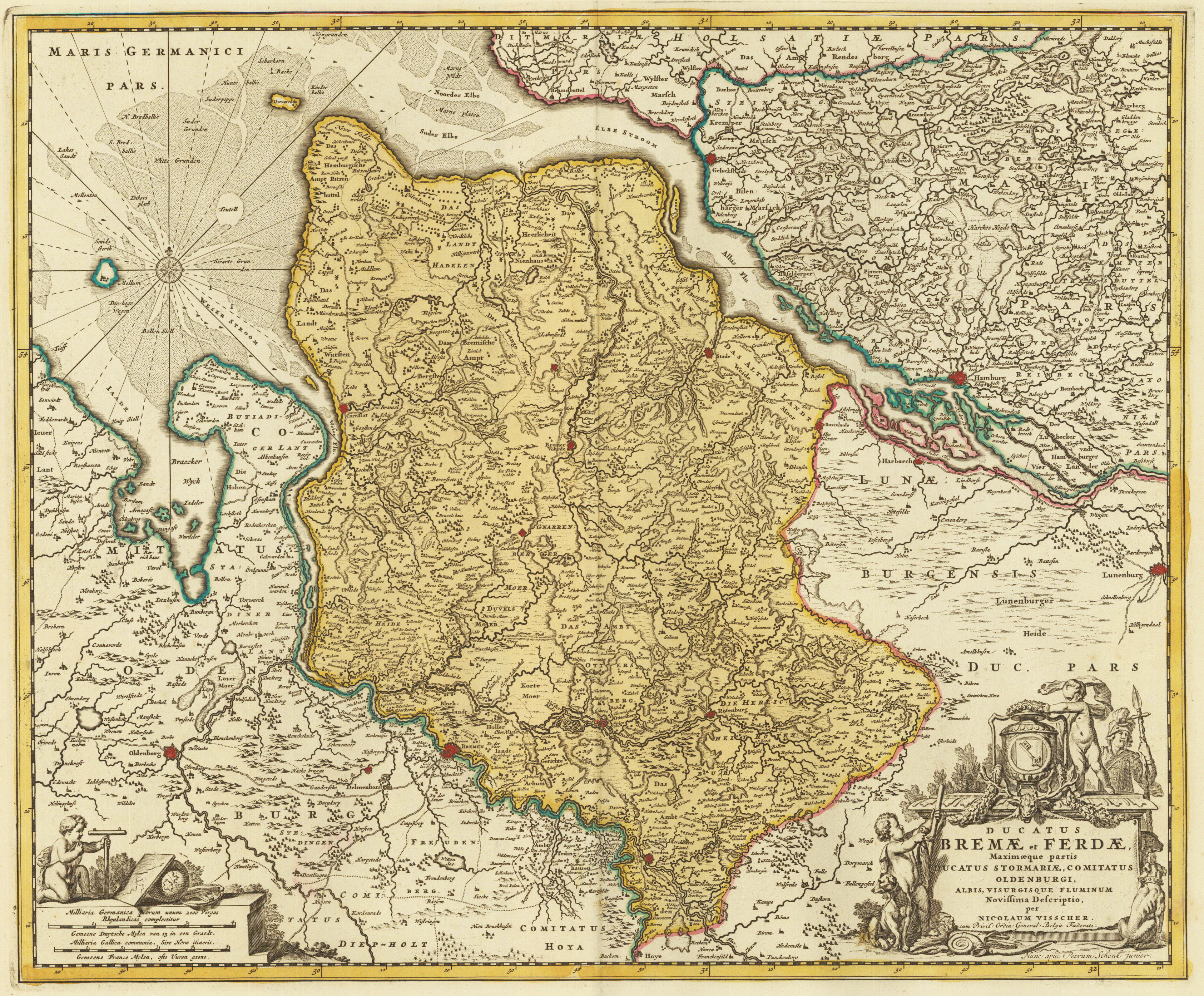
Copper engraving, handcolored in wash and outline, when published. In the lower right corner ornated with a large barocque title cartouche, with coats of arms of Bremen and Verden and allegories on the rivers. In the lower left corner a small milage scale with an allegory on the cartography. On this map the duchies of Bremen and Verden are detailed shown with the neighbouring Hamburg and Stormarn in the north and Oldenburg in the south. The map is equipped much with details. Many small villages and places are named, small rivers and waters, as well along the coast line the sand-banks and islands are named.
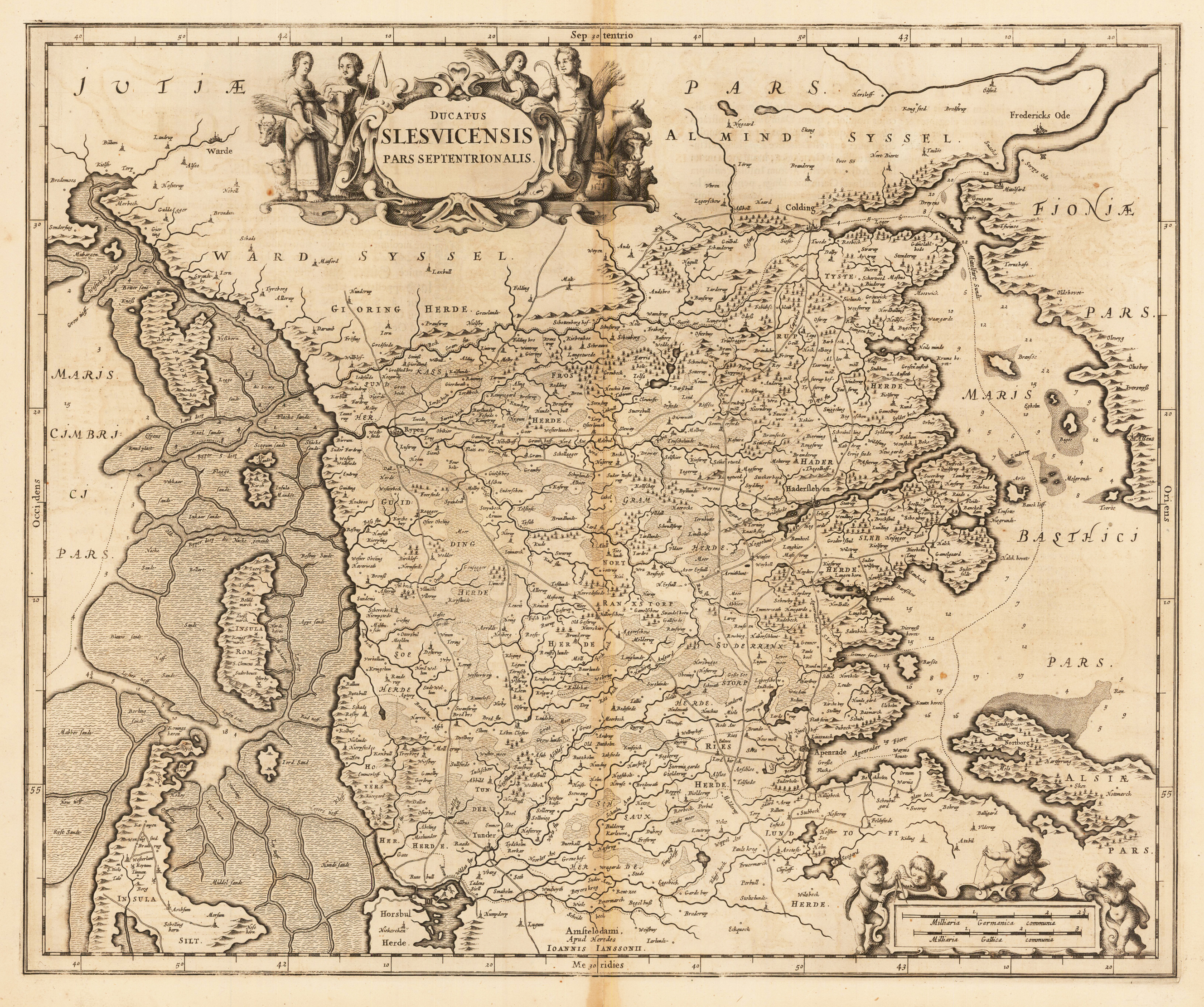
Original antiker Kupferstich, unkoloriert. Das Kartenbild zeigt den Bereich von der Gegend um Tondern im Süden bis kurz nach Kolding im Norden. Im Westen ist der nördliche Inselteil von Sylt zu sehen, darüber die Inseln Rømø, Mandø und Fanø. Johann Janssonius (* 1588 in Arnhem; † 1664 in Amsterdam), eigentlich Jan Janszoon, weitere Schreibweisen Jan Jansz., Joan, Johannes, Ioannis, Io(h)annem ; Ianssonii, Ianßonium oder Jansonium) war ein niederländischer Kartograph, Verleger und Hersteller von Globen. Janssonius führte auch die Herausgabe der Atlanten von Mercator-Hondius fort. Im Jahre 1612 heiratete er die Tochter Elisabeth von Jodocus Hondius (1563–1612). Da Hondius der Eigentümer der Druckplatten von Gerardus Mercator war, arbeiteten sie zusammen, nach Jodocus Hondius' Tod mit seinen Söhnen Jodocus II und Henricus, an neuen Ausgaben des Atlasses von Mercator. 1633 erfolgte die Herausgabe des zweiten Bands des Atlasses. Dieser wird häufig bezeichnet als Mercator-Hondius-Janssonius. Das bedeutendste Werk von Jan Janssonius ist der Atlas Theatre du Monde, veröffentlicht 1639 in drei Bänden. Durch die ständigen Ergänzungen hatte der Atlas im Jahre 1662 elf Bände. Er entwickelte sich zum schärfsten Konkurrenten von Joan Blaeus (1596–1673) Werk Theatrum Orbis Terrarum. Nach dem Tod von Jansson wurde die Gesellschaft von seinem Schwager Waesberg weitergeführt. 1694 wurden die Druckplatten von Janssonius von Peter Schenk d. Ä. (ca. 1660–1711) erworben. (Wikipedia)
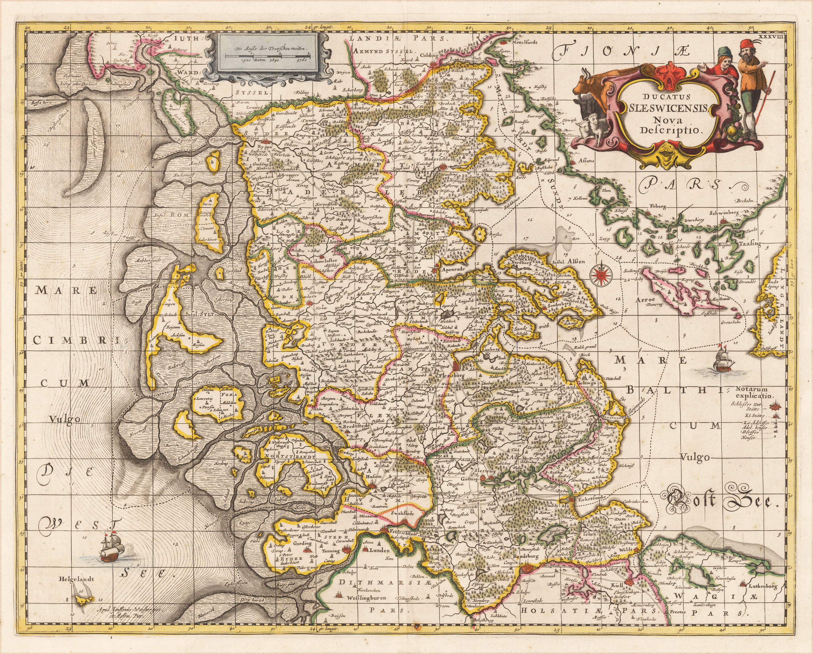
Kupferstich in zeitgenössischem Grenz- und Flächenkolorit. Rückseitig ohne Rückentext. Schönes Exemplar der detaillierten Karte über die Region Schleiswig-Holstein, die in Amsteram erstmals erschienen ist und hier in der Ausgabe von Janssonius Waesberge und Moses Pitt vorliegt. Sie zeigt den Bereich von Tönningen, Rendsberg und Kiellim Süden bis nach Colding, Rypen und Hadersleben im Norden. Andere größere Städte sind Schleswig, Flensburg, Tondern und Arenraden. Die detaillierte Darstellung von eingezeichneten Straßen, vorgelagerten Inseln und dem Nordfriesischem Wattenmeer ist für eine Karte dieser Zeit ungewöhnlich.
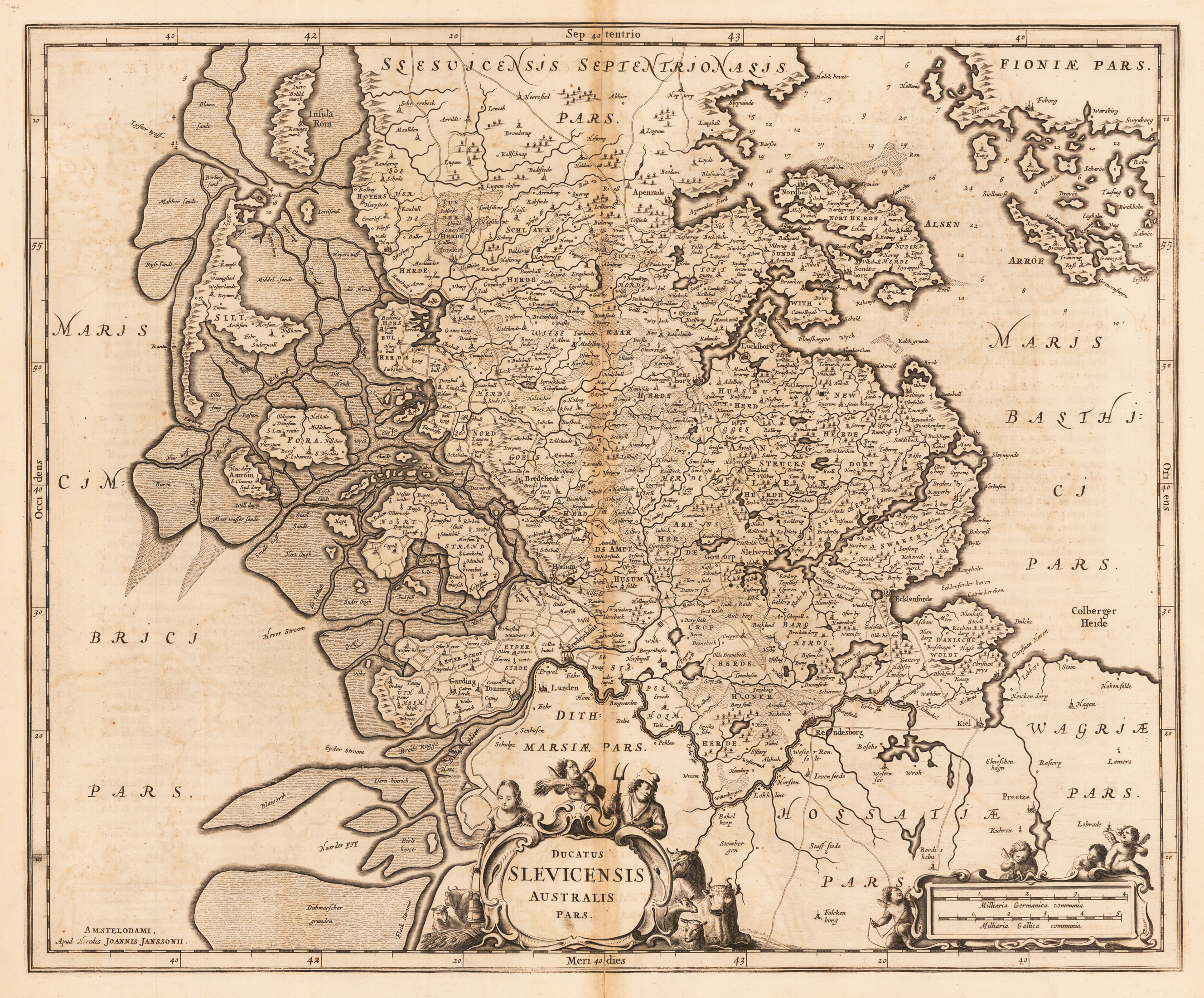
Original antiker Kupferstich, unkoloriert. Das Kartenbild zeigt den Bereich von Falkenborg im Süden bis zum südlichen Teil von Dänemark in Höhe der Insel Rømø. Im Westen sind die Nordseeinseln Sylt, Amrum, Nordmarsch-Langeneß, Hooge, Pellworm. Im Osten die südlichsten Inseln von Schweden. Johann Janssonius (* 1588 in Arnhem; † 1664 in Amsterdam), eigentlich Jan Janszoon, weitere Schreibweisen Jan Jansz., Joan, Johannes, Ioannis, Io(h)annem ; Ianssonii, Ianßonium oder Jansonium) war ein niederländischer Kartograph, Verleger und Hersteller von Globen. Janssonius führte auch die Herausgabe der Atlanten von Mercator-Hondius fort. Im Jahre 1612 heiratete er die Tochter Elisabeth von Jodocus Hondius (1563–1612). Da Hondius der Eigentümer der Druckplatten von Gerardus Mercator war, arbeiteten sie zusammen, nach Jodocus Hondius' Tod mit seinen Söhnen Jodocus II und Henricus, an neuen Ausgaben des Atlasses von Mercator. 1633 erfolgte die Herausgabe des zweiten Bands des Atlasses. Dieser wird häufig bezeichnet als Mercator-Hondius-Janssonius. Das bedeutendste Werk von Jan Janssonius ist der Atlas Theatre du Monde, veröffentlicht 1639 in drei Bänden. Durch die ständigen Ergänzungen hatte der Atlas im Jahre 1662 elf Bände. Er entwickelte sich zum schärfsten Konkurrenten von Joan Blaeus (1596–1673) Werk Theatrum Orbis Terrarum. Nach dem Tod von Jansson wurde die Gesellschaft von seinem Schwager Waesberg weitergeführt. 1694 wurden die Druckplatten von Janssonius von Peter Schenk d. Ä. (ca. 1660–1711) erworben. (Wikipedia)
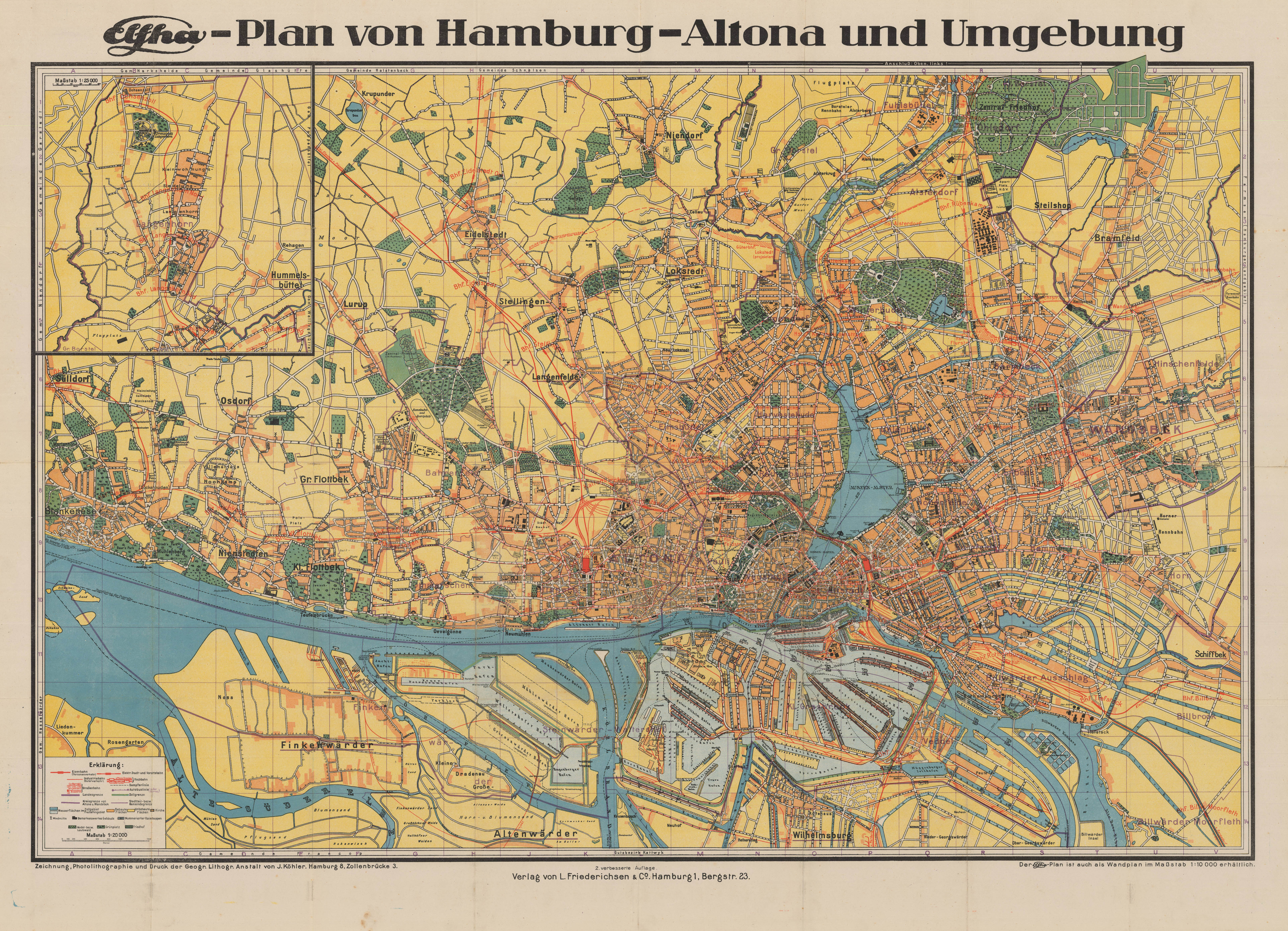
Original Farblithographie. Dargestellt wird die Hansestadt Hamburg. Das Kartenbild reicht von Fuhlsbüttel im Norden bis Altenwärder im Süden, von Blankenese im Westen bis Schiffbek im Osten. In der linken oberen Ecke ist eine Insetkarte von Langenhorn und die Legende links unten.
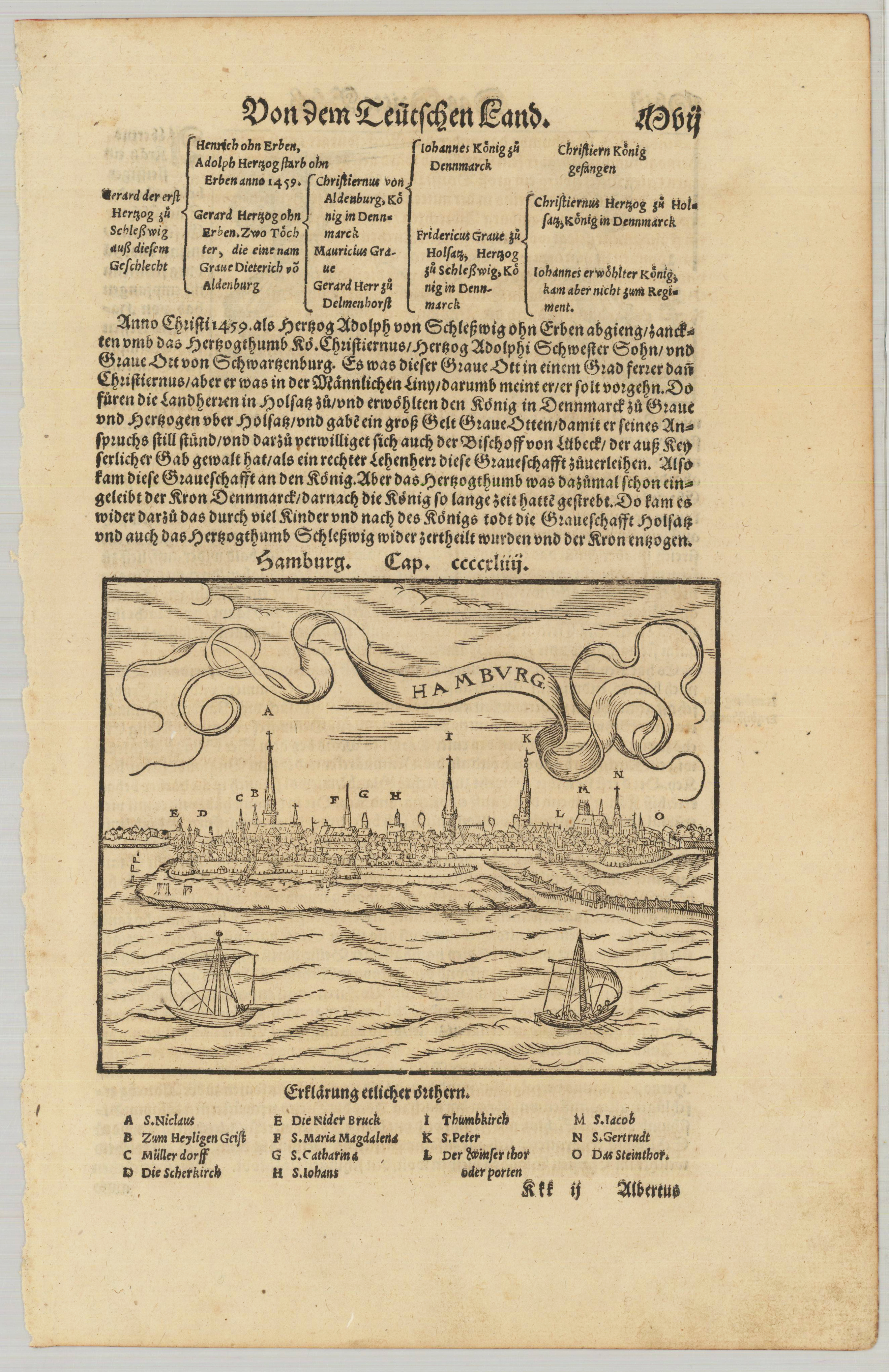
Woodcut published 1628 in the 'Cosmographia' by Sebastian Münster, printed on the full text sheet. German text edition. Decorative 16th century view across the river towards Hamburg with its city walls, below with an explanation for the woodcut naming the churches of the city of Hamburg and a few city gates. Printed on a full text sheet of Sebastian Münsters Cosmographia. This fine antique print was published 1578 in a German text edition of Sebastian Münster's ,Cosmographia', the first detailed scientific and popular description of the world in Sebastian Münster's native language as well as a supreme effort of geographical study and literature of the Reformation period. One of the most popular treatises of the sixteenth and seventeenth centuries the Cosmographia reached a total of forty-six editions in six languages by 1650 each incorporating additions and revisions. Sebastian Münster was a professor of Hebrew at Basel university and a most distinguished Hebraist linguist mathematician and geographer. This encyclopedic work was his major undertaking. In its completion, which occupied him for fifteen years, Münster received the assistance of more than one hundred and twenty collaborators, who provided him with the most up-to-date information relating to the towns and places described. The scientifically most valuable sections are those which deal with Germany and Central Europe.
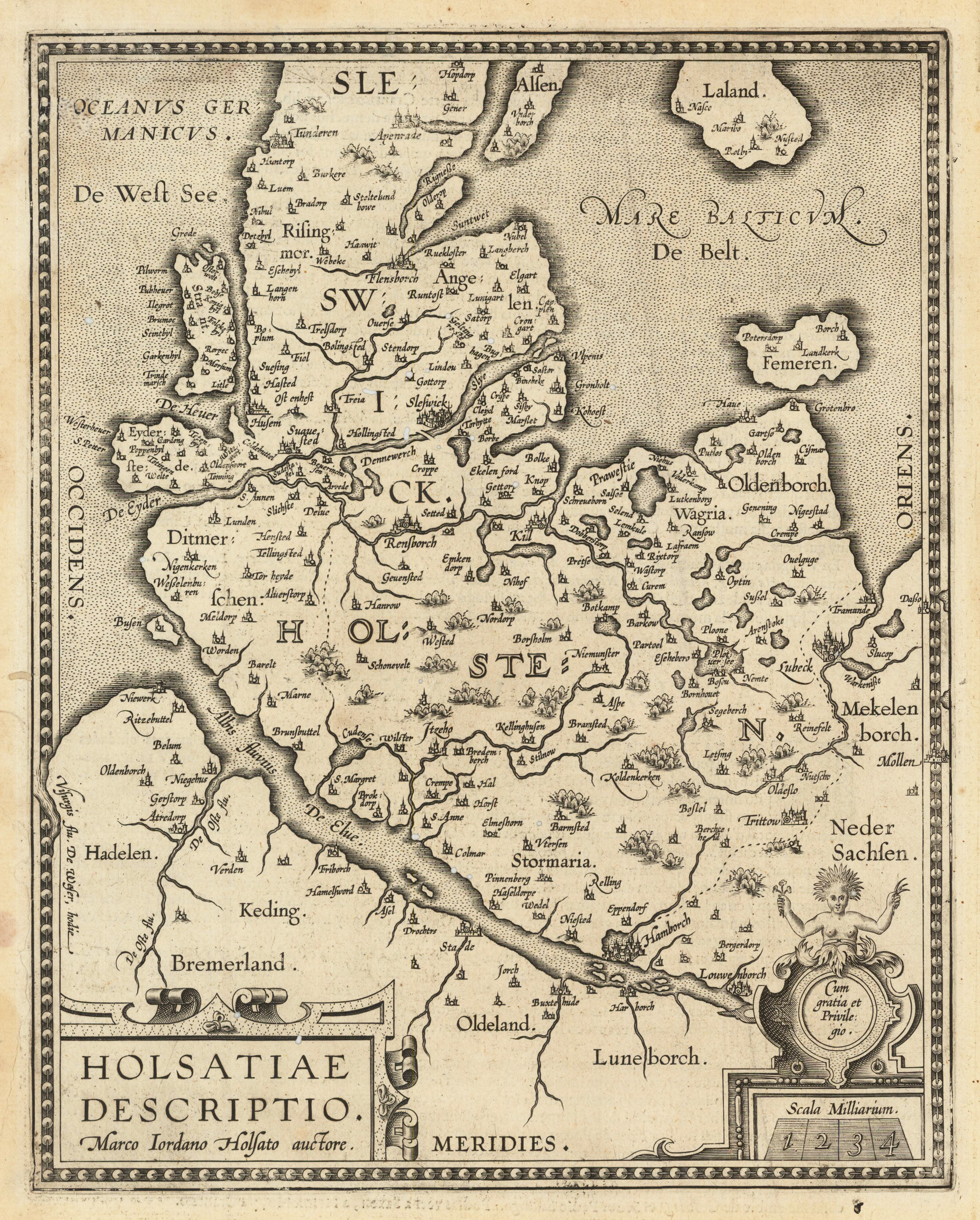
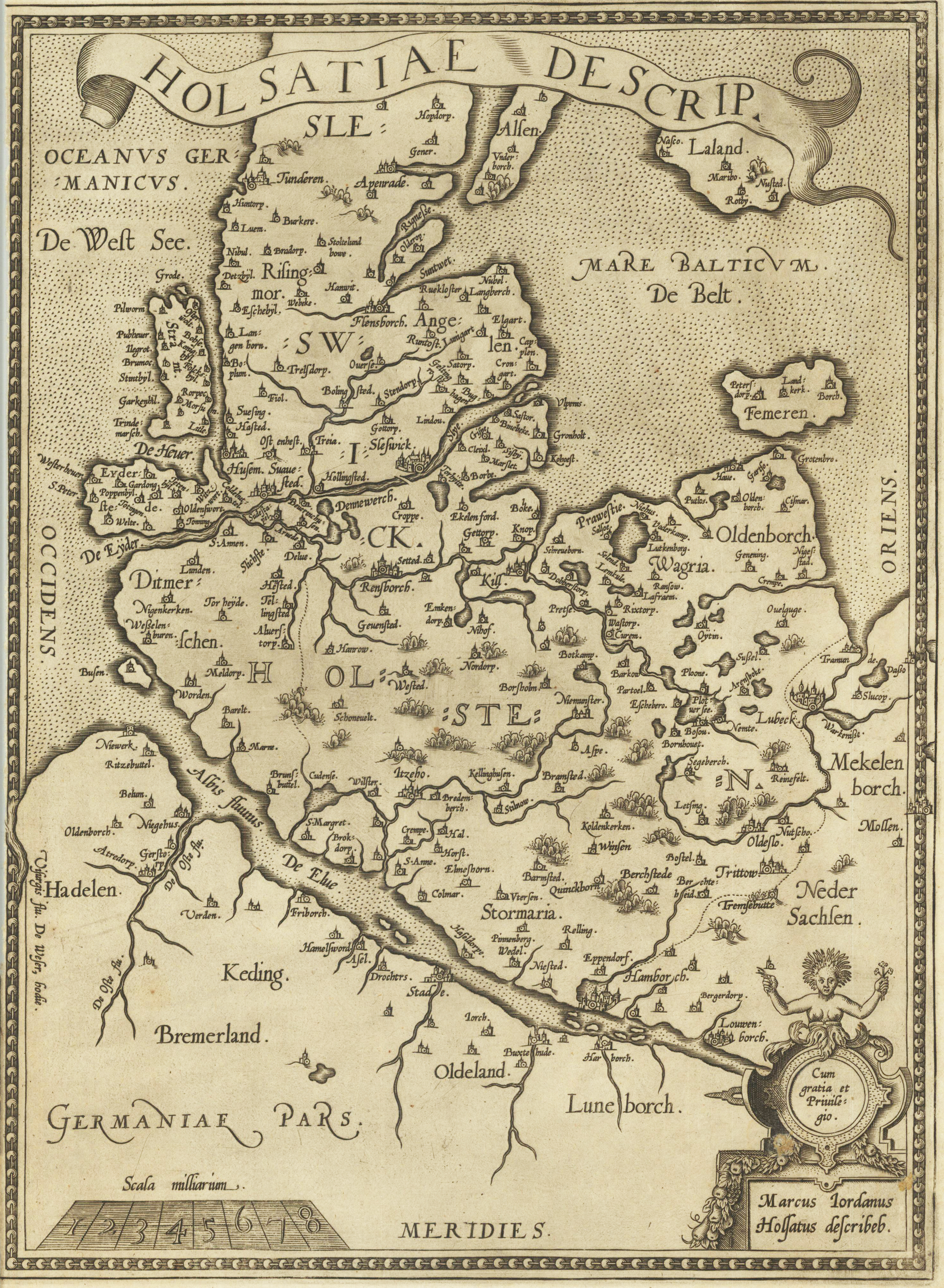
Copper engraving, uncolored as published. This antique map extends from Hamburg and Louwenburg in the south to Tundereen, Allan and Laland Islands in the North, Centered on Sleswick. Published in Ortelius' Theatrum Orbis Terrarum, the first modern atlas of the World.
Original Kupferstich unkoloriert. Doppelblatt mit zwei Karten. Erschienen in,Theatrum Orbis Terrarum Abrahami Ortelii Antverp. Geographi Regii.' 1612. Kupferstich von Marco Iordano Holsato aus dem Atlas "Theatrum Orbis Terrarum" von Abraham Ortelius. Dies ist eine Karte von Schleswig-Holstein, dem Norden Deutschlands. Das benachbarte Südjütland (Dänemark) mit den Inseln Alsen und Laland sowie Sylt und Femarn. Teile Niedersachsens südlich der Elbe und Hinweise auf Mecklenburg grenzen an. Verso: Text in italienisch. Ortelius wurde am 14. April 1527 in der Stadt Antwerpen geboren, die sich damals in den Habsburger Niederlanden (dem heutigen Belgien) befand. Die Familie Orthellius stammte ursprünglich aus Augsburg, einer freien Reichsstadt des Heiligen Römischen Reiches. 1535 war die Familie unter den Verdacht des Protestantismus geraten. Nach dem Tod von Ortelius 'Vater kehrte sein Onkel Jacobus van Meteren aus dem religiösen Exil in England zurück, um sich um Ortelius zu kümmern. Abraham blieb seinem Cousin Emanuel van Meteren nahe, der später nach London ziehen sollte. 1575 wurde er auf Empfehlung von Arias Montanus, der für seine Orthodoxie bürgte, zum Geographen des spanischen Königs Philipp II. ernannt. Er reiste viel in Europa und ist bekannt dafür, dass er durch die siebzehn Provinzen gereist ist. In Süd-, West-, Nord- und Ostdeutschland (z. B. 1560, 1575–1576); Frankreich (1559–1560); England und Irland (1576); und Italien (1578 und vielleicht zweimal oder dreimal zwischen 1550 und 1558). Er begann als Kartenstecher und trat 1547 als Illuminator von Karten in die Antwerpener Gilde des Heiligen Lukas ein. Ortelius ergänzte seinen Einkommenshandel mit Büchern, Drucken und Karten. Seine Reisen beinhalteten jährliche Besuche der Frankfurter Buch- und Druckmesse, wo er 1554 Gerardus Mercator traf. 1560 als er mit Mercator nach Trier, Lothringen und Poitiers ging, scheint er vor allem durch Mercators Einfluss von der Karriere eines wissenschaftlichen Geographen angezogen worden zu sein. (Wikipedia)
Original Kupferstich unkoloriert. Kupferstich von Marco Iordano Holsato aus dem Atlas "Theatrum Orbis Terrarum" von Abraham Ortelius. Dies ist eine Karte von Schleswig-Holstein, dem Norden Deutschlands. Das benachbarte Südjütland (Dänemark) mit den Inseln Alsen und Laland sowie Sylt und Femarn. Teile Niedersachsens südlich der Elbe und Hinweise auf Mecklenburg grenzen an. Verso: Text in spanisch.
Ortelius wurde am 14. April 1527 in der Stadt Antwerpen geboren, die sich damals in den Habsburger Niederlanden (dem heutigen Belgien) befand. Die Familie Orthellius stammte ursprünglich aus Augsburg, einer freien Reichsstadt des Heiligen Römischen Reiches. 1535 war die Familie unter den Verdacht des Protestantismus geraten. Nach dem Tod von Ortelius 'Vater kehrte sein Onkel Jacobus van Meteren aus dem religiösen Exil in England zurück, um sich um Ortelius zu kümmern. Abraham blieb seinem Cousin Emanuel van Meteren nahe, der später nach London ziehen sollte. 1575 wurde er auf Empfehlung von Arias Montanus, der für seine Orthodoxie bürgte, zum Geographen des spanischen Königs Philipp II. Ernannt.
Er reiste viel in Europa und ist bekannt dafür, dass er durch die siebzehn Provinzen gereist ist. in Süd-, West-, Nord- und Ostdeutschland (z. B. 1560, 1575–1576); Frankreich (1559–1560); England und Irland (1576); und Italien (1578 und vielleicht zweimal oder dreimal zwischen 1550 und 1558).
Er begann als Kartengraveur und trat 1547 als Illuminator von Karten in die Antwerpener Gilde des Heiligen Lukas ein. Er ergänzte seinen Einkommenshandel mit Büchern, Drucken und Karten, und seine Reisen beinhalteten jährliche Besuche der Frankfurter Buch- und Druckmesse, wo er 1554 Gerardus Mercator traf. 1560 jedoch, als er mit Mercator nach Trier, Lothringen und Poitiers scheint er vor allem durch Mercators Einfluss von der Karriere eines wissenschaftlichen Geographen angezogen worden zu sein.
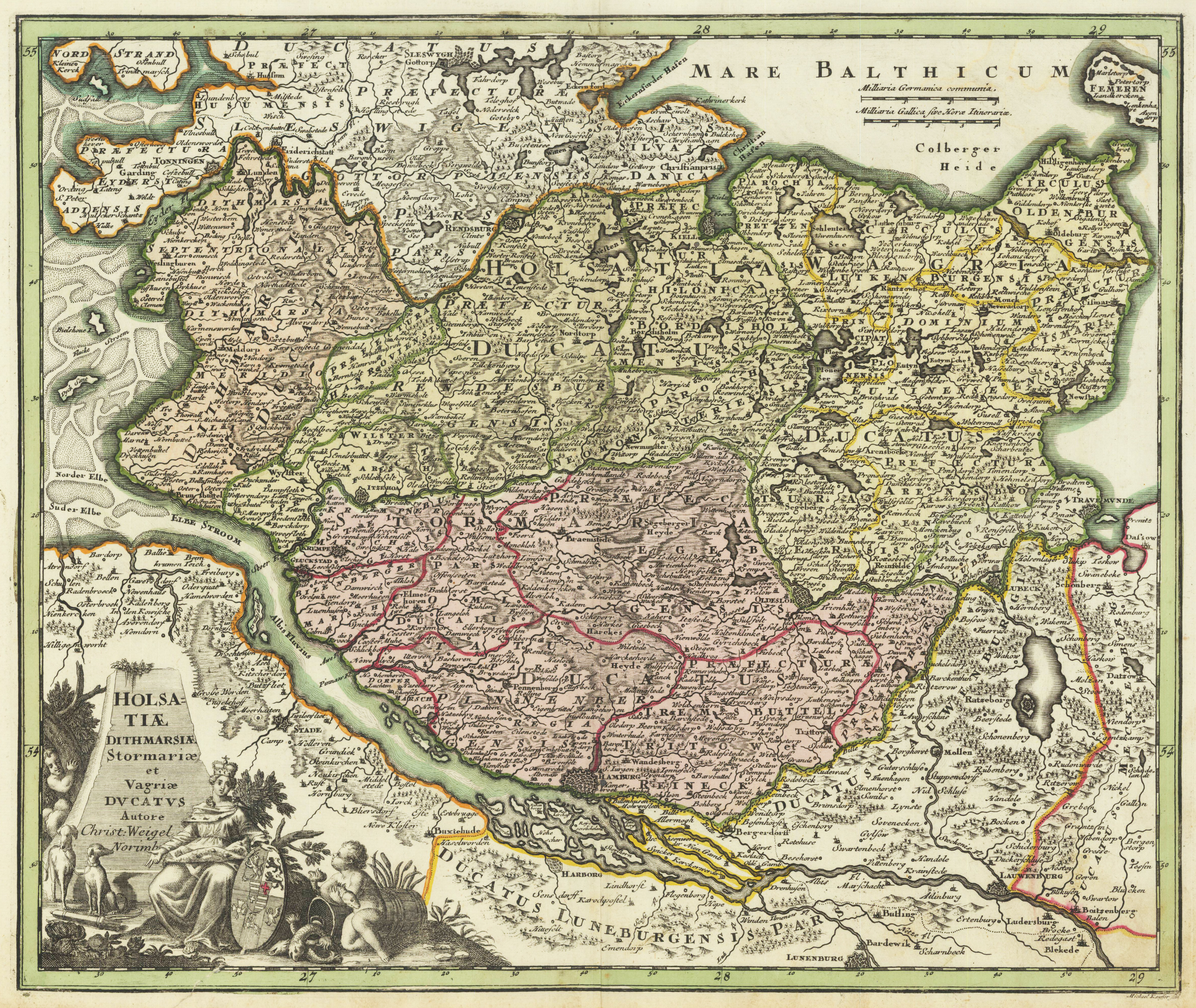
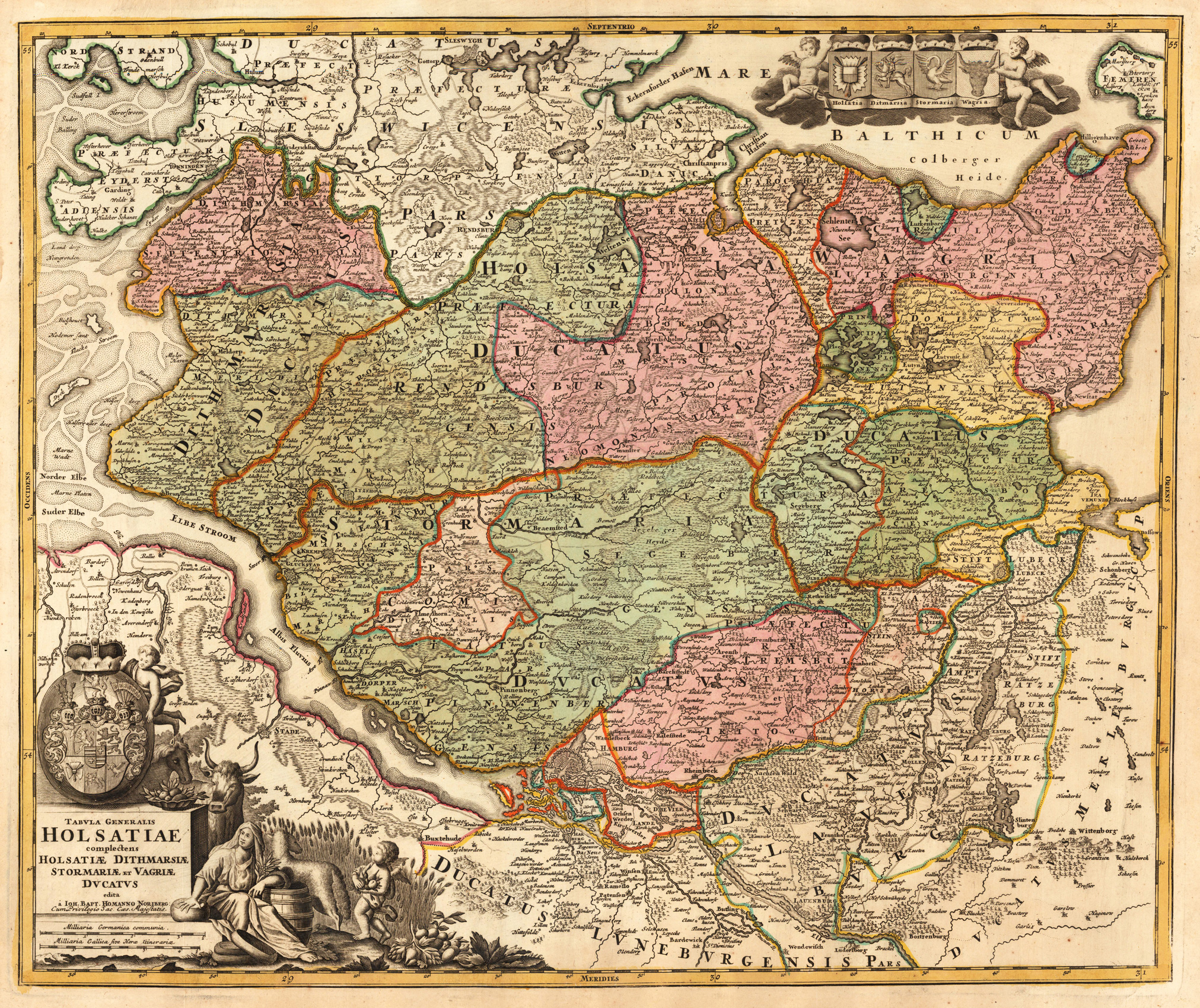
Copper engraving, hand colored in outline and wash when published. This antique map shows Holstein. Inside the map are many place names, streets, rivers, mountains, trees, etc. to see. In the left lower corner we look to a wonderful figurative cartouche. In the upper right side we found a mileage scale. The cartographer Christoph Weigel worked around 1719 in Nürnberg and his maps are showing the typical style of this period in mapmaking in Southern German. He worked very close as with Johann B. Homann in Nürnberg. All his maps were hand colored in outline and decorative body color immediately in his printing house, after they were printed.
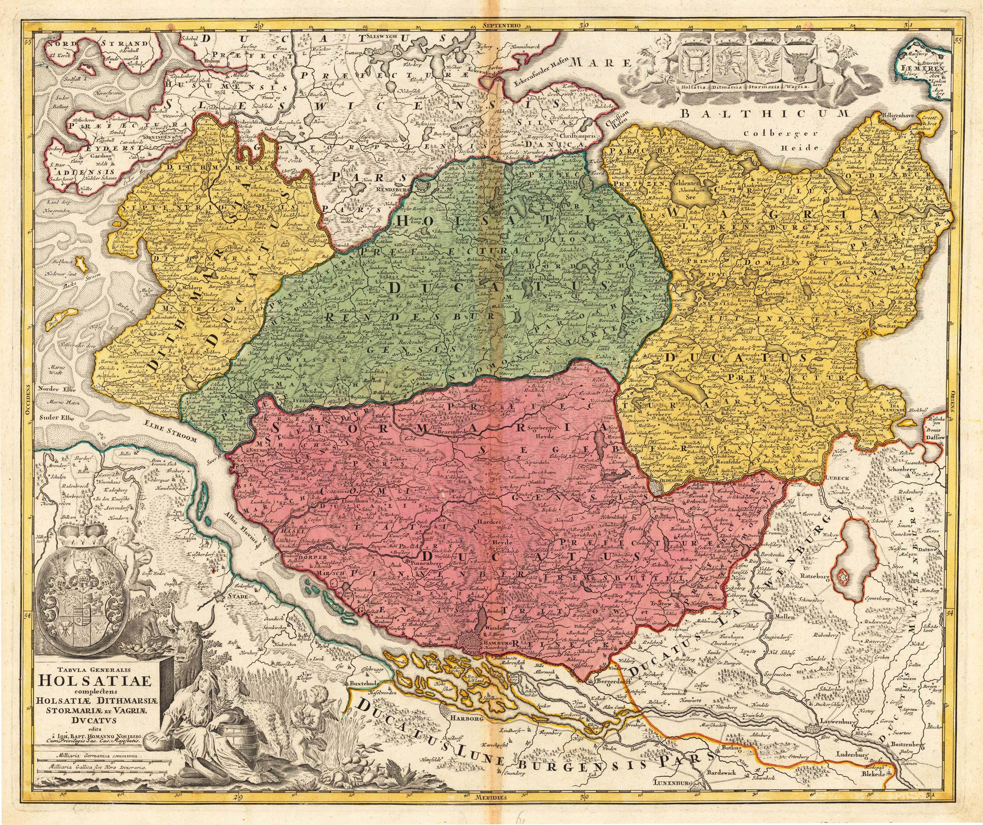
Original antique copper engraving, hand colored in outline and wash when published. Kupferstichkarte in zeitgenössischem Grenz- und Flächenkolorit. Links unten dekorative Titelkartusche mit Allegorien auf die Landwirtschaft und Privileg. Darunter Meilenzeiger. Rechts oben Wappen der holsteinischen Herzogtümer, von Putten gehalten. Originally coloured copper engraving with decorative title cartouche. Right upper side, on top of the map coat of arms of the duchies of Holstein. At the left lower corner we look to the big figurative allegoric title cartouche with a small mileage scale. Johann Baptist Homann (20 March 1664 – 1 July 1724) was a German geographer and cartographer, who also made maps of the Americas. Homann was born in Oberkammlach near Kammlach in the Electorate of Bavaria. Although educated at a Jesuit school, and preparing for an ecclesiastical career, he eventually converted to Protestantism and from 1687 worked as a civil law notary in Nuremberg. He soon turned to engraving and cartography; in 1702 he founded his own publishing house. Homann acquired renown as a leading German cartographer, and in 1715 was appointed Imperial Geographer by Emperor Charles VI. Giving such privileges to individuals was an added right that the Holy Roman Emperor enjoyed. In the same year he was also named a member of the Prussian Academy of Sciences in Berlin. Of particular significance to cartography were the imperial printing privileges (Latin: privilegia impressoria). These protected for a time the authors in all scientific fields such as printers, copper engravers, map makers and publishers. They were also very important as a recommendation for potential customers. In 1716 Homann published his masterpiece Grosser Atlas ueber die ganze Welt (Grand Atlas of all the World). Numerous maps were drawn up in cooperation with the engraver Christoph Weigel the Elder, who also published Siebmachers Wappenbuch. Homann died in Nuremberg in 1724. He was succeeded by his son Johann Christoph (1703-1730). The company carried on upon his death as Homann heirs company, managed by Johann Michael Franz and Johann Georg Ebersberger. After subsequent changes in management the company folded in 1852.[1] The company was known as "Homann Erben", "Homanniani Heredes", or "Heritiers de Homann" abroad. (Wikipedia)
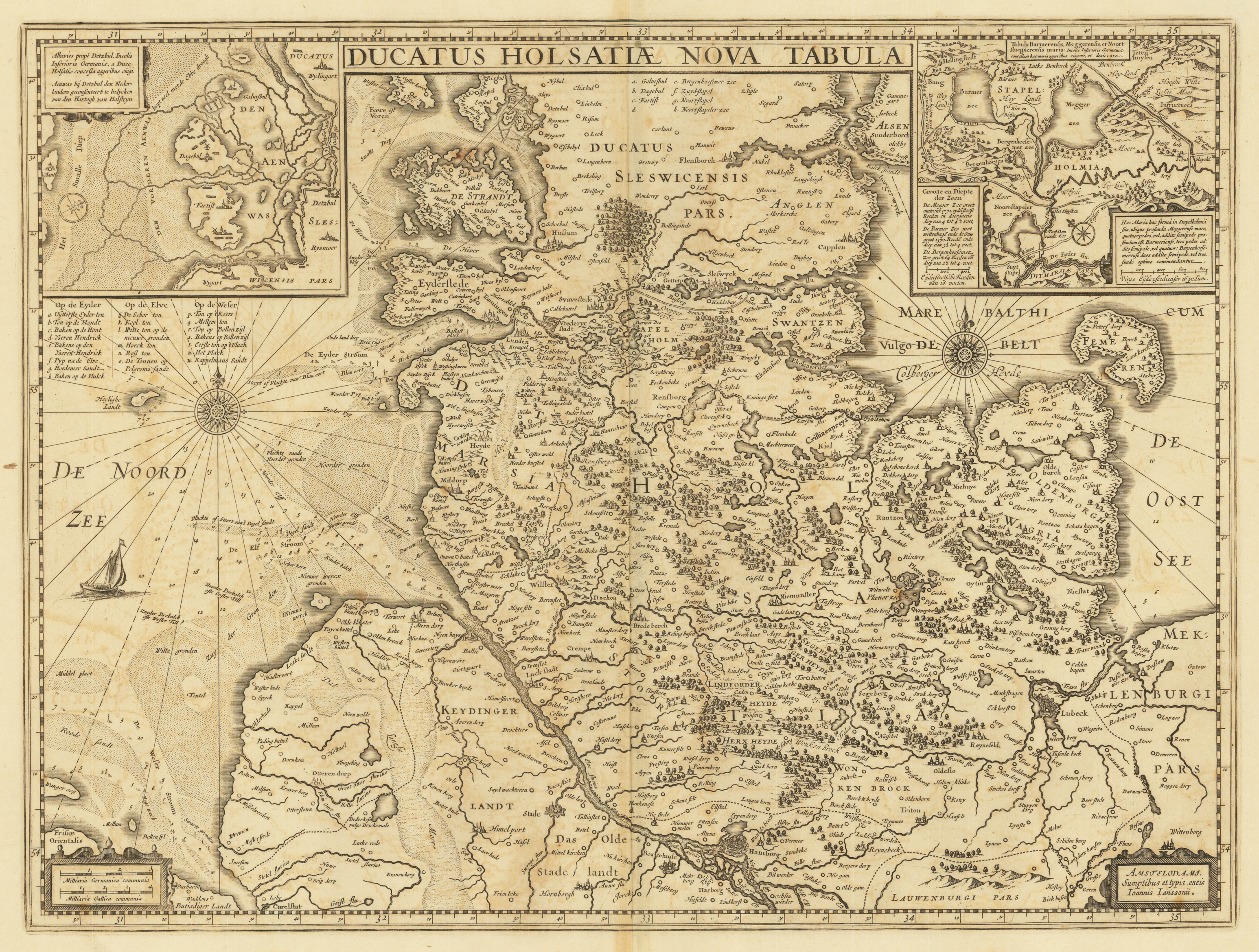
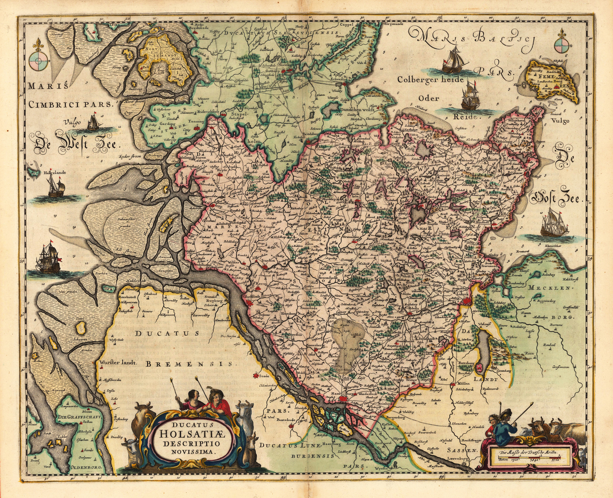
Copper engraving, uncolored as published. Kupferstichkarte, im Oberrand rechts u. links 2 Insetkarten, dazwischen mittig Titelleiste. In den unteren Ecken in kleinen Rollwerkskartuschen Meilenzeiger u. Verlegerangaben. Dargestellt wird das Herzogtum Holstein von Janssonius um 1650. Die 2 Insetkarten (je 10 x 12,5cm) im Oberrand dekorativ aufgemacht, desweiteren 2 Kompaßrosen in der Nord- u. Ostsee, sowie Angaben von Wassertiefen in der Nordsee. Das Kartenbild mit vielen Ortsangaben, sowie eingezeichneten Wäldern u. Flüssen.
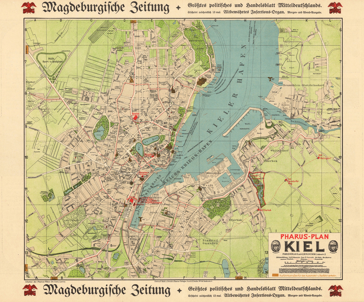
Lithographie, handkoloriert. Diese detaillierte Lithographie zeigt den Plan von Kiel. Die Karte ist in wunderschönen Farben gezeichnet und stellt eine detaillierte Gesamtübersicht von Kiel dar. Außerdem sind viele Strassen, Strassennamen, Kirchen, Bahnhöfe, der Kieler Hafen und Sehenswürdigkeiten eingezeichnet.
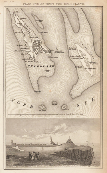
Original Stahlstich, unkoloriert erschienen bei Meyer in Hildburghausen. Der sehr detaillierte seltene Plan zeigt Helgoland und seine Nachbarinseln. Viele Orte wurden eingraviert, wie z.B. das Nordhorn, das Südhorn, der Süder und der Nordhafen, Gebäude sowie der Leuchtturm. Auf der Sand Insel links davon, sind der Badeplatz der Damen, der Badeplatz der Herren, der Trinkbrunnen und das Vorratshaus. Zwischen den Inseln ist der Ankerplatz für Dampfboote eingezeichnet. Im unteren Drittel ist die Ansicht des Oberlandes mit Feriengästen.
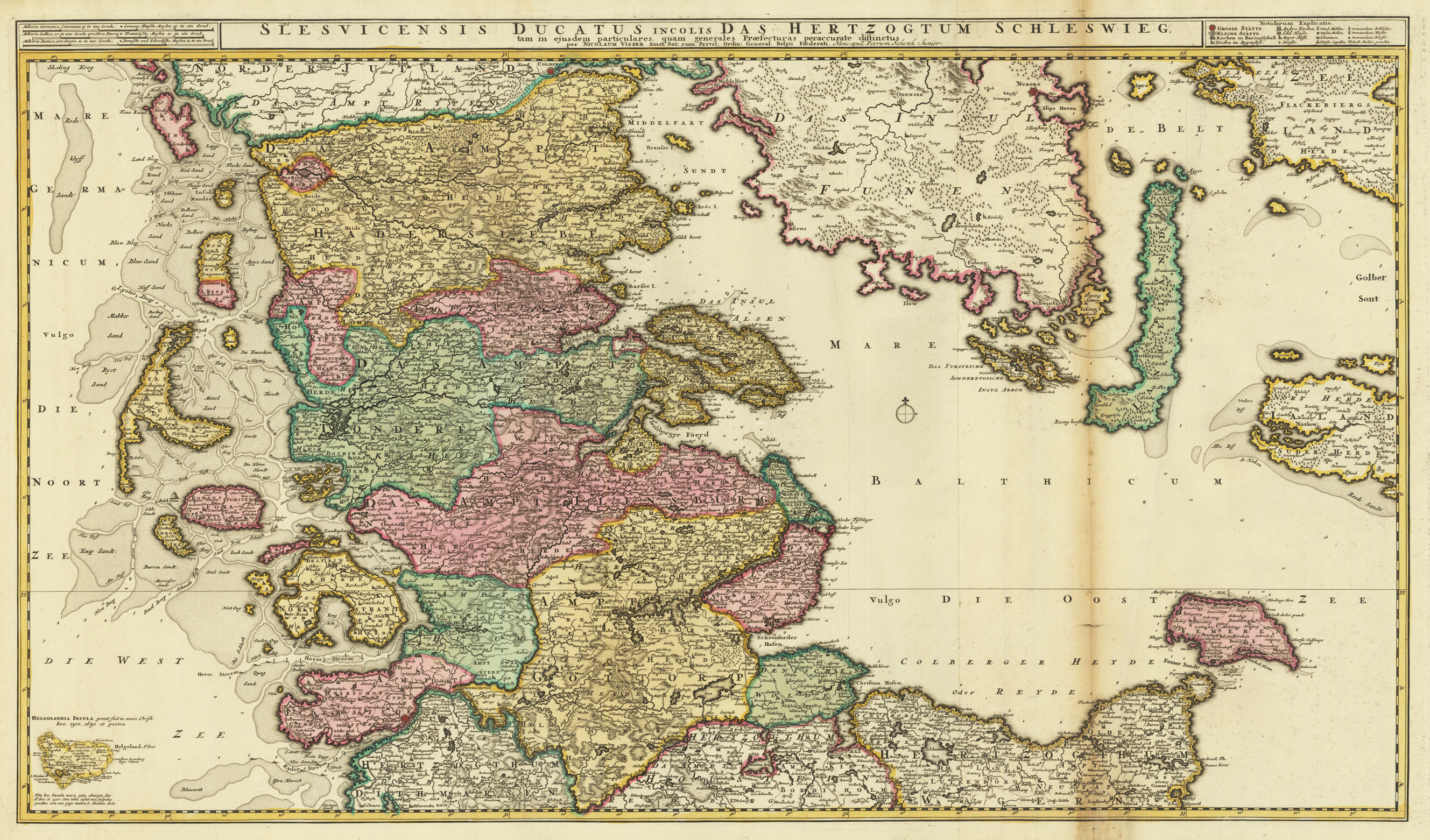
Original Kupferstich in zeitgenössischem Grenz- und Flächenkolorit. Die von zwei Platten gedruckte Karte mit Titelkopfleiste (auf beiden Seiten des Titels befinden die die Legende und der Meilenzeiger) zeigt das Herzogtum Schleswig mit den Nordfriesischen Inseln (Sylt, Amrum, Föhr etc.), Helgoland und der Ostsee bis Fehmarn sowie dem dänischen Zeeland. Leichte Quetschfalten und Bräunungen, sowie kleinere Hinterlegungen verso im Altkolorit, dies meist im rechten Kartenbild.
Copper engraving, hand colored in outline and wash. Originally hand colored copper engraving with decorative title cartouche. At the upper right side four engraved coat of arms of the duchies of Holstein. In the lower left corner we look at a large figurative allegoric title cartouche with a small mileage scale. The map shows the mouth of the river Elbe into the German Sea with Hamburg, Holstein, Dittmarschen, Stormarn and Wagrien.
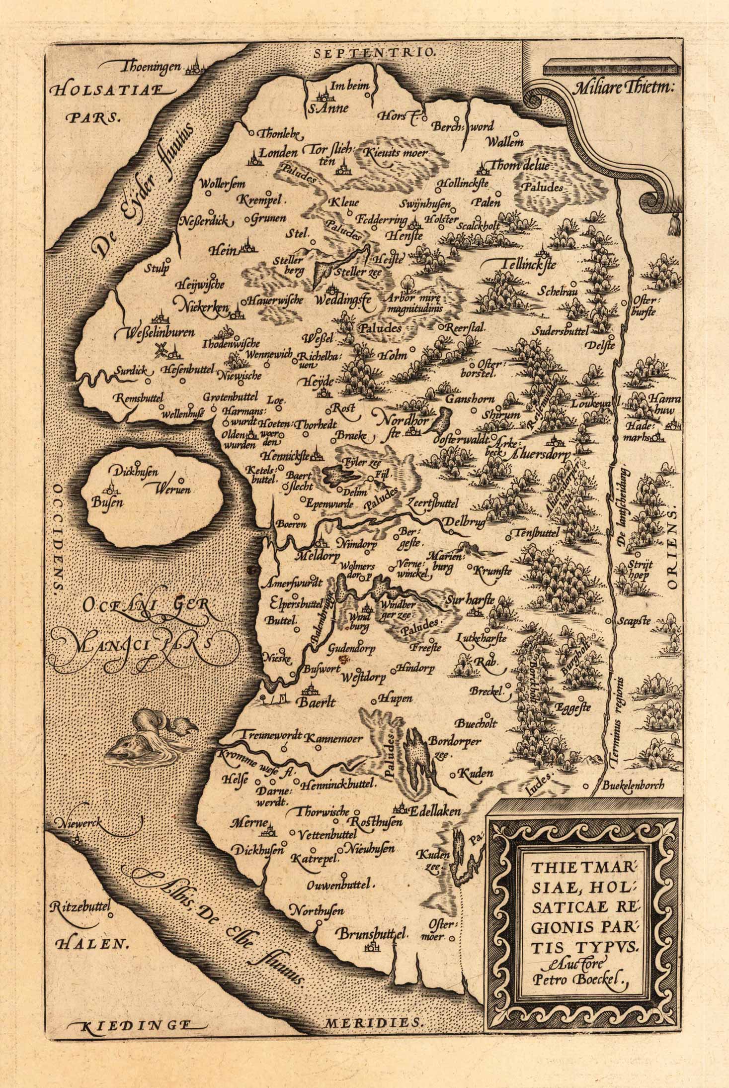
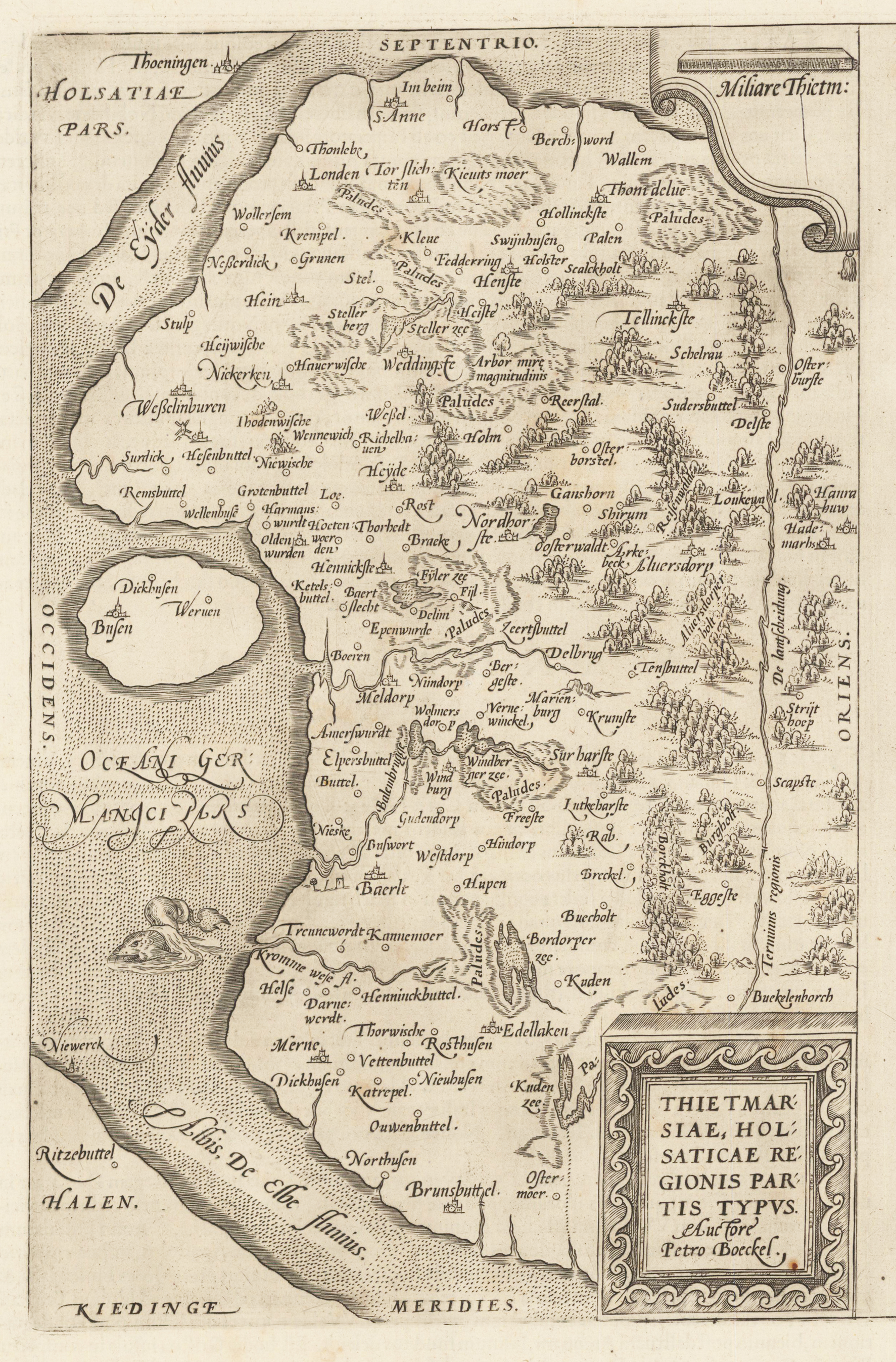
Original antique copper engraving, uncolored as published, by Peter Boeckel from the atlas Theatrum Orbis Terrarum. This decorative map shows the Elbe River including a sea monster. From Brunsbuttel in the south to Thoeningen (Tönning)in the north, and from Ritzebüttel in the west to Hanrahuw (Haunau) in the east. In the upper left corner is the mouth of the Eider River . Ortelius was born on 14 April 1527 in the city of Antwerp, which was then in the Habsburg Netherlands (modern-day Belgium). The Orthellius family were originally from Augsburg, a Free imperial city of the Holy Roman Empire. In 1535, the family had fallen under suspicion of Protestantism. Following the death of Ortelius's father, his uncle Jacobus van Meteren returned from religious exile in England to take care of Ortelius. Abraham remained close to his cousin Emanuel van Meteren, who would later move to London. In 1575 he was appointed geographer to the king of Spain, Philip II, on the recommendation of Arias Montanus, who vouched for his orthodoxy. He travelled extensively in Europe and is specifically known to have traveled throughout the Seventeen Provinces; in southern, western, northern, and eastern Germany (e.g., 1560, 1575–1576); France (1559–1560); England and Ireland (1576); and Italy (1578, and perhaps twice or thrice between 1550 and 1558). Beginning as a map-engraver, in 1547 he entered the Antwerp Guild of Saint Luke as an illuminator of maps. He supplemented his income trading in books, prints, and maps, and his journeys included yearly visits to the Frankfurt book and print fair, where he met Gerardus Mercator in 1554. In 1560, however, when travelling with Mercator to Trier, Lorraine, and Poitiers, he seems to have been attracted, largely by Mercator's influence, towards the career of a scientific geographer. (Wikipedia)
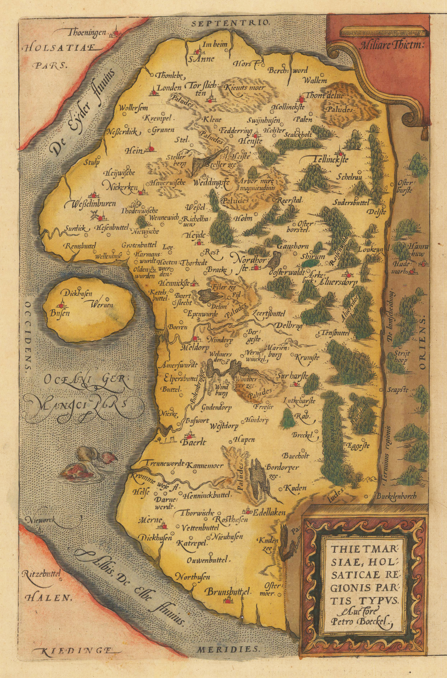
Original antique copper engraving, hand colored in outline and wash when published. This decorative map shows the Elbe River including a sea monster. From Brunsbuttel in the south to Thoeningen (Tönning)in the north, and from Ritzebüttel in the west to Hanrahuw (Haunau) in the east. In the upper left corner is the mouth of the Eider River . Ortelius was born on 14 April 1527 in the city of Antwerp, which was then in the Habsburg Netherlands (modern-day Belgium). The Orthellius family were originally from Augsburg, a Free imperial city of the Holy Roman Empire. In 1535, the family had fallen under suspicion of Protestantism. Following the death of Ortelius's father, his uncle Jacobus van Meteren returned from religious exile in England to take care of Ortelius. Abraham remained close to his cousin Emanuel van Meteren, who would later move to London. In 1575 he was appointed geographer to the king of Spain, Philip II, on the recommendation of Arias Montanus, who vouched for his orthodoxy. He travelled extensively in Europe and is specifically known to have traveled throughout the Seventeen Provinces; in southern, western, northern, and eastern Germany (e.g., 1560, 1575–1576); France (1559–1560); England and Ireland (1576); and Italy (1578, and perhaps twice or thrice between 1550 and 1558). Beginning as a map-engraver, in 1547 he entered the Antwerp Guild of Saint Luke as an illuminator of maps. He supplemented his income trading in books, prints, and maps, and his journeys included yearly visits to the Frankfurt book and print fair, where he met Gerardus Mercator in 1554. In 1560, however, when travelling with Mercator to Trier, Lorraine, and Poitiers, he seems to have been attracted, largely by Mercator's influence, towards the career of a scientific geographer. (Wikipedia)

![Holsatiae Descriptio [on sheet with] Rugiae, Usedomiae, et Iulinae, Wandalicarum Insularum Vera Descriptio.](https://bergbook-sw6.1drop.dev/media/0d/a3/11/1713265652/33373.jpg "33373")