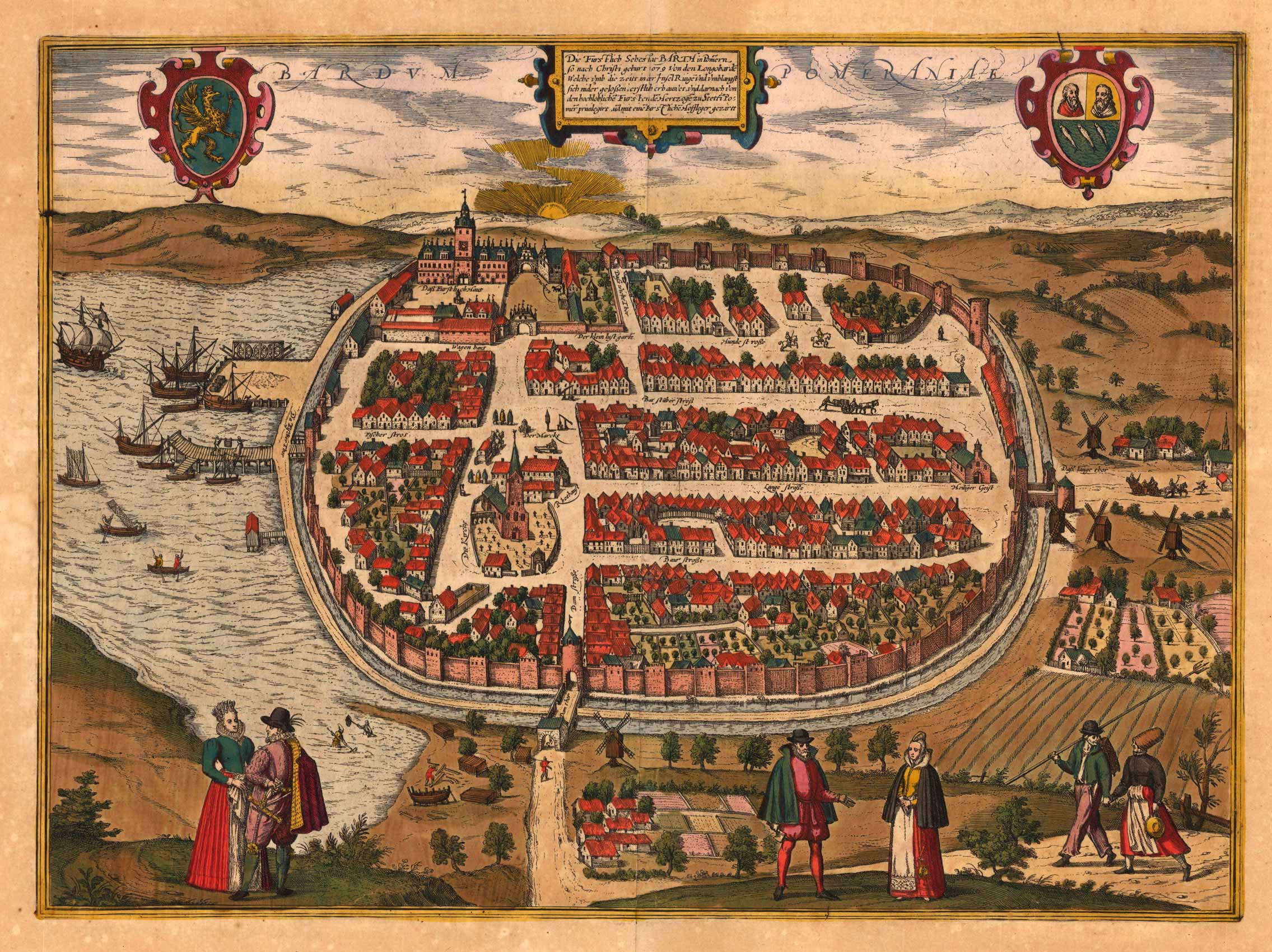
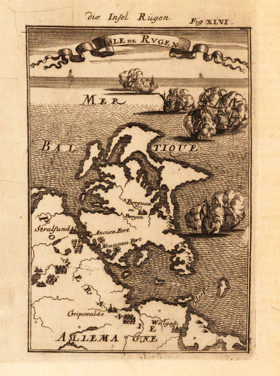
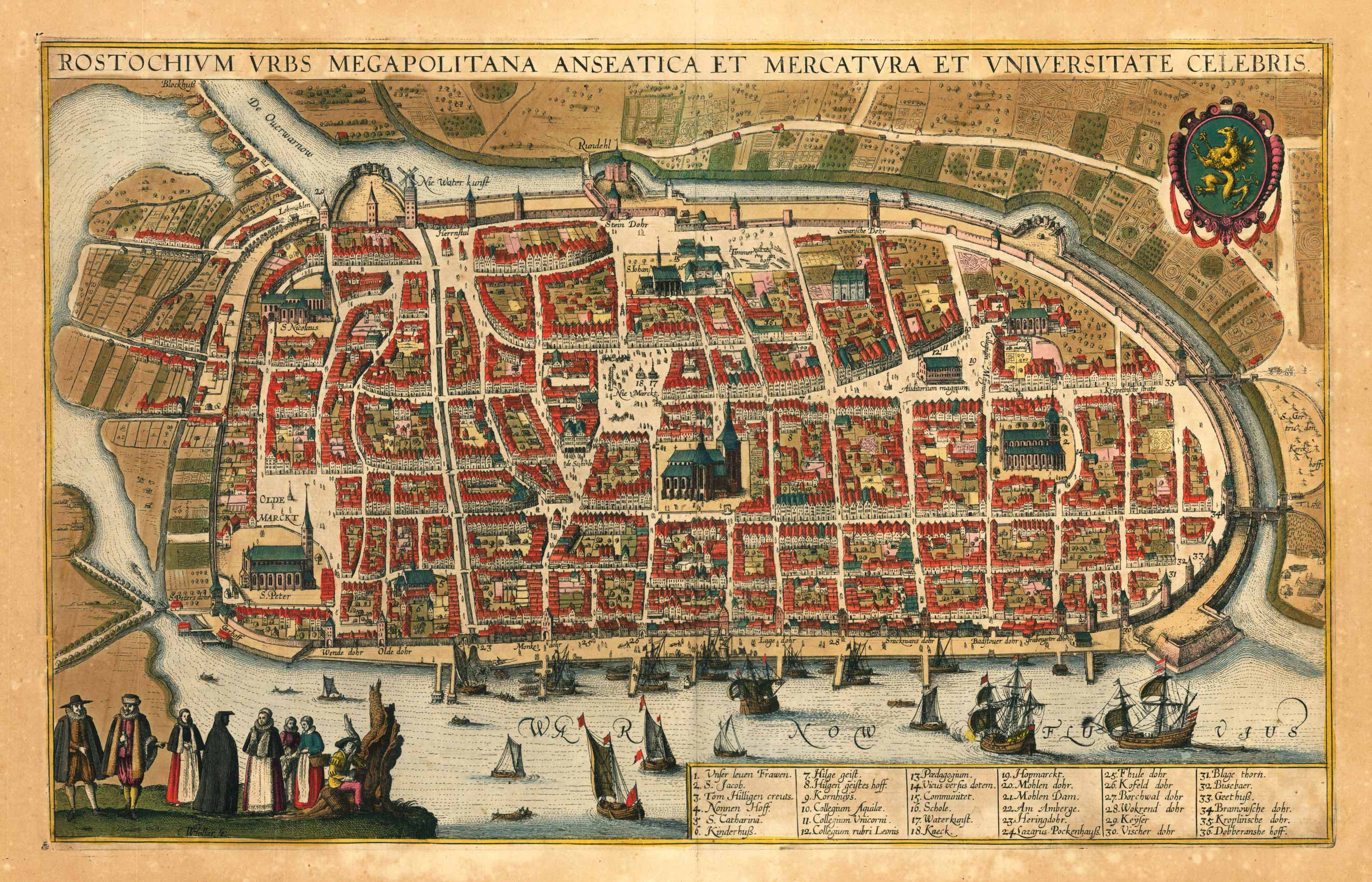
Original antique copper engraving, hand colored in outline when published. The plate was first published in the townbooks ,Civitates Orbis Terrarum' by Braun & Hogenberg. The plates were later aquired by J. Janssonius and were published in his townbooks 1657 in Amsterdam. Johannes Janssonius (1588, Arnhem – buried July 11, 1664, Amsterdam) (born Jan Janszoon, in English also Jan Jansson) was a Dutch cartographer and publisher who lived and worked in Amsterdam in the 17th century. Janssonius was born in Arnhem, the son of Jan Janszoon the Elder,[1] a publisher and bookseller. In 1612 he married Elisabeth de Hondt, the daughter of Jodocus Hondius. He produced his first maps in 1616 of France and Italy. In 1623 Janssonius owned a bookstore in Frankfurt am Main, later also in Danzig, Stockholm, Copenhagen, Berlin, Königsberg, Geneva and Lyon. Elisabeth Hondius died in 1627 and he remarried Elisabeth Carlier in 1629. In the 1630s he formed a partnership with his brother in law Henricus Hondius, and together they published atlases as Mercator/Hondius/Janssonius. Under the leadership of Janssonius the Hondius Atlas was steadily enlarged. Renamed Atlas Novus, it had three volumes in 1638, one fully dedicated to Italy. In 1646, a fourth volume came out with "English County Maps", a year after a similar issue by Joan Blaeu. Janssonius' maps are similar to those of Blaeu, and he is often accused of copying from his rival, but many of his maps predate those of Blaeu and/or covered different regions. By 1660, at which point the atlas bore the appropriate name "Atlas Major", there were 11 volumes, containing the work of about a hundred credited authors and engravers. It included a description of "most of the cities of the world" (Townatlas), of the waterworld (Atlas Maritimus in 33 maps), and of the Ancient World (60 maps). The eleventh volume was the Atlas of the Heavens by Andreas Cellarius. Editions were printed in Dutch, Latin, French, and a few times in German. After Janssonius's death, the publishing company was continued by his son-in law, Johannes van Waesbergen. The London bookseller Moses Pitt attempted publication of the Atlas Major in English, but ran out of resources after the fourth volume in 1683. (Wikipedia)
Original Stahlstichkarte, in zeitgenössischem Grenzkolorit des Verlags. Erschienen im großen Zeitungsatlas von Joseph Meyer in Hildburghausen. Die alte Karte zeigt die Grossherzogthümer Mecklenburg-Schwerin und Mecklenburg-Strelitz um 1867. Die politischen Grenzen sind detailliert gestochen und in zeitgenössischem Grenzkolorit herausgearbeitet. Mit insetplan von Schwerin rechts oben eingearbeitet, sowie links unten Farberklärungen zu den politischen Grenzen und rechts unten ausführliche Legende.
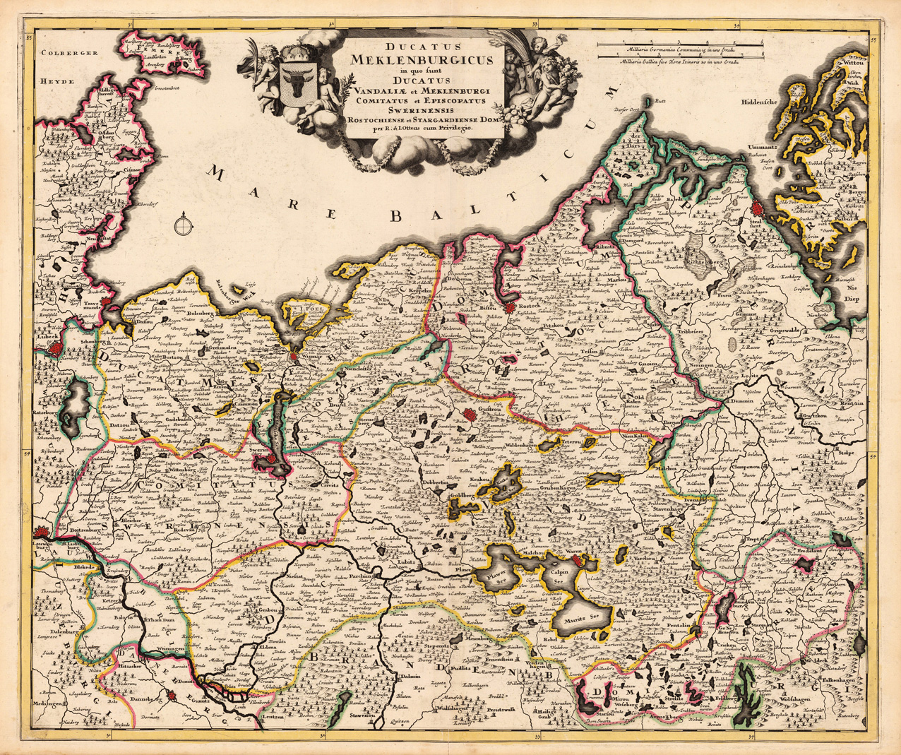
Copperengraving, handcolored in outline when published. A decorative and accurate map of the duchy of Mecklenburg divided up in its various principalities and duchies. With many place names of cities and smaller places, castles, monastries, rivers, lakes, woods and mountains. Ornated in the upper center with a highly decorative title cartouche showing the coat of arms of Mecklenburg.
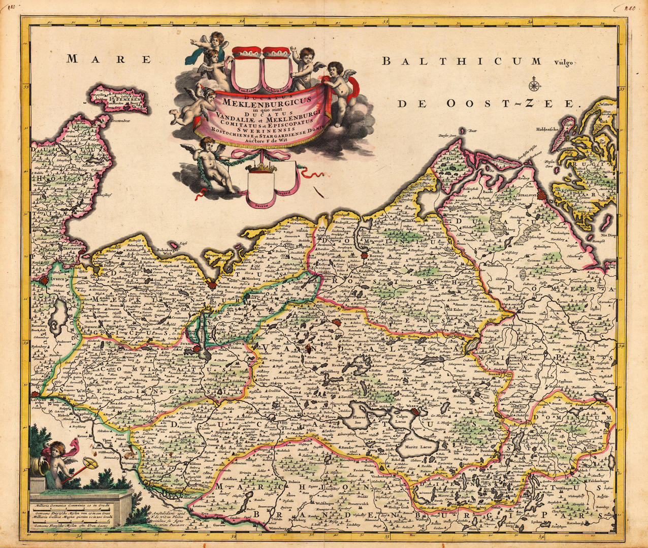
Copper engraving, hand colored in outline when published. A decorative and accurate map of the duchy of Mecklenburg divided up in its various principalities and duchies. With many place names of cities and smaller places, castles, monastries, rivers, lakes, woods and mountains. Ornated in the upper center with a highly decorative title cartouche showing the coats of arms (here left blank) of Mecklenburg surrounded by angels. A decorative with a putti ornated milage scale in the lower left corner.
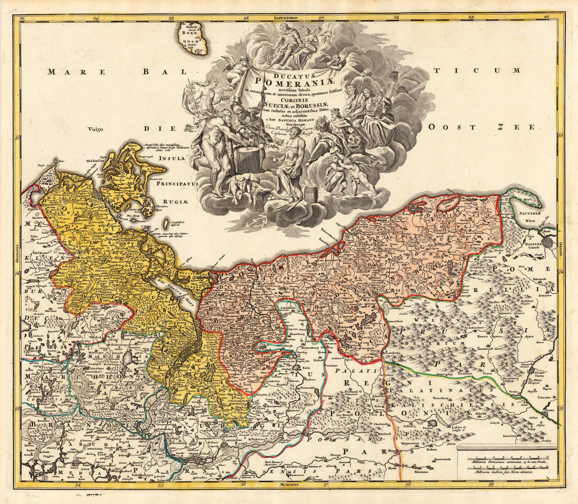
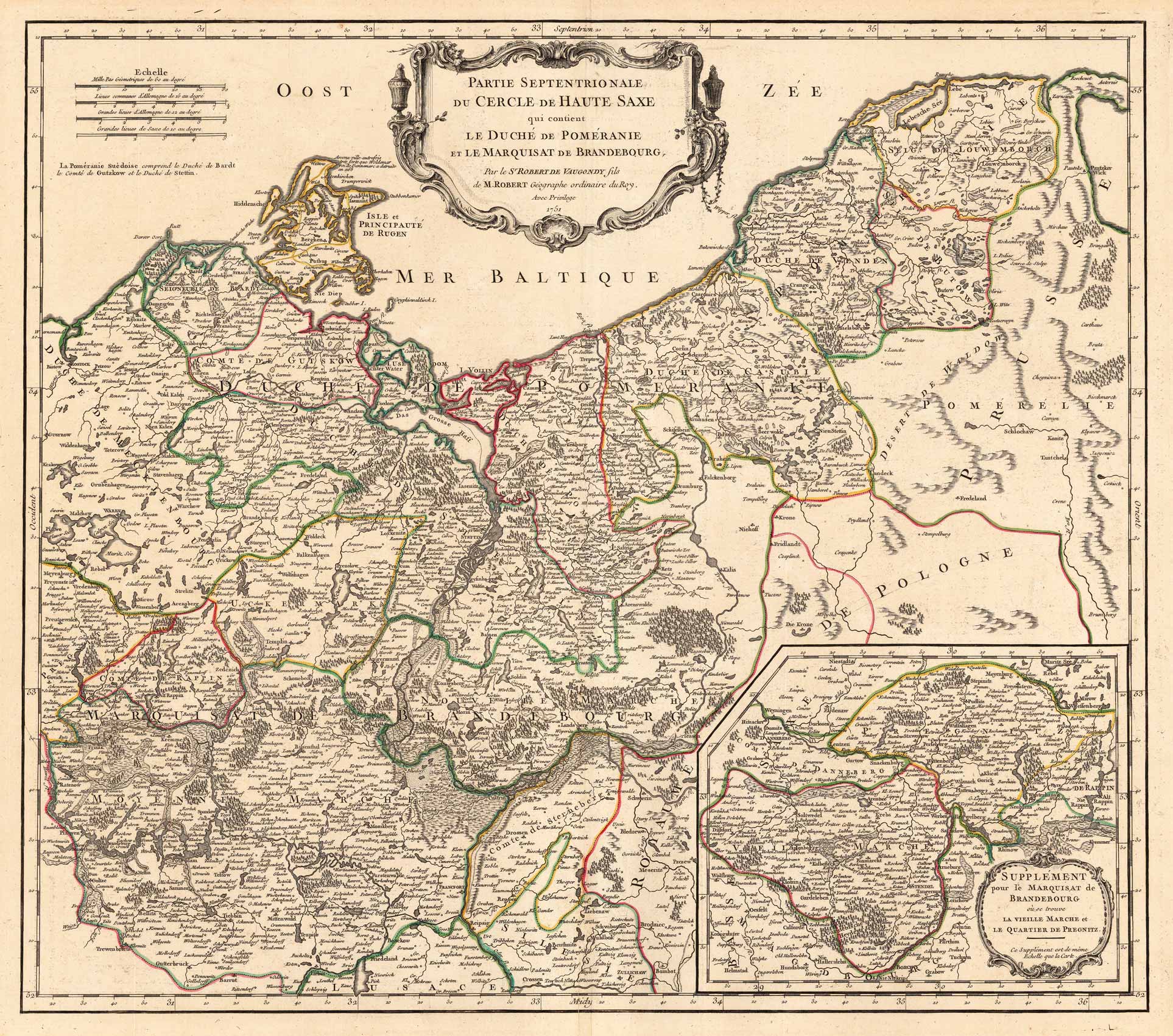
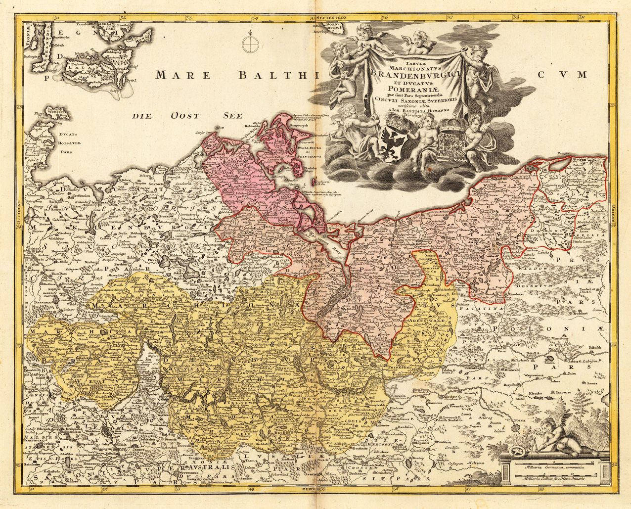
Original antique copper engraving, hand colored in outline and wash when published. Zeigt die Ostseeküste von Stralsund inkulsive Rügen und Usedom bis Danzig. Mit Berlin, Stettin, Toru . Mittig in der oberen Hälfte mit imposanter Titelkartusche. Shows the Baltic Sea coast from Stralsund with Rügen and Usedom to Gdansk. With Berlin, Stettin, Toru . Decorated with an impressive title cartouche. Johann Baptist Homann (20 March 1664 – 1 July 1724) was a German geographer and cartographer, who also made maps of the Americas. Homann was born in Oberkammlach near Kammlach in the Electorate of Bavaria. Although educated at a Jesuit school, and preparing for an ecclesiastical career, he eventually converted to Protestantism and from 1687 worked as a civil law notary in Nuremberg. He soon turned to engraving and cartography; in 1702 he founded his own publishing house. Homann acquired renown as a leading German cartographer, and in 1715 was appointed Imperial Geographer by Emperor Charles VI. Giving such privileges to individuals was an added right that the Holy Roman Emperor enjoyed. In the same year he was also named a member of the Prussian Academy of Sciences in Berlin. Of particular significance to cartography were the imperial printing privileges (Latin: privilegia impressoria). These protected for a time the authors in all scientific fields such as printers, copper engravers, map makers and publishers. They were also very important as a recommendation for potential customers. In 1716 Homann published his masterpiece Grosser Atlas ueber die ganze Welt (Grand Atlas of all the World). Numerous maps were drawn up in cooperation with the engraver Christoph Weigel the Elder, who also published Siebmachers Wappenbuch. Homann died in Nuremberg in 1724. He was succeeded by his son Johann Christoph (1703-1730). The company carried on upon his death as Homann heirs company, managed by Johann Michael Franz and Johann Georg Ebersberger. After subsequent changes in management the company folded in 1852.[1] The company was known as "Homann Erben", "Homanniani Heredes", or "Heritiers de Homann" abroad. (Wikipedia)
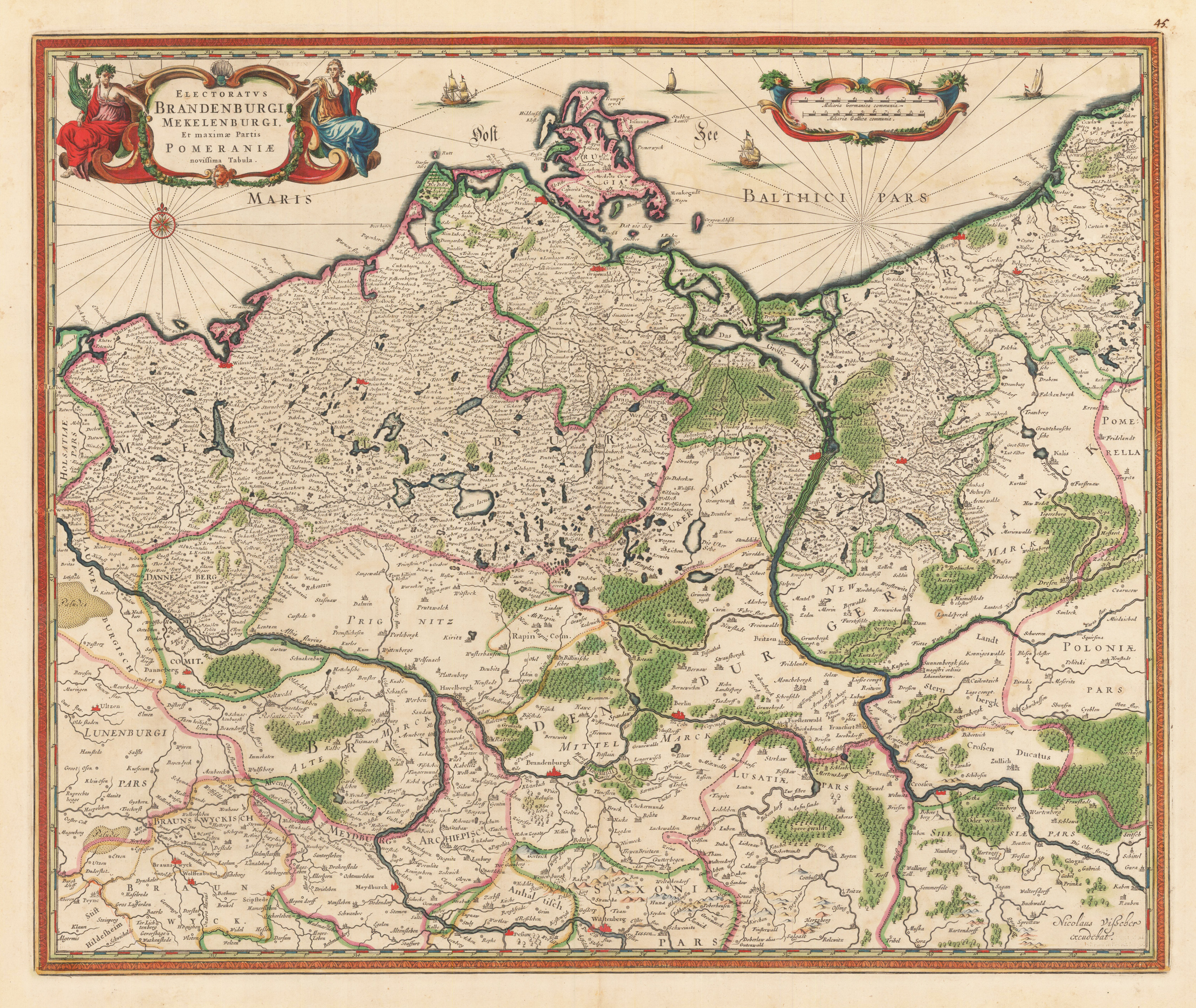
Original anitque copper engraving, hand colored in outline and wash when published. An interesting Visscher map of Brandenburg, including Mecklenburg and part of Pomerania. This map comes from Visscher's compiled 'Atlas Minor siue Geographia Compendiosa, Qua Orbis Terrarum, per paucas attamen novissimas tabulas ostenditu'. A decorative title cartouche with two female figures, presumably flora and fauna, adorns the upper left corner. A compass rose in the area of the Baltic Sea is engraved in the left corner under the cartridge. The original hand color looks fresh and beautiful; verso shows green oxidation. The Atlas Minor is a fine and comprehensive composite atlas and is one of a series of large atlases that were compiled and sold by art dealers and cartographers in the 17th century by the Visscher family. The factory founded by Nicholas Visscher is known for the high quality of the engraving, the exceptionally fine ornamentation and the precise geographical information.
Copper engraving, hand colored in outline and wash when published. A nice and detailed small map of Brandenburg showing Berlin and its surrounding in the centre of the map. Many engraved place names, streets, rivers, lakes and mountains. The various regions are shown in fine hand color in outline and wash.
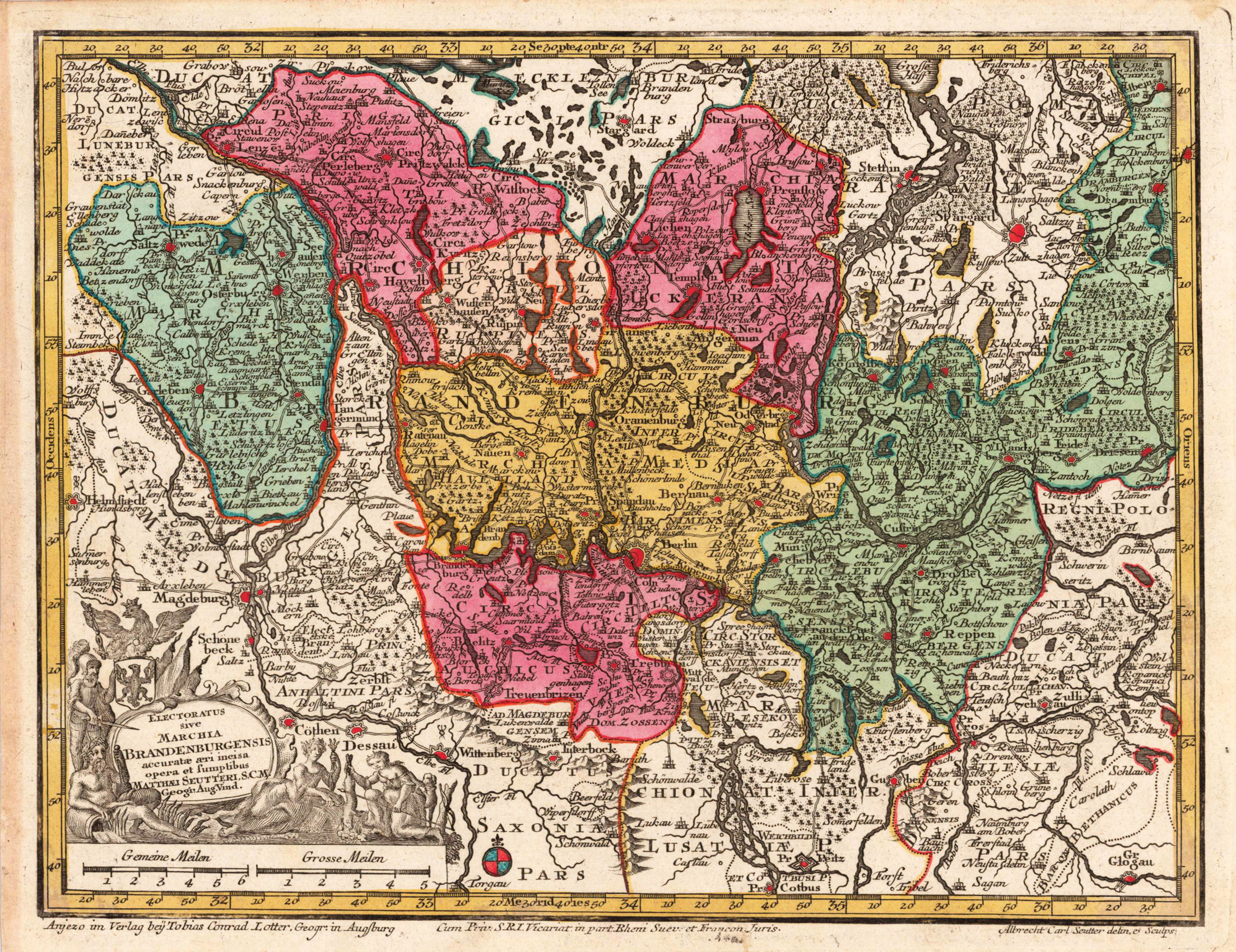
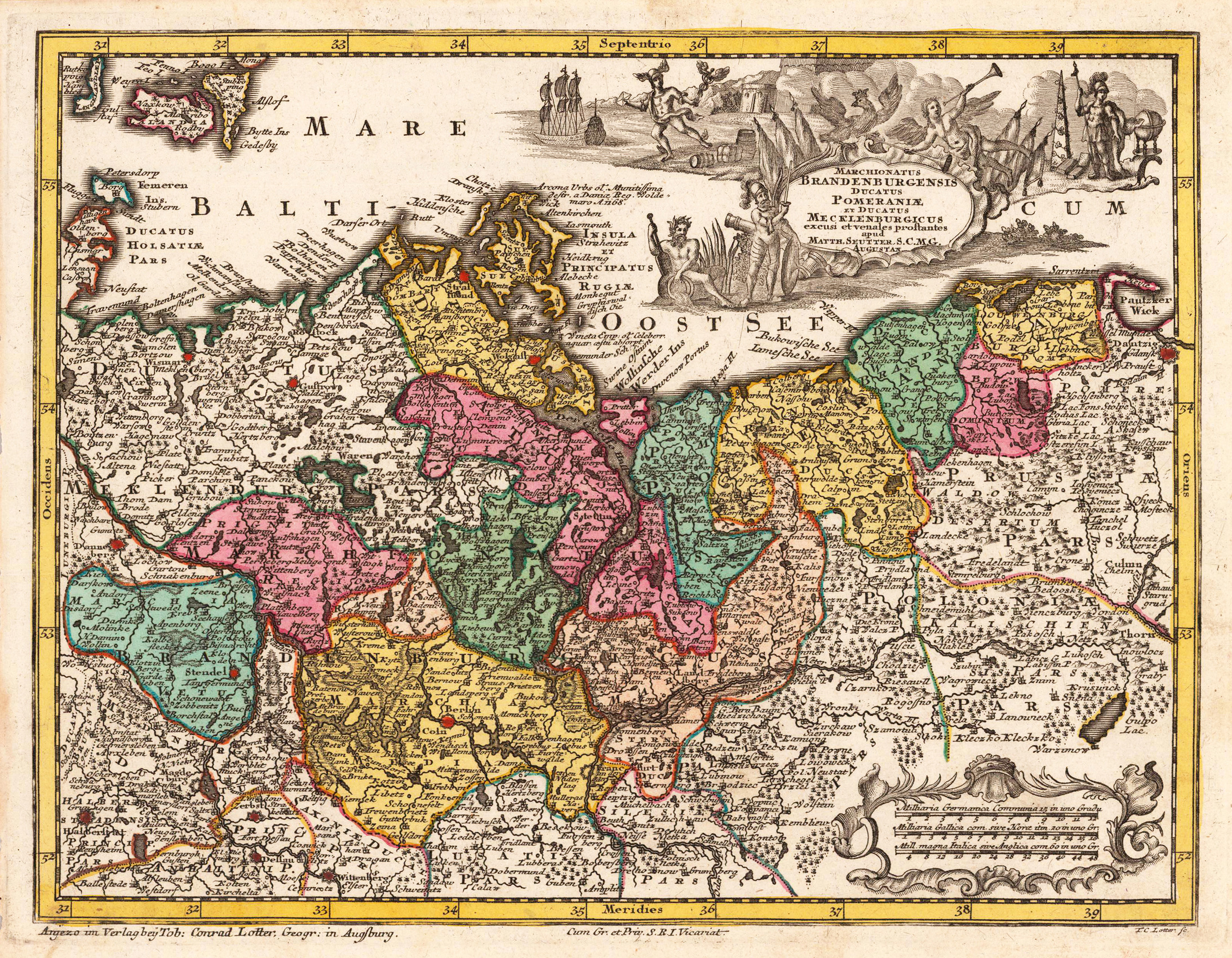
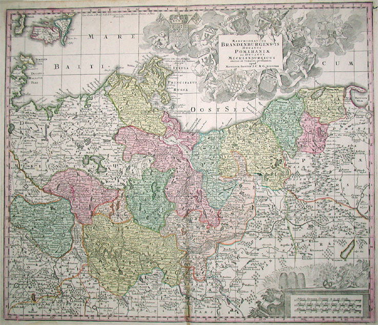
Copper-engraving, handcolored in wash and outline, when published. In the upper right corner ornated with a large barocque title cartouche, surrounded by angels holding coat of arms the various regions. In the lower right corner an allegoric milage scale. On this map the Mark Brandenburg is shown together with the duchy of Mecklenburg by Matthäus Seutter around 1725. The map reaches in the North from Rügen down to the Neisse in the South. In the west with the neighbouring Lüneburg and in the east until Thorn / Weichsel in Poland.
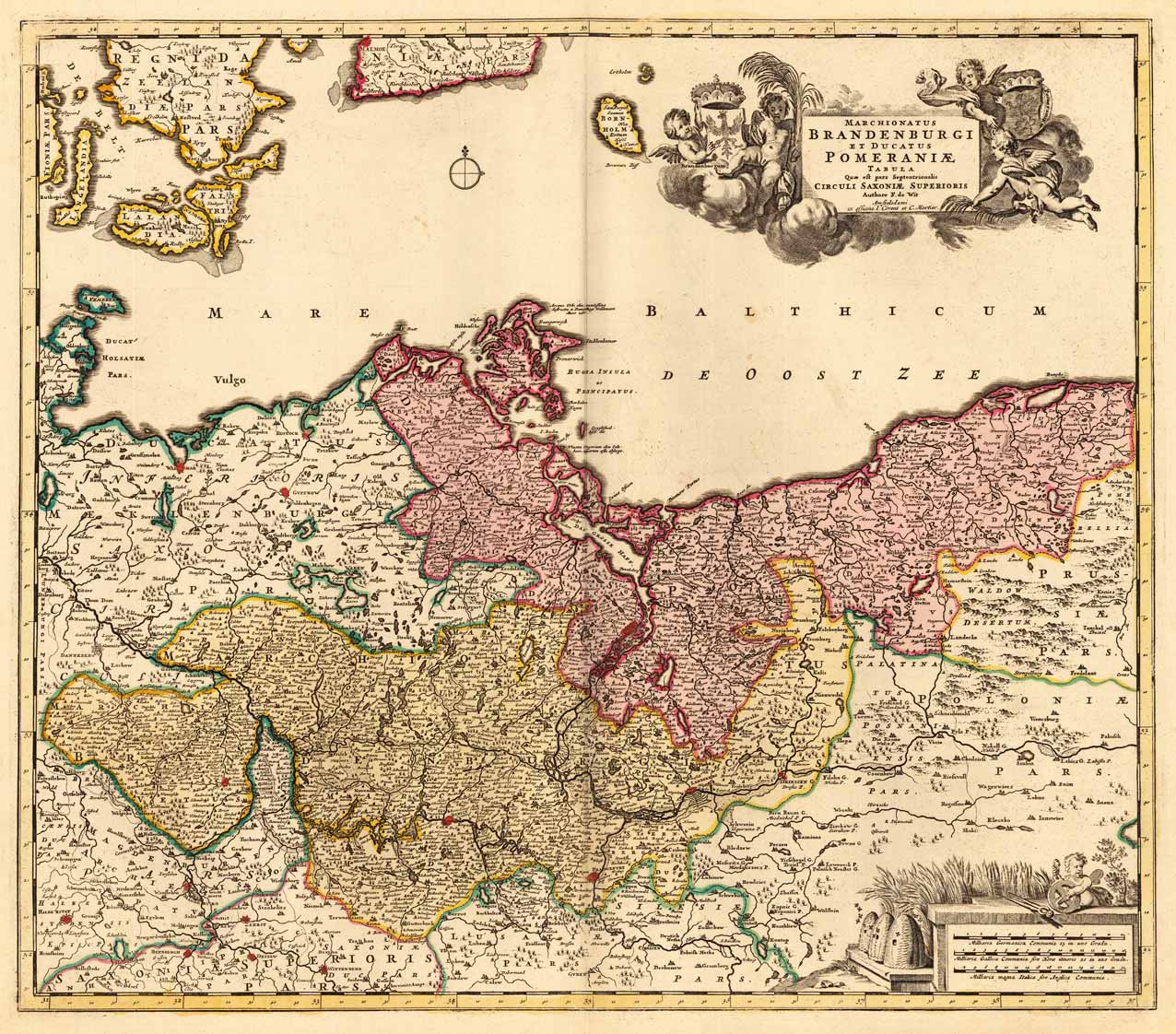
Copper-engraving, handcolored in wash and outline, when published. In the upper right corner ornated with a large barocque title cartouche, surrounded by angels holding coat of arms the various regions. In the lower right corner an allegoric milage scale. On this map the Mark Brandenburg is shown together with the duchy of Pommerania by Frederic de Wit, published at Covens & Mortier around 1740-55. The map reaches in the North from Rügen down to Frankfurt / Oder in the South. In the west with the neighbouring Lower Saxonia and in the east until the borders of Poland.
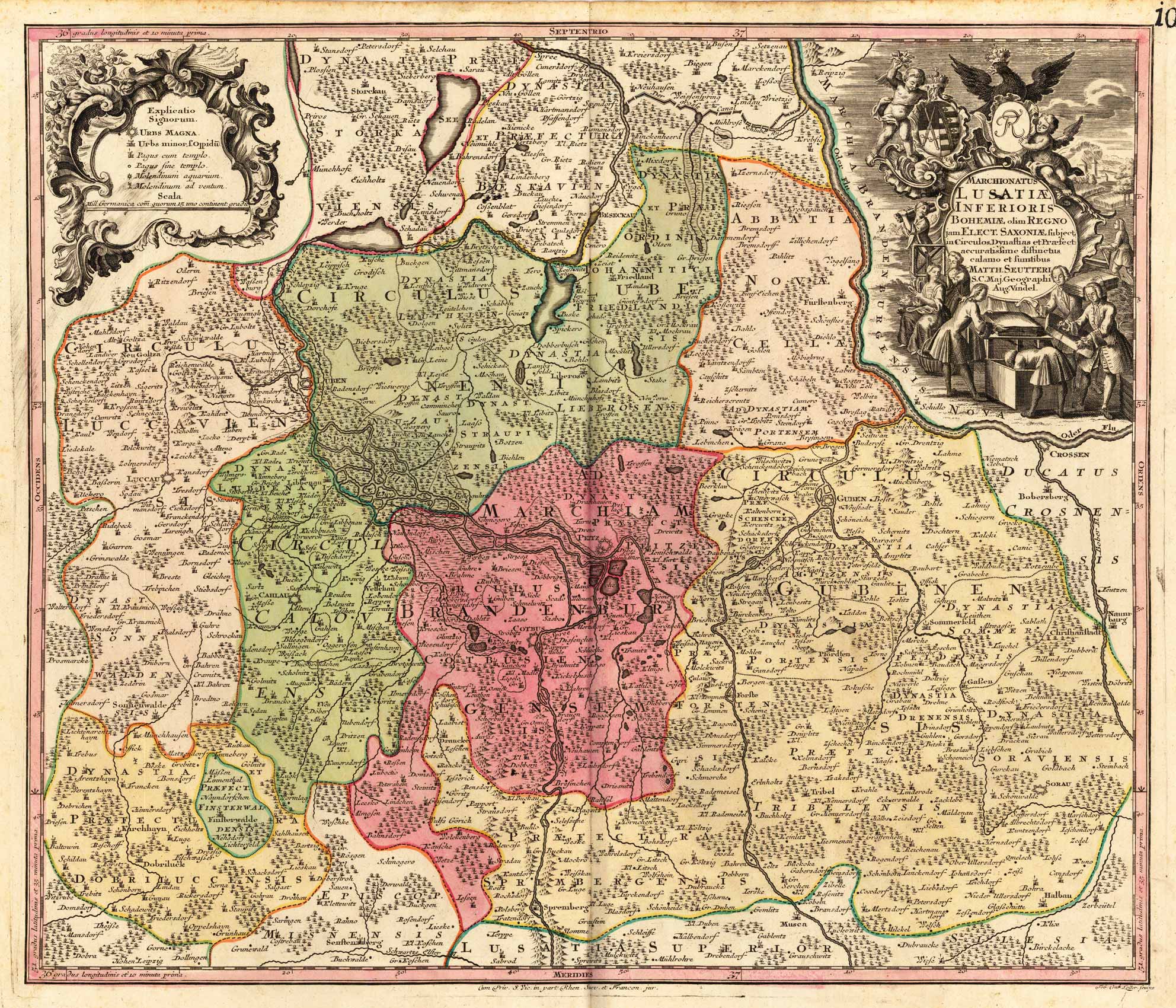
Copper engraving, hand colored in outline and wash when published. A detailed map of the ,Niederlausnitz' with Peitz and Cotbus in the centre of the map published in the famous Augsburg printing house by Matthäus Seutter. In the iupper right corner with a highly decorative title cartouche showing an allegory on the trade to the Lausnitz region.
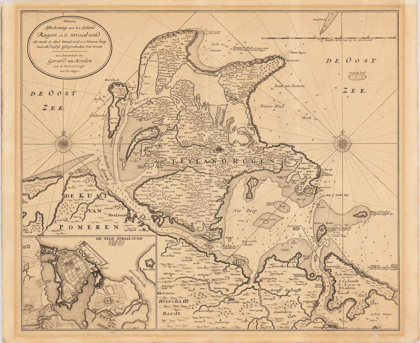
Original antique copper engraving, uncolored as published. Published in ,de Nieuwen brugh' in Amsterdam. A very rare sea chart of the Baltic sea with the coastline from Bardt, Stralsund, Greifwalde and Wolgast in a large scale. The map features the island of Rügen and the neighbourging island Usedom. A highly detailled sea chart of this region in ,Mecklenburg-Vorpommern' with the coastling along the Baltic Sea. The map is in an extremly high scale with an enormous amount of small place names, islands, anchor places, marked sand banks, depths, etc. In the lower left corner eqipped with a fine plan of Stralsund. Johannes van Keulen (1654 in Deventer – 1715 in Amsterdam) was a 17th-century Dutch cartographer. He published the influential nautical atlas the Zee-Atlas and the pilot guide Zee-Fakkel (meaning Sea-Torch in English). In 1678 Johannes van Keulen established himself in Amsterdam and in 1680 he obtained a patent from the States of Holland and West Friesland allowing him to print and publish maritime atlases and shipping guides. These were books of maps and descriptions of itineraries, used by helmsmen for safe navigation. The patent was a kind of protection against illegal copying of produced books and charts. This was especially important for the atlases which were made with extensive initial costs. Van Keulen named his firm 'In de Gekroonde Lootsman' ('In the Crowned Pilot'). Soon Van Keulen struck a deal with cartographer Claes Jansz. Vooght. From 1681 onwards the Nieuwe Lichtende Zee-Fakkel appeared, a five-volume atlas for which Vooght compiled the maps[1] and which was illustrated by Jan Luyken. The five volume Zee-Fakkel made Johannes van Keulen famous. The Zee-Fakkel was published in 5 volumes between 1681 and 1684 containing over 130 new charts. (Wikipedia)
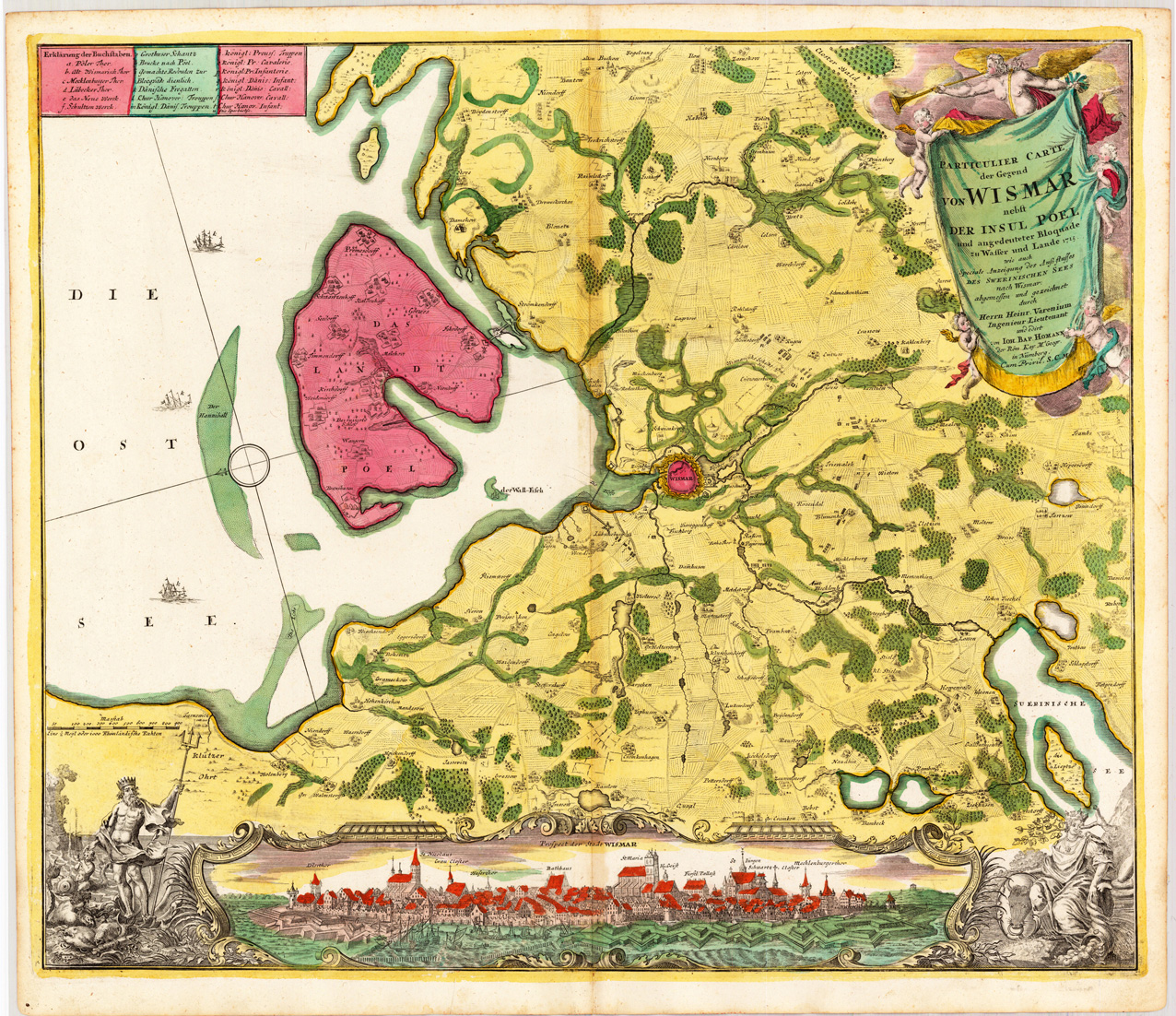
Copper engraving, hand colored in outline and wash when published. Detailed map of the surrounding of Wismar at the Baltic coast, the map provides an enormous information on little villages around Wismar. As well woods, trails and fields are shown. The Island of Pöel is shown detailed. Below we find a city view of Wismar (Prospect der Stadt Wismar).
Copper engraving, hand colored in outline and wash when published. The plate was first published in the townbooks ,Civitates Orbis Terrarum' by Braun & Hogenberg. The plates were later aquired by J. Janssonius and were published in his townbooks 1657 in Amsterdam.
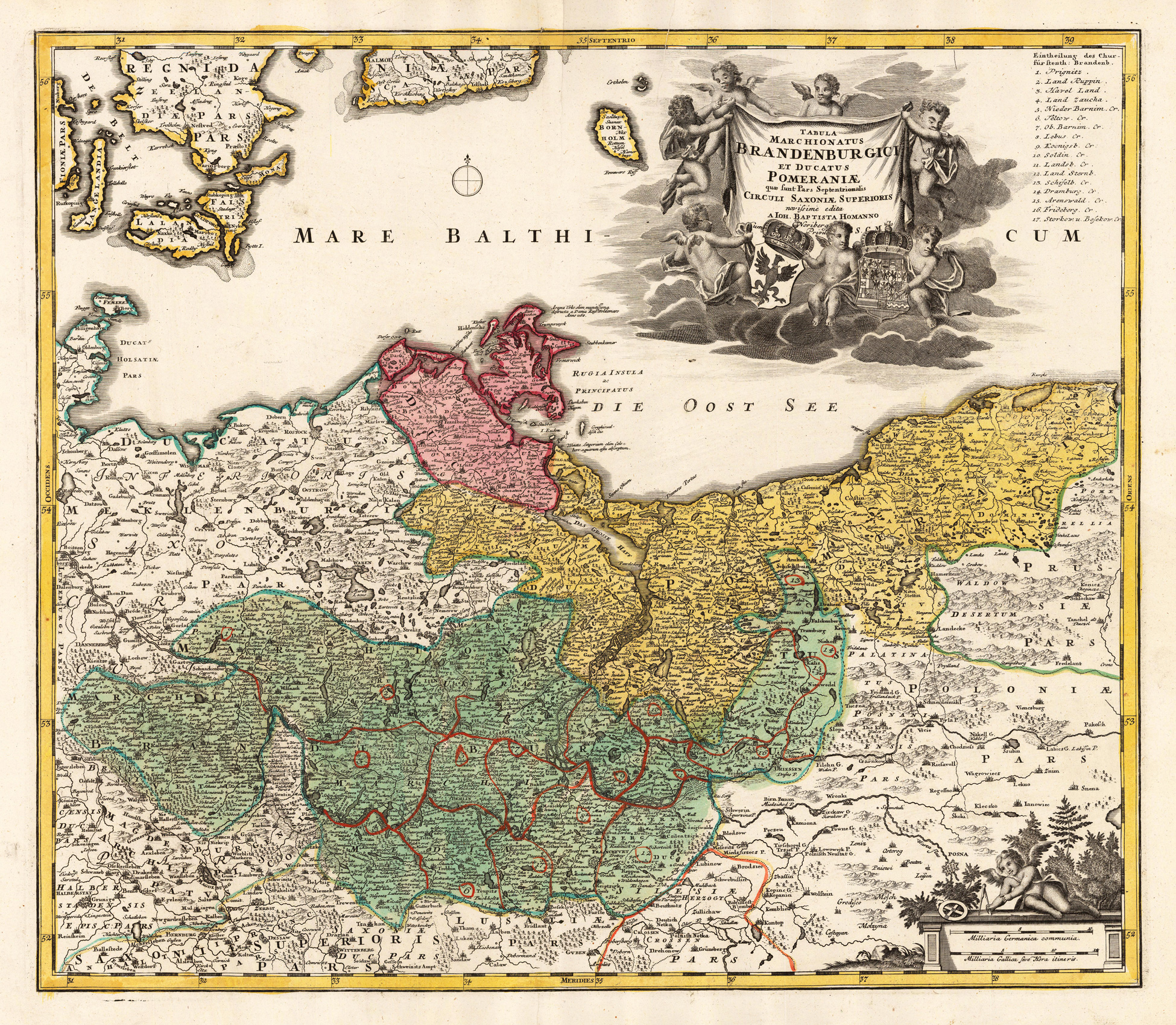
Original antique copper engraving, hand colored in outline and wash, when published. Diese hochdekorative Karte zeigt den Mark Brandenburg mit der Ostsee und der Insel Rügen. Die Karte ist mit vielen kleinen Ortsnamen, Flüssen, Bergen, Wäldern, Seen usw. ausgestattet. In der oberen rechten Ecke finden Sie eine Erklärung der Karte und eine große bildliche Titelkartusche. This highly decorative map shows the 'Mark Brandenburg' with the Baltic Sea and the island of Rügen. The map is equipped with many small place names, rivers, mountains, woods, lakes, etc. In the upper right corner we find an explanation of the map and a large figurative title cartouche. Johann Baptist Homann (20 March 1664 – 1 July 1724) was a German geographer and cartographer, who also made maps of the Americas. Homann was born in Oberkammlach near Kammlach in the Electorate of Bavaria. Although educated at a Jesuit school, and preparing for an ecclesiastical career, he eventually converted to Protestantism and from 1687 worked as a civil law notary in Nuremberg. He soon turned to engraving and cartography; in 1702 he founded his own publishing house. Homann acquired renown as a leading German cartographer, and in 1715 was appointed Imperial Geographer by Emperor Charles VI. Giving such privileges to individuals was an added right that the Holy Roman Emperor enjoyed. In the same year he was also named a member of the Prussian Academy of Sciences in Berlin. Of particular significance to cartography were the imperial printing privileges (Latin: privilegia impressoria). These protected for a time the authors in all scientific fields such as printers, copper engravers, map makers and publishers. They were also very important as a recommendation for potential customers. In 1716 Homann published his masterpiece Grosser Atlas ueber die ganze Welt (Grand Atlas of all the World). Numerous maps were drawn up in cooperation with the engraver Christoph Weigel the Elder, who also published Siebmachers Wappenbuch. Homann died in Nuremberg in 1724. He was succeeded by his son Johann Christoph (1703-1730). The company carried on upon his death as Homann heirs company, managed by Johann Michael Franz and Johann Georg Ebersberger. After subsequent changes in management the company folded in 1852.[1] The company was known as "Homann Erben", "Homanniani Heredes", or "Heritiers de Homann" abroad. (Wikipedia)
Original antique copper engraving, hand colored in outline and wash when published. Diese hochdekorative Karte zeigt den Mark Brandenburg mit der Ostsee und der Insel Rügen. Die Karte ist mit vielen kleinen Ortsnamen, Flüssen, Bergen, Wäldern, Seen usw. ausgestattet. In der oberen rechten Ecke finden Sie eine Erklärung der Karte und eine große bildliche Titelkartusche. This highly decorative map shows the 'Mark Brandenburg' with the Baltic Sea and the island of Rügen. The map is equipped with many small place names, rivers, mountains, woods, lakes, etc. In the upper right corner we find an explanation of the map and a large figurative title cartouche. Johann Baptist Homann (20 March 1664 – 1 July 1724) was a German geographer and cartographer, who also made maps of the Americas. Homann was born in Oberkammlach near Kammlach in the Electorate of Bavaria. Although educated at a Jesuit school, and preparing for an ecclesiastical career, he eventually converted to Protestantism and from 1687 worked as a civil law notary in Nuremberg. He soon turned to engraving and cartography; in 1702 he founded his own publishing house. Homann acquired renown as a leading German cartographer, and in 1715 was appointed Imperial Geographer by Emperor Charles VI. Giving such privileges to individuals was an added right that the Holy Roman Emperor enjoyed. In the same year he was also named a member of the Prussian Academy of Sciences in Berlin. Of particular significance to cartography were the imperial printing privileges (Latin: privilegia impressoria). These protected for a time the authors in all scientific fields such as printers, copper engravers, map makers and publishers. They were also very important as a recommendation for potential customers. In 1716 Homann published his masterpiece Grosser Atlas ueber die ganze Welt (Grand Atlas of all the World). Numerous maps were drawn up in cooperation with the engraver Christoph Weigel the Elder, who also published Siebmachers Wappenbuch. Homann died in Nuremberg in 1724. He was succeeded by his son Johann Christoph (1703-1730). The company carried on upon his death as Homann heirs company, managed by Johann Michael Franz and Johann Georg Ebersberger. After subsequent changes in management the company folded in 1852.[1] The company was known as "Homann Erben", "Homanniani Heredes", or "Heritiers de Homann" abroad. (Wikipedia)
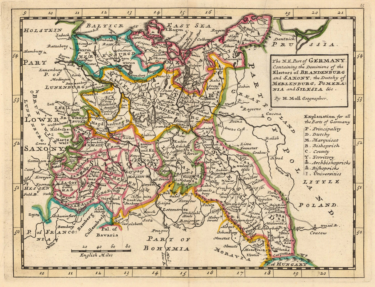
Copper engraving, hand colored in outline when published. Small and decorative map of the northeastern part of Germany, Brandenburg with Berlin in the center mainly covering Pomeranian, Saxonia and Silesia towards the borders of Poland. The Geographer Hermann Moll worked came originally from the Netherlands and worked in London in the beginning for Moses Pitt. Later he became one of the important map publishers in England. The atlases, which he published were widely well known. He engraved as well maps for other English publishers (John Seller, etc.).
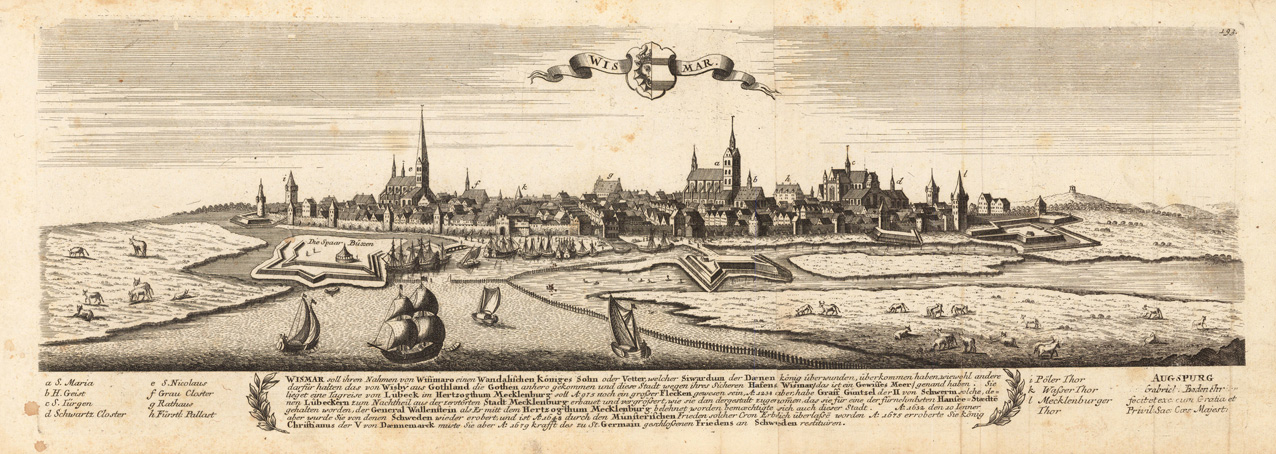
Copper engraving, uncolored as published. This fine engraving was published in Gabriel Bodenehr's famous serious "Europeans Macht und Pracht", a series of engravings depicting city views, plans, fortresses and castles in Europe. Many plates often are showing fortifications in Hungary and Southeast Europe, Spain, Belgium, Austria and Germany. Gabriel Bodenehr was during this period a successful publisher for maps and prints in Augsburg in Southern Germany.