
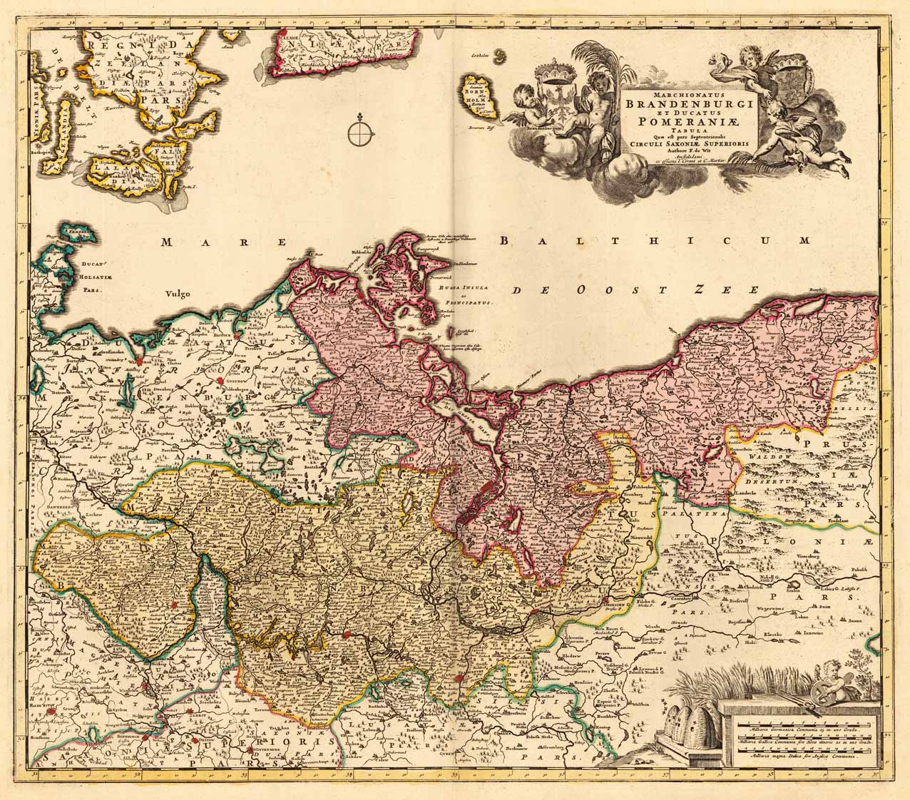
Marchionatus Brandenburgi Et Ducatus Pomeraniae Tabula Quae est pars Septentrionalis Circuli Saxoniae Superioris Authore F. de Wit Amstelodami ex officina I. Covens et C. Mortier.
Product information: Marchionatus Brandenburgi Et Ducatus Pomeraniae Tabula Quae est pars Septentrionalis Circuli Saxoniae Superioris Authore F. de Wit Amstelodami ex officina I. Covens et C. Mortier.
Copper-engraving, handcolored in wash and outline, when published. In the upper right corner ornated with a large barocque title cartouche, surrounded by angels holding coat of arms the various regions. In the lower right corner an allegoric milage scale. On this map the Mark Brandenburg is shown together with the duchy of Pommerania by Frederic de Wit, published at Covens & Mortier around 1740-55. The map reaches in the North from Rügen down to Frankfurt / Oder in the South. In the west with the neighbouring Lower Saxonia and in the east until the borders of Poland.
Properties
| Category: | Brandenburg - Pommern |
|---|---|
| Issue date: | 1740/55 |
| Published place: | Amsterdam |
| Technique: | Copper engraving / Original color. |
| Type: | Antique Map, map |