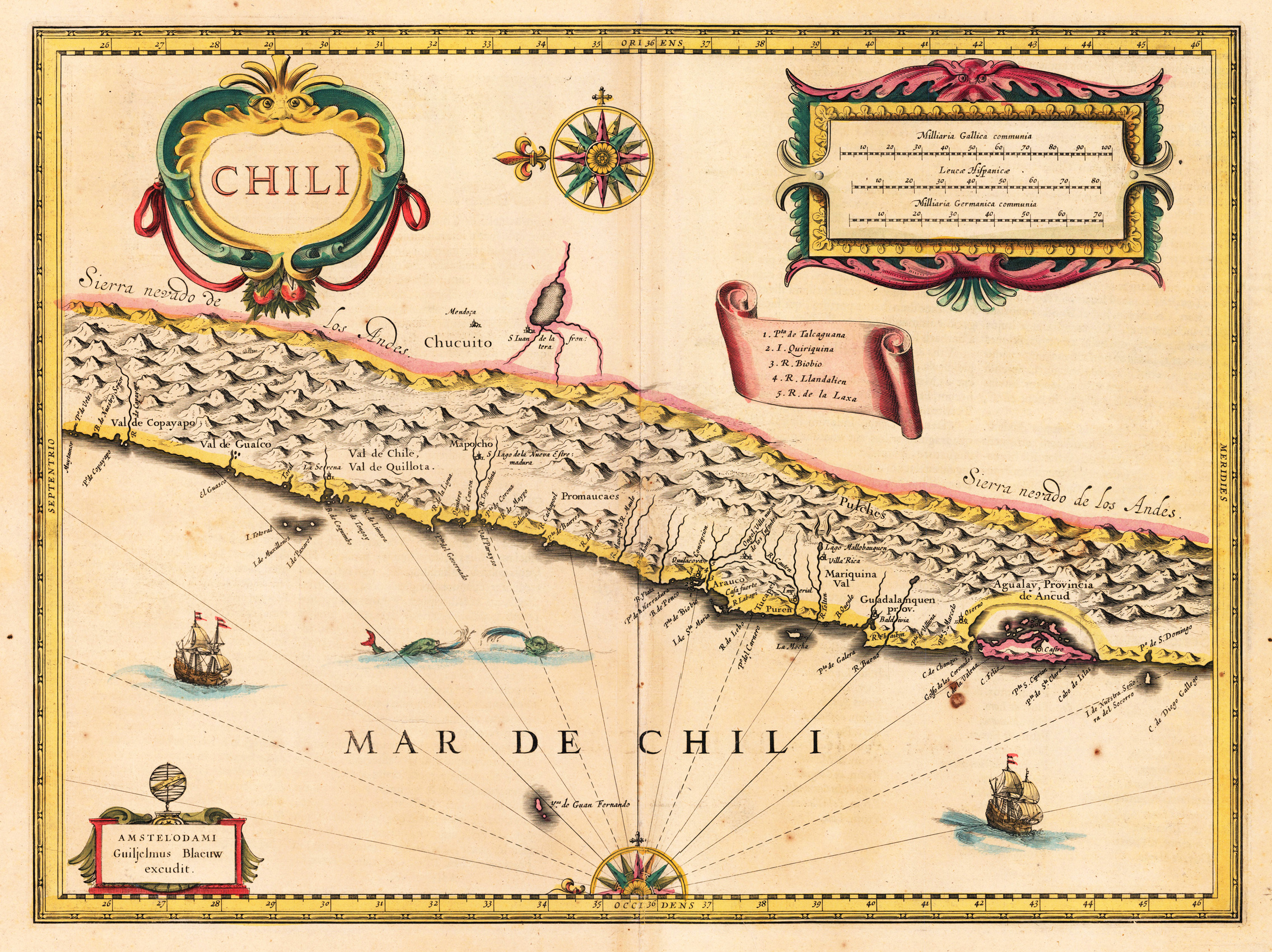
Engraved map in fine contemporary colors in outline and wash. Published in the edition of Blaeu's "Atlas Maior". This nice map shows the coast of Chili. Ornated with a nice allegoric cartouche, ships and shields for coat of arms. Joan Blaeu (23 September 1596 – 21 December 1673) was a Dutch cartographer born in Alkmaar, the son of cartographer Willem Blaeu. In 1620 he became a doctor of law but he joined the work of his father. In 1635 they published the Atlas Novus (full title: Theatrum orbis terrarum, sive, Atlas novus) in two volumes. Joan and his brother Cornelius took over the studio after their father died in 1638. Joan became the official cartographer of the Dutch East India Company. Blaeu's world map, Nova et Accuratissima Terrarum Orbis Tabula, incorporating the discoveries of Abel Tasman, was published in 1648. This map was revolutionary in that it "depicts the solar system according to the heliocentric theories of Nicolaus Copernicus, which show the earth revolving around the sun.... Although Copernicus's groundbreaking book On the Revolutions of the Spheres had been first printed in 1543, just over a century earlier, Blaeu was the first mapmaker to incorporate this revolutionary heliocentric theory into a map of the world." Blaeu's map was copied for the map of the world set into the pavement of the Groote Burger-Zaal of the new Amsterdam Town Hall, designed by the Dutch architect Jacob van Campen (now the Amsterdam Royal Palace), in 1655. Blaeu's Hollandia Nova was also depicted in his Archipelagus Orientalis sive Asiaticus published in 1659 in the Kurfürsten Atlas (Atlas of the Great Elector). and used by Melchisédech Thévenot to produce his map, Hollandia Nova—Terre Australe (1664). As Joan Blaeu, he also published the 12 volume "Le Grand Atlas, ou Cosmographie blaviane, en laquelle est exactement descritte la terre, la mer, et le ciel". One edition is dated 1663. That was folio (540 x 340 mm), and contained 593 engraved maps and plates. In March 2015, a copy was on sale for £750,000. Around 1649 Joan Blaeu published a collection of Dutch city maps named Toonneel der Steeden (Views of Cities). In 1651 he was voted into the Amsterdam council. In 1654 Joan published the first atlas of Scotland, devised by Timothy Pont. In 1662 he reissued the Atlas Novus, also known as Atlas Maior, in 11 volumes, and one for oceans.[citation needed] A cosmology was planned as their next project, but a fire destroyed the studio completely in 1672. (Wikipedia)
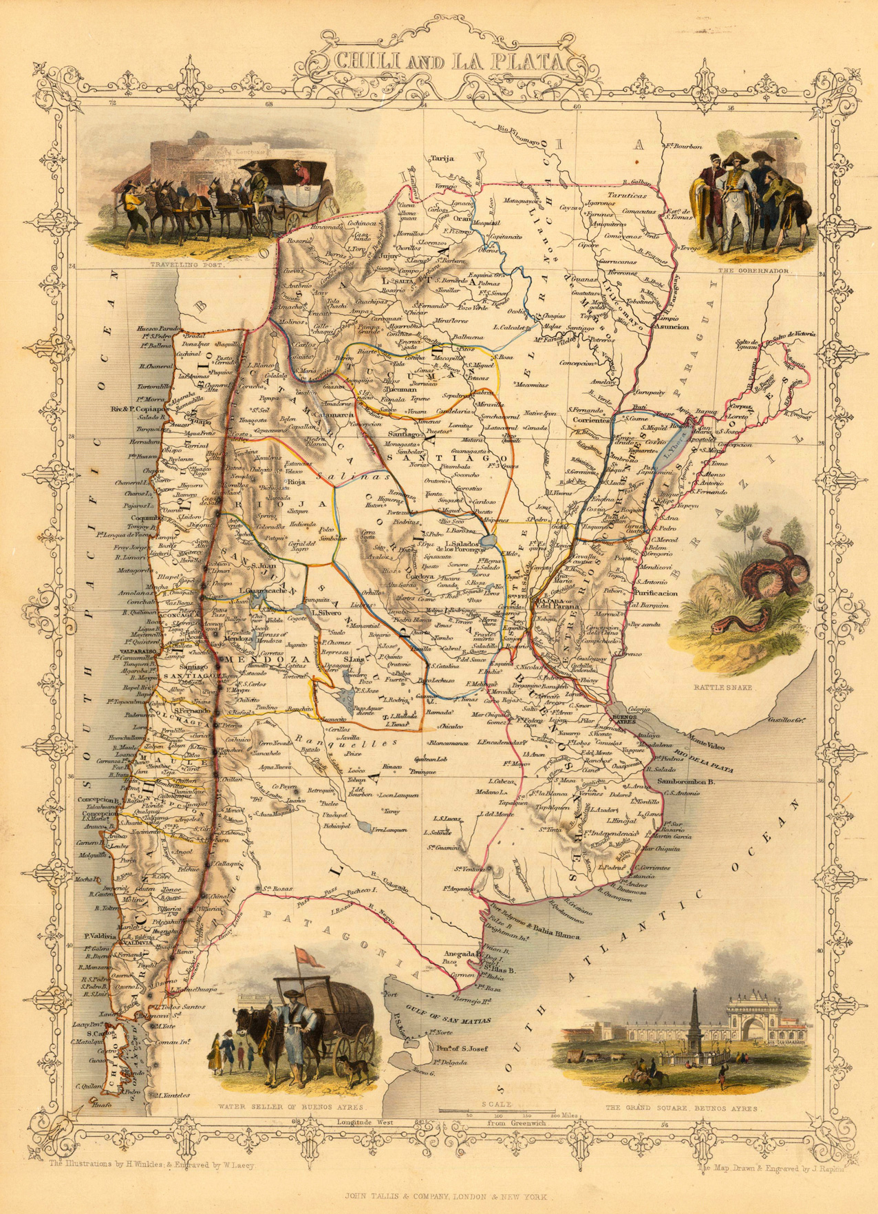
Steel engraving, hand colored in outline and wash. The fine engraved map is showing Chili and La Plata with many details and the South Pacific and the South Atlantic Ocean. The map is decorated with five finely hand colored engraved vignettes: the travelling post, the governor, a rattlesnake, a water seller and the grand square of Buenos Ayres. The actual map was drawn and engraved by J. Rapkin. The illustrations were engraved by various artists: R. Radclyffe, W. Lacy, J. Rogers, J. H. Kernot, J. B. Allen, T. Fleming, H. Winkles, R. Baker after drawings by H. Warren, H. Winkles and H. Wray.
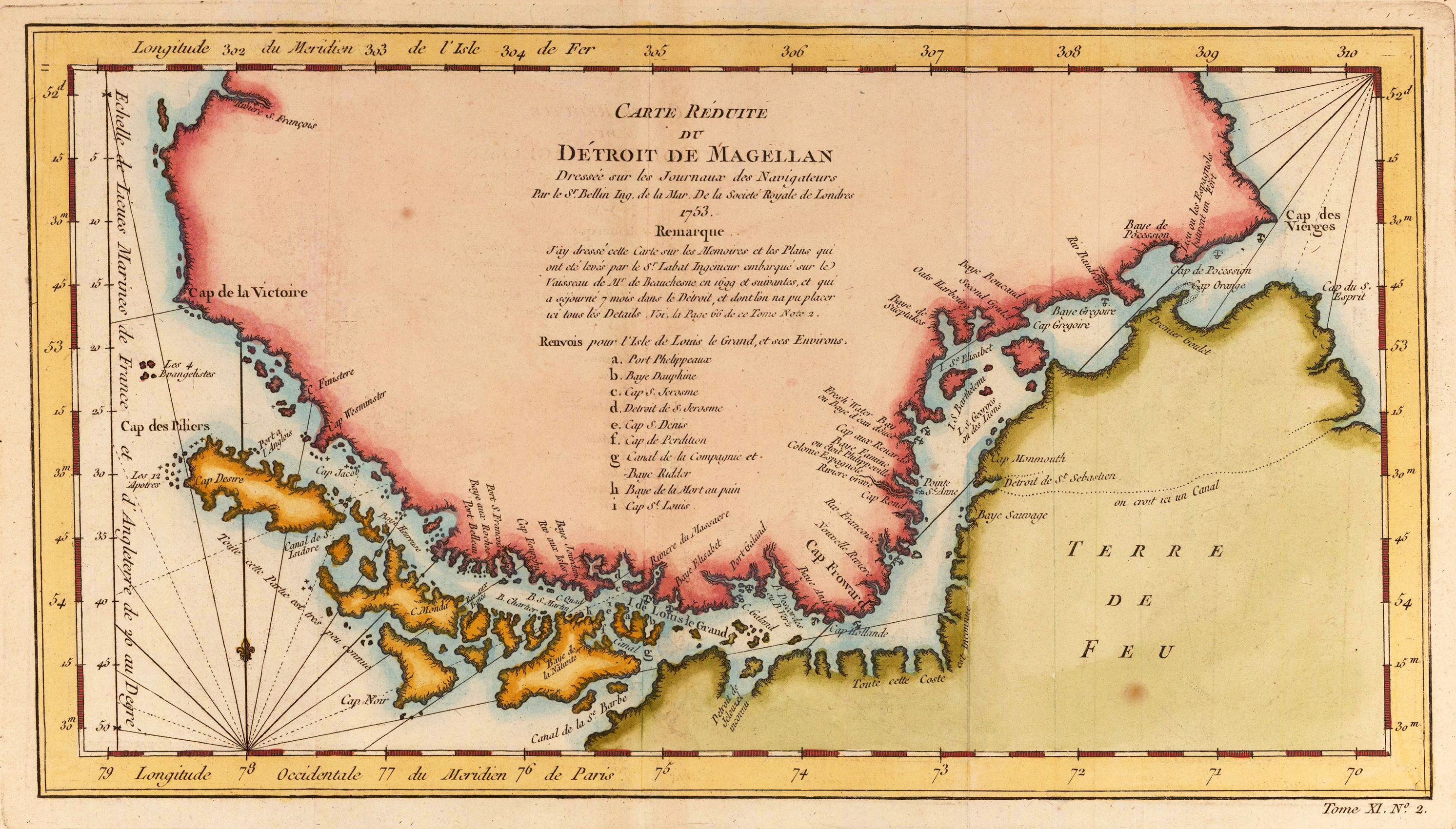
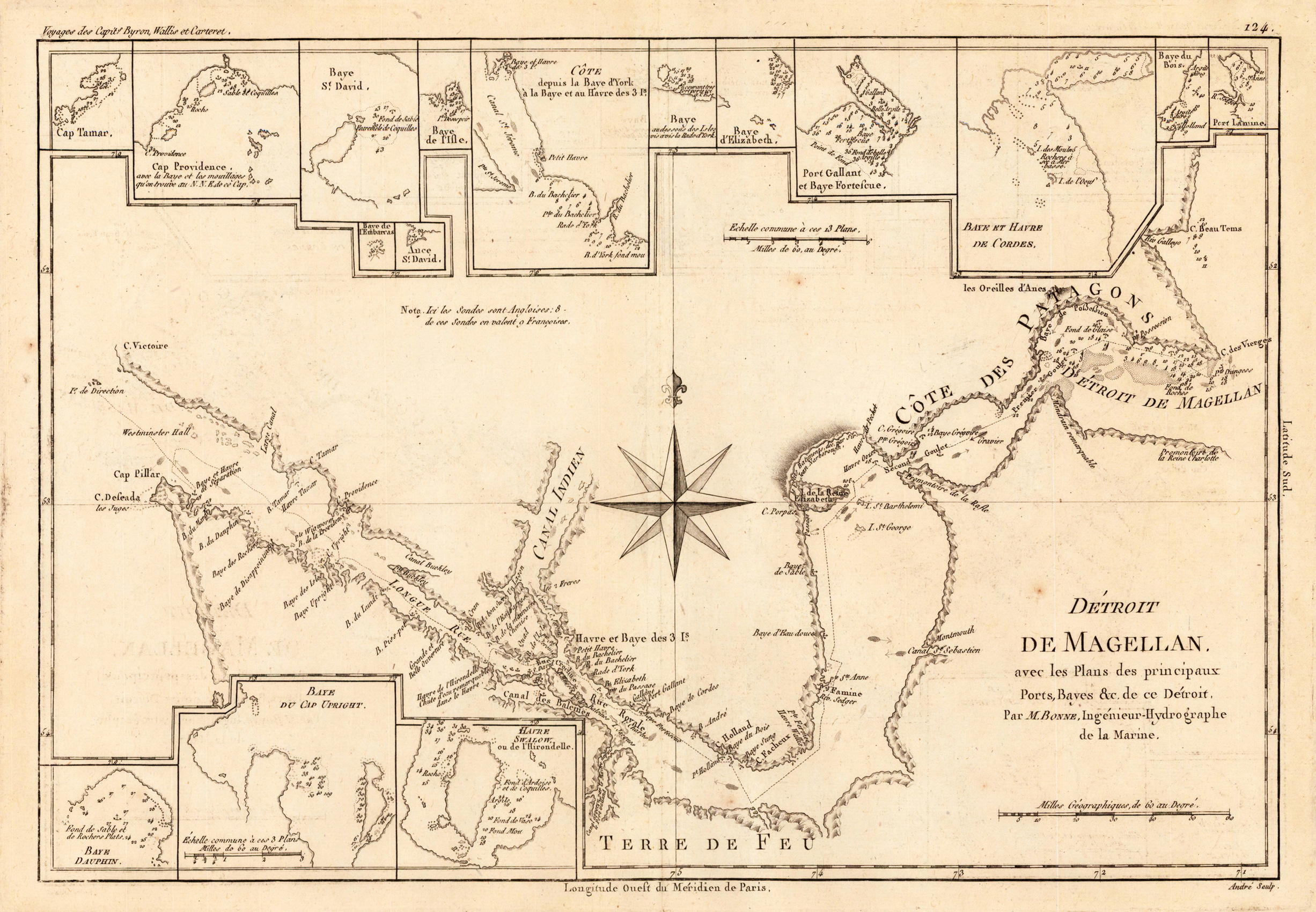
Copper engraving, uncolored as published. Detailed map of the Straits of Magellan by Rigobert Bonne. The interesting map depicts the detailed the coastlines along the Straits of Magellan including anchor places, small islands, bays harbors, soundings. Further along the coastline most of the bays are named. The map is equipped with 16 small inset maps with details of the Straits of Magellan. Rigobert Bonne (1727-1794) was a French cartographer of the late 18th century. He studied in Paris and practiced cartography. He became a skilled cartographer and hydrographer and became a royal hydrographer at the ,Depot de la Marine' in 1773. In 1780 he engraved and published the maps for Abbe Raynal's work ,Atlas de Toutes Les Parties Connues du Globe Terrestre'. He also published many charts for the ,Depot de la Marine', further he engraved the maps for the ,Atlas Encyclopedique' in 1788 together with Nicholas Desmarest.
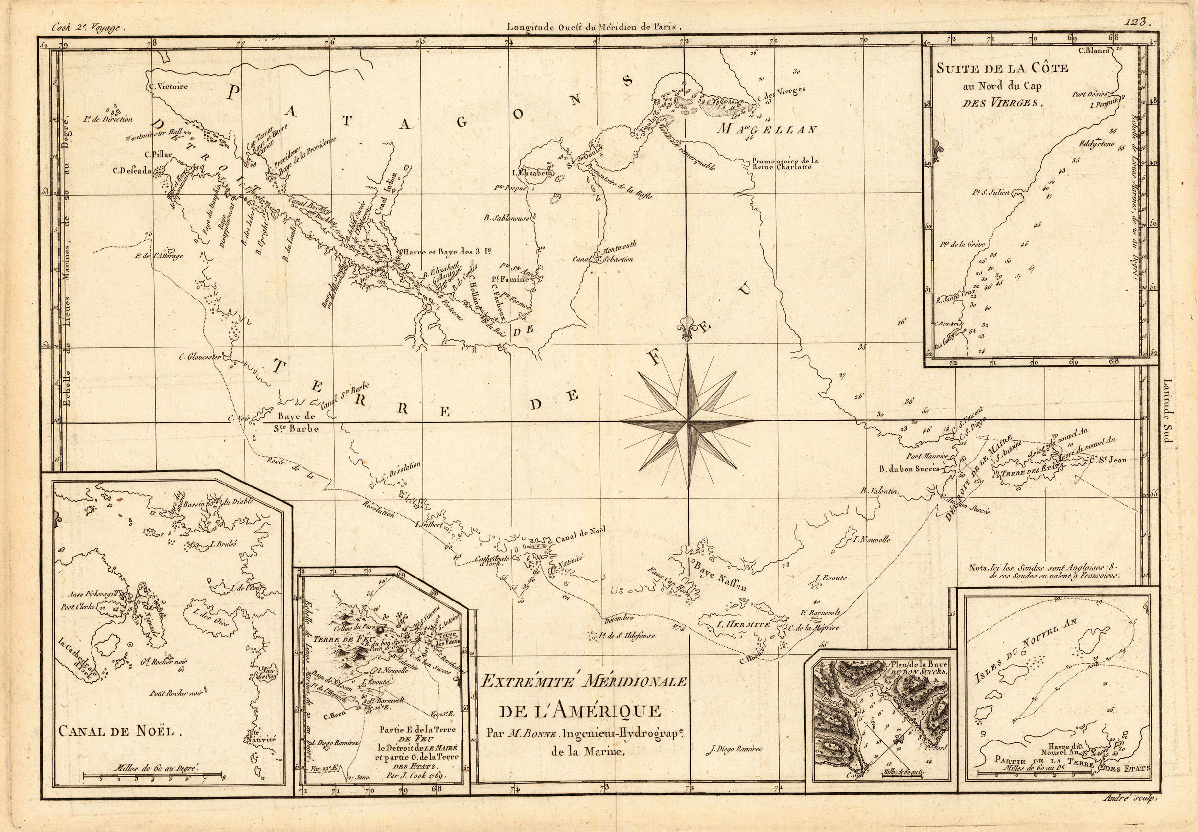
Original antique copper engraving, uncolored as published. Detailed map of the southern tip of Patagonia with Fireland and the Magellan Street. More over the map is ornated with five small detailed inset maps. Ornated with a compass rose. Rigobert Bonne (6 October 1727 – 2 September 1794) was a French cartographer, widely considered to be one of the most important cartographers of the late 18th century. In 1773 Bonne succeeded Jacques Nicolas Bellin as Royal Cartographer to France in the office of the Hydrographer at the Depôt de la Marine. Working in his official capacity, Bonne compiled some of the most detailed and accurate maps of the period. Bonne's work represents an important step in the evolution of the cartographic ideology away from the decorative work of the 17th and early 18th century towards a more detail oriented and practical aesthetic. With regard to the rendering of terrain Bonne maps bear many stylistic similarities to those of his predecessor, Bellin. However, Bonne maps generally abandon such common 18th century decorative features such as hand coloring, elaborate decorative cartouches, and compass roses. While mostly focusing on coastal regions, the work of Bonne is highly regarded for its detail, historical importance, and overall aesthetic appeal. (Wikipedia)
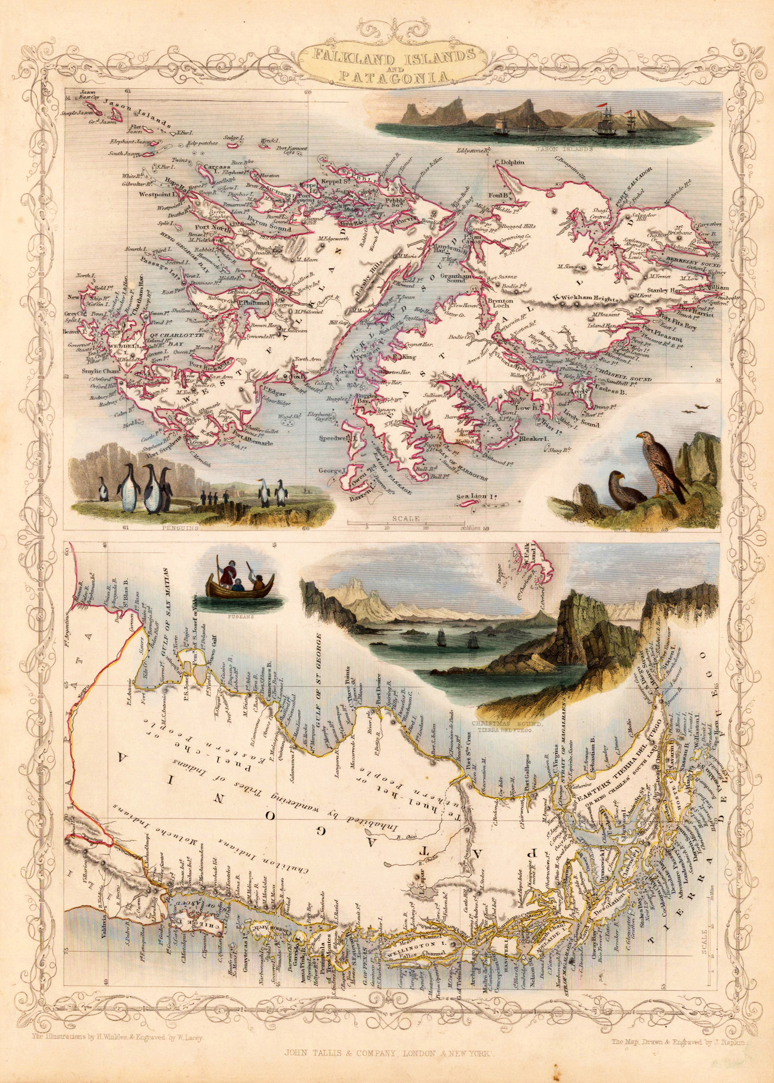
Steel engraving, hand colored in outline and wash. Decorative engraving showing the Falkland Islands and Patagonia, equipped with animals of the Southern hemisphere and decorative landscape.
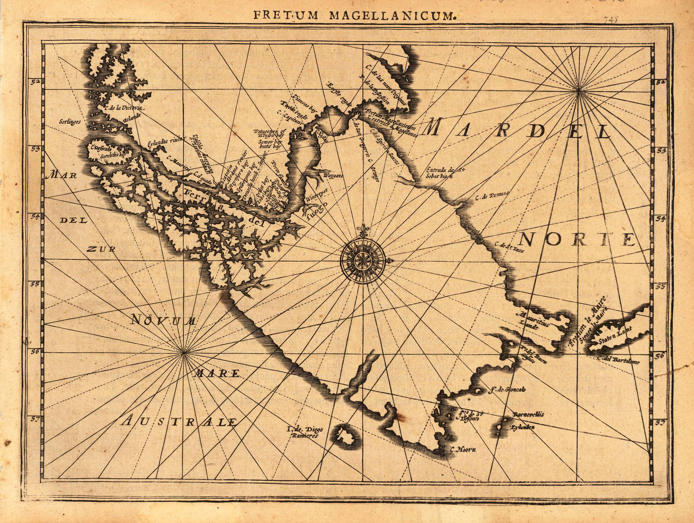
Copper engraving, uncolored as published.Original antique copper engraving, uncolored as published. A fine copy in a dark impression, full margins as published. The map shows the Magellan Street. This is the first so-called Cloppenburgh editions which was a competive edition with new engraved maps in a larger format. Most of the maps were engraved by Pieter van den Keere. The Cloppenburgh edition was continued for a couple of years but seems to have been suppressed after 1636 ... . This is another Cloppenburgh edition, now with Latin text. The maps from the Appendix have been incorporated. The title-page is followed by a dedication to Prince Frederik Hendrik, dated 1632 and signed by Johannes Cloppenburgh. (Koeman Atlantes Neerlandici). Gerardus Mercator (5 March 1512 – 2 December 1594) was a 16th-century geographer, cosmographer and cartographer from the County of Flanders. He is most renowned for creating the 1569 world map based on a new projection which represented sailing courses of constant bearing (rhumb lines) as straight lines—an innovation that is still employed in nautical charts. Mercator was one of the pioneers of cartography and is widely considered the most notable figure of the school in its golden age (approximately 1570s–1670s). In his own day, he was a notable as maker of globes and scientific instruments. In addition, he had interests in theology, philosophy, history, mathematics and geomagnetism. He was also an accomplished engraver and calligrapher. Unlike other great scholars of the age he travelled little and his knowledge of geography came from his library of over one thousand books and maps, from his visitors and from his vast correspondence (in six languages) with other scholars, statesmen, travellers, merchants and seamen. Mercator's early maps were in large formats suitable for wall mounting but in the second half of his life, he produced over 100 new regional maps in a smaller format suitable for binding into his Atlas of 1595. This was the first appearance of the word Atlas in reference to a book of maps. However, Mercator used it as a neologism for a treatise (Cosmologia) on the creation, history and description of the universe, not simply a collection of maps. He chose the word as a commemoration of the Titan Atlas, "King of Mauretania", whom he considered to be the first great geographer. A large part of Mercator's income came from sales of his terrestrial and celestial globes. For sixty years they were considered the finest in the world, and were sold in such great numbers that there are many surviving examples. This was a substantial enterprise involving the manufacture of the spheres, printing the gores, building substantial stands, packing and distributing all over Europe. He was also renowned for his scientific instruments, particularly his astrolabes and astronomical rings used to study the geometry of astronomy and astrology. Mercator wrote on geography, philosophy, chronology and theology. All of the wall maps were engraved with copious text on the region concerned. As an example the famous world map of 1569 is inscribed with over five thousand words in fifteen legends. The 1595 Atlas has about 120 pages of maps and illustrated title pages but a greater number of pages are devoted to his account of the creation of the universe and descriptions of all the countries portrayed. His table of chronology ran to some 400 pages fixing the dates (from the time of creation) of earthly dynasties, major political and military events, volcanic eruptions, earthquakes and eclipses. He also wrote on the gospels and the old testament. Mercator was a devout Christian born into a Catholic family at a time when Martin Luther's Protestantism was gaining ground. He never declared himself as a Lutheran but he was clearly sympathetic and he was accused of heresy by Catholic authorities; after six months in prison he was released unscathed. This period of persecution is probably the major factor in his move from Catholic Leuven (Louvain) to a more tolerant Duisburg, in the Holy Roman Empire, where he lived for the last thirty years of his life. Walter Ghim, Mercator's friend and first biographer, describes him as sober in his behaviour, yet cheerful and witty in company, and never more happy than in debate with other scholars. Above all he was pious and studious until his dying days. (Wikipedia)
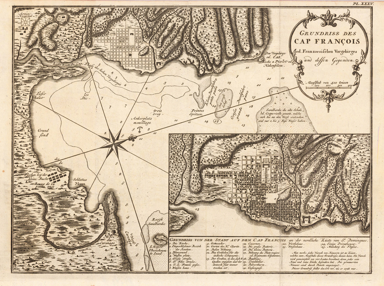
Copper engraving, uncolored as published. Detailed map showing the bay of 'Cap Francois' with an inset map of the city of Cap Francois. Below a table of explanations. On the map we find details like depths in the sea, sand banks, anchor places, etc. Detailed and interesting map engraved by Bellin after earlier voyages.
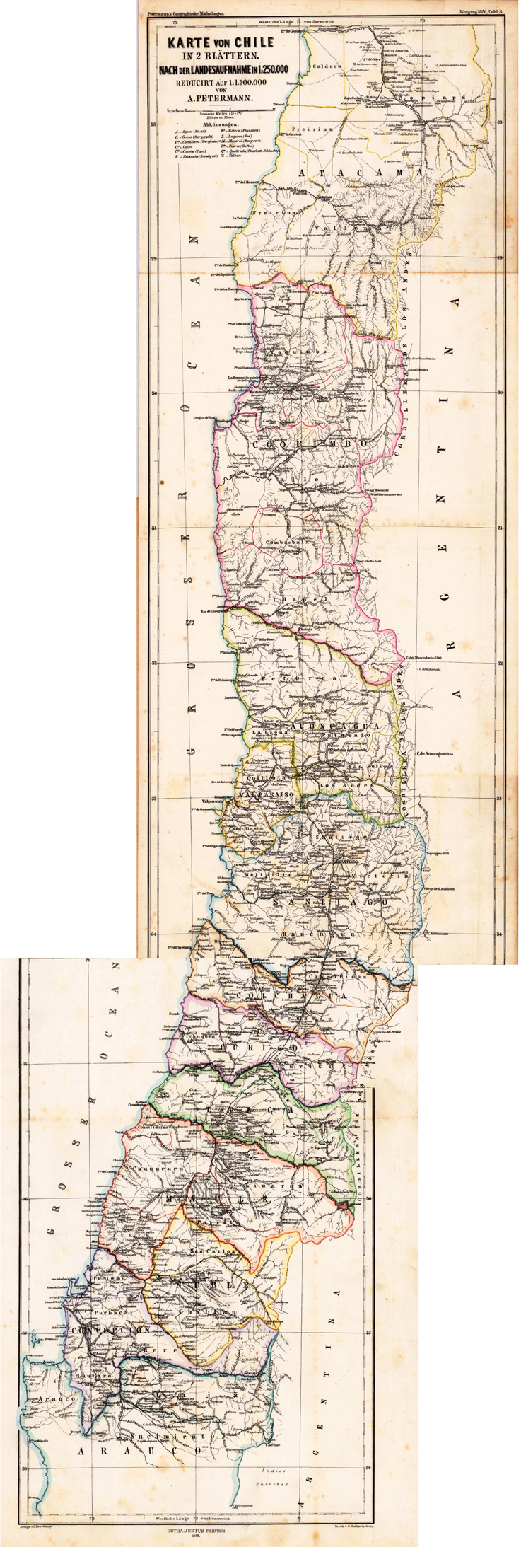
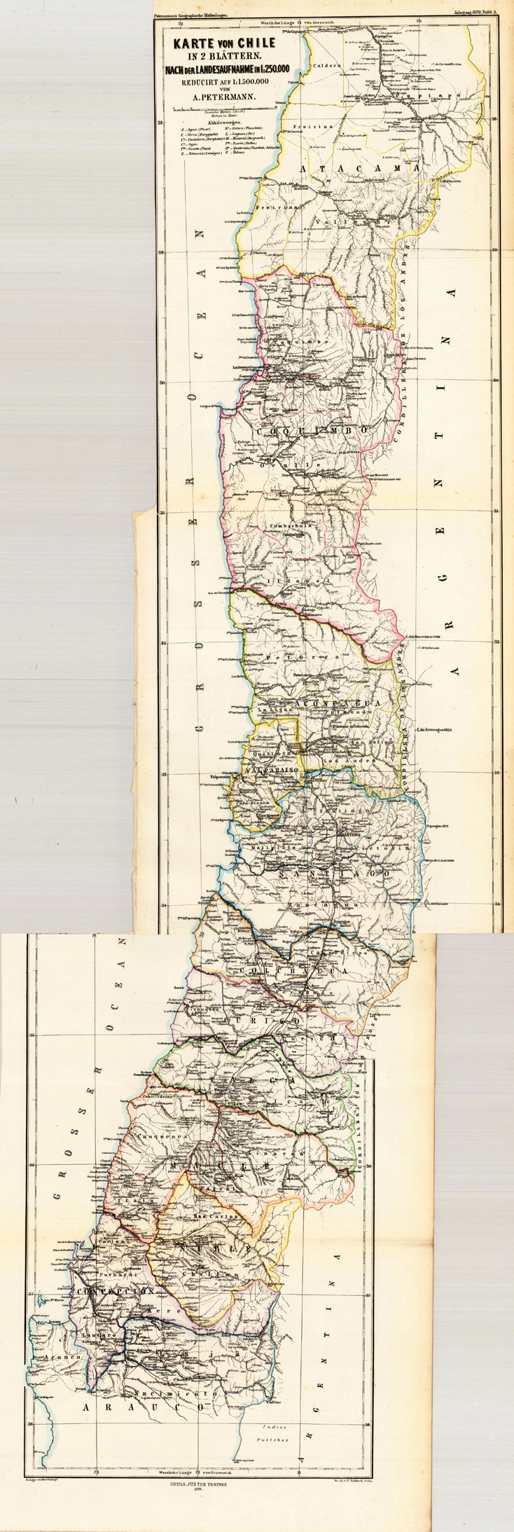
Lithograph, original color in outline. Dekorative alte Landkarte in 2 Blättern von Chile in Südamerika. Dargestellt wird Chile von der südlichen Provinz Arauco bis hin zur nördlichen Provinz Atacama. Gezeigt wird das Land Chile aufgeteilt in seine einzelnen Provinzen. Die politischen Grenzen sind in einem zeitgenössischem Grenzkolorit dargestellt. Mit vielen detaillierten Ortsangaben, eingezeichneten Namen von Provinzen und Gebieten, sowie Flüßen, Bergen, Seen und einigen Eisenbahnstrecken. Links oben beim Titel ein kleiner Meilenzeiger, sowie eine Legende mit Erklärungen zur Landkarte.
Lithograph, original color in outline. Dekorative alte Landkarte in 2 Blättern von Chile in Südamerika. Dargestellt wird Chile von der südlichen Provinz Arauco bis hin zur nördlichen Provinz Atacama. Gezeigt wird das Land Chile aufgeteilt in seine einzelnen Provinzen. Die politischen Grenzen sind in einem zeitgenössischem Grenzkolorit dargestellt. Mit vielen detaillierten Ortsangaben, eingezeichneten Namen von Provinzen und Gebieten, sowie Flüßen, Bergen, Seen und einigen Eisenbahnstrecken. Links oben beim Titel ein kleiner Meilenzeiger, sowie eine Legende mit Erklärungen zur Landkarte.
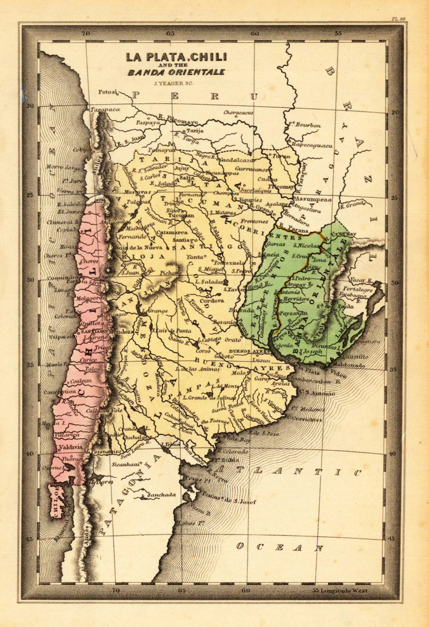
Steel engraving, hand colored in outline and wash when published. This fine small engraved old map shows La Plata, Chili and the Banda Orientale. This rare antique original map was published by Carey & Lea in Philadelphia in a small pocket atlas. Detailed engraved with place names, rivers and mountain chains.
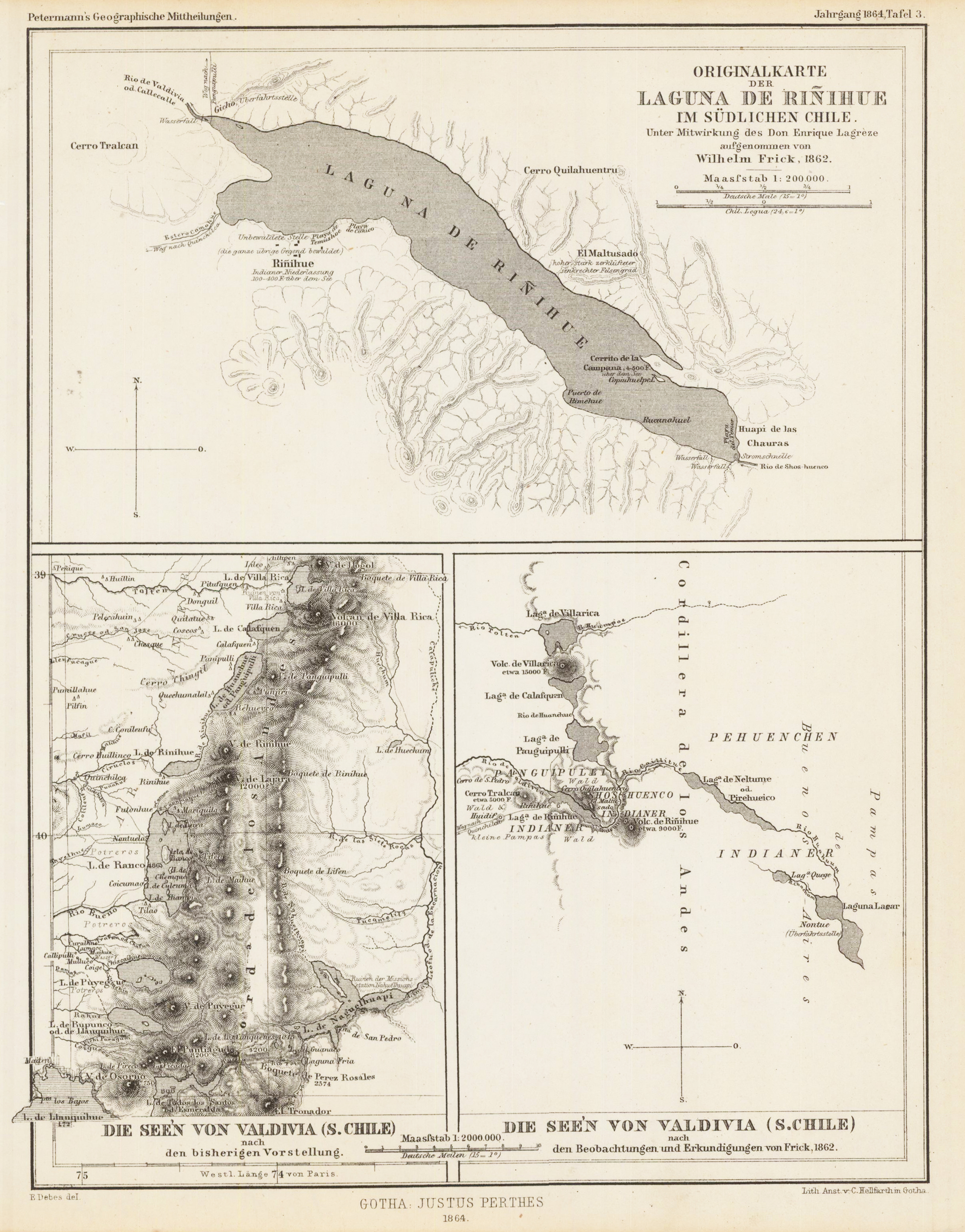
Lithograph, original color in outline, engraved by E. Debes. Three maps on one sheet. The top map is of the Laguna de Rinihue. The lower two show the lakes of Valdivia. August Heinrich Petermann (born April 18, 1822 in Bleicherode; † September 25, 1878 in Gotha (suicide)) was one of the most famous geographers and cartographers of the 19th century. Cartographic services August Petermann is considered an excellent, internationally highly respected cartographer. After his training in Potsdam he worked in Edinburgh with Alexander Keith Johnston with British scholars, navigators and explorers on the English edition of Berghaus' Physical Atlas. His maps of population density and the spread of cholera in England stand out from the London era, illustrating not only social aspects of infectious diseases in the early stages of their medical research. With them, Petermann joined the founding generation of thematic maps. With the maps for Petermanns Mitteilungen, such more topographical characters come to the fore. The publisher of the magazine benefited from innovations in card technology in Gotha: Bernhardt Perthes (1821–1857, grandson of the company founder) had developed an electro-chemical process for duplicating copperplate plates with electroplating, which drastically reduced the amount of work and time required allowed the production of map excerpts. Emil von Sydow had brought color lithography to production maturity in card manufacture, which also increased productivity and made it possible to use color on a broad scale for conveying information in cards. After more than a decade of practice, both card technologies had their teething problems and the combination of both techniques in card production behind them. With great organizational talent, Petermann turned this lead into a best seller. Since Petermann not only reconstructed the travel routes but also integrated them into maps, many authors saw this as a great advantage and turned to the communications for the purpose of implementation, which was usually done quickly and in an appealing quality. No magazine was published without a map insert, and 25 to 35 map inserts were published per year. The development effort for this was comparable to that for a school atlas. The synthetic approach in the presentation of the new discoveries sometimes brought hypothetical aspects with it, which led to annoyance or even controversy between the authors and the very self-confident editor. These maps were not only used for communications, they were also important sources for the three revised editions of Stieler's Hand-Atlas, in which Petermann played a decisive role. The redesign of the hand atlases is thanks to his influence. The scales were converted to the international metric system. In addition to the politico-geographical statements, physical-geographical statements such as the representation of deserts, periodically water-bearing rivers, numbers for sea depths, height numbers, names of peaks, etc. have been added to larger-scale additional maps for areas of high population density. With the growth of cities in the 19th century, the representation of places became more dense, and an objectified, leaner, but still legible font was developed for the increased names. In Hermann Berghaus and Carl Vogel (1828–1897), Petermann was assisted by outstanding cartographers, and Vogel in particular developed a significantly improved relief representation in hatches. The high content density and display quality repeatedly resulted in complaints about black copies. The development of the atlas maps in the division of labor between up to seven map processors, engravers, lithographers, printers and other workers required the development of a specific business organization. The changeover from the publishing system to the factory system, begun by publisher Bernhardt Perthes, also required Petermann's organizational talent after his early death. But experts at Gothaer Anstalt disagree with the view that Petermann had a managerial function. It cannot be overlooked that Petermann developed little sense for theoretical questions of cartography and he faced the upswing in the natural sciences of his time as an autodidact. (Wikipedia)
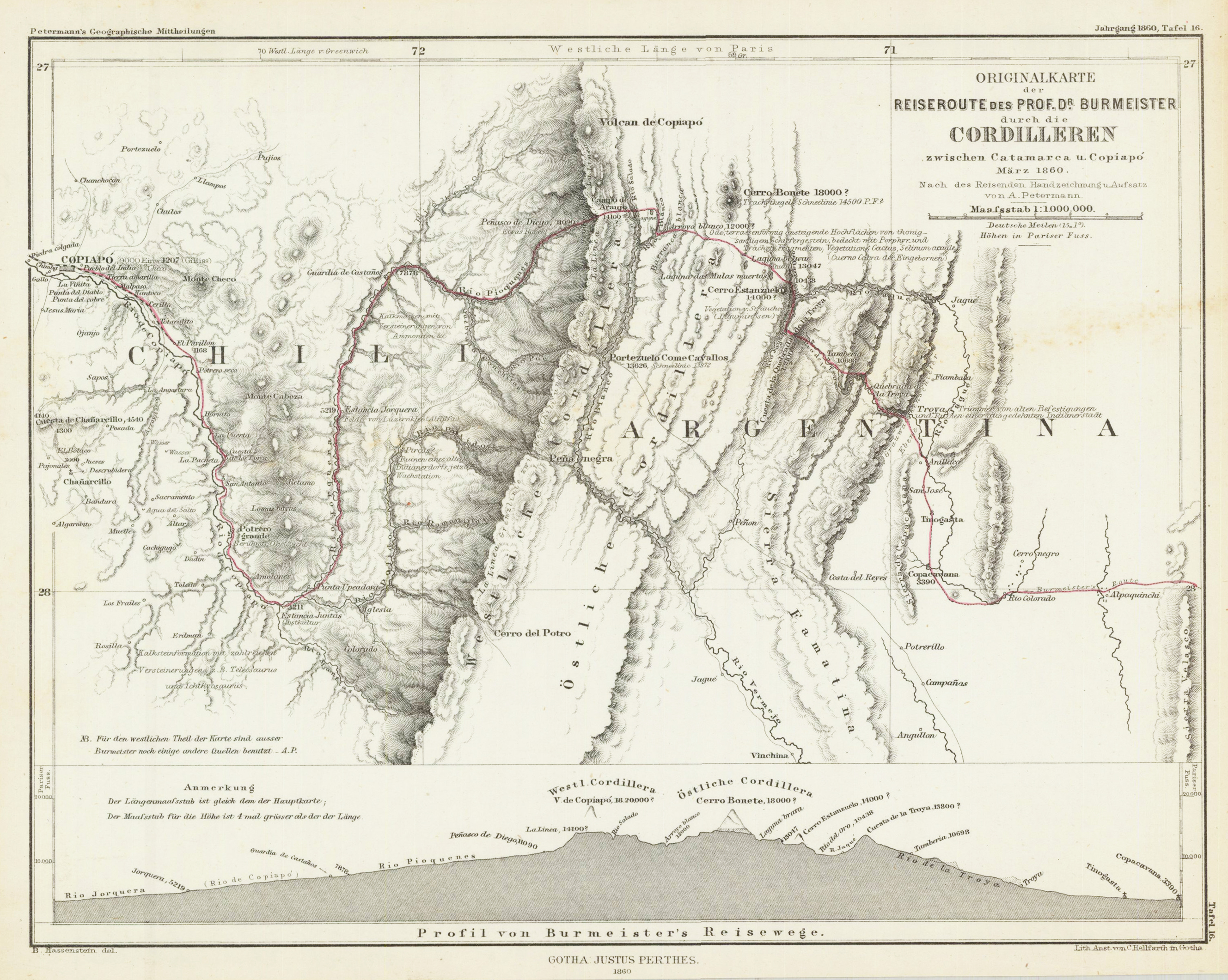
Lithograph, original hand colored in outline when published. This map shows Prof. Burmeister's route through Chile and Argentina. August Heinrich Petermann (born April 18, 1822 in Bleicherode; † September 25, 1878 in Gotha (suicide)) was one of the most famous geographers and cartographers of the 19th century. August Petermann is considered an excellent, internationally highly respected cartographer. After his training in Potsdam he worked in Edinburgh with Alexander Keith Johnston with British scholars, navigators and explorers on the English edition of Berghaus' Physical Atlas. His maps of population density and the spread of cholera in England stand out from the London era, illustrating not only social aspects of infectious diseases in the early stages of their medical research. With them, Petermann joined the founding generation of thematic maps. With the maps for Petermanns Mitteilungen, such more topographical characters come to the fore. The publisher of the magazine benefited from innovations in card technology in Gotha: Bernhardt Perthes (1821–1857, grandson of the company founder) had developed an electro-chemical process for duplicating copperplate plates with electroplating, which drastically reduced the amount of work and time required allowed the production of map excerpts. Emil von Sydow had brought color lithography to production maturity in card manufacture, which also increased productivity and made it possible to use color on a broad scale for conveying information in cards. After more than a decade of practice, both card technologies had their teething problems and the combination of both techniques in card production behind them. With great organizational talent, Petermann turned this lead into a best seller. Since Petermann not only reconstructed the travel routes but also integrated them into maps, many authors saw this as a great advantage and turned to the communications for the purpose of implementation, which was usually done quickly and in an appealing quality. No magazine was published without a map insert, and 25 to 35 map inserts were published per year. The development effort for this was comparable to that for a school atlas. The synthetic approach in the presentation of the new discoveries sometimes brought hypothetical aspects with it, which led to annoyance or even controversy between the authors and the very self-confident editor. These maps were not only used for communications, they were also important sources for the three revised editions of Stieler's Hand-Atlas, in which Petermann played a decisive role. The redesign of the hand atlases is thanks to his influence. The scales were converted to the international metric system. In addition to the politico-geographical statements, physical-geographical statements such as the representation of deserts, periodically water-bearing rivers, numbers for sea depths, height numbers, names of peaks, etc. have been added to larger-scale additional maps for areas of high population density. With the growth of cities in the 19th century, the representation of places became more dense, and an objectified, leaner, but still legible font was developed for the increased names. In Hermann Berghaus and Carl Vogel (1828–1897), Petermann was assisted by outstanding cartographers, and Vogel in particular developed a significantly improved relief representation in hatches. The high content density and display quality repeatedly resulted in complaints about black copies. The development of the atlas maps in the division of labor between up to seven map processors, engravers, lithographers, printers and other workers required the development of a specific business organization. The changeover from the publishing system to the factory system, begun by publisher Bernhardt Perthes, also required Petermann's organizational talent after his early death. But experts at Gothaer Anstalt disagree with the view that Petermann had a managerial function. It cannot be overlooked that Petermann developed little sense for theoretical questions of cartography and he faced the upswing in the natural sciences of his time as an autodidact. (Wikipedia)
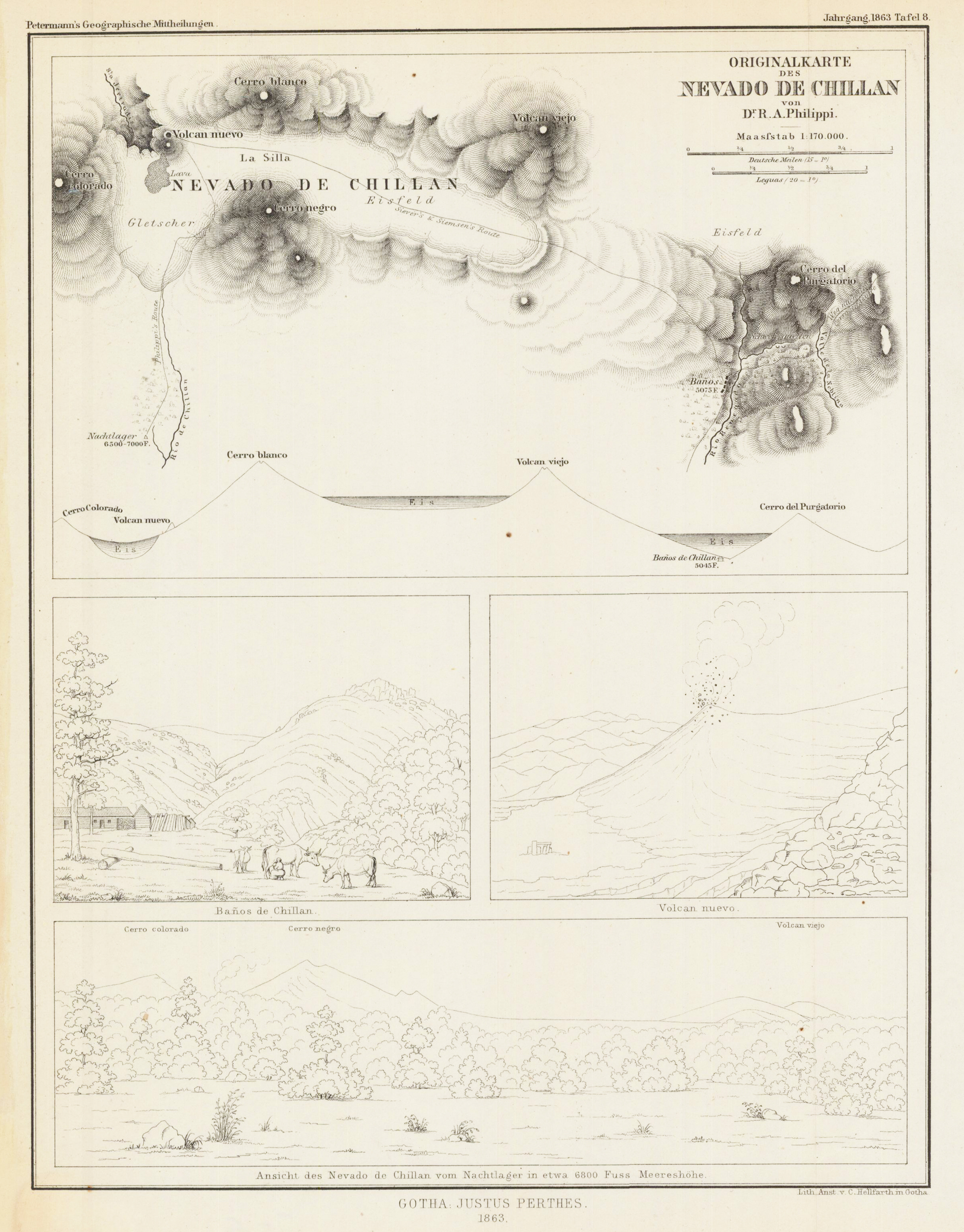
Lithograph, uncolored as published. August Heinrich Petermann (born April 18, 1822 in Bleicherode; † September 25, 1878 in Gotha (suicide)) was one of the most famous geographers and cartographers of the 19th century. Cartographic services August Petermann is considered an excellent, internationally highly respected cartographer. After his training in Potsdam he worked in Edinburgh with Alexander Keith Johnston with British scholars, navigators and explorers on the English edition of Berghaus' Physical Atlas. His maps of population density and the spread of cholera in England stand out from the London era, illustrating not only social aspects of infectious diseases in the early stages of their medical research. With them, Petermann joined the founding generation of thematic maps. With the maps for Petermanns Mitteilungen, such more topographical characters come to the fore. The publisher of the magazine benefited from innovations in card technology in Gotha: Bernhardt Perthes (1821–1857, grandson of the company founder) had developed an electro-chemical process for duplicating copperplate plates with electroplating, which drastically reduced the amount of work and time required allowed the production of map excerpts. Emil von Sydow had brought color lithography to production maturity in card manufacture, which also increased productivity and made it possible to use color on a broad scale for conveying information in cards. After more than a decade of practice, both card technologies had their teething problems and the combination of both techniques in card production behind them. With great organizational talent, Petermann turned this lead into a best seller. Since Petermann not only reconstructed the travel routes but also integrated them into maps, many authors saw this as a great advantage and turned to the communications for the purpose of implementation, which was usually done quickly and in an appealing quality. No magazine was published without a map insert, and 25 to 35 map inserts were published per year. The development effort for this was comparable to that for a school atlas. The synthetic approach in the presentation of the new discoveries sometimes brought hypothetical aspects with it, which led to annoyance or even controversy between the authors and the very self-confident editor. These maps were not only used for communications, they were also important sources for the three revised editions of Stieler's Hand-Atlas, in which Petermann played a decisive role. The redesign of the hand atlases is thanks to his influence. The scales were converted to the international metric system. In addition to the politico-geographical statements, physical-geographical statements such as the representation of deserts, periodically water-bearing rivers, numbers for sea depths, height numbers, names of peaks, etc. have been added to larger-scale additional maps for areas of high population density. With the growth of cities in the 19th century, the representation of places became more dense, and an objectified, leaner, but still legible font was developed for the increased names. In Hermann Berghaus and Carl Vogel (1828–1897), Petermann was assisted by outstanding cartographers, and Vogel in particular developed a significantly improved relief representation in hatches. The high content density and display quality repeatedly resulted in complaints about black copies. The development of the atlas maps in the division of labor between up to seven map processors, engravers, lithographers, printers and other workers required the development of a specific business organization. The changeover from the publishing system to the factory system, begun by publisher Bernhardt Perthes, also required Petermann's organizational talent after his early death. But experts at Gothaer Anstalt disagree with the view that Petermann had a managerial function. It cannot be overlooked that Petermann developed little sense for theoretical questions of cartography and he faced the upswing in the natural sciences of his time as an autodidact. (Wikipedia)
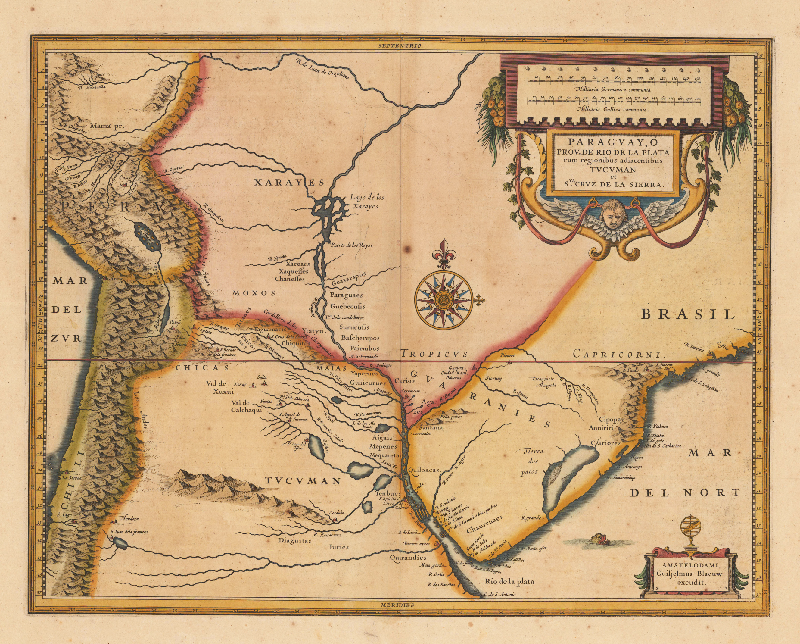
Original copper engraving, hand colored in outline and wash. Published in J. Blaeu's Theatrum in Amsterdam 1640-43 with Latin text verso. The fine antique hand colored map published by the Dutch cartographer Joan Blaeu depicts the region of Rio de la Plata in South America. In the upper right side this old map is beautiful ornated with a title cartouche and a mileage scale. In its centre a large compass rose was used to decorate this map of the Rio de la Plata region. In the Atlantic Ocean we find a fine engraved scene of a seamonster. Joan Blaeu (23 September 1596 – 21 December 1673) was a Dutch cartographer born in Alkmaar, the son of cartographer Willem Blaeu. In 1620 he became a doctor of law but he joined the work of his father. In 1635 they published the Atlas Novus (full title: Theatrum orbis terrarum, sive, Atlas novus) in two volumes. Joan and his brother Cornelius took over the studio after their father died in 1638. Joan became the official cartographer of the Dutch East India Company. Blaeu's world map, Nova et Accuratissima Terrarum Orbis Tabula, incorporating the discoveries of Abel Tasman, was published in 1648. This map was revolutionary in that it "depicts the solar system according to the heliocentric theories of Nicolaus Copernicus, which show the earth revolving around the sun.... Although Copernicus's groundbreaking book On the Revolutions of the Spheres had been first printed in 1543, just over a century earlier, Blaeu was the first mapmaker to incorporate this revolutionary heliocentric theory into a map of the world." Blaeu's map was copied for the map of the world set into the pavement of the Groote Burger-Zaal of the new Amsterdam Town Hall, designed by the Dutch architect Jacob van Campen (now the Amsterdam Royal Palace), in 1655. Blaeu's Hollandia Nova was also depicted in his Archipelagus Orientalis sive Asiaticus published in 1659 in the Kurfürsten Atlas (Atlas of the Great Elector). and used by Melchisédech Thévenot to produce his map, Hollandia Nova—Terre Australe (1664). As Joan Blaeu, he also published the 12 volume "Le Grand Atlas, ou Cosmographie blaviane, en laquelle est exactement descritte la terre, la mer, et le ciel". One edition is dated 1663. That was folio (540 x 340 mm), and contained 593 engraved maps and plates. In March 2015, a copy was on sale for £750,000. Around 1649 Joan Blaeu published a collection of Dutch city maps named Toonneel der Steeden (Views of Cities). In 1651 he was voted into the Amsterdam council. In 1654 Joan published the first atlas of Scotland, devised by Timothy Pont. In 1662 he reissued the Atlas Novus, also known as Atlas Maior, in 11 volumes, and one for oceans.[citation needed] A cosmology was planned as their next project, but a fire destroyed the studio completely in 1672. (Wikipedia)
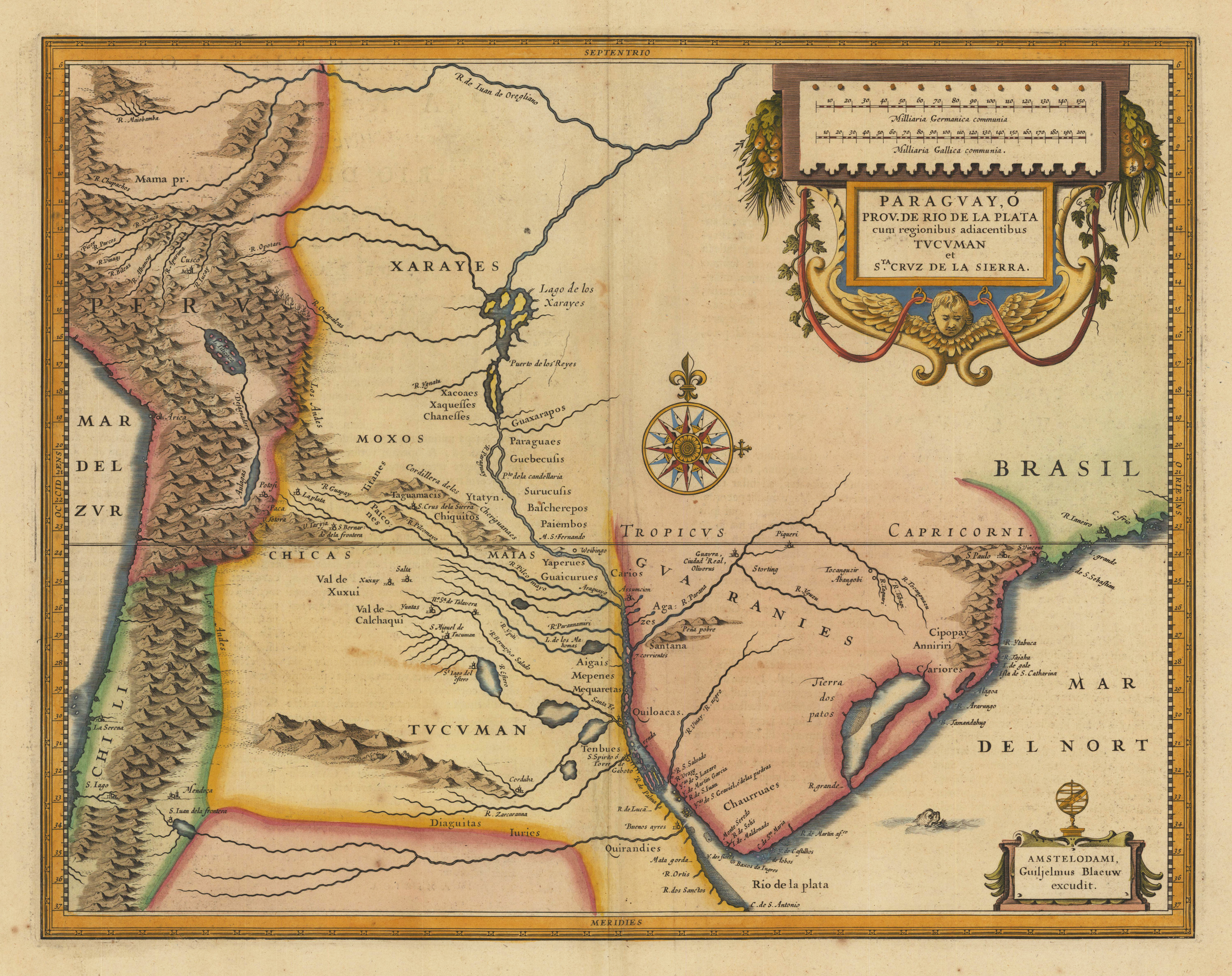
Original antique copper engraving, hand colored in outline and wash when published. The fine antique hand colored map published by the Dutch cartographer Joan Blaeu depicts the region of Rio de la Plata in South America. In the upper right side this old map is beautiful ornated with a title cartouche and a mileage scale. In its centre a large compass rose was used to decorate this map of the Rio de la Plata region. In the Atlantic Ocean we find a fine engraved scene of a seamonster. Joan Blaeu (23 September 1596 – 21 December 1673) was a Dutch cartographer born in Alkmaar, the son of cartographer Willem Blaeu. In 1620 he became a doctor of law but he joined the work of his father. In 1635 they published the Atlas Novus (full title: Theatrum orbis terrarum, sive, Atlas novus) in two volumes. Joan and his brother Cornelius took over the studio after their father died in 1638. Joan became the official cartographer of the Dutch East India Company. Blaeu's world map, Nova et Accuratissima Terrarum Orbis Tabula, incorporating the discoveries of Abel Tasman, was published in 1648. This map was revolutionary in that it "depicts the solar system according to the heliocentric theories of Nicolaus Copernicus, which show the earth revolving around the sun.... Although Copernicus's groundbreaking book On the Revolutions of the Spheres had been first printed in 1543, just over a century earlier, Blaeu was the first mapmaker to incorporate this revolutionary heliocentric theory into a map of the world." Blaeu's map was copied for the map of the world set into the pavement of the Groote Burger-Zaal of the new Amsterdam Town Hall, designed by the Dutch architect Jacob van Campen (now the Amsterdam Royal Palace), in 1655. Blaeu's Hollandia Nova was also depicted in his Archipelagus Orientalis sive Asiaticus published in 1659 in the Kurfürsten Atlas (Atlas of the Great Elector). and used by Melchisédech Thévenot to produce his map, Hollandia Nova—Terre Australe (1664). As Joan Blaeu, he also published the 12 volume "Le Grand Atlas, ou Cosmographie blaviane, en laquelle est exactement descritte la terre, la mer, et le ciel". One edition is dated 1663. That was folio (540 x 340 mm), and contained 593 engraved maps and plates. In March 2015, a copy was on sale for £750,000. Around 1649 Joan Blaeu published a collection of Dutch city maps named Toonneel der Steeden (Views of Cities). In 1651 he was voted into the Amsterdam council. In 1654 Joan published the first atlas of Scotland, devised by Timothy Pont. In 1662 he reissued the Atlas Novus, also known as Atlas Maior, in 11 volumes, and one for oceans.[citation needed] A cosmology was planned as their next project, but a fire destroyed the studio completely in 1672. (Wikipedia)
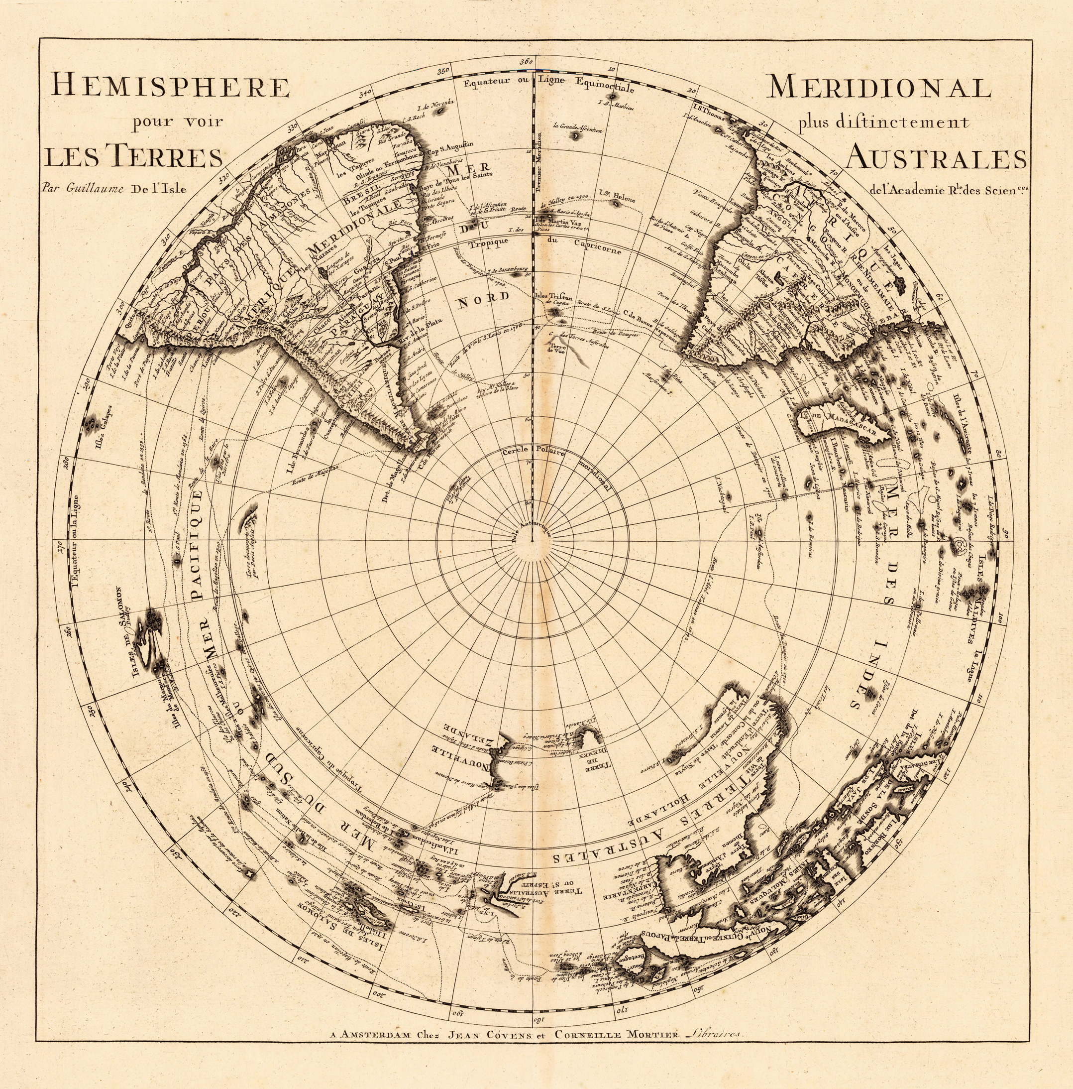
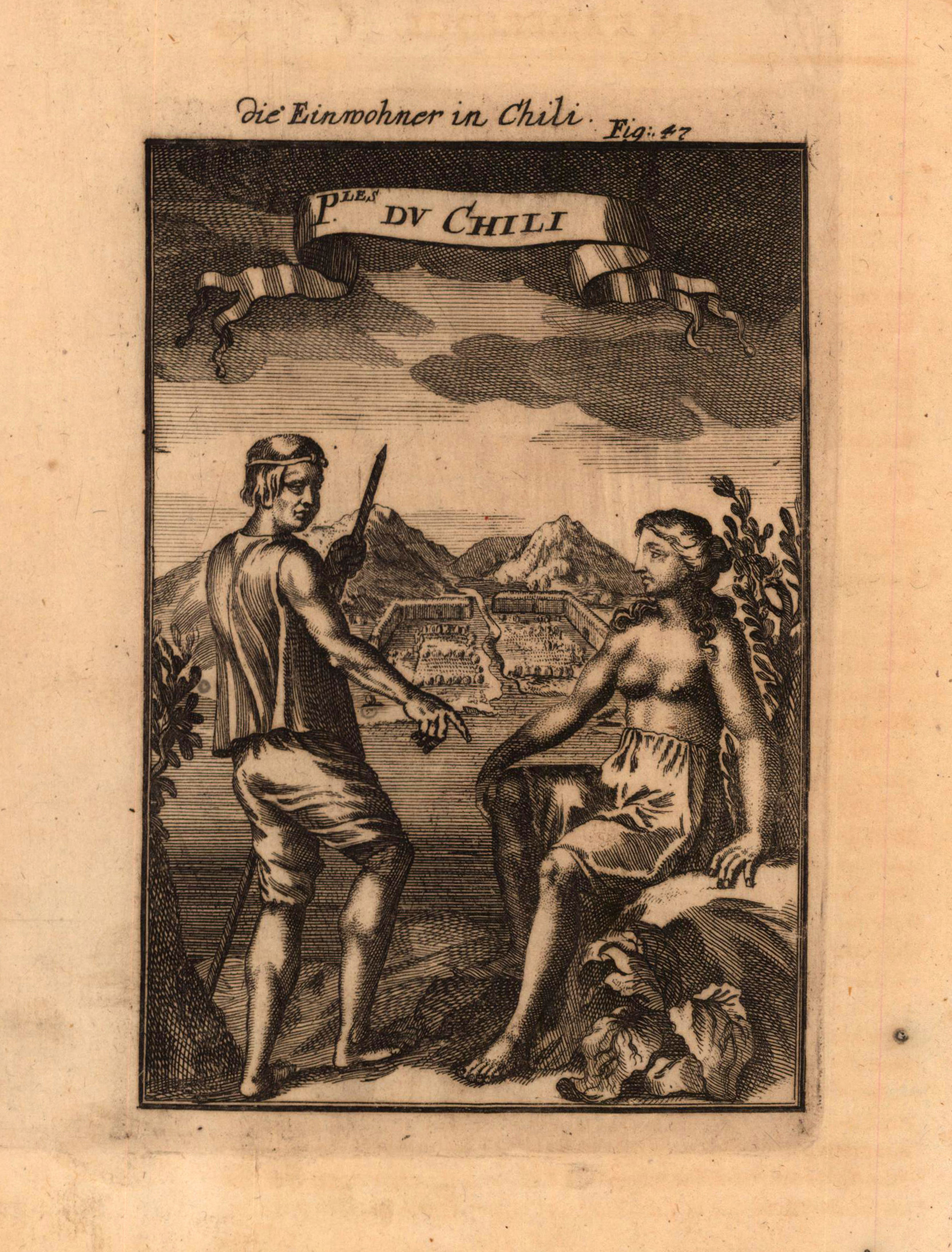
Copper engraving published in Allain M. Mallet's description of the world 'Description De L' Univers, Contenant Les Differents Systemes Du Monde, Les Cartes generales & particulieres ...'. French text edition with additional German titles on top.
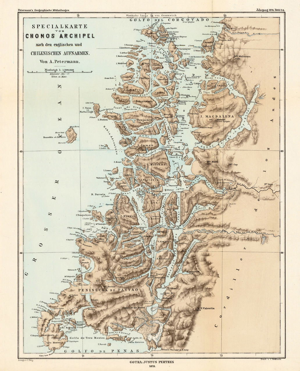
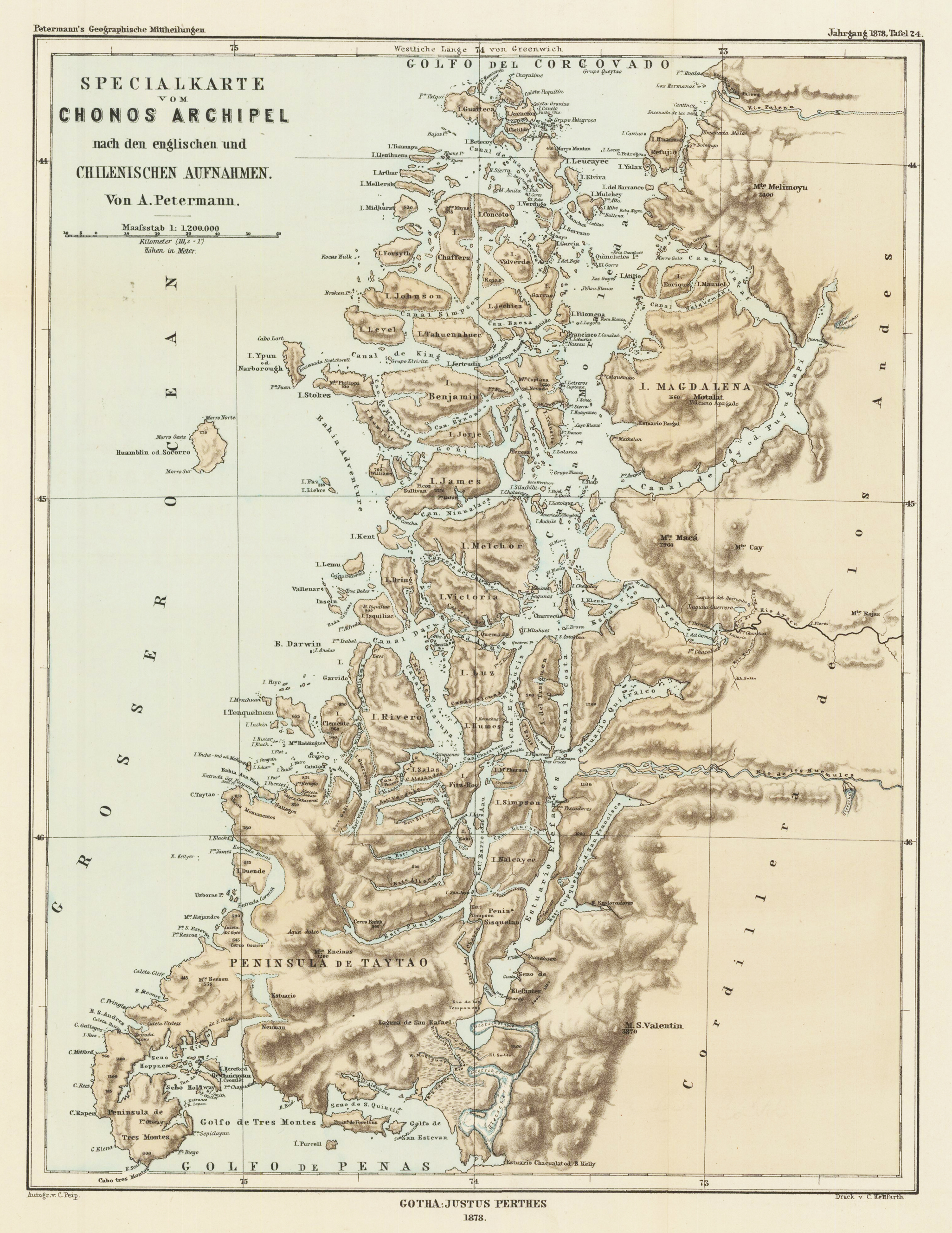
Lithograph, printed in colors when published. Detailled map, showing the Chonos Archipel from the gulf of Penas with the Peninsula de Taytao up to the gulf of Corcovado. Very detailled map with an enormous number of islands and peninsulas, most of them with place names. The map provides an overview of the results of the travel by Th. von Heugelin to Somalia. It is also ornated with a scene of birds and mammals, which were discovered by Th. Heugelin in Somali.
Lithograph, printed in colors when published. Detailled map, showing the Chonos Archipel from the gulf of Penas with the Peninsula de Taytao up to the gulf of Corcovado. Very detailled map with an enormous number of islands and peninsulas, most of them with place names. The map provides an overview of the results of the travel by Th. von Heugelin to Somalia. It is also ornated with a scene of birds and mammals, which were discovered by Th. Heugelin in Somali. August Heinrich Petermann (born April 18, 1822 in Bleicherode; † September 25, 1878 in Gotha (suicide)) was one of the most famous geographers and cartographers of the 19th century. August Petermann is considered an excellent, internationally highly respected cartographer. After his training in Potsdam he worked in Edinburgh with Alexander Keith Johnston with British scholars, navigators and explorers on the English edition of Berghaus' Physical Atlas. His maps of population density and the spread of cholera in England stand out from the London era, illustrating not only social aspects of infectious diseases in the early stages of their medical research. With them, Petermann joined the founding generation of thematic maps. With the maps for Petermanns Mitteilungen, such more topographical characters come to the fore. The publisher of the magazine benefited from innovations in card technology in Gotha: Bernhardt Perthes (1821–1857, grandson of the company founder) had developed an electro-chemical process for duplicating copperplate plates with electroplating, which drastically reduced the amount of work and time required allowed the production of map excerpts. Emil von Sydow had brought color lithography to production maturity in card manufacture, which also increased productivity and made it possible to use color on a broad scale for conveying information in cards. After more than a decade of practice, both card technologies had their teething problems and the combination of both techniques in card production behind them. With great organizational talent, Petermann turned this lead into a best seller. Since Petermann not only reconstructed the travel routes but also integrated them into maps, many authors saw this as a great advantage and turned to the communications for the purpose of implementation, which was usually done quickly and in an appealing quality. No magazine was published without a map insert, and 25 to 35 map inserts were published per year. The development effort for this was comparable to that for a school atlas. The synthetic approach in the presentation of the new discoveries sometimes brought hypothetical aspects with it, which led to annoyance or even controversy between the authors and the very self-confident editor. These maps were not only used for communications, they were also important sources for the three revised editions of Stieler's Hand-Atlas, in which Petermann played a decisive role. The redesign of the hand atlases is thanks to his influence. The scales were converted to the international metric system. In addition to the politico-geographical statements, physical-geographical statements such as the representation of deserts, periodically water-bearing rivers, numbers for sea depths, height numbers, names of peaks, etc. have been added to larger-scale additional maps for areas of high population density. With the growth of cities in the 19th century, the representation of places became more dense, and an objectified, leaner, but still legible font was developed for the increased names. In Hermann Berghaus and Carl Vogel (1828–1897), Petermann was assisted by outstanding cartographers, and Vogel in particular developed a significantly improved relief representation in hatches. The high content density and display quality repeatedly resulted in complaints about black copies. The development of the atlas maps in the division of labor between up to seven map processors, engravers, lithographers, printers and other workers required the development of a specific business organization. The changeover from the publishing system to the factory system, begun by publisher Bernhardt Perthes, also required Petermann's organizational talent after his early death. But experts at Gothaer Anstalt disagree with the view that Petermann had a managerial function. It cannot be overlooked that Petermann developed little sense for theoretical questions of cartography and he faced the upswing in the natural sciences of his time as an autodidact. (Wikipedia)