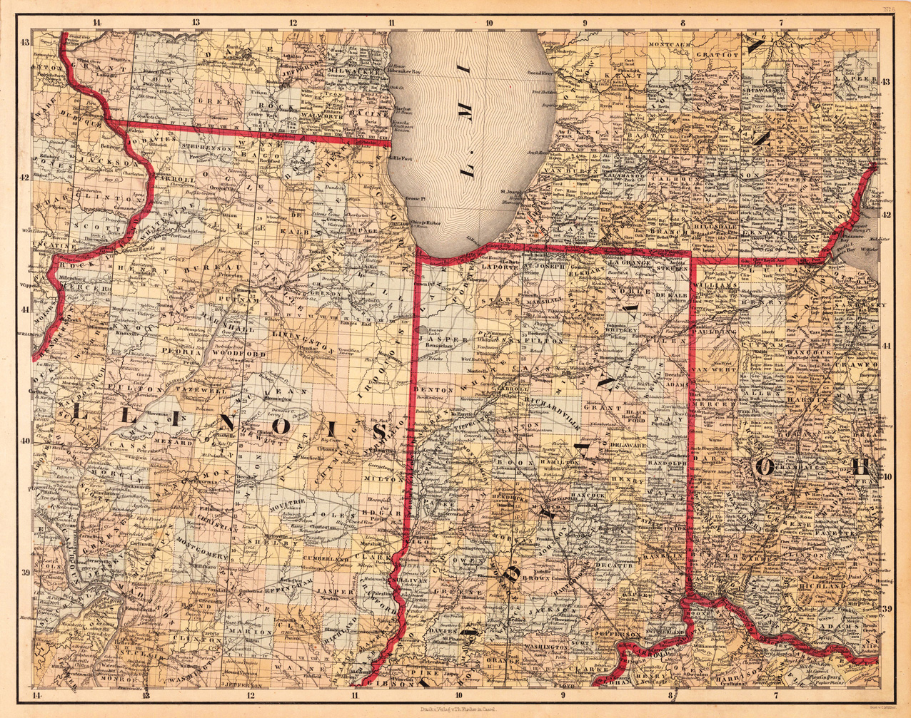
Lithograph, original color in outline and wash. This decorative map shows Illinois, Indiana and a part of Ohio. Further the southern part of Lake Michigan is shown. Inside the map are many place names, rivers, lakes, etc. engraved. The various counties are colored in wash and explicitly detailed named. This is one sheet (map no 6) of Calvin Smith's famous map of North America. Here is the rare version in lithograph present, published in Cassel in Germany. A splendid detailed map, showing nicely Illinois, Indiana, the southern part of Lake Michigan and adjacenting states. The map is highly detailed colored in outline and wash by counties and states, many place names, streets or routes, rivers, mountains, etc. are shown.
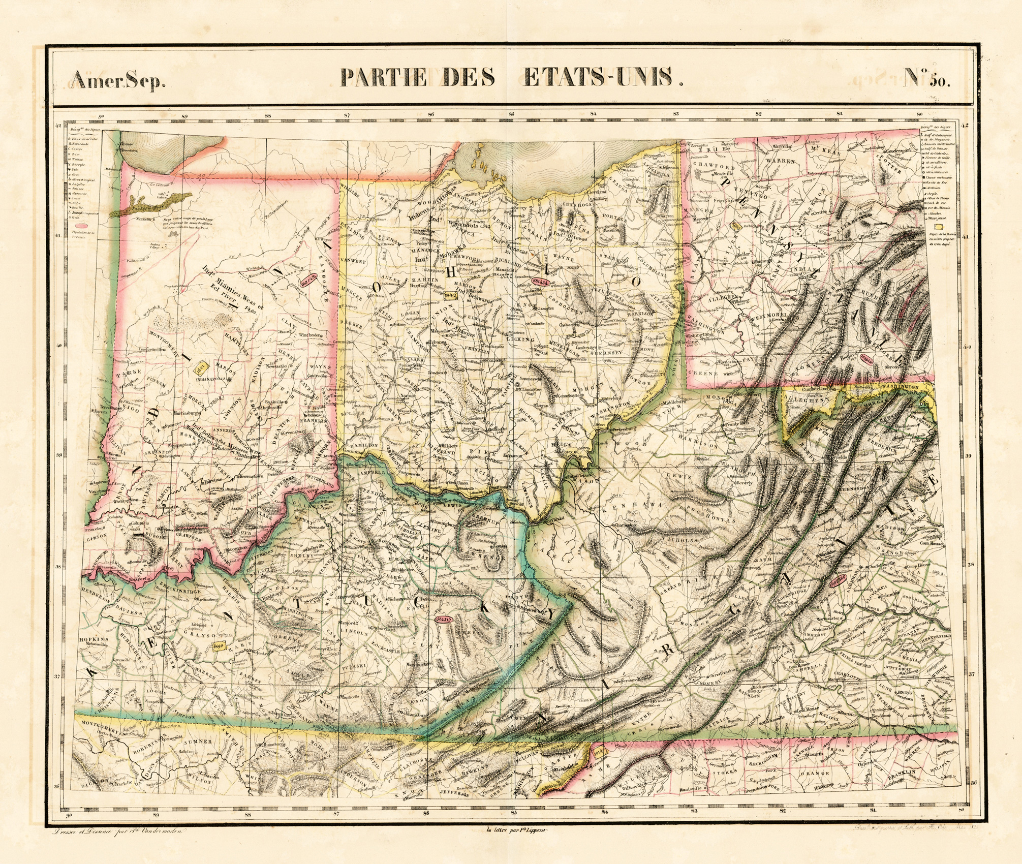
Lithograph, original hand colored in outline. The decorative colorful outline hand colored map shows in its centre Indian & Ohio, Kentucky and the adjacenting Virginia and Pennsylvania. It provides detailed information on place names, little streets and routes, rivers, lakes, mountains. Further the states are divided up into its counties in outline color.
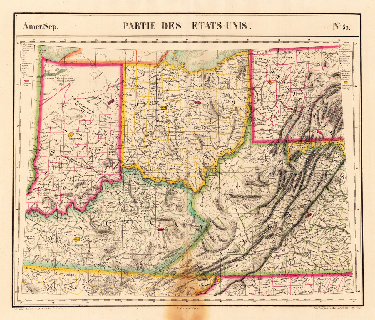
Lithograph, original hand colored in outline. The decorative colorful outline handcolored map shows in its centre Indian & Ohio, Kentucky and the adjacenting Virginia and Pennsylvania. It provides detailed information on place names, little streets and routes, rivers, lakes, mountains. Further the states are divided up into its counties in outline color. Overall size of the map circa 18 1/2 x 22 inches. The interesting map in vivid period hand color. At the lower centre fold and bottom marginal browning, affecting also slightly the engraved image of the map towards the border of Virginia, not really too disturbing. Verso a small mending.
Copper engraving, hand colored in outline and wash when published. Fine engraved map of the state of Ohio showing various rivers, trails, streets, villages and small place names. Ohio is divided up into its counties in original wash hand color. The map is surrounded by descriptive text on Ohio providing information on the climate, the rivers, cities and its history. A nice and decorative map of the state of Ohio. French edition of the 1822 in Philadelphia published map by Carey & Lea. The actual map, which is surrounded by text, has the size of approx. 11 1/2 x 9 1/2 inches.
Steel engraving, hand colored in outline when published. This antique map shows the Great Lakes with the Midwest Illinois, Indiana, Ohio, Kentucky & Tennessee and the western neighbouring Missouri. The map has three inset maps which are showing the surrounding of Nashville, Cincinnati and Lexington. Inside the map are many place names, rivers, lakes, etc. engraved. A interesting and detailed map of the Midwest of United States for the beginning collector of antique maps of the United States.
Lithograph, original color in outline and wash. This detailed map shows the state of Ohio and Indiana. Equipped in the lower right corner with a print view of the State Capitol at Columbus. This variation here with the vignette view on the map appeared only for a short period. Inside the map are many place names, rivers, etc. engraved. At the top of the map we look at Lake Erie and the Lake Michigan.
Lithograph, hand colored in outline and wash. Detailed map of the state of Minnesota, colored by counties and showing townships, towns, villages, post offices, canals, roads, railroads (projected and completed), towns, etc. A highly detailed map.
Original antique steel engraving, hand colored in outline when published. On this sheet of the SDUK North America are the states Illinois, Missouri (with the Sioux District) and Indiana. The title and the mileage scale are outside the image.
Copper engraving, hand colored in outline and wash. Interesting old map depicting in the centre of the ,Great Lakes' in Eastern Canada. This antique map has a lot of information on the names of forts, rivers, lakes, mountains and Indian tribes of the various regions. Published in Paris around 1780 in an atlas by M. Bonne. Rigobert Bonne (1727-1794) was a French cartographer of the late 18th century. He studied in Paris and practiced cartography. He became a skilled cartographer and hydrographer and became a royal hydrographer at the ,Depot de la Marine' in 1773. In 1780 he engraved and published the maps for Abbe Raynal's work ,Atlas de Toutes Les Parties Connues du Globe Terrestre'. He also published many charts for the ,Depot de la Marine', further he engraved the maps for the ,Atlas Encyclopedique' in 1788 together with Nicholas Desmarest.