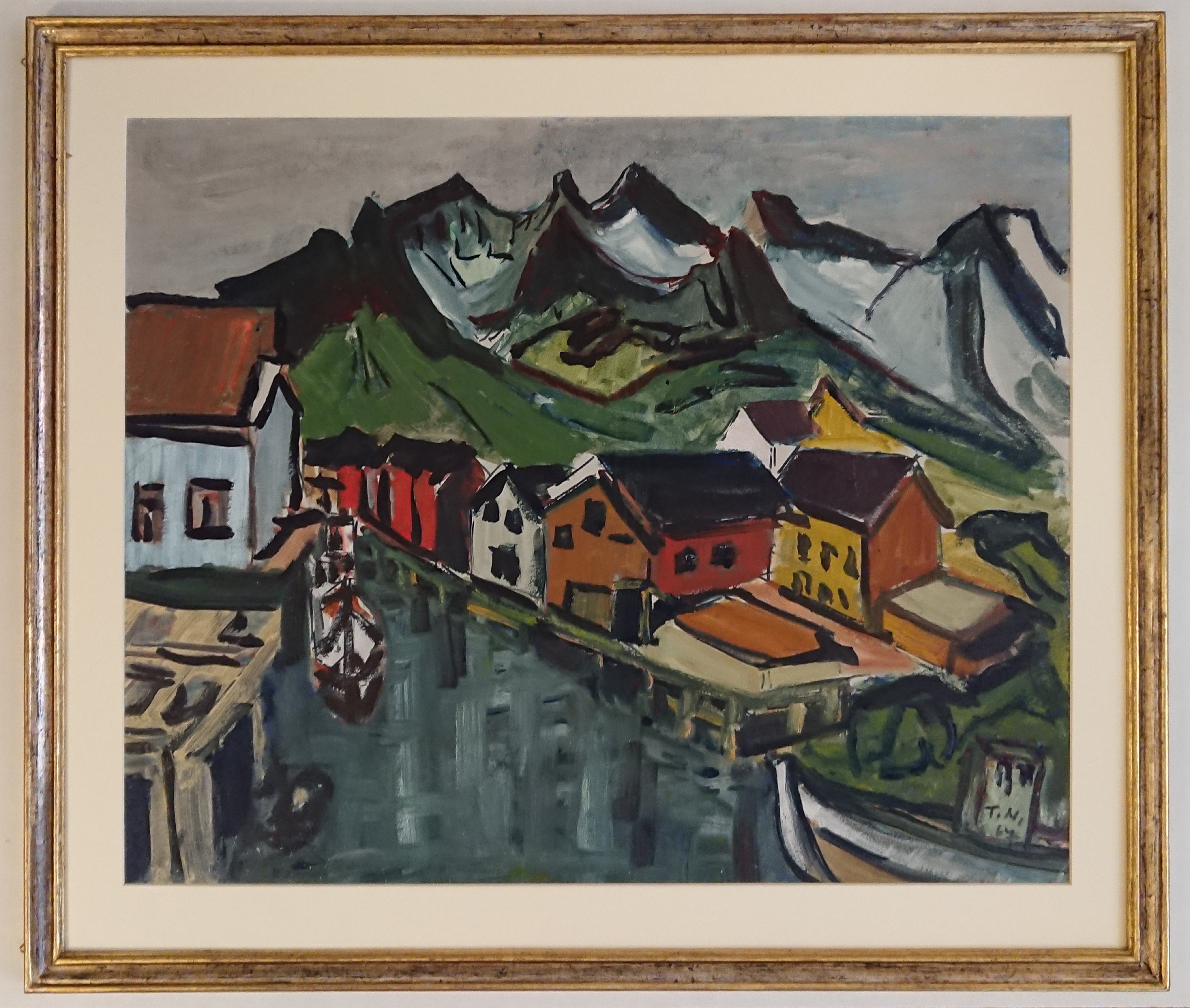
Oil on hardboard. Signed lower right "T.N." and dated (19)67. Port city on the Lofoten Islands in northern Norway. Thomas Niederreuther (* July 1, 1909 in Munich; † January 23, 1990 in Munich) was a German businessman, painter and writer. Niederreuther studied Economics, political science and sociology in Hamburg, Berlin and Munich. After his doctorate, he took over the family business, a delicatessen trading company. He learned painting and writing autodidactically, painting among other things through numerous trips to Europe and the USA. In 1949 he became a member of the Neue Gruppe, an association of fine artists in Munich, in whose group exhibitions in the Haus der Kunst he regularly took part from 1949. His work was shown for the first time in a solo exhibition in Munich, Mannheim and Cologne in 1962. Thomas Niederreuther was a member of the Deutscher Künstlerbund, founded in 1984 he and his son Tomy set up the Niederreuther Foundation to promote Bavarian painters and to collect theirs r works. He was friendly with the painter Josef Fottner, among others. Niederreuther has published five novels and several volumes of short stories. There are also three books of aphorisms. His 80th birthday in 1989 is celebrated with exhibitions by the Hierling Gallery and the Munich City Museum. A year later the artist dies in Munich. (Wikipedia)
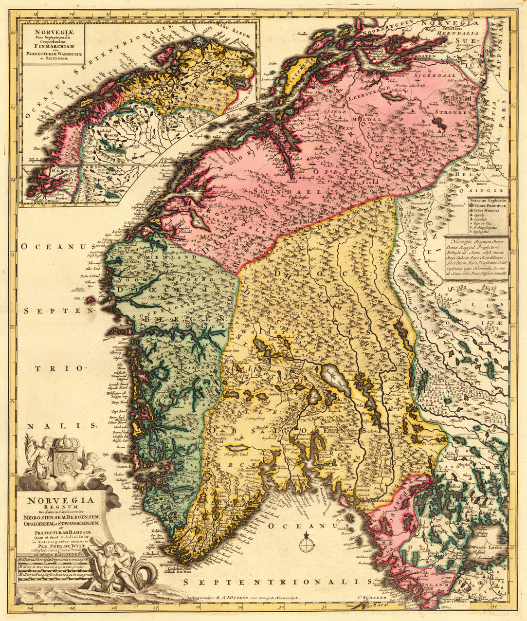
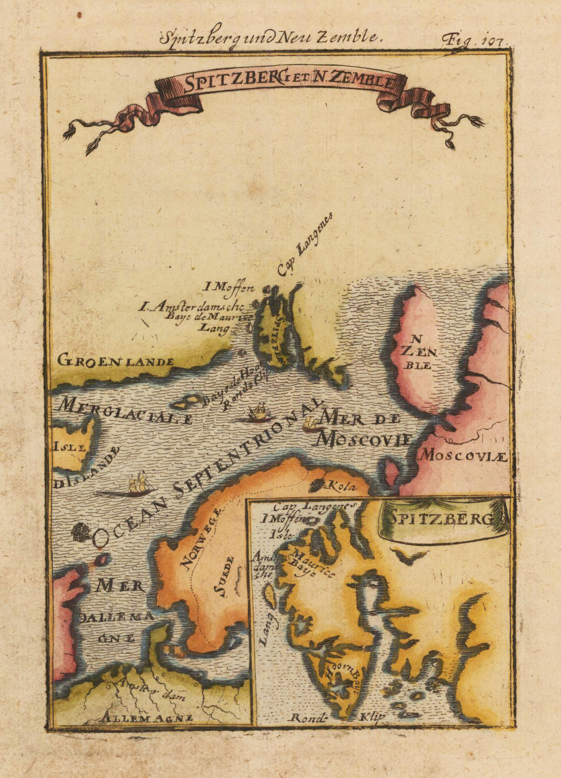
Copper engraving, hand colored in wash.
Frederik de Wit (born Frederik Hendriksz; c. 1629 – July 1706) was a Dutch cartographer and artist. The first cartographic images that De Wit engraved were a plan of Haarlem that has been dated to 1648,[8] and sometime before 1649, De Wit engraved the city views – city maps for the cities of Rijsel and Doornik that appeared in the richly illustrated Flandria Illustrata by the Flemish historian, Antonius Sanderus.
The first charts engraved by De Wit were published in 1654 under the "De Drie Crabben" address. The first map that was both engraved and dated by De Wit was that of Denmark: "Regni Daniæ Accuratissima delineatio Perfeckte Kaerte van 't Conjnckryck Denemarcken" in 1659. His first world maps, "Nova Totius Terrarum Orbis Tabula Auctore F. De Wit" (approx. 43 × 55 cm) and Nova Totius Terrarum Orbis Tabula (a wall map approx. 140 × 190 cm) appeared around 1660.
His Atlas began to appear around 1662 and by 1671 included anywhere from 17 to 151 maps each. In the 1690s, he began to use a new title page "Atlas Maior" but continued to use his old title page. His atlas of the Low Countries first published in 1667, was named Nieuw Kaertboeck van de XVII Nederlandse Provinciën and contained 14 to 25 maps. De Wit quickly expanded upon his first small folio atlas which contained mostly maps printed from plates that he had acquired, to an atlas with 27 maps engraved by or for him.
By 1671, he was publishing a large folio atlas with as many as 100 maps. Smaller atlases of 17 or 27 or 51 maps could still be purchased and by the mid-1670s an atlas of as many as 151 maps and charts could be purchased from his shop. His atlases cost between 7 and 20 Guilders depending on the number of maps, color and the quality of binding (€47 or $70 to €160 or $240 today). In about 1675, De Wit released a new nautical atlas. The charts in this atlas replaced the earlier charts from 1664 that are known today in only four bound examples and a few loose copies. De Wit's new charts were sold in a chart book and as part of his atlases. De Wit published no fewer than 158 land maps and 43 charts on separate folio sheets.
In 1695, De Wit began to publish a town atlas of the Netherlands after he acquired a large number of city plans at the auction of the famous Willem Blaeu publishing firm's printing plates. Dating De Wit's atlases is considered difficult because usually no dates were recorded on the maps and their dates of publication extended over many years. (Wikipedia)
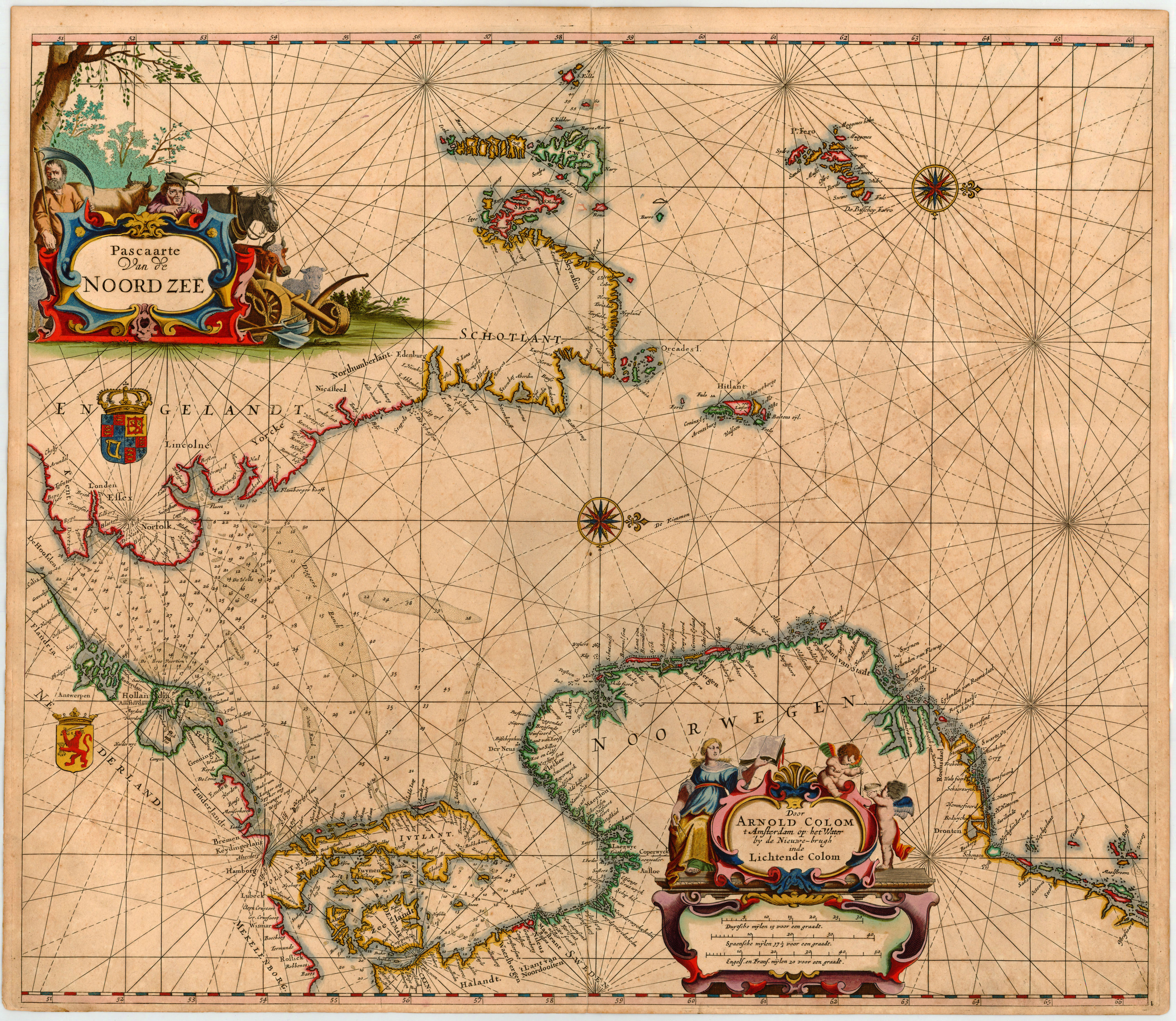
Copper engraving, finely hand colored in outline in the period when published. This sea chart by Arnold Colom was published 1658 in his very rare sea atlas 'Zee Atlas Ofte Water-Wereldt'. The entire sea atlas contents only 17 maps plus a world map. His atlas was shortly published after J. Janssonius's 'Atlas Maritimus (1650), which was part of the five volume Atlas Novus. Detailed sea chart of the German Sea from the English coast in the west extending towards Jutland, Denmark, Sweden and Norway orientated with the north to the right. Equipped with two decorative allegoric engraved title cartouches. Printed on thick atlas paper, with full margins as published. The title cartouches, compass roses and the coat of arms heightened in gold.
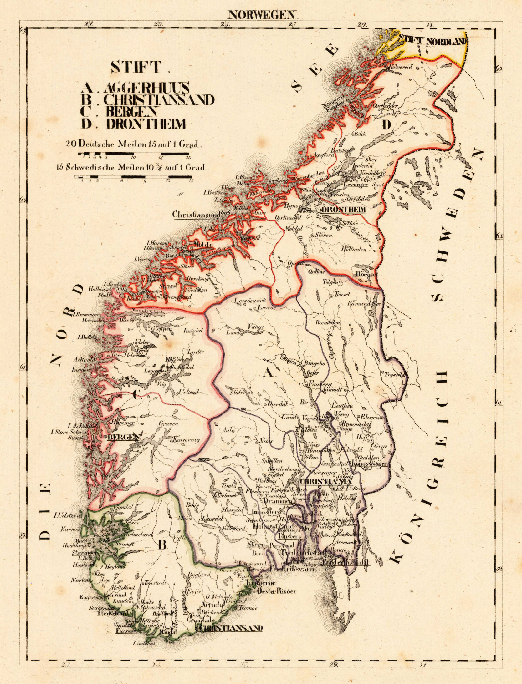
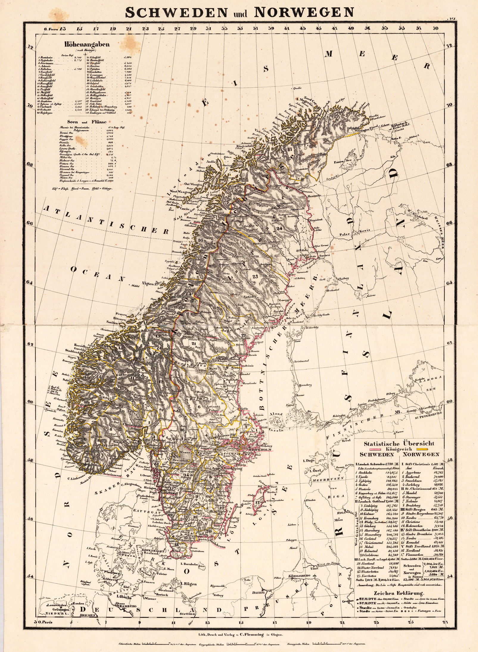
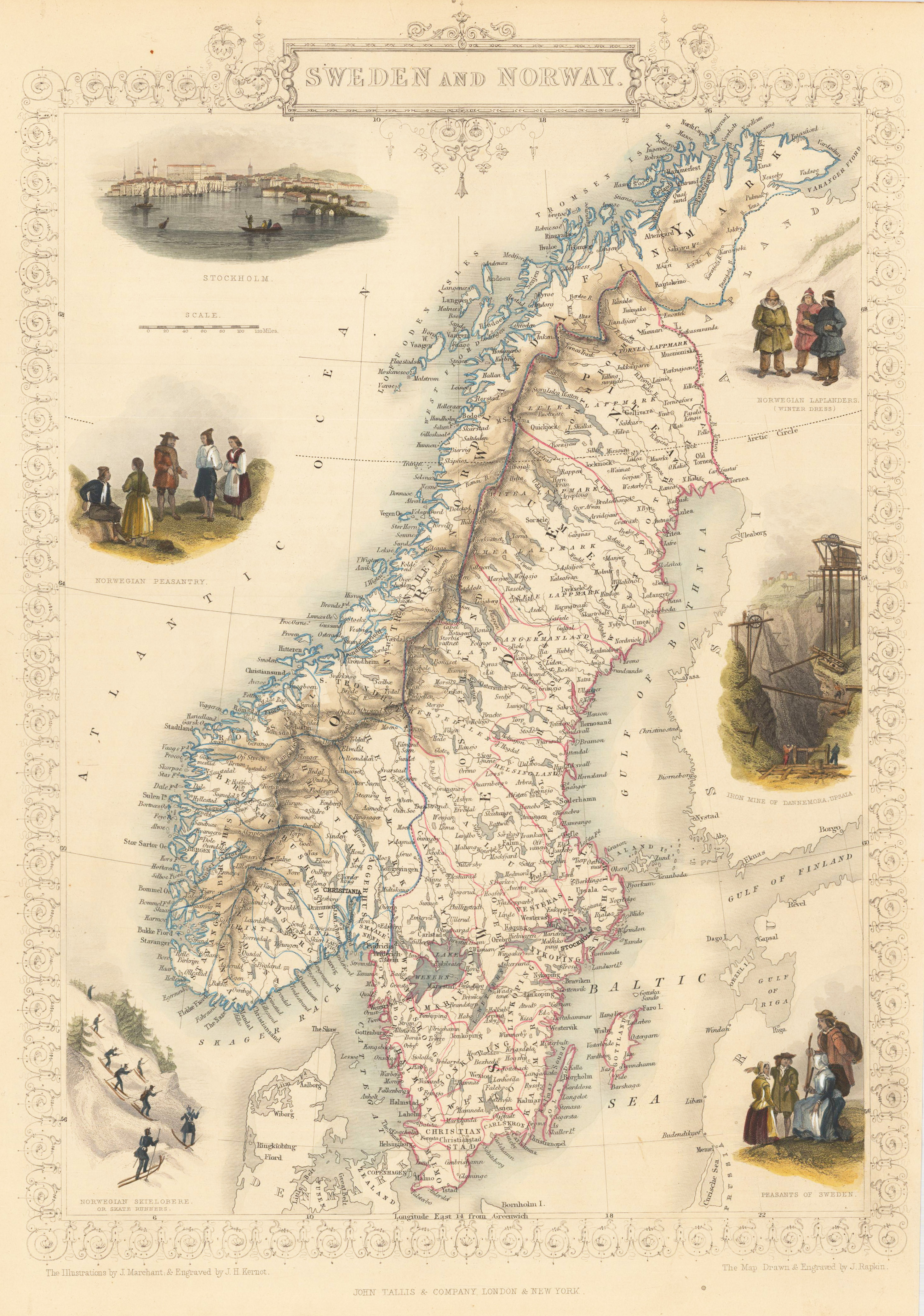
Lithograph, hand colored in outline when published. Detailed map of Southern Sweden and Norway, providing detailed information on settlements, villages and cities, rivers, lakes etc. Ornated in the lower right corner with a mileage scale and table of explanations.