
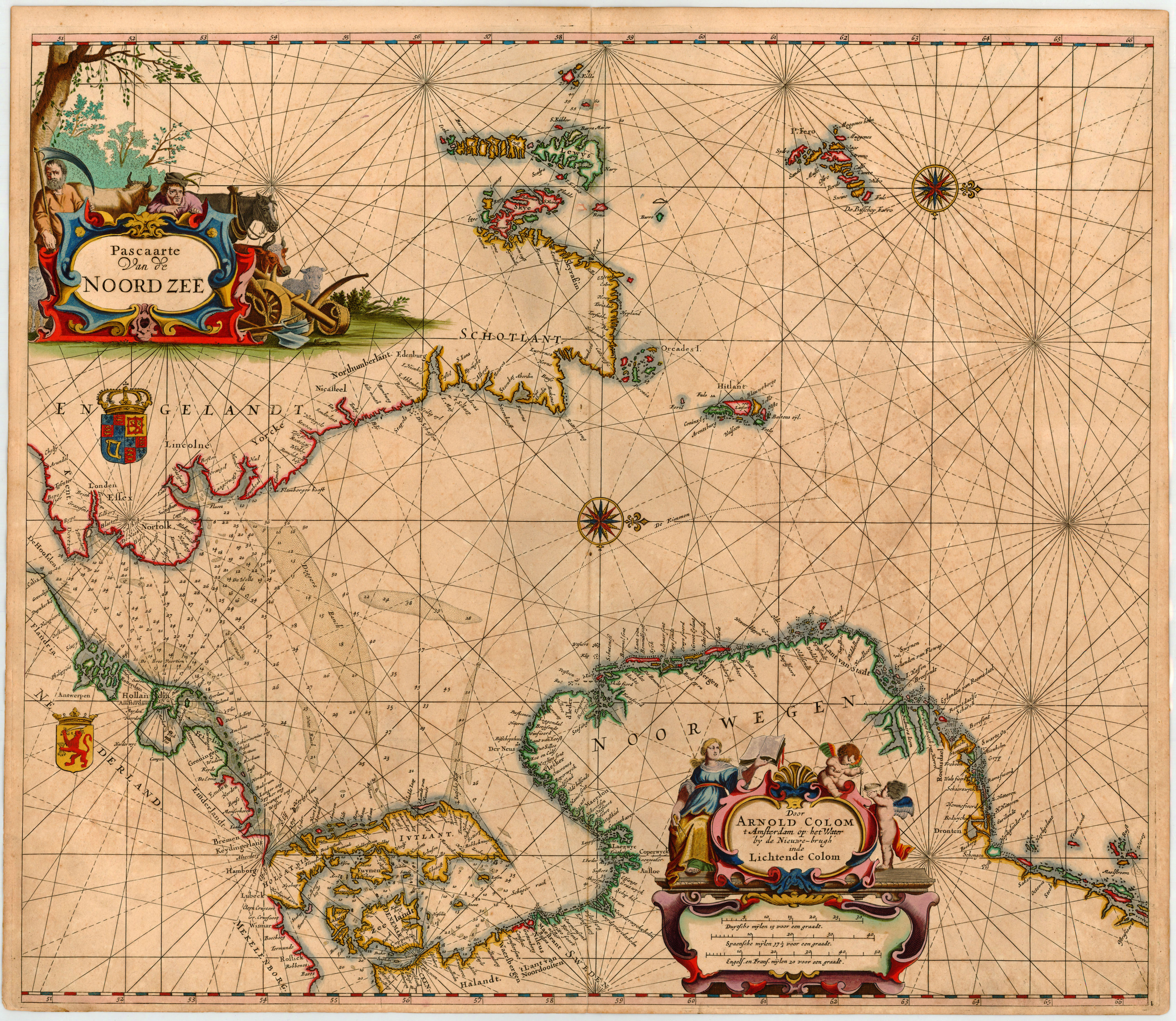
Pascaarte van de Noord Zee Door Arnold Colom t Amsterdam op het Water by de Nieuwe-brugh´ inde Lichtende Colom.
Product information: Pascaarte van de Noord Zee Door Arnold Colom t Amsterdam op het Water by de Nieuwe-brugh´ inde Lichtende Colom.
Copper engraving, finely hand colored in outline in the period when published. This sea chart by Arnold Colom was published 1658 in his very rare sea atlas 'Zee Atlas Ofte Water-Wereldt'. The entire sea atlas contents only 17 maps plus a world map. His atlas was shortly published after J. Janssonius's 'Atlas Maritimus (1650), which was part of the five volume Atlas Novus. Detailed sea chart of the German Sea from the English coast in the west extending towards Jutland, Denmark, Sweden and Norway orientated with the north to the right. Equipped with two decorative allegoric engraved title cartouches. Printed on thick atlas paper, with full margins as published. The title cartouches, compass roses and the coat of arms heightened in gold.
Properties
| Category: | Norway, German Sea & England |
|---|---|
| Issue date: | 1657 |
| Published place: | Amsterdam |
| Technique: | Copper engraving / Original color. |
| Type: | Antique Map, map |