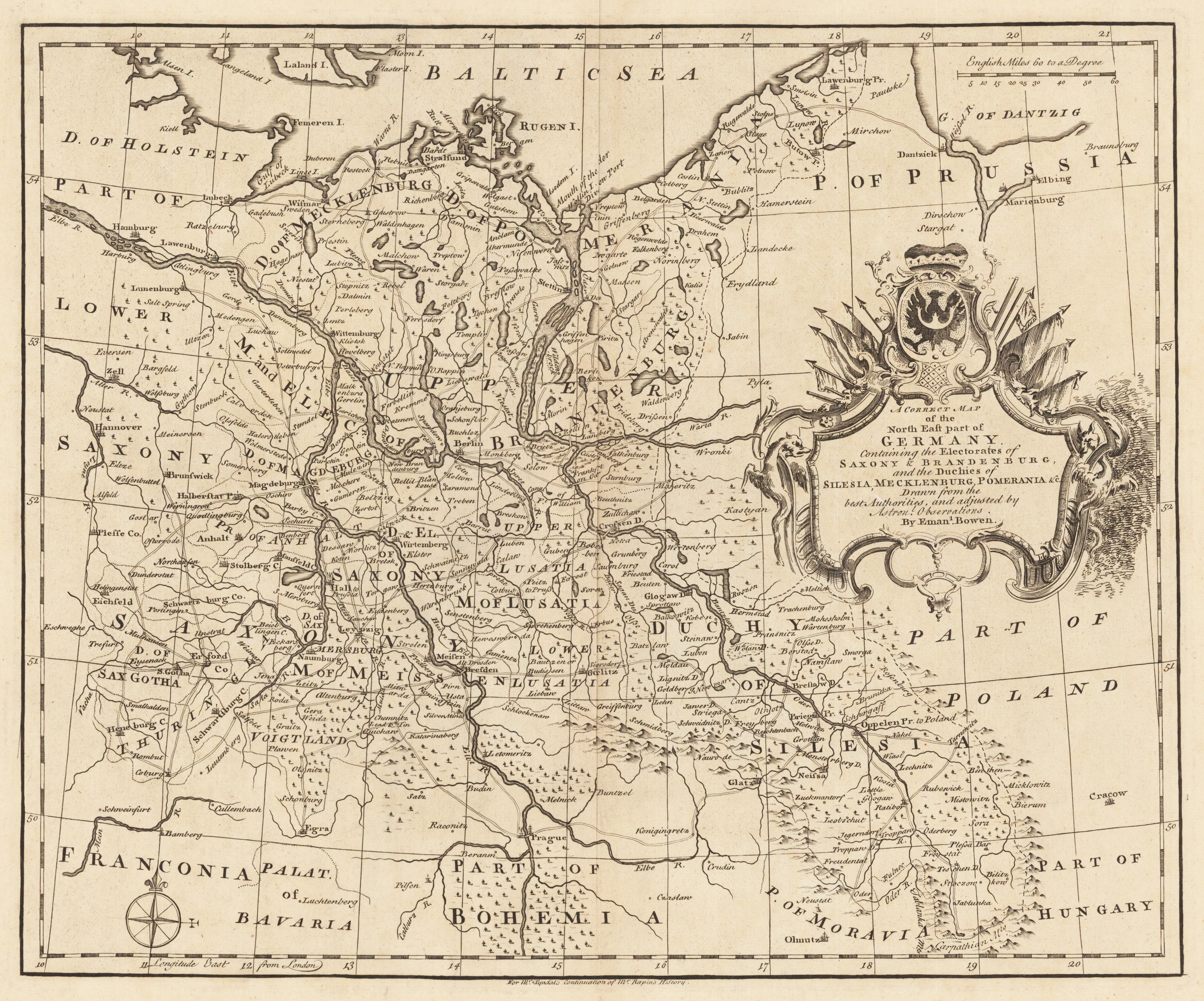
Original Kupferstich, unkoloriert erschienen. Dargestellt wird der nordöstliche Teil Deutschlands mit Teilen von Preussen, Polen, Ungarn, Böhmen und Bayern. Die sehr dekorative Kartusche befindet sich auf der rechten Kartenseite mittig. Der Meilenzeiger ist im rechten oberen Eck angebracht und links unten finden wir eine Kompassrose.
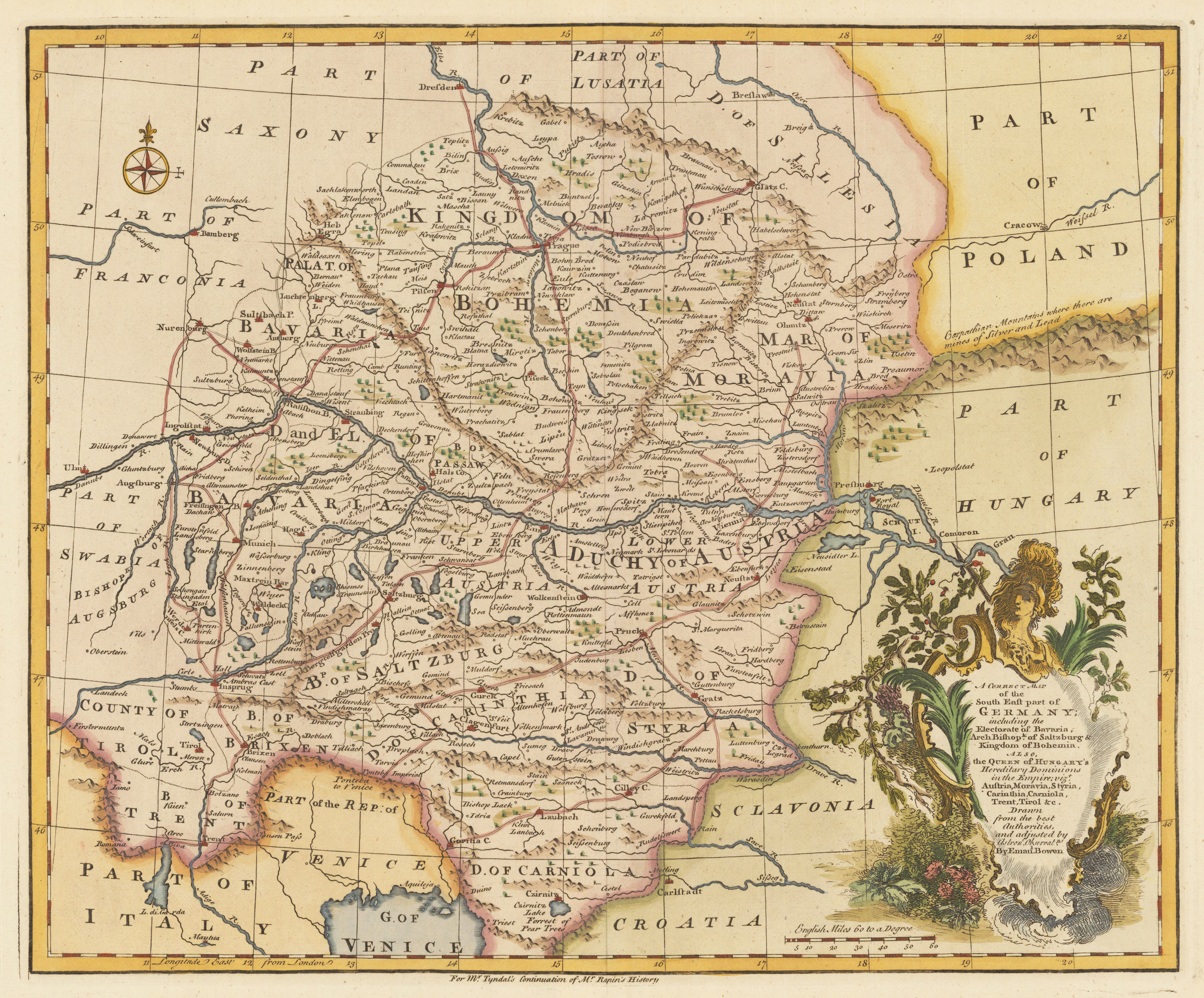
Original handkolrierter Kupferstich. Dargestellt wird der südöstliche Teil Deutschlands mit Teilen von Polen, Ungarn, Slovenien, Kroatien, Italien. Die sehr dekorative Kartusche und der Meilenzeiger befinden sich im rechten unteren Eck und eine kleine Kompassrose ist im linken oberen Eck eingraviert.
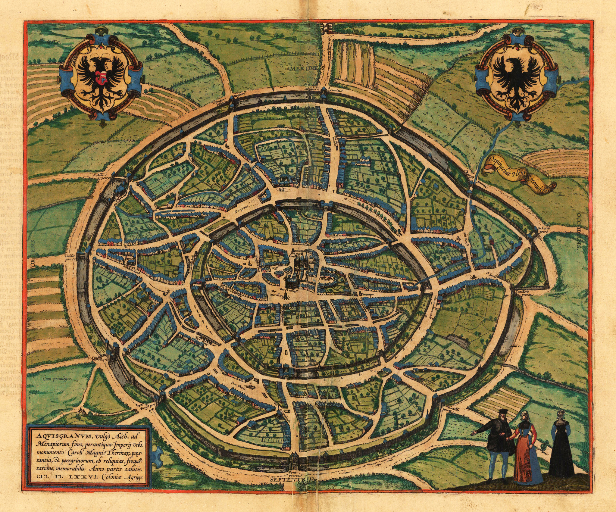
Original antique copper engraving, hand colored in wash, published 1576 in volume I of the town book 'Civitates Orbis Terrarum' by Braun and Hogenberg. The entire series of the 'Civitates Orbis Terrarum' comprised six volumes and was published and printed from 1572 towards 1619. This decorative plan shows a bird's eye view of the city of Aachen. A very nice and detailed plan of the city of Aachen with its walls and the nearby surrounding. The map is richly equipped with many houses, churches, etc. In the foreground with inhabitants. In the upper corners are two coat of arms of Aachen engraved. The title cartouche is in the lower left corner. Old colored example of this map, verso with descriptive German text. This view of Aachen by Braun and Hogenberg after the sketch by Hendrick Steenwyck, was only published from 1572 towards 1578, it was then replaced by a similar bird's eye view of Aachen in the townbooks by Braun & Hogenberg. Georg Braun (also Brunus, Bruin; 1541 – 10 March 1622) was a topo-geographer. From 1572 to 1617 he edited the Civitates orbis terrarum, which contains 546 prospects, bird's-eye views and maps of cities from all around the world. He was the principal editor of the work, he acquired the tables, hired the artists, and wrote the texts. He died as an octogenarian in 1622, as the only survivor of the original team to witness the publication of volume VI in 1617. Braun was born and died in Cologne. His principal profession was as a Catholic cleric. However, he spent thirty-seven years as canon and dean at the church, St. Maria ad Gradus, in Cologne. His six-volume work was inspired by Sebastian Münster's Cosmographia. In form and layout it resembles the 1570 Theatrum orbis terrarum by Abraham Ortelius, as Ortelius was interested in a complementary companion for the Theatrum. The Braun publication set new standards in cartography for over 100 years. Frans Hogenberg (1535–1590, from Mechelen) created the tables for volumes I through IV, and Simon van den Neuwel created those for volumes V and VI. Other contributors were Joris Hoefnagel, Jacob Hoefnagel, cartographer Daniel Freese, and Heinrich Rantzau. Works by Jacob van Deventer, Sebastian Münster, and Johannes Stumpf were also used. Primarily European cities are depicted in the publication; however, Cairo Casablanca and Mexico City as well as Cuzco on one sheet are also included in volume I, whereas Tunis is featured in volume II. Frans Hogenberg (1535–1590) was a Flemish and German painter, engraver, and mapmaker. Hogenberg was born in Mechelen in Flanders as the son of Nicolaas Hogenberg. In 1568 he was banned from Antwerp by the Duke of Alva and travelled to London, where he stayed a few years before emigrating to Cologne. He is known for portraits and topographical views as well as historical allegories. He also produced scenes of contemporary historical events. Hogenberg died in Cologne. (Wikipedia)
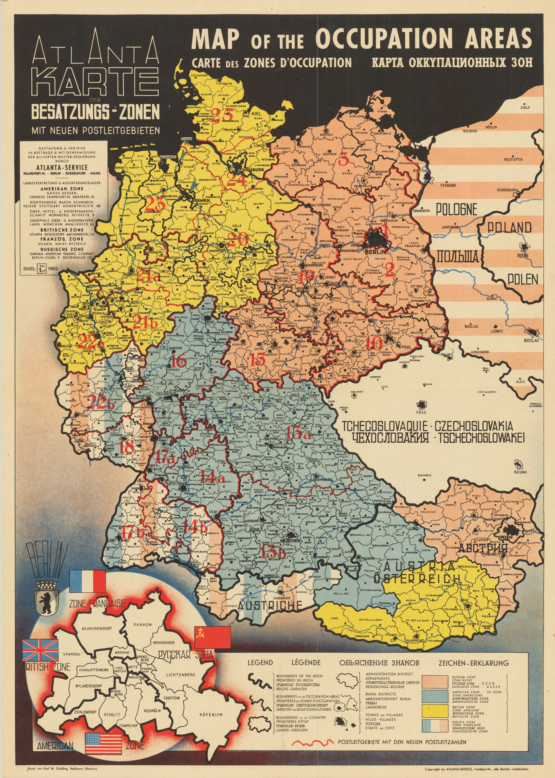
Modern color print after the original lithograph from 1946. Important monument of the division of Germany after the Second World War. Shows postal codes in allied occupation zones in Germany from 1945 until 1949. An Inset map in the left lower left corner shows the postal codes in Berlin, divided between American, French, British and Russian occupation zones.
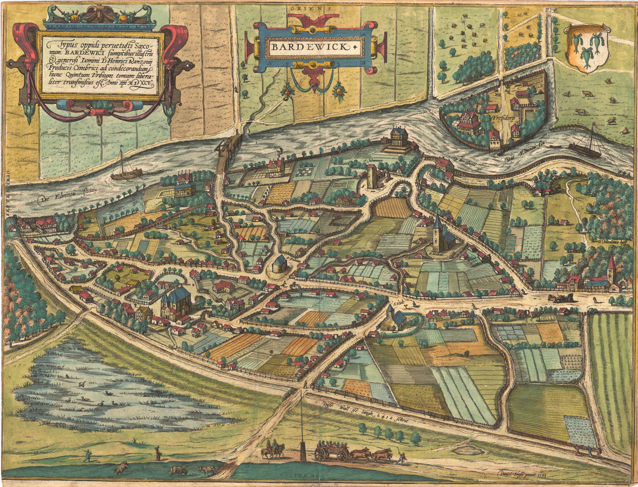
Original copper engraving, published ca.1598 in volume V of the town book 'Civitates Orbis Terrarum' by Braun and Hogenberg. The entire series of the 'Civitates Orbis Terrarum' comprised six volumes and was published and printed from 1572 towards 1619. German text edition. Decorative bird's eye view of the city of Bardowick near Lüneburg in Niedersachsen. The engraving is based on the sketch after Daniel Frese (1588). Georg Braun (also Brunus, Bruin; 1541 – 10 March 1622) was a topo-geographer. From 1572 to 1617 he edited the Civitates orbis terrarum, which contains 546 prospects, bird's-eye views and maps of cities from all around the world. He was the principal editor of the work, he acquired the tables, hired the artists, and wrote the texts. He died as an octogenarian in 1622, as the only survivor of the original team to witness the publication of volume VI in 1617. Braun was born and died in Cologne. His principal profession was as a Catholic cleric. However, he spent thirty-seven years as canon and dean at the church, St. Maria ad Gradus, in Cologne. His six-volume work was inspired by Sebastian Münster's Cosmographia. In form and layout it resembles the 1570 Theatrum orbis terrarum by Abraham Ortelius, as Ortelius was interested in a complementary companion for the Theatrum. The Braun publication set new standards in cartography for over 100 years. Frans Hogenberg (1535–1590, from Mechelen) created the tables for volumes I through IV, and Simon van den Neuwel created those for volumes V and VI. Other contributors were Joris Hoefnagel, Jacob Hoefnagel, cartographer Daniel Freese, and Heinrich Rantzau. Works by Jacob van Deventer, Sebastian Münster, and Johannes Stumpf were also used. Primarily European cities are depicted in the publication; however, Cairo Casablanca and Mexico City as well as Cuzco on one sheet are also included in volume I, whereas Tunis is featured in volume II. Frans Hogenberg (1535–1590) was a Flemish and German painter, engraver, and mapmaker. Hogenberg was born in Mechelen in Flanders as the son of Nicolaas Hogenberg. In 1568 he was banned from Antwerp by the Duke of Alva and travelled to London, where he stayed a few years before emigrating to Cologne. He is known for portraits and topographical views as well as historical allegories. He also produced scenes of contemporary historical events. Hogenberg died in Cologne. (Wikipedia)
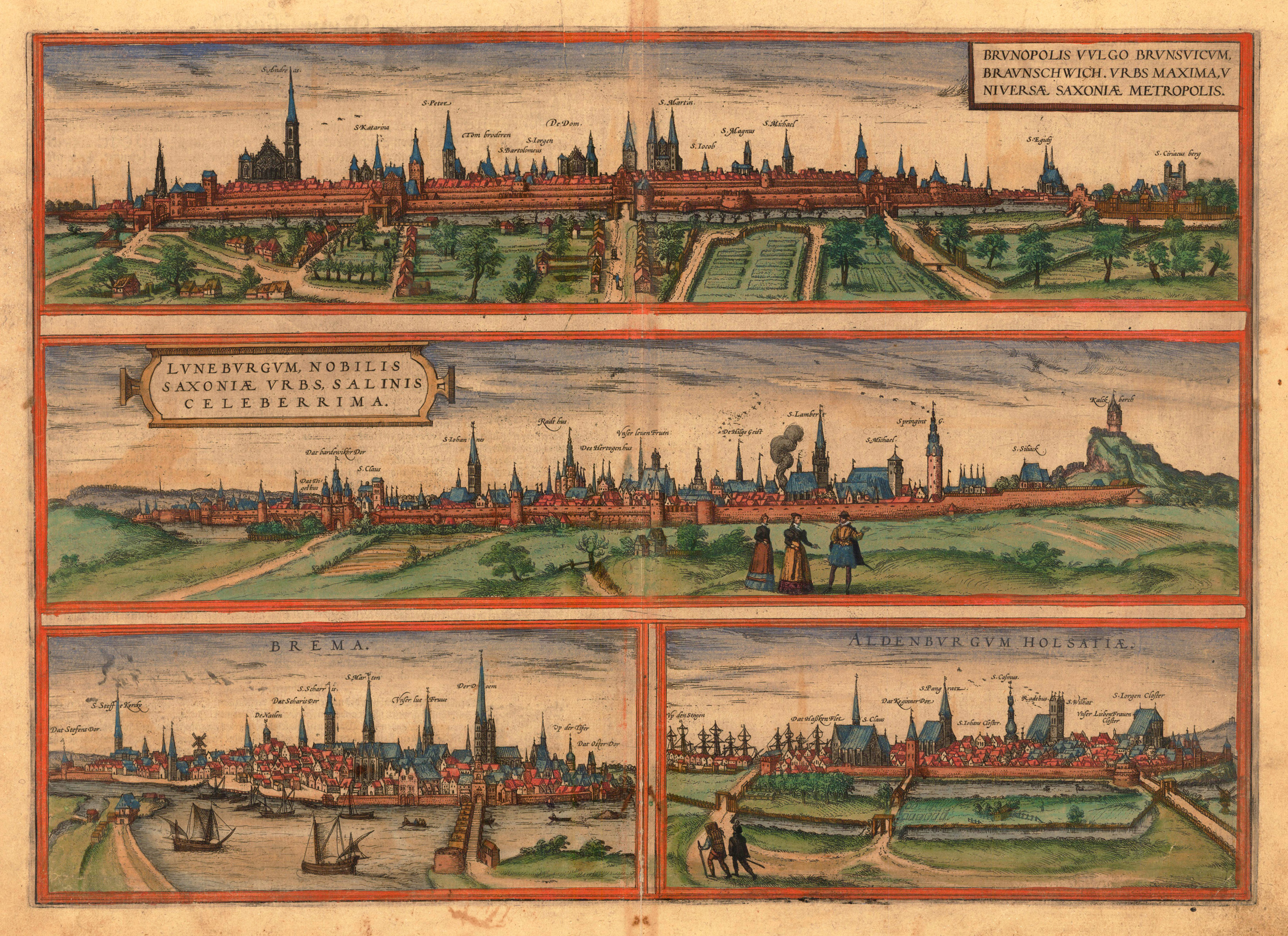
Original copper engraving, hand colored in wash, published 1572-78 in volume I of the town book 'Civitates Orbis Terrarum' by Braun and Hogenberg. The entire series of the 'Civitates Orbis Terrarum' comprised six volumes and was published and printed from 1572 towards 1619. This decorative map have four inset maps. One shows Braunschweig, the second shows Lüneburg, the third Bremen and the fourth Oldenburg. All the towns are in Germany. This is a very nice bird´s ey view of the towns. The map is equipped with many houses, streets, churches, river, trees, garden, peoples, a fortress around the towns, sailing ships, birds, etc. A large German text is on the back side of this map.
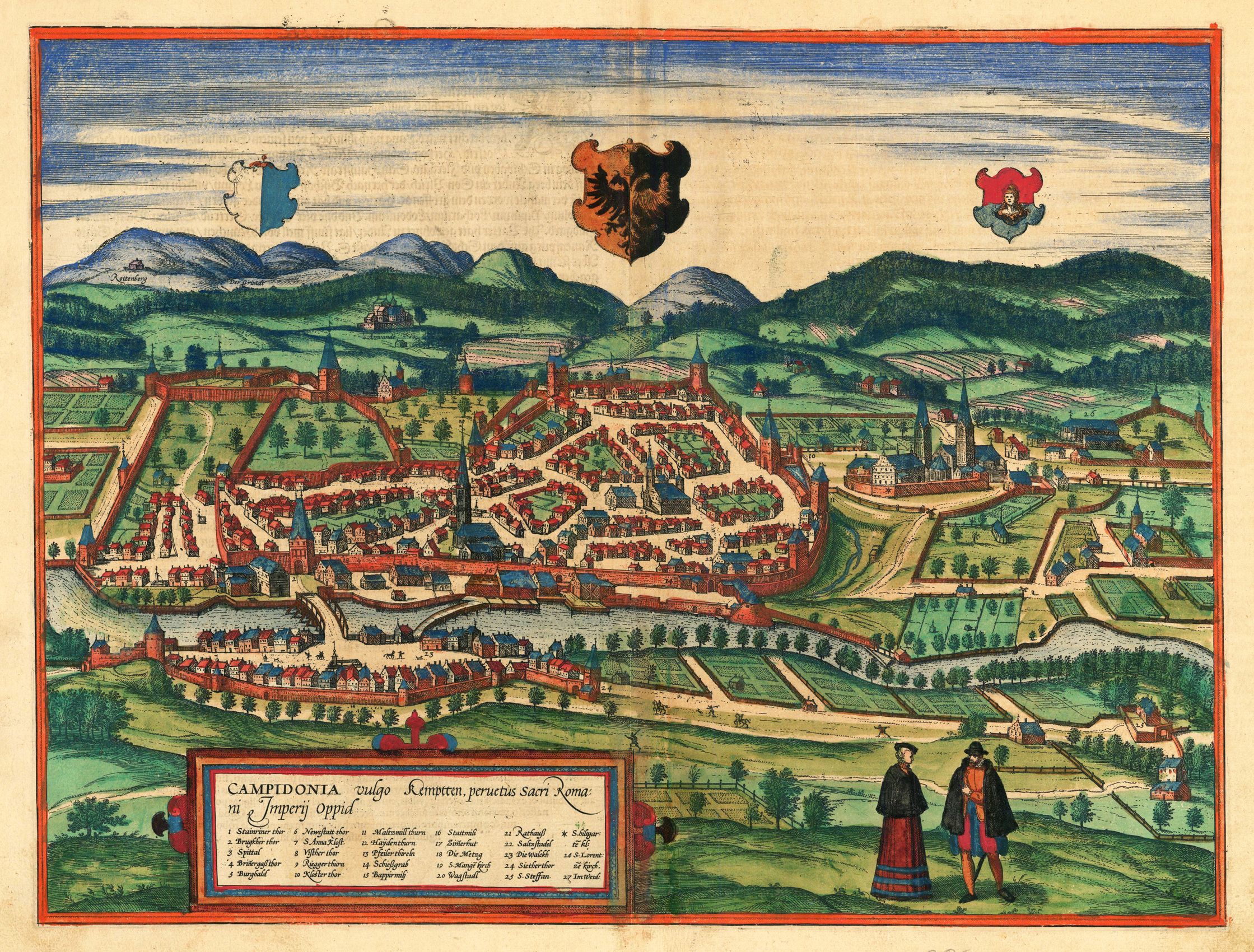
Original copper engraving, hand colored in wash published ca. 1572-78 in volume II of the famous town book 'Civitates Orbis Terrarum' by Braun and Hogenberg. The entire series of the 'Civitates Orbis Terrarum' comprised six volumes and was published and printed from 1572 towards 1619 in Cologne. This decorative map shows a panoramic bird´s eye view of the town Kempten in Germany. In the upper field we find three coat of arms. In the lower left side we find a title cartouche. The map is equipped with many houses, a fortress around the town, many trees, fields, peoples, etc. On the back side of the map is a large German text. Georg Braun (also Brunus, Bruin; 1541 – 10 March 1622) was a topo-geographer. From 1572 to 1617 he edited the Civitates orbis terrarum, which contains 546 prospects, bird's-eye views and maps of cities from all around the world. He was the principal editor of the work, he acquired the tables, hired the artists, and wrote the texts. He died as an octogenarian in 1622, as the only survivor of the original team to witness the publication of volume VI in 1617. Braun was born and died in Cologne. His principal profession was as a Catholic cleric. However, he spent thirty-seven years as canon and dean at the church, St. Maria ad Gradus, in Cologne. His six-volume work was inspired by Sebastian Münster's Cosmographia. In form and layout it resembles the 1570 Theatrum orbis terrarum by Abraham Ortelius, as Ortelius was interested in a complementary companion for the Theatrum. The Braun publication set new standards in cartography for over 100 years. Frans Hogenberg (1535–1590, from Mechelen) created the tables for volumes I through IV, and Simon van den Neuwel created those for volumes V and VI. Other contributors were Joris Hoefnagel, Jacob Hoefnagel, cartographer Daniel Freese, and Heinrich Rantzau. Works by Jacob van Deventer, Sebastian Münster, and Johannes Stumpf were also used. Primarily European cities are depicted in the publication; however, Cairo Casablanca and Mexico City as well as Cuzco on one sheet are also included in volume I, whereas Tunis is featured in volume II. Frans Hogenberg (1535–1590) was a Flemish and German painter, engraver, and mapmaker. Hogenberg was born in Mechelen in Flanders as the son of Nicolaas Hogenberg. In 1568 he was banned from Antwerp by the Duke of Alva and travelled to London, where he stayed a few years before emigrating to Cologne. He is known for portraits and topographical views as well as historical allegories. He also produced scenes of contemporary historical events. Hogenberg died in Cologne. (Wikipedia)
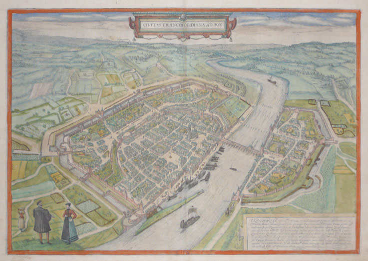
Original copper engraving, hand colored in wash, published 1572-78 in volume I of the town book 'Civitates Orbis Terrarum' by Braun and Hogenberg. The entire series of the 'Civitates Orbis Terrarum' comprised six volumes and was published and printed from 1572 towards 1619. This decorative map shows Frankfurt in Germany. This is a very nice bird´s ey view of the town Frankfurt with a fortress around the town. The map is equipped with many houses, streets, churches, river, trees, garden, peoples, etc. The title cartouche is in the upper middle field. At the lower right corner we find a cartouche with a Latin text. Also a large Latin text is on the back side of this map. Georg Braun (also Brunus, Bruin; 1541 – 10 March 1622) was a topo-geographer. From 1572 to 1617 he edited the Civitates orbis terrarum, which contains 546 prospects, bird's-eye views and maps of cities from all around the world. He was the principal editor of the work, he acquired the tables, hired the artists, and wrote the texts. He died as an octogenarian in 1622, as the only survivor of the original team to witness the publication of volume VI in 1617. Braun was born and died in Cologne. His principal profession was as a Catholic cleric. However, he spent thirty-seven years as canon and dean at the church, St. Maria ad Gradus, in Cologne. His six-volume work was inspired by Sebastian Münster's Cosmographia. In form and layout it resembles the 1570 Theatrum orbis terrarum by Abraham Ortelius, as Ortelius was interested in a complementary companion for the Theatrum. The Braun publication set new standards in cartography for over 100 years. Frans Hogenberg (1535–1590, from Mechelen) created the tables for volumes I through IV, and Simon van den Neuwel created those for volumes V and VI. Other contributors were Joris Hoefnagel, Jacob Hoefnagel, cartographer Daniel Freese, and Heinrich Rantzau. Works by Jacob van Deventer, Sebastian Münster, and Johannes Stumpf were also used. Primarily European cities are depicted in the publication; however, Cairo Casablanca and Mexico City as well as Cuzco on one sheet are also included in volume I, whereas Tunis is featured in volume II. Frans Hogenberg (1535–1590) was a Flemish and German painter, engraver, and mapmaker. Hogenberg was born in Mechelen in Flanders as the son of Nicolaas Hogenberg. In 1568 he was banned from Antwerp by the Duke of Alva and travelled to London, where he stayed a few years before emigrating to Cologne. He is known for portraits and topographical views as well as historical allegories. He also produced scenes of contemporary historical events. Hogenberg died in Cologne. (Wikipedia)
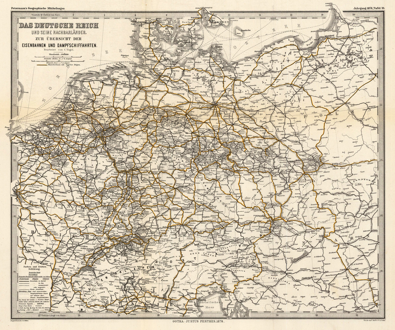
Steel engraving, hand colored in outline when published. This detailed antique map shows Germany with its neighboring countries, it provides an overview about the railroad routes and steamboat routes.
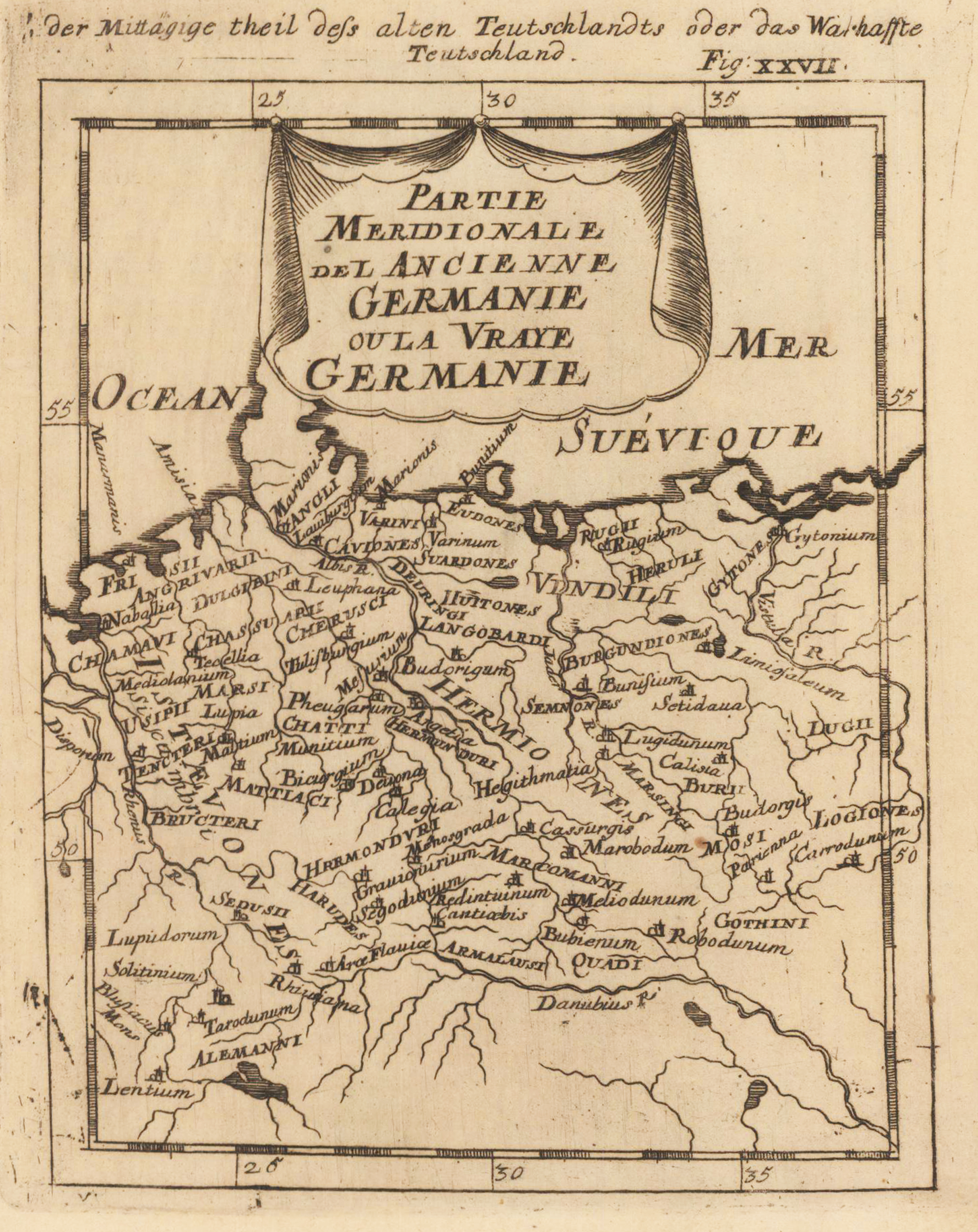
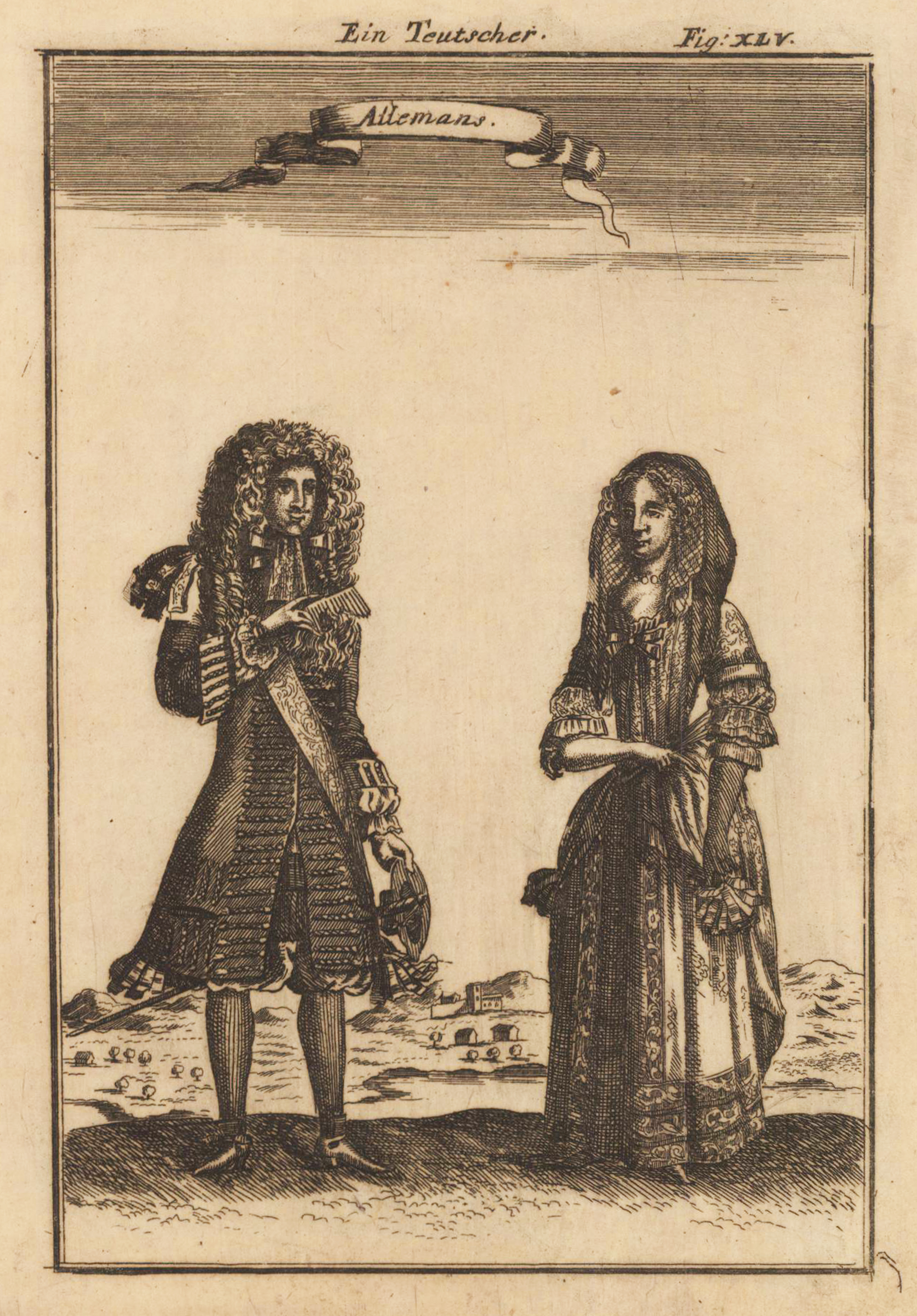
Copper engraving published in Allain M. Mallet's description of the world 'Description De L' Univers, Contenant Les Differents Systemes Du Monde, Les Cartes generales & particulieres ...'. French text edition with additional German titles on top.
Copper engraving published in Allain M. Mallet's description of the world 'Description De L' Univers, Contenant Les Differents Systemes Du Monde, Les Cartes generales & particulieres ...'. French text edition with additional German titles on top.
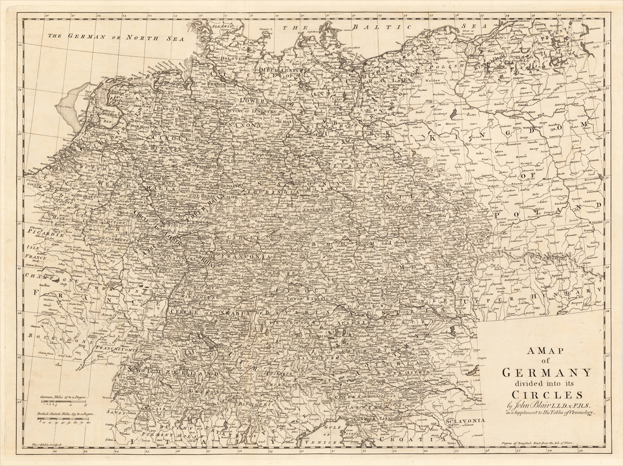
Orginal Kupferstichkarte, gestochen von Thomas Kitchen (1718-84). Dargestellt wird Deutschland mit angrenzenden Ländern von der Nord und Ostsee bis zum südlichen angrenzenden Norditalien. Die einzelnen Kreise sind detailliert bezeichnet und mit gestochenen politischen Grenzen versehen. Mit vielen Ortsangaben, Flüssen, etc. Schöne Gesamtkarte von Deutschland Karte in tadellosem Erhaltungszustand.
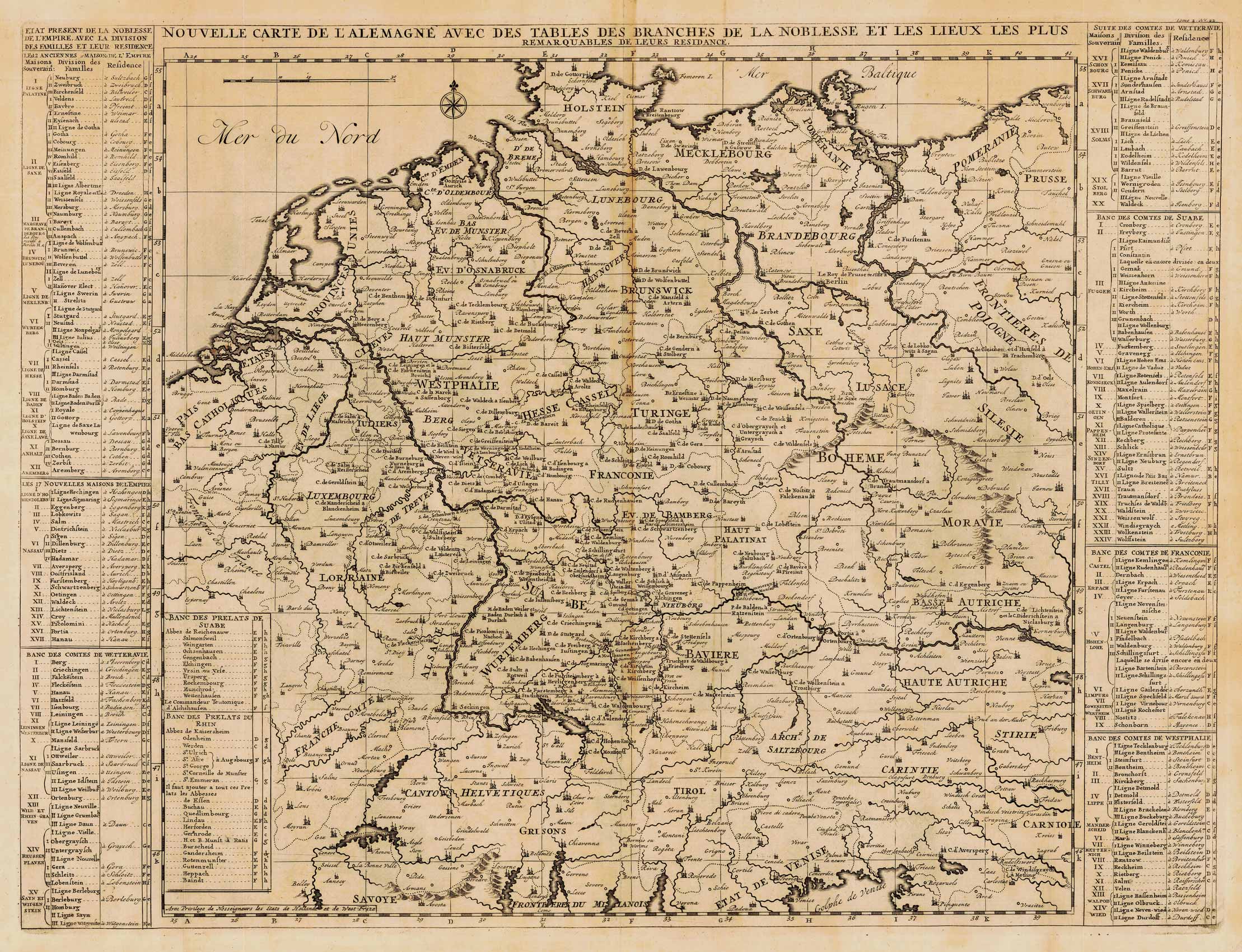
Antike Kupferstichkarte, unkoloriert erschienen im Atlas historique... v. H. Chatelein. Rechts und links neben dem Kartenbild sind die Angaben zu den wichtigsten Besitztümern des deutschen Adels mit Hinweis auf den Ort auf der Karte. Schöne, dekorative Karte.
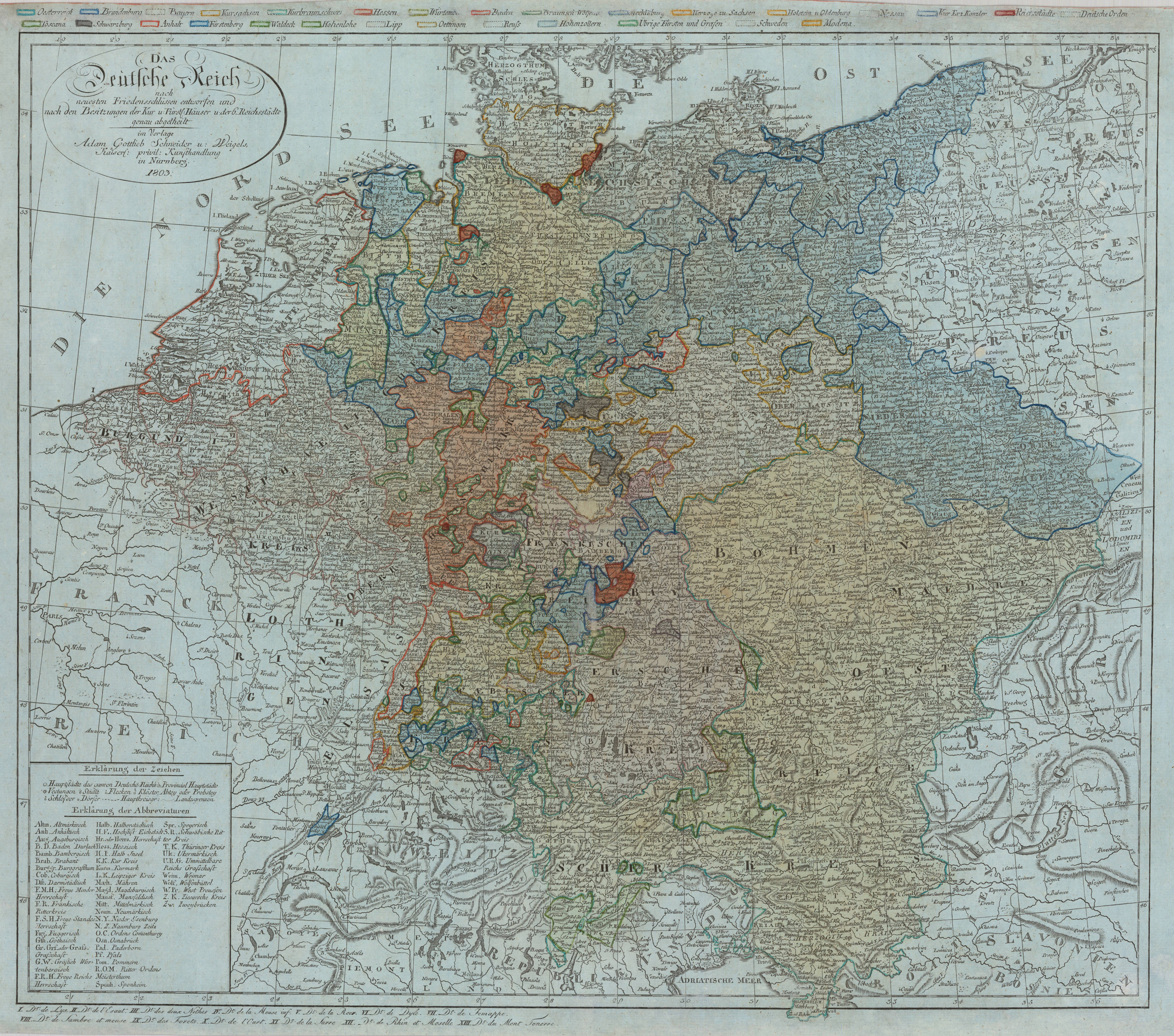
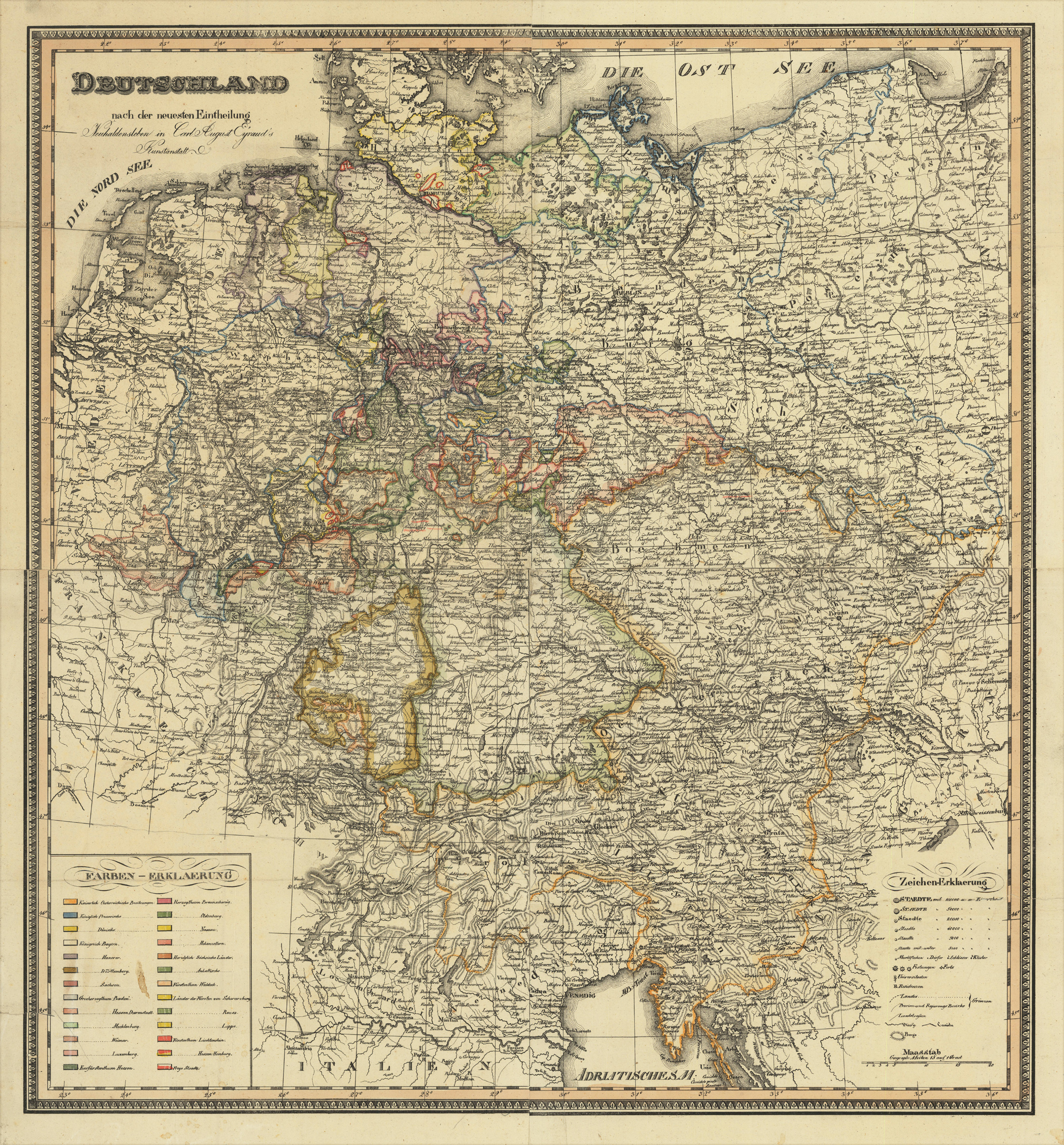
Original lithograph, hand colored in outline when published. A fine large and detailed engraved map of Germany published in Carl August Eyraud's printing house in Neuhaldensleben in Saxonia. An unusual and rare 19th century lithograph map, printed from four plates, depicting Germany with its newest political divisions. The map was published in the small printing house by Carl August Eyraud in Neuhaldensleben near Magdeburg in Saxonia. The publication date is probably between 1816-37 (the map depicts Rhein Bayern, which was founded 1816 and existed only until 1837). The scale of the map highly detailed and shows cities, towns, small place names, rivers, lakes, mountains political borders as well roads between the various places. In the lower left corner a large table of explanations in various colors to explain the political posessions of the various kingdoms, duchies and free cities.
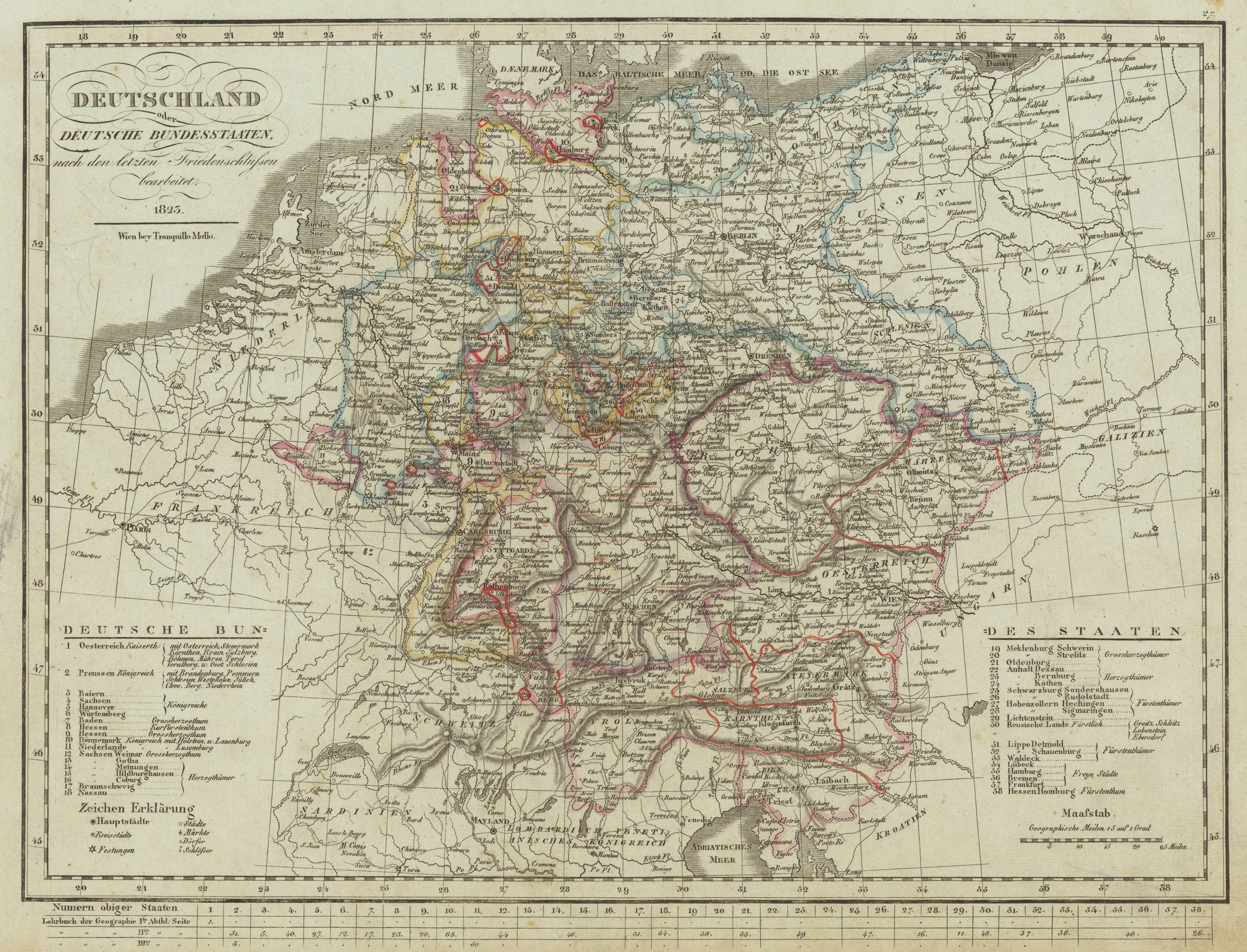
Original copper engraving, hand colored in outline when published. Original Kupferstichkarte in zeitgenössischem Grenzkolorit. Diese historische Karte von Deutschland umfasst Deutschland mit seinen Bundesstaaten um 1825. Die Karte mit vielen Ortsangaben, Flüssen, sowie politischen Grenzen und einer Legende. In tadellosem Erhaltungszustand. This historical map of Germany includes Germany with its states around 1825. The map with many locations, rivers, political borders and a legend. In perfect condition. Tranquillo Maria Laurentio Mollo (August 10, 1767 - March 29, 1837) was Vienna based Swiss/Italian graphic designer, printer, art and music dealer, and publisher active in the late 18th and early 20th centuries. From about 1792 Mollo worked with the Vienna firm Artaria and Company. In 1798 he separated from Artaria to found, along with partner Franz Bernardini, his own music, art, and map publishing company, T. Mollo and Co. The partner collapsed after one year and Mollo took a new partner, Domenico Artaria, a scion of the Artaria family. In 1802 Mollo and Domenico acquired Artaria and Company from Carlo Artaria. Domenico and Mollo parted ways in 1804, after which Mollo published independently. Under his own imprint, he became one of Austria's most important globe and map publishers. He collaborated extensively with English and French publishers to bring French material to his work. Among his more significant collaborators was the Vienna publisher Joseph Dirwaldt. In 1832 Mollo passed the company to his sons, Eduard (1799-1842) and Florian Mollo (1803-1869). The Mollo brothers ran the business until 1839, three years after Tranquillo Mollo's death, before dividing the concern into separate business. Mollo married Dorothea Defelavis († 29. Juli 1822). (Wikipedia)
Copper engraving published in Allain M. Mallet's description of the world 'Description De L' Univers, Contenant Les Differents Systemes Du Monde, Les Cartes generales & particulieres ...'. French text edition with additional German titles on top.
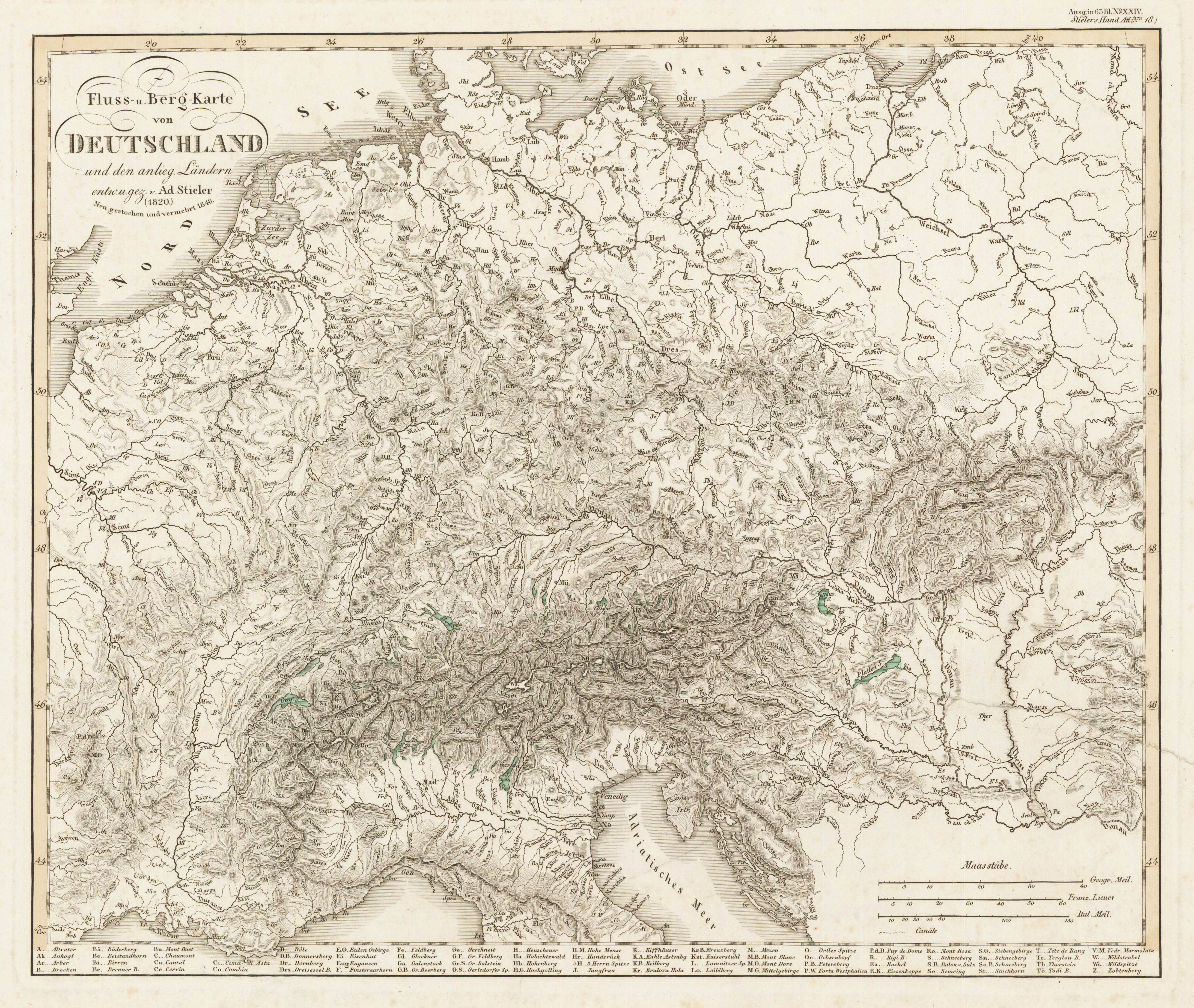
Stahlstich, koloriert (nur die Seen) erschienen. Dargestellt wird ganz Deutschland und Teile seiner Nachbarländer. Große und auch kleine Flüsse sind alle mit Namen benannt, Berge und Gebirgszüge sind mit Kürzeln benannt, die unterhalb der Karte in der Legende aufgelistet sind. Im linken oberen Eck befindet sich der Titel und im rechten unteren Eck sind drei Meilenzeiger eingraviert.
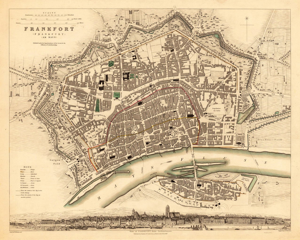
Steel engraving, hand colored in outline and wash when published. This decorative map shows the plan of Frankfurt in Germany. The map is equipped with many engraved streets, streets names, ground plans of garden around the city, the river Main and the surrounding fields. In the upper left corner we find the title with a mileage scale and in the lower bottom we find a very decorative view of the city of Frankfurt.
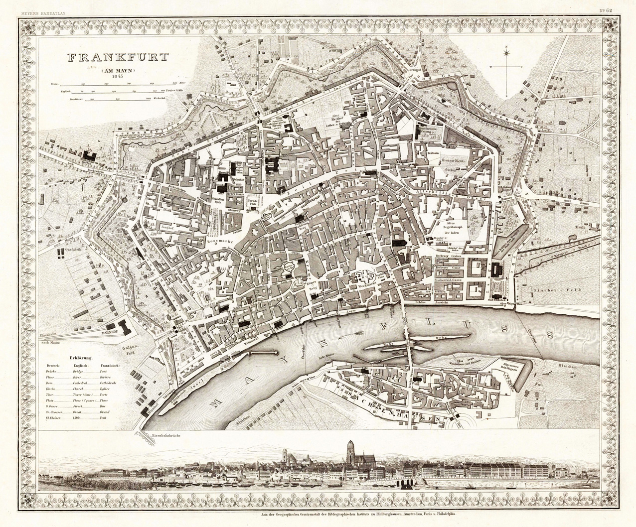
Steel engraving, uncolored as published. This decorative map shows the plan of Frankfurt in Germany. The map is equipped with many engraved streets, streets names, ground plans of garden around the city, the river Main and the surrounding fields. In the upper left corner we find the title with a mileage scale and in the lower bottom we find a very decorative view of the city of Frankfurt.