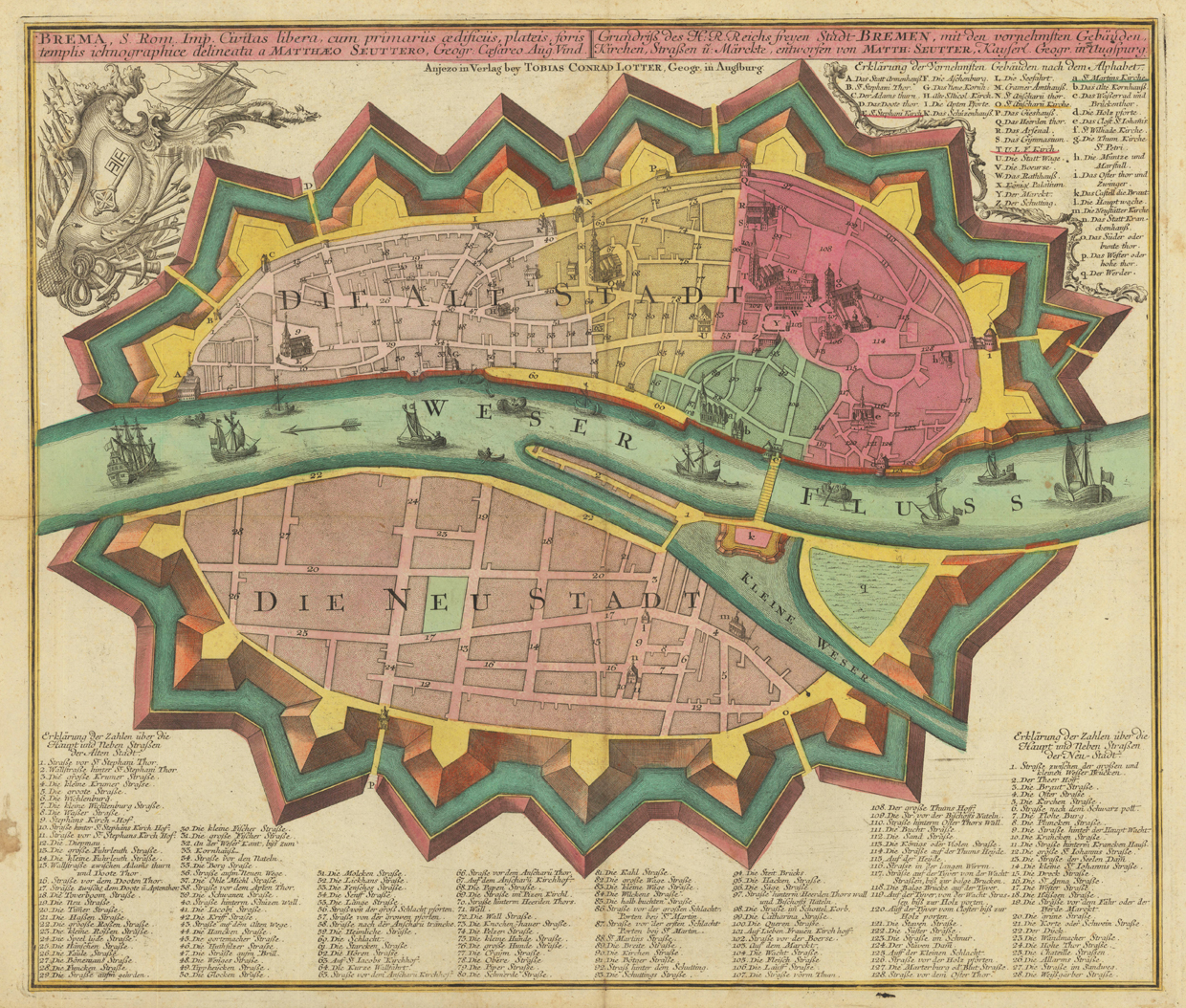
Engraved map, hand colored in wash when published. A detailed plan of the free imperial city of Bremen with its city walls located at the river Weser. Depicted is the old and new city of Bremen on both sides of the river Weser. Title in Latin and German language at the top of the map, below the imprint of the publisher Tobias Conrad Lotter from Augsburg. In the upper left corner allegories to the free imperial city of Bremen and in the upper right corner explanations A-q on the most important buildings and churches of the city. At the bottom of the map below the ,Neustadt of Bremen' an extensive listing of 128 street- and place names of the ,Altstadt of Bremen' and another listing of 28 street- and place names of the ,Neustadt of Bremen'.
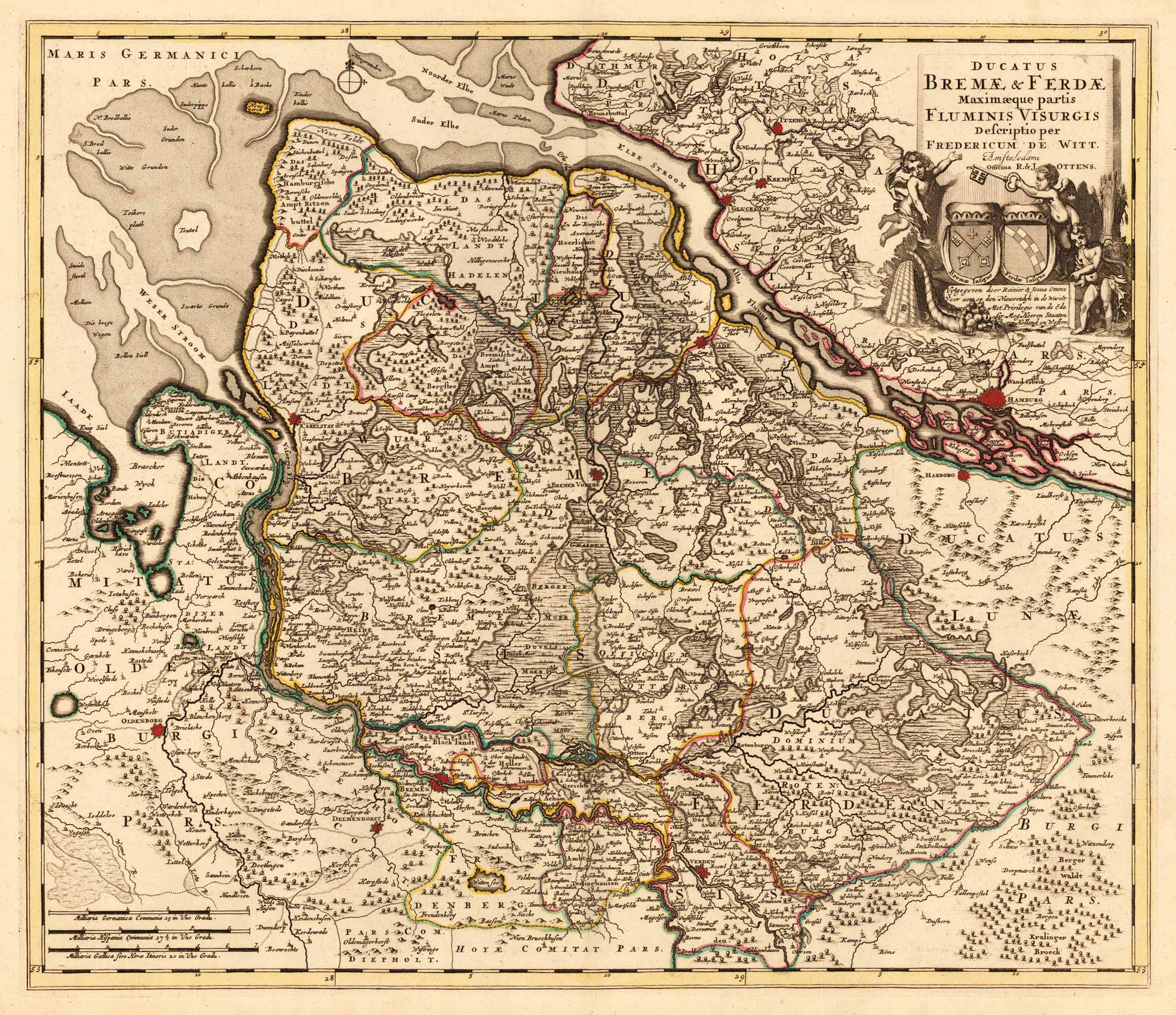
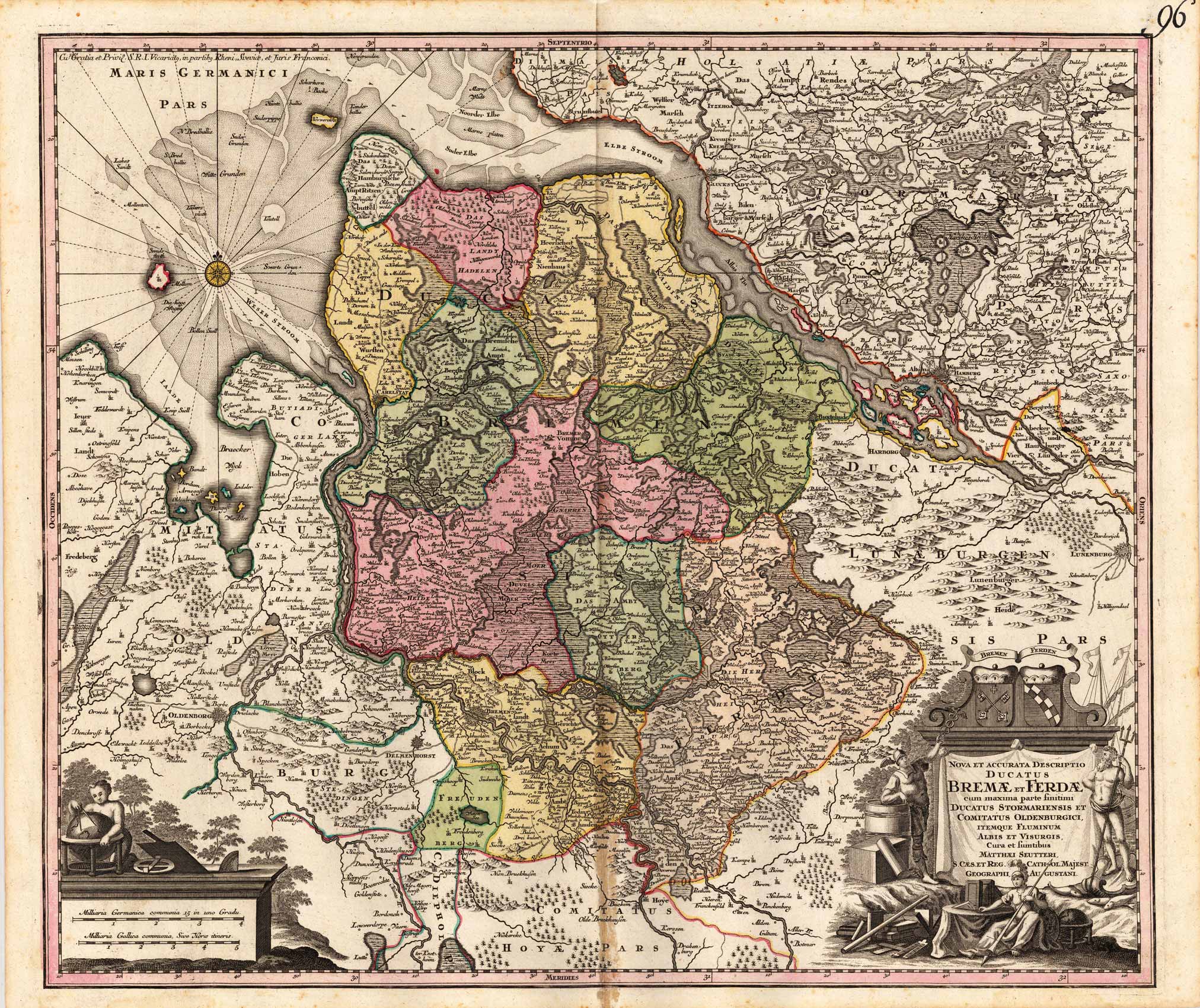
Copper-engraving, handcolored in wash and outline, when published. In the upper right corner ornated with a large barocque title cartouche, with three angels holding the coats of arms of Bremen and Verden. In the lower left corner a small milage scale. On this map the duchies of Bremen and Verden are detailed shown with the neighbouring Hamburg in the north and Oldenburg in the South. The map is equipped with much details. Many small villages and places are named, small rivers and waters, as well along the coast line the sand-banks are named.
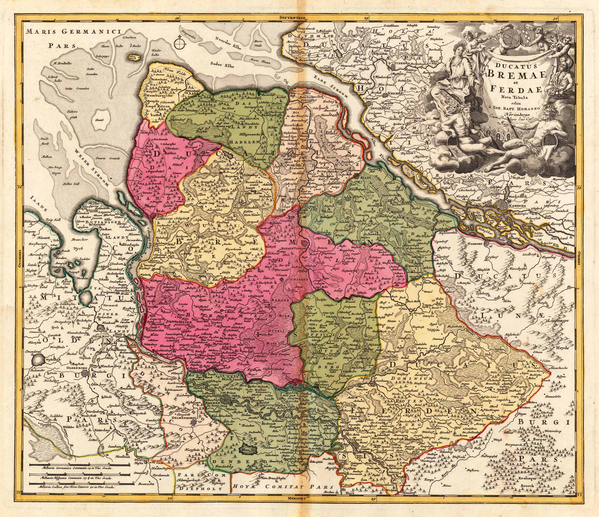
Original antique copper engravings, hand colored in outline and wash, when published. In the upper right corner ornated with a large barocque title cartouche, with coats of arms of Bremen and Verden and allegories on the rivers Elbe and Wesel. In the lower left corner a small milage scale. On this map the duchies of Bremen and Verden are detailed shown with the neighbouring Hamburg in the north and Oldenburg and Delmenhorst in the south. The map is equipped much with details. Many small villages and places are named, small rivers and waters, as well along the coast line the sand-banks and islands are named. Johann Baptist Homann (20 March 1664 – 1 July 1724) was a German geographer and cartographer, who also made maps of the Americas. Homann was born in Oberkammlach near Kammlach in the Electorate of Bavaria. Although educated at a Jesuit school, and preparing for an ecclesiastical career, he eventually converted to Protestantism and from 1687 worked as a civil law notary in Nuremberg. He soon turned to engraving and cartography; in 1702 he founded his own publishing house. Homann acquired renown as a leading German cartographer, and in 1715 was appointed Imperial Geographer by Emperor Charles VI. Giving such privileges to individuals was an added right that the Holy Roman Emperor enjoyed. In the same year he was also named a member of the Prussian Academy of Sciences in Berlin. Of particular significance to cartography were the imperial printing privileges (Latin: privilegia impressoria). These protected for a time the authors in all scientific fields such as printers, copper engravers, map makers and publishers. They were also very important as a recommendation for potential customers. In 1716 Homann published his masterpiece Grosser Atlas ueber die ganze Welt (Grand Atlas of all the World). Numerous maps were drawn up in cooperation with the engraver Christoph Weigel the Elder, who also published Siebmachers Wappenbuch. Homann died in Nuremberg in 1724. He was succeeded by his son Johann Christoph (1703-1730). The company carried on upon his death as Homann heirs company, managed by Johann Michael Franz and Johann Georg Ebersberger. After subsequent changes in management the company folded in 1852.[1] The company was known as "Homann Erben", "Homanniani Heredes", or "Heritiers de Homann" abroad. (Wikipedia)
Copper-engraving, handcolored in wash and outline, when published. In the lower right corner ornated with a large barocque title cartouche, with coats of arms of Bremen and Verden and allegories on the rivers. In the lower left corner a small milage scale with an allegory on the cartography. On this map the duchies of Bremen and Verden are detailed shown with the neighbouring Hamburg and Stormarn in the north and Oldenburg in the south. The map is equipped much with details. Many small villages and places are named, small rivers and waters, as well along the coast line the sand-banks and islands are named.
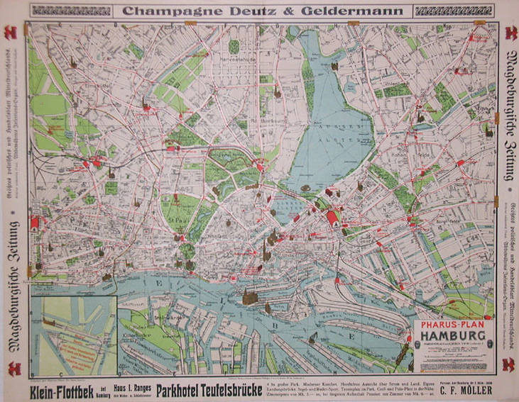
Original lithograph, printed in colors. Detailed decorative lithograph plan of the city of Hamburg with Altona, St. Pauli, the Aussen Alster und the river Elbe. The plan gives a detailled overview on the center of the city including important buildings like the Warenspeicher (warehouses), the city hall, concert hall, the Alster Pavillion, St. Nikolai church, St. Petri church in Altona, the fishmarket hall in Altona, the Reeperbahn, etc. This city map of Hamburg and Altona includes streets, rivers, channels, trainstations, parks, etc. The plan is verso illustrated with descriptive text and regional advertisements.
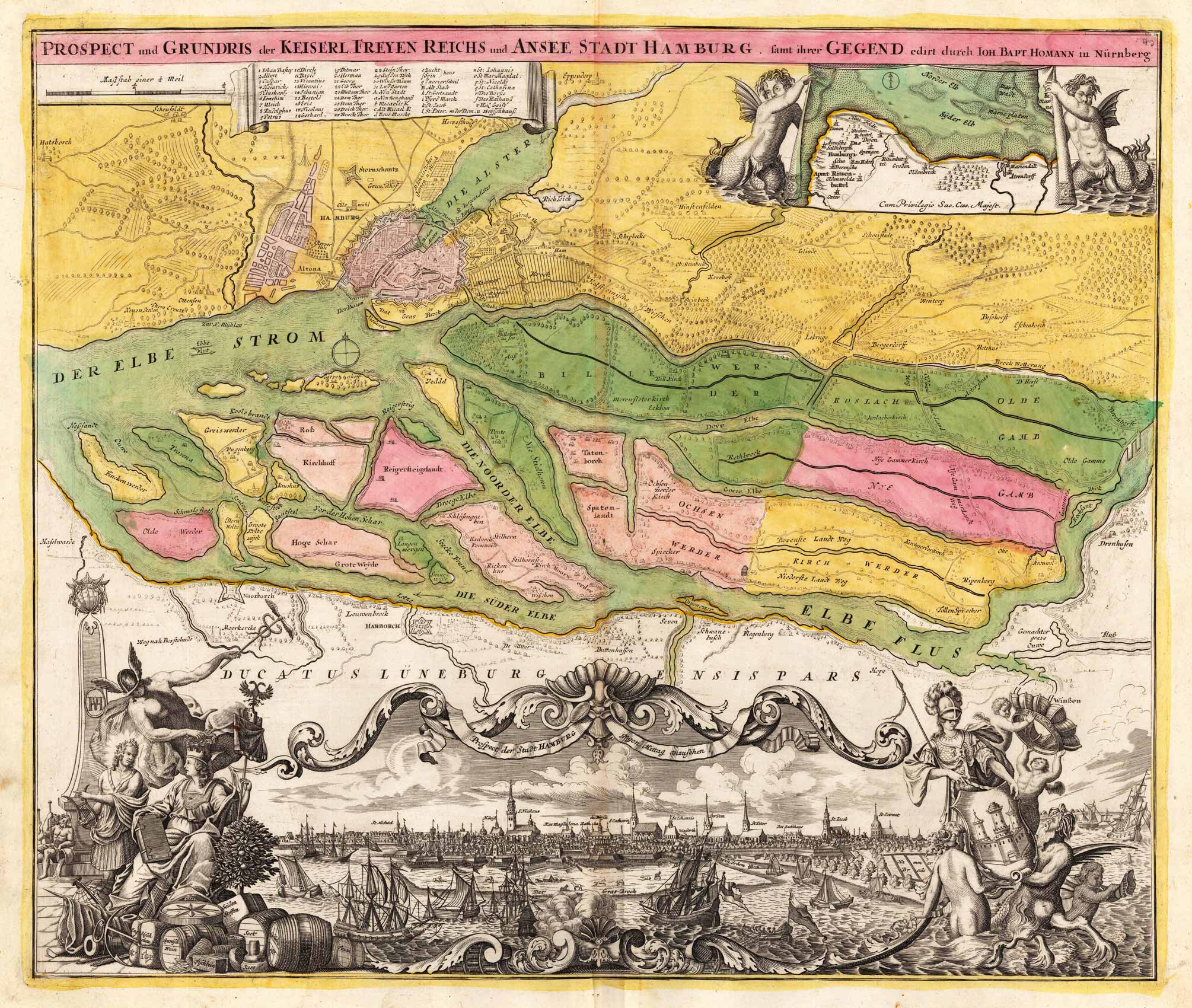
Original Kupferstich in zeitgenössischem Grenz- und Flächenkolorit. Planansicht auf Hamburg und Altona mit umliegender Gegend, sowie dem Elbefluss bis hin zur Süderelbe mit Harburg, im angrenzenden Herzogtum Lüneburg. Im unteren Rand des Plans eine große dekorative Panoramansicht mit Prospekt der Stadt Hamburg gegen Mittag. Diese ist links eingefasst von Allegorien zum Handel in der Hansestadt und rechts Meeresgötter, welche das Wappen der Stadt Hamburg aus dem Meer dem weltlichen Herscher empor reichen. Oben rechts kleine Insetkarte zur Norder- und Syder Elb gehalten von zwei Meereswesen.