Copper engraving, hand colored in outline. This map is depicting the southeastern part of the United States with Mexico and the gulf of Mexico. Texas is named ,Nouveau Leon', also the French discoveries near Galveston in Texas. The map first appeared in Santini's Atlas Universel in 1776-79 in Paris. In 1784 Santini sold the plates of the maps to M. Remondini, who published then these maps in Venice with his additional imprint in the title cartouches.
Steel engraving, hand colored in outline when published. This large and decorative map shows detailed Mexico and Central America. The map is equipped with many small place names, rivers, lakes, the gulf of Mexico and the Pacific coast. A interesting map for the Southwest US and the Southeast US with Florida. In the lower left corner we find two inset maps. One shows the railway project of Tehuantepec and the other a inset map of San Salvador and Honduras. Along the the countries of Central America (Mexico, Guatemala, S. Salvador, Nicaragua, Costa Rica) tables with abbreviations of the names of mountains in these countries. At bottom of the map we find detailed explanations for the map and a mileage scale. This map is the revised edition engraved by Kratz published 1866 in Weimar.
Steel engraving, hand colored in outline and wash when published. This antique map shows Arkansas with his canals, streets and distances from the main points. The map is equipped with many streets, routes, rivers, lakes, place names, etc. In the upper side we find a mileage scale and steamship routes: Little Rock - Pittsburg, Little Rock - Fort Gibson & Little Rock - New Orleans. A detailed engraved map by the famous German map maker Meyer Joseph. The map is based on Tanner's work in the early 1840s.
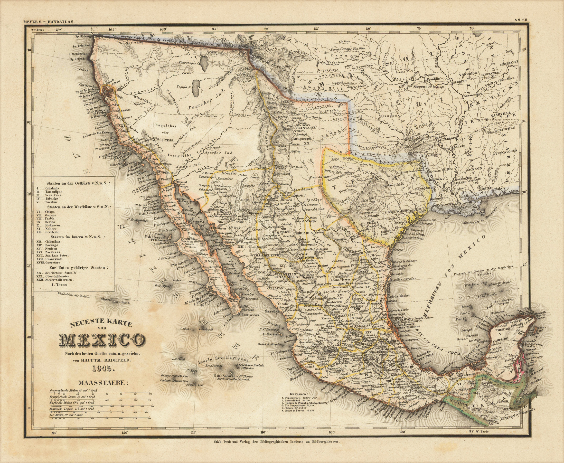
Steel engraving, hand colored in outline when published. A highly detailed map showing Mexico and Texas in 1845. The interesting antique map is equipped with many details as place names, engraved rivers, lakes and mountains. The map extends from Guatemala towards north of San Francisco. At the left side is a small engraved table with a listing of the various states and their political belongings. New Mexico with Santa Fe, Upper and Lower California is belonging to the Union. This map was published in the so-called ,Zeitungsatlas', which is famous because of the great details of the various US maps, which were included in this atlas. Most of these maps were based on the cartographic information by Tanner and were updated with German geographic sources.
Steel engraving, hand colored in outline when published. A highly detailed map of Texas, compiled and drawn by Captain Radefeld, published by Joseph Meyer in his famous edition of the large,Zeitungsatlas' around 1850-53 in Hildburghausen. Map shows the western boundary of Texas encompassing Santa Fe, the eastern boundary encompassing area of Louisiana along the Red River and into the Mississippi River delta.Texas is shown very detailed on this map with engraved place names, streets, routes, rivers, mountains and even a silver mine, salt lakes and Indian tribes are shown on the map. The outline hand color is from the period as published. Information on the various Indian tribes is given on the map as well. Texas extends in the north towards the neighboring Wyoming with the Missouri territory, in the west to New Mexico and the Utah territory. This map was published in the so-called,Zeitungsatlas', which is famous because of the great details of the various US maps, which were included in this atlas. Most of these maps were based on the cartographic information by Tanner and were updated with German geographic sources.
Steel engraving, hand colored in outline when published. A highly detailed map of Texas, compiled and drawn by Captain Radefeld, published by Joseph Meyer in one of the early editions of the large ,Zeitungsatlas' around 1846 in Hildburghausen. The map shows the western boundary of Texas encompassing Santa Fe, the eastern boundary encompassing area of Louisiana along the Red River and into the Mississippi River delta. Texas is shown very detailed on this map with engraved place names, streets, routes, rivers, mountains and even a silver mine, salt lakes and Indian tribes are shown on the map. The outline hand color is from the period as published. Information on the various Indian tribes is given on the map as well. Texas extends in the north towards the neighboring Wyoming with the Missouri territory, in the west to New Mexico and the Utah territory. This map was published in the so-called ,Zeitungsatlas', which is famous because of the great details of the various US maps, which were included in this atlas. Most of these maps were based on the cartographic information by Tanner and were updated with German geographic sources.