
Your results
4
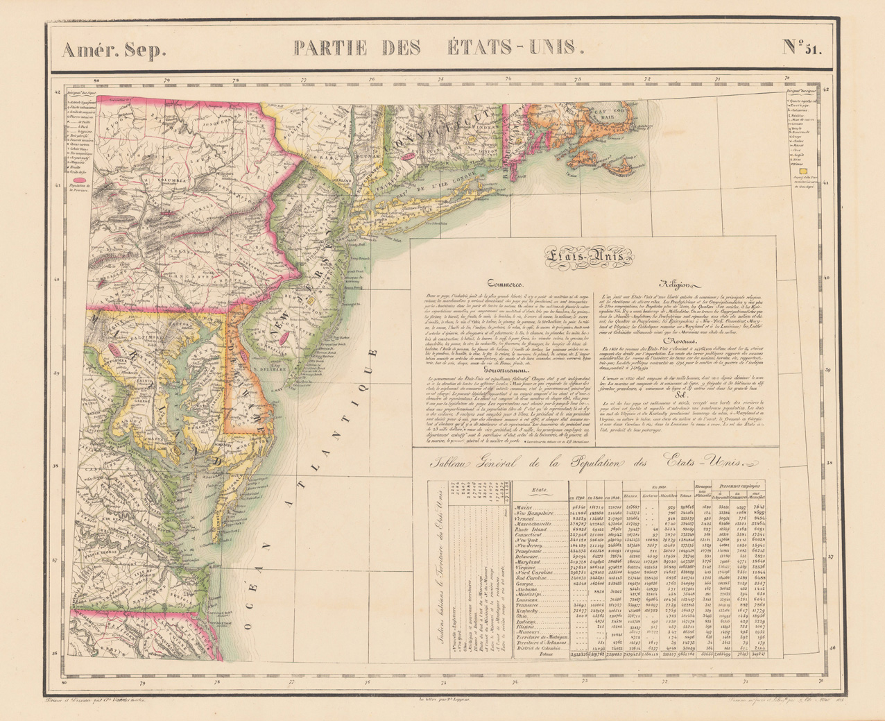
Amér. Sep. Partie de la Nouvelle Hanovre. No. 51.
€220.00*
Lithograph, original hand colored in outline. A detailed antique map of the Eastern sea board from Cape Code in the North East towards Norfolk in Virginia. The map provides highly detailed information on counties, cities, small villages and towns, roads, rivers, lakes, mountains, Indian tribes, forts and other geographical details. It shows parts of Connecticut, Pennsylvania, New Jersey, Maryland and Virginia. Published in Philippe Marie Vandermaelen's atlas volume of North America. This atlas volume was part of his six volume atlas ,Atlas Universal', which consists of 387 maps at a large scale of 1:1.6 million. The Belgian cartographer Philippe Marie Vandermaelen (1795-1869) was very interestered in cartography already in young age onwards, he was part of the leadership in establishing the important ,Establissement geographique de Bruxelles'. His maps are remarkable detailed, he also was well educated in mathematics and astronomy. Philippe Vandermaelen (Philippe Vander Maelen or van der Maelen), born in Brussels, on December 23, 1795, died in Molenbeek-Saint-Jean, on May 29, 1869, was an eminent geographer and cartographer, famous for having conceived an authoritative universal Atlas and for having founded the Brussels Geographical Establishment in Molenbeek-Saint-Jean. Philippe Vandermaelen drew up numerous high-level scientific charts at scales based on the metric system recently introduced in Belgium. Alex Pasquier wrote about him in 1936: ,A geographer like Mercator, an organizer like Theodore Verhaegen, an assembler of cards like Paul Otlet, Philippe Vandermaelen personified to a remarkable degree, in the middle of the nineteenth century, the qualities of method and order that were laborious. characterize our country.' (Wikipedia)

Belgii Novi, Angliae Novae, Et Partis Virginiae Novissima Delineatio Prostant Amstelaedami apud Petrum Schenk, et Gerardum Valk, C.P.
€4,000.00*
Original copper engraving, handcolored in wash and outline, when published. A famous and decorative map of New England, showing the Eastcoast from South of the Chesapeake towards the St. Lawrence river in the North. The map was published in 1651 by J. Jansson for the first time. We also find examples of this map in Janssons' Seatatlas and the Atlas Constractus. This Dutch map is a detailed and informative map of the Dutch province of New Netherland and the surrounding region. 'It shows English settlements on the west end of Long Island (Greenwyck, Gravesand), along the shore of Long Island Sound (Stamford, Strotford, Nieuhaven and Milfort ... ' Tooley p. 283. The map was ornated with a decorative floral vignettes around the title cartouche and a small decorative dedication to Gualthero de Raet. As well Indian life, probably taken from the de Bry' s voyages, was used to ornate this map. The map here is present in its third state published by Schenk and Valk.

Boston with Charlestown and Roxbury - Published under the Superintendence of the Society for the Diffusion of Useful Knowleage.
€295.00*
Steel engraving, hand colored in outline and wash when published. Decorative detailed bird's eye plan of the cvity of Boston with with Charlestown and Roxbury and its harbour.