
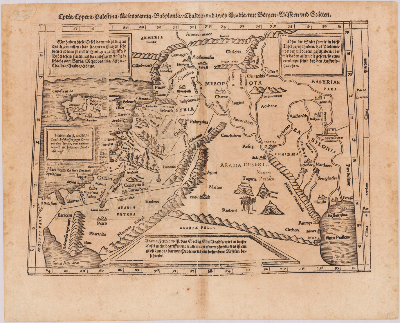

Syria, Cypern, Palestina, Mesopotamia, Babylonia, Shaldea und zwey Arabia mit Bergen, Wässern und Stätten.
Product information: Syria, Cypern, Palestina, Mesopotamia, Babylonia, Shaldea und zwey Arabia mit Bergen, Wässern und Stätten.
Woodcut map, uncolored as published. Verso illustrated with a decorative woodcut illustration. German text edition. The map depicts the eastern part of the Mediterranean Sea with Cyprus, Palestine, Syria, the neighboring Armenia, as well Mesopotamia, Bablyonia and Arabia towards the gulf of Persia. With small schematic miniature views next to the larger place names on the map, rivers, lakes and mountain chains are also shown on the map. Tn the corners with four tables of explaining the map in German text. The map was cut and published in Sebastian Münster's Cosmographie after geographical and historical sources by Ptolemy. A decorative early woodcut map by the famous map maker Sebastian Münster, which was published and printed in his German text edition of the ,Cosmographia' in 1578 in Basel at Heinrich Petri. The decorative woodcut bordures verso were probably cut by the famous 16th century woodcutter Hans Holbein. Nearly none of these captivating woodcut borders by Holbein verso are repeating in Sebastian Münster's atlas, they are mainly shaped by allegoric scenes, coat of arms or wonderful initials.
Properties
| Category: | Near East with Palestine, Syria, Cyprus |
|---|---|
| Issue date: | 1578 |
| Published place: | Basel |
| Publisher: | H. Petri |
| Technique: | Woodcut, uncolored. |
| Type: | map |