
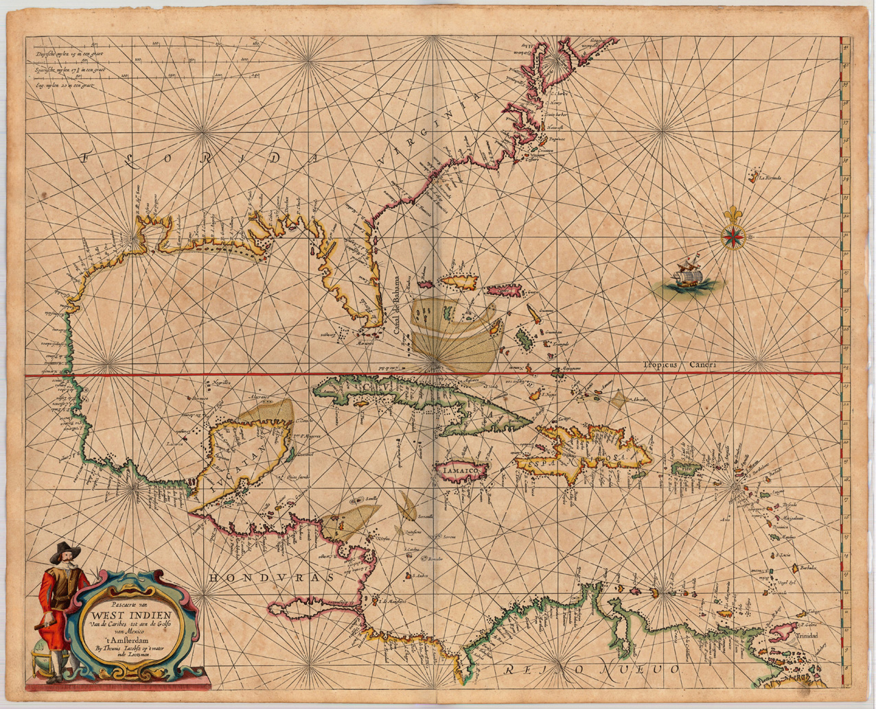
Pascaerte van West Indien Van de Caribes tot aen de Golfo van Mexico 't Amsterdam By Theunis Iacobsz op't water inde Lootsman.
Product information: Pascaerte van West Indien Van de Caribes tot aen de Golfo van Mexico 't Amsterdam By Theunis Iacobsz op't water inde Lootsman.
Copper engraving, finely hand colored in outline, when published. Partially heightened in gold. A highly decorative and important map showing Florida, the Eastern seaboard and the West Indies. The southern tip of Florida with the Tortugos islands and the Martinier islands. Along the eastern coast of Florida with some engraved capes and river names, among them Cape Canaveral. An important chart of this period showing the sea routes and explorations of the Spanish and Dutch during this period. This chart of the West Indies by Jacobsz Theunis was published in a Dutch composite sea atlas mainly with charts by Pieter Goos, who was 'one of the best known maritime booksellers of Amsterdam' (Koeman), he published a number of different sea-atlases or pilot books, his work was very much derivative. With his 'Zee-Atlas' he relied heavily on Hendrick Doncker's 'Zee-Atlas' of 1659. Our example of this sea chart 'Pascaerte van West Indien ...' by the Lootsman (Anthony Iacobsen) Family was published in an early composit sea atlas probably around 1665/66. This map is printed on excellent thick double paper, it stands out through the highly decorative hand colors and the partially heightening of gold in title cartouches, mileage scales, compass roses or other places.
Properties
| Category: | West Indies |
|---|---|
| Issue date: | 1666 |
| Published place: | Amsterdam |
| Technique: | Copper engraving / Original color. |
| Type: | Antique Map, map |