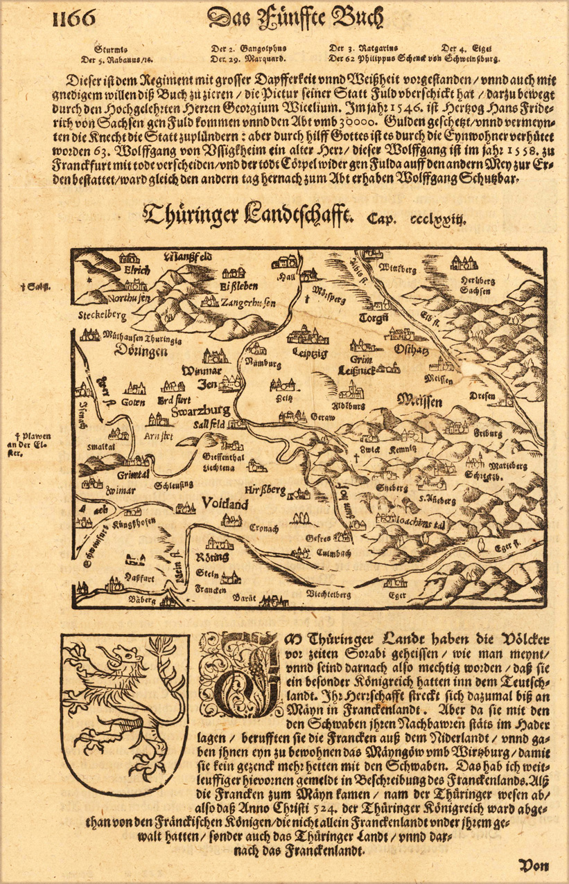
Woodcut published 1628 in the 'Cosmographia' by Sebastian Münster, printed on the full text sheet. Early and decorative map of Thuringia. City views are shown as miniature views.
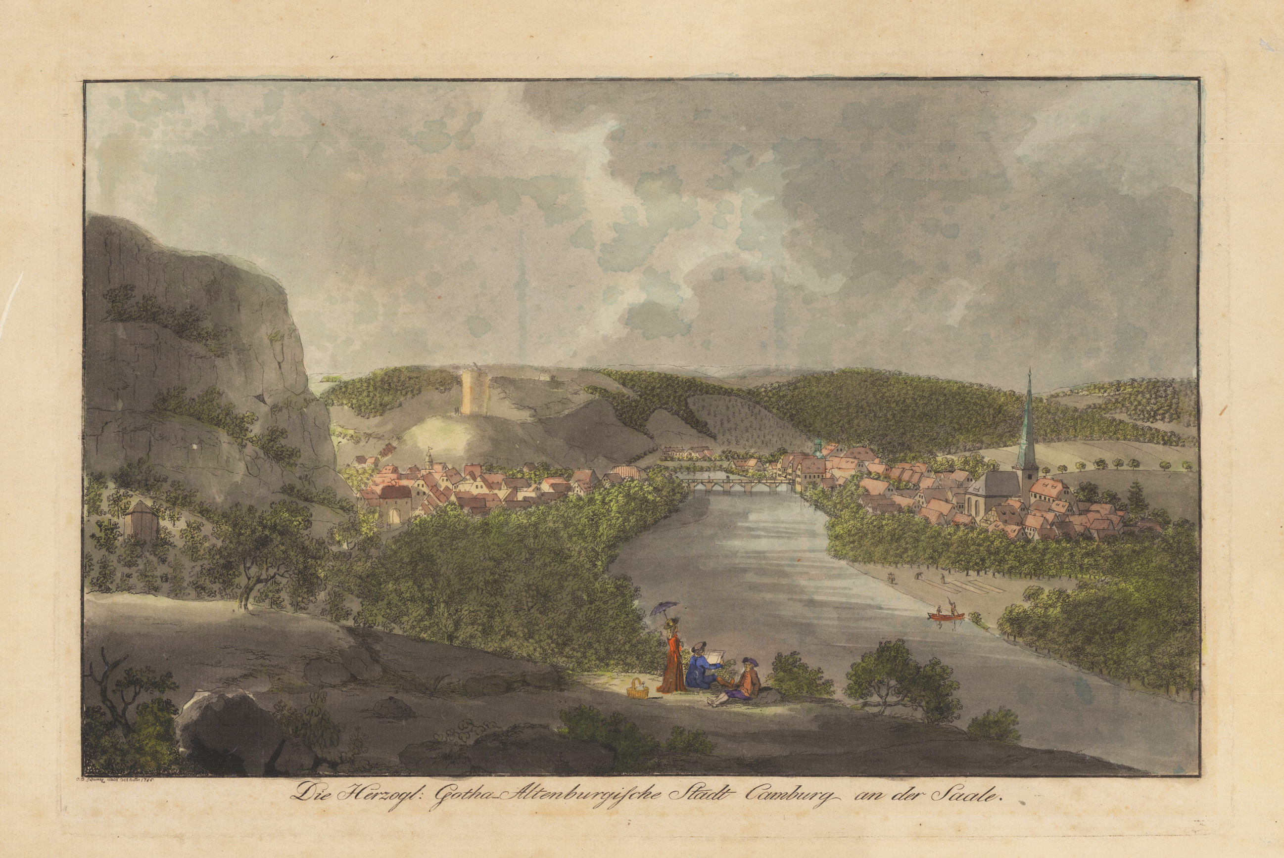
Original Radierung, handkoloriert. Stadtansicht von Camburg an der Saale (heute Dornburg-Camburg in Thüringen) von Norden, links im Hintergrund befindet sich die Burg, rechts die Trinitatiskirche. Im Vordergrund ist der Zeichner mit Begleitung. Carl Benjamin Schwarz (* 1757 in Leipzig; † 21. Oktober 1813 ebenda) war ein deutscher Zeichner, Kupferstecher und Maler. Schwarz lernte das Tischlerhandwerk und ging dann als Geselle nach Paris. Dort trat er in ein Regiment ein, mit dem er unter anderem auch nach Straßburg und Flandern zog. Sein Interesse galt der Architektur und der Malerei und er begann Bauwerke der besuchten Städte zu malen. 1779 kehrte er in seine Heimat zurück und begann an der Akademie in Leipzig bei Adam Friedrich Oeser zu lernen. Unterstützt wurde er von Breitkopf und Winckler. Er unternahm Reisen entlang der Saale und beteiligte sich an Ausstellungen. Von Winckler wurde er schließlich zum Aufseher seines angesehenen Kabinetts in Leipzig ernannt. Schwarz malte einige Prospekte. Hauptsächlich erstellte er aber malerische Kupferstiche, die er teilweise kolorierte. Es entstanden zahlreiche Ansichten von Leipzig und anderen sächsischen Städten. Auch in Berlin war er tätig und arbeitete mit dem Verlag „Jean Morino et Comp." zusammen.
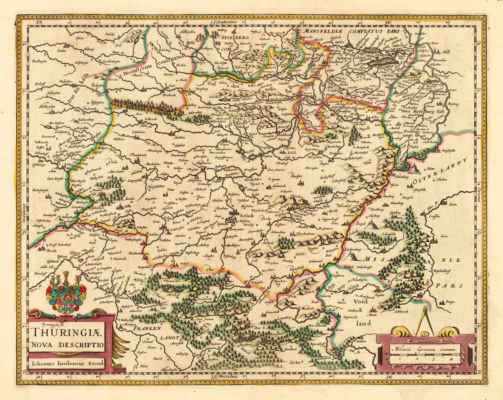
Original antique copper engraving, hand colored in outline when published. Title cartouche with coat of arms below left and the mileage scale below right. The engraving covers the area between Stolberg in the north, Gera and Zeitz in the east, Schleiz and Meiningen in the south and Berka and Halberstadt in the west. In the center of the city of Erfurt and the region of the Saale and Unstrut region. Johannes Janssonius (1588, Arnhem – buried July 11, 1664, Amsterdam) (born Jan Janszoon, in English also Jan Jansson) was a Dutch cartographer and publisher who lived and worked in Amsterdam in the 17th century. Janssonius was born in Arnhem, the son of Jan Janszoon the Elder,[1] a publisher and bookseller. In 1612 he married Elisabeth de Hondt, the daughter of Jodocus Hondius. He produced his first maps in 1616 of France and Italy. In 1623 Janssonius owned a bookstore in Frankfurt am Main, later also in Danzig, Stockholm, Copenhagen, Berlin, Königsberg, Geneva and Lyon. Elisabeth Hondius died in 1627 and he remarried Elisabeth Carlier in 1629. In the 1630s he formed a partnership with his brother in law Henricus Hondius, and together they published atlases as Mercator/Hondius/Janssonius. Under the leadership of Janssonius the Hondius Atlas was steadily enlarged. Renamed Atlas Novus, it had three volumes in 1638, one fully dedicated to Italy. In 1646, a fourth volume came out with "English County Maps", a year after a similar issue by Joan Blaeu. Janssonius' maps are similar to those of Blaeu, and he is often accused of copying from his rival, but many of his maps predate those of Blaeu and/or covered different regions. By 1660, at which point the atlas bore the appropriate name "Atlas Major", there were 11 volumes, containing the work of about a hundred credited authors and engravers. It included a description of "most of the cities of the world" (Townatlas), of the waterworld (Atlas Maritimus in 33 maps), and of the Ancient World (60 maps). The eleventh volume was the Atlas of the Heavens by Andreas Cellarius. Editions were printed in Dutch, Latin, French, and a few times in German. After Janssonius's death, the publishing company was continued by his son-in law, Johannes van Waesbergen. The London bookseller Moses Pitt attempted publication of the Atlas Major in English, but ran out of resources after the fourth volume in 1683. (Wikipedia)
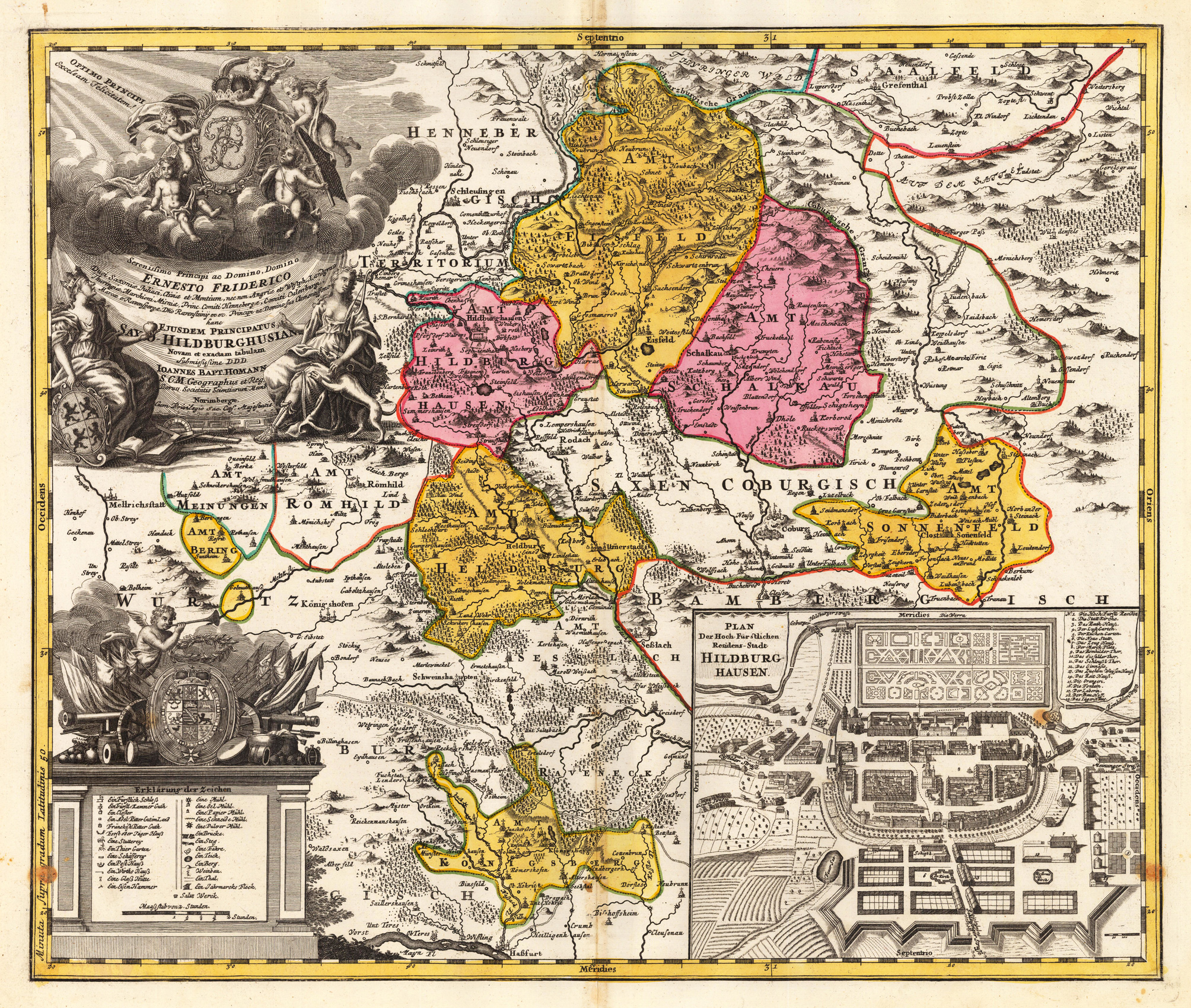
Original antique copper engraving, hand colored in outline and wash when published. Fine district map of the area of Hildburghausen, ornated with large allegoric cartouches and explanations and a plan of the city in the lower right corner. Hand colored when published in outline and wash. Johann Baptist Homann (20 March 1664 – 1 July 1724) was a German geographer and cartographer, who also made maps of the Americas. Homann was born in Oberkammlach near Kammlach in the Electorate of Bavaria. Although educated at a Jesuit school, and preparing for an ecclesiastical career, he eventually converted to Protestantism and from 1687 worked as a civil law notary in Nuremberg. He soon turned to engraving and cartography; in 1702 he founded his own publishing house. Homann acquired renown as a leading German cartographer, and in 1715 was appointed Imperial Geographer by Emperor Charles VI. Giving such privileges to individuals was an added right that the Holy Roman Emperor enjoyed. In the same year he was also named a member of the Prussian Academy of Sciences in Berlin. Of particular significance to cartography were the imperial printing privileges (Latin: privilegia impressoria). These protected for a time the authors in all scientific fields such as printers, copper engravers, map makers and publishers. They were also very important as a recommendation for potential customers. In 1716 Homann published his masterpiece Grosser Atlas ueber die ganze Welt (Grand Atlas of all the World). Numerous maps were drawn up in cooperation with the engraver Christoph Weigel the Elder, who also published Siebmachers Wappenbuch. Homann died in Nuremberg in 1724. He was succeeded by his son Johann Christoph (1703-1730). The company carried on upon his death as Homann heirs company, managed by Johann Michael Franz and Johann Georg Ebersberger. After subsequent changes in management the company folded in 1852.[1] The company was known as "Homann Erben", "Homanniani Heredes", or "Heritiers de Homann" abroad. (Wikipedia)
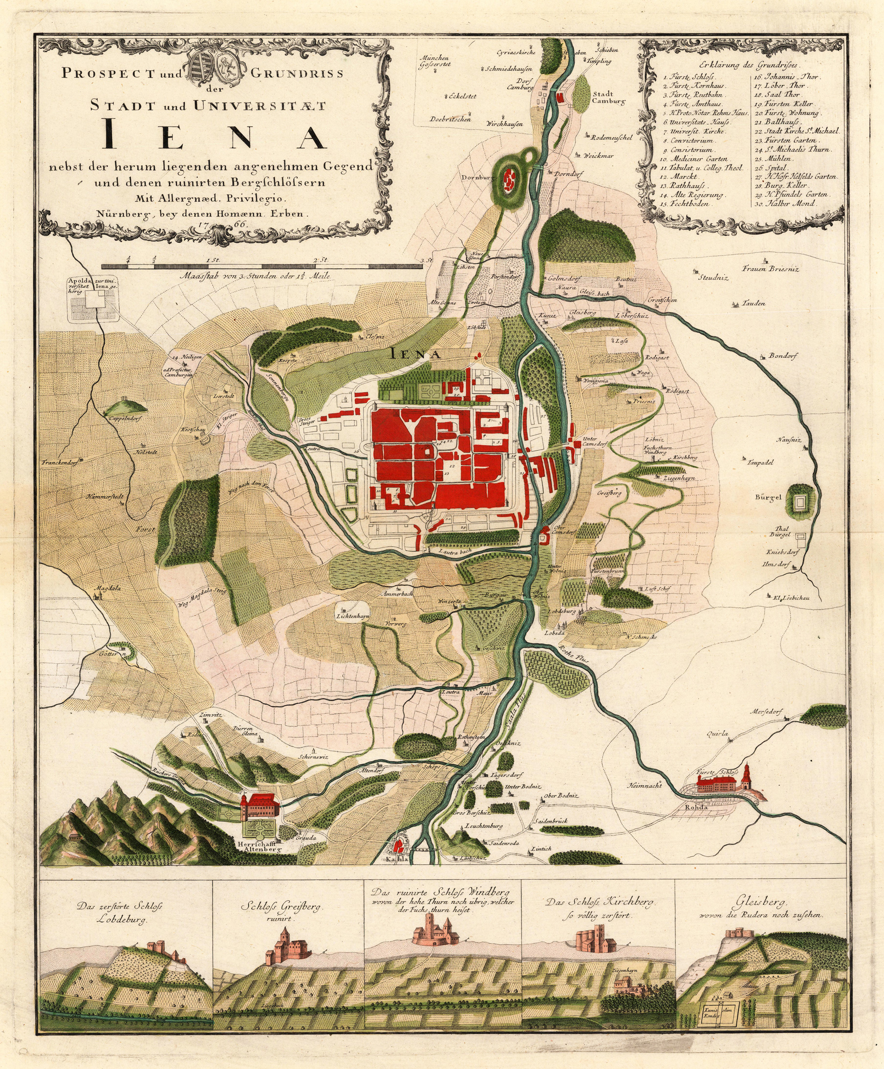
Original antique copper engraving, hand colored in outline and wash. Links oben floral einfaßte Titelkartusche u. ausführliche Legende rechts oben. Unten 5 Prospekte von zerstörten Schlössern. Prachtvoller Plan der Stadt Jena mit ihrer Umgebung aus der Vogelschau. Die Karte besticht durch ihre detailliert verzeichneten Wege, Angaben von Gehöften u. Orten, eingezeichneten Feldern u. Wäldern. Das Kartenbild im Norden bis Camburg u. im Süden bis Kahla. Im Westen bis hin nach Frankendorf u. im Südosten noch bis Mersedorf u. Rhoda. Die 5 Darstellungen von zerstörten Schlössern (Lobdebur, Greifberg, Windberg, Kirchberg, Gleisberg) im Unterrand reizvoll jeweils im Gelände dargestellt. Dekorative Karte von gutem Erhaltungszustand, in schönem frischen Verlagskolorit. Title cartouche with flowers in the upper left corner. Detailed legend at the top right. Magnificent map of the city of Jena and its surroundings from a bird's eye view. The map impresses with detailed routes and details of farmsteads. Locations, drawn fields and forests. The map to Camburg in the north and Kahla in the south. To the west to Frankendorf and to the southeast to Mersedorf and Rhoda. The 5 representations of destroyed castles (Lobdebur, Greifberg, Windberg, Kirchberg, Gleisberg) at the bottom are each shown in the terrain. Decorative map in good condition, in nice fresh color. Johann Baptist Homann (20 March 1664 – 1 July 1724) was a German geographer and cartographer, who also made maps of the Americas. Homann was born in Oberkammlach near Kammlach in the Electorate of Bavaria. Although educated at a Jesuit school, and preparing for an ecclesiastical career, he eventually converted to Protestantism and from 1687 worked as a civil law notary in Nuremberg. He soon turned to engraving and cartography; in 1702 he founded his own publishing house. Homann acquired renown as a leading German cartographer, and in 1715 was appointed Imperial Geographer by Emperor Charles VI. Giving such privileges to individuals was an added right that the Holy Roman Emperor enjoyed. In the same year he was also named a member of the Prussian Academy of Sciences in Berlin. Of particular significance to cartography were the imperial printing privileges (Latin: privilegia impressoria). These protected for a time the authors in all scientific fields such as printers, copper engravers, map makers and publishers. They were also very important as a recommendation for potential customers. In 1716 Homann published his masterpiece Grosser Atlas ueber die ganze Welt (Grand Atlas of all the World). Numerous maps were drawn up in cooperation with the engraver Christoph Weigel the Elder, who also published Siebmachers Wappenbuch. Homann died in Nuremberg in 1724. He was succeeded by his son Johann Christoph (1703-1730). The company carried on upon his death as Homann heirs company, managed by Johann Michael Franz and Johann Georg Ebersberger. After subsequent changes in management the company folded in 1852.[1] The company was known as "Homann Erben", "Homanniani Heredes", or "Heritiers de Homann" abroad. (Wikipedia)
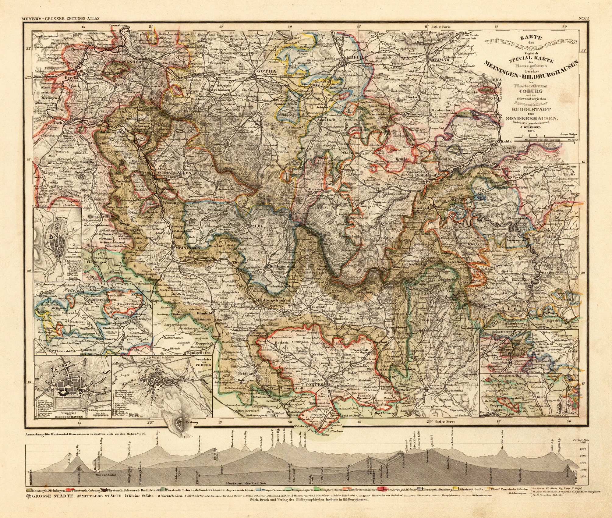
Detailed map of the Thüringer-Wald-Gebirges. Published in Meyer's Zeitungsatlas. Original steel-engraving, contempory hand-colored in outline, when published. A fine example.
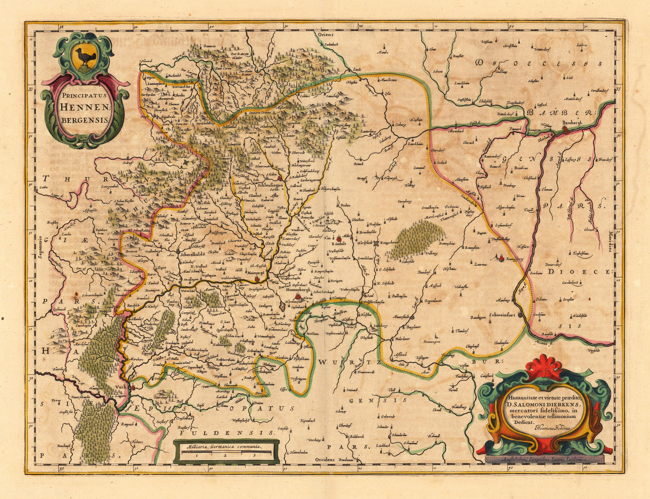
Copper engraving, hand colored in outline and wash when published. This antique map shows the county of Henneberg in Thüringen. In the upper left side we see the title cartouche and in the lower left side we look to a description from Hondius. Inside the map are many small place names, rivers, mountains, woods, etc. At the left bottom is a cartouche with a mileage scale.
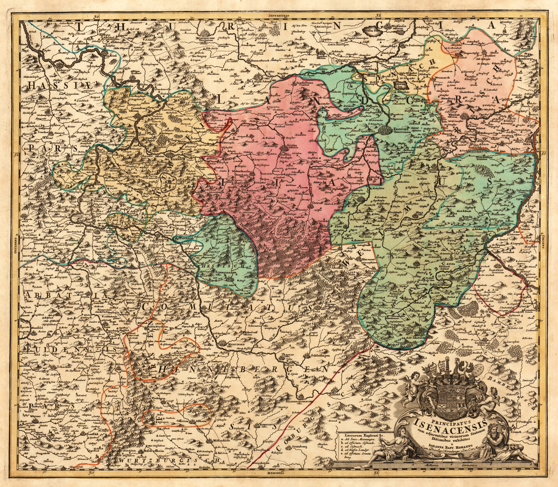
Original antique copper engraving, hand colored in outline and wash when published. Zeigt das Fürstentum Eisenach mit dem Gebiet zwischen Eschwege, Jena, Bad Königshoven und Weissensse. Shows the principality of Eisenach with the area between Eschwege, Jena, Bad Königshoven and Weissensse. Johann Baptist Homann (20 March 1664 – 1 July 1724) was a German geographer and cartographer, who also made maps of the Americas. Homann was born in Oberkammlach near Kammlach in the Electorate of Bavaria. Although educated at a Jesuit school, and preparing for an ecclesiastical career, he eventually converted to Protestantism and from 1687 worked as a civil law notary in Nuremberg. He soon turned to engraving and cartography; in 1702 he founded his own publishing house. Homann acquired renown as a leading German cartographer, and in 1715 was appointed Imperial Geographer by Emperor Charles VI. Giving such privileges to individuals was an added right that the Holy Roman Emperor enjoyed. In the same year he was also named a member of the Prussian Academy of Sciences in Berlin. Of particular significance to cartography were the imperial printing privileges (Latin: privilegia impressoria). These protected for a time the authors in all scientific fields such as printers, copper engravers, map makers and publishers. They were also very important as a recommendation for potential customers. In 1716 Homann published his masterpiece Grosser Atlas ueber die ganze Welt (Grand Atlas of all the World). Numerous maps were drawn up in cooperation with the engraver Christoph Weigel the Elder, who also published Siebmachers Wappenbuch. Homann died in Nuremberg in 1724. He was succeeded by his son Johann Christoph (1703-1730). The company carried on upon his death as Homann heirs company, managed by Johann Michael Franz and Johann Georg Ebersberger. After subsequent changes in management the company folded in 1852.[1] The company was known as "Homann Erben", "Homanniani Heredes", or "Heritiers de Homann" abroad. (Wikipedia)
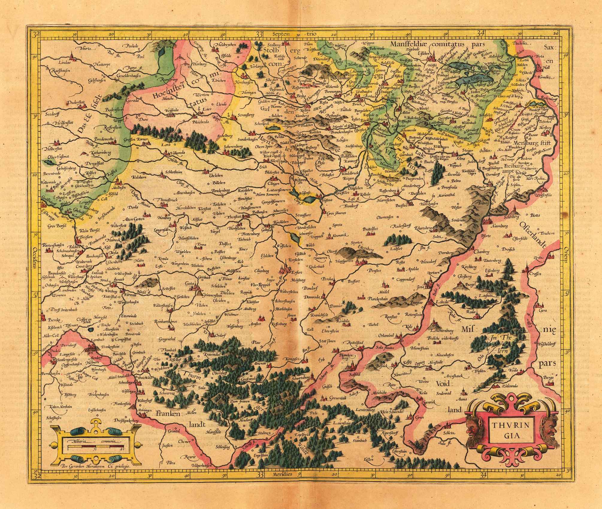
Original antique copper engraving, hand colored when published. The colored title cartouche is in the lower right corner and a mileage scale in the lower left. Cities, mountains and forest areas shown in colored miniatures. Extensive explanations in French on the back. Kupferstichkarte in zeitgenössischem Grenzkolorit, verlegt von Jodocus Hondius. Rechts unten kolorierte Titelkartusche mit Beschlagwerk. Unten links kolorierte Beschlagwerkskartusche mit Meilenzeiger. Städte, Berge und Waldgebiete in kolorierten Miniaturen dargestellt. Umfangreiche Erklärungen in französischer Sprache auf der Rückseite. Gerardus Mercator (5 March 1512 – 2 December 1594) was a 16th-century geographer, cosmographer and cartographer from the County of Flanders. He is most renowned for creating the 1569 world map based on a new projection which represented sailing courses of constant bearing (rhumb lines) as straight lines—an innovation that is still employed in nautical charts. Mercator was one of the pioneers of cartography and is widely considered the most notable figure of the school in its golden age (approximately 1570s–1670s). In his own day, he was a notable as maker of globes and scientific instruments. In addition, he had interests in theology, philosophy, history, mathematics and geomagnetism. He was also an accomplished engraver and calligrapher. Unlike other great scholars of the age he travelled little and his knowledge of geography came from his library of over one thousand books and maps, from his visitors and from his vast correspondence (in six languages) with other scholars, statesmen, travellers, merchants and seamen. Mercator's early maps were in large formats suitable for wall mounting but in the second half of his life, he produced over 100 new regional maps in a smaller format suitable for binding into his Atlas of 1595. This was the first appearance of the word Atlas in reference to a book of maps. However, Mercator used it as a neologism for a treatise (Cosmologia) on the creation, history and description of the universe, not simply a collection of maps. He chose the word as a commemoration of the Titan Atlas, "King of Mauretania", whom he considered to be the first great geographer. A large part of Mercator's income came from sales of his terrestrial and celestial globes. For sixty years they were considered the finest in the world, and were sold in such great numbers that there are many surviving examples. This was a substantial enterprise involving the manufacture of the spheres, printing the gores, building substantial stands, packing and distributing all over Europe. He was also renowned for his scientific instruments, particularly his astrolabes and astronomical rings used to study the geometry of astronomy and astrology. Mercator wrote on geography, philosophy, chronology and theology. All of the wall maps were engraved with copious text on the region concerned. As an example the famous world map of 1569 is inscribed with over five thousand words in fifteen legends. The 1595 Atlas has about 120 pages of maps and illustrated title pages but a greater number of pages are devoted to his account of the creation of the universe and descriptions of all the countries portrayed. His table of chronology ran to some 400 pages fixing the dates (from the time of creation) of earthly dynasties, major political and military events, volcanic eruptions, earthquakes and eclipses. He also wrote on the gospels and the old testament. Mercator was a devout Christian born into a Catholic family at a time when Martin Luther's Protestantism was gaining ground. He never declared himself as a Lutheran but he was clearly sympathetic and he was accused of heresy by Catholic authorities; after six months in prison he was released unscathed. This period of persecution is probably the major factor in his move from Catholic Leuven (Louvain) to a more tolerant Duisburg, in the Holy Roman Empire, where he lived for the last thirty years of his life. Walter Ghim, Mercator's friend and first biographer, describes him as sober in his behaviour, yet cheerful and witty in company, and never more happy than in debate with other scholars. Above all he was pious and studious until his dying days.
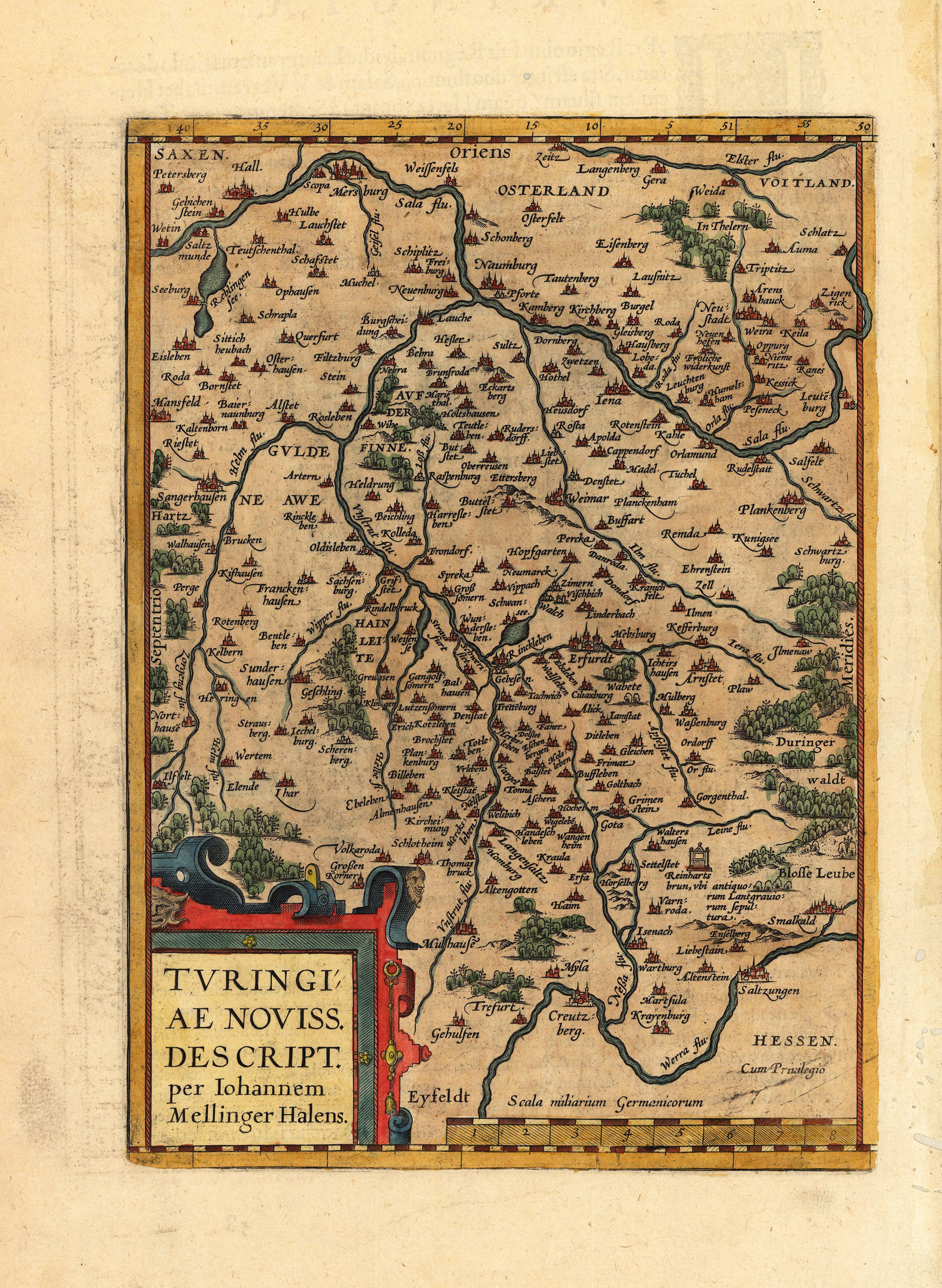
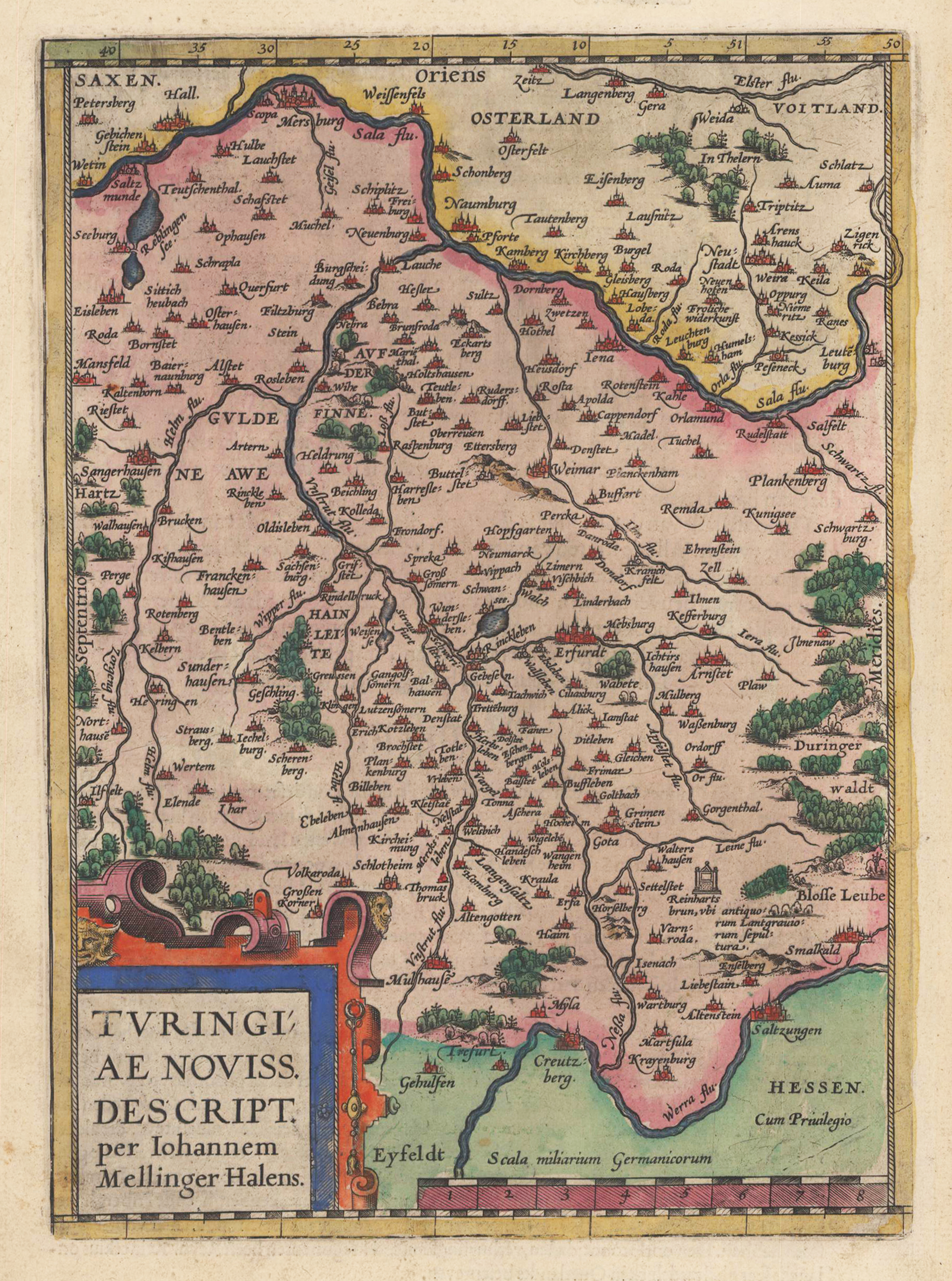
Antique original copper engraving, hand colored in outline and wash when published at Theatrum Orbis Terrarum. Decorative map of Thuringia with the region between Mansfeld, Merseburg, Saalfeld, Schmalkalden and Mühlhausen with the city of Erfurt in the middle. Beautiful Renaissance cartouche with the card title "Turingiae Noviss [ima] Descript [io] / per Iohannem Mellinger Halens." Mileage scale below right . Certain endorsement of the privilege "Cum Privilegio". Ortelius was born on 14 April 1527 in the city of Antwerp, which was then in the Habsburg Netherlands (modern-day Belgium). The Orthellius family were originally from Augsburg, a Free imperial city of the Holy Roman Empire. In 1535, the family had fallen under suspicion of Protestantism. Following the death of Ortelius's father, his uncle Jacobus van Meteren returned from religious exile in England to take care of Ortelius. Abraham remained close to his cousin Emanuel van Meteren, who would later move to London. In 1575 he was appointed geographer to the king of Spain, Philip II, on the recommendation of Arias Montanus, who vouched for his orthodoxy. He travelled extensively in Europe and is specifically known to have traveled throughout the Seventeen Provinces; in southern, western, northern, and eastern Germany (e.g., 1560, 1575–1576); France (1559–1560); England and Ireland (1576); and Italy (1578, and perhaps twice or thrice between 1550 and 1558). Beginning as a map-engraver, in 1547 he entered the Antwerp Guild of Saint Luke as an illuminator of maps. He supplemented his income trading in books, prints, and maps, and his journeys included yearly visits to the Frankfurt book and print fair, where he met Gerardus Mercator in 1554. In 1560, however, when travelling with Mercator to Trier, Lorraine, and Poitiers, he seems to have been attracted, largely by Mercator's influence, towards the career of a scientific geographer. (Wikipedia)
Original Kupferstich, in zeitgenössischem prachtvollen Grenz- und Flächenkolorit. Das Kartenbild reicht von Halle im Norden bis hin nach Bad Saltzungen an der Werra. Die Stadt Erfurt im Zentrum des Kartenbildes. Mit vielen eingezeichneten Orts- und Städtenamen, diese meist als Miniaturansichten dargestellt. Ferner sind Flüße, Seen und Wälder detailliert eingezeichnet. Schöne und dekorative alte Landkarte des 16. Jahrhunderts von Thüringen. Erschienen im,Theatrum Orbis Terrarum' von A. Ortelius, deutsche Textausgabe von 1580. Links unten dekorative ausgemalte Rollwerkskartusche.