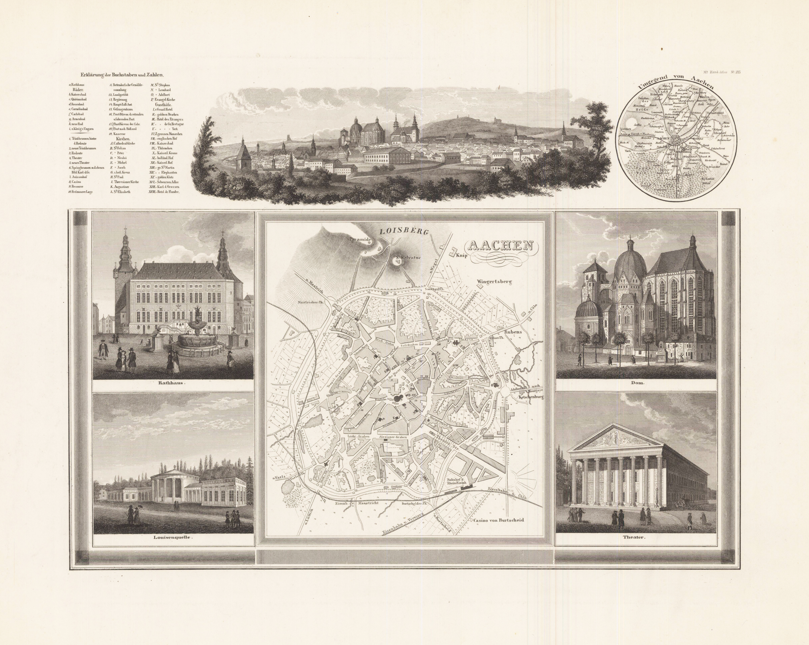
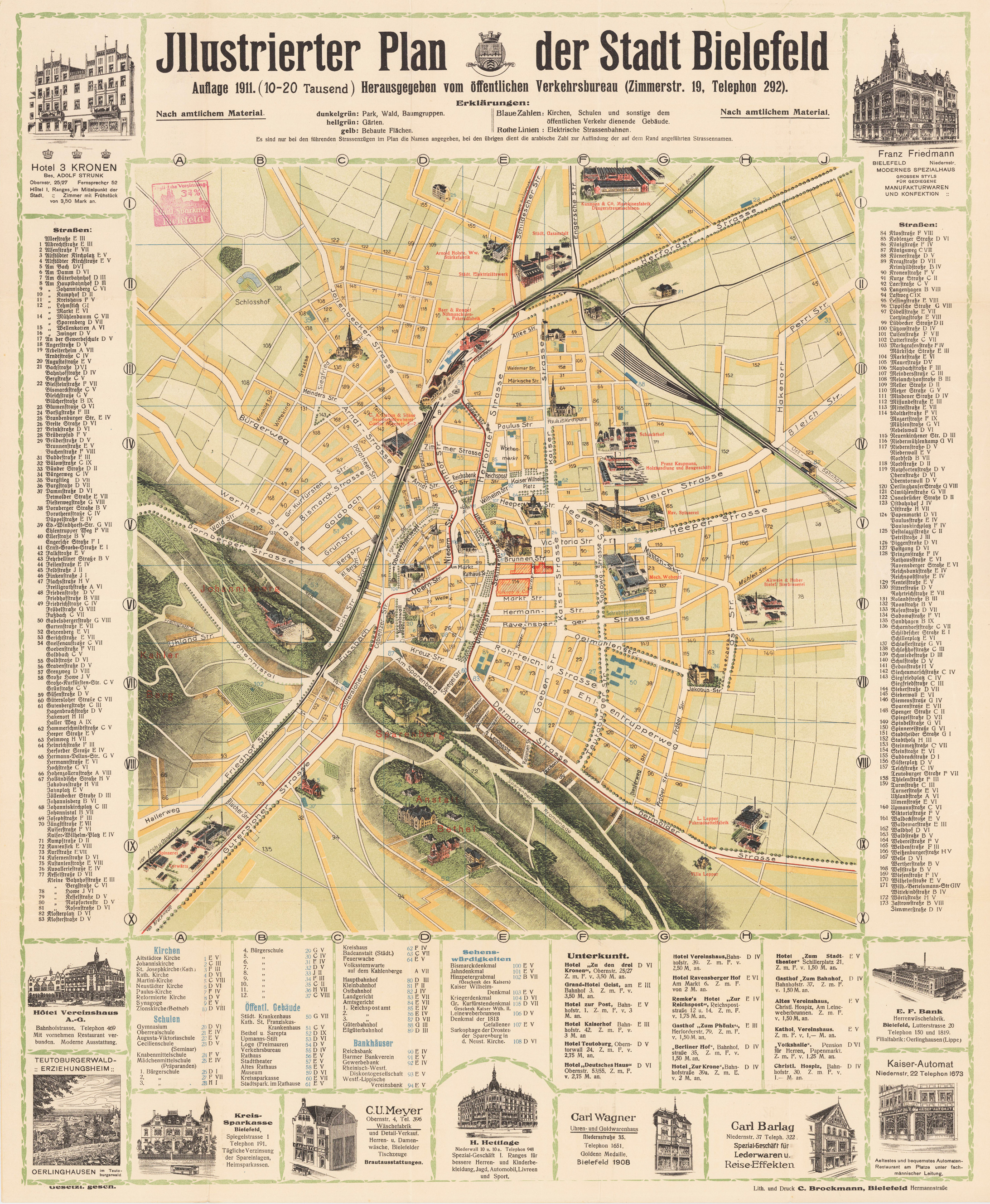
Original Stahlstich, unkoloriert. Stadtplan mit Gesamtansicht und 4 Teilansichten Nr. 11, Zeichnung von Friedrich Perlberg. Gesamtansicht (6,5 x 21 cm), darunter Stadtplan (16 x 14,5 cm), umgeben von vier Ansichten (Rathaus, Louisenquelle, Dom und Theater). Oben links neben der Panoramaansicht der Stadt ist eine Erklärungstafel mit Zahlen und Buchstaben. Rechts davon eine kreisrunde Umgebungskarte. Sehr breitrandig. Selten. Großer Hand-Atlas über alle Theile der Erde in 170 Karten.
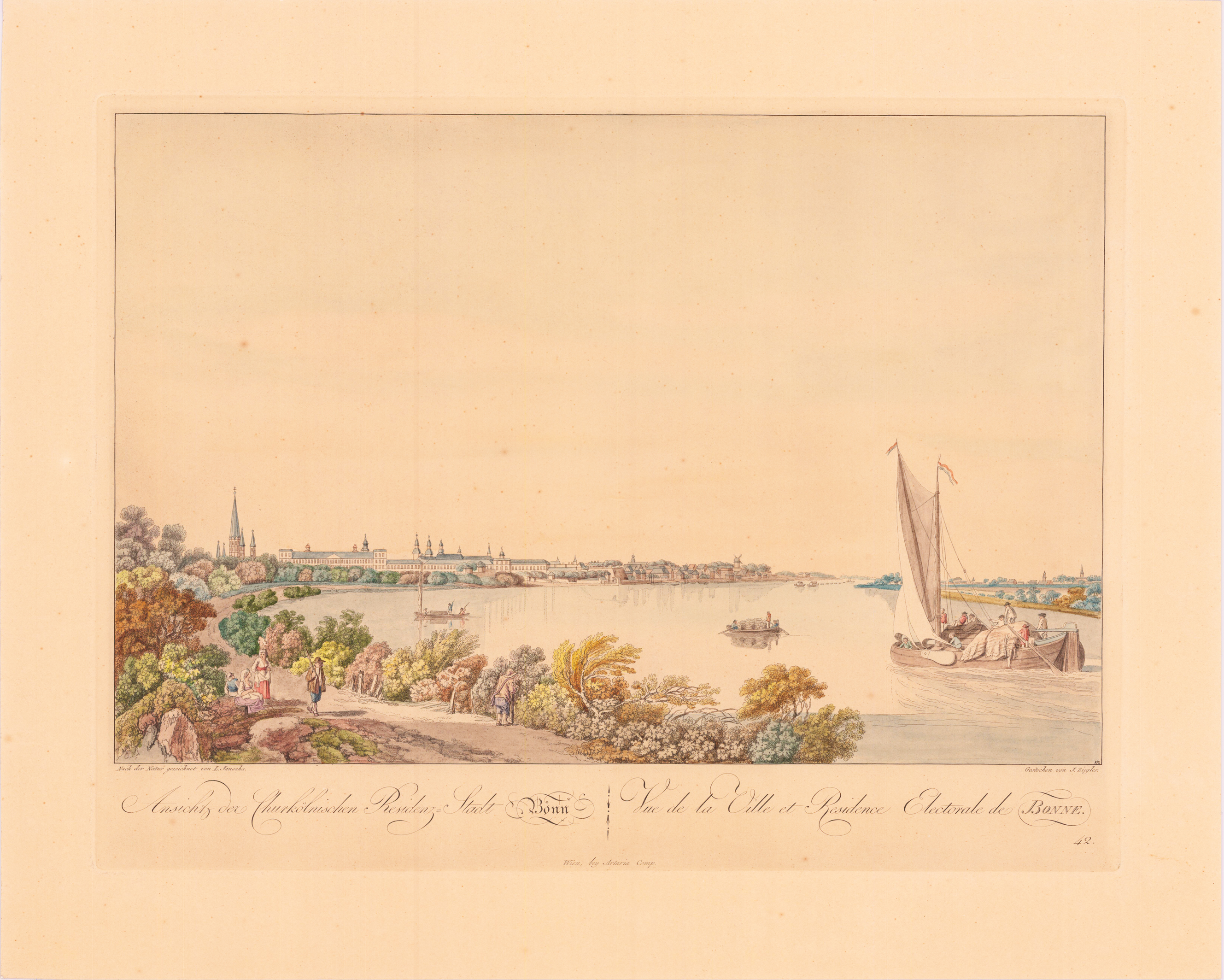
Original handkolorierter Kupferstich. Später Abdruck. Erschienen in der Folge:,Fünfzig malerische Ansichten des Rhein-Stromes, Wien 1798'. Gestochen von Johann Ziegler nach einer Zeichnung von Laurenz Janscha.
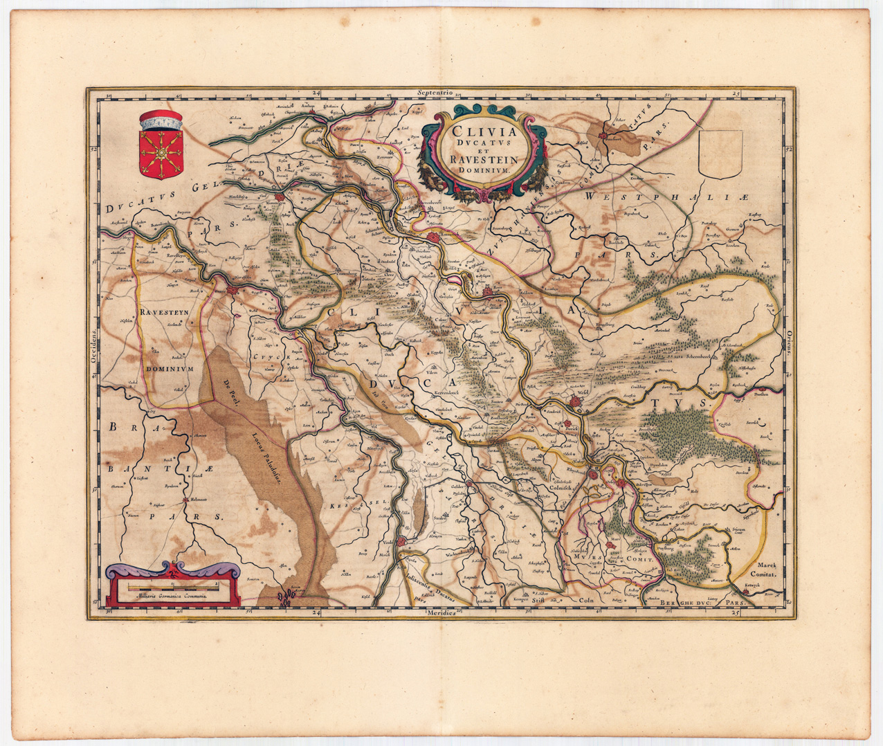
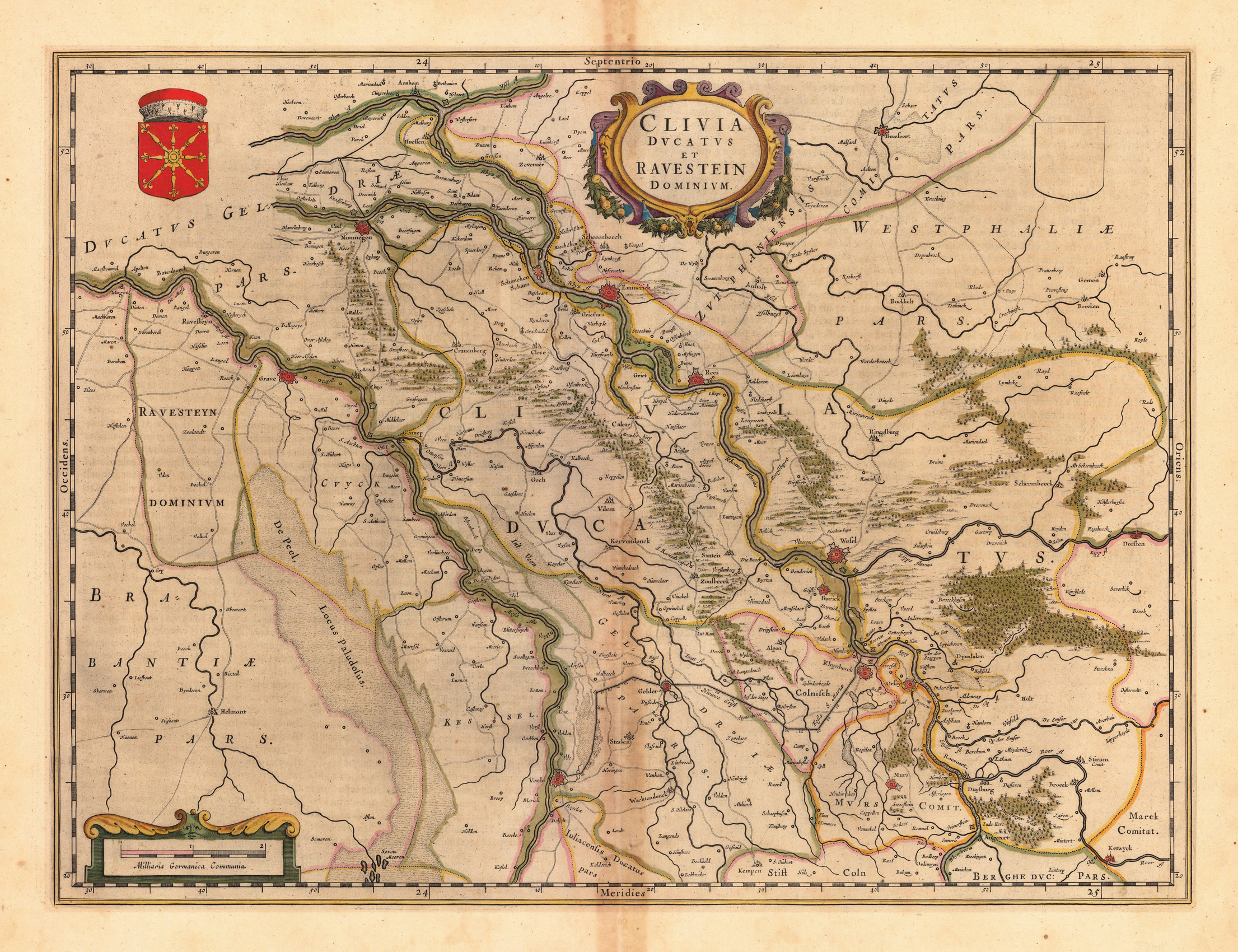
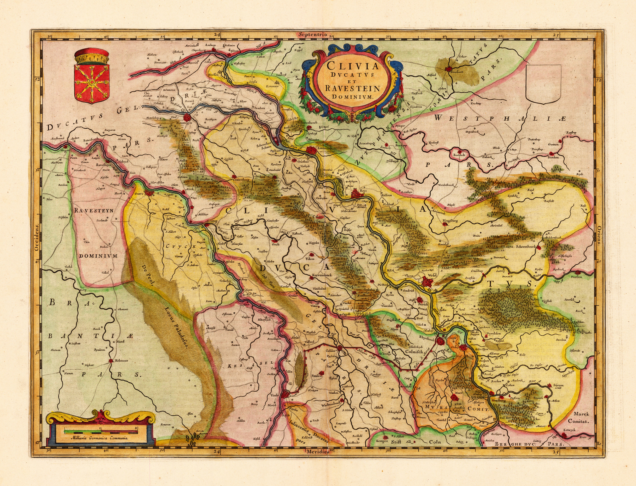
Engraved map in fine contemporary colors in outline and wash. Published in the edition of Blaeu's "Atlas Maior". Altkolorierte Kupferstichkarte, erschienen im Atlas Major von Blaeu. Oben fast mittig dekorative Rollwerkskartusche mit Titel, sowie im linken oberen Eck ein Wappen und rechts oben ein unausgefŸlltes Wappenschild (alle in schönem Altkolorit ausgemalt, Kartuschen teils goldgehöht). Dargestellt wird detailliert das Herzogtum Kleve mit der Grafschaft Ravenstein. Das Kartenbild reicht im Norden von Arnheim bis südlich von Duisburg. Rees fast mittig im Kartenbild. Im Westen mit der zu Brabant benachbarten Grafschaft Ravenstein bishin nach Dorsten a.d. Lippe im Osten. Mit vielen Ortsangaben, eingezeichneten Wegen, der Fossa Eugenia, u.v.m. Karte in dekorativem Grenzkolorit. Tadellos, in gutem bis sehr gutem Erhaltungszustand. Leicht gebräunt. Oldcolored copper engraved map, published in the Atlas Major by Blaeu. Almost center decorative scrollwork cartouche with title, as well as a coat of arms in the upper left corner and an unfilled coat of arms on the top right (all painted in beautiful old coloring, cartridges partially heightened with gold). The Duchy of Kleve with the county of Ravenstein is shown in detail. The map image extends in the north from Arnhem to south of Duisburg. Rees almost in the middle of the map. In the west with the neighboring county of Ravenstein to Brabant until Dorsten a.d. Lippe in the east. With many locations, marked trails, the Fossa Eugenia, and much more. Joan Blaeu (23 September 1596 – 21 December 1673) was a Dutch cartographer born in Alkmaar, the son of cartographer Willem Blaeu. In 1620 he became a doctor of law but he joined the work of his father. In 1635 they published the Atlas Novus (full title: Theatrum orbis terrarum, sive, Atlas novus) in two volumes. Joan and his brother Cornelius took over the studio after their father died in 1638. Joan became the official cartographer of the Dutch East India Company. Blaeu's world map, Nova et Accuratissima Terrarum Orbis Tabula, incorporating the discoveries of Abel Tasman, was published in 1648. This map was revolutionary in that it "depicts the solar system according to the heliocentric theories of Nicolaus Copernicus, which show the earth revolving around the sun.... Although Copernicus's groundbreaking book On the Revolutions of the Spheres had been first printed in 1543, just over a century earlier, Blaeu was the first mapmaker to incorporate this revolutionary heliocentric theory into a map of the world." Blaeu's map was copied for the map of the world set into the pavement of the Groote Burger-Zaal of the new Amsterdam Town Hall, designed by the Dutch architect Jacob van Campen (now the Amsterdam Royal Palace), in 1655. Blaeu's Hollandia Nova was also depicted in his Archipelagus Orientalis sive Asiaticus published in 1659 in the Kurfürsten Atlas (Atlas of the Great Elector). and used by Melchisédech Thévenot to produce his map, Hollandia Nova—Terre Australe (1664). As Joan Blaeu, he also published the 12 volume "Le Grand Atlas, ou Cosmographie blaviane, en laquelle est exactement descritte la terre, la mer, et le ciel". One edition is dated 1663. That was folio (540 x 340 mm), and contained 593 engraved maps and plates. In March 2015, a copy was on sale for £750,000. Around 1649 Joan Blaeu published a collection of Dutch city maps named Toonneel der Steeden (Views of Cities). In 1651 he was voted into the Amsterdam council. In 1654 Joan published the first atlas of Scotland, devised by Timothy Pont. In 1662 he reissued the Atlas Novus, also known as Atlas Maior, in 11 volumes, and one for oceans.[citation needed] A cosmology was planned as their next project, but a fire destroyed the studio completely in 1672. (Wikipedia)
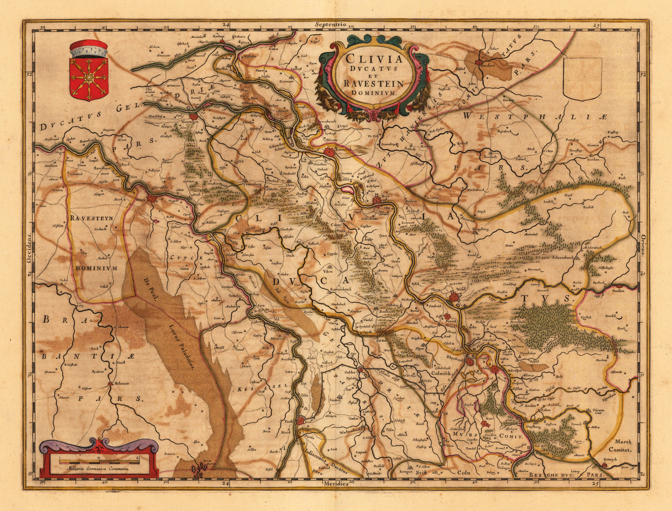
Original Kupferstichkarte, in zeitgenössischem Grenzkolorit, gedruckt und verlegt 1643-50. Altkolorierte Kupferstichkarte, erschienen im Atlas Blaeu's 'Theatrum'. Oben fast mittig dekorative Rollwerkskartusche mit Titel, sowie im linken oberen Eck ein Wappen und rechts oben ein unausgefuelltes Wappenschild (alle in schönem Altkolorit. Dargestellt wird detailliert das Herzogtum Kleve mit der Grafschaft Ravenstein. Das Kartenbild reicht im Norden von Arnheim bis südlich von Duisburg. Rees fast mittig im Kartenbild. Im Westen mit der zu Brabant benachbarten Grafschaft Ravenstein bishin nach Dorsten a.d. Lippe im Osten. Mit vielen Ortsangaben, eingezeichneten Wegen, der Fossa Eugenia, u.v.m. Karte in dekorativem Grenzkolorit. Tadellos, in gutem bis sehr gutem Erhaltungszustand. Leicht gebräunt im Randbereich des oberen und unteren Mittelbugs. Rückseitig französischer Text. Joan Blaeu (23 September 1596 – 21 December 1673) was a Dutch cartographer born in Alkmaar, the son of cartographer Willem Blaeu. In 1620 he became a doctor of law but he joined the work of his father. In 1635 they published the Atlas Novus (full title: Theatrum orbis terrarum, sive, Atlas novus) in two volumes. Joan and his brother Cornelius took over the studio after their father died in 1638. Joan became the official cartographer of the Dutch East India Company. Blaeu's world map, Nova et Accuratissima Terrarum Orbis Tabula, incorporating the discoveries of Abel Tasman, was published in 1648. This map was revolutionary in that it "depicts the solar system according to the heliocentric theories of Nicolaus Copernicus, which show the earth revolving around the sun.... Although Copernicus's groundbreaking book On the Revolutions of the Spheres had been first printed in 1543, just over a century earlier, Blaeu was the first mapmaker to incorporate this revolutionary heliocentric theory into a map of the world." (Wikipedia)
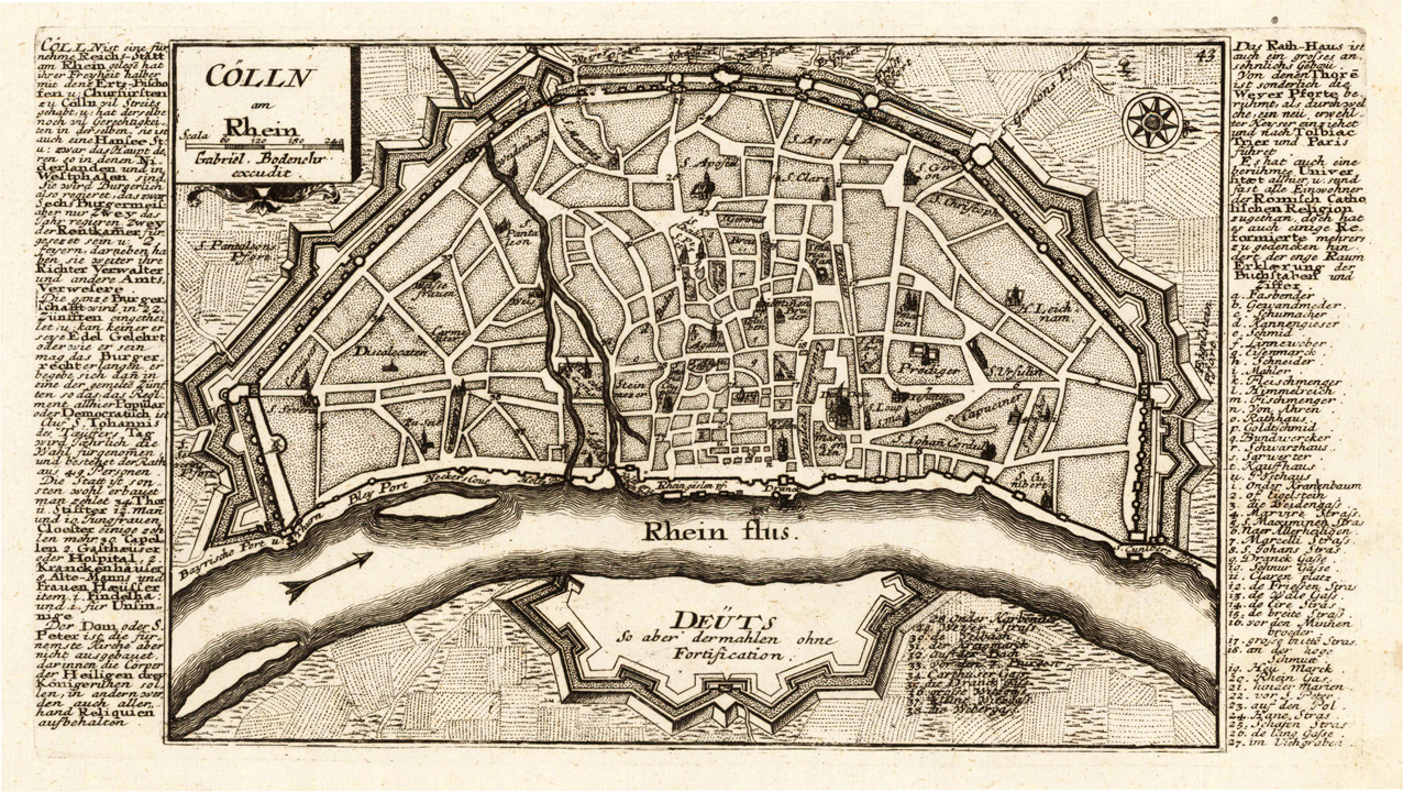
Original antique copper engraving, uncolored as published. This fine copper engraving shows the city of Cologne at the river Rhine and was published in Gabriel Bodenehr's famous serious "Europeans Macht und Pracht", a series of engravings depicting city views, plans, fortresses and castles in Europe. Many plates often are showing fortifications in Hungary and Southeast Europe, Spain, Belgium, Austria and Germany. Gabriel Bodenehr was during this period a successful publisher for maps and prints in Augsburg in Southern Germany. Gabriel Bodenehr the Elder (1664-1758 or 1673-1765) was a German map maker and member of a famous engraver and publisher family of Augsburg. His main work was "Atlas Curieux" first published 1704. He was the son of Johann Georg Bodenehr (1631-1703). Gabriel's son was Gabriel Bodenehr the Younger (1705–1792).
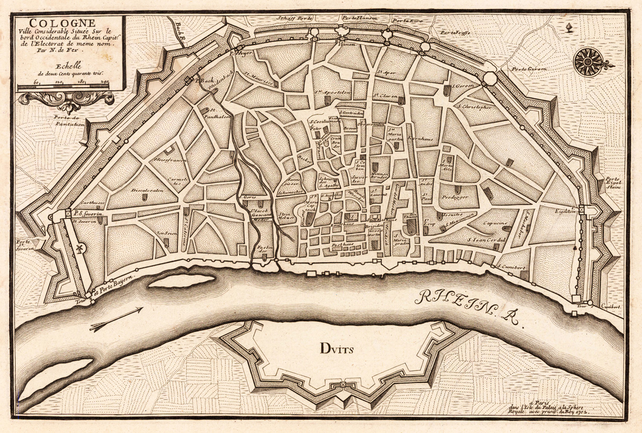
Copper engraving, uncolored as published. This antique map shows a bird's eye view of Cologne at the river Rhein in Germany. Interesting city plan of Cologne with engraved details old the old city. Dekorativer Plan der Stadt Köln aus der Vogelschau mit dem Rhein und den Befestigungsanlagen um die Altstadt. Verschiedene Gebäude, etc. sind im Plan eingezeichnet. Rechts mit älterer Falte im Papier, ansonsten in sehr gutem Zustand.
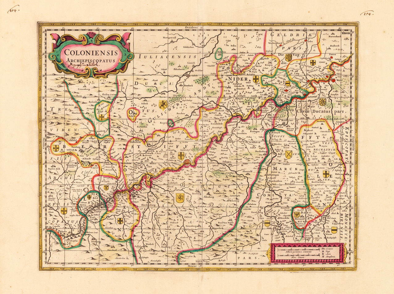
Original antique copper engraving, hand colored in outline when published. Decorative and detailed map of the archbishopric of Cologne with its neighboring areas. Cologne is in the center of the map with the river Rhine, with many engraved place names, rivers and mountains. The individual duchies and regions are all equipped with coats of arms of their region. This antique map of the the archbishopric of Cologne was published for the first time in 1630 in the edition by Hendrik Hondius and appeared then in various editions by Hondius and Janssonius. In the this edition by Johannes Jansonnius van Waesbergen a graticule was added to the map and the Janssonius imprint was removed. The Johannes Jansonnius van Waesbergen was an English edition, which was printed by Moses & Pitt in Oxford. Verso blank without text. Title cartouche with inscription in ink. Johannes Janssonius (1588, Arnhem – buried July 11, 1664, Amsterdam) (born Jan Janszoon, in English also Jan Jansson) was a Dutch cartographer and publisher who lived and worked in Amsterdam in the 17th century. Janssonius was born in Arnhem, the son of Jan Janszoon the Elder,[1] a publisher and bookseller. In 1612 he married Elisabeth de Hondt, the daughter of Jodocus Hondius. He produced his first maps in 1616 of France and Italy. In 1623 Janssonius owned a bookstore in Frankfurt am Main, later also in Danzig, Stockholm, Copenhagen, Berlin, Königsberg, Geneva and Lyon. Elisabeth Hondius died in 1627 and he remarried Elisabeth Carlier in 1629. In the 1630s he formed a partnership with his brother in law Henricus Hondius, and together they published atlases as Mercator/Hondius/Janssonius. Under the leadership of Janssonius the Hondius Atlas was steadily enlarged. Renamed Atlas Novus, it had three volumes in 1638, one fully dedicated to Italy. In 1646, a fourth volume came out with "English County Maps", a year after a similar issue by Joan Blaeu. Janssonius' maps are similar to those of Blaeu, and he is often accused of copying from his rival, but many of his maps predate those of Blaeu and/or covered different regions. By 1660, at which point the atlas bore the appropriate name "Atlas Major", there were 11 volumes, containing the work of about a hundred credited authors and engravers. It included a description of "most of the cities of the world" (Townatlas), of the waterworld (Atlas Maritimus in 33 maps), and of the Ancient World (60 maps). The eleventh volume was the Atlas of the Heavens by Andreas Cellarius. Editions were printed in Dutch, Latin, French, and a few times in German. After Janssonius's death, the publishing company was continued by his son-in law, Johannes van Waesbergen. The London bookseller Moses Pitt attempted publication of the Atlas Major in English, but ran out of resources after the fourth volume in 1683. (Wikipedia)
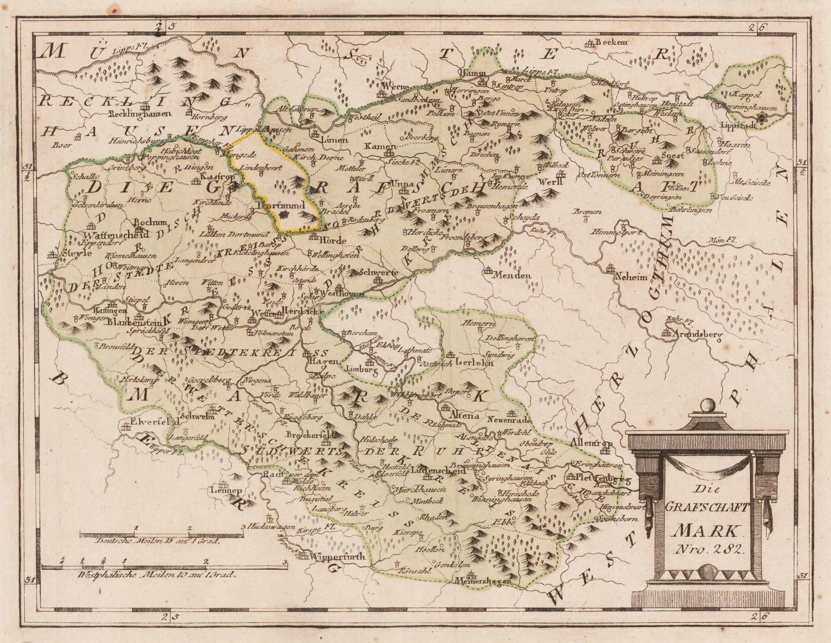
Original Kupferstich, in zeitgenöss. Flächenkolorit der Zeit. Detaillierte Landkarte der Grafschaft Mark. Im Zentrum das Gebiet Dortmund, Schwerte, Hagen. Im Osten bis Soest und Lippstadt, im Süden noch bis Wipperfurth. Rechts unten mit ornamentaler Kartusche. - Die Grafschaft Mark war ein Territorium des Heiligen Römischen Reiches deutscher Nation im Niederrheinisch-Westfälischen Reichskreis. Sie gehörte seit dem 17. Jahrhundert zu Brandenburg-Preußen. Die Grafschaft erstreckte sich zu beiden Seiten der Ruhr entlang von Volme und Lenne, zwischen dem Vest Recklinghausen, der Freien Reichsstadt Dortmund, dem Fürstbistum Münster, der Grafschaft Limburg, den Herzogtümern Westfalen und Berg, der Grafschaft Gimborn, der Reichsabtei Werden und dem Reichsstift Essen. Die Grafen von der Mark zählten im Hochmittelalter zu den mächtigsten und einflussreichsten westfälischen Regenten im Heiligen Römischen Reich. Ihr Name geht auf ihre Residenz Burg Mark bei dem heute zur Stadt Hamm gehörenden Dorf Mark zurück. Er lebt heute weiter im Namen des Märkischen Kreises und in der geographischen Bezeichnung Märkisches Sauerland (Wikipedia)
Der österreichische Kartograf Franz Joh. Josef von Reilly veröffentlichte um 1789 in Wien eine große Anzahl sehr detaillierter Bezirkskarten Mitteleuropas. Diese Karten sind berühmt für ihre großen Maßstäbe und die vielen Details, die sie bieten. Sogar winzige Ortsnamen sind auf diesen Karten zu finden, Flüsse, Berge, Straßen und Klöster sind ebenfalls eingraviert. Die Karten, die Franz J. Reilly gravierte, wurden speziell für das österreichische Königshaus entworfen und zeigen Länder, Provinzen und Bezirke des österreichisch-ungarischen Reiches.
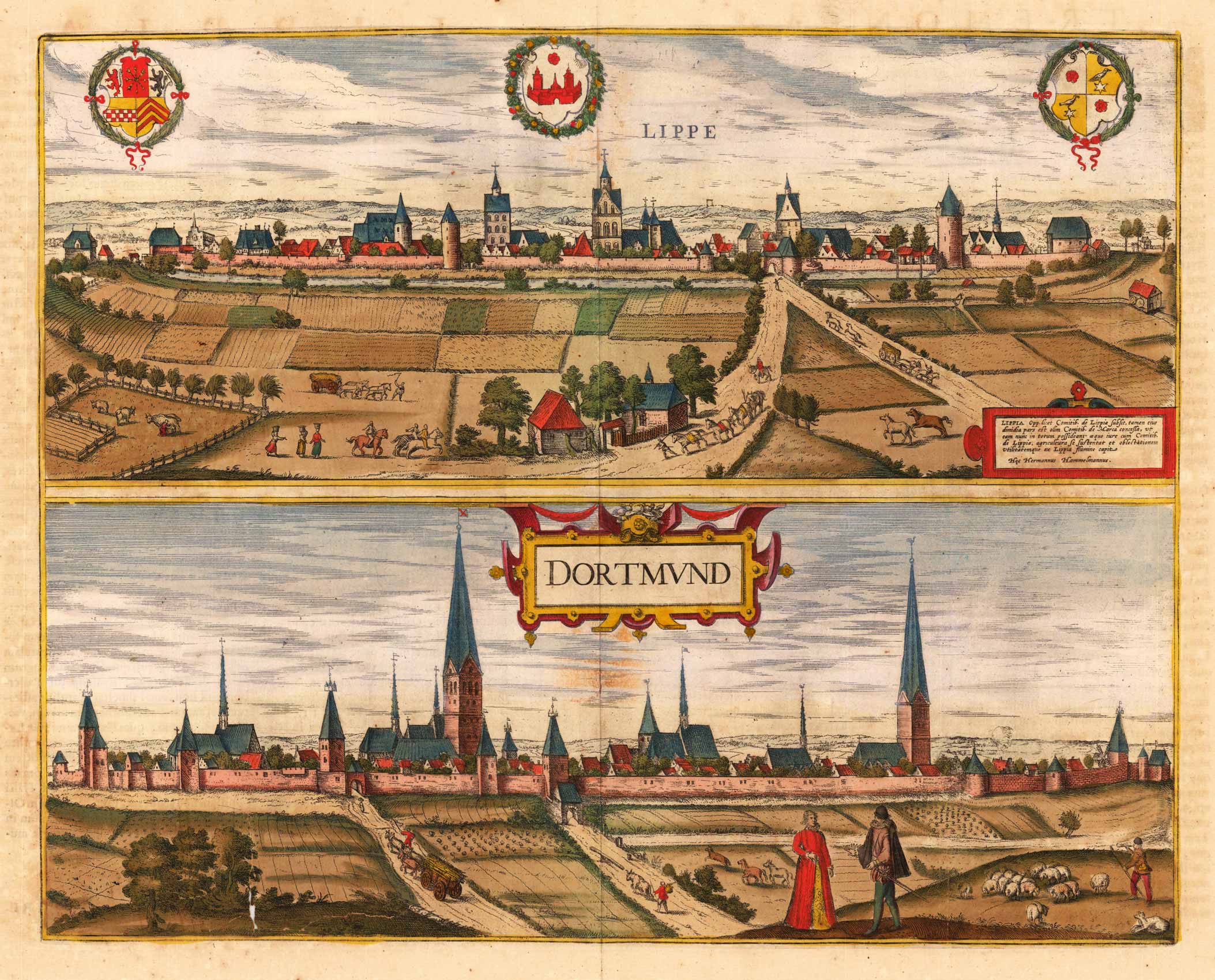
Original antique copper engraving, hand colored in outline when published. The plate was first published in the townbooks ,Civitates Orbis Terrarum' by Braun & Hogenberg. The plates were later aquired by J. Janssonius and were published in his townbooks 1657 in Amsterdam. Johannes Janssonius (1588, Arnhem – buried July 11, 1664, Amsterdam) (born Jan Janszoon, in English also Jan Jansson) was a Dutch cartographer and publisher who lived and worked in Amsterdam in the 17th century. Janssonius was born in Arnhem, the son of Jan Janszoon the Elder,[1] a publisher and bookseller. In 1612 he married Elisabeth de Hondt, the daughter of Jodocus Hondius. He produced his first maps in 1616 of France and Italy. In 1623 Janssonius owned a bookstore in Frankfurt am Main, later also in Danzig, Stockholm, Copenhagen, Berlin, Königsberg, Geneva and Lyon. Elisabeth Hondius died in 1627 and he remarried Elisabeth Carlier in 1629. In the 1630s he formed a partnership with his brother in law Henricus Hondius, and together they published atlases as Mercator/Hondius/Janssonius. Under the leadership of Janssonius the Hondius Atlas was steadily enlarged. Renamed Atlas Novus, it had three volumes in 1638, one fully dedicated to Italy. In 1646, a fourth volume came out with "English County Maps", a year after a similar issue by Joan Blaeu. Janssonius' maps are similar to those of Blaeu, and he is often accused of copying from his rival, but many of his maps predate those of Blaeu and/or covered different regions. By 1660, at which point the atlas bore the appropriate name "Atlas Major", there were 11 volumes, containing the work of about a hundred credited authors and engravers. It included a description of "most of the cities of the world" (Townatlas), of the waterworld (Atlas Maritimus in 33 maps), and of the Ancient World (60 maps). The eleventh volume was the Atlas of the Heavens by Andreas Cellarius. Editions were printed in Dutch, Latin, French, and a few times in German. After Janssonius's death, the publishing company was continued by his son-in law, Johannes van Waesbergen. The London bookseller Moses Pitt attempted publication of the Atlas Major in English, but ran out of resources after the fourth volume in 1683. (Wikipedia)
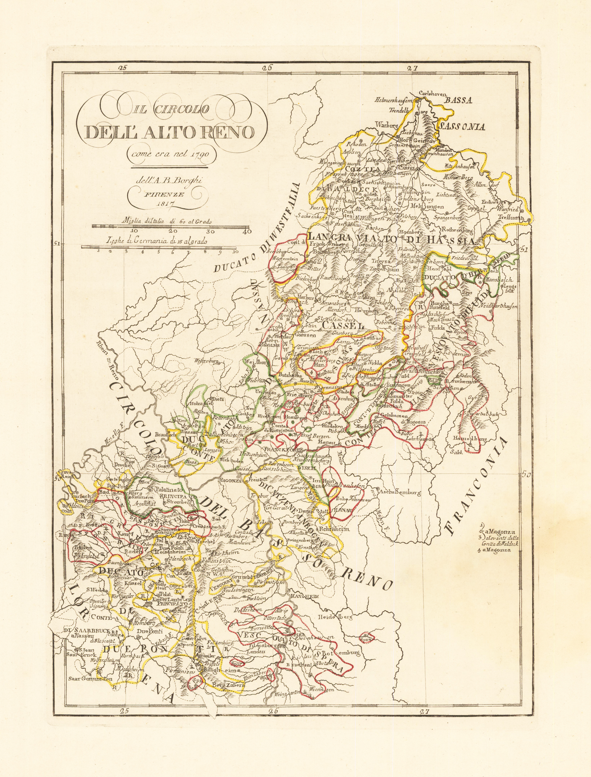
Copper engraving, uncolored. Published in Zatta's "Atlante Novissimo". This beautiful map shows Hessen and Baden-Württemberg. The map provides many regional details, as well an enormous amount of small place names. Rivers, lakes, mountains, woods, etc. are shown on the map. In the upper left is the cartouche with two mileage scales.
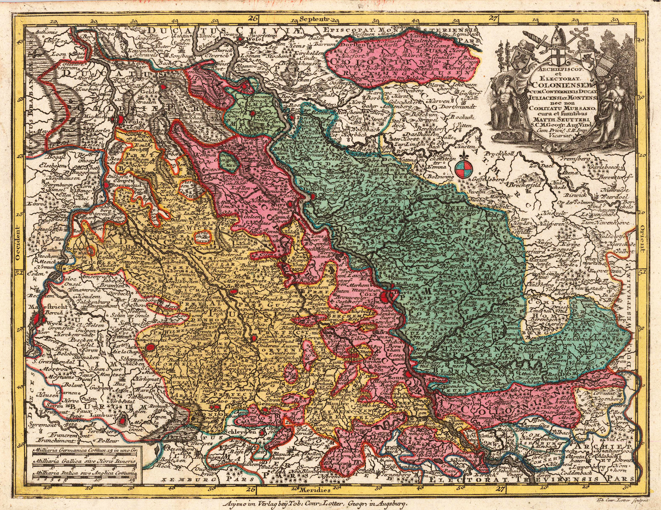
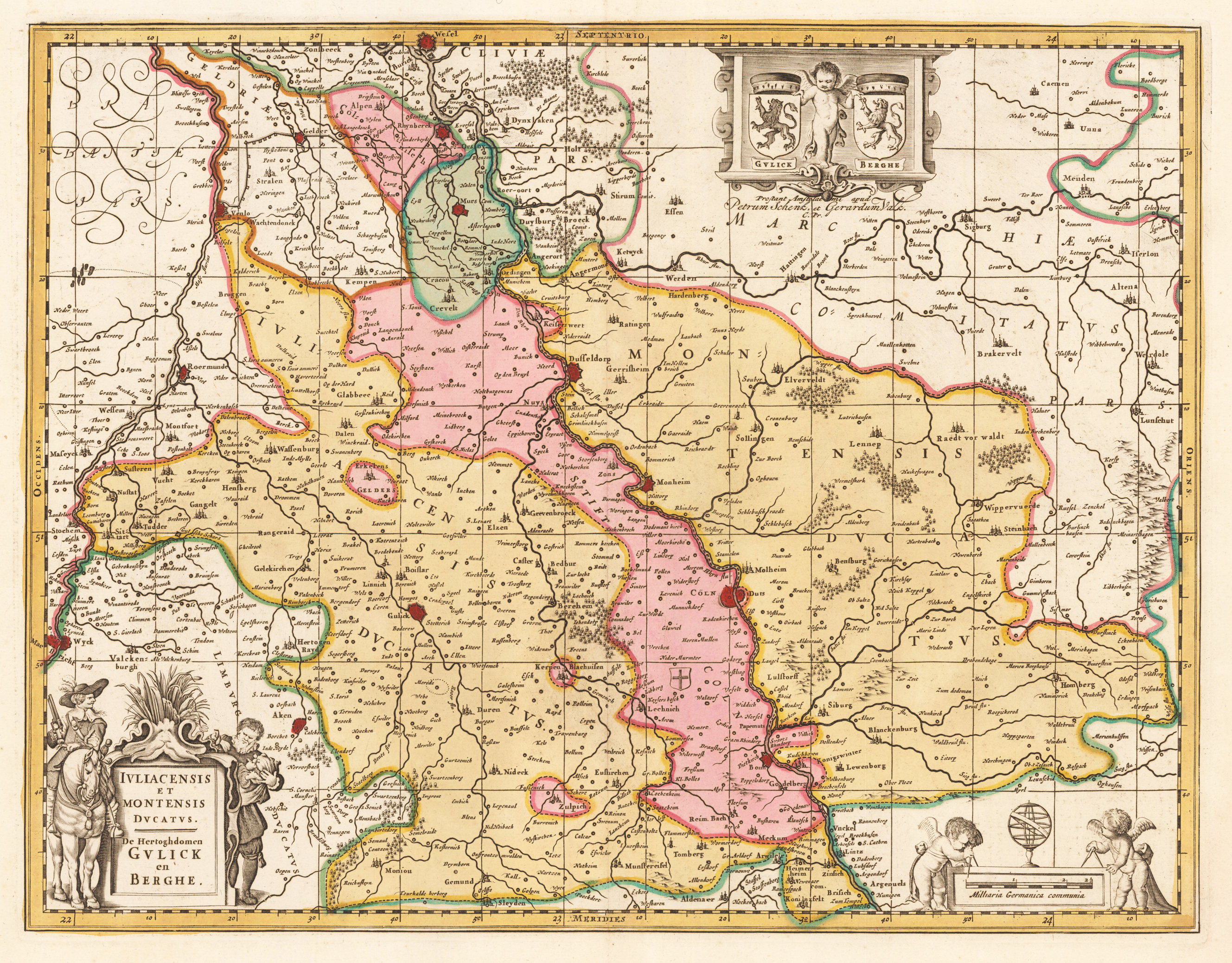
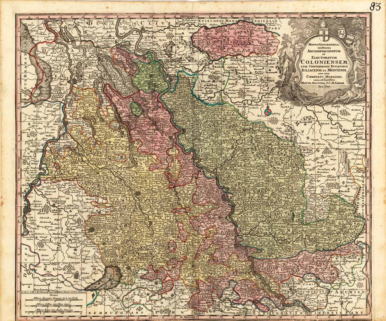
Kupferstichkarte, in zeitgenöss. Grenz- u. Flächenkolorit. Links unten große, figürliche, ausgemalte Titelkartusche, rechts unten Meilenzeiger mit 2 Putten, im Oberrand die Wappen von Jülich & Berg, gehalten v. 1 Putte. Dargestellt wird mittig Köln mit dem Herzogtum Berg u. Jülich rechts u. links des Rheins, sowie den angrenzenden Gebieten.
Original antique copper engraving, hand colored in outline and wash when published. Dargestellt wird detailliert das Herzogtum Kleve mit der Grafschaft Ravenstein. Das Kartenbild reicht im Norden von Arnheim bis südlich von Duisburg. Rees fast mittig im Kartenbild. Im Westen mit der zu Brabant benachbarten Grafschaft Ravenstein bishin nach Dorsten a.d. Lippe im Osten. Mit vielen Ortsangaben, eingezeichneten Wegen, der Fossa Eugenia, u.v.m. Karte in dekorativem Grenz- u. Flächenkolorit, die größeren Orte rot im Kolorit hervorgehoben. Kolorierte Kupferstichkarte, erschienen im Atlas Major von Blaeu. Oben fast mittig dekorative Rollwerkskartusche mit Titel, sowie im linken oberen Eck ein Wappen und rechts oben ein unausgefülltes Wappenschild (alle in schönem Kolorit ausgemalt). The Duchy of Kleve with the county of Ravenstein is shown in detail. The map image extends in the north from Arnhem to south of Duisburg. Rees almost in the middle of the map. In the west with the neighboring county of Ravenstein to Brabant until Dorsten a.d. Lippe in the east. With many locations, marked trails, the Fossa Eugenia, and much more. Card in decorative border u. Surface color, the larger places highlighted in red in color. Colored map, published in the Atlas Major by Blaeu. Decorative scrollwork cartouche with title almost in the middle, as well as a coat of arms in the upper left corner and an unfilled coat of arms on the upper right (all painted in beautiful colors). Joan Blaeu (23 September 1596 – 21 December 1673) was a Dutch cartographer born in Alkmaar, the son of cartographer Willem Blaeu. In 1620 he became a doctor of law but he joined the work of his father. In 1635 they published the Atlas Novus (full title: Theatrum orbis terrarum, sive, Atlas novus) in two volumes. Joan and his brother Cornelius took over the studio after their father died in 1638. Joan became the official cartographer of the Dutch East India Company. Blaeu's world map, Nova et Accuratissima Terrarum Orbis Tabula, incorporating the discoveries of Abel Tasman, was published in 1648. This map was revolutionary in that it "depicts the solar system according to the heliocentric theories of Nicolaus Copernicus, which show the earth revolving around the sun.... Although Copernicus's groundbreaking book On the Revolutions of the Spheres had been first printed in 1543, just over a century earlier, Blaeu was the first mapmaker to incorporate this revolutionary heliocentric theory into a map of the world." Blaeu's map was copied for the map of the world set into the pavement of the Groote Burger-Zaal of the new Amsterdam Town Hall, designed by the Dutch architect Jacob van Campen (now the Amsterdam Royal Palace), in 1655. Blaeu's Hollandia Nova was also depicted in his Archipelagus Orientalis sive Asiaticus published in 1659 in the Kurfürsten Atlas (Atlas of the Great Elector). and used by Melchisédech Thévenot to produce his map, Hollandia Nova—Terre Australe (1664). As Joan Blaeu, he also published the 12 volume "Le Grand Atlas, ou Cosmographie blaviane, en laquelle est exactement descritte la terre, la mer, et le ciel". One edition is dated 1663. That was folio (540 x 340 mm), and contained 593 engraved maps and plates. In March 2015, a copy was on sale for £750,000. Around 1649 Joan Blaeu published a collection of Dutch city maps named Toonneel der Steeden (Views of Cities). In 1651 he was voted into the Amsterdam council. In 1654 Joan published the first atlas of Scotland, devised by Timothy Pont. In 1662 he reissued the Atlas Novus, also known as Atlas Maior, in 11 volumes, and one for oceans.[citation needed] A cosmology was planned as their next project, but a fire destroyed the studio completely in 1672. (Wikipedia)
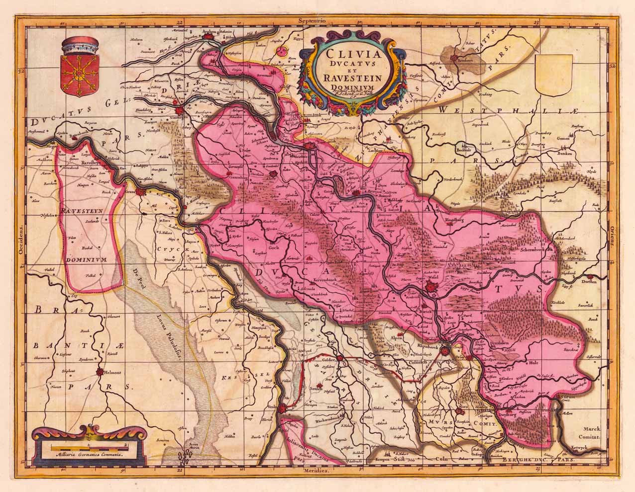
Copper engraving, hand colored in outline and wash when published. Kupferstichkarte, in zeitgenöss. Grenz- u. Flächenkolorit. Oben fast mittig ausgemalte Rollwerkskartusche mit Titel, links unten Meilenzeiger, sowie oben rechts u. links von der Kartusche 2 Wappen. Gezeigt wird das Herzogtum Kleve mit angrenzenden Gebieten. Das Kartenbild reicht von Arnheim im Norden bis nach Duisburg im Süden. Mit vielen Ortsangaben. Tadellos, in schönem Altkolorit.
Kolorierte Kupferstichkarte, erschienen im Atlas Major von Blaeu. Oben fast mittig dekorative Rollwerkskartusche mit Titel, sowie im linken oberen Eck ein Wappen und rechts oben ein unausgefülltes Wappenschild (alle in schönem Kolorit ausgemalt). Dargestellt wird detailliert das Herzogtum Kleve mit der Grafschaft Ravenstein. Das Kartenbild reicht im Norden von Arnheim bis südlich von Duisburg. Rees fast mittig im Kartenbild. Im Westen mit der zu Brabant benachbarten Grafschaft Ravenstein bishin nach Dorsten a.d. Lippe im Osten. Mit vielen Ortsangaben, eingezeichneten Wegen, der Fossa Eugenia, u.v.m. Karte in dekorativem Grenz- u. Flächenkolorit, Kartuschen teilweise in gold gehöht, sowie die größeren Orte rot im Kolorit hervorgehoben.
Kupferstichkarte in zeitgenössischem Grenz- und Flächenkolorit. Oben rechts dekorative Titelkartusche mit Figuren und Wappen. Daneben kolorierter Kompasszeiger. Links unten Meilenzeiger. Originally colored copper engraving with decorative title cartouche at the right upper corner. In the left lower corner we see a small mileage scale.
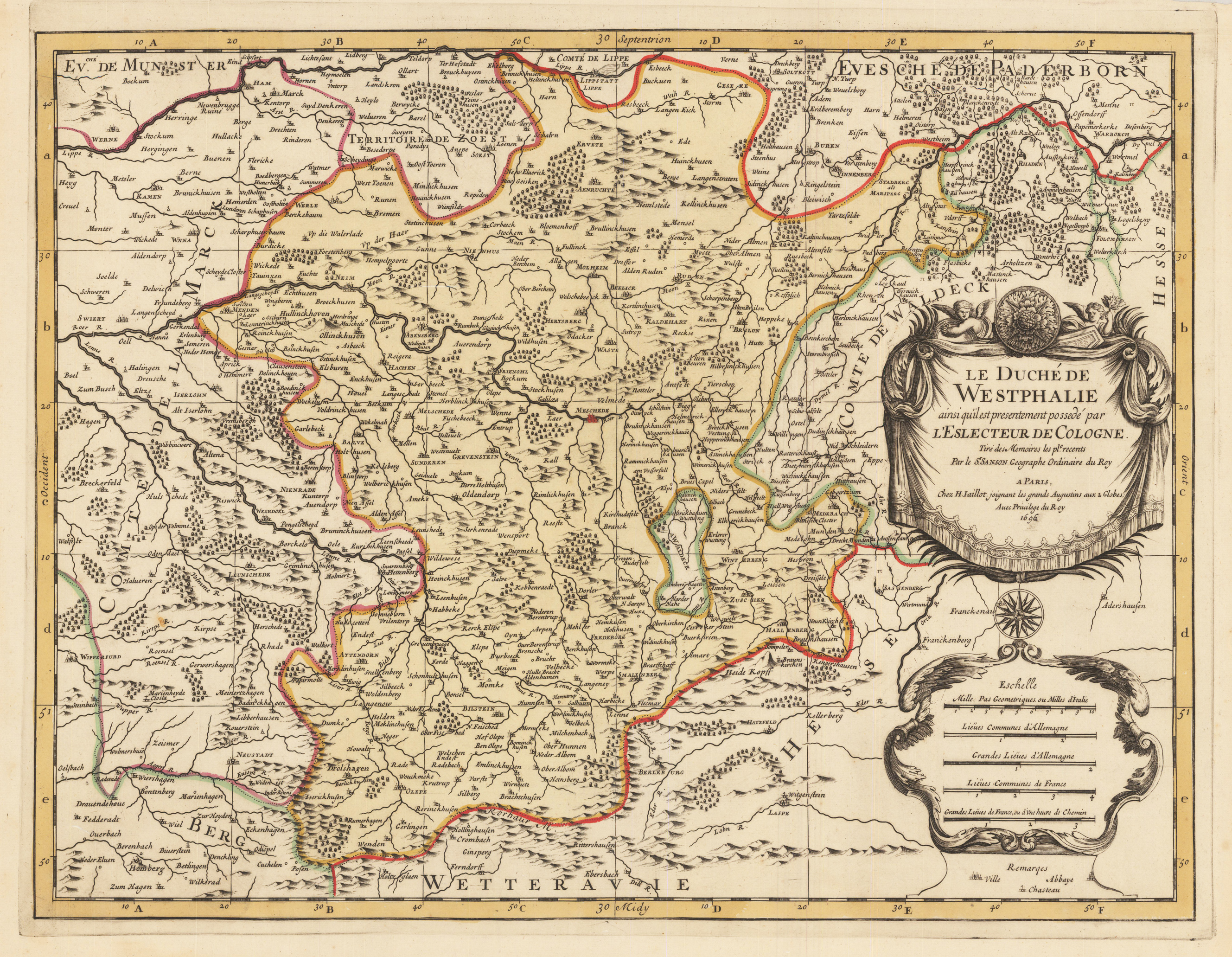
Original antike Kupferstichkarte, in zeitgenössischem Grenzkolorit. Mit großer, prächtiger, allegorischer Kartusche, sowie Meilenzeiger mit Legende. Erschienen im großen Atlas Atlas Nouveau contenant.. von Nicolaus Sanson u. Hubert Jaillot. Dargestellt wird das Gebiet Lippstadt, Warburg, Laasphe, Wipperfürth mit Meschede im Zentrum. Alexis Hubert Jaillot (* ca. 1632 in Avignon-lès-Saint-Claude, Freigrafschaft Burgund; † 2. November 1712 in Paris) war ein bedeutender französischer Kartograph und Verleger. Alexis Hubert Jaillot wurde circa 1632 in Avignon-lès-Saint-Claude geboren. Seine Eltern waren Jean Jaillot und Etiennette Fournier. Sein Bruder war Pierre-Simón (1631–23. September 1681). Jaillot heiratete am 11. Januar 1665 Jeanne Berey († 1. November 1675), die Tochter des Graveurs und Kartenverlegers Nicolas I Berey (1610–1665) aus Paris. Aus dieser Ehe gingen sieben Kinder hervor, darunter François Hubert-Joseph (* 1671) und Bernard Jean-Hyacinthe (* 11. Februar 1673–1739). Nach dem Tod seiner ersten Frau heiratete er am 26. Abril 1676 Charlotte Orbane. Aus dieser Ehe gingen acht Kinder hervor, darunter Charles-Hubert (* 1678). Als Jaillots Geburtsjahr wird 1632 angenommen, weil in der Sterbeurkunde sein Alter mit 80 Jahren angegeben wurde.[1] Der Geburtsort war Avignon-lès-Saint-Claude, damals ein kleiner Weiler in der zum spanischen Königreich gehörenden Exklave Freigrafschaft Burgund. Schon seit seiner Kindheit hatte Jaillot ein gutes Talent für Künste und Gestaltung. Von seinem Bruder Pierre-Simón lernte er die Bildhauerei. Infolge französisch-spanischer Auseinandersetzungen wurde ihr Heimatort verwüstet, und so gingen die beiden Brüder 1657 nach Paris. Dort erwarben sie sich bald eine gewisse Reputation und den Titel Sculpteur du Roy. 1665 heiratete Jaillot in die Kartenverleger-Familie Berey ein. Nach dem Tod seines Schwagers Nicolas II Berey (1640–1667) kaufte er von der Schwägerin die Berey-Kartensammlung. So hatte er einen wertvollen Grundstock, den er gleich vermarkten konnte, ohne je selbst eine Karte hergestellt zu haben. Jaillot stieg in einem günstigen Moment in das Kartengeschäft ein. Anfang 1668 gewann Ludwig XIV. den ersten seiner Reunionskriege, und es begann eine Zeit, in der Frankreich sein Territorium ständig vergrößerte. Es entwickelte sich eine große Nachfrage nach Karten, die die französischen Triumphe und die neuen Grenzen, sowie anstehende Expansionsabsichten darstellten. Zu Jaillots Kartensammlung gehörten auch Druckplatten, die Pierre Duval (1619–1683) (Neffe von Nicolas Sanson) erstellt und ursprünglich an Nicolas Berey verkauft hatte. Aber Duval, der seine Karten auch selbst verlegte, wehrte sich gegen die Neuauflage seiner alten Karten. Auf dem Höhepunkt der Auseinandersetzung mit Duval gewann Jaillot Ende 1670 die Söhne von Nicolas Sanson Guillaume und Adrien, als Kartenmacher und Geschäftspartner. Mit ihnen konnte er neue Karten mit dem prestigeträchtigen Namen Sansons vermarkten. Sein erster Atlas von 1681 Atlas Nouveau wurde ein so großer kommerzieller Erfolg, dass andere Verleger damit begannen, Plagiate zu vertreiben. Jaillot suchte die königliche Patronage und widmete viele seiner Kartenauflagen dem König. Schließlich wurde er am 20. Juli 1686 zum Géographe du Roy ernannt und erhielt eine jährliche Pension von 600 Livres. Dieser Titel, zusammen mit einer protektionistischen und kontrollierenden Gesetzgebung, erlaubten ihm, sich erfolgreich gegen seine Plagiatoren zu wehren. Seit dem frühen 18. Jahrhundert legte Jaillot immer weniger Karten auf. Es wurden immer mehr zeitnah aktualisierte Karten nachgefragt und es gelang ihm immer weniger auf die Anforderungen des Marktes zu reagieren. Jüngere Konkurrenten waren gut ausgebildete Geographen wie Guillaume Delisle, die die Kartenerstellung selbst vornehmen konnten. Mit der Zeit gab Jaillot das Geschäft an seinen Sohn Bernard Jean-Hyacinthe ab. Alexis Hubert Jaillot starb am 2. November 1712 in Paris, im Alter von 80 Jahren. Er wurde im Convent des Grands-Augustins beigesetzt. (Wikipedia)
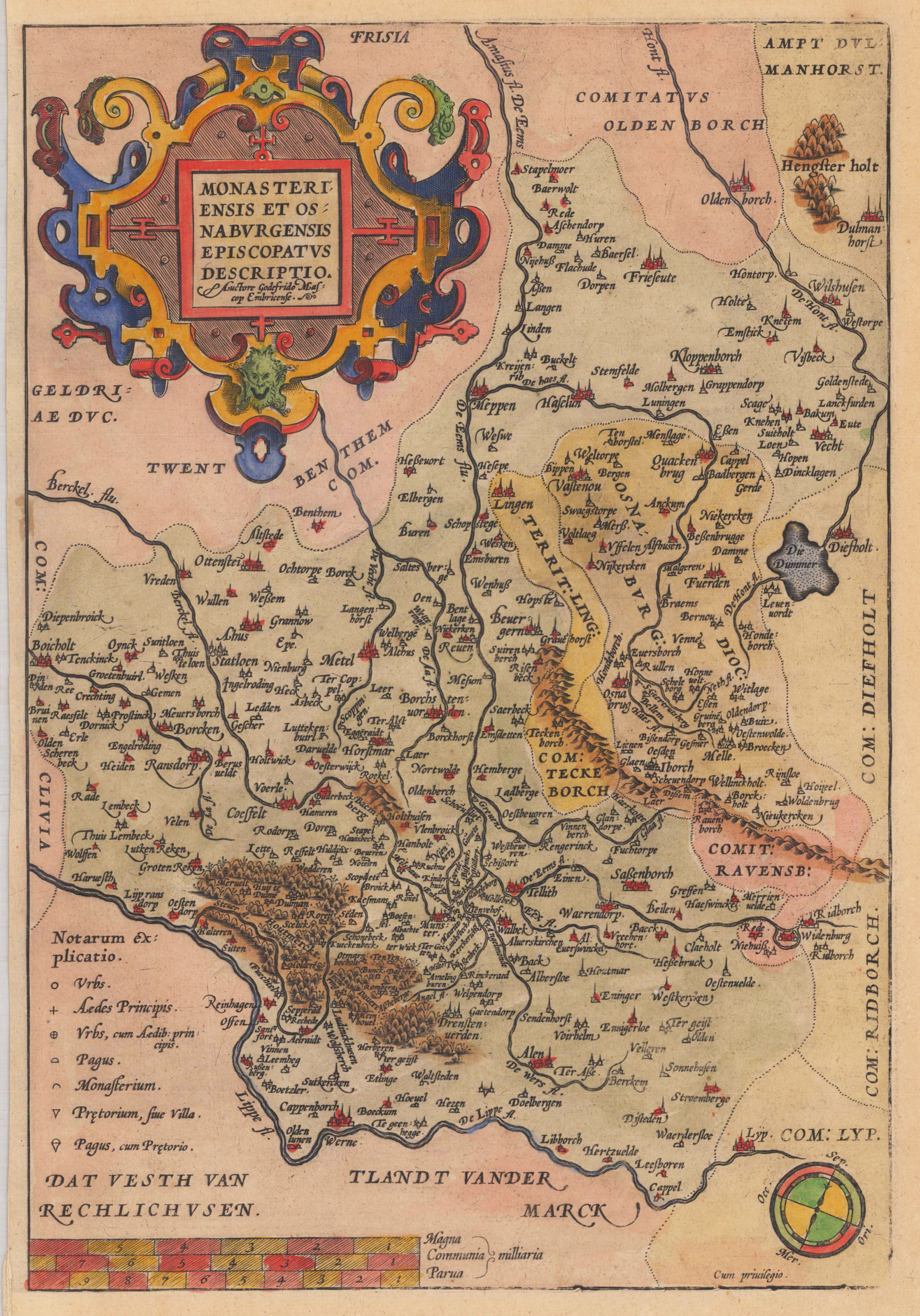
Original antiker Kupferstich, handkoloriert. Verso ohne Text. Kupferstichkarte erschienen bei Abraham Ortelius, in Theatrum Orbis Terrarum. Karte ist mit den für A. Ortelius typischen Rollwerkskartuschen und Meilenzeigern ausgestattet. Gezeigt werden die 2 benachbarten Erzbistümer Münster u. Osnabrück mit angrenzenden Gebieten. Gestochen nach der Zeichnung von Gottfried Mascop. Das Kartenbild reicht im Norden bis Oldenburg, im Süden bis Werne /Lippe. Im Westen von Bocholt bis nach Wiedenbrück im Osten. Abraham Ortelius (auch Ortels, Orthellius, Wortels; * 4. oder 14. April 1527 in Antwerpen; † 28. Juni 1598 ebenda) war ein flämischer Geograph und Kartograf. Ortelius entstammte einer von Augsburg in die südlichen Niederlande eingewanderten Familie. Er studierte erst bei seinem Onkel Jakob van Meteren und dann auf eigene Initiative Griechisch, Latein und Mathematik in Antwerpen. Ortelius trat als 20-Jähriger der Antwerpener Sint-Lukasgilde bei, kolorierte zunächst Landkarten, war dann Karten- und Buchhändler und bildete sich zum Kartografen weiter. Laut John Vermeulen hat Ortelius mit seinem Zeitgenossen Gerhard Mercator zusammengearbeitet.
Original antique copper engraving, hand colored in outline when published. The plate was first published in the townbooks ,Civitates Orbis Terrarum' by Braun & Hogenberg. The plates were later aquired by J. Janssonius and were published in his townbooks 1657 in Amsterdam. Johannes Janssonius (1588, Arnhem – buried July 11, 1664, Amsterdam) (born Jan Janszoon, in English also Jan Jansson) was a Dutch cartographer and publisher who lived and worked in Amsterdam in the 17th century. Janssonius was born in Arnhem, the son of Jan Janszoon the Elder,[1] a publisher and bookseller. In 1612 he married Elisabeth de Hondt, the daughter of Jodocus Hondius. He produced his first maps in 1616 of France and Italy. In 1623 Janssonius owned a bookstore in Frankfurt am Main, later also in Danzig, Stockholm, Copenhagen, Berlin, Königsberg, Geneva and Lyon. Elisabeth Hondius died in 1627 and he remarried Elisabeth Carlier in 1629. In the 1630s he formed a partnership with his brother in law Henricus Hondius, and together they published atlases as Mercator/Hondius/Janssonius. Under the leadership of Janssonius the Hondius Atlas was steadily enlarged. Renamed Atlas Novus, it had three volumes in 1638, one fully dedicated to Italy. In 1646, a fourth volume came out with "English County Maps", a year after a similar issue by Joan Blaeu. Janssonius' maps are similar to those of Blaeu, and he is often accused of copying from his rival, but many of his maps predate those of Blaeu and/or covered different regions. By 1660, at which point the atlas bore the appropriate name "Atlas Major", there were 11 volumes, containing the work of about a hundred credited authors and engravers. It included a description of "most of the cities of the world" (Townatlas), of the waterworld (Atlas Maritimus in 33 maps), and of the Ancient World (60 maps). The eleventh volume was the Atlas of the Heavens by Andreas Cellarius. Editions were printed in Dutch, Latin, French, and a few times in German. After Janssonius's death, the publishing company was continued by his son-in law, Johannes van Waesbergen. The London bookseller Moses Pitt attempted publication of the Atlas Major in English, but ran out of resources after the fourth volume in 1683. (Wikipedia)
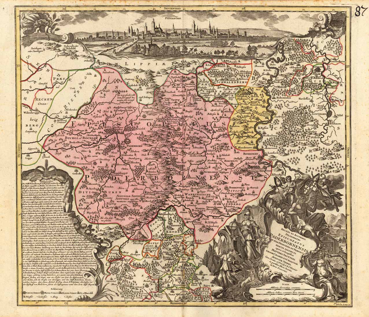
Kupferstichkarte in zeitgenössischem Grenz- und Flächenkolorit.Unten rechts große dekorative figürliche Rollwerkskartusche mit Titel. Privileg und Meilenzeiger. Rechts unten florale Kartusche mit Legende. Mittig oben, fast über die gesamte Kartenbreite Ansicht der Stadt Paderborn. Originally coloured copper engraving with large decorative title cartouche. On the left side floral cartouche with explanantions. On top of the map view of the old city of Paderborn.
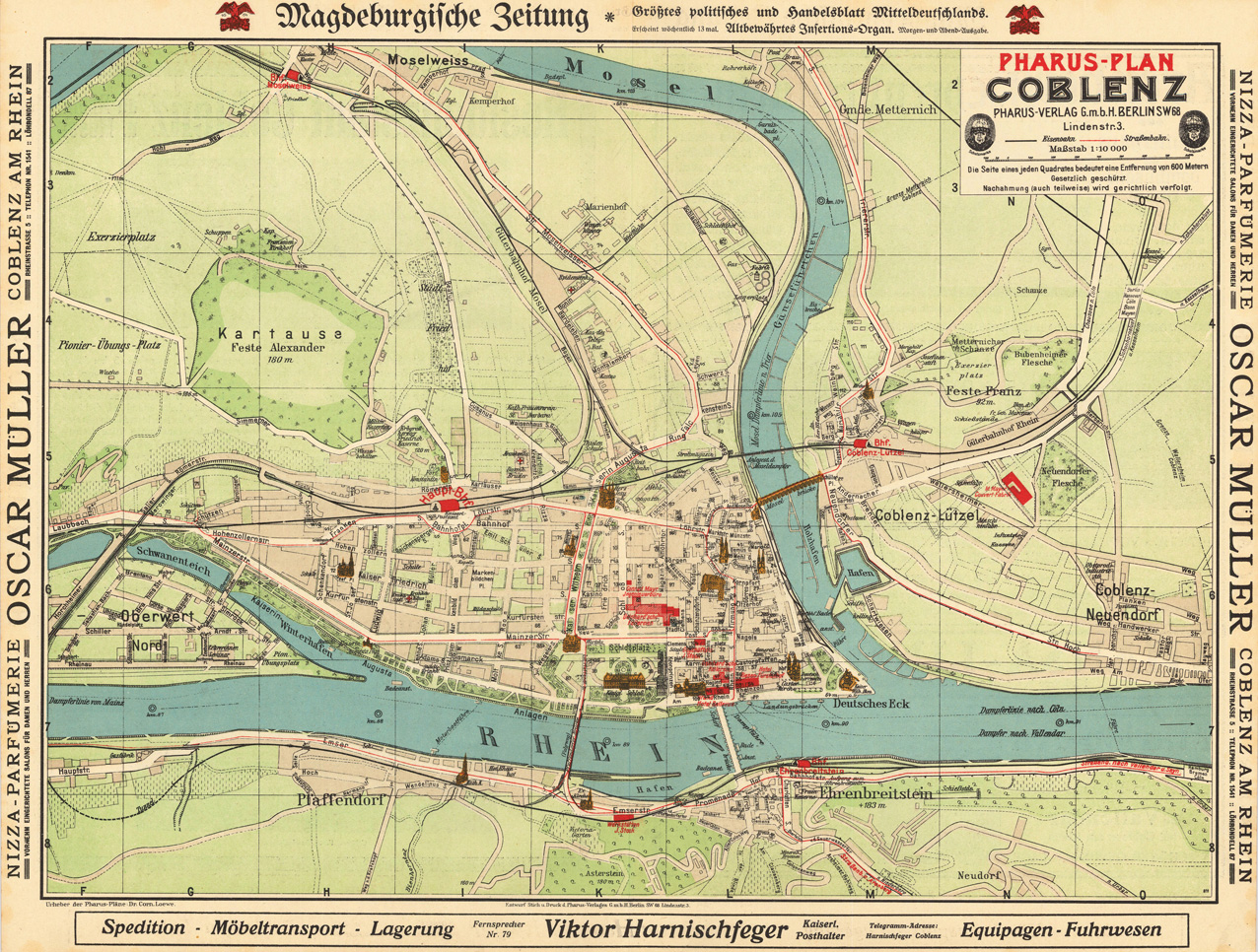
Lithographie, hand koloriert. Diese detaillierte Lithographie zeigt den Plan von Koblenz. Die Karte ist in wunderschönen Farben gezeichnet und stellt eine detaillierte Gesamtübersicht von Koblenz dar. Außerdem sind viele Strassen, Strassennamen, Kirchen, der Rhein, Hauptbahnhof und Sehenswürdigkeiten eingezeichnet.
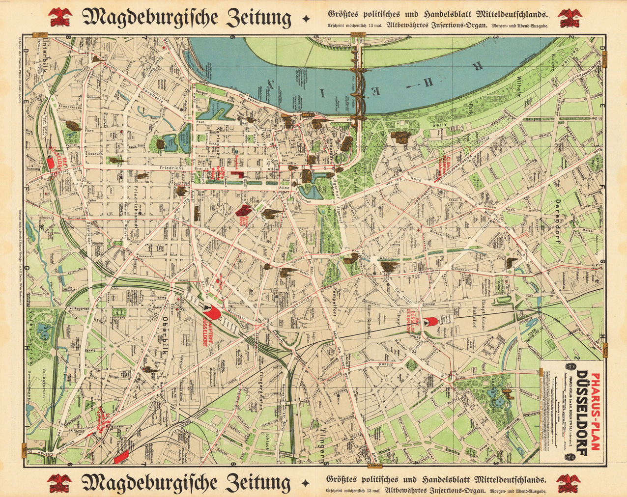
Lithographie, handkoloriert. Diese detaillierte Lithographie zeigt den Plan von Düsseldorf. Die Karte ist in wunderschönen Farben gezeichnet und stellt eine detaillierte Gesamtübersicht von Düsseldorf dar. Außerdem sind viele Strassen, Strassennamen, Kirchen, Bahnhöfe, der Fluss Rhein und Sehenswürdigkeiten eingezeichnet.