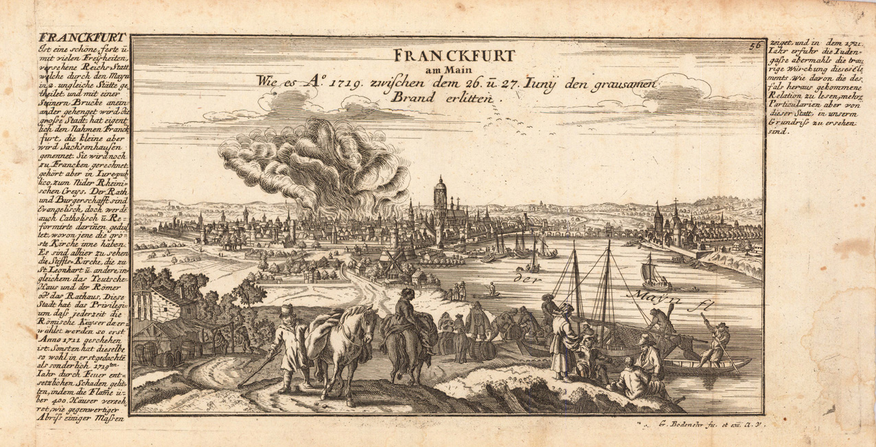
Copper engraving, uncolored as published. This fine engraving was published in Gabriel Bodenehr's famous serious "Europeans Macht und Pracht", a series of engravings depicting city views, plans, fortresses and castles in Europe. Many plates often are showing fortifications in Hungary and Southeast Europe, Spain, Belgium, Austria and Germany. Gabriel Bodenehr was during this period a successful publisher for maps and prints in Augsburg in Southern Germany.
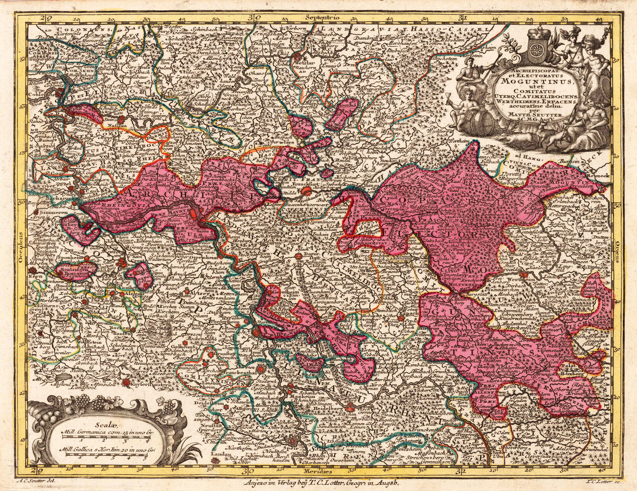
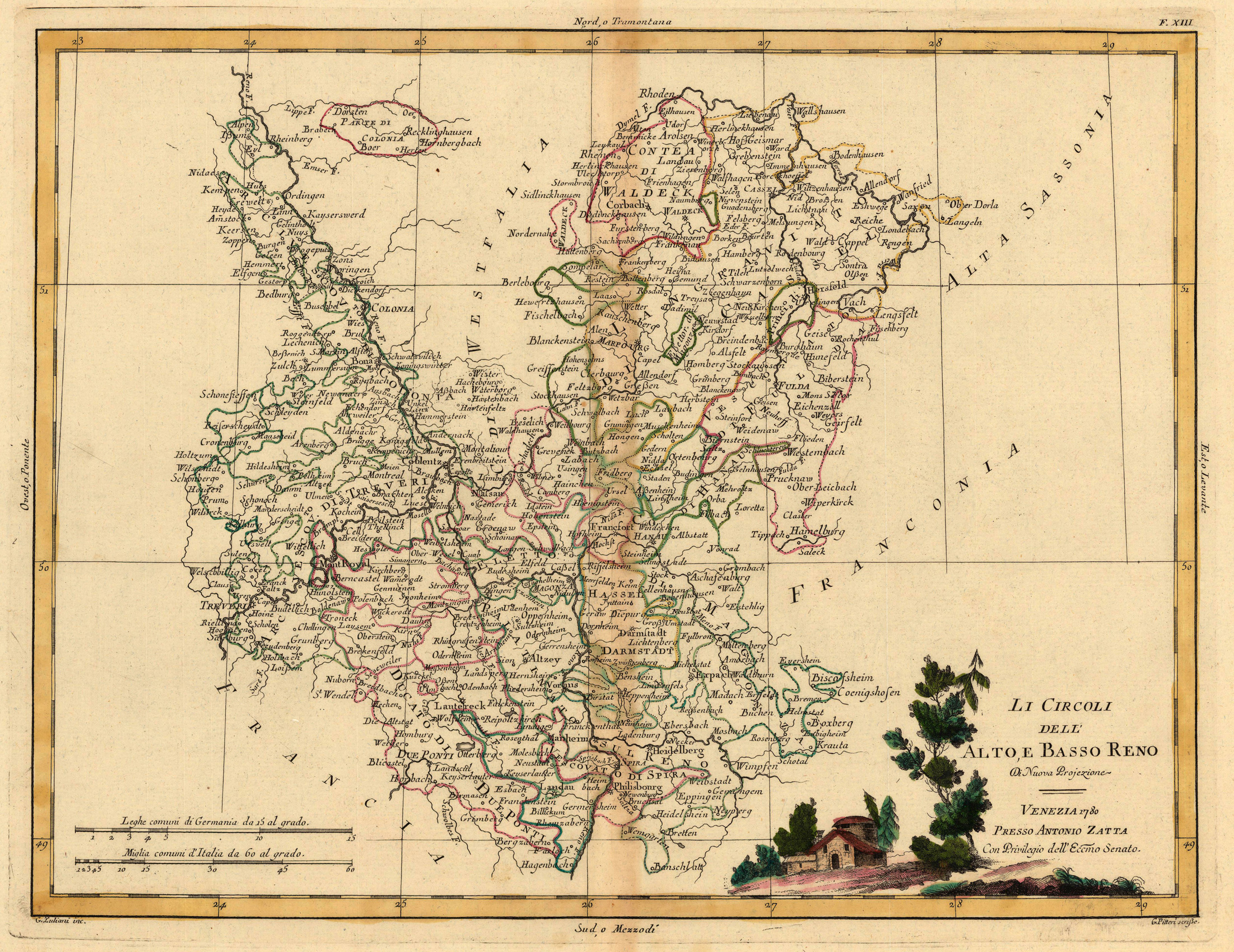
Copper engraving, hand colored in outline and wash when published. Map of the Archdiocese with the area between Speyer, Koblenz and Bischofsheim. Large figurative cartouche top right, small cartouche with mileage indicator and explanations bottom left.
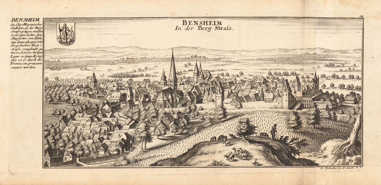
Original antique copper engraving, uncolored as published. This beautiful copperplate engraving shows the city of Bensheim. Bensheim is in the southern Hessian district of Bergstrasse. Today it is the largest city in the district with more than 40,000 inhabitants. Outside the illustration is a small description and next to it the coat of arms of the city. This fine engraving was published in Gabriel Bodenehr's famous serious "Europeans Macht und Pracht", a series of engravings depicting city views, plans, fortresses and castles in Europe. Many plates often are showing fortifications in Hungary and Southeast Europe, Spain, Belgium, Austria and Germany. Gabriel Bodenehr was during this period a successful publisher for maps and prints in Augsburg in Southern Germany. Gabriel Bodenehr the Elder (1664-1758 or 1673-1765) was a German map maker and member of a famous engraver and publisher family of Augsburg. His main work was "Atlas Curieux" first published 1704. He was the son of Johann Georg Bodenehr (1631-1703). Gabriel's son was Gabriel Bodenehr the Younger (1705–1792).
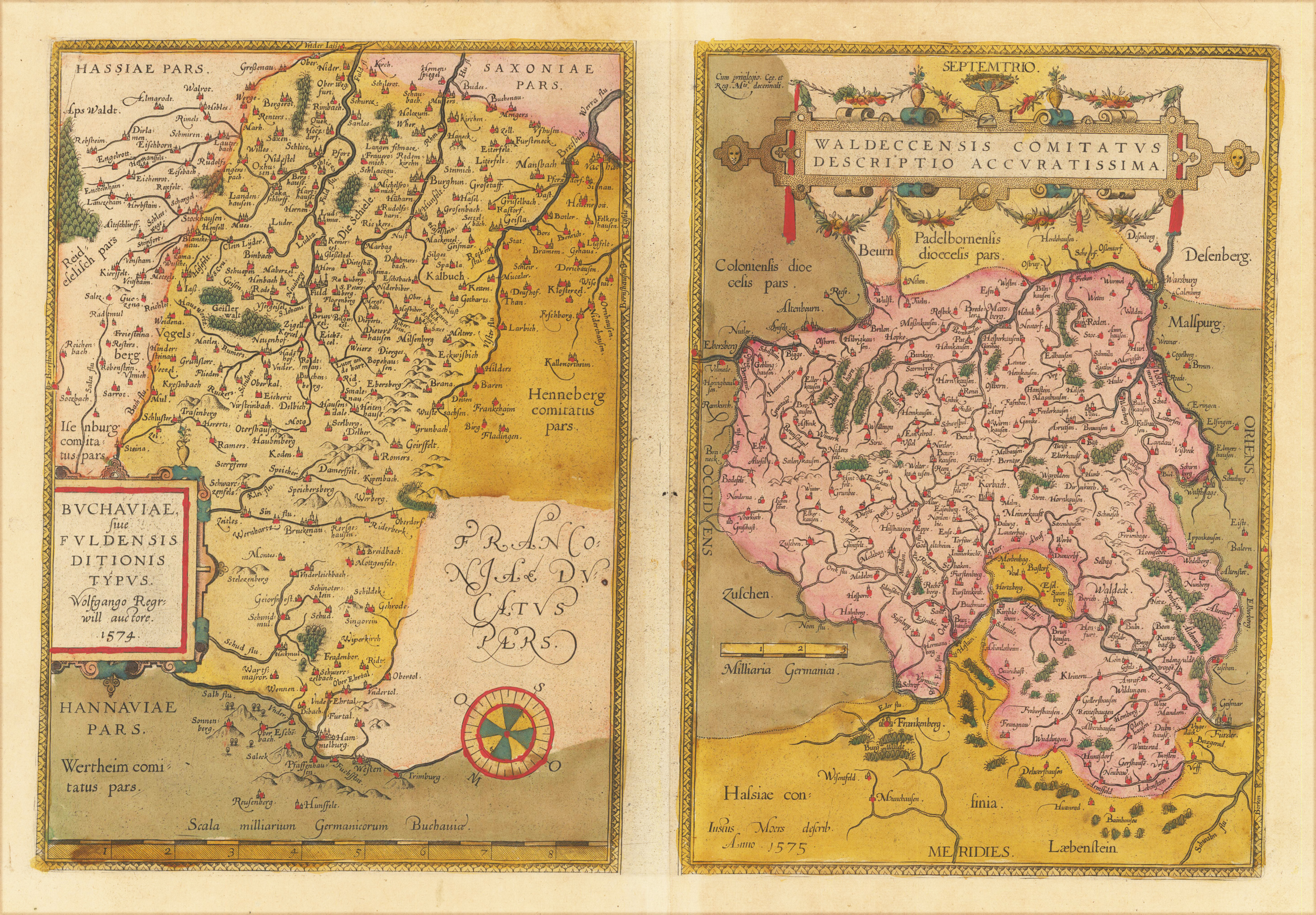
Origianl antique copper engraving, hand colored in wash when published. Decorative and early map of Fulda published in a 1574 Latin text edition of the 'Theatrum Orbis Terrarum' by A. Ortelius. A highly decorative early map of Fulda and surrounding . Mountains, woods, rivers and lakes are decorative engraved. Ortelius was born on 14 April 1527 in the city of Antwerp, which was then in the Habsburg Netherlands (modern-day Belgium). The Orthellius family were originally from Augsburg, a Free imperial city of the Holy Roman Empire. In 1535, the family had fallen under suspicion of Protestantism. Following the death of Ortelius's father, his uncle Jacobus van Meteren returned from religious exile in England to take care of Ortelius. Abraham remained close to his cousin Emanuel van Meteren, who would later move to London. In 1575 he was appointed geographer to the king of Spain, Philip II, on the recommendation of Arias Montanus, who vouched for his orthodoxy. He travelled extensively in Europe and is specifically known to have traveled throughout the Seventeen Provinces; in southern, western, northern, and eastern Germany (e.g., 1560, 1575–1576); France (1559–1560); England and Ireland (1576); and Italy (1578, and perhaps twice or thrice between 1550 and 1558). Beginning as a map-engraver, in 1547 he entered the Antwerp Guild of Saint Luke as an illuminator of maps. He supplemented his income trading in books, prints, and maps, and his journeys included yearly visits to the Frankfurt book and print fair, where he met Gerardus Mercator in 1554. In 1560, however, when travelling with Mercator to Trier, Lorraine, and Poitiers, he seems to have been attracted, largely by Mercator's influence, towards the career of a scientific geographer. (Wikipedia)
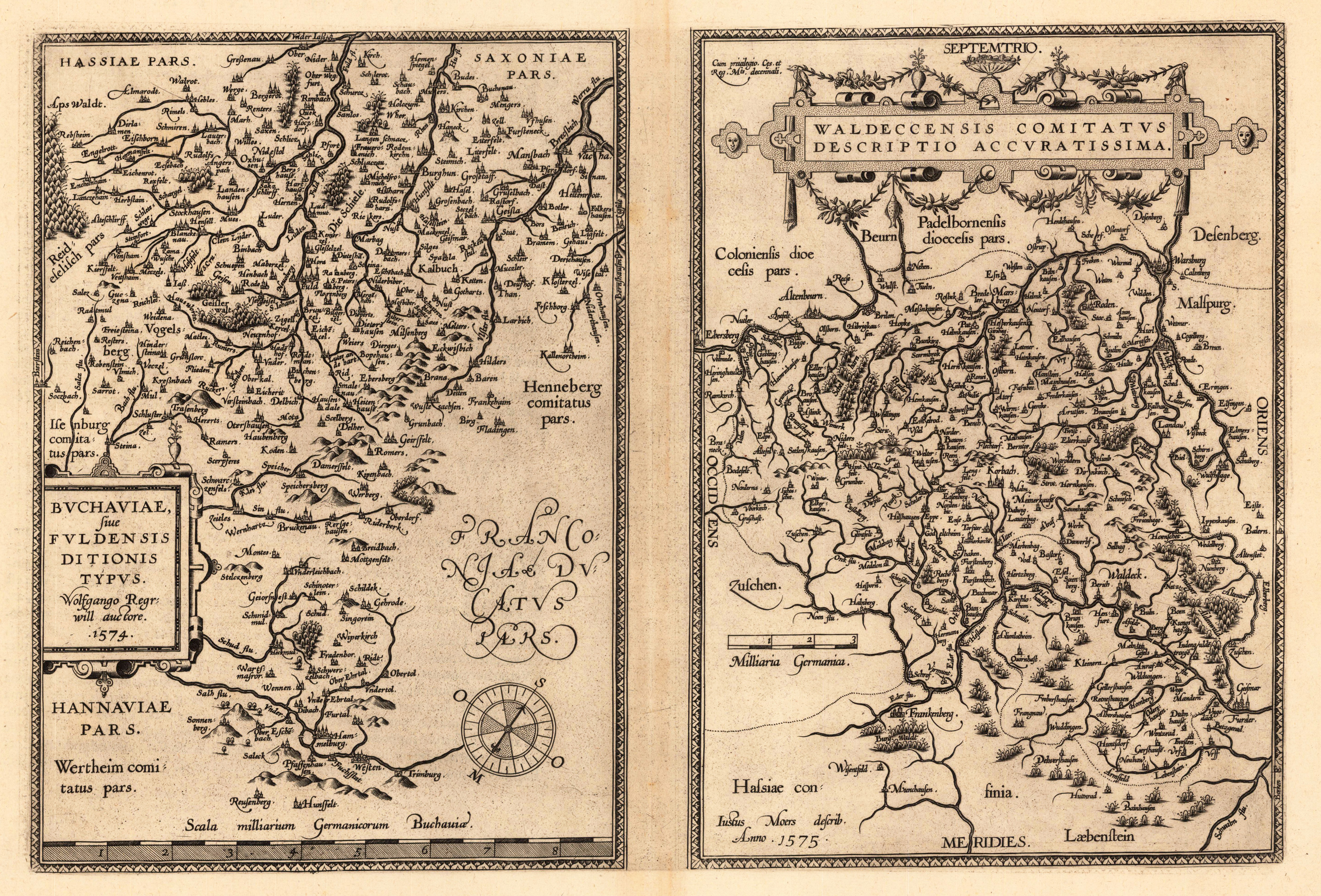
Copper engraving, uncolored when published. Decorative and early map of Fulda published in a 1574 Latin text edition of the 'Theatrum Orbis Terrarum' by A. Ortelius. A highly decorative early map of Fulda and surrounding . Mountains, woods, rivers and lakes are decorative engraved. Ortelius was born on 14 April 1527 in the city of Antwerp, which was then in the Habsburg Netherlands (modern-day Belgium). The Orthellius family were originally from Augsburg, a Free imperial city of the Holy Roman Empire. In 1535, the family had fallen under suspicion of Protestantism. Following the death of Ortelius's father, his uncle Jacobus van Meteren returned from religious exile in England to take care of Ortelius. Abraham remained close to his cousin Emanuel van Meteren, who would later move to London. In 1575 he was appointed geographer to the king of Spain, Philip II, on the recommendation of Arias Montanus, who vouched for his orthodoxy. He travelled extensively in Europe and is specifically known to have traveled throughout the Seventeen Provinces; in southern, western, northern, and eastern Germany (e.g., 1560, 1575–1576); France (1559–1560); England and Ireland (1576); and Italy (1578, and perhaps twice or thrice between 1550 and 1558). Beginning as a map-engraver, in 1547 he entered the Antwerp Guild of Saint Luke as an illuminator of maps. He supplemented his income trading in books, prints, and maps, and his journeys included yearly visits to the Frankfurt book and print fair, where he met Gerardus Mercator in 1554. In 1560, however, when travelling with Mercator to Trier, Lorraine, and Poitiers, he seems to have been attracted, largely by Mercator's influence, towards the career of a scientific geographer. (Wikipedia)
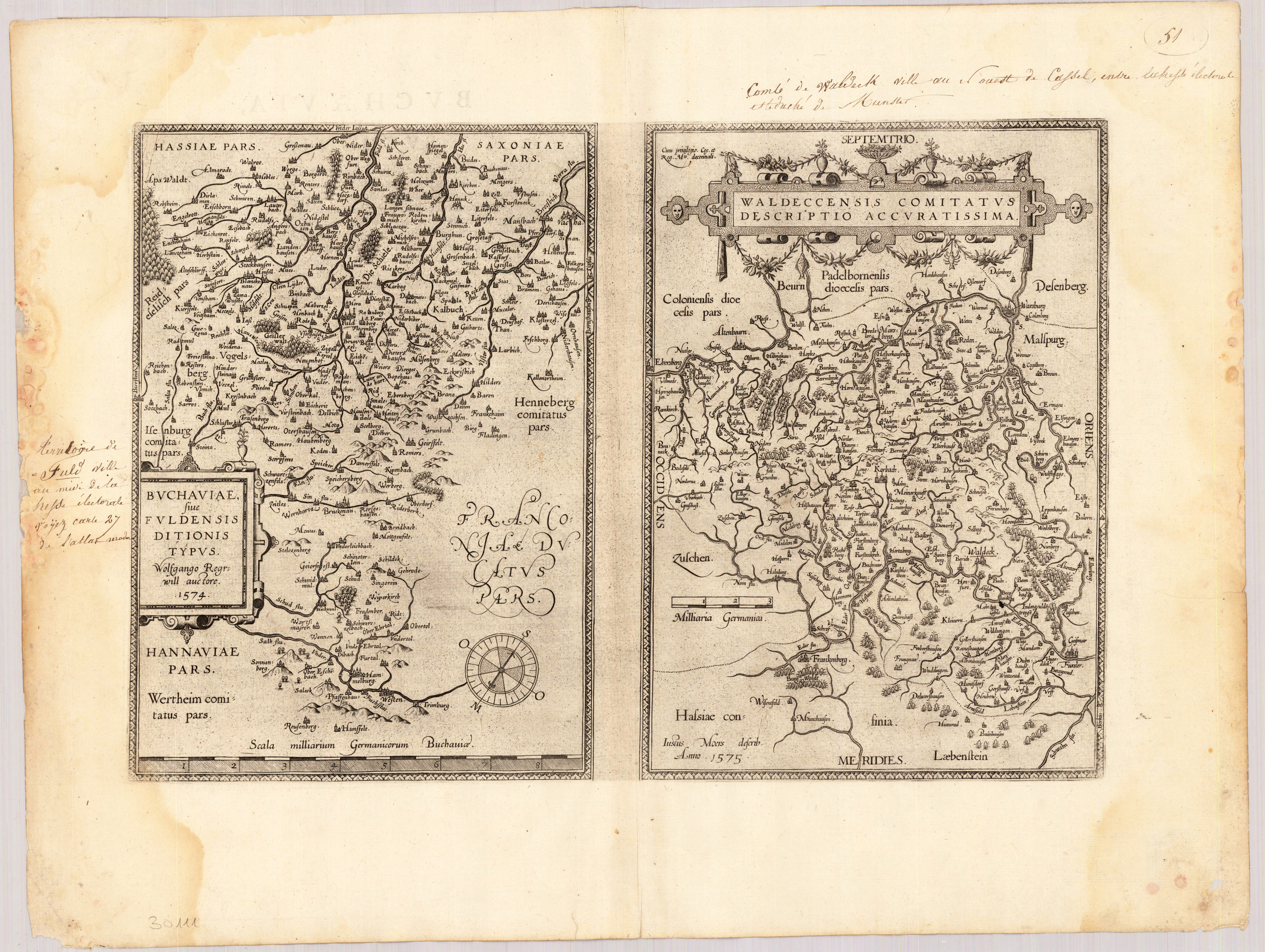
Copper engraving, uncolored when published. Decorative and early map of Fulda published in a 1574 Latin text edition of the 'Theatrum Orbis Terrarum' by A. Ortelius. A highly decorative early map of Fulda and surrounding . Mountains, woods, rivers and lakes are decorative engraved. Ortelius was born on 14 April 1527 in the city of Antwerp, which was then in the Habsburg Netherlands (modern-day Belgium). The Orthellius family were originally from Augsburg, a Free imperial city of the Holy Roman Empire. In 1535, the family had fallen under suspicion of Protestantism. Following the death of Ortelius's father, his uncle Jacobus van Meteren returned from religious exile in England to take care of Ortelius. Abraham remained close to his cousin Emanuel van Meteren, who would later move to London. In 1575 he was appointed geographer to the king of Spain, Philip II, on the recommendation of Arias Montanus, who vouched for his orthodoxy. He travelled extensively in Europe and is specifically known to have traveled throughout the Seventeen Provinces; in southern, western, northern, and eastern Germany (e.g., 1560, 1575–1576); France (1559–1560); England and Ireland (1576); and Italy (1578, and perhaps twice or thrice between 1550 and 1558). Beginning as a map-engraver, in 1547 he entered the Antwerp Guild of Saint Luke as an illuminator of maps. He supplemented his income trading in books, prints, and maps, and his journeys included yearly visits to the Frankfurt book and print fair, where he met Gerardus Mercator in 1554. In 1560, however, when travelling with Mercator to Trier, Lorraine, and Poitiers, he seems to have been attracted, largely by Mercator's influence, towards the career of a scientific geographer. (Wikipedia)
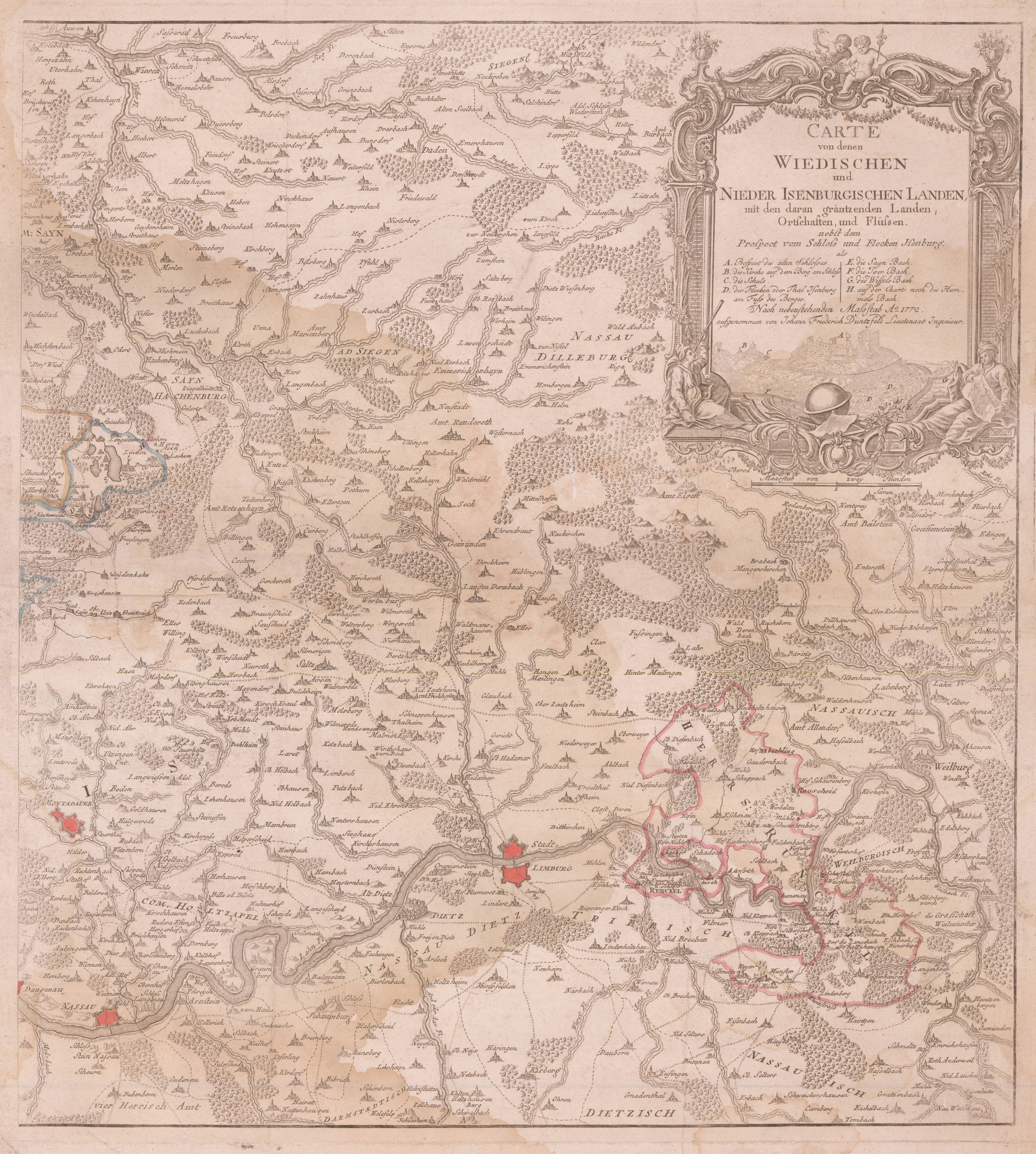
Original antike Kupferstichkarte, unkoloriert mit leichtem Grenzkolorit des Verlegers. Rechter Teil der Karte der Wiedischen und Isenburgischen Lande. Zeigt den Lauf der Lahn von Nassau, Diez, Runkel und Weilburg bis Selters, im Norden bis zur Sieg reichend. Rechts oben mit großer Titelkartusche mit Ansicht von Isenburg. Die Städte und Orte sind als kleine Vogelschauansichten bzw. Befestigungspläne eingezeichnet, desweiteren detaillierte gestochene Flußläufe, Seen, einzeichnete Berge und Wälder.
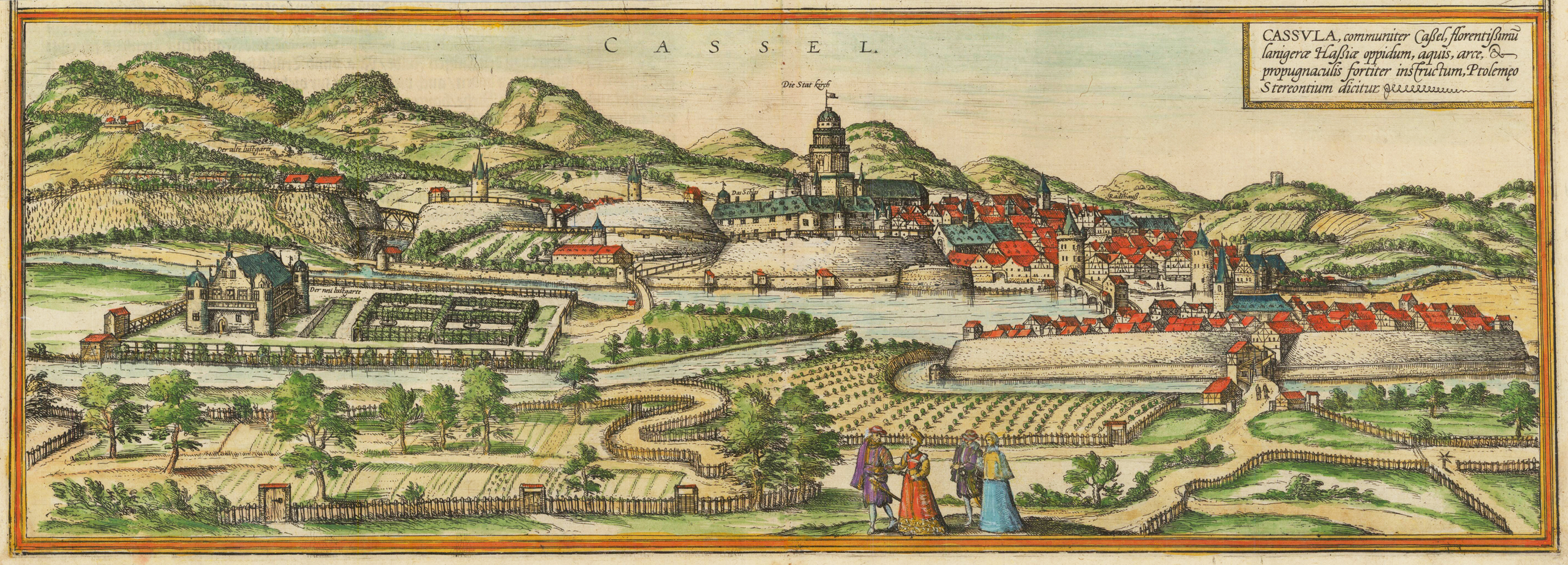
Original antiker Kupferstich, handkoloriert. Gesamtansicht von Kassel vom gegenüberliegenden Ufer der Fulda gesehen. Im Vordergrund Figurenstaffage und Gartenanlagen.
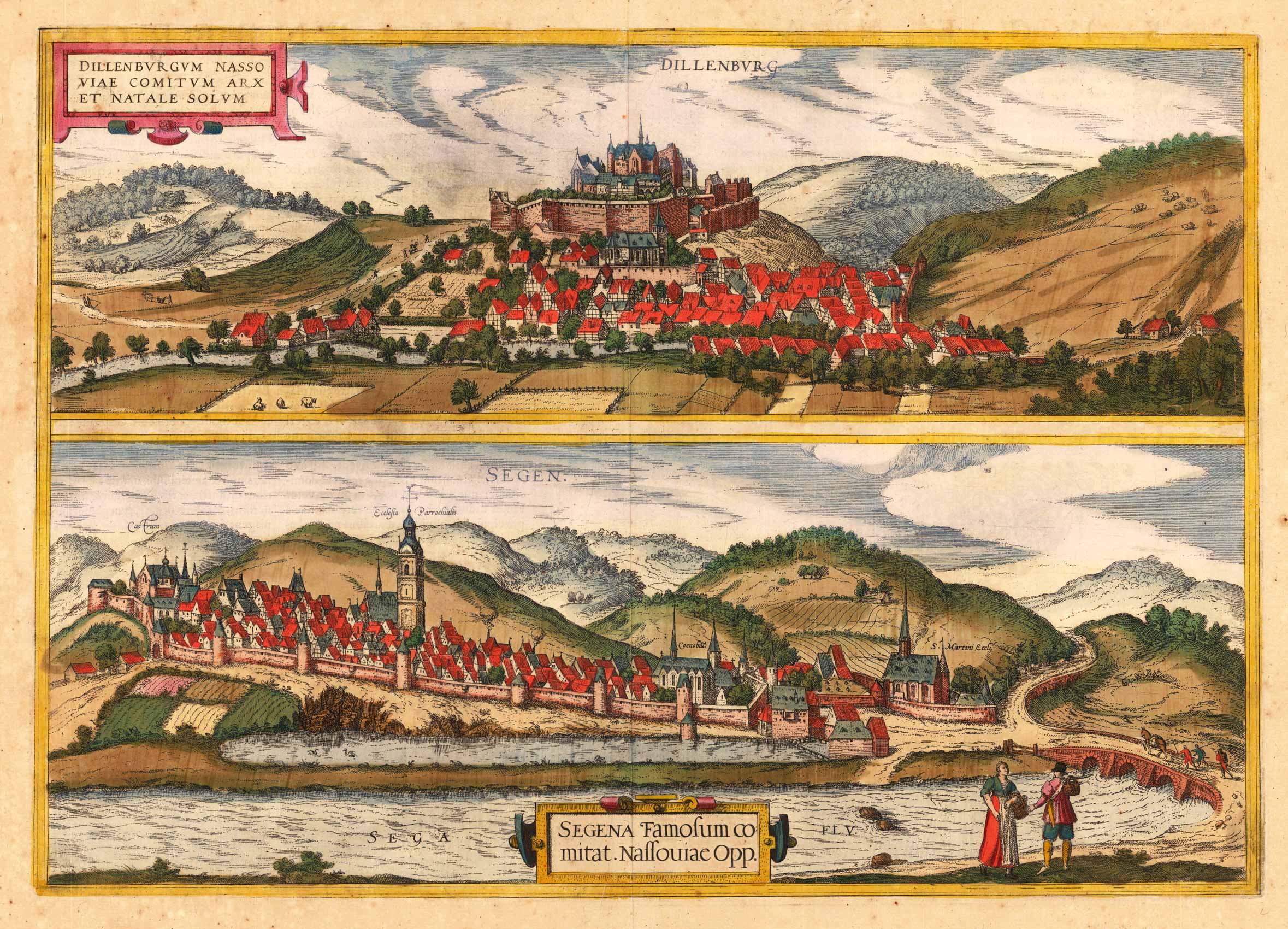
Original antique copper engraving, hand colored in outline when published. The plate was first published in the townbooks ,Civitates Orbis Terrarum' by Braun & Hogenberg. The plates were later aquired by J. Janssonius and were published in his townbooks 1657 in Amsterdam. Johannes Janssonius (1588, Arnhem – buried July 11, 1664, Amsterdam) (born Jan Janszoon, in English also Jan Jansson) was a Dutch cartographer and publisher who lived and worked in Amsterdam in the 17th century. Janssonius was born in Arnhem, the son of Jan Janszoon the Elder,[1] a publisher and bookseller. In 1612 he married Elisabeth de Hondt, the daughter of Jodocus Hondius. He produced his first maps in 1616 of France and Italy. In 1623 Janssonius owned a bookstore in Frankfurt am Main, later also in Danzig, Stockholm, Copenhagen, Berlin, Königsberg, Geneva and Lyon. Elisabeth Hondius died in 1627 and he remarried Elisabeth Carlier in 1629. In the 1630s he formed a partnership with his brother in law Henricus Hondius, and together they published atlases as Mercator/Hondius/Janssonius. Under the leadership of Janssonius the Hondius Atlas was steadily enlarged. Renamed Atlas Novus, it had three volumes in 1638, one fully dedicated to Italy. In 1646, a fourth volume came out with "English County Maps", a year after a similar issue by Joan Blaeu. Janssonius' maps are similar to those of Blaeu, and he is often accused of copying from his rival, but many of his maps predate those of Blaeu and/or covered different regions. By 1660, at which point the atlas bore the appropriate name "Atlas Major", there were 11 volumes, containing the work of about a hundred credited authors and engravers. It included a description of "most of the cities of the world" (Townatlas), of the waterworld (Atlas Maritimus in 33 maps), and of the Ancient World (60 maps). The eleventh volume was the Atlas of the Heavens by Andreas Cellarius. Editions were printed in Dutch, Latin, French, and a few times in German. After Janssonius's death, the publishing company was continued by his son-in law, Johannes van Waesbergen. The London bookseller Moses Pitt attempted publication of the Atlas Major in English, but ran out of resources after the fourth volume in 1683. (Wikipedia)
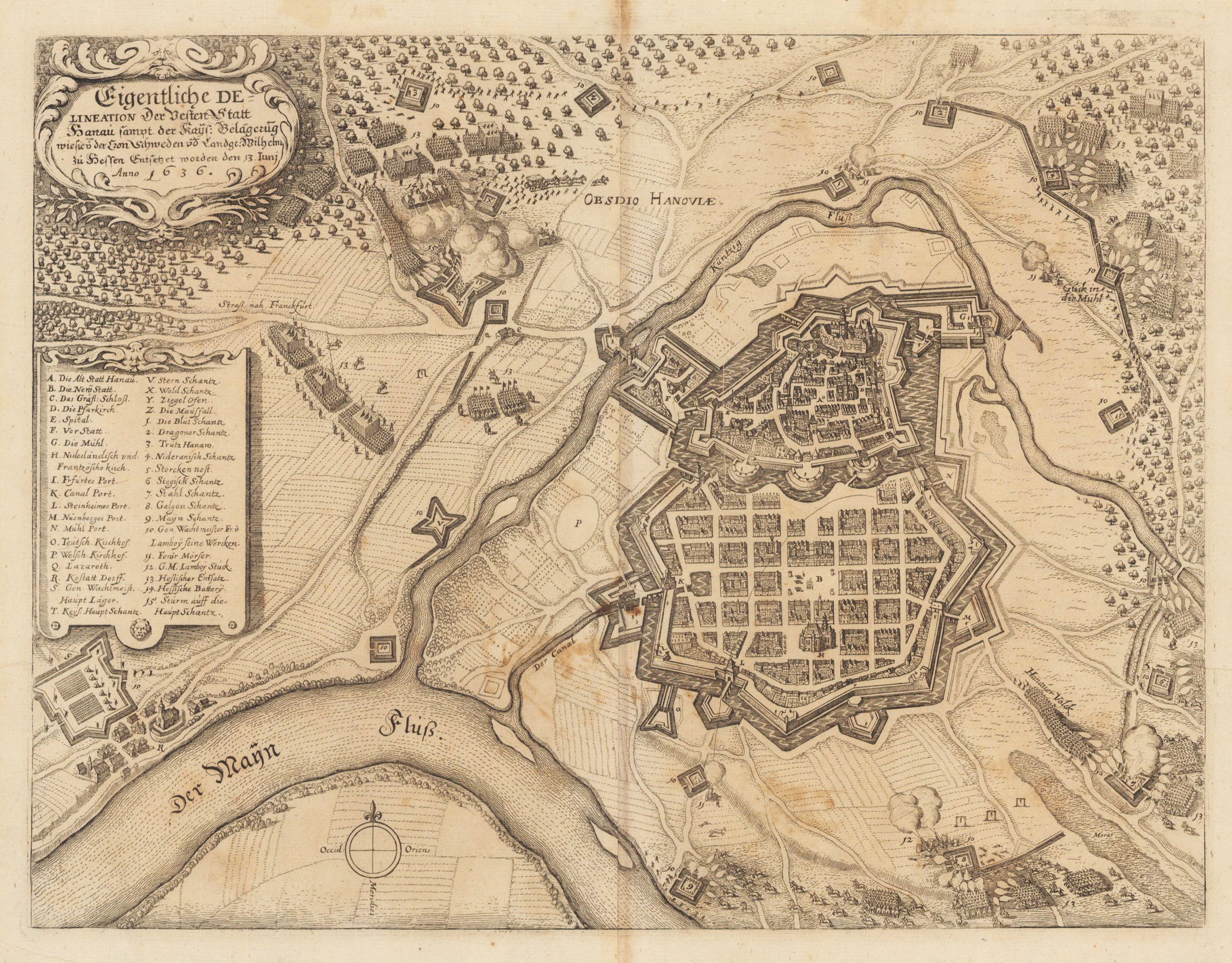
Kupferstichkarte,, erschienen im Theatrum Europaeum von M. Merian. Dargestellt wird die Belagerung der Stadt Hanau in Hessen durch die schwedischen Truppen im Jahre 1636 während des 30-jährigen Krieges.
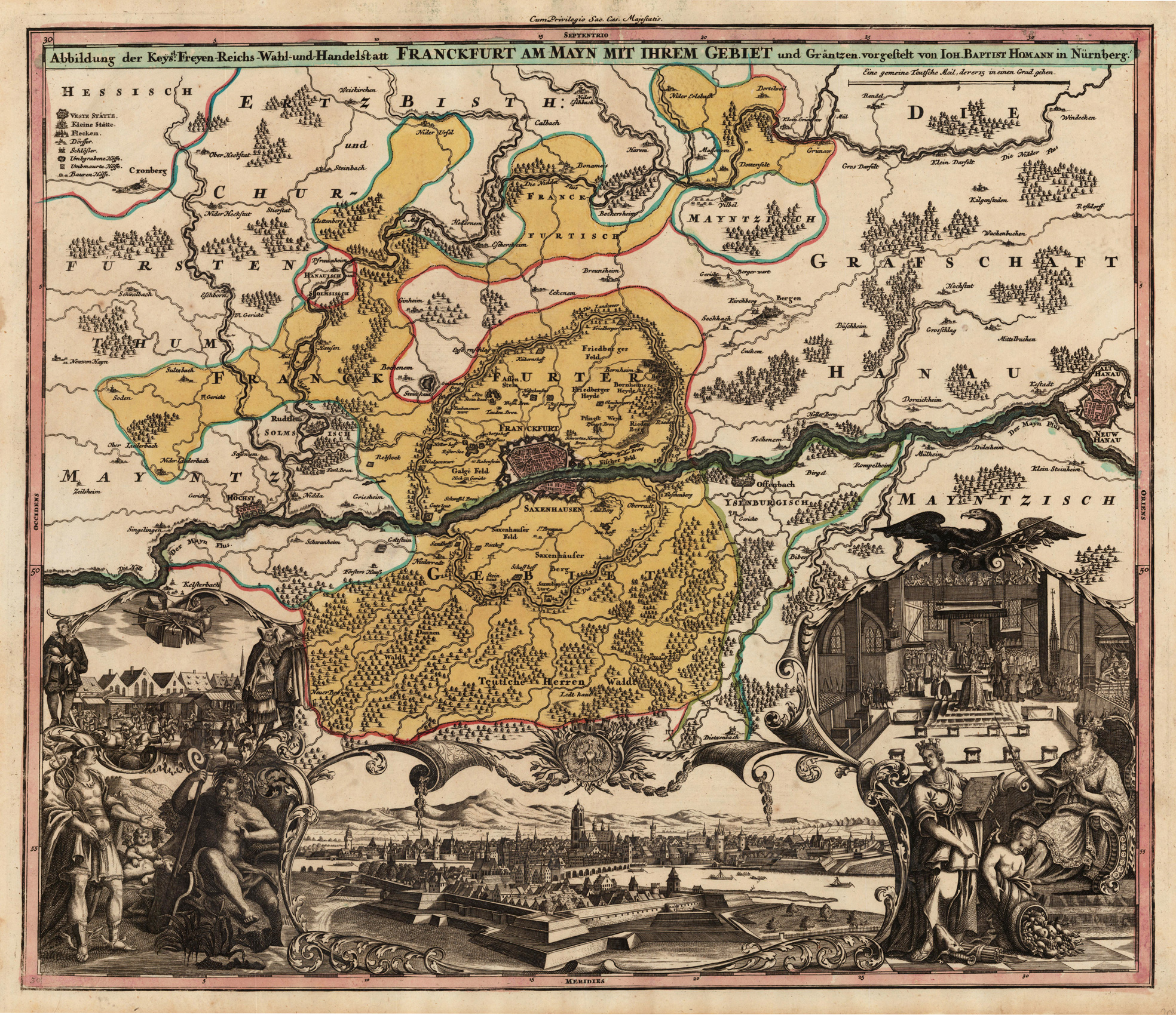
Original antique copper engraving in full contemporary hand color in wash and outline when published. Die Karte zeigt mittig Frankfurt mit dem umliegenden Gebiet. Im Nordwesten noch mit Kronberg im Taunus u. im Westen noch bis Hanau. Durchwegs schönes, kräftig gedrucktes Exemplar. This large and decorative antique map shows detailed the city of Frankfurt in Hessen. Ornated at the bottom with a large decorative allegoric city view of Frankfurt. At the lower left and right side is a impressive allegoric scene to the commerce and trade and to the election of the German emperor. In the centre of the map is Frankfurt with its surrounding. The map extends towards the northwest with 'Kronberg im Taunus' and in the west towards Hanau. Johann Baptist Homann (20 March 1664 – 1 July 1724) was a German geographer and cartographer, who also made maps of the Americas. Homann was born in Oberkammlach near Kammlach in the Electorate of Bavaria. Although educated at a Jesuit school, and preparing for an ecclesiastical career, he eventually converted to Protestantism and from 1687 worked as a civil law notary in Nuremberg. He soon turned to engraving and cartography; in 1702 he founded his own publishing house. Homann acquired renown as a leading German cartographer, and in 1715 was appointed Imperial Geographer by Emperor Charles VI. Giving such privileges to individuals was an added right that the Holy Roman Emperor enjoyed. In the same year he was also named a member of the Prussian Academy of Sciences in Berlin. Of particular significance to cartography were the imperial printing privileges (Latin: privilegia impressoria). These protected for a time the authors in all scientific fields such as printers, copper engravers, map makers and publishers. They were also very important as a recommendation for potential customers. In 1716 Homann published his masterpiece Grosser Atlas ueber die ganze Welt (Grand Atlas of all the World). Numerous maps were drawn up in cooperation with the engraver Christoph Weigel the Elder, who also published Siebmachers Wappenbuch. Homann died in Nuremberg in 1724. He was succeeded by his son Johann Christoph (1703-1730). The company carried on upon his death as Homann heirs company, managed by Johann Michael Franz and Johann Georg Ebersberger. After subsequent changes in management the company folded in 1852.[1] The company was known as "Homann Erben", "Homanniani Heredes", or "Heritiers de Homann" abroad. (Wikipedia)
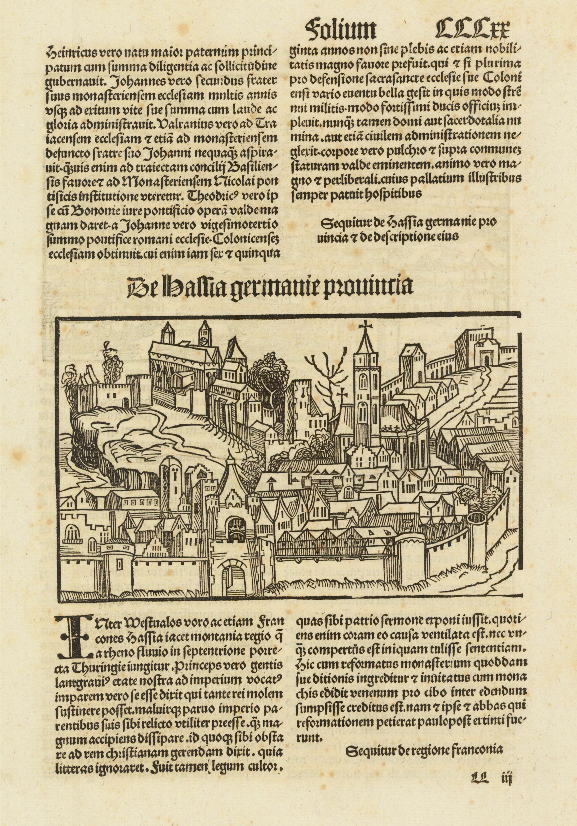
Woodcut published in the so-called pirate edition of the "small Schedel" in Augsburg, 1497, Latin edition. Originally the Nuremberg Chronicle by Hartmann Schedel was published 1493 in Nürnberg. The Latin edition was in July 1493, followed by the German edition in December 1493. After the great success of this first illustrated description of the world, Johann Schönsperger published February 1st, 1497 in Augsburg a pirate edition of the Nuremberg chronicle. A Latin edition 1497 and a German edition in 1500. It was also illustrated with approximately 1800 woodcuts in text after M. Wolgemut and W. Pleydenwurff. The size of this pirate edition was reduced to approximately 2/3 of its original size. This woodcut illustration shows us the landscape of Franconia in southern Germany. One of the earliest obtainable schematic scenes with medival towns rivers and mountains. A very good copy of this rare woodcut illustration.
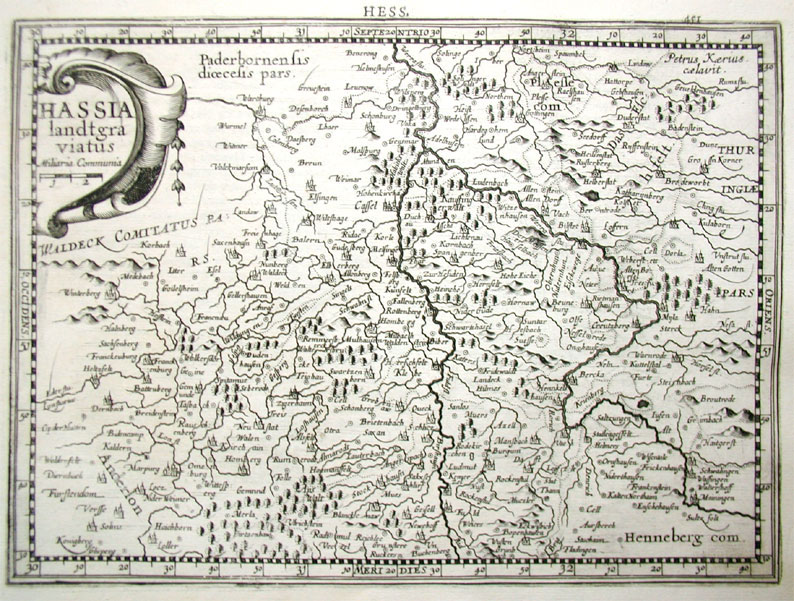
Original antique copper engraving, uncolored. A fine copy in a dark impression, full margins as published. Engraved map of the Hessen region is centered on Kassel. Shows towns, villages, landmarks, mountains, forests and rivers. Published in the first Cloppenburgh edition of Gerhard Mercator's "Atlas Minor" in 1630, verso French text. This is the first so-called Cloppenburgh editions which was a competive edition with new engraved maps in a larger format. Most of the maps were engraved by Pieter van den Keere. The Cloppenburg edition was continued for a couple of years but seems to have been suppressed after 1636 ... (Koeman Atlantes Neerlandici). Gerardus Mercator (5 March 1512 – 2 December 1594) was a 16th-century geographer, cosmographer and cartographer from the County of Flanders. He is most renowned for creating the 1569 world map based on a new projection which represented sailing courses of constant bearing (rhumb lines) as straight lines—an innovation that is still employed in nautical charts. Mercator was one of the pioneers of cartography and is widely considered the most notable figure of the school in its golden age (approximately 1570s–1670s). In his own day, he was a notable as maker of globes and scientific instruments. In addition, he had interests in theology, philosophy, history, mathematics and geomagnetism. He was also an accomplished engraver and calligrapher. Unlike other great scholars of the age he travelled little and his knowledge of geography came from his library of over one thousand books and maps, from his visitors and from his vast correspondence (in six languages) with other scholars, statesmen, travellers, merchants and seamen. Mercator's early maps were in large formats suitable for wall mounting but in the second half of his life, he produced over 100 new regional maps in a smaller format suitable for binding into his Atlas of 1595. This was the first appearance of the word Atlas in reference to a book of maps. However, Mercator used it as a neologism for a treatise (Cosmologia) on the creation, history and description of the universe, not simply a collection of maps. He chose the word as a commemoration of the Titan Atlas, "King of Mauretania", whom he considered to be the first great geographer. A large part of Mercator's income came from sales of his terrestrial and celestial globes. For sixty years they were considered the finest in the world, and were sold in such great numbers that there are many surviving examples. This was a substantial enterprise involving the manufacture of the spheres, printing the gores, building substantial stands, packing and distributing all over Europe. He was also renowned for his scientific instruments, particularly his astrolabes and astronomical rings used to study the geometry of astronomy and astrology. Mercator wrote on geography, philosophy, chronology and theology. All of the wall maps were engraved with copious text on the region concerned. As an example the famous world map of 1569 is inscribed with over five thousand words in fifteen legends. The 1595 Atlas has about 120 pages of maps and illustrated title pages but a greater number of pages are devoted to his account of the creation of the universe and descriptions of all the countries portrayed. His table of chronology ran to some 400 pages fixing the dates (from the time of creation) of earthly dynasties, major political and military events, volcanic eruptions, earthquakes and eclipses. He also wrote on the gospels and the old testament. Mercator was a devout Christian born into a Catholic family at a time when Martin Luther's Protestantism was gaining ground. He never declared himself as a Lutheran but he was clearly sympathetic and he was accused of heresy by Catholic authorities; after six months in prison he was released unscathed. This period of persecution is probably the major factor in his move from Catholic Leuven (Louvain) to a more tolerant Duisburg, in the Holy Roman Empire, where he lived for the last thirty years of his life. Walter Ghim, Mercator's friend and first biographer, describes him as sober in his behaviour, yet cheerful and witty in company, and never more happy than in debate with other scholars. Above all he was pious and studious until his dying days. (Wikipedia)
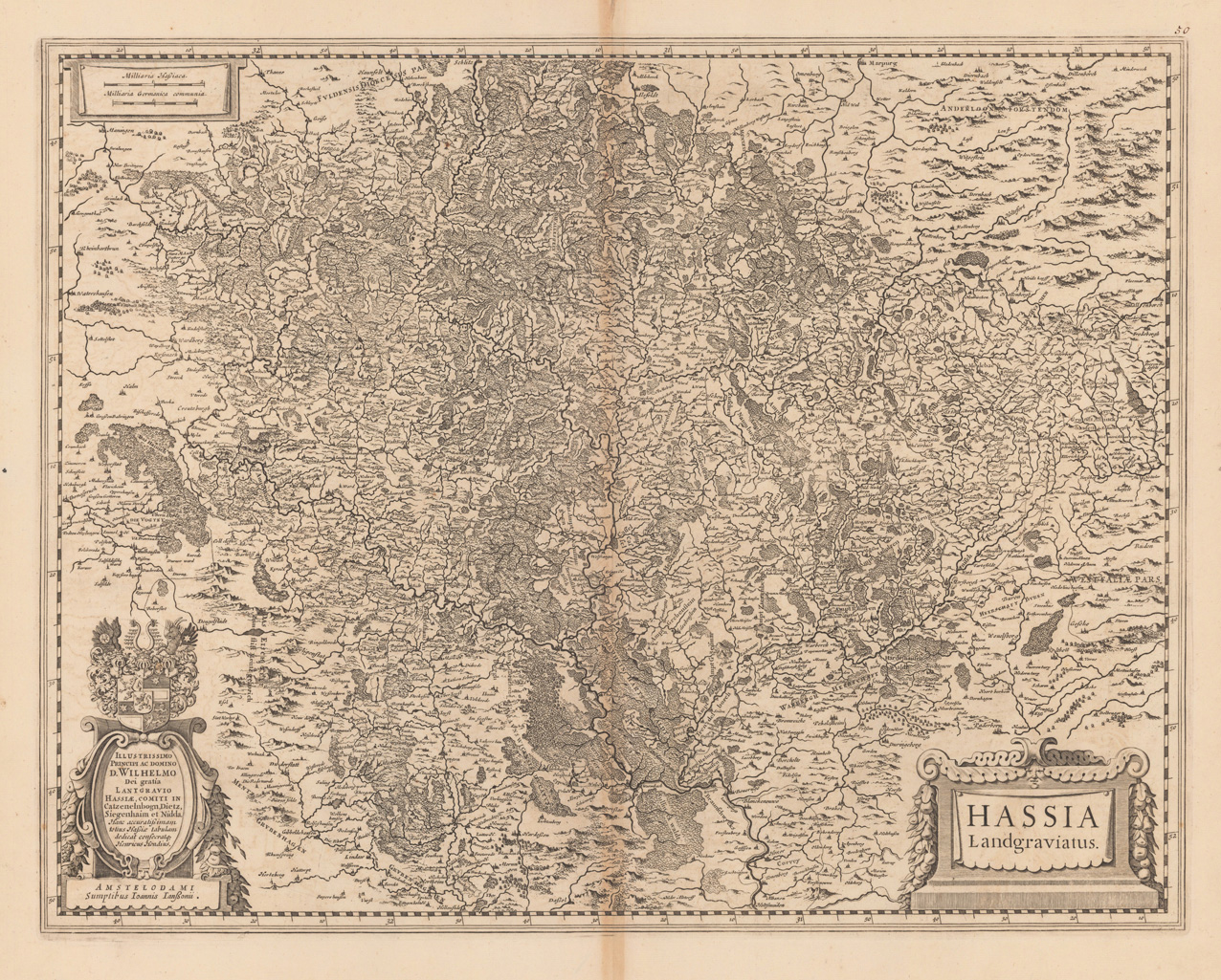
Copper engraving, uncolored as published. Dekorative detaillierte Karte der Landgrafschaft Hessen mit Kassel im Zentrum des Kartenbildes. Mit dem Impressum,Amstelodami Sumptibus Ioannis Ianßonii', verso ohne Text, wie bei Koeman beschrieben. Wohl nach 1650 mit der geänderten Addresse des Verlegers erschienen. Erschien ursprünglich von 1633-49 mit dem Imprint,Amstelodami Sumptibus Hendrici Hondii'. Breitrandiges Exemplar, geringfügige Bräunung im Bereich des Mittelfalzes.
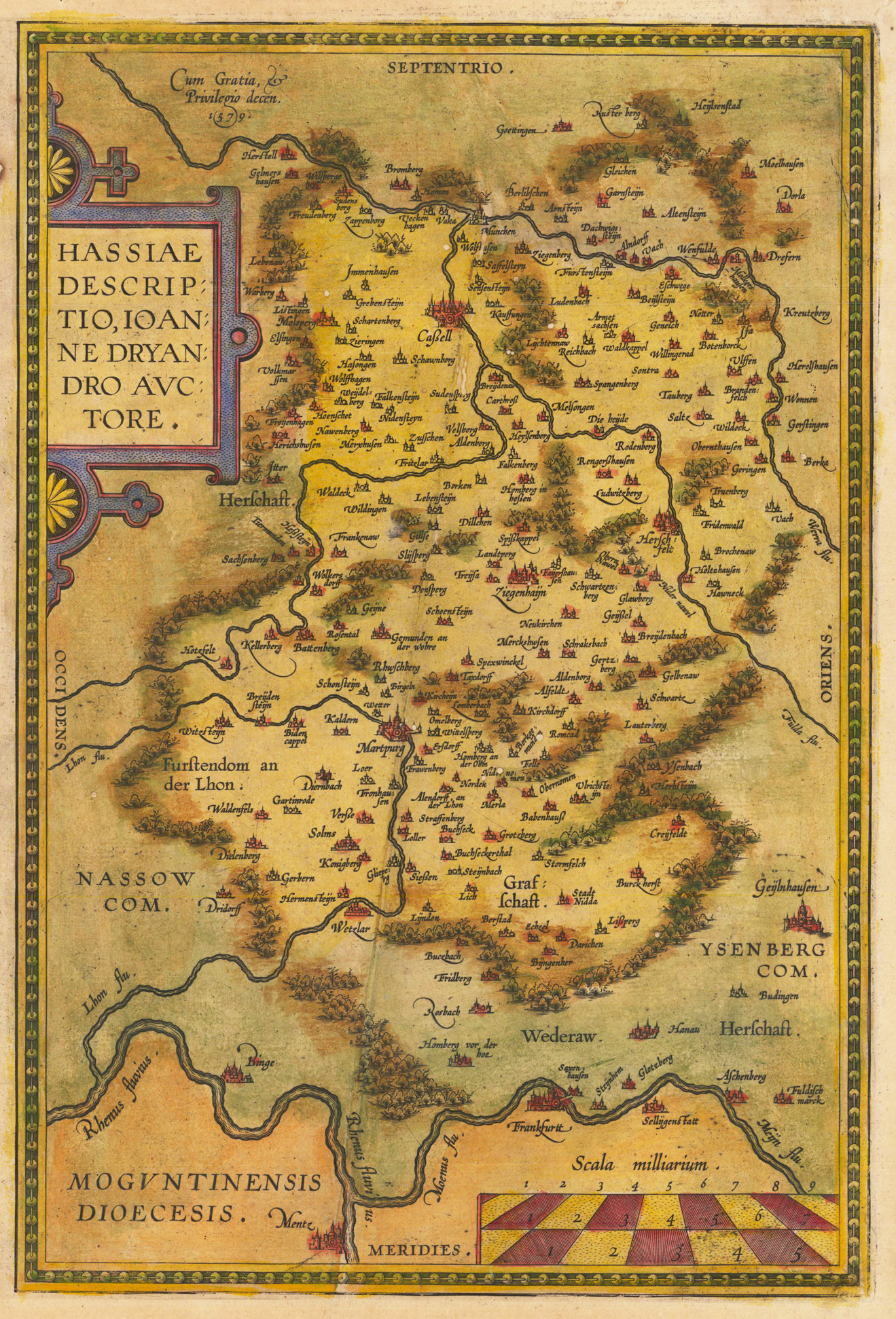
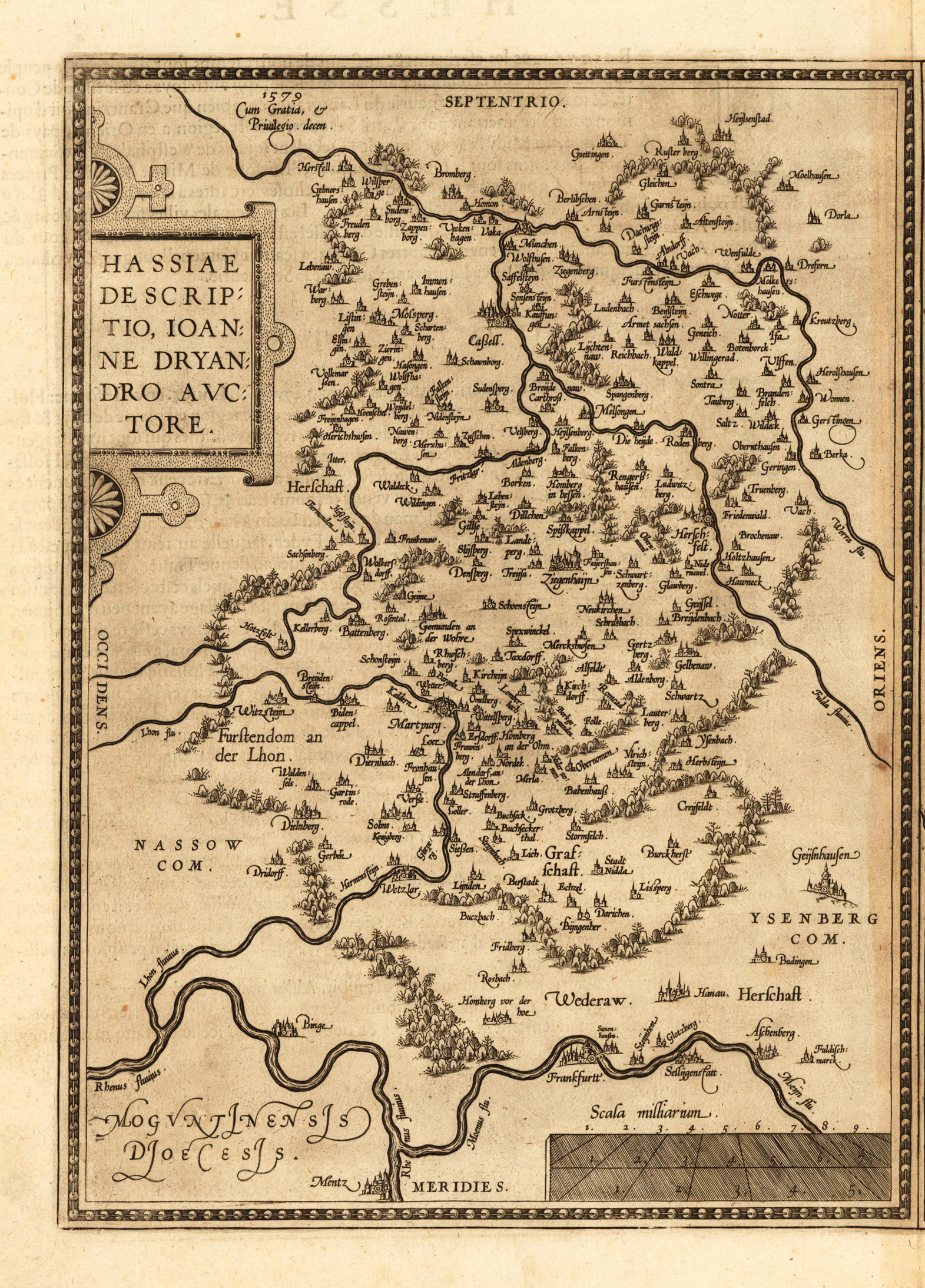
Original antique copper engraving, hand colored in wash. Interesting antique map of Hessen by the Dutch cartographer Abraham Ortelius. The map depicts Hessen with Frankfurt and the river Main in the south and extends towards the region of Kassel in the north. With many engraved place names, rivers and woods. Larger towns and cities are engraved as miniature city views on the map. The map of Hessen is based on the cartographic sources after Johannes Dryander. Ortelius was born on 14 April 1527 in the city of Antwerp, which was then in the Habsburg Netherlands (modern-day Belgium). The Orthellius family were originally from Augsburg, a Free imperial city of the Holy Roman Empire. In 1535, the family had fallen under suspicion of Protestantism. Following the death of Ortelius's father, his uncle Jacobus van Meteren returned from religious exile in England to take care of Ortelius. Abraham remained close to his cousin Emanuel van Meteren, who would later move to London. In 1575 he was appointed geographer to the king of Spain, Philip II, on the recommendation of Arias Montanus, who vouched for his orthodoxy. He travelled extensively in Europe and is specifically known to have traveled throughout the Seventeen Provinces; in southern, western, northern, and eastern Germany (e.g., 1560, 1575–1576); France (1559–1560); England and Ireland (1576); and Italy (1578, and perhaps twice or thrice between 1550 and 1558). Beginning as a map-engraver, in 1547 he entered the Antwerp Guild of Saint Luke as an illuminator of maps. He supplemented his income trading in books, prints, and maps, and his journeys included yearly visits to the Frankfurt book and print fair, where he met Gerardus Mercator in 1554. In 1560, however, when travelling with Mercator to Trier, Lorraine, and Poitiers, he seems to have been attracted, largely by Mercator's influence, towards the career of a scientific geographer. (Wikipedia)
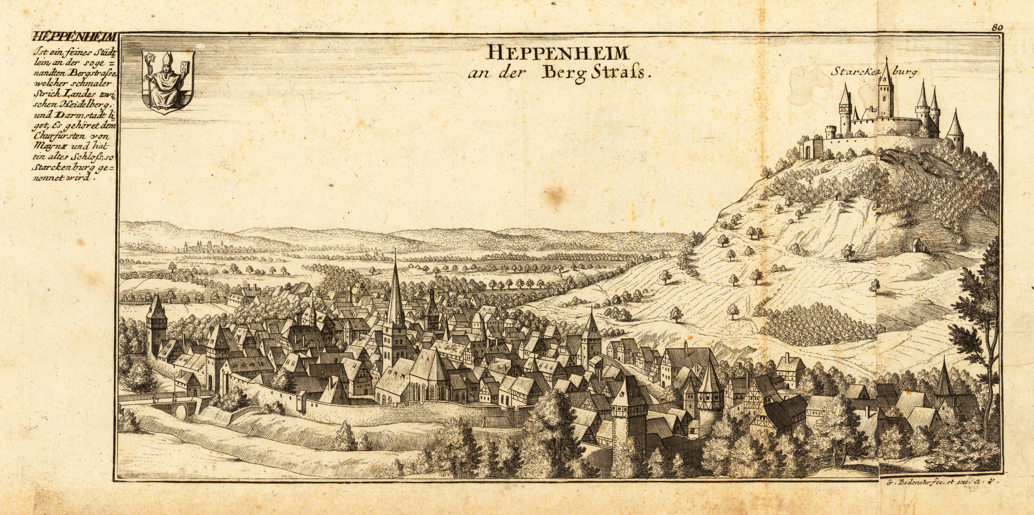
Original antique copper engraving, uncolored as published. Copper engraving of the city Heppenheim in South Hessen. This fine engraving was published in Gabriel Bodenehr's famous serious "Europeans Macht und Pracht", a series of engravings depicting city views, plans, fortresses and castles in Europe. Many plates often are showing fortifications in Hungary and Southeast Europe, Spain, Belgium, Austria and Germany. Gabriel Bodenehr was during this period a sucessful publisher for maps and prints in Augsburg in Southern Germany. Gabriel Bodenehr the Elder (1664-1758 or 1673-1765) was a German map maker and member of a famous engraver and publisher family of Augsburg. His main work was "Atlas Curieux" first published 1704. He was the son of Johann Georg Bodenehr (1631-1703). Gabriel's son was Gabriel Bodenehr the Younger (1705–1792).
Original antique copper engraving, uncolored as published. This map was published exactly 1598 in a French text edition of the atlas Theatrum orbis terrarum by Platin in Antwerp. Interesting antique map of Hessen by the Dutch cartographer Abraham Ortelius. The map depicts Hessen with Frankfurt and the river Main in the south and extends towards the region of Kassel in the north. With many engraved place names, rivers and woods. Ortelius was born on 14 April 1527 in the city of Antwerp, which was then in the Habsburg Netherlands (modern-day Belgium). The Orthellius family were originally from Augsburg, a Free imperial city of the Holy Roman Empire. In 1535, the family had fallen under suspicion of Protestantism. Following the death of Ortelius's father, his uncle Jacobus van Meteren returned from religious exile in England to take care of Ortelius. Abraham remained close to his cousin Emanuel van Meteren, who would later move to London. In 1575 he was appointed geographer to the king of Spain, Philip II, on the recommendation of Arias Montanus, who vouched for his orthodoxy. He travelled extensively in Europe and is specifically known to have traveled throughout the Seventeen Provinces; in southern, western, northern, and eastern Germany (e.g., 1560, 1575–1576); France (1559–1560); England and Ireland (1576); and Italy (1578, and perhaps twice or thrice between 1550 and 1558). Beginning as a map-engraver, in 1547 he entered the Antwerp Guild of Saint Luke as an illuminator of maps. He supplemented his income trading in books, prints, and maps, and his journeys included yearly visits to the Frankfurt book and print fair, where he met Gerardus Mercator in 1554. In 1560, however, when travelling with Mercator to Trier, Lorraine, and Poitiers, he seems to have been attracted, largely by Mercator's influence, towards the career of a scientific geographer. (Wikipedia)
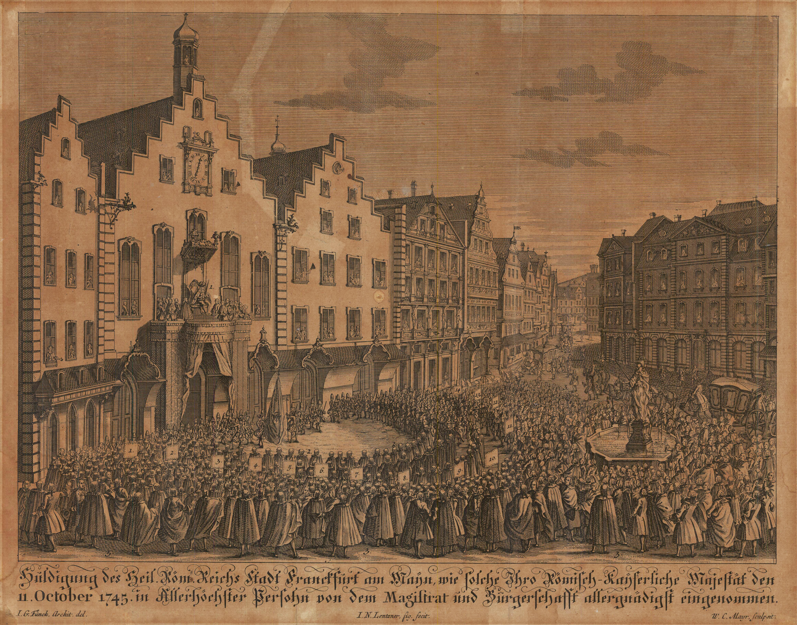
Original antiker Kufperstich, unkoloriert. Kupferstich gestochen von W.C. Mayr, nach einer Zeichnung von Johann Georg Funck (auch Finck, Fünck, Fünch, 1721-1757). Dargestellt wird der Römer, das Wahrzeichen von Frankfurt und der Justiziabrunnen. Der Römer ist seit dem 15. Jahrhundert das Rathaus der Stadt Frankfurt am Main und mit seiner charakteristischen Treppengiebelfassade eines ihrer Wahrzeichen. Er ist als Zentrum der Stadtpolitik Sitz der Stadtvertreter und des Oberbürgermeisters. Das mittlere der ursprünglich drei eigenständigen Gebäude am Römerberg ist das eigentliche Haus zum Römer. Unter „Römer" wird schon seit Jahrhunderten der gesamte Rathauskomplex verstanden. Warum das zentrale Gebäude „Römer" heißt, ist unbekannt; es existieren verschiedene, einander widersprechende Deutungen.
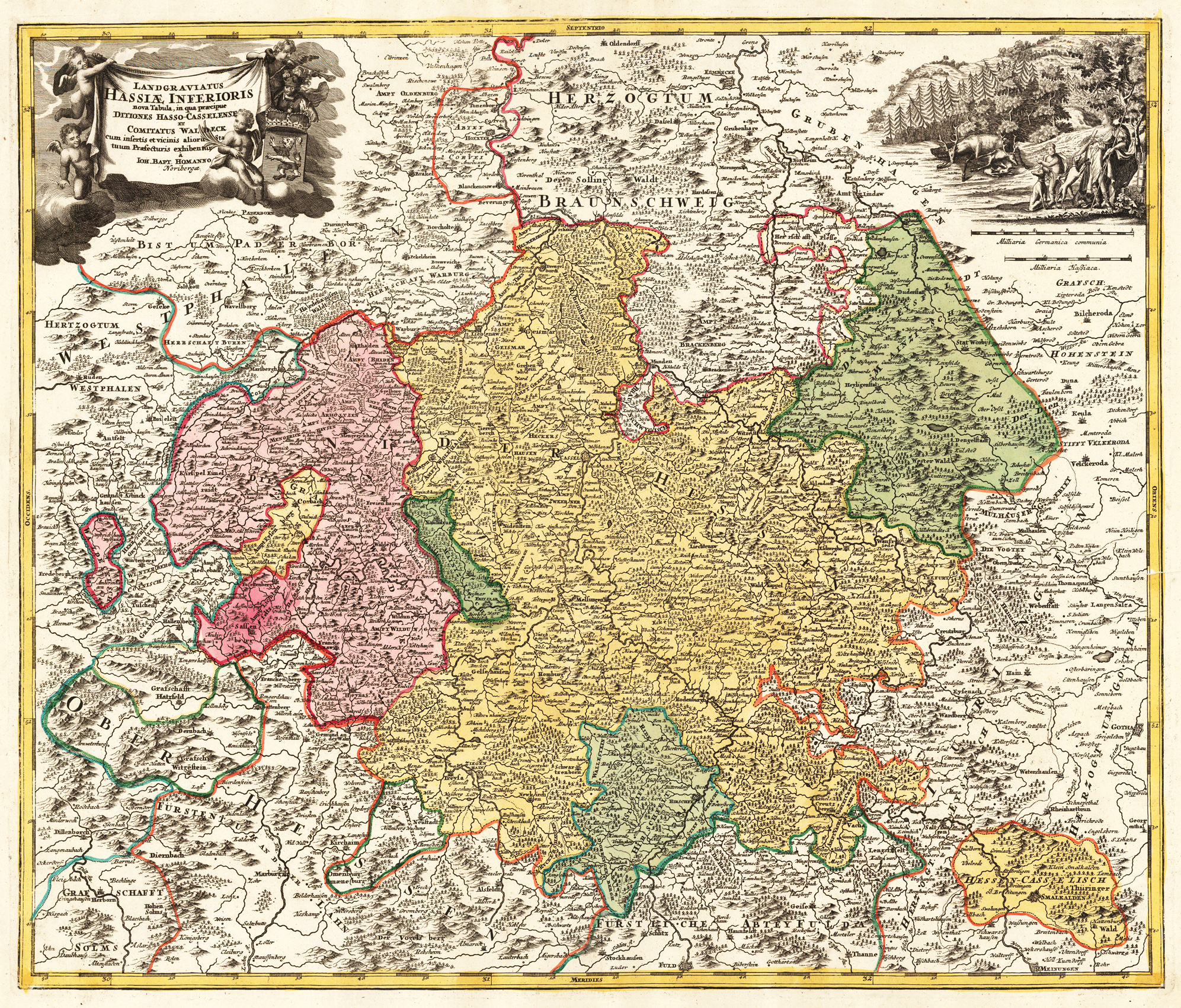
Original antique copper engraving, hand colored in outline and wash when published. Antike Landkarte von Hessen mit seinen den einzelnen Herzogtümern und Gebieten. Die detaillierte Karte zeigt eine enorme Anzahl gravierter Ortsnamen, Flüsse, Wälder und Berge. In den oberen Ecken eine allegorische Szene mit Meilenzeiger und einer figurativen Titelkartusche. Large detailed map of Hessen with its individual duchies and territories. The detailed map with enormous amount of engraved place names, rivers, woods and mountains. In the upper corners an allegoric scene with a mileage scale and a figurative title cartouche. Johann Baptist Homann (20 March 1664 – 1 July 1724) was a German geographer and cartographer, who also made maps of the Americas. Homann was born in Oberkammlach near Kammlach in the Electorate of Bavaria. Although educated at a Jesuit school, and preparing for an ecclesiastical career, he eventually converted to Protestantism and from 1687 worked as a civil law notary in Nuremberg. He soon turned to engraving and cartography; in 1702 he founded his own publishing house. Homann acquired renown as a leading German cartographer, and in 1715 was appointed Imperial Geographer by Emperor Charles VI. Giving such privileges to individuals was an added right that the Holy Roman Emperor enjoyed. In the same year he was also named a member of the Prussian Academy of Sciences in Berlin. Of particular significance to cartography were the imperial printing privileges (Latin: privilegia impressoria). These protected for a time the authors in all scientific fields such as printers, copper engravers, map makers and publishers. They were also very important as a recommendation for potential customers. In 1716 Homann published his masterpiece Grosser Atlas ueber die ganze Welt (Grand Atlas of all the World). Numerous maps were drawn up in cooperation with the engraver Christoph Weigel the Elder, who also published Siebmachers Wappenbuch. Homann died in Nuremberg in 1724. He was succeeded by his son Johann Christoph (1703-1730). The company carried on upon his death as Homann heirs company, managed by Johann Michael Franz and Johann Georg Ebersberger. After subsequent changes in management the company folded in 1852.[1] The company was known as "Homann Erben", "Homanniani Heredes", or "Heritiers de Homann" abroad. (Wikipedia)
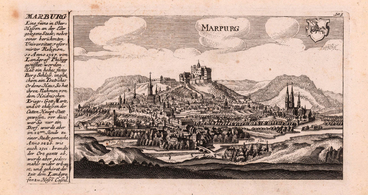
Original antique copper engraving, uncolored as published. Decorative panoramic city view of Marburg in Hessen. This fine engraving was published in Gabriel Bodenehr's famous serious "Europeans Macht und Pracht", a series of engravings depicting city views, plans, fortresses and castles in Europe. Many plates often are showing fortifications in Hungary and Southeast Europe, Spain, Belgium, Austria and Germany. Gabriel Bodenehr was during this period a successful publisher for maps and prints in Augsburg in Southern Germany. Gabriel Bodenehr the Elder (1664-1758 or 1673-1765) was a German map maker and member of a famous engraver and publisher family of Augsburg. His main work was "Atlas Curieux" first published 1704. He was the son of Johann Georg Bodenehr (1631-1703). Gabriel's son was Gabriel Bodenehr the Younger (1705–1792).