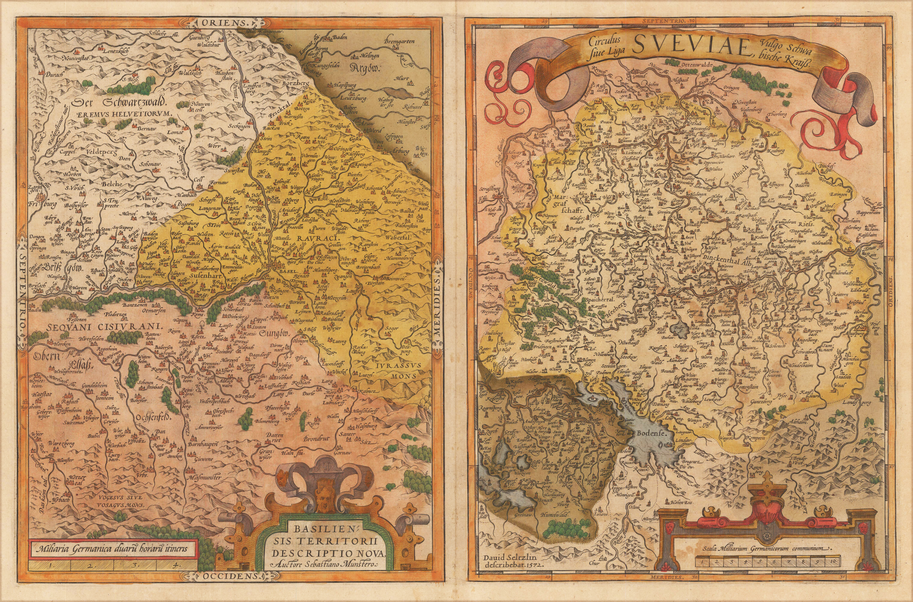
Original copper engraving, published 1612 in the famous Vrients-edition of the "Theatrum Orbis Terrarum". Old colored. Two maps on one plate both showing title cartouches and scale bars. Villages and towns are shown as miniature views.
Original antique copper engraving, uncolored as published. This fine engraving shows the city of Breisach at the river Rhine and was published in Gabriel Bodenehr's famous serious "Europeans Macht und Pracht", a series of engravings depicting city views, plans, fortresses and castles in Europe. Many plates often are showing fortifications in Hungary and Southeast Europe, Spain, Belgium, Austria and Germany. Gabriel Bodenehr was during this period a successful publisher for maps and prints in Augsburg in Southern Germany. The discription and the explanation is on both sides of the plan. Gabriel Bodenehr the Elder (1664-1758 or 1673-1765) was a German map maker and member of a famous engraver and publisher family of Augsburg. His main work was "Atlas Curieux" first published 1704. He was the son of Johann Georg Bodenehr (1631-1703). Gabriel's son was Gabriel Bodenehr the Younger (1705–1792).
Original antique copper engraving, uncolored as published. This fine engraving shows the city of Breisach at the river Rhine and was published in Gabriel Bodenehr's famous serious "Europeans Macht und Pracht", a series of engravings depicting city views, plans, fortresses and castles in Europe. Many plates often are showing fortifications in Hungary and Southeast Europe, Spain, Belgium, Austria and Germany. Gabriel Bodenehr was during this period a successful publisher for maps and prints in Augsburg in Southern Germany. Gabriel Bodenehr the Elder (1664-1758 or 1673-1765) was a German map maker and member of a famous engraver and publisher family of Augsburg. His main work was "Atlas Curieux" first published 1704. He was the son of Johann Georg Bodenehr (1631-1703). Gabriel's son was Gabriel Bodenehr the Younger (1705–1792).
Original antique copper engraving, uncolored as published. This fine engraving shows the city of Breisach at the river Rhine and was published in Gabriel Bodenehr's famous serious "Europeans Macht und Pracht", a series of engravings depicting city views, plans, fortresses and castles in Europe. Many plates often are showing fortifications in Hungary and Southeast Europe, Spain, Belgium, Austria and Germany. Gabriel Bodenehr was during this period a successful publisher for maps and prints in Augsburg in Southern Germany. Gabriel Bodenehr the Elder (1664-1758 or 1673-1765) was a German map maker and member of a famous engraver and publisher family of Augsburg. His main work was "Atlas Curieux" first published 1704. He was the son of Johann Georg Bodenehr (1631-1703). Gabriel's son was Gabriel Bodenehr the Younger (1705–1792).
Copper engraving, hand colored in outline. Decorative early 19th antique map by the famous Austrian publisher and cartographer Tranquillo Mollo depicting the kingdom of Würtemberg and the great duchy of Baaden. The detailed map is divided up into its various circles with their political borders in outline colors of the period. A table of explanations, a listing of the various circles and a mileage scale is provided next to the title in the upper left part of the map. The map also provides many details like small place names, rivers, lakes, mountains, valleys, streets and trails.
Original antique copper engraving, hand colored in outline and wash, when published. A fine copy, published plano without a centerfold in one of J.B. Homann's atlases around 1730-35. Decorative map of the circle of Sueviae with its neighbouring areas. In the upper left corner with the title-cartouche and in the lower right corner with a small milage scale. A small inset with explations as well on the lower bottom of map. Johann Baptist Homann (20 March 1664 – 1 July 1724) was a German geographer and cartographer, who also made maps of the Americas. Homann was born in Oberkammlach near Kammlach in the Electorate of Bavaria. Although educated at a Jesuit school, and preparing for an ecclesiastical career, he eventually converted to Protestantism and from 1687 worked as a civil law notary in Nuremberg. He soon turned to engraving and cartography; in 1702 he founded his own publishing house. Homann acquired renown as a leading German cartographer, and in 1715 was appointed Imperial Geographer by Emperor Charles VI. Giving such privileges to individuals was an added right that the Holy Roman Emperor enjoyed. In the same year he was also named a member of the Prussian Academy of Sciences in Berlin. Of particular significance to cartography were the imperial printing privileges (Latin: privilegia impressoria). These protected for a time the authors in all scientific fields such as printers, copper engravers, map makers and publishers. They were also very important as a recommendation for potential customers. In 1716 Homann published his masterpiece Grosser Atlas ueber die ganze Welt (Grand Atlas of all the World). Numerous maps were drawn up in cooperation with the engraver Christoph Weigel the Elder, who also published Siebmachers Wappenbuch. Homann died in Nuremberg in 1724. He was succeeded by his son Johann Christoph (1703-1730). The company carried on upon his death as Homann heirs company, managed by Johann Michael Franz and Johann Georg Ebersberger. After subsequent changes in management the company folded in 1852.[1] The company was known as "Homann Erben", "Homanniani Heredes", or "Heritiers de Homann" abroad. (Wikipedia)
Copper engraving, hand colored in outline and wash, when published. Published in one of J.B. Homann's atlases around 1743. Dekorative Karte des Kreises von Sueviae mit seinen Nachbargebieten. In der oberen linken Ecke mit der Titelkartusche und in der unteren rechten Ecke der Meilenzeiger. Ein kleiner Ausschnitt mit Erläuterungen am unteren Rand der Karte. Die Karte zeigt weiterhin den Ortsnamen Nußdorf zwischen Offenburg und Oberkirch bei Kehl. Decorative map of the circle of Sueviae with its neighbouring areas. In the upper left corner with the title-cartouche and in the lower right corner with a small milage scale. A small inset with explations as well on the lower bottom of map. The map further shows the place name ,Nußdorf' between Offenburg and Oberkirch near Kehl. Johann Baptist Homann (20 March 1664 – 1 July 1724) was a German geographer and cartographer, who also made maps of the Americas. Homann was born in Oberkammlach near Kammlach in the Electorate of Bavaria. Although educated at a Jesuit school, and preparing for an ecclesiastical career, he eventually converted to Protestantism and from 1687 worked as a civil law notary in Nuremberg. He soon turned to engraving and cartography; in 1702 he founded his own publishing house. Homann acquired renown as a leading German cartographer, and in 1715 was appointed Imperial Geographer by Emperor Charles VI. Giving such privileges to individuals was an added right that the Holy Roman Emperor enjoyed. In the same year he was also named a member of the Prussian Academy of Sciences in Berlin. Of particular significance to cartography were the imperial printing privileges (Latin: privilegia impressoria). These protected for a time the authors in all scientific fields such as printers, copper engravers, map makers and publishers. They were also very important as a recommendation for potential customers. In 1716 Homann published his masterpiece Grosser Atlas ueber die ganze Welt (Grand Atlas of all the World). Numerous maps were drawn up in cooperation with the engraver Christoph Weigel the Elder, who also published Siebmachers Wappenbuch. Homann died in Nuremberg in 1724. He was succeeded by his son Johann Christoph (1703-1730). The company carried on upon his death as Homann heirs company, managed by Johann Michael Franz and Johann Georg Ebersberger. After subsequent changes in management the company folded in 1852.[1] The company was known as "Homann Erben", "Homanniani Heredes", or "Heritiers de Homann" abroad. (Wikipedia)
Original doppelblattgroßer Holzschnitt erschienen in der Inkunabel 'Liber Chronicarum ...', gedruckt und verlegt in Nürnberg bei Anton Koberger am 23. Juli 1493. Kräftig gedruckter doppelblattgroßer Holzschnitt mit der Stadtansicht von Konstanz am Bodensee. Deutsche Textausgabe, erschienen im Dezember 1493. Rückseitig illustriert mit sechs Darstellungen von Heiligen und Gelehrten, unter anderem dem Hl. Johannes, Hl. Hieronymus, St. Leonard sowie einem kolorierten Holzschnitts mit der Darstellung des Konzils zu Konstanz (5. November 1414 bis 22. April 1418), welches auf das Betreiben des römisch-deutschen Königs Sigismund von dem Gegenpapst Johannes XXIII. einberufen wurde. Der Gastgeber dazu war der Fürstbischof Otto III. von Hachberg. Die ,Schedelsche Weltchronik' war die früheste and am reichsten illustrierte Inkunabel und Weltbeschreibung zugleich, illustriert mit den frühesten authentischen Stadtansichten von Europa und Kleinasien. Die meisten der Holzschnitte wurden von Pleydenwurff geschnitten.
Original woodcut from the famous ,Nurnberg Chronicle', printed in Nürnberg, in July 1493. Uncolored city view, verso illustrated as well with seven small uncolored woodcuts of saints. Latin text edition. This view of Konstanz is one of the earliest obtainable authentic city views, published only a few years before 1500. This plate was exactly published and printed in July 1493 in Nurnberg at Koberger. The ,Nurnberg Chronicle' was the earliest and most richly illustrated incunable and descripton of the world, which was as well illustrated with a small number of authentic doublepage city views. The woodcuts were mostly cut by Pleydenwurff.
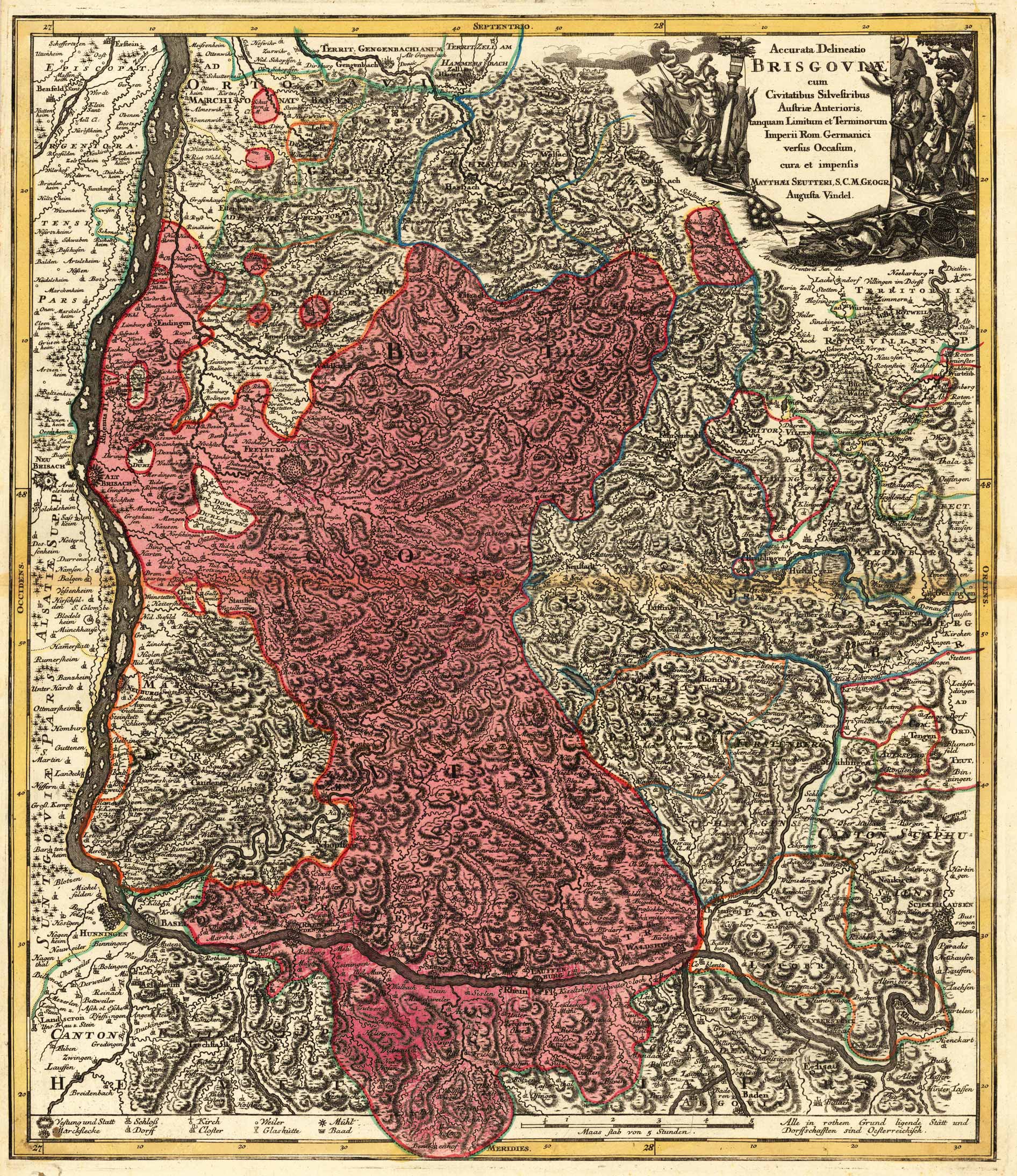
Copper engraving, hand colored in outline and wash when published.
Matthäus Seutter (September 20, 1678 – March 1757) was one of the most important and prolific German map publishers of the 18th century.
Seutter started his career as an apprentice brewer. Apparently uninspired by the beer business, Seutter left his apprenticeship and moved to Nuremberg where he apprenticed as an engraver under the tutelage of the prominent J. B. Homann. Sometime in the early 18th century Seutter left Homann to establish his own independent cartographic publishing firm in Augsburg. Though he struggled in the early years of his independence, Seutter’s engraving skill and commitment to diversified map production eventually gained him a substantial following. Most of Seutter’s maps were heavily based upon, if not copies of, earlier work done by the Homann and Delisle firms.[citation needed]
By 1732 Seutter was one of the most prolific publishers of his time and was honored by the German Emperor Charles VI with the title of “Imperial Geographer”. Seutter continued to publish until his death, at the height of his career, in 1757. The Seutter firm continued under Seutter’s wastrel son Albrecht Carl until his death in 1762. Following Albrecht’s death, the firm was divided between the established Probst firm and the emerging firm of Tobias Conrad Lotter. Lotter, Matthäus Seutter’s son in law, was a master engraver and worked on behalf of the Seutter firm. Lotter would eventually become one of the most prominent cartographers of his day.
Woodcut published 1628 in the 'Cosmographia' by Sebastian Münster, printed on the full text sheet. Latin text edition. Early and decorative bird´s eye view of imperial city Lindau at the Lake Constance with the island Mainau in the foreground and the mountains in the background. The woodcut was cut first in 1569. Grown out of a market settlement of the Lindau Canon Foundation, which was founded in the 9th century on an island in eastern Lake Constance. The economic boom and royal politics made the city more independent towards the monastery, so that it rose to the imperial city. Because of its convenient location, it served as a hub for trade. In terms of foreign policy, the city was always exposed to the interests of the Counts of Montfort and Austria. Nevertheless, she was able to build up a small territory on the nearby mainland. While the monastery remained Catholic, the city joined the Reformation. Lindau came to the princes of Bretzenheim in 1802, to Austria in 1804 and to Bavaria in 1806. (Historisches Lexikon Bayerns)
Original antique copper engraving, uncolored as published. Decorative engraving of the city Esslingen in Baden-Württemberg, published in Gabriel Bodenehr's famous serious "Europeans Macht und Pracht", a series of engravings depicting city views, plans, fortresses and castles in Europe. Many plates often are showing fortifications in Hungary and Southeast Europe, Spain, Belgium, Austria and Germany. Gabriel Bodenehr was during this period a successful publisher for maps and prints in Augsburg in Southern Germany. Gabriel Bodenehr the Elder (1664-1758 or 1673-1765) was a German map maker and member of a famous engraver and publisher family of Augsburg. His main work was "Atlas Curieux" first published 1704. He was the son of Johann Georg Bodenehr (1631-1703). Gabriel's son was Gabriel Bodenehr the Younger (1705–1792).
Original antique copper engraving, uncolored as published. Copper engraving from the german city Freiburg in the Breisgau. This fine engraving was published in Gabriel Bodenehr's famous serious "Europeans Macht und Pracht", a series of engravings depicting city views, plans, fortresses and castles in Europe. Many plates often are showing fortifications in Hungary and Southeast Europe, Spain, Belgium, Austria and Germany. Gabriel Bodenehr was during this period a sucessful publisher for maps and prints in Augsburg in Southern Germany. Gabriel Bodenehr the Elder (1664-1758 or 1673-1765) was a German map maker and member of a famous engraver and publisher family of Augsburg. His main work was "Atlas Curieux" first published 1704. He was the son of Johann Georg Bodenehr (1631-1703). Gabriel's son was Gabriel Bodenehr the Younger (1705–1792).
Original antique copper engraving, uncolored as published. Copper engraving of the city Geislingen in Baden-Wuerttemberg. This fine engraving was published in Gabriel Bodenehr's famous serious "Europeans Macht und Pracht", a series of engravings depicting city views, plans, fortresses and castles in Europe. Many plates often are showing fortifications in Hungary and Southeast Europe, Spain, Belgium, Austria and Germany. Gabriel Bodenehr was during this period a sucessful publisher for maps and prints in Augsburg in Southern Germany. Gabriel Bodenehr the Elder (1664-1758 or 1673-1765) was a German map maker and member of a famous engraver and publisher family of Augsburg. His main work was "Atlas Curieux" first published 1704. He was the son of Johann Georg Bodenehr (1631-1703). Gabriel's son was Gabriel Bodenehr the Younger (1705–1792).
Original antique copper engraving, hand colored in outline and wash when published. Schöne handkolorierte Karte mit der Provinz Breisgau mit dem benachbarten Schwarzwald, dem Rhein von Schaffhausen in Richtung Ottenheim nördlich von Neu-Breysach. Verziert mit einer dekorativen allegorischen Titelkartusche in der oberen rechten Ecke. Die Karte ist mit vielen kleinen Ortsnamen, Flüssen, Seen, Bergen, Wäldern usw. ausgestattet. Unter dem Kartenbild ist die Zeichenerklärung und ein Meilenzeiger. Eine dekorative allegorische Kartusche die zwei Adler zeigt. Fine hand colored and highly decorative map showing the province Breisgau with the neighboring 'Schwarzwald', the Black Forest and the river Rhine from Schaffhausen towards Ottenheim north of Neu-Breysach. Ornated with a decorative allegoric title cartouche in the upper right corner. The map is equipped with many small place names, rivers, lakes, mountains, woods, etc. At the bottom we see the explanation and a mileage scale. A strong and clear impression with decorative allegoric cartouches showing two eagles. Johann Baptist Homann (20 March 1664 – 1 July 1724) was a German geographer and cartographer, who also made maps of the Americas. Homann was born in Oberkammlach near Kammlach in the Electorate of Bavaria. Although educated at a Jesuit school, and preparing for an ecclesiastical career, he eventually converted to Protestantism and from 1687 worked as a civil law notary in Nuremberg. He soon turned to engraving and cartography; in 1702 he founded his own publishing house. Homann acquired renown as a leading German cartographer, and in 1715 was appointed Imperial Geographer by Emperor Charles VI. Giving such privileges to individuals was an added right that the Holy Roman Emperor enjoyed. In the same year he was also named a member of the Prussian Academy of Sciences in Berlin. Of particular significance to cartography were the imperial printing privileges (Latin: privilegia impressoria). These protected for a time the authors in all scientific fields such as printers, copper engravers, map makers and publishers. They were also very important as a recommendation for potential customers. In 1716 Homann published his masterpiece Grosser Atlas ueber die ganze Welt (Grand Atlas of all the World). Numerous maps were drawn up in cooperation with the engraver Christoph Weigel the Elder, who also published Siebmachers Wappenbuch. Homann died in Nuremberg in 1724. He was succeeded by his son Johann Christoph (1703-1730). The company carried on upon his death as Homann heirs company, managed by Johann Michael Franz and Johann Georg Ebersberger. After subsequent changes in management the company folded in 1852.[1] The company was known as "Homann Erben", "Homanniani Heredes", or "Heritiers de Homann" abroad. (Wikipedia)
Original Lithographie gedruckt in Farben. Die detaillierte Karte des Königl. Württembergischem Oberamt Horb um 1880-90, erschienen im Spezialatlass von Württemberg von L. Rachel. Detaillierte Karte von Horb mit der näheren Umgebung bis hin nach Trillfingen und im Norden nach Gundringen, mit eingezeichneten Weilern und Höfen, Schlößern, Ruinen, Mühlen, Fahrwegen, ect.
Original Lithographie gedruckt in Farben. Die detaillierte Karte des Königl. Württembergischem Oberamt Rottweil um 1880-90, erschienen im Spezialatlass von Württemberg von L. Rachel. Detaillierte Karte von Rottweil mit der näheren Umgebung bis hin nach Spaichingen und im Norden nach Harthausen, mit eingezeichneten Weilern und Höfen, Schlößern, Ruinen, Mühlen, Fahrwegen, ect.
Original antique copper engraving, hand colored in outline and wash when published. Decorative large map showing Baden and the Elsaß. The map reaches from Schaffhausen towards Germersheim and extends in the west towards Saarbrücken and the neighboring Lothrigen. A strong and clear impression with an decorative allegoric cartouche. Johann Baptist Homann (20 March 1664 – 1 July 1724) was a German geographer and cartographer, who also made maps of the Americas. Homann was born in Oberkammlach near Kammlach in the Electorate of Bavaria. Although educated at a Jesuit school, and preparing for an ecclesiastical career, he eventually converted to Protestantism and from 1687 worked as a civil law notary in Nuremberg. He soon turned to engraving and cartography; in 1702 he founded his own publishing house. Homann acquired renown as a leading German cartographer, and in 1715 was appointed Imperial Geographer by Emperor Charles VI. Giving such privileges to individuals was an added right that the Holy Roman Emperor enjoyed. In the same year he was also named a member of the Prussian Academy of Sciences in Berlin. Of particular significance to cartography were the imperial printing privileges (Latin: privilegia impressoria). These protected for a time the authors in all scientific fields such as printers, copper engravers, map makers and publishers. They were also very important as a recommendation for potential customers. In 1716 Homann published his masterpiece Grosser Atlas ueber die ganze Welt (Grand Atlas of all the World). Numerous maps were drawn up in cooperation with the engraver Christoph Weigel the Elder, who also published Siebmachers Wappenbuch. Homann died in Nuremberg in 1724. He was succeeded by his son Johann Christoph (1703-1730). The company carried on upon his death as Homann heirs company, managed by Johann Michael Franz and Johann Georg Ebersberger. After subsequent changes in management the company folded in 1852.[1] The company was known as "Homann Erben", "Homanniani Heredes", or "Heritiers de Homann" abroad. (Wikipedia)
Original antique copper engraving, hand colored in wash, published 1617 in the townbook 'Civitates Orbis Terrarum' by Braun and Hogenberg. The entire series of the 'Civitates Orbis Terrarum' comprised six volumes and was published and printed from 1572 towards 1619. Decorative panoramic city view of Lauingen on the Danube in Suevia.
Original antique copper engraving, hand colored when published. This map shows in the center the city of Philippsburg in Baden-Würtemberg with its city wall and the surrounding villages such as Germersheim, Wiesental and the river Rhine.