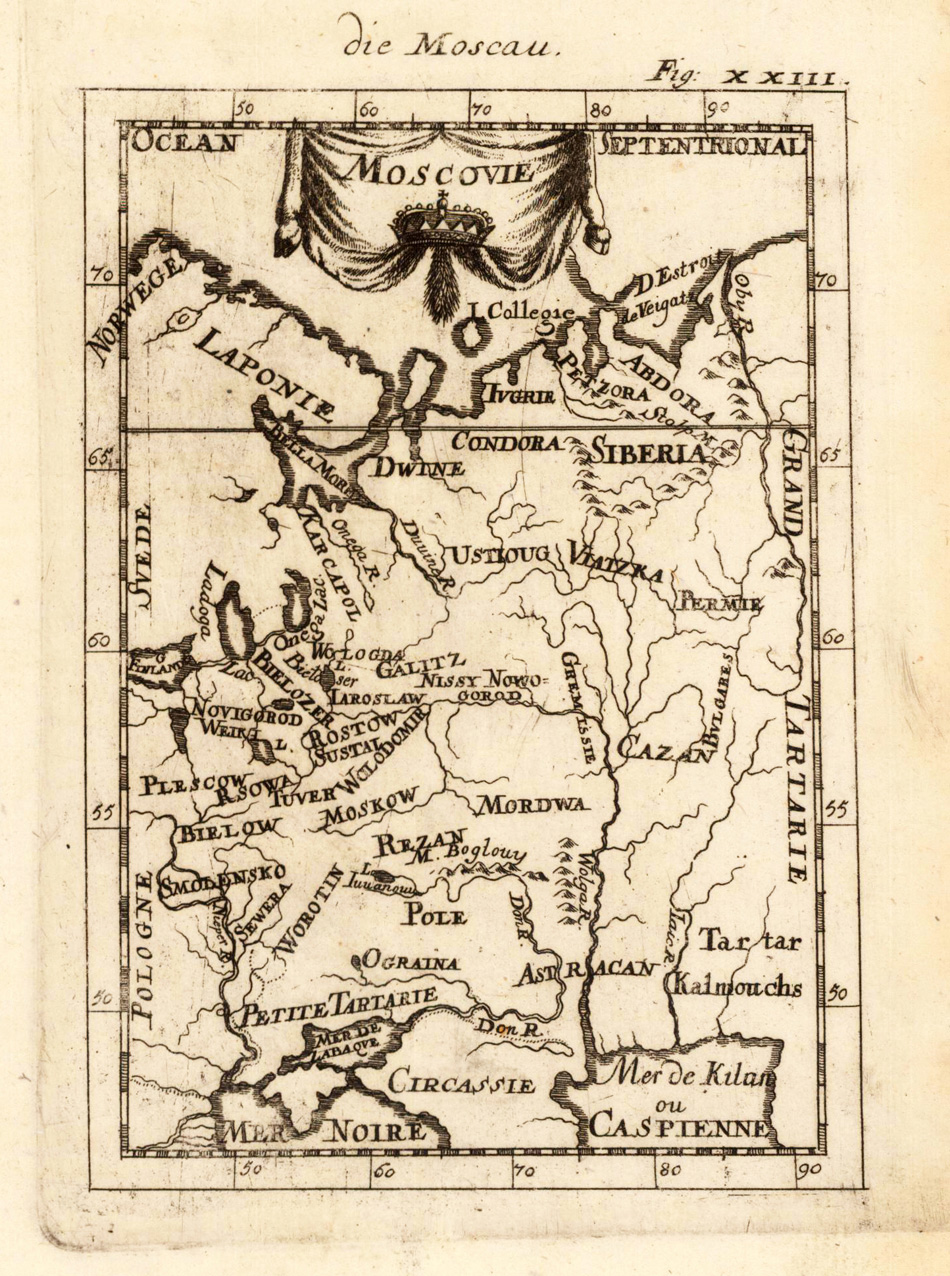
Copper engraving, uncolored, published in Allain Manesson Mallet s description of the world. This antique map shows us Moscau. Inside the map are many place names, rivers, etc. In the upper side we look to the title cartouche.
Copper engraving, hand colored in wash and outline, published in Allain Manesson Mallet s description of the world. This antique map shows us Moscau. Inside the map are many place names, rivers, etc. In the upper side we look to the title cartouche.
Fine copper-engraved map, printed into the full text page, published in Geografia ... Universale de la Terra , which was translated by Cernoti and published 1621 in Padua.
Woodcut map, finely hand colored in wash by a later hand. Verso illustrated with a decorative colored woodcut illustration.Woodcut map, finely hand colored in wash by a later hand. Verso illustrated with a decorative colored woodcut illustration. A highly decorative woodcut map by famous mapmaker Sebastian Münster published in his Ptolemy edition 1552 in Basel at Heinrich Petri. The decorative woodcut bordures verso were probably cut by the famous 16th century woodcutter Hans Holbein. Nearly none of the captivating woodcut borders verso are repeating, they are mainly shaped by allegoric scenes, coat of arms or wonderful initials. A rare and early mid 16th century woodcut map showing Italy, the Adriatic Sea, Illyria, Dalmatia, parts of the Balkan and parts of Macedonia, Epirus and Sicily published in Sebastian Münster s Ptolemy edition 1552 (Latin text) in Basel. The beautiful map is ornated with a Putto riding on a dolphin through the Thyrrenium Sea, also with a large table listing place names the various regions of this map. The interesting woodcut map has still miniature city views as engraved woodcut silhouettes, also rivers and mountain chains are schematic shown. An interesting and highly decorative map for the collector of rare maps of the antique Italy.
Original antique copper engraving, hand colored in outline published in Joan Blaeu's 'Atlas Novus'. This antique map shows the Black Sea with the Ukraine. Originally colored boundaries and title cartouche, depicting hills and forests, larger cities as colored miniature views. Detailed explanations in Latin on the back. Joan Blaeu (23 September 1596 – 21 December 1673) was a Dutch cartographer born in Alkmaar, the son of cartographer Willem Blaeu. In 1620 he became a doctor of law but he joined the work of his father. In 1635 they published the Atlas Novus (full title: Theatrum orbis terrarum, sive, Atlas novus) in two volumes. Joan and his brother Cornelius took over the studio after their father died in 1638. Joan became the official cartographer of the Dutch East India Company. Blaeu's world map, Nova et Accuratissima Terrarum Orbis Tabula, incorporating the discoveries of Abel Tasman, was published in 1648. This map was revolutionary in that it "depicts the solar system according to the heliocentric theories of Nicolaus Copernicus, which show the earth revolving around the sun.... Although Copernicus's groundbreaking book On the Revolutions of the Spheres had been first printed in 1543, just over a century earlier, Blaeu was the first mapmaker to incorporate this revolutionary heliocentric theory into a map of the world." Blaeu's map was copied for the map of the world set into the pavement of the Groote Burger-Zaal of the new Amsterdam Town Hall, designed by the Dutch architect Jacob van Campen (now the Amsterdam Royal Palace), in 1655. Blaeu's Hollandia Nova was also depicted in his Archipelagus Orientalis sive Asiaticus published in 1659 in the Kurfürsten Atlas (Atlas of the Great Elector). and used by Melchisédech Thévenot to produce his map, Hollandia Nova—Terre Australe (1664). As Joan Blaeu, he also published the 12 volume "Le Grand Atlas, ou Cosmographie blaviane, en laquelle est exactement descritte la terre, la mer, et le ciel". One edition is dated 1663. That was folio (540 x 340 mm), and contained 593 engraved maps and plates. In March 2015, a copy was on sale for £750,000. Around 1649 Joan Blaeu published a collection of Dutch city maps named Toonneel der Steeden (Views of Cities). In 1651 he was voted into the Amsterdam council. In 1654 Joan published the first atlas of Scotland, devised by Timothy Pont. In 1662 he reissued the Atlas Novus, also known as Atlas Maior, in 11 volumes, and one for oceans.[citation needed] A cosmology was planned as their next project, but a fire destroyed the studio completely in 1672. (Wikipedia)
Woodcut published 1628 in the Cosmographia by Sebastian Münster. Early woodcut map published in the 1628 edition of Sebastian Münster's Cosmography'. A very clear impression of this woodcut. This early 17th century map depicts the Black Sea, Armenia and a part of the Caspian Sea in the North it shows the Ucraine into Russia towards Castrom and Novogardia'. The Cosmography by Sebastian Münster was published from 1545 to 1628 onwards in several languages. It was one of the most famous atlases and townbooks after the famous Nurnberg Chronicle. Münster's Cosmography was extended from edition to edition and is variing in many woodcut illustrations. Many of the woodcuts were cut by David Kandel.