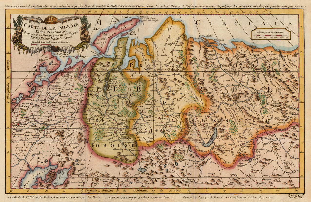
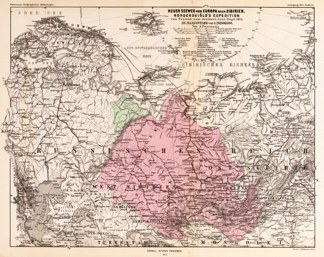
Original copper engravings, hand colored in outline and wash. Decorative antique map of Siberia with neighboring regions, Kazakhstan, Mongolia and Central Russia towards the East Siberian Sea. Interesting antique map with engraved political borders, rivers, lakes, woods and mountains. Published in an atlas volume of Nicolaus Bellin s Histoire generale des Voyages around 1760 in Paris.
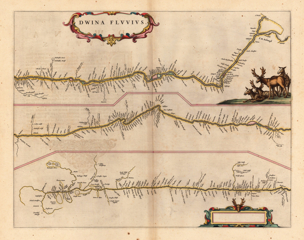
Original antique copper engraving, hand colored in outline and wash when published. The map is divided into three sections to follow the course of the river from its source in the Vologod Province as it empties into Dvina Bay of the White Sea near Archangle. Along the way smaller tributaries and towns. A beautiful title cartouche is included in the top left with another cartouche illustrated with a reindeer's head is included in the bottom right. On the right side is a group of reindeers engraved. Joan Blaeu (23 September 1596 – 21 December 1673) was a Dutch cartographer born in Alkmaar, the son of cartographer Willem Blaeu. In 1620 he became a doctor of law but he joined the work of his father. In 1635 they published the Atlas Novus (full title: Theatrum orbis terrarum, sive, Atlas novus) in two volumes. Joan and his brother Cornelius took over the studio after their father died in 1638. Joan became the official cartographer of the Dutch East India Company. Blaeu's world map, Nova et Accuratissima Terrarum Orbis Tabula, incorporating the discoveries of Abel Tasman, was published in 1648. This map was revolutionary in that it "depicts the solar system according to the heliocentric theories of Nicolaus Copernicus, which show the earth revolving around the sun.... Although Copernicus's groundbreaking book On the Revolutions of the Spheres had been first printed in 1543, just over a century earlier, Blaeu was the first mapmaker to incorporate this revolutionary heliocentric theory into a map of the world." Blaeu's map was copied for the map of the world set into the pavement of the Groote Burger-Zaal of the new Amsterdam Town Hall, designed by the Dutch architect Jacob van Campen (now the Amsterdam Royal Palace), in 1655. Blaeu's Hollandia Nova was also depicted in his Archipelagus Orientalis sive Asiaticus published in 1659 in the Kurfürsten Atlas (Atlas of the Great Elector). and used by Melchisédech Thévenot to produce his map, Hollandia Nova—Terre Australe (1664). As Joan Blaeu, he also published the 12 volume "Le Grand Atlas, ou Cosmographie blaviane, en laquelle est exactement descritte la terre, la mer, et le ciel". One edition is dated 1663. That was folio (540 x 340 mm), and contained 593 engraved maps and plates. In March 2015, a copy was on sale for £750,000. Around 1649 Joan Blaeu published a collection of Dutch city maps named Toonneel der Steeden (Views of Cities). In 1651 he was voted into the Amsterdam council. In 1654 Joan published the first atlas of Scotland, devised by Timothy Pont. In 1662 he reissued the Atlas Novus, also known as Atlas Maior, in 11 volumes, and one for oceans.[citation needed] A cosmology was planned as their next project, but a fire destroyed the studio completely in 1672. (Wikipedia)
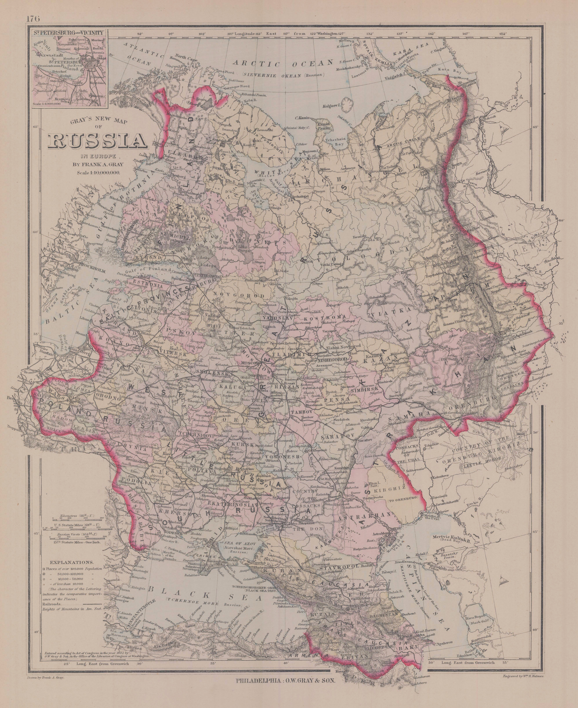
Original antique lithograph, hand colored when published. Detailed map, colored by counties and showing townships, towns, villages, post offices, canals, roads, railroads (projected and completed), towns, etc. A highly detailed map. In the upper left corner is an inset map of St. Petersburg.
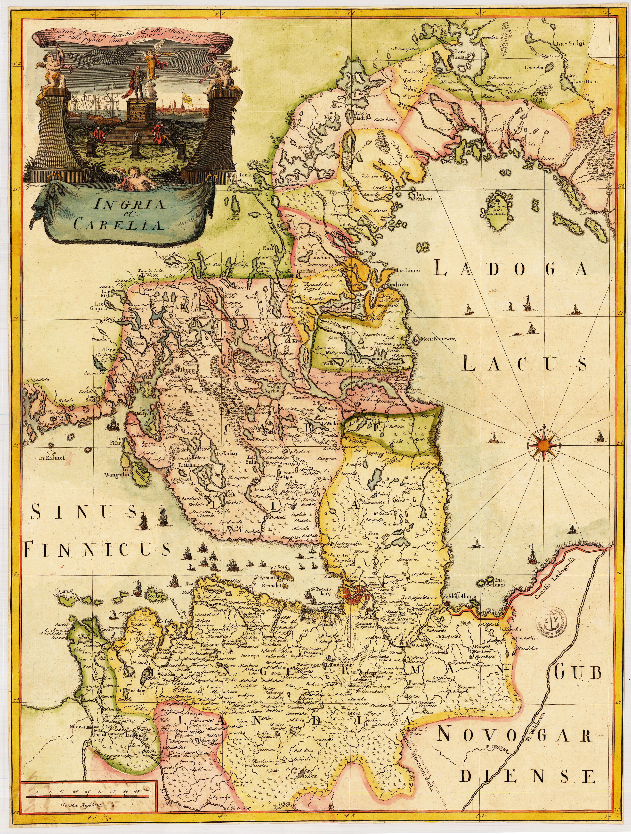
Original copper engraving, hand colored in wash and outline. The decorative map depicts roads, rivers, waterways, administrative boundaries, monasteries, vegetation, and sailing ships. The title cartouche with statue of Peter the Great and a view of St.Petersburg. Title in Latin. A fine map from the first Russian atlas, centered around Crimea. The French astronomer and cartographer Joseph Nicolas Delisle (1688-1768) was called by the Czar Peter the Great to Saint Petersburg to create and run the school of astronomy. In 1740 he undertook an expedition to Siberia with the object of observing from Beryozovo the transit of Mercury across the sun. Back in Saint Petersburg he was encouraged to realize Peter the Great's project of a Russian atlas, which was carried out under the reign of Empress Anna. The famous Atlas Rossicus with maps in Cyrillic and Latin script was the result; it is a landmark in the surveying and represention of the vast Empire with reliable maps. The Saint Petersburg cartographer and military leader Carl von Frauendorff drew this map showing the location of the Russian-Turkish War, which had been triggered by raids of the Crimean Tartars on the Cossack Hetmanate at the end of 1735 and the Crimean Khan's military campaign in the Caucasus. At the beginning of summer of 1736, the Russian Dniepr Army under the command of Field Marshal von Münnich responded by taking the Crimean fortifications at Perekop, occupying Bakhchysarai, and defeating the Crimean khans. This map was frequently included in De l'Isle's atlas, and was distributed on its own. Frauendorff was Imperial Russian major general (1731-1763) and the first governor of the Irkutsk province.
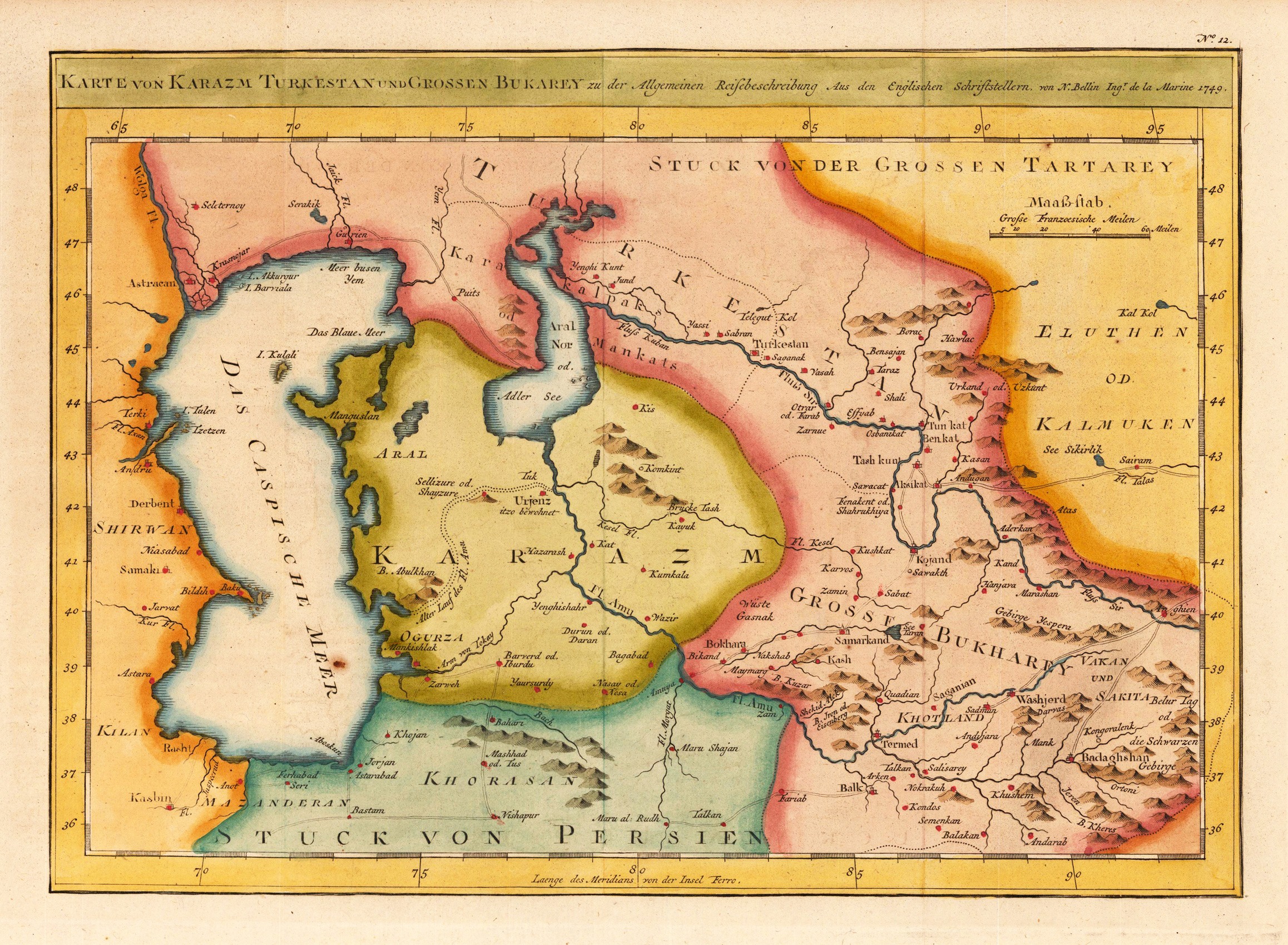
Copper engraving, hand colored in outline and wash. Interesting and decorative antique map of Russia covering the Caspian Sea and the Aral Sea with parts of Kazakhstan. Interesting antique map with engraved political borders, rivers, lakes, woods and mountains. A fine detailed and interesting map engraved by Bellin after earlier voyages. Published in the German edition by Schwabe in Leipzig of Bellin's travel books.
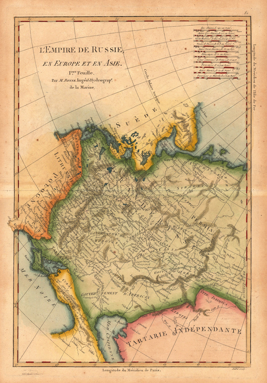
Original antique copper engraving, hand colored in outline and wash. Decorative map of Russia and Europe in Asia. Rigobert Bonne (6 October 1727 – 2 September 1794) was a French cartographer, widely considered to be one of the most important cartographers of the late 18th century. In 1773 Bonne succeeded Jacques Nicolas Bellin as Royal Cartographer to France in the office of the Hydrographer at the Depôt de la Marine. Working in his official capacity, Bonne compiled some of the most detailed and accurate maps of the period. Bonne's work represents an important step in the evolution of the cartographic ideology away from the decorative work of the 17th and early 18th century towards a more detail oriented and practical aesthetic. With regard to the rendering of terrain Bonne maps bear many stylistic similarities to those of his predecessor, Bellin. However, Bonne maps generally abandon such common 18th century decorative features such as hand coloring, elaborate decorative cartouches, and compass roses. While mostly focusing on coastal regions, the work of Bonne is highly regarded for its detail, historical importance, and overall aesthetic appeal. (Wikipedia)