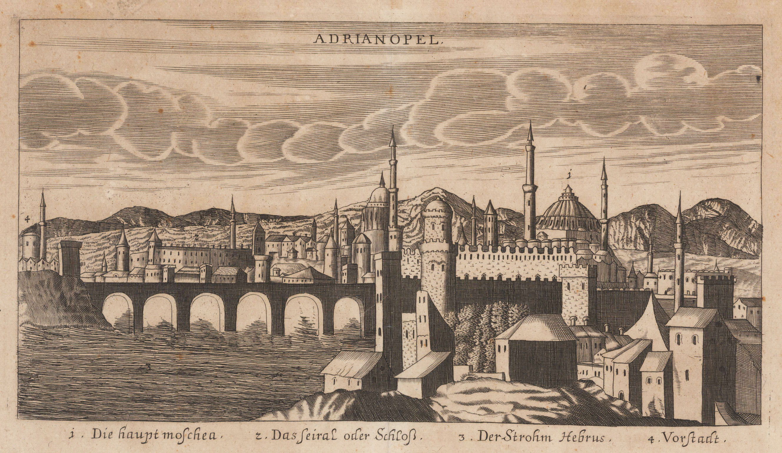
Original antique copper engraving, uncolored. Copper engraving from Johann Christoph Wagners,Delinatio Provinciarum Pannoniae Et Imperii Turcici In Oriente' 1685. Depicted is an overview of Adrianopel in Turkey, with mountains in the background. Under the view are declarations from 1 to 4.
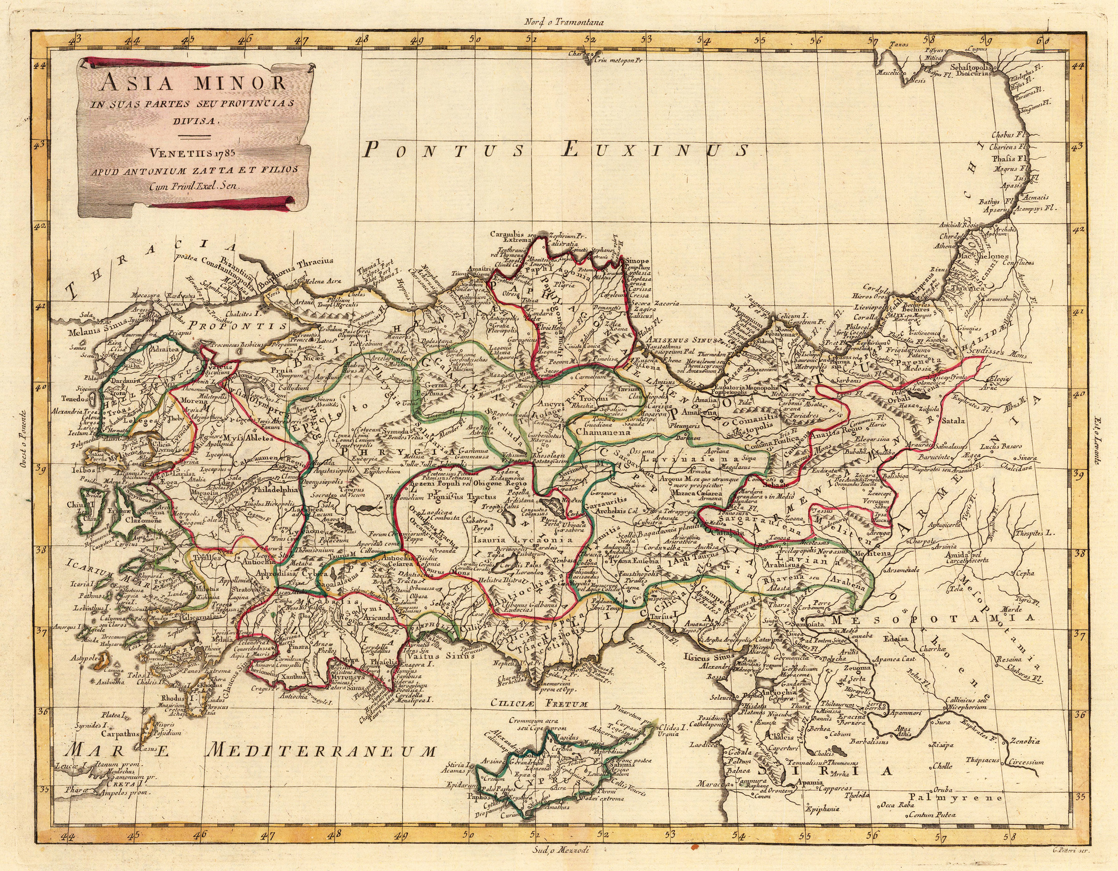
Copper engraving, in contemporary original color in outline. Published in Zatta's "Atlante Novissimo". A decorative map of Asia divided up into its regions with the neighboring island Cyprus in the Eastern Mediterranean Sea. Further it shows the adjacenting Armenia and Mesopotamia. Equipped with a decorative title cartouche in the upper left corner.
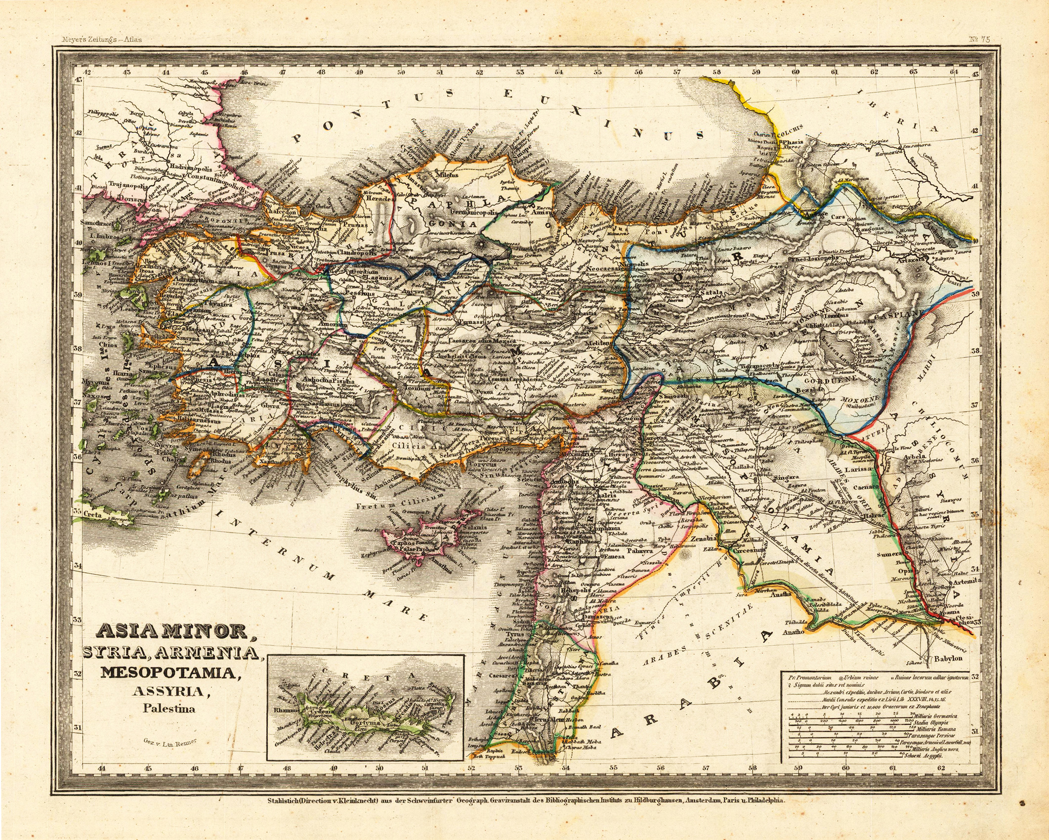
Steel engraving, hand colored in outline when published. This antique map shows Asia Minor with a small part of Arabia. Inside the map are many place names, rivers, etc. At the bottom of the map we see small inset map, which shows the island Crete. In the lower right corner is a inset map, which shows the mileage scales.
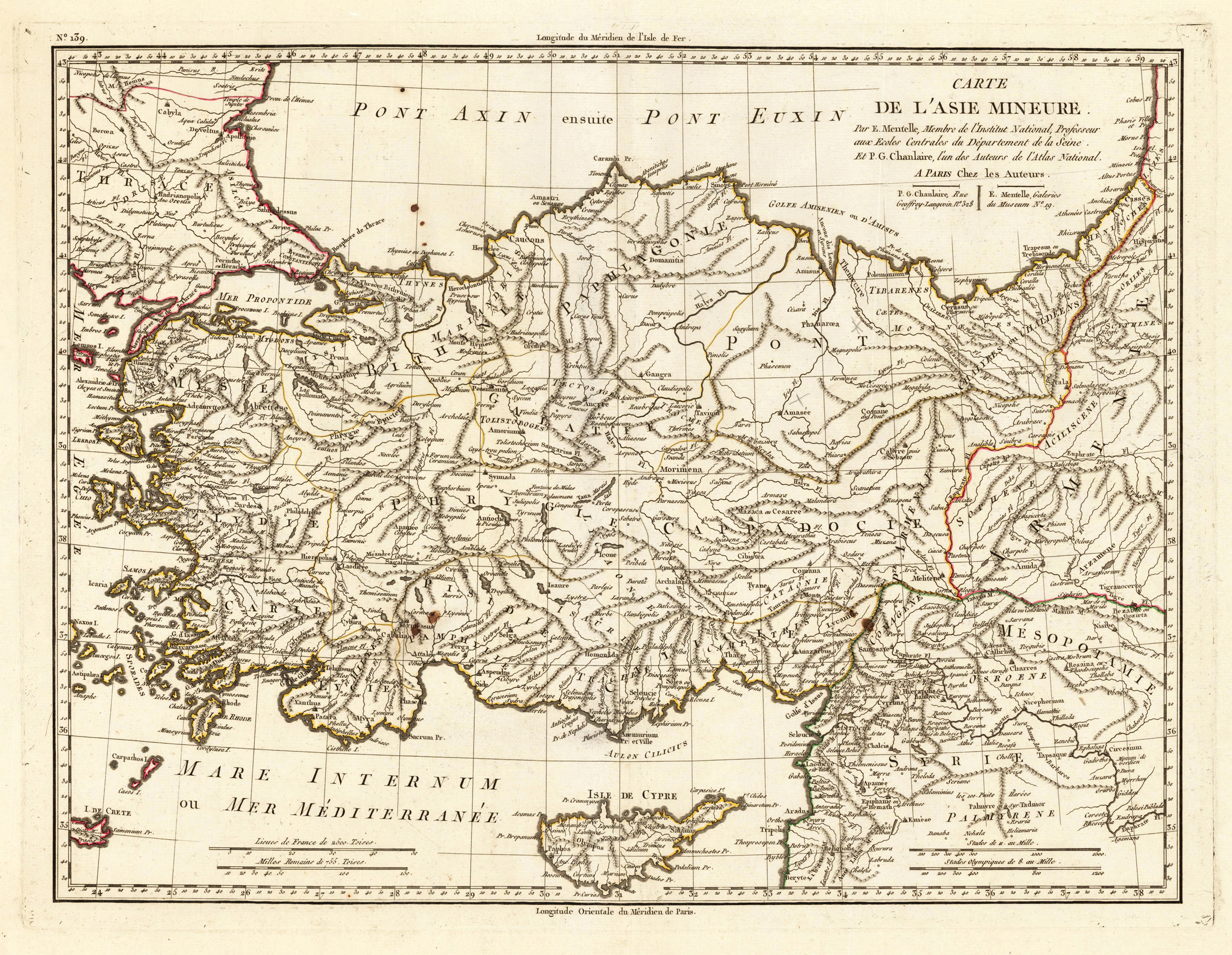
Original antique copper engraving, in contemporary original color in outline. Decorative map showing 'Asia Minor' with its neighbouring countries. The eastern part of the Mediterranean Sea with Cyprus is as well shown. The various political regions in Turkey are shown in outline colors. The map provides a lot of information on the various regions, its cities and villages, rivers, mountains are as well shown.
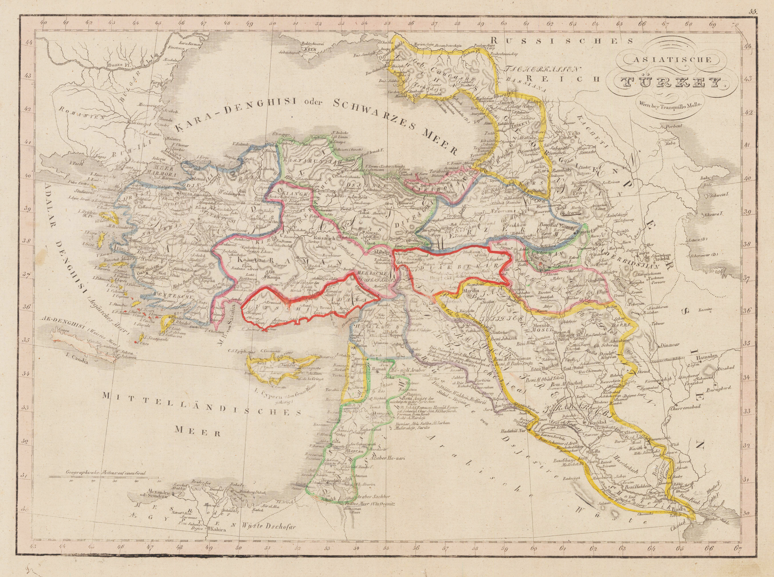
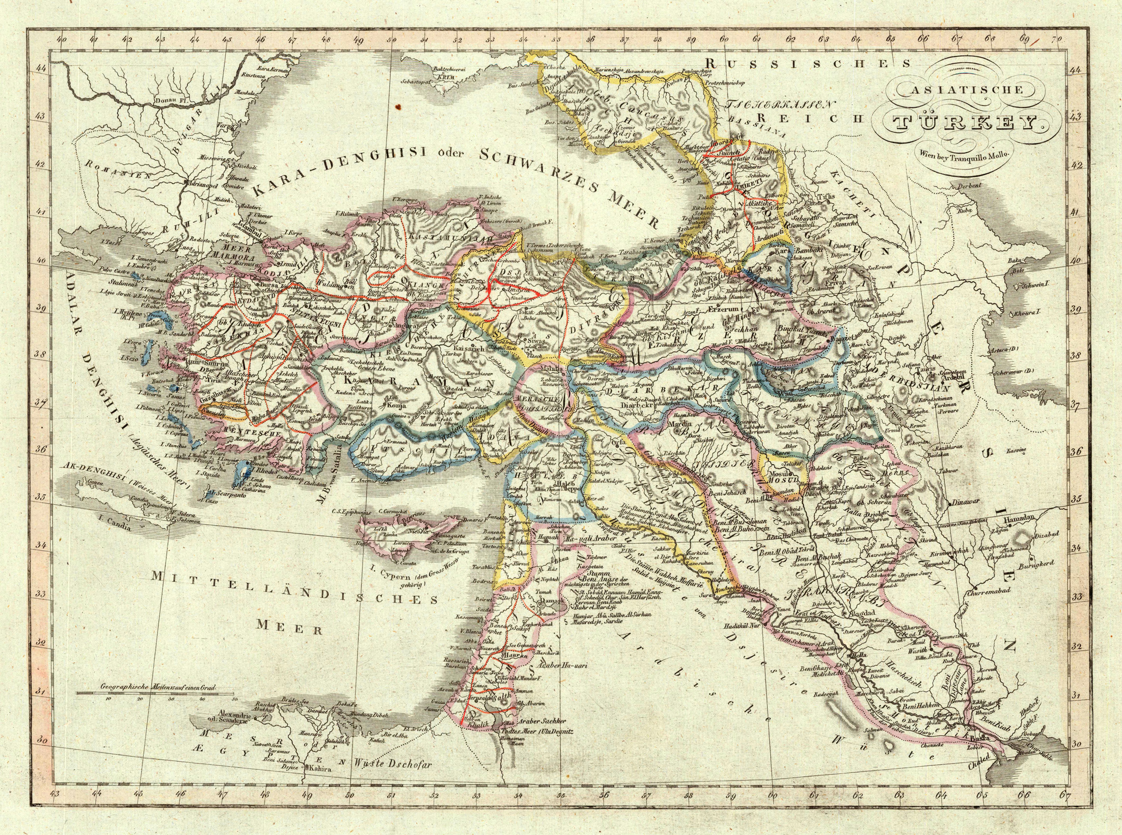
Original antique copper engraving, hand colored in outline and wash, when published. Decorative map showing 'Asia Minor' with its neighbouring countries. The eastern part of the Mediterranean Sea with Cyprus is as well shown. The various political regions in Turkey are shown in outline colors. The map provides a lot of information on the various regions, its cities and villages, rivers, mountains are as well shown. Tranquillo Maria Laurentio Mollo (August 10, 1767 - March 29, 1837) was Vienna based Swiss/Italian graphic designer, printer, art and music dealer, and publisher active in the late 18th and early 20th centuries. From about 1792 Mollo worked with the Vienna firm Artaria and Company. In 1798 he separated from Artaria to found, along with partner Franz Bernardini, his own music, art, and map publishing company, T. Mollo and Co. The partner collapsed after one year and Mollo took a new partner, Domenico Artaria, a scion of the Artaria family. In 1802 Mollo and Domenico acquired Artaria and Company from Carlo Artaria. Domenico and Mollo parted ways in 1804, after which Mollo published independently. Under his own imprint, he became one of Austria's most important globe and map publishers. He collaborated extensively with English and French publishers to bring French material to his work. Among his more significant collaborators was the Vienna publisher Joseph Dirwaldt. In 1832 Mollo passed the company to his sons, Eduard (1799-1842) and Florian Mollo (1803-1869). The Mollo brothers ran the business until 1839, three years after Tranquillo Mollo's death, before dividing the concern into separate business. Mollo married Dorothea Defelavis († 29. Juli 1822). (Wikipedia)
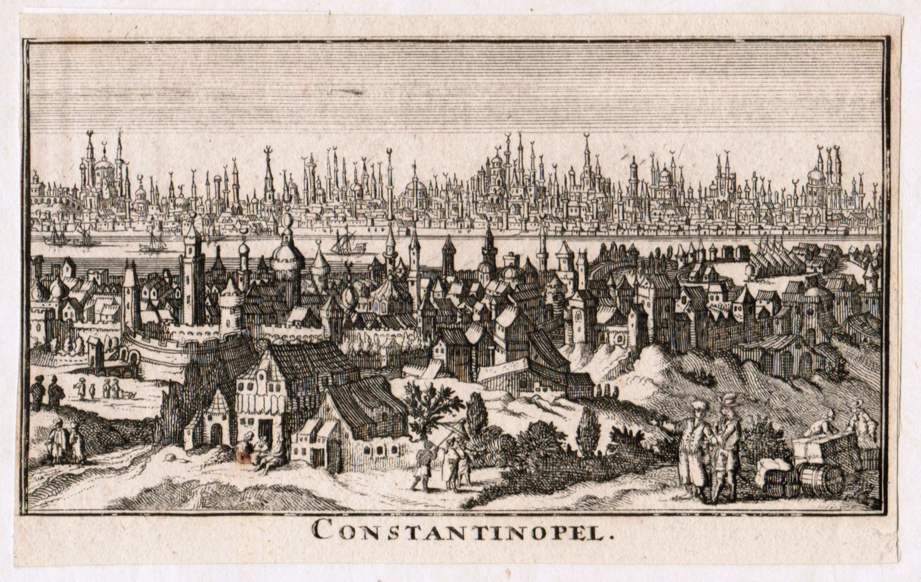
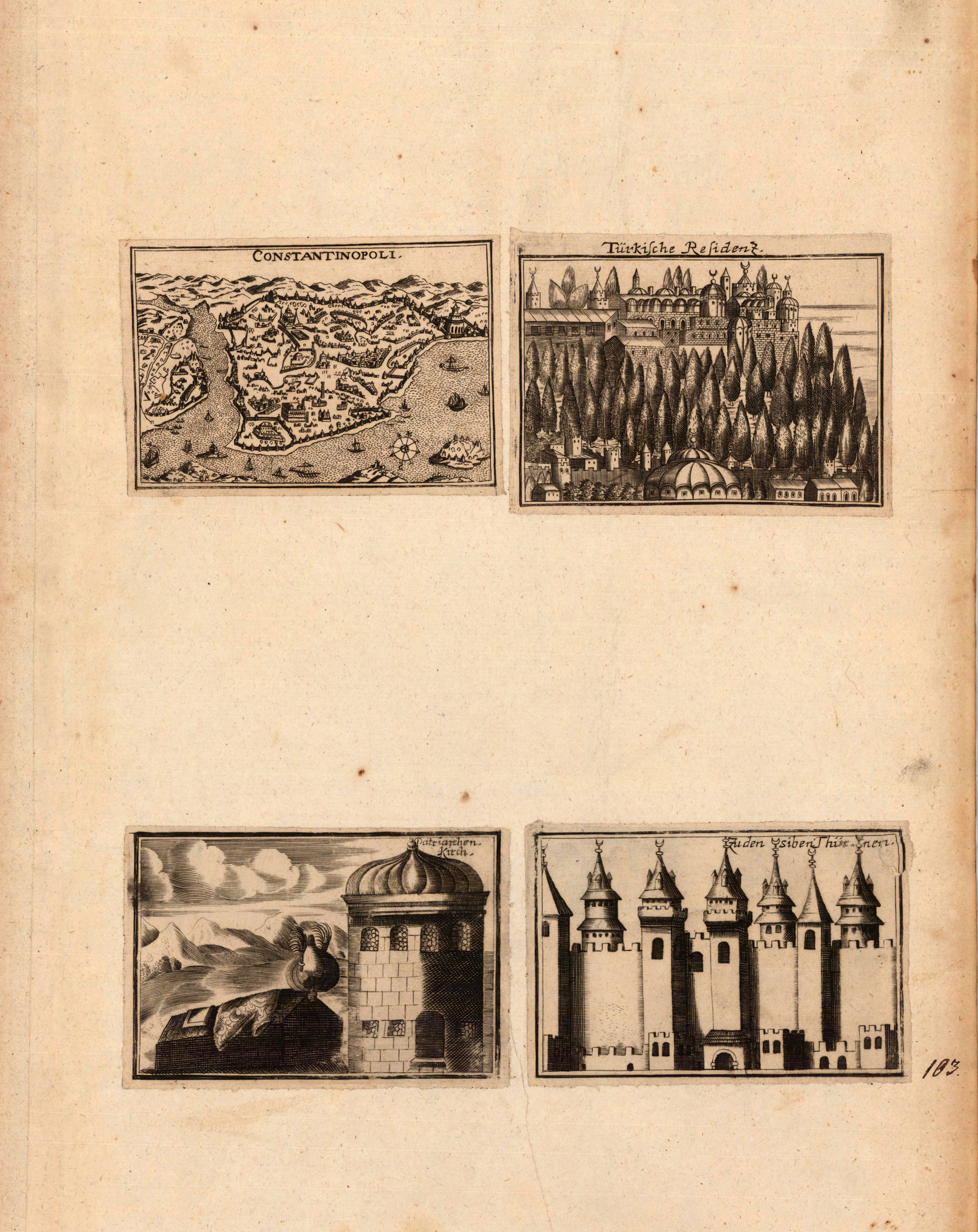
Copper engraving, uncolored as published. A fine bird'eye panoramic map showing Constantinople at the end of the 17th century. Rural landscape in the foreground with inhabitants. The engraving was probably published in a large doublepage map showing views of cities and fortresses in the Balkan and around Constantinople. Therefore the engraving is cut close the margins.
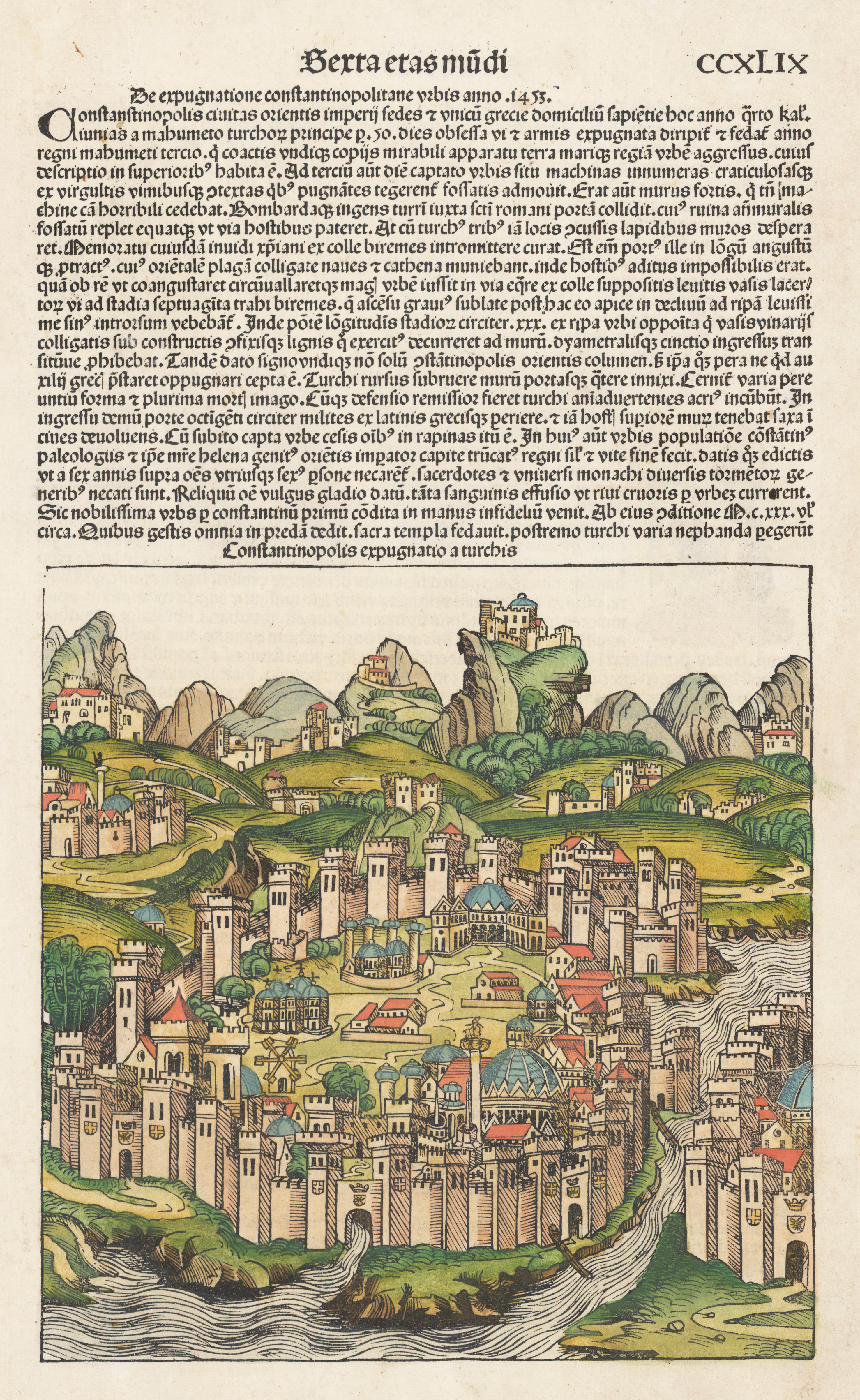
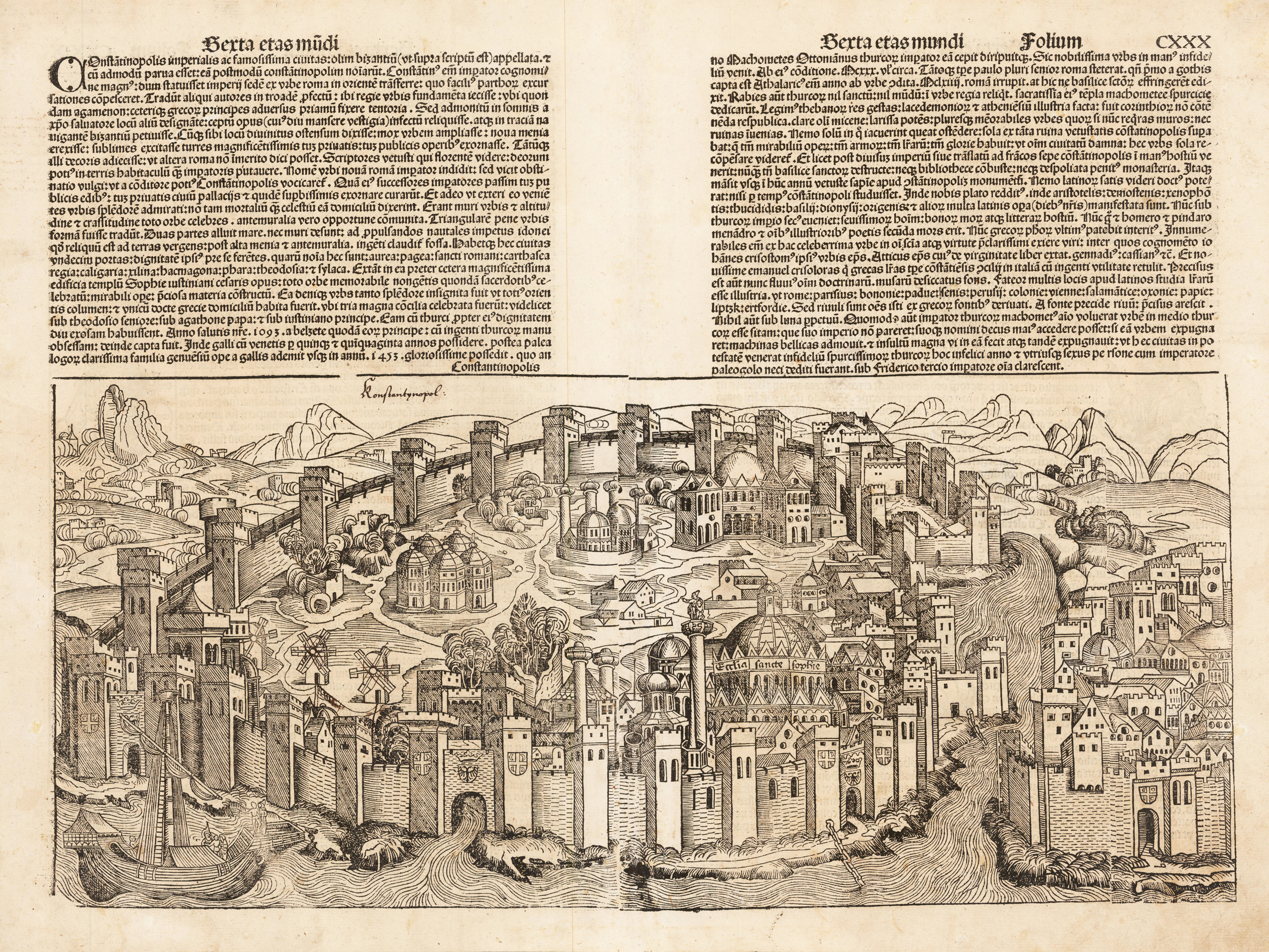
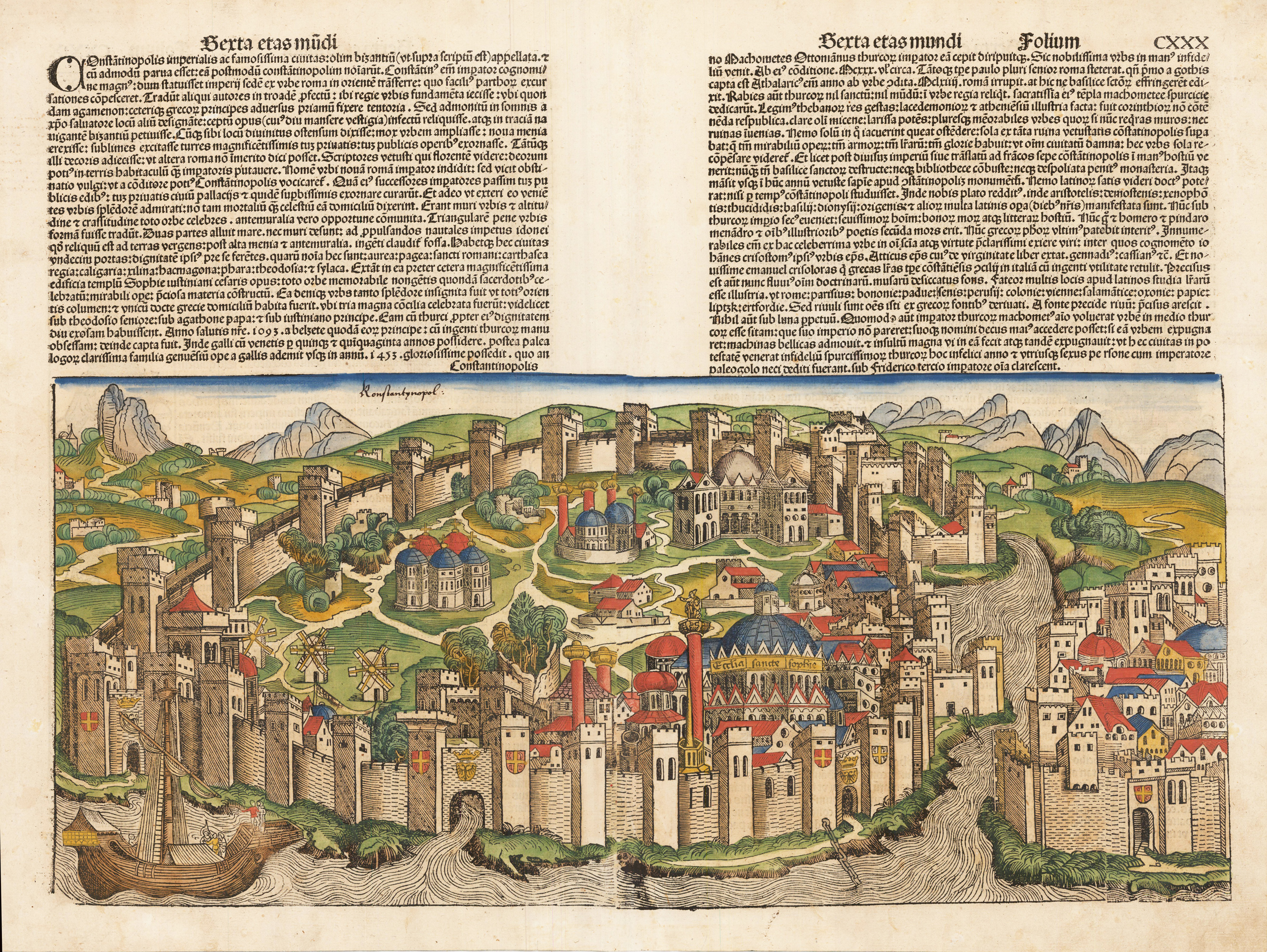
Original woodcut from the famous "Nurnberg Chronicle", printed in Nürnberg in December 1493. This plate was exactly published and printed in December 1493 in Nurnberg at Anton Koberger. The "Nurnberg Chronicle" was the earliest and most richly illustrated incunabula and description of the world, which was as well illustrated with a small number of authentic double page city views. The woodcuts were mostly cut by Pleydenwurff.
Original woodcut from the famous "Nurnberg Chronicle", printed in Nürnberg, in July 1493. Verso illustrated as well with four smaller woodcuts of saints. Latin text edition. This view of Konstantinopel is one of the earliest obtainable authentic city views, published only a few years before 1500. This plate was exactly published and printed in July 1493 in Nurnberg at Koberger. The "Nurnberg Chronicle" was the earliest and most richly illustrated incunable and descripton of the world, which was as well illustrated with a small number of authentic doublepage city views. The woodcuts were mostly cut by Pleydenwurff. On the full sheet as published. Mended stitch wholes at the centre fold and other smaller paper restorations excellent done. Please note: This item, if shipped outside the EU requires an export license, please allow 10-14 work days. We will take for it. Questions please contact us.
Original hand colored woodcut from the famous "Nurnberg Chronicle", printed in Nürnberg, in July 1493. Verso illustrated as well with four smaller woodcuts of saints. Latin text edition. This view of Konstantinopel is one of the earliest obtainable authentic city views, published only a few years before 1500. This plate was exactly published and printed in July 1493 in Nurnberg at Koberger. The "Nurnberg Chronicle" was the earliest and most richly illustrated incunable and descripton of the world, which was as well illustrated with a small number of authentic doublepage city views. The woodcuts were mostly cut by Pleydenwurff. On the full sheet as published. Mended stitch wholes at the centre fold and other smaller paper restorations excellent done.
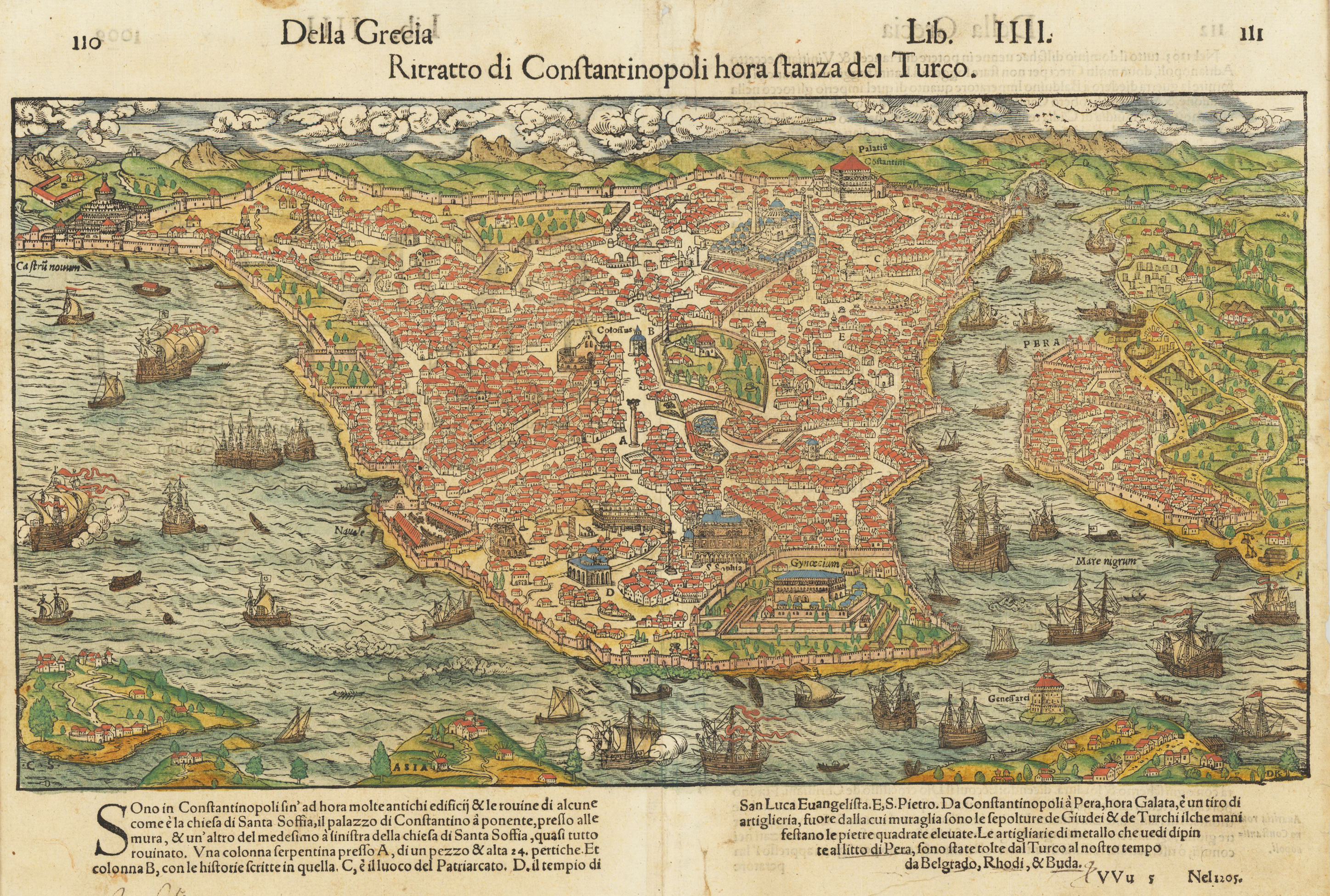
Original woodcut map, hand colored in wash. This fine beautiful hand colored decorative bird's eye view depicts Constantinoples around 1545-60. The map was published in an Italian text edition of Sebastian Münster's Cosmographia. Printed on the full double page as published. Overall in good condition, minor marginal tiny tears and a few creases and small pin wholes near the centre-fold. Overall an attractive example of this woodcut map of Constantinoples.
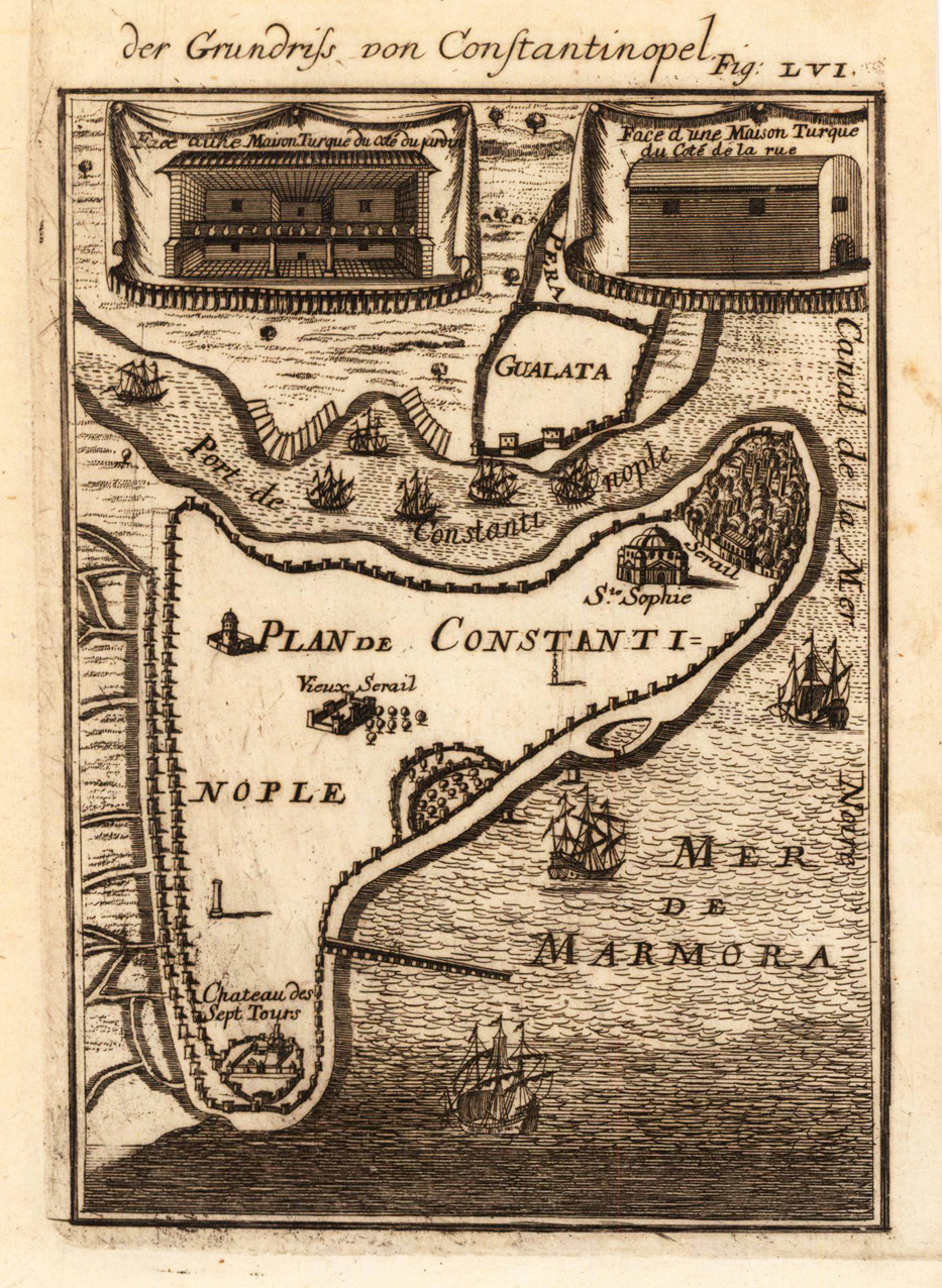
Copper engraving published in Allain M. Mallet's description of the world 'Description De L' Univers, Contenant Les Differents Systemes Du Monde, Les Cartes generales & particulieres ...'. French text edition with additional German titles on top. Decorative bird's eye plan of Constantinoples with port of Constantinoples, Galata and the Marmara sea. Engraved ships and buildings.
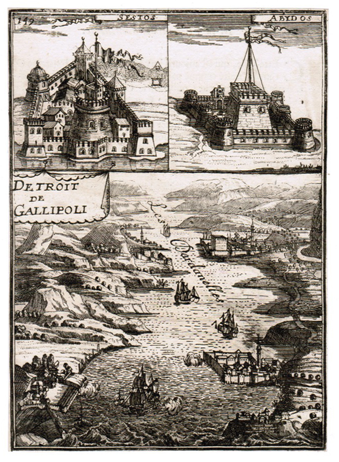
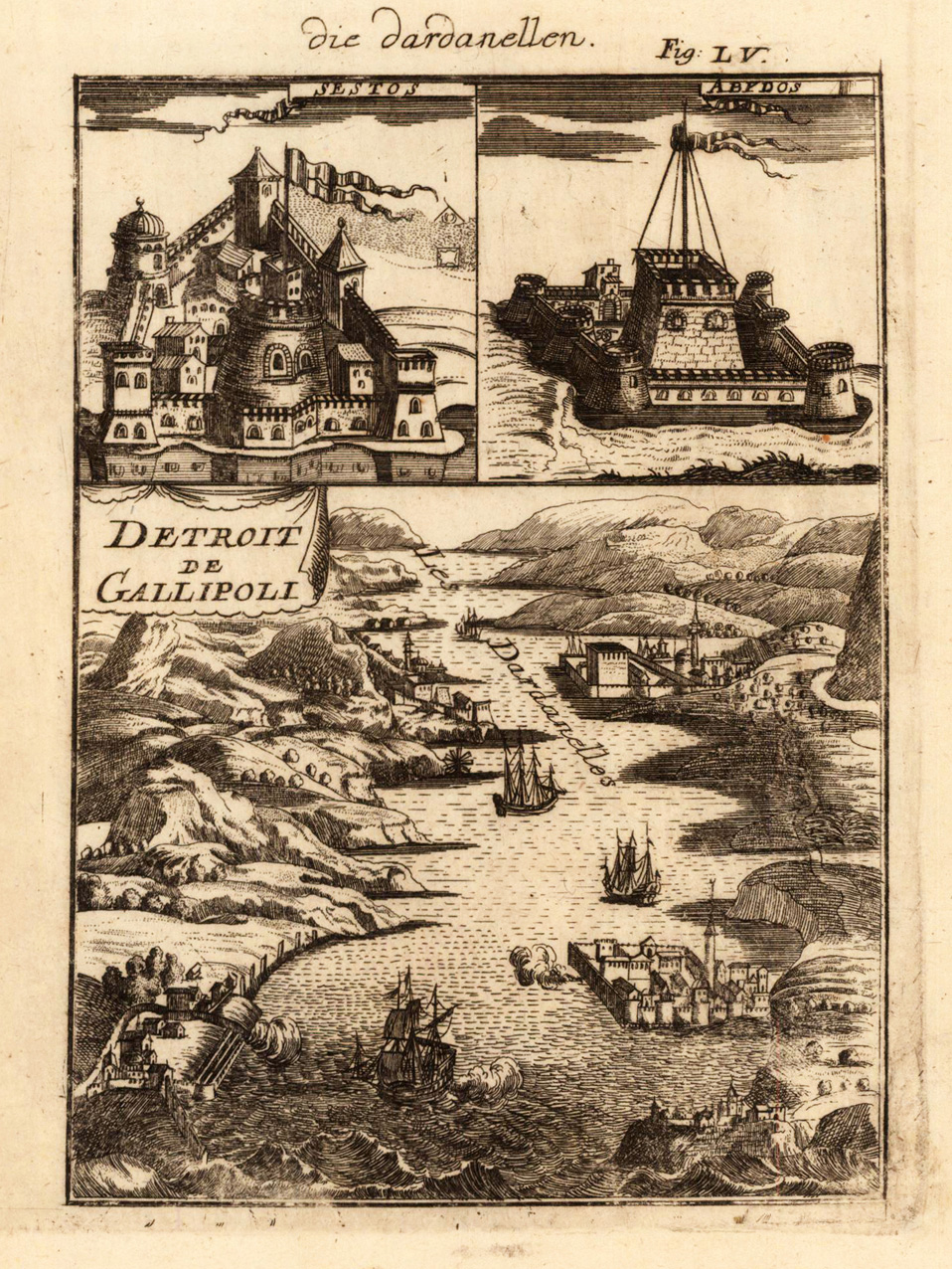
Original copper engraving, uncolored as published in Allain M. Mallet's description of the world 'Description De L' Univers, Contenant Les Differents Systemes Du Monde, Les Cartes generales & particulieres ...'. French text edition verso. A fine and decorative bird'eye map combined with two inset views of fortresses ,Sestos' and ,Abydos'.
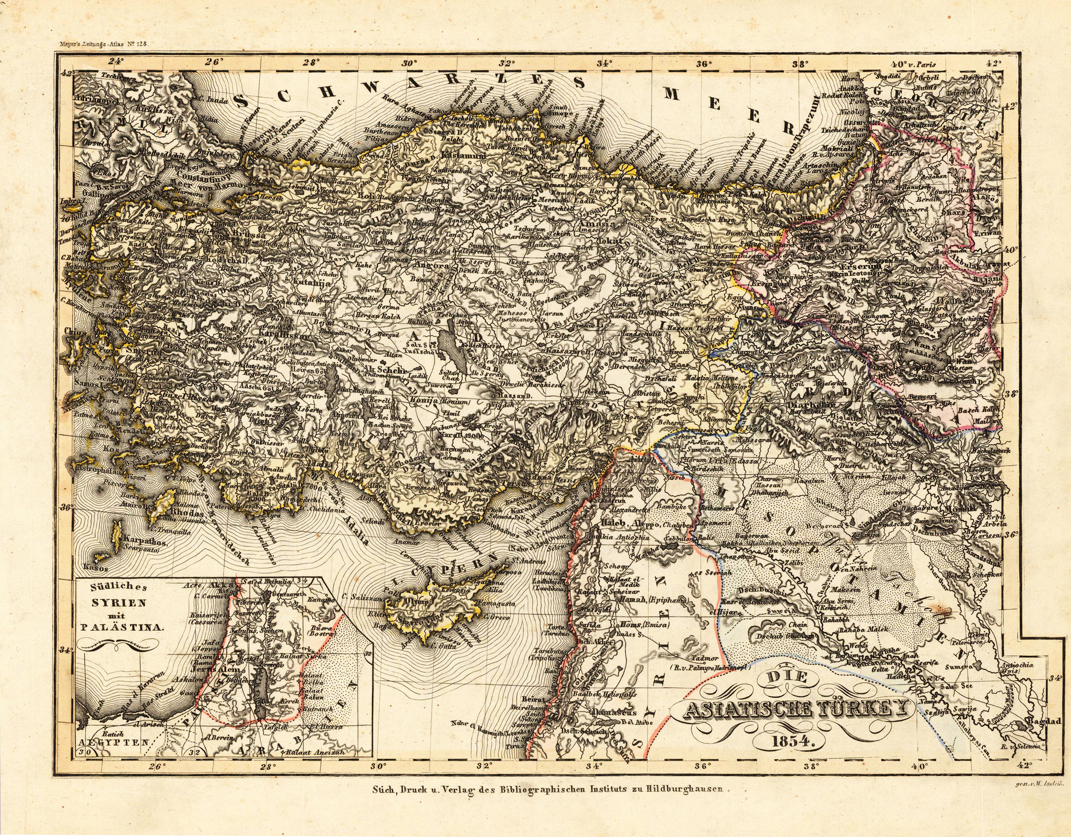
Steel engraving, hand colored in outline when published. This antique map shows the Asian part of Turkey. Inside the map are many place names, rivers, etc. In the lower left corner is a small inset map, which shows Southern Syria with Palestine.
Copper engraving published in Allain M. Mallet's description of the world 'Description De L' Univers, Contenant Les Differents Systemes Du Monde, Les Cartes generales & particulieres ...'. French text edition with additional German titles on top.
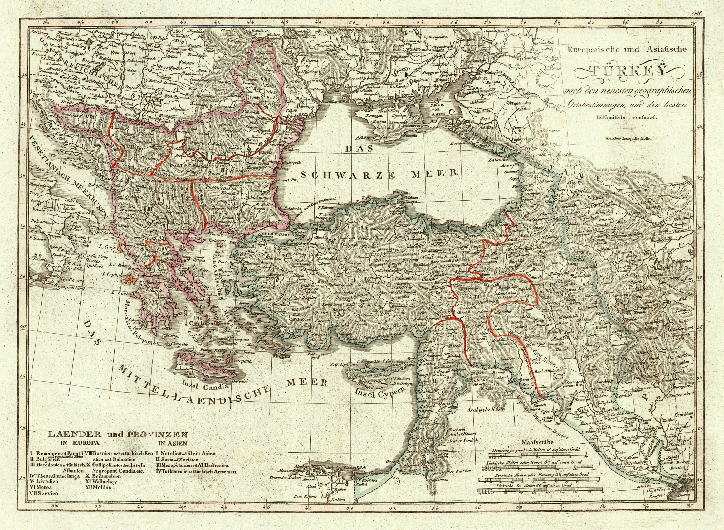
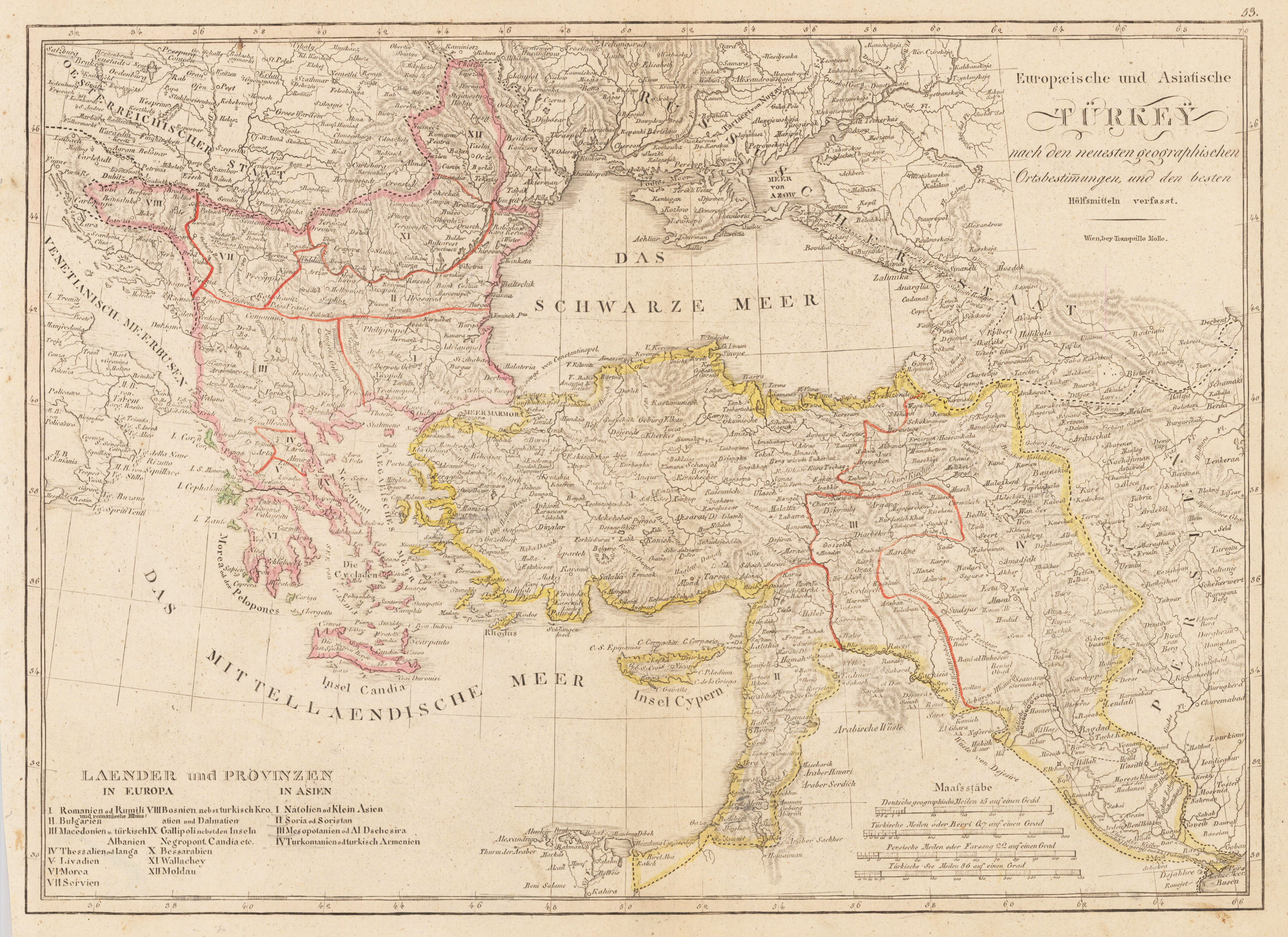
Original antique copper engraving, hand colored in outline and wash, when published. Decorative map showing the 'European & Asian Turkey' with its neighbouring countries. The eastern part of the Mediterranean Sea with Cyprus is as well shown. The various political borders of Turkey are shown in outline colors. The map provides a lot of information on the various regions, the neighbouring countries, its cities and villages, rivers, mountains are as well shown. In the lower left corner a table with a listing of the countries and provinces of Europe and Asia. Tranquillo Maria Laurentio Mollo (August 10, 1767 - March 29, 1837) was Vienna based Swiss/Italian graphic designer, printer, art and music dealer, and publisher active in the late 18th and early 20th centuries. From about 1792 Mollo worked with the Vienna firm Artaria and Company. In 1798 he separated from Artaria to found, along with partner Franz Bernardini, his own music, art, and map publishing company, T. Mollo and Co. The partner collapsed after one year and Mollo took a new partner, Domenico Artaria, a scion of the Artaria family. In 1802 Mollo and Domenico acquired Artaria and Company from Carlo Artaria. Domenico and Mollo parted ways in 1804, after which Mollo published independently. Under his own imprint, he became one of Austria's most important globe and map publishers. He collaborated extensively with English and French publishers to bring French material to his work. Among his more significant collaborators was the Vienna publisher Joseph Dirwaldt. In 1832 Mollo passed the company to his sons, Eduard (1799-1842) and Florian Mollo (1803-1869). The Mollo brothers ran the business until 1839, three years after Tranquillo Mollo's death, before dividing the concern into separate business. Mollo married Dorothea Defelavis († 29. Juli 1822). (Wikipedia)
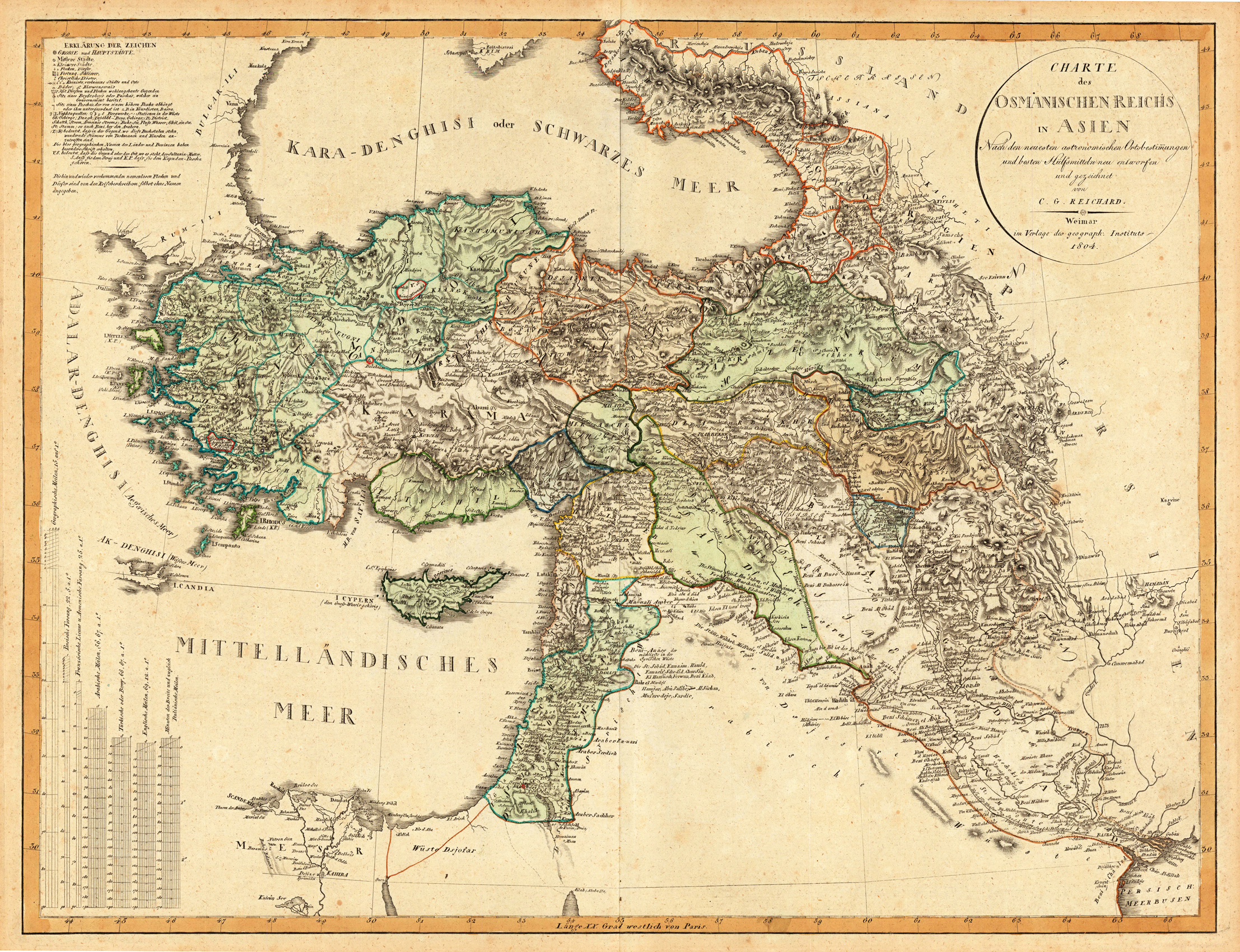
Original antique copper engraving, in contemporary original color in outline. Decorative map showing 'Asia Minor' with its neighbouring countries. The eastern part of the Mediterranean Sea with Cyprus is as well shown. The various political regions in Turkey are shown in outline colors. The map provides a lot of information on the various regions, its cities and villages, rivers, mountains are as well shown.
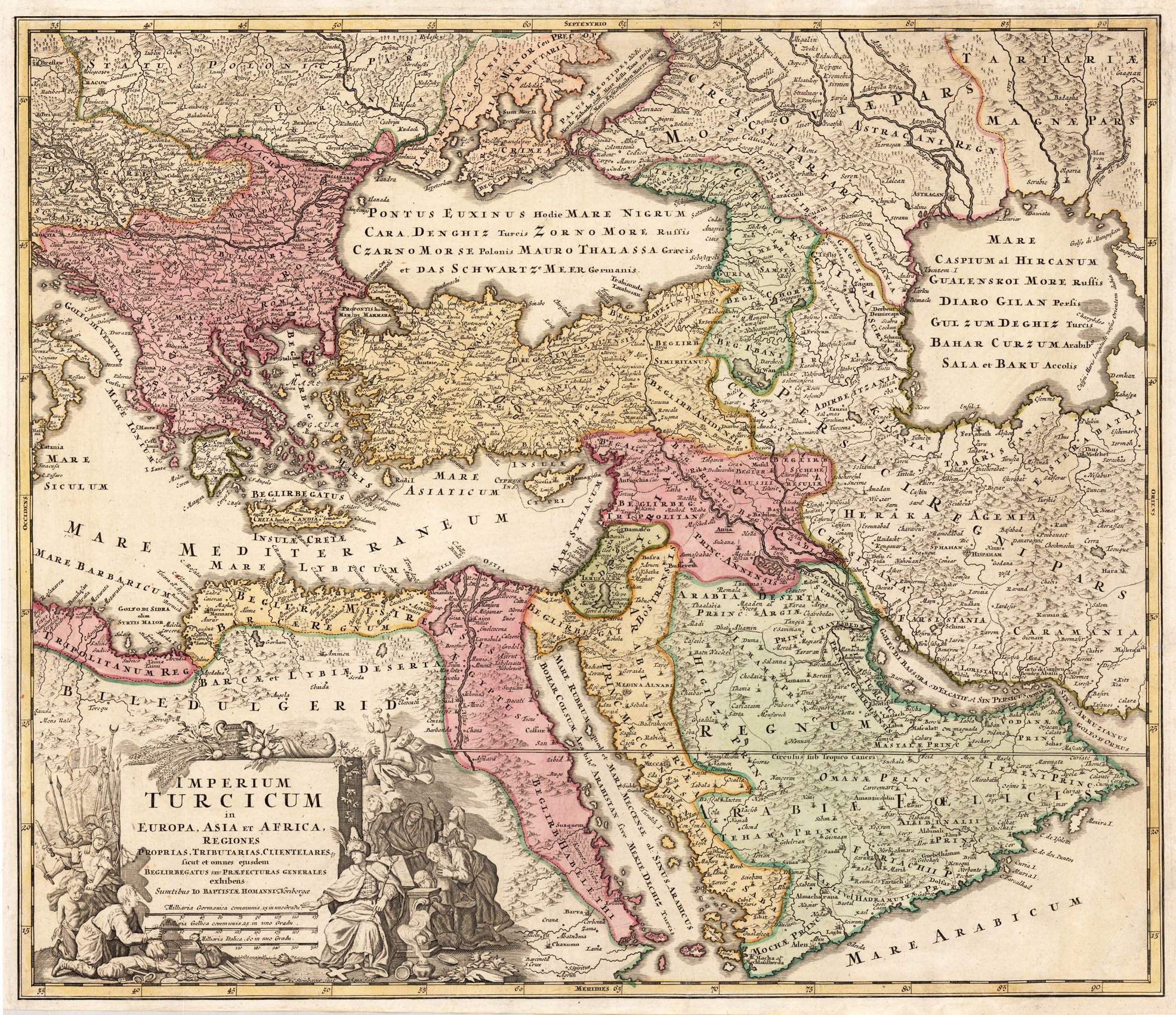
Original antique copper engraving, hand colored in outline and wash when published. This decorative antique map shows us the Turkish empire around 1720-40. Political borders are shown in the old outline handcoloring. The map is equipped with many place names, rivers, islands, mountains, woods, etc. In the lower left corner with an allegoric title cartouche showing the ruler of the Osman empire with merchants and soldiers. Johann Baptist Homann (20 March 1664 – 1 July 1724) was a German geographer and cartographer, who also made maps of the Americas. Homann was born in Oberkammlach near Kammlach in the Electorate of Bavaria. Although educated at a Jesuit school, and preparing for an ecclesiastical career, he eventually converted to Protestantism and from 1687 worked as a civil law notary in Nuremberg. He soon turned to engraving and cartography; in 1702 he founded his own publishing house. Homann acquired renown as a leading German cartographer, and in 1715 was appointed Imperial Geographer by Emperor Charles VI. Giving such privileges to individuals was an added right that the Holy Roman Emperor enjoyed. In the same year he was also named a member of the Prussian Academy of Sciences in Berlin. Of particular significance to cartography were the imperial printing privileges (Latin: privilegia impressoria). These protected for a time the authors in all scientific fields such as printers, copper engravers, map makers and publishers. They were also very important as a recommendation for potential customers. In 1716 Homann published his masterpiece Grosser Atlas ueber die ganze Welt (Grand Atlas of all the World). Numerous maps were drawn up in cooperation with the engraver Christoph Weigel the Elder, who also published Siebmachers Wappenbuch. Homann died in Nuremberg in 1724. He was succeeded by his son Johann Christoph (1703-1730). The company carried on upon his death as Homann heirs company, managed by Johann Michael Franz and Johann Georg Ebersberger. After subsequent changes in management the company folded in 1852.[1] The company was known as "Homann Erben", "Homanniani Heredes", or "Heritiers de Homann" abroad. (Wikipedia)