
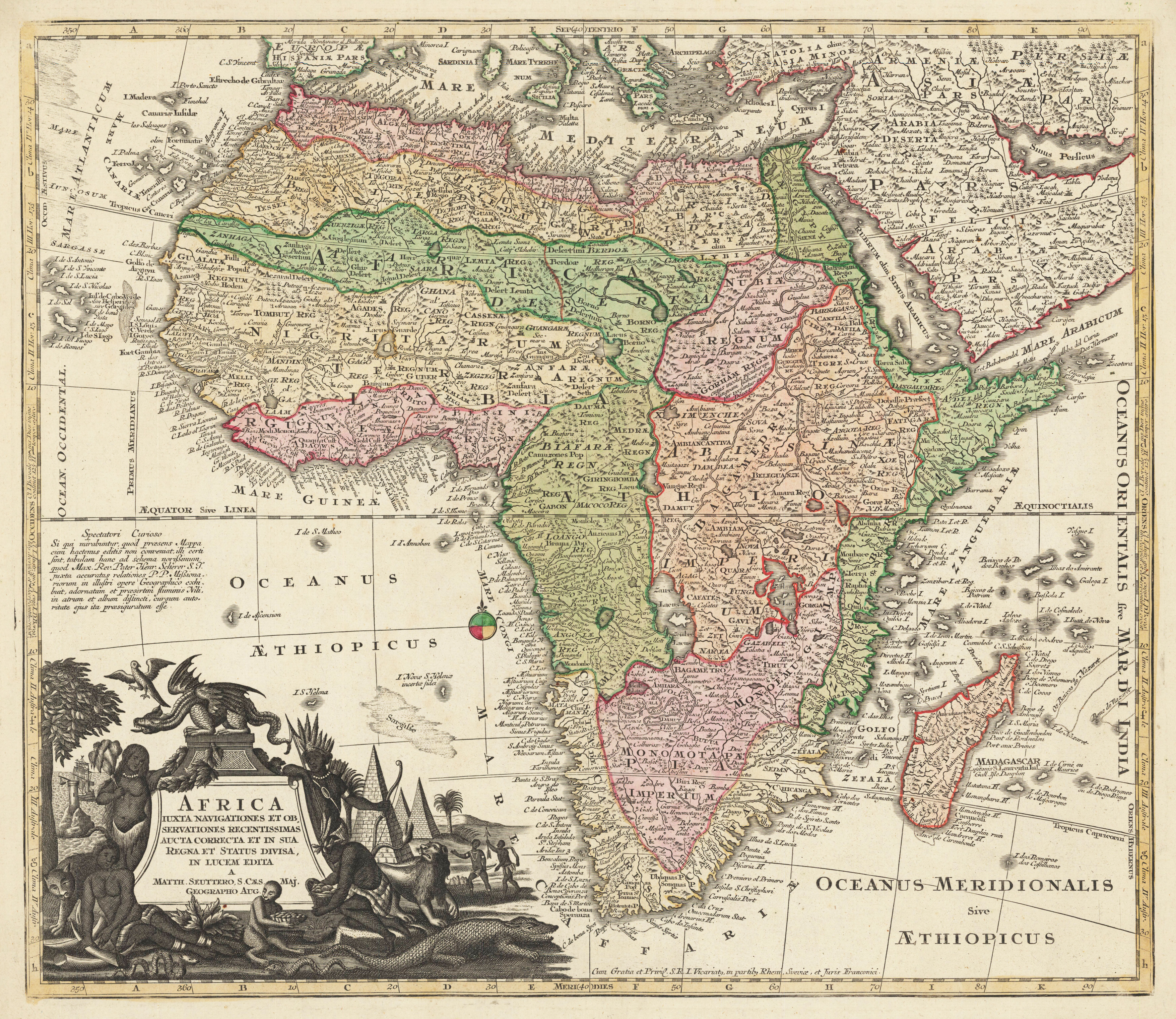
Africa iuxta navibationes et observationes recentissimas aucta correcta et in sua regna et status divisa in lucem edita a Matth. Seuttero, S. Caes. Maj. Geographo Aug. Cum Gratis et Privel. S.R.I. Vicariatg, in partibg Rheni Sueviae, et Juris Franconici.
Original copper engraving, hand colored in outline and wash when published. A fine and detailled map of continent of Africa with the Mediterranean Sea in the north and the cape of good hope and Madagascar in the south. Ornated with a beautiful title cartouche in the lower left corner, it depicts with some animals and natives of the African continent. At the lower bottom with the engraved ,privileg' and a compass rose in the South Atlantic. The royal privileg gave the publisher the permission to print the map for a decade. The map was published around 1720 for the first time, with the privileg it is very likely printed ca. 1730-40. Overall the map is very good to excellent condition, however the map is verso backed with thin Japan paper, this was very likely done by a previous owner to avoid, that the centre fold of the map is visible. Further the reverse side shows around at the outer margins old paper stripes from older framing.
| Category: | Africa |
|---|---|
| Issue date: | 1725-40 |
| Published place: | Augsburg |
| Publisher: | Matthäus Seutter |
| Technique: | Copper engraving / Original color. |
| Type: | map |