
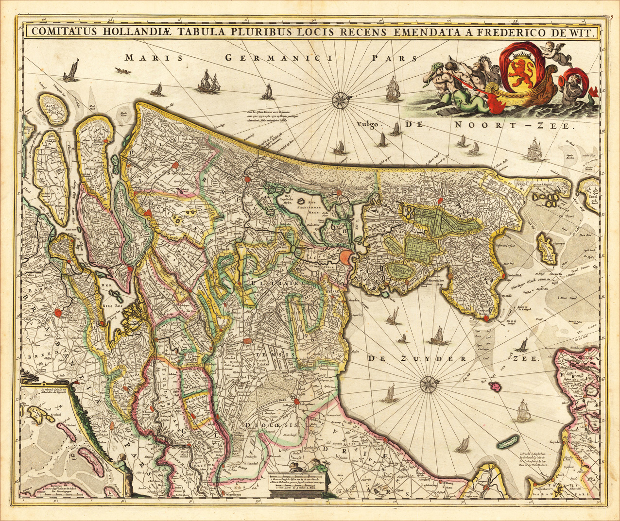
Comitatus Hollandiae Tabula Pluribus Locis Recens Emendata A Frederico de Wit.
Product information: Comitatus Hollandiae Tabula Pluribus Locis Recens Emendata A Frederico de Wit.
Copper engraving, hand colored in outline and wash. A highly decorative map of Holland titled ,Comitatus Hollandiae ...´, the county of Holland with all its places by the famous Dutch map maker Frederic de Wit from Amsterdam. Published in his atlas of the low countries around 1680 in Amsterdam. Top of the map with engraved title, upper rightr corner with a maritime allegoric scence and the coat of arms of Holland. Orientated with the west to the top, a compass rose in the Zuyder Zee and in the lower left corner with an inset map of the Texel and Vlieland islands. With many engraved place names, channels, rivers, place names, routes and trails, further a small mileage scale at the bottom.
Properties
| Category: | Netherlands |
|---|---|
| Issue date: | 1680-86 |
| Published place: | Amsterdam |
| Publisher: | de Wit |
| Technique: | Copper engraving / Original color. |
| Type: | Antique Map, map |